

Free Northern Ontario Travel Guide & Mobile App
Explore Northern Ontario with free travel guides. Discover regional history, expert tips, proposed trips, and audio guides on web or mobile app.


Explore Northern Ontario for Lake Superior shores, boreal forests, Indigenous cultures, canoe routes, mining heritage and remote Canadian wilderness.
Read more about Northern Ontario
When is the best time to visit Northern Ontario?
Best: June–August · 24–28°C| Month | High (°C) | Rainfall (mm) |
|---|---|---|
| January | -10 | 40 |
| February | -8 | 35 |
| March | -2 | 40 |
| April | 8 | 50 |
| May | 18 | 60 |
| June (best) | 24 | 70 |
| July (best) | 28 | 80 |
| August (best) | 26 | 70 |
| September | 19 | 60 |
| October | 12 | 50 |
| November | 4 | 45 |
| December | -6 | 40 |
Getting to and around Northern Ontario
How to get there
Transportation
Top city travel guides in Northern Ontario
The cities of Northern Ontario, and the easiest places to base yourself.
-

-

-


Swipe for more cities
Best attractions in Northern Ontario
Northern Ontario's attractions are closely tied to its scale and geology. Lake Superior Provincial Park, Sleeping Giant Provincial Park and the shoreline around Thunder Bay offer hiking, beaches, viewpoints and rugged coastal scenery, while Killarney Provincial Park and Quetico Provincial Park are major destinations for canoeing, portaging and wilderness camping. Wabakimi Provincial Park and the waterways around Lake of the Woods provide more remote paddling experiences, generally requiring greater logistical planning. Kakabeka Falls near Thunder Bay is an accessible waterfall, and Manitoulin Island combines walking, boating and Indigenous cultural experiences. Urban attractions include the Canadian Bushplane Heritage Centre in Sault Ste. Marie, Science North and Dynamic Earth in Sudbury, and museums and galleries in Thunder Bay, Timmins and other regional centres. Historic mining sites, working landscapes, railway stories and local festivals add context to outdoor travel, while fishing lodges and guided wildlife excursions provide access to lakes and boreal habitats without requiring every visitor to undertake a multi-day expedition.
-
 Park
Algonquin Provincial Park
Explore Algonquin Provincial Park: a stunning natural retreat in Ontario, filled with hiking, canoeing, and wildlife adventures.
-
National park
Fathom Five National Marine Park
Discover the breathtaking beauty and rich heritage of Fathom Five National Marine Park, a premier destination for nature lovers and adventure seekers in Ontario.
-
Park
Killarney Provincial Park
Discover Killarney Provincial Park, a stunning natural paradise featuring breathtaking landscapes, hiking trails, and camping amidst Ontario's pristine wilderness.
-
Nature preserve
Torrance Barrens Dark-Sky Preserve
Explore the stunning Torrance Barrens Dark-Sky Preserve, where celestial wonders meet breathtaking nature in Ontario's serene landscapes.


Best landmarks in Northern Ontario
Northern Ontario's most recognisable landmarks often belong to the landscape itself. The Sleeping Giant, a long volcanic formation on the Sibley Peninsula, dominates views east of Thunder Bay and gives Sleeping Giant Provincial Park its name. Kakabeka Falls, on the Kaministiquia River west of Thunder Bay, is one of the region's most accessible major waterfalls and has long been associated with travel routes around Lake Superior. The St Marys River and its rapids define Sault Ste. Marie's setting, while the International Bridge links the Canadian city with Sault Ste. Marie, Michigan, outside the region. Sudbury's Big Nickel is a prominent symbol of the city's mining identity, and the towering Wawa Goose has become an instantly recognisable roadside emblem near the Lake Superior route. Farther east, the rocky shores and island-filled waters of Manitoulin Island and Georgian Bay form a distinctive geographical landmarkscape, shaped by limestone, exposed Shield rock, glacial movement and Indigenous and settler histories.
-
Historical place
Parliament Hill
Discover the heart of Canadian democracy at Parliament Hill—an architectural masterpiece offering guided tours, events, and stunning views in Ottawa.
-
Tourist attraction
Journey Behind the Falls
Uncover the breathtaking views and thrilling experiences at Journey Behind the Falls, a top-rated attraction at Niagara Falls, Ontario.
-
Museum
Fort York National Historic Site
Discover the captivating history of Fort York National Historic Site, where Toronto's past comes to life through engaging exhibits and beautiful landscapes.
-
Art
Screaming Heads
Explore Screaming Heads in Burk's Falls, Ontario, where art meets nature in a stunning outdoor sculpture gallery.


Explore Northern Ontario on the map
Plan your trip on one map. See where the top cities, national parks and sights are, and book hotels and experiences in a few clicks.
Best hotels in Northern Ontario
Best restaurants in Northern Ontario
Dining in Northern Ontario reflects its lakes, forests, working towns and short growing season. Walleye, often called pickerel locally, is widely associated with freshwater fishing, while smoked fish, wild rice, blueberries, cranberries, maple products and locally made preserves appear in markets, cafés and seasonal menus. In Indigenous communities and Indigenous-led settings, food experiences may draw on regional harvesting traditions, but practices and availability vary and should be approached respectfully. Larger centres such as Thunder Bay, Sudbury, Sault Ste. Marie and North Bay offer the broadest choice of Canadian, international and contemporary restaurants, whereas smaller towns rely more on cafés, family restaurants, bakeries, diners, pubs and roadside stops. Farmers' markets are useful for regional produce in season, and camp kitchens or lodge dining are often part of a wilderness trip. Local breweries and small food producers add variety, but opening patterns and supplies can be seasonal outside the main towns.
-
Italian
Giovanni's Restaurant
Discover authentic Italian cuisine at Giovanni's Restaurant in Sault Ste. Marie—where every meal tells a story.
-
Restaurant
ONoir Toronto
Experience dining like never before at ONoir Toronto – indulge your senses in complete darkness while savoring exquisite cuisine.
-
Steak
Station Tap House & Steak Co
Experience mouthwatering steaks and local flavors at Station Tap House & Steak Co in North Bay - where great taste meets inviting ambiance.
-
Restaurant
Ivan's Restaurant
Discover Ivan's Restaurant in North Bay - where delicious food meets an inviting atmosphere at affordable prices.


Best bars in Northern Ontario
Evening life in Northern Ontario is concentrated in regional cities and service towns rather than organised around large club districts. Thunder Bay, Sudbury and Sault Ste. Marie have the widest selection of pubs, breweries, cocktail bars, live-music venues and late-opening restaurants, while university populations give parts of Sudbury and Thunder Bay a more active night-time calendar. In smaller communities such as Kenora, Timmins, North Bay, Dryden and Wawa, traditional pubs, hotel bars, community events and restaurants are more characteristic than nightclubs. Lakeside resorts and fishing lodges may offer relaxed evening socialising during the summer season, but services can be limited once visitors leave the main centres. Check local arrangements rather than assuming late opening hours, and remember that long rural drives, wildlife and winter road conditions make drinking and driving particularly hazardous.
-
Bar
Horseshoe Tavern
Discover the heartbeat of Toronto's live music scene at Horseshoe Tavern, a historic bar offering unforgettable performances and a vibrant atmosphere.
-
Cocktail bar
BarChef
Discover the essence of mixology at BarChef, Toronto's premier cocktail bar, renowned for its innovative drinks and vibrant atmosphere.
-
Lounge
Hala Kahiki Lounge
Experience the vibrant spirit of Hawaii at Hala Kahiki Lounge, where tropical cocktails and a unique ambiance come together in River Grove, Illinois.
-
Pub
Collins Brewhouse
Discover the vibrant atmosphere and delicious menu at Collins Brewhouse, a top pub and restaurant in Dundas, Ontario, known for local craft beer and hearty meals.


Best nightclubs in Northern Ontario
Evening life in Northern Ontario is concentrated in regional cities and service towns rather than organised around large club districts. Thunder Bay, Sudbury and Sault Ste. Marie have the widest selection of pubs, breweries, cocktail bars, live-music venues and late-opening restaurants, while university populations give parts of Sudbury and Thunder Bay a more active night-time calendar. In smaller communities such as Kenora, Timmins, North Bay, Dryden and Wawa, traditional pubs, hotel bars, community events and restaurants are more characteristic than nightclubs. Lakeside resorts and fishing lodges may offer relaxed evening socialising during the summer season, but services can be limited once visitors leave the main centres. Check local arrangements rather than assuming late opening hours, and remember that long rural drives, wildlife and winter road conditions make drinking and driving particularly hazardous.
-
Night club
Club 54 Nightclub
Discover Burlington's nightlife at Club 54 Nightclub, where the music never stops and the fun is just beginning.
-
Night club
Club Se7en
Discover the electrifying nightlife at Club Se7en, Niagara Falls' premier night club, featuring top DJs and an unforgettable atmosphere.
-
Night club
Dragonfly Nightclub
Immerse yourself in the electrifying nightlife at Dragonfly Nightclub, a premier entertainment hub in Niagara Falls, Ontario.
-
Night club
Moda Night Club
Discover North York's nightlife at Moda Night Club, where vibrant music and a lively atmosphere await your arrival.



Best shops in Northern Ontario
Shopping in Northern Ontario is centred on practical town services, independent high streets, malls in larger centres and seasonal markets rather than concentrated luxury retail. Thunder Bay, Sudbury and Sault Ste. Marie provide the broadest choice of clothing, books, outdoor equipment, galleries and regional food shops, while smaller communities such as Kenora, North Bay, Timmins and Wawa are useful for locally made goods and supplies for road or wilderness trips. Look for maple products, smoked fish, preserves, wild-berry products, art, photography, beadwork, jewellery and crafts, taking care to buy Indigenous-made work from identified artists or reputable Indigenous-owned sources. Farmers' markets vary by season and community, and galleries often provide a better route to regional art than generic souvenir outlets. Outdoor equipment, fishing tackle and canoe-related services are particularly important purchases for visitors travelling into the backcountry.
-
Gift shop
Primitive Designs
Explore Primitive Designs in Port Hope for unique gifts and local artistry that capture the essence of Ontario's creative spirit.
-
Gift shop
French River Trading Post
Explore Canadian culture and craftsmanship at the French River Trading Post, your go-to destination for unique gifts and local treasures in Ontario.
-
Antique store
One Of A Kind Antiques & Collectibles
Explore the charm of vintage finds at One Of A Kind Antiques & Collectibles in Woodstock, Ontario, where every piece has a story.
-
Gift shop
Northwest Trading Company
Explore Northwest Trading Company in Espanola for unique gifts and local crafts that embody the spirit of Northern Ontario.


Get your free copy of our complete guide to Northern Ontario, delivered straight to you.
Everything on this page, from attractions and restaurants to essentials and local phrases, in one PDF you can read offline, print or share.
Already have an account? Sign in
Your Northern Ontario guide is ready.
We'll send it to · Not you? Sign out

Getting your guide ready…
We are putting together a fresh copy of the Northern Ontario guide. This can take up to a minute.
This can take a few moments. If your browser asks, choose Allow so the download can start. You'll find the guide in your Downloads folder.
Nothing happened? Download it again
Sorry, the guide is taking longer than usual. Please try again in a minute, or get it by email instead.
Northern Ontario essentials
Currency and Payment
Safety
Emergency Situations
Do's and Don'ts
Local Tips
From Eve
Local phrases worth knowing
You don't need to get them perfect. A few words go a long way, and locals appreciate the effort.
Basics
| English | Local | Say it |
|---|---|---|
| Hello | Boozhoo | [boo-zhoo] |
| Goodbye | Miigwech | [mee-gwech] |
| Yes | Aaniin | [ah-nee] |
| No | Kaa | [kah] |
| Please/You're welcome | Niawen | [nee-ah-wen] |
| Thank you | Miigwech | [mee-gwech] |
| Excuse me/Sorry | Gichi-mikwen | [gee-chee-mik-wen] |
| How are you? | Aaniin ezhi-ayaad? | [ah-nee-in eh-zhi-ah-yahd] |
| Fine. And you? | Nimino-ayaa. Izhin! | [nee-mee-noh-ah-yah. ih-zhi-n] |
| Do you speak English? | Nin giiwew iikidowin? | [neen gee-eh-w iw-kee-doh-win] |
| I don't understand | Nin gii zhi-ayaad | [neen gee zhi-ah-yahd] |
Eating & Drinking
| English | Local | Say it |
|---|---|---|
| I'd like to see the menu, please | Nin gii-bizindaw minikwe, miigwech | [neen gee-bee-zin-dow min-ee-kweh, mee-gwech] |
| I don't eat meat | Nin gii-nitam nibiin | [neen gee-nee-tam nee-been] |
| Cheers! | Naadmaad | [nahd-mahd] |
| I would like to pay, please | Nin gii-wiijiiwa, miigwech | [neen gee-wee-jee-wah, mee-gwech] |
Emergencies
| English | Local | Say it |
|---|---|---|
| Help! | Nin gii-wiijiwa! | [neen gee-wee-jee-wah] |
| Go away! | Aaniin gii-kidowin! | [ah-nee-in gee-kee-doh-win] |
| Call the Police! | Gii-bagak n'kikendaw! | [gee-bah-gak n'kee-kendow] |
| Call a doctor! | Gii-bagak n'isaad! | [gee-bah-gak n'ee-sahd] |
| I'm lost | Nin gii-kikendaag | [neen gee-kee-kendahg] |
| I'm ill | Nin gii-nibin | [neen gee-nee-bin] |
Shopping
| English | Local | Say it |
|---|---|---|
| I'd like to buy... | Nin gii-bagak... | [neen gee-bah-gak] |
| I'm just looking | Nin gii-mino-ayaad | [neen gee-mee-noh-ah-yahd] |
| How much is it? | Aaniin daan? | [ah-nee-in dahn] |
| That's too expensive | Ishkode daan | [eesh-koh-day dahn] |
| Can you lower the price? | Gego gii-nikaan daan? | [geh-go gee-nee-kahn dahn] |
Time & Numbers
| English | Local | Say it |
|---|---|---|
| What time is it? | Aaniin waabandan? | [ah-nee-in wah-bahn-dahn] |
| It's one o'clock | Nin gii-nisid | [neen gee-nee-sid] |
| Half past (10) | Nin gii-wiikwen naanan | [neen gee-wee-kwen nah-nahn] |
| Morning | Nibin | [nee-bin] |
| Afternoon | Dibik-giizis | [dee-bik-gee-zis] |
| Evening | Dibik-giizis | [dee-bik-gee-zis] |
| Yesterday | Gii-zhichig | [gee-zee-cheeg] |
| Today | Nin gii-zhichig | [neen gee-zee-cheeg] |
| Tomorrow | Nin gii-zhichig | [neen gee-zee-cheeg] |
| 1 | Nii | [nee] |
| 2 | Niizh | [nee-zh] |
| 3 | Niswi | [nee-swee] |
| 4 | Niiwin | [nee-win] |
| 5 | Naan | [nahn] |
| 6 | Ningodwaaswi | [ning-oh-dwah-swee] |
| 7 | Ninso | [neen-soh] |
| 8 | Nisito | [nee-see-toh] |
| 9 | Ninigo | [nee-nee-go] |
| 10 | Niswi-niswi | [nee-swee-nee-swee] |
Transport & Directions
| English | Local | Say it |
|---|---|---|
| Where's a/the...? | Aaniin gii-mikwendam? | [ah-nee-in gee-mik-wen-dahm] |
| What's the address? | Aaniin gii-wiijiiwa gii-nisid? | [ah-nee-in gee-wee-jee-wah gee-nee-sid] |
| Can you show me (on the map)? | Gego gii-bagak gii-ziibii? | [geh-go gee-bah-gak gee-zee-bee] |
| When's the next (bus)? | Aaniin gii-nisid gii-wiikwen? | [ah-nee-in gee-nee-sid gee-wee-kwen] |
| A ticket (to ....) | Nin gii-bagak ticket (na...) | [neen gee-bah-gak tick-et (nah...)] |
History of Northern Ontario
Anishinaabe, Cree and Oji-Cree Homelands
Northern Ontario has been home to Indigenous peoples for thousands of years, with Anishinaabe nations prominent across much of the Great Lakes and boreal north, and Cree and Oji-Cree communities farther north and west. Lakes and rivers served as travel corridors, while seasonal harvesting, fishing, hunting and trade shaped relationships with the land. Treaties, including the Robinson Treaties of 1850 and later numbered treaties, transformed the legal relationship between Indigenous nations and the Crown, though their interpretation and consequences remain living matters. Contemporary communities, languages, art and land-based practices are essential to understanding the region.
The Fur Trade and Great Lakes Routes
From the seventeenth century, European fur traders entered networks already established by Indigenous peoples. French and later British traders moved through Lake Superior, the Kaministiquia route near present-day Thunder Bay and the waterways linking the Great Lakes to the interior. Fort William became an important nineteenth-century fur-trade centre after the North West Company and Hudson's Bay Company consolidated their operations. The trade connected Northern Ontario to wider commercial systems but also brought disease, colonial pressure and changing political relationships for Indigenous communities.
Treaties, Settlement and Ontario's Northern Boundary
During the nineteenth century, colonial authorities extended administrative control across northern lands through treaties, surveys and settlement policies. The Robinson-Huron and Robinson-Superior Treaties were followed by agreements applying farther north and west, while the boundaries of Ontario itself expanded through negotiations with Canada and the federal government. New townsites, missions and trading posts developed beside established Indigenous communities. This period laid foundations for later resource development but also produced dispossession, restrictions and disputes that continue to influence law, governance and land-use decisions.
Railways and the Rise of Resource Towns
Railways radically altered Northern Ontario in the late nineteenth and early twentieth centuries. The Canadian Pacific Railway reached remote mining and timber districts, while the National Transcontinental Railway and later routes connected communities such as Cochrane, Hearst and Hearst-area settlements with southern markets. Rail access helped establish towns, move ore and timber, and support immigration, but it also reinforced a resource-export economy. Many northern communities still reflect this history in their station buildings, mine landscapes, company housing and continuing dependence on transport corridors.
Mining, Forestry and Industrial Expansion
Discoveries of silver around Cobalt in the early twentieth century, gold at places including Timmins and Red Lake, and nickel near Sudbury made mineral extraction central to Northern Ontario's economy. Sudbury's nickel industry became internationally important, while pulp and paper, sawmilling and hydroelectric development reshaped towns and waterways across the region. Resource industries generated employment and infrastructure but also left environmental legacies, labour conflicts and boom-and-bust cycles. Mining remains important, alongside growing attention to rehabilitation, Indigenous consultation and more diversified regional economies.
The Residential School Legacy
Residential schools operated in and around northern communities as part of Canada's policy of forced assimilation. Children were removed from families, languages and cultural practices, and many experienced neglect and abuse; the harm continues across generations. Sites and records connected with institutions such as the St Joseph's residential school at Fort William and schools serving northern communities form part of this history. Visitors should approach related museums, memorials and Indigenous-led interpretation with respect. Truth and reconciliation are ongoing processes, not historical subjects confined to the past.
Modern Northern Identity and Environmental Stewardship
Since the mid-twentieth century, Northern Ontario has combined resource industries with universities, healthcare, tourism, arts and Indigenous-led economic development. Provincial parks and conservation areas protect major wilderness landscapes, while debates over mining, forestry, hydroelectricity, climate change and protected areas continue to shape public life. Cultural institutions in Thunder Bay, Sudbury, Sault Ste. Marie and smaller communities preserve regional histories, but northern identity remains closely tied to working landscapes, long-distance travel and relationships with lakes and forests.
Northern Ontario in Photos
Browse through our photo collection highlighting the charm and character of the destination.
Neighbouring regions of Northern Ontario
The closest regions to Northern Ontario, if you have time for more than one.
-
-

-

-

-


Swipe for more regions
Explore more
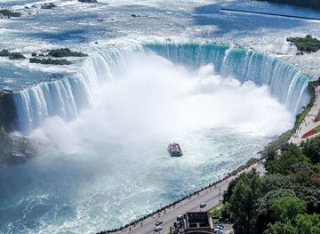
Explore more of Canada
Discover Canada's breathtaking landscapes, diverse cities, and rich cultural heritage. A must-visit destination for outdoor adventures and vibrant urban experiences.
Explore Canada