Background

Jegindø – Quiet Limfjord Island on Thyholm

Low-lying Limfjord island-peninsula with a working harbour, quiet beaches and wide skies, ideal for slow walks, cycling and everyday Danish coastal life.

★★★★★4.4 (90)

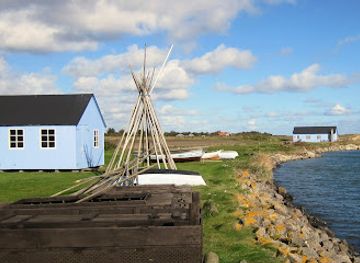
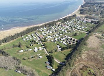
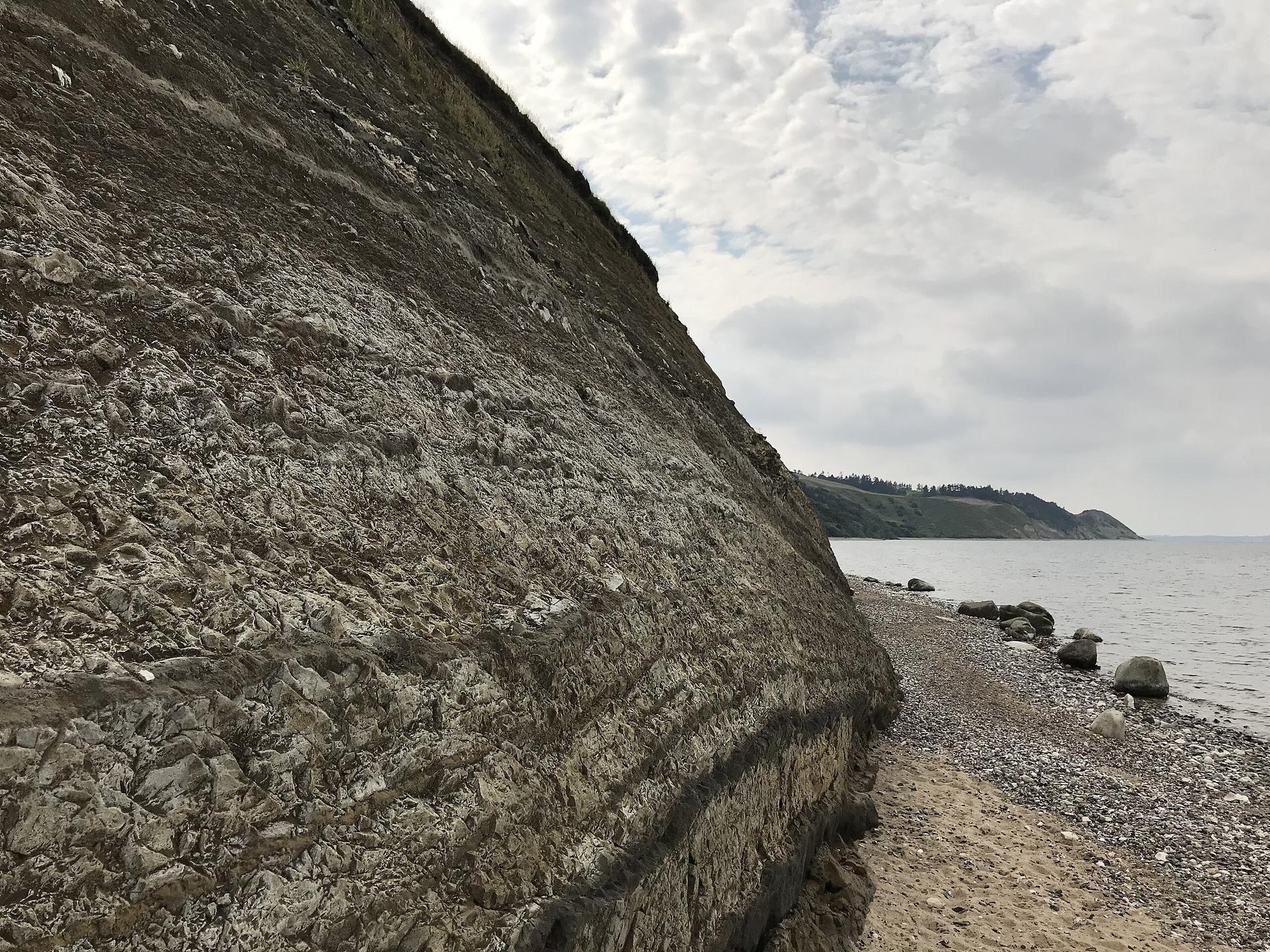
Jegindø is a small, low-lying island-peninsula off Thyholm in the Limfjord, connected to the mainland by a causeway since 1916. Open fields, gentle shoreline and big skies set the scene for slow walks, cycling and birdwatching. A compact fishing harbour with a marina, the little museum Æ Fywerhus and nearby Jegindø Tap beach showcase the island’s maritime heritage, from eel traps to modern mussel and oyster fishing. This is a tranquil, everyday Danish island where agriculture, sea and sky dominate.

Plan your visit

A brief summary to Jegindø

Opening times, essentials, and a few local tips gathered into one calmer, easier-to-scan planning section.

Plan your visit

📍
Thyholm, DK
🕒
Duration: 2 to 6 hours
💷
Free
🏛
Outdoor
📶
Mobile reception: 4 out of 5

Explore places near Jegindø

    See all →

    Unlock the Best of Jegindø

    Find tickets, tours with entry, and experiences available for this location.

    Buy tickets

    No tickets available

    Book tours with entry

    No tours with entry available

    Book tours without entry

    No tours without entry available

    Getting There

    Car from Struer

    From Struer town, Jegindø is typically reached by regional roads via Thyholm, crossing the causeway to the island. The journey usually takes around 35–45 minutes depending on traffic. There are no tolls, and parking near the harbour and around Jegindø Tap is generally free, though spaces can be limited on peak summer days.

    Regional train and bus

    Take a regional train to Thyholm Station, a common access point for Jegindø, which from Struer normally takes about 20–25 minutes. From the station, a local bus service or seasonal flex-transport typically connects to Jegindø in about 20–30 minutes. Combined, allow 45–70 minutes of travel time, and expect a modest fare covering both train and bus segments.

    Cycling via Thyholm

    Confident cyclists can reach Jegindø by riding through Thyholm and over the low causeway. From central Struer the distance is roughly 25–30 kilometres, usually taking 1.5–2.5 hours depending on fitness and wind direction. Roads are generally quiet but exposed; expect strong crosswinds at times and limited shelter in bad weather.

    Car from Nykøbing Mors

    From Nykøbing Mors, Jegindø is accessed by regional roads skirting the Limfjord and continuing onto Thyholm before crossing the causeway. Travel time is commonly 45–60 minutes. Road surfaces are good, and there are fuel stations en route, but services on Jegindø itself are limited, so plan provisions ahead, especially outside summer.

    For the on-the-go comforts that matter to you

    Restrooms
    Drink Options
    Drinking Water
    Food Options
    Seating Areas
    Picnic Areas
    Trash Bins
    Information Boards
    Visitor Center

    Local tips

    Bring a windproof layer year-round; the flat, open landscape leaves you very exposed to breezes off the Limfjord even on sunny days.
    Explore by bike to link the harbour, church and Jegindø Tap in one relaxed circuit on mostly quiet roads.
    If you visit Æ Fywerhus, allow time to wander the quays afterwards to see modern fishing activity that echoes the stories in the museum.
    Time a visit to Jegindø Tap for late afternoon or evening when the low light over the Limfjord makes for especially atmospheric photos.
    Respect private farmland by staying on lanes and marked paths; many appealing viewpoints are reached via public roads rather than field tracks.

    Jegindø location weather suitability

    Catch the right light and the right mood, whether you want a bright city moment or a more cinematic evening visit.

    Weather icon
    Clear Skies
    Weather icon
    Windy Conditions
    Weather icon
    Mild Temperatures
    Weather icon
    Cold Weather
    Weather icon
    Any Weather

    Discover more about Jegindø

    An island of fields, water and big skies

    Jegindø sits in the western Limfjord, a small island-peninsula shaped by wind, water and farming rather than dramatic cliffs or forests. Almost entirely flat, its highest point rises only a few metres above sea level, so horizons feel wide and the sky seems enormous. Crops grow right up to the lanes, and the patchwork of fields is punctuated by farmsteads, shelterbelts and the occasional cluster of houses around the village of Jegind. The coastline shifts from low grassy banks to small beaches and stone-strewn shores, with constantly changing views over the fjord. Because there are no lakes or rivers on the island and only tiny woodland patches, the landscape feels open and exposed. That simplicity is exactly its charm: the elements are the main attraction here – light, clouds, wind and the soft wash of the sea.

    From royal gift to causeway-linked community

    Jegindø has been inhabited for millennia, with traces of early settlements scattered around the island’s more sheltered spots. For centuries it lay somewhat apart from the mainland, reaching the wider world via local ferry connections across the sunds of the Limfjord. In the early 1500s the island was granted as an estate to a noble family, and later the land gradually passed into the hands of the farmers who worked it. The watershed moment came in 1916 when a low dam and road linked Jegindø to neighbouring Thyholm. The new causeway replaced the older ferry crossing and quietly transformed life here, making it far easier to move livestock, goods and people. Around the same period, community buildings such as the whitewashed church and the mission house reinforced Jegindø’s identity as a small but self-contained society on the fjord.

    Harbour life and fishing heritage

    On the eastern side of Jegindø a compact harbour forms the island’s social and economic heart. Built in the 1930s and later expanded with a marina, it now combines working fishing boats with visiting yachts. Mussels, oysters and other shellfish are still important, and you may see stacks of gear and small vessels heading out along the channels of the Limfjord. Just north of the quays stands Æ Fywerhus, a modest local museum devoted to the island’s fishing traditions. Inside, old eel traps, photographs and tools tell the story of how generations have relied on the fjord alongside farming. Outside, the smell of salt, tarred wood and seaweed mixes with the sound of halyards tapping against masts, reminding you that Jegindø’s rhythm is still closely tied to the water.

    Jegindø Tap and the edge of the fjord

    At the southern tip of the island, Jegindø Tap is a long, narrow spit of sand and gravel stretching into the Limfjord. With shallow water on both sides and low dunes underfoot, it is the place to feel how delicately the island is balanced between land and sea. On calm days the water laps gently and the fjord can look almost like a lake; in stronger winds the waves chop and the air fills with the calls of gulls and waders. Simple paths lead along the spit, inviting unhurried walks and quiet pauses to watch birds feeding in the shallows. In summer, hardy swimmers wade out from the beach, while in cooler seasons the attraction is the sense of space and the play of light over the water. There are few distractions here – just sand, stones, shells and the wide Limfjord.

    Exploring at a slow, local pace

    Jegindø is best experienced slowly, on foot or by bicycle along its small network of roads and tracks. Distances are short enough that you can easily cross from harbour to church, from fields to shoreline, within a leisurely day. The absence of large attractions means attention naturally shifts to smaller details: patterns in ploughed earth, a line of geese over the fjord, the changing colour of clouds across the afternoon. Scattered holiday houses and local homes blend into the agricultural setting, and the island keeps a lived-in, working character. It feels like a gentle retreat rather than a stage set, somewhere to breathe deeply, watch the weather roll in over the Limfjord and gain a sense of everyday island life in western Denmark.

    A brief summary to Jegindø

    Use Tower Bridge as your starting point for nearby food, family ideas, nightlife, and more local discoveries.

    Plan around the quieter times

    A quick look at seasonal patterns and peak visiting hours.

    Busiest months of the year

    Seasonality

    Busiest hours of the day

    Footfall
    Mobile App
    Get the app

    Your all‑in‑one travel companion app

    Explore expert travel guides, compare and book tours, experiences, hotels, and more—all from the palm of your hand. Download now for seamless trip planning wherever your wanderlust takes you.

    File:Mors Limford Hanklit Moler and prehistoric Ash layers (5).jpg -  Wikimedia Commons

    More about Limfjord

    Discover Limfjord in Denmark: A serene waterway offering a blend of nature, culture, and history with charming villages, Viking sites, and vibrant arts scenes.

    Tell me more about Limfjord

    Select Currency

    Choose the currency you want prices to display in.