Yding Skovhøjs Parking Area
Simple forest-edge parking with toilets and picnic tables, serving as the quiet gateway to Yding Skovhøj’s high ridge, Bronze Age mounds and rolling hill country.
Forest Gateway to Denmark’s High Country
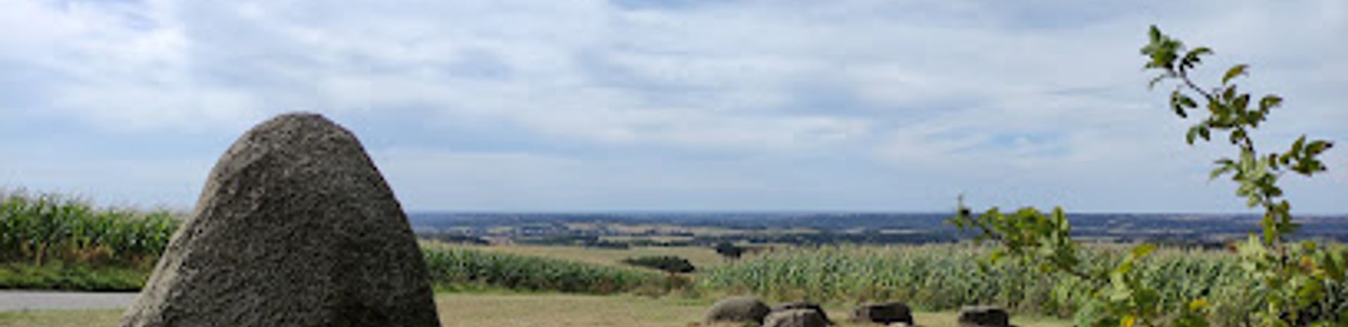
Yding Skovhøjs parking area sits quietly in the countryside west of Skanderborg, where gentle farmland gives way to dark, dense woodland. It is not a destination in its own right so much as the front door to Yding Skovhøj, one of Denmark’s highest points, and to the hilly landscapes that locals call “bakkelandet.” You arrive at a modest clearing by the forest edge, framed by tall trees and birdsong, with just enough open sky to hint at the views waiting higher up. The setting feels surprisingly remote for such an accessible spot. Sky, field and forest overlap at the margins, and the slope of the land is already visible from the parked cars. On still days you may only hear the wind moving through the canopy and the crunch of gravel underfoot as visitors set off towards the heights.Practical Base for Exploring Yding Skovhøj
Despite its low-key appearance, the parking area is well equipped for a short outing. There is a simple toilet block and picnic tables with benches, ideal for a quick break before or after a walk. These facilities make the site convenient for families and day trippers who want to explore without giving up basic comforts. From here, a clearly marked path leads into Yding Skov. The trail climbs steadily but not severely, suitable for most walkers with reasonable mobility, though it is not designed for wheelchairs or prams and can be muddy after rain. Waymarking and information from local hiking routes often reference this car park, using it as a starting point for circuits that link forest tracks, viewpoints and nearby hills.Pathway to Ancient Burial Mounds
Just beyond the parking area, beneath the trees, you enter a landscape shaped not only by ice and time but also by people of the Bronze Age. On the top of Yding Skovhøj stand three burial mounds, visible once you gain height and the forest opens out. These low, rounded crowns are modest in scale but rich in symbolism, reminders that this ridge has been a significant place in the landscape for millennia. The debate about whether Yding Skovhøj or neighbouring peaks should be considered Denmark’s “highest point” hinges on these mounds, since their man-made height slightly elevates the summit. While surveyors and geographers argue the details, walkers from the parking area experience something simpler: the satisfaction of standing on a ridge that feels unusually high by Danish standards, with forest, farmland and distant lakes unfurling below.Quiet Moments Among Trees and Views
For many visitors, the charm of Yding Skovhøjs parking area lies in its tranquillity. There is no visitor centre, no souvenir shop, only a handful of cars and the occasional cyclist catching their breath. The picnic tables are perfect for a thermos of coffee, a packed lunch or a pause after tackling the ascent. On clear days, light filters through the trees in shifting bands, and in autumn the forest floor is carpeted with leaves. Even if you choose not to walk far, the sense of open space and the slightly cooler air of the ridge country are palpable. The car park offers glimpses of the surrounding hills and fields, enough to convey the relief of the terrain and the promise of wider panoramas higher up in the forest.Starting Point for Wider Hill Country Adventures
Yding Skovhøjs parking area also serves as a practical launch pad for longer explorations of the surrounding highlands. The broader area between Horsens, Silkeborg and Skanderborg is dotted with prominent hills such as Møllehøj and Ejer Bavnehøj, and many walkers link several high points in a single day. From this car park it is easy to combine a short summit walk with further rambles through mixed woodland, field paths and quiet rural lanes. Because it is small and uncommercialised, the atmosphere stays relaxed even when a few groups are using it. Hikers with maps or route descriptions often spread them out on the picnic tables to plan the next leg, while others simply stretch their legs before continuing a scenic drive. In every case, the parking area plays the same role: a compact, functional and pleasantly green threshold to one of the highest ridges in Denmark.Local tips
- Bring sturdy footwear; the forest path from the parking area to Yding Skovhøj can be steep, uneven and muddy after rain.
- Pack drinks and snacks for a picnic at the tables by the car park or near the top, as there are no food outlets on site.
- Visit on a clear, dry day if possible to enjoy better views from the ridge and avoid slippery conditions on the forest trails.
- Arrive earlier in the day on weekends and holidays, as the small parking area can fill up when local walkers head for the hills.
A brief summary to Yding Skovhøjs parkeringsplads
- Skanderborg, 8660, DK
Getting There
-
Car from Skanderborg
From Skanderborg town centre, reaching Yding Skovhøjs parking area by car typically takes 20–25 minutes, following regional roads through rolling countryside. The route includes some narrow, winding sections near the hills but is fully paved and suitable for standard vehicles all year, though caution is advised in snow or heavy frost. Parking at the forest edge is free, with a limited number of spaces; at busy times you may need to wait briefly for a spot.
-
Car from Horsens
From Horsens, plan 25–30 minutes of driving on regional roads to reach the car park near Yding Skovhøj. The final approach runs through small villages and undulating terrain but remains on asphalt, so no special vehicle is required. There is no formal parking fee and no marked time limit, but the area is compact, so it is considerate to park efficiently and avoid blocking the turning space used by other visitors.
-
Bicycle from the surrounding hill country
Experienced cyclists exploring the Ejer Bjerge and Yding area can reach the parking place via quiet country roads in roughly 45–75 minutes from nearby towns such as Skanderborg or Brædstrup. Expect sustained gradients and short, steep sections as you approach the high ground. There are no dedicated bike lanes on the final stretch, so visibility gear and lights are recommended outside daylight hours. Bicycle access and parking are free, and the picnic tables by the car park offer a natural rest point before tackling the final walk to the top.


