Background

Dragsmur Isthmus, Helgenæs

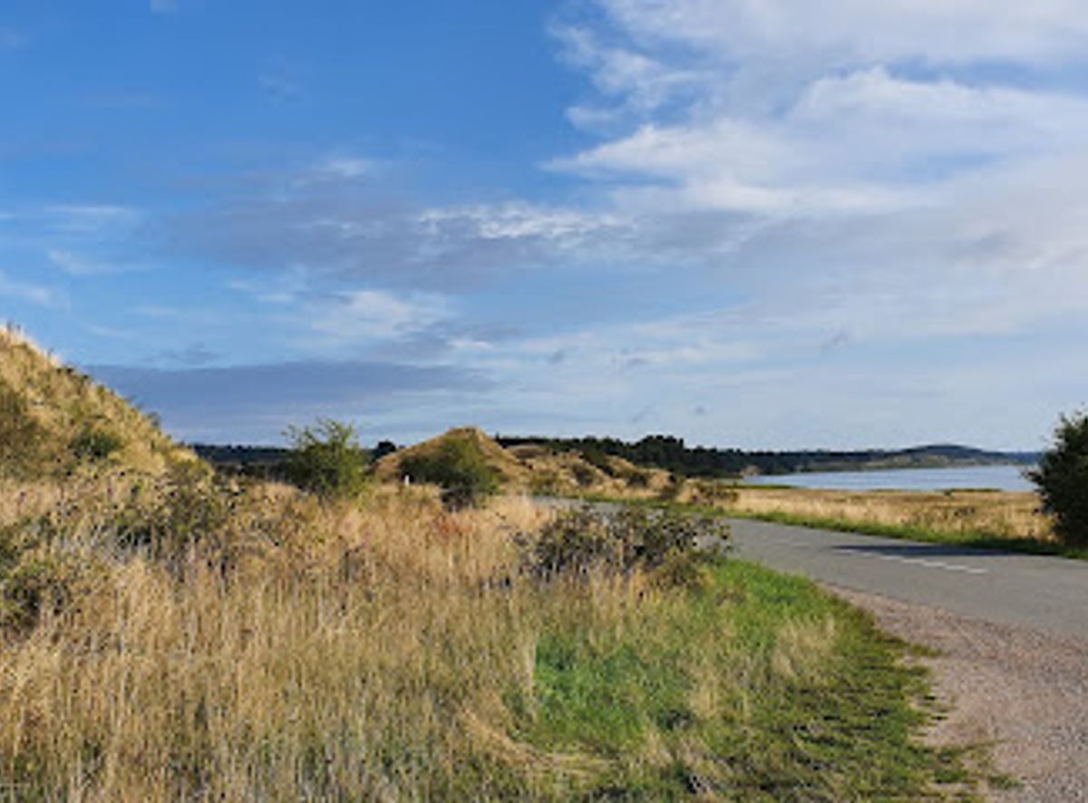
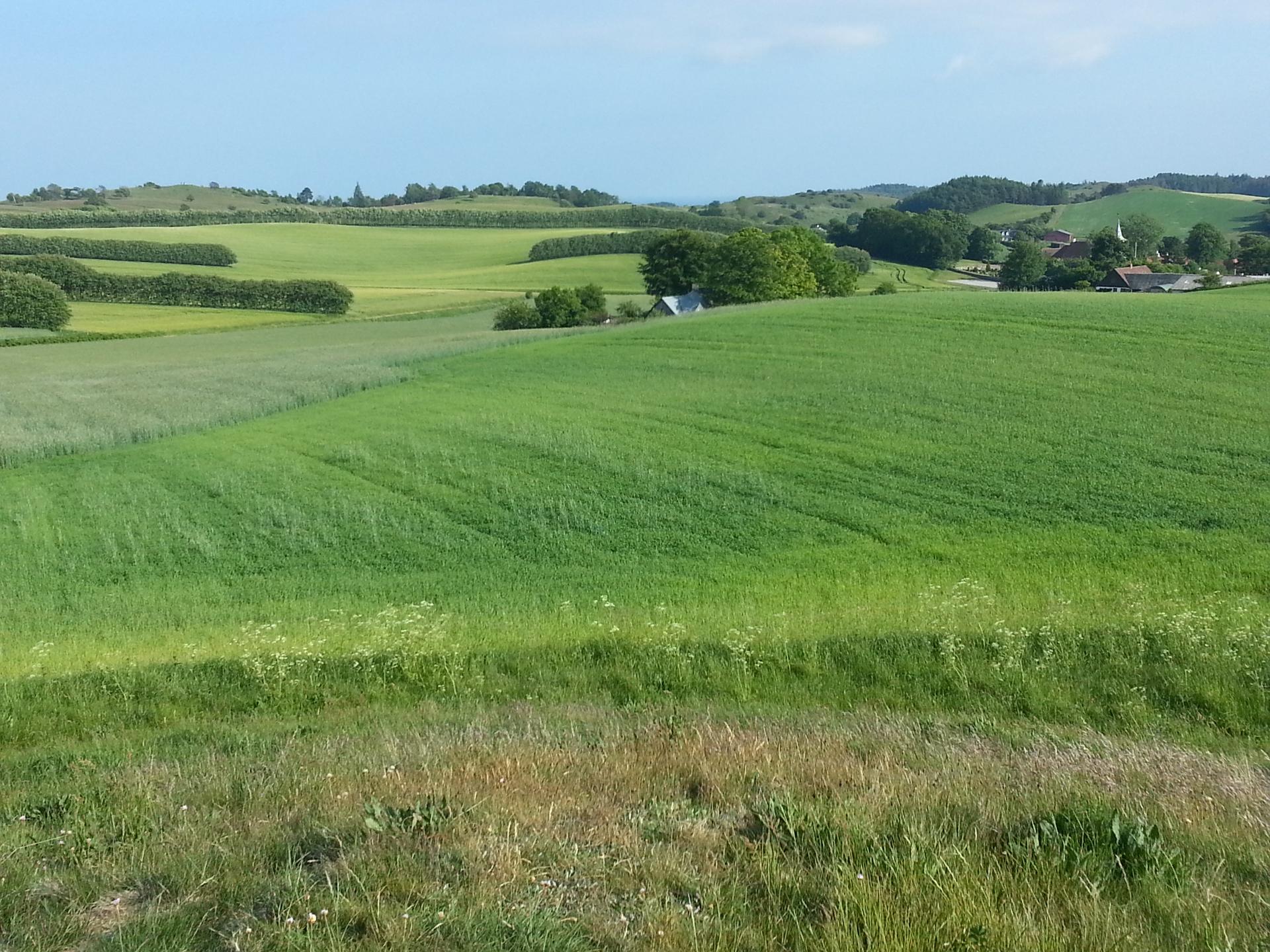
A slender, wind‑shaped isthmus between two bays, Dragsmur ties Helgenæs to Mols with Ice Age hills, stony shores and quietly protected coastal nature.

★★★★★4.5 (61)

Dragsmur is the narrow sandy isthmus that almost turns the Helgenæs peninsula into an island, a dramatic Ice Age landscape strung between Begtrup Vig and Aarhus Bay near Knebel. Here low, dune‑like hills, steep coastal slopes and stony beaches meet calm, shallow waters rich in birdlife. The area is managed for nature conservation, with simple camping spots nearby and wide views over sea, coves and the rolling contours of Mols Bjerge on the horizon.

Plan your visit

A brief summary to Dragsmur

Opening times, essentials, and a few local tips gathered into one calmer, easier-to-scan planning section.

Plan your visit

📍
Olaf Ryes Vej 4, Knebel, 8420, DK
🕒
Duration: 1 to 5 hours
💷
Free
🏛
Outdoor
📶
Mobile reception: 4 out of 5

Explore places near Dragsmur

    See all →

    Unlock the Best of Dragsmur

    Find tickets, tours with entry, and experiences available for this location.

    Buy tickets

    No tickets available

    Book tours with entry

    No tours with entry available

    Book tours without entry

    No tours without entry available

    Getting There

    Car from Aarhus

    From central Aarhus, driving to Dragsmur via the Djursland peninsula typically takes about 50–65 minutes depending on traffic. The route follows main regional roads through Rønde and Mols toward Knebel and Helgenæs. There is no entrance fee or parking charge at the nature area itself, but recent restrictions mean that cars must be left in designated public parking areas slightly away from the most sensitive dunes and beaches.

    Bus and walk from Ebeltoft

    From Ebeltoft, regional buses run towards Mols and Knebel several times a day, with journey times generally around 30–45 minutes to the nearest stops before Helgenæs. From there, you should expect a further 45–60 minutes of walking on minor roads and paths to reach Dragsmur, mainly on gently undulating terrain. Standard single bus tickets in the region are usually in the range of 30–60 DKK depending on distance. Services are less frequent in evenings and on weekends, so check timetables in advance.

    Cycling from Knebel and Mols area

    Cycling from Knebel or nearby villages on Mols to Dragsmur is a popular low‑impact option, with typical riding times of 20–40 minutes each way. The route uses quiet country roads with some short hills and occasional strong crosswinds near open stretches, but no technical difficulty. There is no cost beyond any bicycle rental, which in the area commonly ranges from about 100–250 DKK per day depending on type of bike and provider.

    For the on-the-go comforts that matter to you

    Restrooms
    Drinking Water
    Trash Bins
    Information Boards

    Local tips

    Wear sturdy shoes; much of the shoreline is uneven and very stony, especially if you plan to follow the coast for a longer stretch.
    Bring windproof layers even on warm days; the isthmus is exposed and breezes from either bay can make it feel cooler than inland.
    Respect protection zones on nearby reefs and keep dogs on a leash in spring and early summer to avoid disturbing nesting birds.

    Dragsmur location weather suitability

    Catch the right light and the right mood, whether you want a bright city moment or a more cinematic evening visit.

    Weather icon
    Clear Skies
    Weather icon
    Windy Conditions
    Weather icon
    Mild Temperatures
    Weather icon
    Any Weather
    Weather icon
    Cold Weather
    Weather icon
    Hot Weather

    Discover more about Dragsmur

    A narrow neck of land between two bays

    Dragsmur is a slim strip of land where sea and sky nearly cut Helgenæs free from the mainland. On one side lies the sheltered Begtrup Vig, on the other the more open Aarhus Bay, and between them the ground rises into a series of low, dune‑like knolls and narrow ridges. Walking here, you are never far from the sound of waves, with water visible in both directions and the sense that a strong tide could almost reclaim the peninsula. This is one of the most distinctive coastal landscapes in the Aarhus region. The coastline shifts quickly from sandy stretches with shallow, clear water to stony, wave‑worked shores where pebbles clatter in the surf. To the north you look towards the soft hills of Mols Bjerge, while to the south the land narrows and runs out into Helgenæs and the distant silhouettes of Ellemandsbjerget and Sletterhage Fyr.

    Shaped by Ice Age seas and shifting sands

    The terrain at Dragsmur owes its character to the last Ice Age and the changing sea levels that followed. The small, volcano‑like mounds and the steep eastern slopes near Ryes Skanser are remnants of an ancient Stone Age shoreline, carved when the sea stood several metres higher than today. Over time, currents carried sand and gravel along the coast, slowly building up the narrow bar that now binds Helgenæs to Mols. Even without specialist knowledge you can read this history in the land. Old coastal cliffs now sit inland, while curved beach ridges and low terraces mark former shorelines. Out in the water to the west, long, shallow reefs and sandbars form important resting and feeding areas for birds and seals, highlighting how dynamic this meeting of land and sea still is.

    Nature, birdlife and quiet coastal habitats

    Despite its modest size, Dragsmur shelters a variety of habitats. Shallow waters along the shores warm quickly in summer and are popular for wading and simple snorkelling, while the stony seabed further out supports mussels, seaweed and small crustaceans. Wading birds and gulls forage along the tideline, and in spring and autumn many migrating species pause here on their journeys along the Danish coasts. Behind the beach, stretches of coastal grassland and low heath cling to the sandy soils. These open areas, together with nearby protected reefs, are sensitive breeding and resting grounds. Parts of the coastal zone west of Dragsmur are designated for nature protection, so visitors are expected to keep good distance from marked bird reserves and to stay on the dry beach or established paths when moving along the shore.

    Walking, simple camping and life by the water

    Dragsmur is best experienced at walking pace. Paths and informal tracks lead over the low hills and down to the beaches, offering constantly changing viewpoints. Strong footwear is useful, as long stretches of shore are uneven and stony. For those keen on longer outings, Dragsmur forms a natural gateway into day‑long coastal hikes that trace much of Helgenæs’ 27‑kilometre shoreline. Near the isthmus there is a modest nature camp where small tents can be pitched close to the water. Facilities are basic, and there is no large communal fire ring, but simple cooking fires are allowed on the beach or beside tents when conditions permit and local rules are respected. The mood is informal and close to nature: you fall asleep to the sound of the sea and wake to light over the bay.

    Conservation rules and a fragile landscape

    In recent years, vehicle access has been tightened to protect the most vulnerable parts of the landscape. Camping with cars and driving on the natural terrain are not permitted, and barriers now keep motor traffic away from sensitive dunes and grassland. Dogs are welcome but must generally be kept on a lead, especially in the bird‑rich breeding season, when nests and chicks are easily disturbed. Visitors are encouraged to tread lightly: stick to established tracks where possible, avoid entering marked reserve zones on nearby reefs, and carry out all rubbish. These simple habits help preserve Dragsmur’s quiet, open character, ensuring that the narrow neck of land remains a refuge for both wildlife and those seeking a calm stretch of coast between two bays.

    A brief summary to Dragsmur

    Use Tower Bridge as your starting point for nearby food, family ideas, nightlife, and more local discoveries.

    Plan around the quieter times

    A quick look at seasonal patterns and peak visiting hours.

    Busiest months of the year

    Seasonality

    Busiest hours of the day

    Footfall
    Mobile App
    Get the app

    Your all‑in‑one travel companion app

    Explore expert travel guides, compare and book tours, experiences, hotels, and more—all from the palm of your hand. Download now for seamless trip planning wherever your wanderlust takes you.

    Fil:Agri Bavnehøj from west..jpg - Wikipedia, den frie encyklopædi

    More about Mols Bjerge National Park

    Discover the natural beauty and historical charm of Mols Bjerge National Park, where rolling hills, ancient woodlands, and serene lakes create a perfect outdoor escape.

    Tell me more about Mols Bjerge National Park

    Select Currency

    Choose the currency you want prices to display in.