Background

Ellemandsbjerget Top, Helgenæs

Low in altitude but rich in horizons, Ellemandsbjerget crowns Helgenæs with sweeping sea views, quiet forest paths and hints of Denmark’s coastal history.

4.8

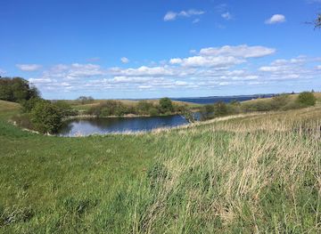
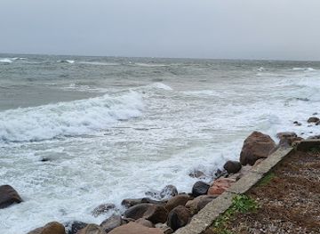
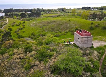
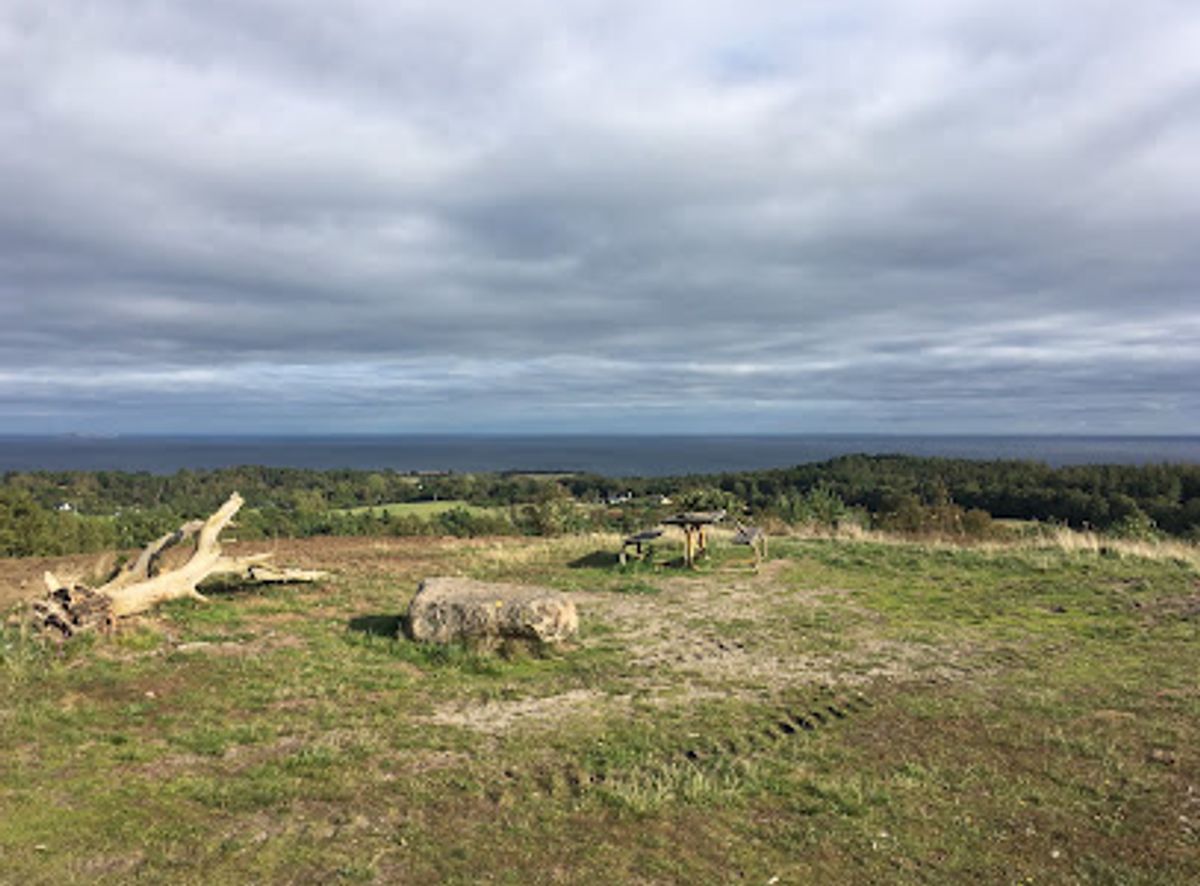
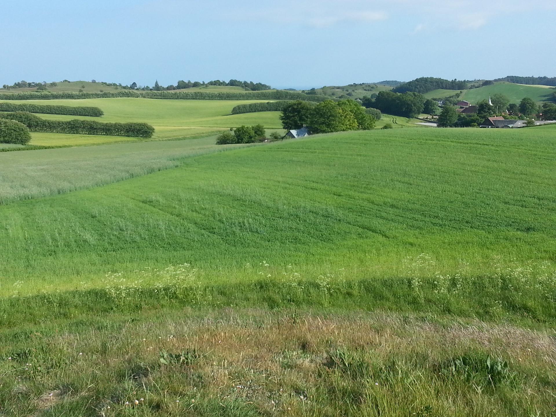
Ellemandsbjerget is a 99 m high hill on the Helgenæs peninsula near Knebel, offering one of Denmark’s broadest coastal panoramas. From the top you can gaze across Aarhus Bay and, on clear days, pick out islands in the southern Kattegat along with parts of Funen and Zealand. Waymarked forest and heathland paths lead to the summit, passing quiet plantations, WWII relics and open viewpoints that feel surprisingly wild for such a lowland country.

A brief summary to Ellemandsbjerget top

  • Ellemandsvej, Knebel, 8420, DK
  • Duration: 1 to 3 hours
  • Free
  • Environment icon Outdoor
  • Mobile reception: 3 out of 5

Local tips

  • Wear sturdy footwear; some stretches near the summit and on the eastern slopes can be steep, uneven and slippery in wet or frosty conditions.
  • Bring layers and a windproof jacket, as the summit is much more exposed and breezy than the lower forest and parking area.
  • Pack binoculars or a camera with a zoom lens to pick out distant islands, ships in Aarhus Bay and the varied coastline around Helgenæs.
  • If you walk with a dog, check local dog-walking guidelines and keep your pet under control around wildlife and steep slopes.
  • Time your visit for early morning or late evening on clear days for softer light and more atmospheric coastal views from the top.
widget icon

Getting There

  • Car from Aarhus

    From central Aarhus, driving to Ellemandsbjerget via the main route through Mols Bjerge typically takes 50–70 minutes depending on traffic. The last part of the journey follows smaller country roads across Helgenæs with gentle hills and occasional sharp bends. Parking near the signed trailhead between Esby and Ørby is free, but spaces are limited on sunny weekends and peak holiday periods.

  • Bus and local walk from Aarhus region

    Public transport connections usually involve a regional bus towards Knebel or the broader Mols area, followed by a change to a local service towards Helgenæs or a taxi for the final stretch. Total travel time often ranges from 1.5 to 2.5 hours depending on waiting times. Expect to pay roughly 40–80 DKK in total for bus tickets within the region, and additional cost if using a taxi from the nearest village.

  • Cycling from Knebel

    From Knebel, experienced cyclists can reach the Ellemandsbjerget area in about 35–55 minutes by following rural roads across Helgenæs. The route includes rolling terrain with a few short, steeper sections and is best suited to riders comfortable sharing the road with local traffic. There is no dedicated bike parking at the trailhead, so bring a lock and be prepared to secure your bike discreetly without blocking access.

Ellemandsbjerget top location weather suitability

  • Weather icon Clear Skies
  • Weather icon Mild Temperatures
  • Weather icon Cold Weather
  • Weather icon Hot Weather
  • Weather icon Any Weather
  • Weather icon Windy Conditions

Unlock the Best of Ellemandsbjerget top

Buy tickets

    No tickets available

Book tours with entry

    No tours available

Book tours without entry

    No tours available

Discover more about Ellemandsbjerget top

A Hilltop That Feels Like the Middle of Denmark

Ellemandsbjerget rises to just 99 m, yet its position at the tip of the Helgenæs peninsula gives the summit an almost central feel in the Danish landscape. From the top you stand above a mosaic of bays, peninsulas and islands, with the sea forming a broad blue ring around you. In clear weather the view stretches across Aarhus Bay to Tunø and Samsø, and further towards Sejerø, Zealand’s Oddde and the open Kattegat beyond. Despite the modest height, the climb has a satisfying sense of ascent. As you follow the marked trail from the surrounding plateau, trees fall away, the wind grows stronger, and the horizon opens in every direction. The contrast between the sheltered lower forest and the exposed crown of the hill makes the summit feel higher than the numbers suggest.

Shaped by Ice, Wind and the Surrounding Sea

Geologically, Ellemandsbjerget is a legacy of the last Ice Age, when glaciers pushed and folded the landscape that now forms Mols Bjerge and Helgenæs. Here at the southern tip, the terrain is more compact, but the glacial ridges still give the land a rolling, undulating character. The hill’s slopes shift between heather, grass, scattered juniper and small plantations of conifer and deciduous trees. The surrounding sea is never far from view. Light reflects off the water, changing the character of the hill through the day and across the seasons. On calm summer days the bay looks like polished glass, while in autumn the wind can race across the summit, driving waves into the coastline far below. This interplay of land and sea is part of what makes the viewpoint memorable.

Traces of Defence and Quiet Stories in the Landscape

Ellemandsbjerget’s strategic position has not only appealed to hikers. The area around the hilltop carries traces of 20th-century coastal defence, including old military installations and remnants linked to past gun positions. These concrete and earth structures blend into the heather and scrub, but once you notice them they add an extra layer to the experience of the place. Away from the summit, forest paths loop through a plantation that softens the hill’s outline. The mix of open glades and denser stands of trees creates good conditions for birds and small mammals, and it is not unusual to catch sight of deer moving quietly between the trunks. The combination of natural drama and low-key cultural history gives the hill an atmosphere that is calm but never bland.

Walking Routes, Dog-Friendly Woods and Seasonal Moods

From the parking area between Esby and Ørby, an obvious marked trail leads towards the top, making the walk accessible without being monotonous. The path climbs progressively, with short steeper sections that may feel demanding but remain manageable for most reasonably fit walkers. Surrounding tracks allow you to extend the outing into a longer loop through forest and open ground. Ellemandsbjerget is also known as a dog-friendly area, with designated walking zones where four-legged companions can explore on-leash trails beneath the trees. The setting changes character throughout the year: spring brings fresh greens and bright light through budding canopies; summer offers long evenings and soft colours over the bay; autumn often means powerful skies; and in winter, a dusting of snow can turn the summit into a quietly dramatic lookout.

A Compact Outing with Big-Sky Rewards

One of the hill’s appeals is how much it offers within a relatively small area. You can reach the top on a short outing, yet still feel that you have stepped into a more rugged, exposed landscape. The open views lend themselves to unhurried pauses: watching the movement of ferries in the distance, tracing the shape of the coastline, or simply standing in the wind and listening to the subdued sounds from the woods below. For many visitors, Ellemandsbjerget becomes a natural focal point within a wider exploration of Helgenæs and the surrounding national park landscapes. It works equally well as a brief viewpoint stop or as the highlight of a half-day walk linking nearby villages, shorelines and other headlands around the peninsula.

Busiest months of the year

Busiest hours of the day

Popular Experiences near Ellemandsbjerget top

Popular Hotels near Ellemandsbjerget top

Select Currency