Discover more about Dragsmur
A Landscape Shaped by Ice and Rising Seas
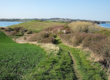
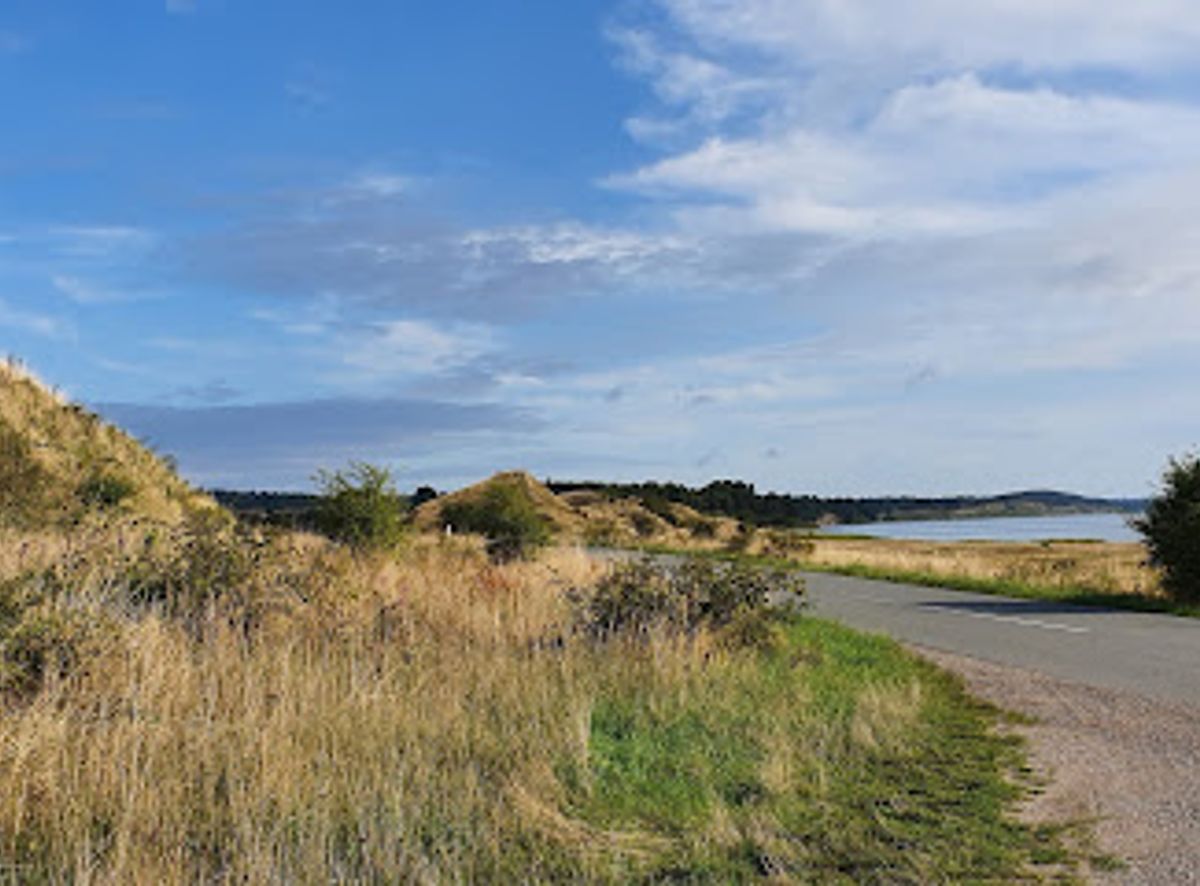
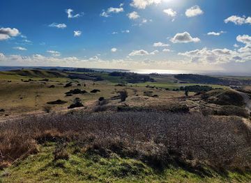
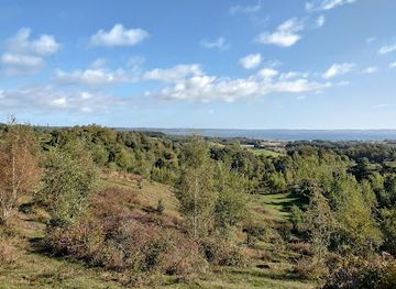
Dragsmur sits on the Draget isthmus, a flat and narrow landform (maximum 2 meters elevation, 300 meters wide) that emerged gradually through post-glacial land uplift beginning around 6,000 to 7,000 years ago. The landscape tells the story of dramatic geological transformation. During the last ice age, approximately 20,000 years ago, glaciers reshaped the terrain, creating the terminal moraines that form the distinctive Mols Bjerge hills. As the climate warmed and ice melted, sea levels rose, and the Draget area became submerged beneath what is known as the Stone Age Sea—approximately 4.5 meters higher than today's water level. Over millennia, the land gradually rose relative to the sea, eventually creating the narrow passage that now connects Helgenæs to the mainland. The isthmus's flat sections are literally raised seabed, while the small volcanic-like hills and steep eastern slopes near Ryes Skanser bear witness to ancient wave action and coastal erosion from that prehistoric ocean.Medieval Defense and the Mystery of Dragsmur Wall
Mid-way across the isthmus runs Dragsmur itself—a low earthen embankment with a core of stone that stretches the entire width of the Draget. Its true origins remain enigmatic. A written account from 1623 suggests it was constructed in the late 1200s by Marsk Stig, a powerful local landowner who controlled Helgenæs at that time. Alternative theories propose it may have served as an ancient boundary for the king's hunting grounds on Helgenæs. Regardless of its original purpose, the wall's strategic location made it a natural military fortification. When Danish general Olaf Rye constructed the impressive Ryes Skanser fortress in 1848 to defend against Swedish forces during the Three Years' War, Dragsmur was reinforced with additional earth on its northern side, creating an advanced defensive line in front of the higher fortifications. The skanser itself features distinctive zigzag trenches with steep forward faces and drainage ditches designed for crossfire and maximum defensive capability. Today, Dragsmur marks the boundary between two parishes (Vistoft and Helgenæs) and serves as the southern boundary of Mols Bjerge National Park.Coastal Ecology and Medieval Agriculture
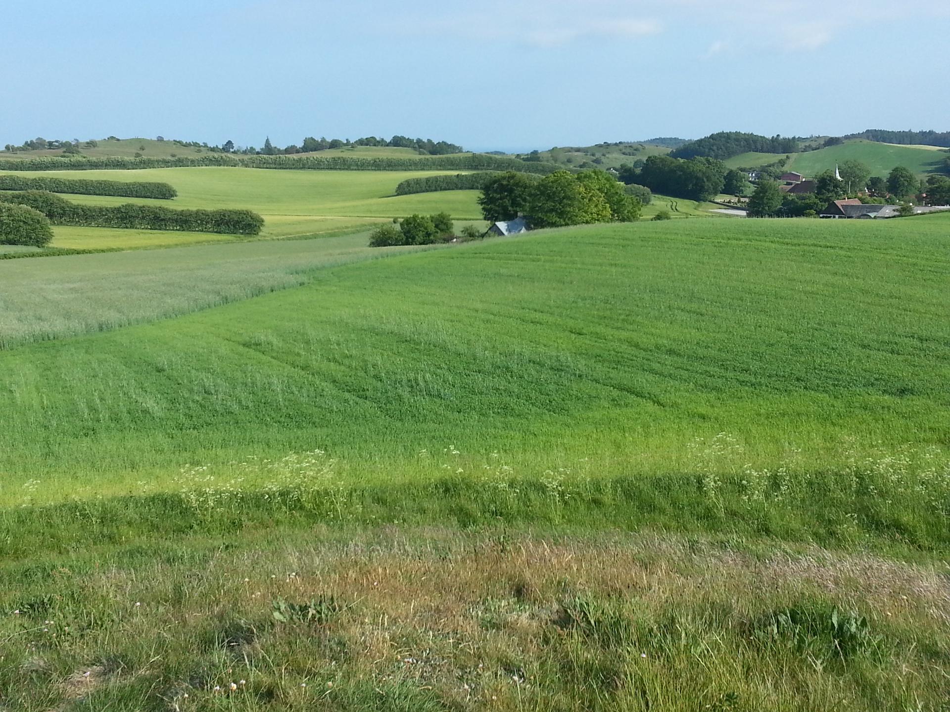
The Draget landscape preserves remarkable evidence of human settlement and land use spanning millennia. Following the shoreline southward, visitors can observe remnants of medieval ridge-and-furrow agriculture preserved in the low coastal cliffs—evidence of intensive farming practices from centuries past. The surrounding waters offer distinct ecological character: Ebeltoft Vig lies to the east and Begtrup Vig to the west, both providing opportunities for swimming and fishing. Ebeltoft Vig is particularly notable as a launching point for small boats and dinghies. The narrow isthmus itself creates a natural corridor where maritime and terrestrial ecosystems meet, supporting diverse coastal vegetation and bird life. The landscape's gentle waves and broad undulations visible across the Draget reflect ancient storm-deposited beach ridges that accumulated gradually as the sea level dropped and the land rose—a natural archive of coastal dynamics.Gateway to Water-Based Adventure
Dragsmur has emerged as a premier departure point for kayaking expeditions along the Djursland coast. The calm waters of both Ebeltoft Vig and Begtrup Vig provide ideal conditions for paddlers of varying experience levels. The narrow isthmus offers a unique vantage point where paddlers can observe the meeting of two distinct water bodies and experience the subtle shifts in coastal topography. The area's accessibility by water and its position within Mols Bjerge National Park make it an important hub for water-based nature exploration.Nature Camping and Low-Impact Recreation
Dragsmur accommodates primitive nature camping through Naturstyrelsen's managed sites, designed for visitors seeking minimal-impact outdoor experiences. These car-free camping areas are equipped with basic facilities including running water and toilets at some locations, with shelters available at select sites. Visitors are limited to two consecutive nights per location. Small cooking fires are permitted on the beach and near tents, though no designated fire pits exist. The sites are not suitable for wheelchair users or those with mobility limitations. Access is restricted to walkers and cyclists, with no vehicles, caravans, or motorhomes permitted. Camping requires advance application through Naturstyrelsen's online system.Seasonal Rhythms and Visitor Patterns
The Dragsmur area experiences distinct seasonal variations in visitor activity. Summer months (June through August) see peak visitation, particularly among kayakers and day-trippers exploring the national park. Spring and autumn offer quieter experiences with pleasant weather for hiking and nature observation. Winter visits are possible but less common, with colder temperatures and shorter daylight hours limiting recreational activities. The area remains accessible year-round, with no seasonal closures, though weather conditions significantly influence the experience and suitability for different activities.