Background

Flodbyen Randers Waterfront District

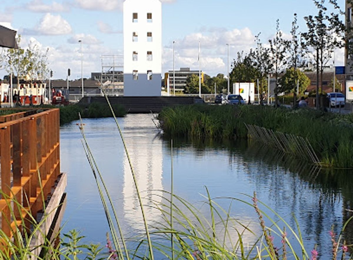
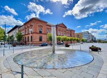
A transforming waterfront where Randers turns to face its river and fjord, blending climate protection, green spaces and future city life along the water’s edge.

★★★★★5 (7)

Flodbyen Randers is an ambitious new waterfront district unfolding along the Gudenå and Randers Fjord, reshaping the link between historic Randers and its blue edge. Centered around climate protection works known as the “Klimabåndet”, the project blends flood defenses, green spaces, promenades and future housing into one continuous riverfront. Even in its evolving state, you can explore paths, views over the water and a front‑row glimpse of one of Denmark’s most visionary urban transformations.

Plan your visit

A brief summary to Flodbyen Randers

Opening times, essentials, and a few local tips gathered into one calmer, easier-to-scan planning section.

Plan your visit

📍
Østervold, Randers, Randers C, 8900, DK
🕒
Duration: 0.5 to 2 hours
💷
Free
🏛
Outdoor
📶
Mobile reception: 4 out of 5

Explore places near Flodbyen Randers

    See all →

    Unlock the Best of Flodbyen Randers

    Find tickets, tours with entry, and experiences available for this location.

    Buy tickets

    No tickets available

    Book tours with entry

    No tours with entry available

    Book tours without entry

    No tours without entry available

    Getting There

    Walk from central Randers

    From the central shopping streets of Randers C, Flodbyen’s riverfront sections can typically be reached on foot in about 5–15 minutes, depending on your starting point. The walk is generally flat and follows ordinary city pavements, making it suitable for most visitors, including families with strollers. Surfaces within Flodbyen itself may vary, so wheelchair users should be prepared for occasional gravel or inclined paths near the Klimabåndet embankments.

    City bus within Randers

    Local city buses running through Randers C stop a short walk from the waterfront along Østervold and nearby streets. Typical travel times within the compact city are 10–20 minutes, with standard single tickets usually in the range of 20–30 DKK depending on zones and any concessions. Services run frequently during the day, though evening and weekend timetables can be less frequent, so it is worth checking departure times in advance.

    Bicycle access

    Randers is a cycle-friendly city, and Flodbyen is designed with cyclists in mind. From residential districts around Randers C and Randers NØ, you can usually reach the waterfront in 10–25 minutes by bike on mostly flat routes. Expect a mix of cycle lanes and shared roads. Bike racks are available in and around the central areas, but during construction phases you may find some sections temporarily rerouted or narrowed.

    Regional arrival to Randers then local transfer

    If you arrive in Randers by regional train or intercity bus, onward access to Flodbyen is straightforward. From Randers Station, the waterfront is typically 10–20 minutes away on foot, or about 5–10 minutes by local bus or taxi. Taxi fares within the city usually start with a base fee and reach roughly 80–140 DKK for short central trips, depending on distance and time of day. The route from the station to the riverfront is mostly level, but expect busier pavements at peak hours.

    For the on-the-go comforts that matter to you

    Restrooms
    Drink Options
    Drinking Water
    Food Options
    Seating Areas
    Sheltered Areas
    Trash Bins
    Information Boards
    Visitor Center

    Local tips

    Wear comfortable shoes: surfaces vary between smooth promenades, gravel paths and occasional construction detours as the area is still developing.
    Bring a windproof layer; the open fjord and riverfront can feel noticeably cooler and breezier than streets further inland.
    Look out for temporary exhibition containers and information boards that explain the Klimabåndet flood defenses and future phases of Flodbyen.
    Visit in late afternoon for soft light over the fjord and reflections on the water, ideal for photography of the evolving skyline.

    Flodbyen Randers location weather suitability

    Catch the right light and the right mood, whether you want a bright city moment or a more cinematic evening visit.

    Weather icon
    Any Weather
    Weather icon
    Clear Skies
    Weather icon
    Windy Conditions
    Weather icon
    Mild Temperatures
    Weather icon
    Cold Weather
    Weather icon
    Hot Weather

    Discover more about Flodbyen Randers

    Where River, Fjord and City Meet

    Flodbyen Randers stretches along the meeting point of the Gudenå River and Randers Fjord, turning what was once mainly working waterfront into a new face of the city. Here, Denmark’s only real river harbour city reorients itself towards the water, opening views back to the historic centre and out towards the broad, tidal fjord. Walking the area today, you encounter a patchwork of finished public spaces, interim paths, grassy embankments and working quays. This is very much a place in transition, where cranes and construction fences share space with benches, wild grasses and the slow movement of the river below.

    A Climate Belt with a Social Heart

    At the core of Flodbyen lies the Klimabåndet – an elevated band of landscape and engineering designed to shield Randers from storm surges, cloudbursts and rising groundwater. Instead of hiding the defenses behind walls, the project turns them into accessible terraces, embankments and routes. You may walk along gently sloping paths that double as flood protection, pause on viewpoints angled towards the fjord, or sit on steps that lead down to floating pontoons when water levels allow. The technical role of the structures fades into the background; what you feel most is the sense of a long, continuous waterfront park wrapping around the city.

    Naturing the Former Harbour Edge

    Flodbyen is also about returning a more natural character to parts of the harbour. Design proposals reintroduce a soft delta-like edge in selected zones, with reeds, shallow inlets and low planting that invite birds, insects and occasional fishers closer to the city. Even in early phases, you notice how grasses and young trees have been woven into former hardstand areas. Information panels and pop-up exhibition containers occasionally explain how new wetlands and nature-based solutions are tied to larger regional efforts to restore water landscapes along the Gudenå and Randers Fjord.

    Everyday Life by the Water

    The ambition is that Flodbyen becomes a lived-in neighbourhood as much as a recreational zone. Future housing, offices and cultural spaces are planned to step down towards the water, with everyday routes leading residents across the Klimabåndet to the riverfront. For now, you may see joggers using the new paths as a continuous loop, cyclists passing between town and fjord, and families stopping at lawns or simple play elements. The scale feels intimate compared with large seafront promenades; distances are walkable, and the old city streets remain just a short stroll away.

    Architecture of Transitions

    Architecturally, Flodbyen is defined less by singular landmark buildings and more by the way terraces, ramps and landscape planes tilt and fold. Materials are robust – concrete, steel, timber and stone – chosen to withstand brackish water and winter storms, then softened by planting and the constantly shifting light over the fjord. Long, low profiles keep views open to church towers and the traditional skyline of Randers. The design language is contemporary and clean, yet attentive to the industrial traces of the old harbour: rails in the pavement, mooring bollards, and preserved edges that tell of a working waterfront history.

    Seeing a City’s Future Take Shape

    Visiting Flodbyen now offers a rare chance to witness a major urban project while it is unfolding. Temporary exhibitions, model displays and viewing points help explain how future streets, canals and green corridors will stitch into the existing city. It is a place that rewards slow exploration: follow a ramp to a higher terrace for a wide panorama of river bends, then drop back down to feel the breeze at the water’s edge. As phases are completed, Flodbyen will gradually read less like a construction site and more like a continuous urban landscape where climate resilience, nature and city life are inseparable.

    Plan around the quieter times

    A quick look at seasonal patterns and peak visiting hours.

    Busiest months of the year

    Seasonality

    Busiest hours of the day

    Footfall
    Mobile App
    Get the app

    Your all‑in‑one travel companion app

    Explore expert travel guides, compare and book tours, experiences, hotels, and more—all from the palm of your hand. Download now for seamless trip planning wherever your wanderlust takes you.

    Fil:Randers Regnskov facade.jpg - Wikipedia, den frie encyklopædi

    More about Randers

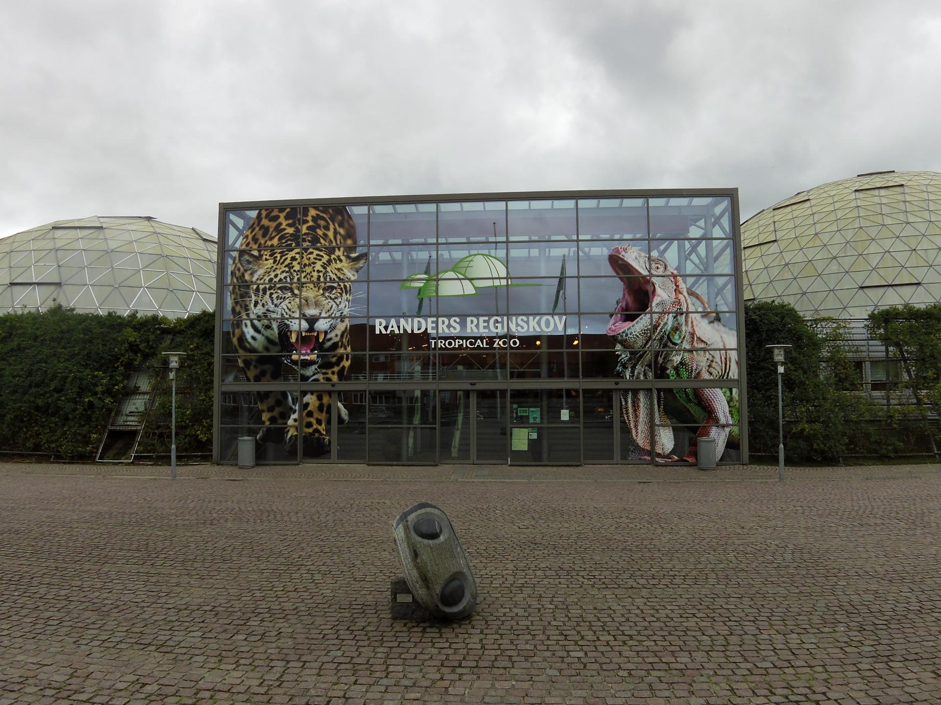
    Discover Randers, Denmark's riverside jewel, where history meets nature in a city full of cultural charm and scenic beauty.

    Tell me more about Randers

    Select Currency

    Choose the currency you want prices to display in.