Background

Kanhavekanalen

A 1,300-year-old Viking shortcut carved across an island to control Denmark's seas.
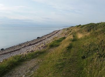
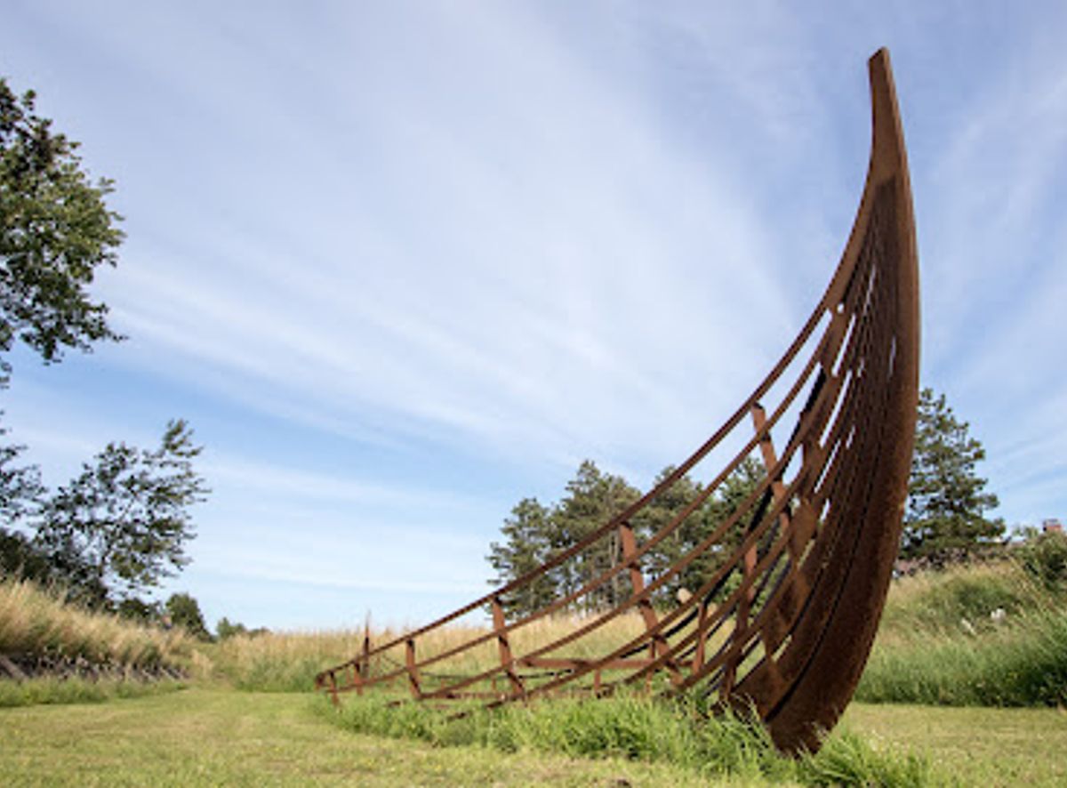
4.1

A Strategic Waterway from the Viking Age

Kanhavekanalen stands as one of Denmark's most impressive Viking-era engineering projects. Built in 726 AD, this 500-meter canal was deliberately cut across the narrowest section of Samsø island, connecting Stavns Fjord in the east to Mårup Vig in the west. The canal measures approximately 11 meters wide and originally reached depths of around 1.25 meters, though water levels have since dropped due to land elevation and silting. This ambitious undertaking required substantial labor and coordination, yet it remains largely undocumented in written historical sources, making its precise purpose a matter of archaeological interpretation.

Engineering Marvel of the Early Medieval Period

The construction of Kanhavekanalen demonstrates sophisticated understanding of hydraulic engineering and structural stability. The canal's sides were reinforced with wooden bulwarks consisting of 2 to 4 horizontal planks, each measuring between 2.5 and 4 meters in length, predominantly fashioned from oak. These planks were secured with long wooden pegs and heavy, pointed stakes driven into the underlying ground. Dendrochronological analysis of the preserved timber has precisely dated the construction to 726 AD, with some samples indicating a range of 724–729. The revetment system was retained by thick diagonal oak piles, a testament to the builders' understanding of load distribution and soil mechanics. Archaeological excavations conducted in 1960, 1977, 1979, and 1995 have progressively revealed the canal's sophisticated design and construction methods.

Military Harbor and Fleet Control

The Kanhave Canal functioned as a military installation designed to organize and marshal the Danish fleet during the Viking Age. Stavns Fjord, with its natural harbor characteristics and protected waters, provided an ideal gathering point for Viking warships. The canal served multiple strategic purposes: it acted as a shortcut for vessels traveling between the Kattegat and the Bay of Aarhus, eliminating the need to sail around the island's perimeter. Ships could be hauled or dragged across wooden poles at the western terminus, saving considerable time compared to conventional sailing routes. A fleet positioned in Stavns Fjord, with observation points at Hjortholm or Vorbjerg, could effectively control north-south maritime traffic along the Jyske coast and monitor passages between Jylland and the eastern regions of Sjælland and Skåne. The canal was specifically designed to accommodate shallow-draft vessels of the snekke class, lightweight warships ideal for rapid deployment and coastal operations.

Logistics and Fleet Operations

The scale of operations at Kanhavekanalen suggests that marshalling a complete fleet required approximately 2 to 3 weeks, necessitating extensive logistical infrastructure. The surrounding beaches and flatlands had to accommodate support systems for potentially several hundred ships, including facilities for sail drying, crew quarters, food storage, and supplies. Archaeological evidence indicates that ships were berthed side by side, enabling rapid launching when needed. The canal's design allowed for efficient ship maintenance and repair, with traces of such activities discovered during excavations. However, no evidence of commercial trade has been found at the site, confirming its exclusively military character.

Historical Context and Decline

The construction of Kanhavekanalen coincided with significant events in Danish Viking history. According to historical sources, King Angantyr ruled Samsø during this period, and the year 728 AD—just two years after the canal's completion—witnessed a major battle on the island in which Angantyr and his eleven brothers reportedly fell. The canal may have played a defensive role in protecting the emerging Viking settlement at Aros (modern Aarhus) located on the nearby mainland. The canal remained in active use throughout the 700s but subsequently fell into disrepair and gradually silted up due to natural land elevation and sediment accumulation. By the medieval period, the waterway had become impassable, though its distinctive depression in the landscape has persisted for over 1,300 years, serving as a tangible reminder of Viking engineering prowess.

Archaeological Significance and Modern Interpretation

Kanhavekanalen represents an unparalleled example of large-scale construction from the late Germanic Iron Age and early Viking period. Its discovery and systematic study have provided invaluable insights into Viking military organization, maritime technology, and engineering capabilities. The site features interpretive markers and informational panels explaining the canal's historical background and construction methods. A Viking ship model is displayed at the location to illustrate the snekke-class vessels that once navigated these waters. The canal's landscape remains largely unchanged, allowing visitors to appreciate the original engineering and imagine the bustling naval operations that once occurred here.

Local tips

  • Visit during clear weather to fully appreciate the canal's landscape depression and the views across the island. The site is open year-round and accessible at any time.
  • Read the interpretive panels carefully to understand the canal's military purpose and engineering details. They provide essential context for appreciating this Viking-era achievement.
  • Combine your visit with nearby attractions on Samsø, including Tranebjerg Kirke and Besser Kirke, to experience the island's broader historical narrative.
  • The site is best explored on foot or by bicycle, allowing you to walk the canal's length and observe the landscape changes that mark its path across the island.
widget icon

Buy tickets

    No tickets available

Book tours with entry

    No tours available

Book tours without entry

    No tours available

A brief summary to The Kanhave Canal

  • Kanhave, Samsø Municipality, 8305, DK

Getting There

  • Ferry and Car

    Take the ferry from Kalundborg (approximately 45 minutes) or Hou (approximately 50 minutes) to Samsø. Upon arrival, rent a car or bicycle at the ferry terminal. Drive or cycle to Kanhave in the northern part of the island, approximately 15–20 minutes from Nordby harbor. Parking is available near the site. Ferry tickets cost approximately 60–80 DKK per person for a standard crossing.

  • Bicycle Tour

    After arriving by ferry, rent a bicycle from local providers on Samsø (approximately 80–120 DKK per day). Cycle north from Nordby toward Kanhave, following local signage. The route is approximately 10–12 kilometers and takes 45–60 minutes on relatively flat terrain. This option offers flexibility and allows exploration of the broader island landscape.

  • Guided Tour

    Book a guided tour through Samsø Museum or local tourism operators that includes transportation from the ferry terminal and expert interpretation of the canal's history and archaeology. Tours typically last 2–3 hours and cost approximately 200–300 DKK per person, including guide services.

Popular Experiences near The Kanhave Canal

Popular Hotels near The Kanhave Canal

Select Currency