Background

Viborg Søerne

Twin glacial lakes in Viborg's heart offering scenic walks, water sports, and rich medieval history.

4.8

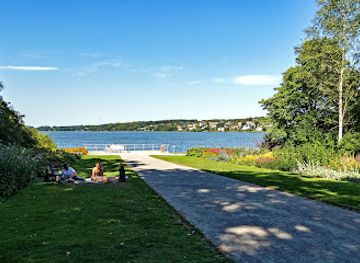
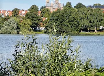
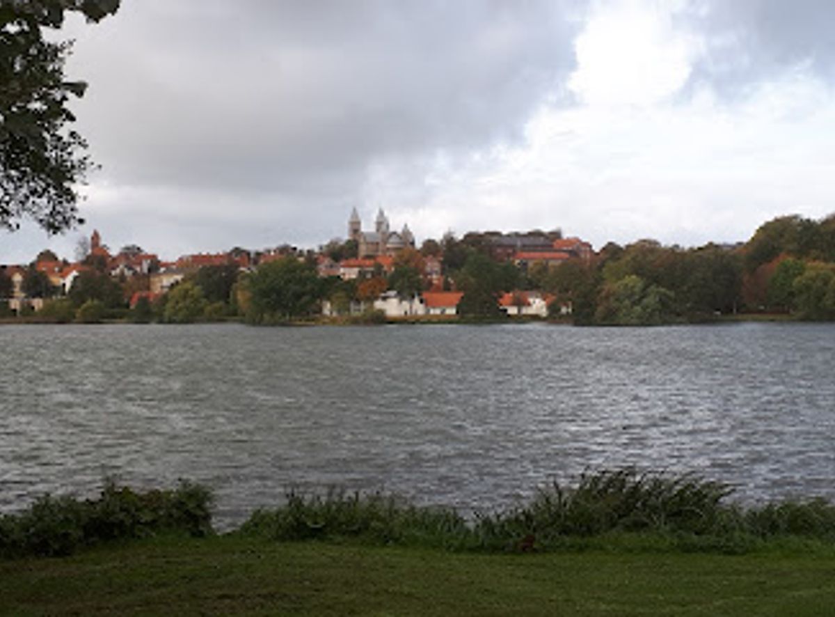
Viborg Søerne comprises two beautiful interconnected lakes—Nørresø and Søndersø—situated in the heart of Viborg, Denmark. Spanning over 275 hectares combined, these glacial lakes are surrounded by lush nature and vibrant city life, offering an ideal escape for outdoor enthusiasts. An 11-kilometer circuit trail encircles both lakes, providing opportunities for walking, cycling, fishing, swimming, and water sports like kayaking and SUP boarding.

A brief summary to Viborg Søerne

  • Randersvej 2, Viborg, 8800, DK
  • Duration: 1.5 to 4 hours
  • Free
  • Environment icon Outdoor
  • Mobile reception: 4 out of 5
  • Monday 12 am-12 am
  • Tuesday 12 am-12 am
  • Wednesday 12 am-12 am
  • Thursday 12 am-12 am
  • Friday 12 am-12 am
  • Saturday 12 am-12 am
  • Sunday 12 am-12 am

Local tips

  • Complete the full 11-kilometer circuit on foot or by bicycle to experience both lakes and encounter all six interpretive signs that reveal the area's fascinating geological and historical narrative.
  • Visit during summer months for optimal conditions: water quality is best, boat rentals are available, and swimming and water sports like SUP and kayaking are in full operation.
  • Bring a national fishing license if you plan to fish; the lakes are free to fish from boats and public shoreline areas, with excellent opportunities for pike, zander, and carp.
  • Pack the printable "Tip en 10'er" quiz before your visit to add an interactive element to your walk and test your knowledge of the lakes' history and natural features.
  • Explore Borgvold castle and the adjacent Biblical Garden (Bibelhaven) at the northern end of Nørresø to combine lakeside recreation with cultural and historical sites.
widget icon

Getting There

  • Public Transport from Viborg City Centre

    From Viborg train station or city center, local buses operate routes to the lakes area. Journey time is approximately 10–15 minutes depending on the specific stop. Buses serve multiple access points around both lakes, including stops near Borgvold and Nørresø bathing area. Fares are modest (typically 20–30 DKK for a single journey) and integrated into the regional transport system. Service frequency is regular on weekdays and reduced on weekends.

  • Cycling from Viborg Centre

    The lakes are easily accessible by bicycle from central Viborg, approximately 2–3 kilometers away via flat, well-maintained cycle paths. Journey time is 10–15 minutes. Viborg has extensive cycling infrastructure, and bike rentals are available at several locations in the city center. This is the most flexible and popular option for visitors, offering direct access to multiple entry points around both lakes.

  • Car with Parking

    Multiple parking areas are located around the lakes, including facilities near Borgvold (northern end of Nørresø), Nørresø bathing area, and various points along the southern shore near Søndersø. Parking is generally free or low-cost. From central Viborg, driving time is 5–10 minutes. The lakes are well signposted from main roads within the city.

  • Walking from Viborg Centre

    A scenic walk from central Viborg to the lakes takes approximately 25–35 minutes depending on your starting point and destination. The route is flat and follows established paths through the city and surrounding areas. This option is ideal for those staying centrally and seeking a gentle introduction to the area before beginning the lakeside circuit.

Viborg Søerne location weather suitability

  • Weather icon Any Weather
  • Weather icon Mild Temperatures
  • Weather icon Clear Skies

Unlock the Best of Viborg Søerne

Buy tickets

    No tickets available

Book tours with entry

    No tours available

Book tours without entry

    No tours available

Discover more about Viborg Søerne

Geological Origins and Formation

Viborg Søerne are geological remnants of the last ice age, which ended approximately 15,000 years ago. The lakes occupy an ancient tunnel valley that extends from Mariager Fjord in the northeast to Hald Sø in the southwest—one of many glacial valleys carved through northern and eastern Viborg Municipality. During the Weichsel ice age, around 23,000 to 20,000 years ago, massive glaciers and meltwater eroded pre-existing river valleys, cutting them 50 to 100 meters deep into earlier sediment layers. When the ice retreated roughly 13,000 years ago, the valley was left with uneven bedrock and deposits of glacial material. The two lakes likely formed from melting ice blocks—dødisklumper—that were buried beneath sediment and slowly thawed over millennia, creating the distinctive basin landscape visible today.

Medieval Transformation and Historical Development

In the early Middle Ages, Nørresø and Søndersø were separate bodies of water, divided by a narrow land bridge. This changed dramatically in 1313 when King Erik Menved constructed Borgvold castle on the peninsula between them. To strengthen the fortification, the lakes were dammed, raising the water level by approximately two meters. The submerged land bridge connected the two lakes into a single body of water, transforming the landscape and severing the ancient road that once crossed the isthmus. For nearly 500 years, travelers were forced to either cross by ferry or take a lengthy 5-kilometer detour around Nørremølle to the north. The unified lake became known simply as Viborg Sø in historical documents and maps from the 1300s onward. Only in 1854–1855, with the construction of the current dam, were the lakes artificially divided again into their present configuration as Nørresø and Søndersø, and the unified name gradually fell from use.

Physical Characteristics and Water Quality

Nørresø, the northern lake, covers approximately 124 hectares, stretches 2.3 kilometers in length, and reaches a maximum width of 700 meters. Its deepest point, 12.2 meters, lies in the northeastern corner. Søndersø, the southern lake, is slightly larger at approximately 151 hectares. The shoreline of both lakes is developed with residential areas and public access points distributed around their perimeters. Historically, both lakes suffered from severe pollution, particularly Søndersø, which received untreated municipal wastewater throughout much of the 20th century. The lake bed remains covered with phosphorus-rich sediment from this period. Nørresø experienced less contamination and has benefited in recent years from artificial aeration systems that pump oxygen into the water during summer months, improving overall water quality and ecosystem health.

Fishing and Aquatic Life

Viborg Søerne support a diverse fish population, including pike, zander, perch, lake trout, eel, and various coarse fish species. Common carp are particularly abundant, with many specimens weighing between 8 and 12 kilograms. Fishing is free from boats and from publicly accessible sections of the shoreline, provided anglers hold a valid national fishing license. The Viborg Fisheries Association manages fishing rights for most of Nørresø and offers daily permits and membership options. While the fish population includes numerous coarse species such as bream and roach, the lakes remain productive for both recreational and serious anglers seeking quality catches.

Recreation and Modern Activities

The complete circuit around both lakes measures 11 kilometers and welcomes walkers and cyclists of all abilities. The route passes through varied landscapes, from the quieter, greener environment around Søndersø to the more urban character of Nørresø's shoreline. Six large interpretive signs positioned around the lakes—at Borgvold, the FDF sailing center, Nordisk Park, Søndermølle, Amtmandens Bro, and Sønæs—provide historical narratives and information about the natural environment. Interactive challenges for children are featured on each sign, making the walk engaging for families. A "Tip en 10'er" quiz allows visitors to test their knowledge by answering ten questions based on information gleaned from the interpretive signs. The lakes are also ideal for water-based activities: kayaking, stand-up paddleboarding (SUP), and swimming are popular during warmer months. Boat rentals are available at a kiosk near Borgvold on Nørresø, providing access to the water for those without their own vessels.

Integration with Urban Life and Accessibility

Despite their natural character, Viborg Søerne remain intimately connected to the city center, lying just east of the historic core. This proximity makes the lakes an accessible retreat for residents and visitors seeking outdoor experiences without traveling far from urban amenities. The well-maintained paths and abundant public access points ensure that the lakes serve as a vital green space for the community, supporting both active recreation and quiet contemplation. The combination of historical significance, ecological importance, and recreational opportunity has established Viborg Søerne as a defining feature of the region's landscape and cultural identity.

Busiest months of the year

Busiest hours of the day

Popular Experiences near Viborg Søerne

Popular Hotels near Viborg Søerne

Select Currency