

Queen's Road Travel Guide - Free Web & App
Your ultimate guide to Queen's Road. Discover top landmarks, proposed trips, and local tips. Free on the web or via the Evendo companion app.


Queen's Road, Gibraltar winds through the Upper Rock Nature Reserve, linking dramatic viewpoints, limestone scenery, Barbary macaques and historic sites.
A Mountain Road Above Gibraltar
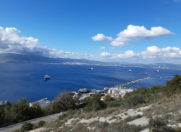
Queen's Road is a winding route across the upper slopes of the Rock of Gibraltar, within or beside the Gibraltar Nature Reserve. It is not a separate town or broad region, but a scenic mountain road linking access points, viewpoints and historic sites in one of the territory's most distinctive landscapes. The road climbs through limestone terrain above the densely settled town, with views extending across the Strait of Gibraltar, the Bay of Gibraltar and, on clear days, the mountains of North Africa.Read more about Queen's Road
Nature, Limestone and History
Exploring the Route
When is the best time to visit Queen's Road?
Best: May–June, October · 25–29°C| Month | High (°C) | Rainfall (mm) |
|---|---|---|
| January | 19 | 82 |
| February | 20 | 76 |
| March | 20 | 71 |
| April | 22 | 64 |
| May (best) | 25 | 57 |
| June (best) | 29 | 49 |
| July | 31 | 46 |
| August | 32 | 48 |
| September | 29 | 54 |
| October (best) | 26 | 61 |
| November | 23 | 69 |
| December | 20 | 76 |
Getting to and around Queen's Road
How to get there
Transportation
Best attractions in Queen's Road
Queen's Road provides access to the wider Upper Rock landscape rather than presenting a single attraction of its own. Its winding course leads through limestone scenery associated with the Gibraltar Nature Reserve, whose viewpoints look across the Bay of Gibraltar, the Strait and the coast of North Africa. Nearby reserve attractions include St Michael's Cave, a large natural cavern used for visits and performances, and the Apes' Den, where Barbary macaques are commonly encountered but remain wild animals. Depending on the permitted route, visitors may also reach historic defensive works, observation points and roads leading towards the summit area. The surrounding slopes are valuable for birdwatching, particularly when migrating birds cross the Strait, while the exposed vegetation and cliff scenery provide a strong contrast with Gibraltar's dense lower town. Roadside stopping places are limited, and many attractions require walking on steep or uneven paths beyond the vehicle route.
-
Tourist attraction
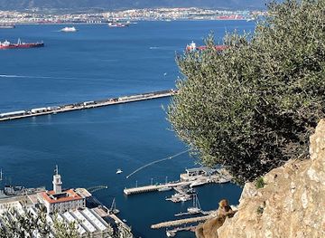
Charles V Wall
Discover the beauty and history of the Charles V Wall in Gibraltar, a stunning fortification with breathtaking views and rich heritage.
Best landmarks in Queen's Road
The principal landmark associated with Queen's Road is the Upper Rock itself, a steep limestone massif whose cliffs and position beside the Strait of Gibraltar have shaped the territory's natural and military identity. St Michael's Cave is a major geological and visitor landmark, formed within the Rock's limestone and known for its cavernous interior. The Apes' Den is culturally prominent because of Gibraltar's Barbary macaques, although the animals are protected wildlife rather than an attraction to handle. Across the surrounding heights, defensive roads, batteries, tunnels and observation works testify to Gibraltar's strategic history, while viewpoints reveal the meeting of Europe, Africa, the Atlantic and the Mediterranean. These features are distributed across the wider Upper Rock and should not be assumed to stand directly beside every section of Queen's Road.
-
Scenic spot
Apes Den
Observe playful Barbary macaques in their natural habitat at Gibraltar's Apes' Den, offering unique wildlife encounters and stunning panoramic views.
-
Historical place
Charles V Wall
Explore the Charles V Wall in Gibraltar: a historic fortress offering panoramic views and a glimpse into the region's rich military past.
-
Historical landmark
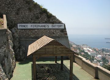
Prince Ferdinand's Battery
Explore a Gibraltar landmark: Prince Ferdinand's Battery, now the Apes' Den, offering history, views, and Barbary macaque encounters.

Explore Queen's Road on the map
Plan your trip on one map. See where the top attractions, landmarks, restaurants and hotels are, and book hotels and experiences in a few clicks.
Best hotels in Queen's Road
Best restaurants in Queen's Road
There are no established restaurant streets or dependable dining facilities along Queen's Road itself, so visitors should eat and buy provisions in Gibraltar Town or another lower Rock area before beginning an Upper Rock excursion. Gibraltar's food culture reflects its British, Andalusian, Mediterranean and Genoese influences, with cafés, pubs and restaurants serving seafood, grilled dishes, international food and familiar British fare. The lower town is the most practical place to find the broadest choice, while outlets near major visitor sites may provide limited refreshments when open. A visit by taxi or organised tour is therefore best planned with water and snacks already arranged, particularly for walkers. Visitors crossing into Spain should treat nearby La Línea de la Concepción as a separate dining area rather than an extension of Queen's Road or Gibraltar.
-
Mediterranean
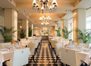
Terrace Restaurant at The Rock Hotel
Experience exquisite Mediterranean dining with stunning views at The Terrace Restaurant in Gibraltar.
Get your free copy of our complete guide to Queen's Road, delivered straight to you.
Everything on this page, from attractions and restaurants to essentials and local phrases, in one PDF you can read offline, print or share.
Already have an account? Sign in
Your Queen's Road guide is ready.
We'll send it to · Not you? Sign out

Getting your guide ready…
We are putting together a fresh copy of the Queen's Road guide. This can take up to a minute.
This can take a few moments. If your browser asks, choose Allow so the download can start. You'll find the guide in your Downloads folder.
Nothing happened? Download it again
Sorry, the guide is taking longer than usual. Please try again in a minute, or get it by email instead.
Queen's Road essentials
Currency and Payment
Safety
Emergency Situations
Do's and Don'ts
Local Tips
From Eve
Local phrases worth knowing
You don't need to get them perfect. A few words go a long way, and locals appreciate the effort.
Basics
| English | Local | Say it |
|---|---|---|
| Hello | Hola | [OH-lah] |
| Goodbye | Adiós | [ah-DYOHSS] |
| Yes | Sí | [see] |
| No | No | [noh] |
| Please/You're welcome | Por favor/De nada | [por fah-VOR/deh NAH-dah] |
| Thank you | Gracias | [GRAH-syahss] |
| Excuse me/Sorry | Perdón/Lo siento | [pehr-DOHN/loh SYEHN-toh] |
| How are you? | ¿Cómo estás? | [KOH-moh ehs-TAHS] |
| Fine. And you? | Bien. ¿Y tú? | [BYEHN. ee TOO] |
| Do you speak English? | ¿Hablas inglés? | [AH-blahss een-GLEHS] |
| I don't understand | No entiendo | [noh ehn-TYEHN-doh] |
Eating & Drinking
| English | Local | Say it |
|---|---|---|
| I'd like to see the menu, please | Quisiera ver el menú, por favor | [kee-SYEHR-ah behr ehl meh-NOO, por fah-VOR] |
| I don't eat meat | No como carne | [noh KOH-moh KAHR-neh] |
| Cheers! | ¡Salud! | [sah-LOOD] |
| I would like to pay, please | Me gustaría pagar, por favor | [meh goo-STAH-ree-ah pah-GAHR, por fah-VOR] |
Emergencies
| English | Local | Say it |
|---|---|---|
| Help! | ¡Ayuda! | [ah-YOO-dah] |
| Go away! | ¡Vete! | [VEH-teh] |
| Call the Police! | ¡Llama a la Policía! | [YAH-mah ah lah poh-lee-SEE-ah] |
| Call a doctor! | ¡Llama a un médico! | [YAH-mah ah oon MEH-dee-koh] |
| I'm lost | Estoy perdido | [ehs-TOY pehr-DEE-doh] |
| I'm ill | Estoy enfermo | [ehs-TOY ehn-FAIR-moh] |
Shopping
| English | Local | Say it |
|---|---|---|
| I'd like to buy... | Quisiera comprar... | [kee-SYEHR-ah kohm-PRAR] |
| I'm just looking | Sólo estoy mirando | [SOH-loh ehs-TOY mee-RAHN-doh] |
| How much is it? | ¿Cuánto cuesta? | [KWAHN-toh KWEHS-tah] |
| That's too expensive | Es demasiado caro | [ehss deh-mah-SYA-doh KAH-roh] |
| Can you lower the price? | ¿Puedes bajar el precio? | [PWEH-dehs BAH-hahr ehl PREH-syoh] |
Time & Numbers
| English | Local | Say it |
|---|---|---|
| What time is it? | ¿Qué hora es? | [keh OR-ah ehs] |
| It's one o'clock | Es la una | [ehss lah OO-nah] |
| Half past (10) | Media (10) | [MEH-dee-ah (DEE-ehss)] |
| Morning | Mañana | [mah-NYAH-nah] |
| Afternoon | Tarde | [TAHR-deh] |
| Evening | Noche | [NOH-cheh] |
| Yesterday | Ayer | [ah-YEHR] |
| Today | Hoy | [OY] |
| Tomorrow | Mañana | [mah-NYAH-nah] |
| 1 | Uno | [OO-noh] |
| 2 | Dos | [DOHS] |
| 3 | Tres | [TREHS] |
| 4 | Cuatro | [KWAH-troh] |
| 5 | Cinco | [SEEN-koh] |
| 6 | Seis | [SAYSS] |
| 7 | Siete | [SYE-teh] |
| 8 | Ocho | [OH-choh] |
| 9 | Nueve | [NWEH-veh] |
| 10 | Diez | [DYEHSS] |
Transport & Directions
| English | Local | Say it |
|---|---|---|
| Where's a/the...? | ¿Dónde está...? | [DOHN-deh ehs-TAH] |
| What's the address? | ¿Cuál es la dirección? | [KWAHL ehs lah dee-rehk-SYOHN] |
| Can you show me (on the map)? | ¿Puedes enseñarme (en el mapa)? | [PWEH-dehs ehn-seh-NYAR-meh (ehn ehl MAH-pah)] |
| When's the next (bus)? | ¿Cuándo es el próximo (autobús)? | [KWAHN-doh ehs ehl proh-KSEE-moh (ow-toh-BOOS)] |
| A ticket (to ....) | Un billete (a ...) | [oon bee-YEH-teh (ah ...)] |
History of Queen's Road
Limestone Foundations of the Rock
Queen's Road crosses the upper limestone massif of Gibraltar, a natural stronghold shaped by geological processes rather than human construction. The Rock rises sharply from the surrounding coastal plain and forms the western gateway to the Mediterranean, with caves, cliffs and steep slopes defining the landscape. These physical characteristics later influenced the placement of roads, fortifications and observation points. The road's character is therefore inseparable from the geology of the Upper Rock: it follows terrain where movement is constrained by escarpments, exposed rock and narrow shelves above the town.
A Strategic Mediterranean Stronghold
Gibraltar's strategic importance developed from its position beside the Strait, and the Upper Rock became a controlled military landscape after the territory came under British rule in the early eighteenth century. Roads and tracks across the heights served the movement of troops, supplies and artillery, while tunnels, batteries and defensive works were added over successive periods. Queen's Road belongs to this wider network of military access routes rather than to a historic settlement. Its surrounding structures reflect Gibraltar's role as a fortified maritime gateway, although some installations remain restricted or are encountered only from designated routes.
From Military Heights to Protected Landscape
As Gibraltar's defensive needs changed, parts of the Upper Rock acquired a second identity as a place of natural and scientific interest. Caves, cliffs, Mediterranean plants and migratory birds attracted attention beyond their military value, while the Barbary macaque population became closely associated with the Rock's public image. The establishment and management of the Gibraltar Nature Reserve helped place greater emphasis on conserving the upper slopes and regulating visitor access. Queen's Road consequently passes through a landscape where military heritage and environmental protection coexist, with some areas managed for access and others remaining sensitive or restricted.
Modern Visitor Access
Modern Queen's Road forms part of Gibraltar's network for reaching the Upper Rock's viewpoints, reserve attractions and historic sites. Its use reflects the territory's transition from a primarily defensive stronghold to a destination combining heritage tourism, nature observation and panoramic sightseeing. The road has not created a conventional commercial district: accommodation, restaurants and retail are concentrated in the lower town and gateway areas. Visitors now encounter a managed historic landscape where road access, conservation requirements and the protection of military sites shape how the Upper Rock can be explored.
Queen's Road in Photos
Browse through our photo collection highlighting the charm and character of the destination.
Cities in Queen's Road
The towns and cities of Queen's Road, and the easiest places to base yourself.

Swipe for more cities
Neighbouring destination travel guides
The closest destinations to Queen's Road, if you have time for more than one.
-
-

-

-
-


Swipe for more destinations
Explore more

Explore more of Upper Rock Nature Reserve
Explore Upper Rock Nature Reserve in Gibraltar: A stunning blend of wildlife, history, and panoramic views, offering unforgettable experiences for nature lovers and history enthusiasts alike.
Explore Upper Rock Nature Reserve
Explore more of Gibraltar
Discover Gibraltar, a unique blend of British and Spanish cultures, stunning natural beauty, and rich history at the gateway to the Mediterranean.
Explore Gibraltar