
Illinois-Indiana Boundary Marker: A Historic Division
Explore the Illinois-Indiana Boundary Marker: A historic landmark marking the state line, dating back to 1838. A testament to early American surveying.
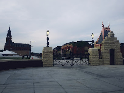
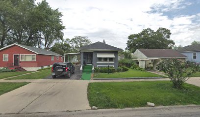
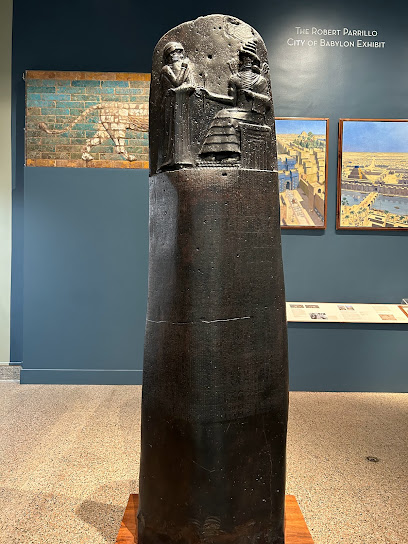
The Illinois-Indiana Boundary Marker, a limestone obelisk, marks the historic border between Illinois and Indiana. Erected in 1838, it stands as a testament to the establishment of state boundaries in the early 19th century and is one of the oldest structures in the Chicago area.
A brief summary to Illinois-Indiana Boundary Marker
- 100-500 Indianapolis Blvd, Whiting, South Side, Indiana, 46394, US
Local tips
- Visit during the early morning or late afternoon for the best lighting for photography.
- Take a leisurely stroll around the site to appreciate the natural beauty of the landscape.
- Check local sources for any guided tours or historical talks that may be available.
Getting There
-
Walking
From Indianapolis Boulevard in Whiting, Indiana, walk north. The marker is located at the end of Avenue G, where it intersects with Indianapolis Boulevard. The walk is short, and the monument is visible from the road.
-
Public Transport
Take the South Shore Line train to the Whiting station. From there, walk east on 119th Street, then turn north onto Indianapolis Boulevard. Continue north until you reach Avenue G. The marker will be at the end of Avenue G. Expect to pay around $20-$30 for the bus and train combined.
Discover more about Illinois-Indiana Boundary Marker
Iconic landmarks you can’t miss
Calumet Park
1.3 km
Discover the beauty and history of Calumet Park in Chicago, an urban oasis perfect for relaxation and family fun amidst the city's vibrant landscape.
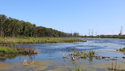
Eggers Grove
2.4 km
Explore the serene landscapes and diverse wildlife at Eggers Grove, a breathtaking nature preserve in Chicago's South Side.
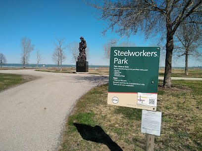
Steelworkers Park
3.3 km
Discover the beauty and history of Steelworkers Park, a serene haven by Lake Michigan that celebrates the legacy of Chicago's steelworkers.
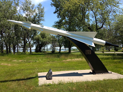
Nike Missile Site C-44
3.5 km
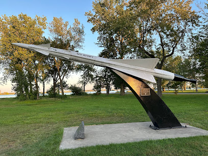
Discover the Nike Missile Site C-44 in Chicago: A historical landmark that reveals the secrets of Cold War military defense strategies and technology.
Nike Missile Monument
4.5 km
Discover the Nike Missile Monument, a significant historical landmark in Chicago that offers insights into Cold War defense strategies and military history.
Pullman National Historical Park
7.1 km
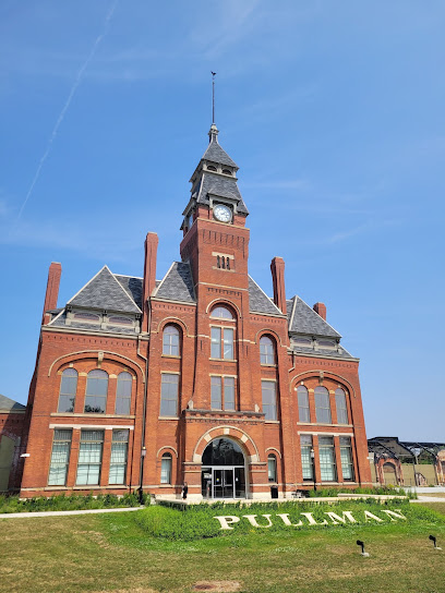
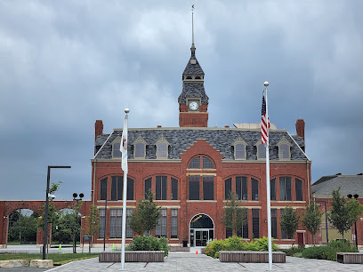
Explore the rich historical tapestry of Pullman National Historical Park, where America's labor movement and architectural marvels come alive.
Marktown Preservation Society
7.1 km
Explore the architectural treasures and rich history of Marktown at the Marktown Preservation Society, a beacon of cultural heritage in East Chicago, Indiana.
Pullman National Historical Park Visitor Center
7.2 km
Discover the historical significance of Pullman at the Visitor Center, your first stop for exploring Chicago's rich heritage in labor and social justice.
Pullman Main Gate And Gatehouse
7.2 km
Explore the Pullman Main Gate and Gatehouse, a historical landmark embodying America's labor movement and industrial heritage in Chicago.
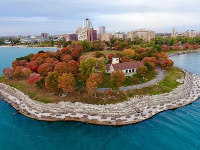
South Shore Cultural Center
7.5 km
Experience the vibrant arts and culture of Chicago at the historic South Shore Cultural Center, a hub for artistic expression and community engagement.
Beaubien Woods
8.0 km
Experience the unspoiled beauty of Beaubien Woods, a serene park in Chicago perfect for hiking, relaxation, and connecting with nature.
Gwendolyn Brooks House
8.9 km
Explore the legacy of acclaimed poet Gwendolyn Brooks at her historic home in Chicago's South Side, celebrating African American literature and culture.
Oak Woods Cemetery
9.2 km
Explore Chicago's history at Oak Woods Cemetery, final resting place of notable figures and site of the Confederate Mound.

Lincoln Funeral Train Historic Marker
9.6 km
Explore history at the Lincoln Funeral Train Historic Marker in Calumet City, Illinois, a poignant tribute to President Abraham Lincoln's final journey.
Al Capone's Chicago Manor
9.9 km
Explore the hauntingly beautiful Al Capone's Chicago Manor, a historical landmark woven into the fabric of Chicago's Prohibition-era narrative.
Unmissable attractions to see
WhoaZone at Whihala Beach
3.7 km
Discover WhoaZone at Whihala Beach, a thrilling water park offering slides, swimming, and kayak rentals for all ages amid beautiful scenery.

Whiting Lakefront Park
4.2 km
Discover Whiting Lakefront Park, a beautiful lakeside destination perfect for relaxation, recreation, and family fun in Indiana.

Pullman Exhibit Hall
7.3 km
Discover the Pullman Exhibit Hall: A historical museum celebrating the rich legacy of the Pullman community and its impact on America's labor movement.

Jackson (Andrew) Park
9.3 km
Discover the natural beauty and cultural heritage of Jackson Park, an expansive urban oasis in Chicago's South Side, perfect for relaxation and recreation.

Jeorse Park Beach
9.8 km
Discover the tranquility of Jeorse Park Beach, a scenic lakeside haven in East Chicago, perfect for families and relaxation seekers.

Garden of the Phoenix
10.0 km
Experience tranquility at the Garden of the Phoenix, a serene Japanese garden in Chicago's South Side with stunning landscapes and cultural beauty.
Griffin Museum of Science and Industry
10.4 km
Explore the Griffin Museum of Science and Industry in Chicago, where discovery, technology, and adventure await visitors of all ages.

Midway Plaisance Park
10.5 km
Explore the lush landscapes and cultural heritage of Midway Plaisance Park, a serene urban escape in Chicago's Hyde Park.
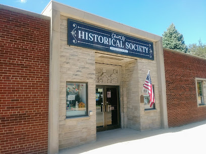
Calumet City Historical Society
10.6 km
Uncover the captivating history of Calumet City at the Historical Society, where local stories and artifacts come together in a charming museum experience.
Burnham Park Promontory Point
10.7 km
Explore the scenic beauty and tranquility of Burnham Park Promontory Point, a must-visit urban oasis in Chicago's Hyde Park.
Frederick C. Robie House
10.9 km
Discover the iconic Frederick C. Robie House, a masterpiece of Frank Lloyd Wright's architecture in Chicago's Hyde Park, blending art and nature seamlessly.
Institute for the Study of Ancient Cultures Museum
10.9 km
Explore the rich heritage of ancient civilizations at the Institute for the Study of Ancient Cultures Museum in Chicago's Hyde Park.
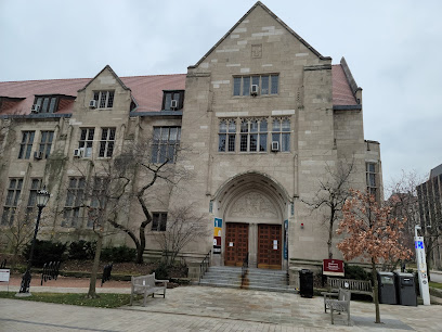
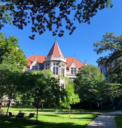
The University of Chicago
11.1 km
Experience the architectural beauty, rich culture, and vibrant academic life at The University of Chicago, a must-visit destination in Hyde Park.
Hyde Park
11.2 km
Discover Hyde Park, Chicago's vibrant neighborhood rich in culture, history, and natural beauty, perfect for tourists seeking a unique urban experience.
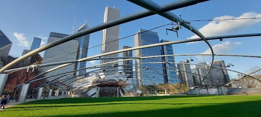
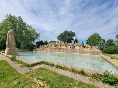
Fountain of Time - George Washington Park
11.2 km
Discover the Fountain of Time in Chicago, a stunning sculpture in Washington Park that beautifully captures the essence of life's journey through art.
Essential places to dine
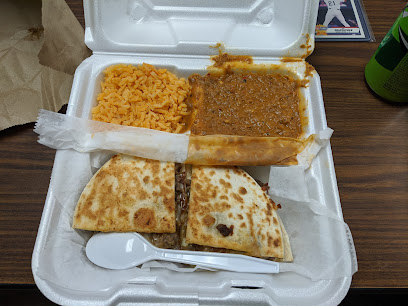
Elio's Hot Dogs & Mexican Food
14.9 km
Experience the delicious fusion of Mexican cuisine and American street food at Elio's Hot Dogs & Mexican Food in Gary, Indiana.
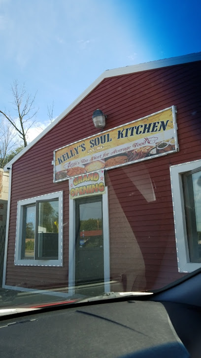
Kelly's Soul Kitchen
15.7 km
Experience authentic soul food at Kelly's Soul Kitchen in Gary, IN - where every bite feels like home.
Big Back Shacq
15.8 km
Experience authentic soul food at Big Back Shacq in Gary, Indiana—where tradition meets flavor in every bite.
Oak Lawn Diner
16.4 km
Experience the charm of classic American breakfasts at Oak Lawn Diner - where every meal feels like home.
Reilly's Daughter Oak Lawn
16.4 km
Experience delightful grilled dishes at Reilly's Daughter in Oak Lawn—where comfort food meets friendly service in an inviting atmosphere.
LongHorn Steakhouse
16.4 km
Experience hearty American cuisine at LongHorn Steakhouse - where every steak tells a story of flavor and tradition.
Black Oak Tavern
16.4 km
Discover the vibrant flavors of Black Oak Tavern in Oak Lawn - where delicious cuisine meets craft beverages in a lively atmosphere.
UNCLE PIGS BREAKFAST & BBQ LLC
16.4 km
Experience authentic barbecue flavors at Uncle Pig's Breakfast & BBQ in Gary, Indiana – where every meal is a celebration of taste!
Hog Wild Oak Lawn
16.5 km
Experience authentic American barbecue at Hog Wild Oak Lawn - where smoky flavors meet warm hospitality in Illinois.
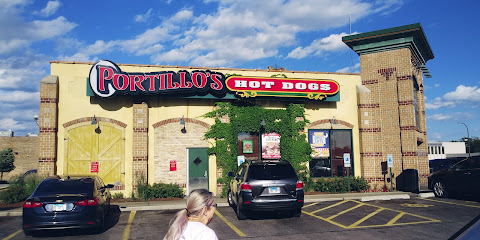
Portillo's Oak Lawn
16.6 km
Experience the best of American fast food at Portillo's Oak Lawn, where delicious hot dogs and hearty sandwiches await every visitor.
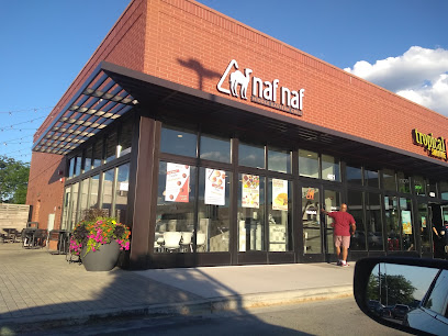
Naf Naf Grill
16.6 km
Experience authentic Middle Eastern cuisine at Naf Naf Grill in Oak Lawn – where fresh flavors meet friendly service.
SteelCity CheeseSteaks
17.1 km
Experience authentic East Coast flavors at SteelCity CheeseSteaks in Gary, Indiana – where every bite tells a delicious story.
Petey's Bungalow Restaurant and Lounge
17.2 km
Experience the best of American cuisine at Petey's Bungalow Restaurant and Lounge - where delicious steak meets refreshing seafood in Oak Lawn.
Farmer's Fridge
17.4 km
Discover fresh and healthy self-service dining at Farmer's Fridge in Oak Lawn - your go-to spot for nutritious meals on the move.

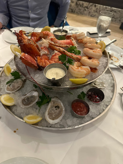
Gracie's Good Love & Cuisine
17.5 km
Discover Gracie's Good Love & Cuisine: A Culinary Treasure Offering Authentic Soul Food in Gary, Indiana.
Markets, malls and hidden boutiques
Museum Shop (The Suq)
10.9 km
Discover unique gifts and artisan crafts at The Suq in Hyde Park, a cultural treasure trove perfect for tourists seeking authentic souvenirs.
River Oaks West Shopping Center
12.5 km
Explore River Oaks West Shopping Center: a vibrant hub of shopping, dining, and entertainment in Calumet City, Illinois.
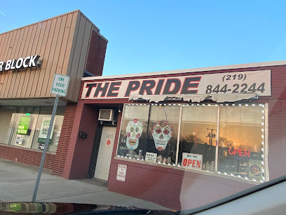
The Pride
13.7 km
Discover a spiritual oasis in Hammond, Indiana, at The Pride, where mystical treasures and mindful practices await you.
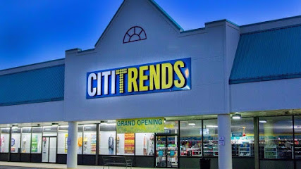
Citi Trends
16.4 km
Explore trendy fashion and affordable clothing for the whole family at Citi Trends in Gary, IN - a discount store with style!
Amazon Fresh
16.5 km
Explore fresh groceries, artisanal baked goods, and a diverse selection of wines at Amazon Fresh in Oak Lawn, a must-visit supermarket for food lovers.
Oak Lawn Commons
16.6 km
Experience the vibrant shopping scene at Oak Lawn Commons, featuring diverse shops, dining, and entertainment in Oak Lawn, Illinois.
Loris Gifts
17.3 km
Discover unique gifts and local treasures at Loris Gifts, the perfect destination for tourists in Oak Lawn, Illinois.
Tarry Town Foods Mart
17.8 km
Discover Tarry Town Foods Mart in Gary, IN – a convenient stop for groceries, snacks, and local flavors to enhance your travel experience.
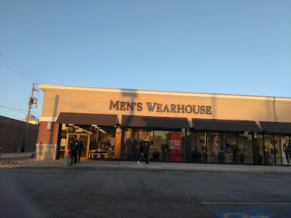
Men's Wearhouse
17.9 km
Discover high-quality men's clothing at Men's Wearhouse in Oak Lawn, offering stylish suits, tuxedos, and more for every occasion.
Green Oak Shopping Center
17.9 km
Explore the Green Oak Shopping Center: A premier shopping destination in Oak Lawn, IL with diverse shops and dining options for every visitor.
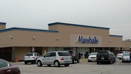
Marshalls
17.9 km
Shop smart at Marshalls, where fashion meets affordability in Oak Lawn, Illinois. Discover amazing deals on clothing, accessories, and home goods.
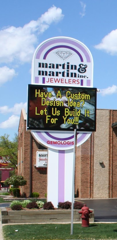
Martin & Martin Inc
17.9 km
Explore the exquisite collection of Martin & Martin Inc, the premier jewelry store in Oak Lawn, offering unique treasures and personalized service for all visitors.
Fasel & Sons Garden Center
17.9 km
Explore the lush offerings of Fasel & Sons Garden Center – your destination for plants, landscaping supplies, and expert gardening advice in Oak Lawn, Illinois.
Family Dollar
17.9 km
Experience unbeatable savings and a diverse selection of products at Family Dollar in Gary, Indiana, your go-to destination for budget-friendly shopping.

Discount Rugs and Furniture
17.9 km
Discover stylish rugs and furniture at Discount Rugs and Furniture in Oak Lawn, IL - where quality meets affordability for every home.
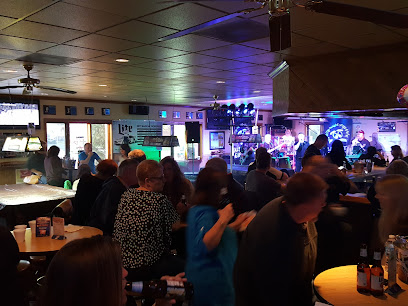
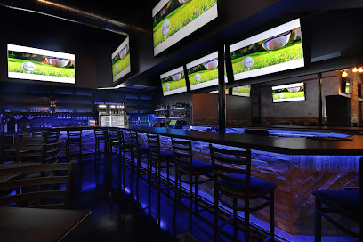
Essential bars & hidden hideouts
Empire Bar and Grill
15.3 km
Discover the energetic vibe of Empire Bar and Grill in Gary, Indiana, where delicious food and drinks meet a vibrant atmosphere.
Tavern of the Oaks
17.6 km
Experience the cozy atmosphere of Tavern of the Oaks, a welcoming bar in Gary, Indiana, perfect for unwinding and connecting with locals.
Just My Luck Bar and Grill
18.0 km
Discover Just My Luck Bar and Grill: A lively Oak Lawn hotspot for delicious food, refreshing drinks, and vibrant entertainment in a welcoming atmosphere.
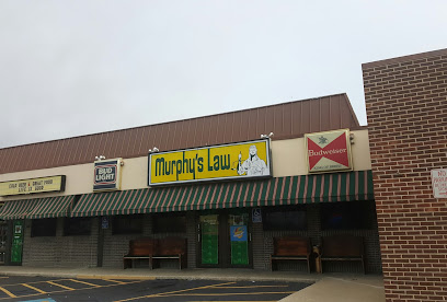
Murphy's Law Bar & Grill
18.0 km
Experience the vibrant atmosphere of Murphy's Law Bar & Grill in Oak Lawn, Illinois, where great food and drinks meet lively entertainment.
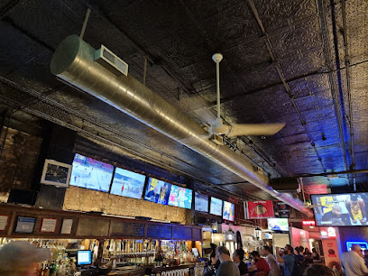
Hot Corner
18.3 km
Experience the vibrant nightlife at Hot Corner, a lively bar in Oak Lawn, Illinois, perfect for tourists seeking fun and affordable drinks.
Best Bar
18.3 km
Discover the vibrant atmosphere and creative cocktails at Chicago's Best Bar, a top destination for cocktail lovers and tourists alike.
Council Oak Bar
18.4 km
Experience the vibrant nightlife at Council Oak Bar in Gary, Indiana, where handcrafted cocktails meet exhilarating entertainment in a stylish setting.
St. James Place
19.1 km
Experience the vibrant atmosphere and diverse drink selection at St. James Place, the perfect bar for tourists in Oak Lawn, Illinois.
PD's Place
19.3 km
Discover the lively ambiance of PD's Place, a premier sports bar in Oak Lawn, Illinois, perfect for enjoying games, darts, and delicious food.
Homestead Barr
19.7 km
Discover the vibrant and welcoming atmosphere of Homestead Barr in Oak Lawn, where great drinks and good company await you.
Demma's Bar & Grill
20.3 km
Experience the vibrant atmosphere and delicious menu at Demma's Bar & Grill in Oak Lawn, the perfect spot for food lovers and fun seekers.
Kasey's Tavern
20.3 km
Discover Kasey's Tavern, a beloved pub in Chicago's South Loop, offering delicious food, a welcoming atmosphere, and a wide selection of drinks.
Panchos Rooftop Cantina
20.7 km
Experience the vibrant flavors of American cuisine and stunning skyline views at Panchos Rooftop Cantina in the heart of Chicago.
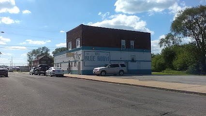
Blue Room Lounge
20.8 km
Discover the lively Blue Room Lounge in Gary, Indiana, where expertly crafted cocktails and a vibrant atmosphere await every visitor.
2Twenty2 Tavern
20.8 km
Experience Chicago's nightlife at 2Twenty2 Tavern, a lively bar offering craft beers, cocktails, and delicious cuisine in the heart of the Loop.

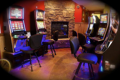
Nightclubs & after hour spots
Night Life Ent
16.2 km
Discover the electrifying nightlife at Night Life Ent, Gary, Indiana's premier club for an unforgettable evening of dancing and entertainment.

Birdies Sports Bar & Grill
16.5 km
Experience the lively ambiance and delicious grill offerings at Birdies Sports Bar & Grill, where every meal is a celebration of flavor and sports.
Tailgators
18.1 km
Discover Tailgators: Oak Lawn's vibrant bar with cocktails, gaming, and live music for an unforgettable night out.
Playo's Nightclub
19.5 km
Discover the pulsating nightlife at Playo's Nightclub in Gary, Indiana, where music, dancing, and unforgettable memories await.
Loft Adiq Ultra Lounge
19.8 km
Discover the nightlife gem of Gary, Indiana at Loft Adiq Ultra Lounge—where vibrant music, stylish ambiance, and unforgettable moments await.
Watra Night Club
19.8 km
Experience Chicago's nightlife at Watra Night Club, where cocktails, comedy, and live music create unforgettable evenings in Archer Heights.

The Delta Lounge
20.0 km
Discover the vibrant atmosphere and exquisite cocktails at The Delta Lounge in Burbank, a must-visit for cocktail enthusiasts and nightlife lovers alike.
YES Bar
20.7 km
Experience the vibrant nightlife of Chicago at YES Bar, where unforgettable evenings of music and dancing await.
Era Social Club
20.7 km
Discover the electrifying nightlife at Era Social Club in Chicago Loop, where pulsating beats and vibrant crowds create unforgettable evenings.

Brando's Speakeasy
20.7 km
Experience the thrill of karaoke at Brando's Speakeasy, a lively bar in Chicago's Loop, perfect for music lovers and night owls alike.
Braceria Se nni mondo esistesse un po' di bene
21.3 km
Experience the vibrant nightlife of Chicago at Braceria Se nni mondo esistesse un po' di bene, where great food, drinks, and music come together.
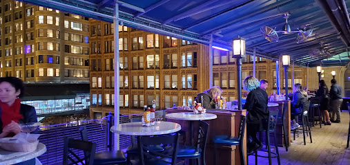
ROOF on theWit
21.6 km
Discover the breathtaking views and vibrant nightlife at ROOF on theWit, Chicago's premier rooftop lounge with delicious American cuisine and live music.

Palyaudvar
21.6 km
Discover the electrifying nightlife of Chicago at Palyaudvar, where music, dance, and vibrant energy come together for an unforgettable experience.
The PIMCO Midway Club
21.8 km
Discover The PIMCO Midway Club in Chicago - a stylish lounge offering American cuisine, crafted cocktails, and an inviting atmosphere for relaxing evenings.
Bodega Nightclub
22.0 km
Discover the electrifying atmosphere of Bodega Nightclub, Chicago's hotspot for nightlife, unique music, and unforgettable dance parties.