

St. Helier Waterfront Travel Guide - Free Web & App
Your ultimate guide to St. Helier Waterfront. Discover top landmarks, proposed trips, and local tips. Free on the web or via the Evendo companion app.


St Helier Waterfront, Jersey combines marinas, sea views, Elizabeth Castle, Liberation Square, maritime history, cafés and easy access to island attractions.
Harbour at the Heart of Jersey
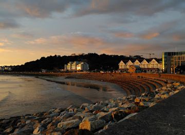
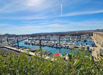
St Helier Waterfront forms the maritime edge of Jersey’s capital, where the island’s principal harbour meets a compact town of granite buildings, pedestrian promenades and busy quays. The area stretches around the modern marina, commercial port and Liberation Square, with views across St Aubin’s Bay towards the wooded headland of Noirmont and the open Channel. Tides continually alter the character of the shoreline: at high water, boats fill the harbour basins; at low water, the broad bay reveals sand, mudflats and exposed foreshore.Read more about St. Helier Waterfront
Sea Views and Island Heritage
Exploring the Waterfront
When is the best time to visit St. Helier Waterfront?
Best: July–September · 21–23°C| Month | High (°C) | Rainfall (mm) |
|---|---|---|
| January | 11 | 90 |
| February | 11 | 79 |
| March | 11 | 69 |
| April | 13 | 59 |
| May | 16 | 49 |
| June | 21 | 39 |
| July (best) | 23 | 32 |
| August (best) | 23 | 35 |
| September (best) | 21 | 42 |
| October | 18 | 60 |
| November | 15 | 75 |
| December | 12 | 85 |
Getting to and around St. Helier Waterfront
How to get there
Transportation
Best attractions in St. Helier Waterfront
The waterfront’s principal attractions include Elizabeth Castle, whose island position and layered fortifications make it inseparable from the seascape, and the Maritime Museum on New North Quay, where Jersey’s boatbuilding and seafaring heritage are interpreted through maritime collections. Liberation Square provides a prominent public setting beside the harbour and commemorates the island’s liberation in 1945, while the marina and Albert Pier offer close views of boats, ferries and the broad tidal sweep of St Aubin’s Bay. The Weighbridge area connects the harbour with central St Helier, including the Jersey Museum and Art Gallery, the Central Market and the pedestrian shopping streets. Beyond the immediate quays, the waterfront is a useful starting point for walking towards Havre des Pas or west along the bay, although route conditions and tides should be considered. The ferry terminal also places visitors near onward island buses, making the waterfront a convenient base for reaching attractions outside St Helier.
-
Garden
Les Jardins de la Mer
Explore the enchanting Les Jardins de la Mer, a coastal garden in St. Helier, Jersey, offering stunning floral displays and breathtaking sea views.
-
Park
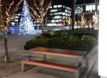
Trenton Square
Discover Trenton Square, a tranquil park in St Helier, Jersey, offering lush greenery, scenic beauty, and a peaceful retreat from city life.
-
Tourist attraction
F.Foot HMV Sign
Explore the F.Foot HMV Sign in St. Helier, Jersey, where music meets culture in a vibrant artistic landmark.
-
Garden
Pilas murchas
Explore the serene beauty of Pilas Murchas, a captivating garden in St Helier perfect for relaxation and nature appreciation.

Best landmarks in St. Helier Waterfront
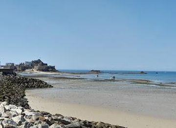
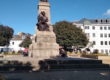
Elizabeth Castle is the defining landmark of St Helier’s seaward outlook, occupying a tidal islet at the entrance to the harbour and recording Jersey’s long history of coastal defence. Liberation Square is the waterfront’s key civic landmark, with its memorial significance linked to the island’s liberation from German Occupation on 9 May 1945. The harbour’s granite piers, quays and marina are landmarks of a different kind, expressing St Helier’s continuing relationship with ferries, commerce and recreation. The Maritime Museum adds a cultural dimension through its focus on Jersey’s boats and maritime life, while the view towards L’Islet, St Aubin’s Bay and the southern coast changes markedly with the tide. Inland, the parish church and historic town centre extend the waterfront’s heritage setting, although they lie beyond the immediate harbour edge.
-
Garden
Les Jardins de la Mer
Discover the tranquility of Les Jardins de la Mer in St Helier, where vibrant flora meets scenic coastal views, creating an unforgettable garden experience.
-
Movie theater
Cineworld - Jersey
Experience the magic of movies at Cineworld Jersey, the ultimate destination for film lovers in St. Helier, surrounded by stunning waterfront views.
-
Park
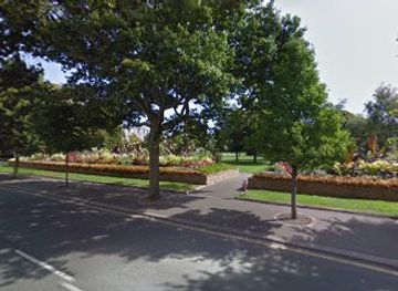
Parade Gardens
Explore the beauty and history of Parade Gardens, a serene park in St Helier, Jersey, perfect for relaxation and cultural experiences.
-
Parking lot
Waterfront Underground Car Park
Discover the ease of parking at the Waterfront Underground Car Park in St Helier, Jersey, your gateway to explore the island's stunning attractions.

Explore St. Helier Waterfront on the map
Plan your trip on one map. See where the top attractions, landmarks, restaurants and hotels are, and book hotels and experiences in a few clicks.
Best hotels in St. Helier Waterfront
Best restaurants in St. Helier Waterfront
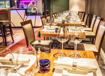
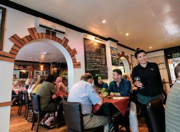
Dining around St Helier Waterfront reflects Jersey’s island setting, with seafood, shellfish, Jersey Royal potatoes and locally produced ingredients appearing alongside familiar British and French influences. Restaurants, cafés, pubs and food outlets are concentrated around the harbour, the Weighbridge, Liberty Wharf and the adjoining town centre, rather than along every quay. Visitors can find informal meals, coffee and pastries close to the ferry terminal as well as more leisurely dining in central St Helier. Jersey’s maritime position gives local menus a natural emphasis on fish and shellfish, while the island’s agricultural traditions support seasonal produce and dairy products. The town’s larger concentration of businesses makes it a more dependable place to eat than remote coastal areas elsewhere in Jersey, where options may be limited or seasonal. Booking and opening arrangements vary, particularly outside the busiest periods.
-
Italian
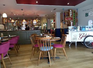
Bella Italia - Jersey
Experience authentic Italian cuisine at Bella Italia in Jersey, offering gluten-free and vegan options in a warm and inviting atmosphere.
-
American
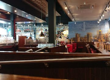
TGI Fridays - Jersey
Experience the best of American cuisine at TGI Fridays - Jersey, where family fun meets flavorful dining in a vibrant atmosphere.
-
Indian
Jaipur Restaurant Jersey
Experience authentic Indian flavors at Jaipur Restaurant Jersey - a culinary treasure in St Helier offering a delightful array of dishes for every palate.
-
Italian
Little Italy
Discover Little Italy: An Authentic Italian Dining Experience in St Helier, Jersey with Delectable Dishes and Warm Hospitality.
Best bars in St. Helier Waterfront
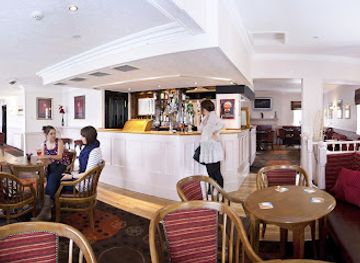
Evening life around St Helier Waterfront is centred on pubs, hotel bars, restaurants and the town’s established entertainment venues rather than a large waterfront club scene. The Weighbridge, Liberty Wharf and streets leading inland from the harbour provide the greatest concentration of places for an evening drink or meal, while the marina and quays offer a quieter setting when port activity has eased. Traditional pubs reflect Jersey’s British and Channel Island connections, and some venues host live music or seasonal entertainment, though programmes and opening patterns change. The ferry terminal itself is primarily a transport facility rather than a nightlife district. Visitors seeking a later evening should remain in central St Helier, where accommodation, taxis and bus connections are more readily available than in the island’s outlying villages.
-
Pub
Post Horn
Experience the heart of St Helier at The Post Horn, where lively ambiance meets delightful cuisine and refreshing drinks.
-
Bar
So Bar - Randalls Pubs
Enjoy a delightful dining experience with stunning coastal views at So Bar - Randalls Pubs, the perfect spot for tourists in St Helier.
-
Bar
Vittoria
Experience the vibrant atmosphere of Vittoria in Jersey, where every sip tells a story amidst delightful drinks and lively conversations.
-
Pub
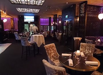
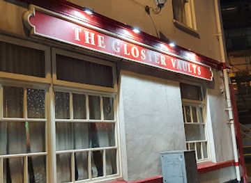
The Gloster Vaults
Discover the charming atmosphere of The Gloster Vaults, a welcoming pub in St Helier offering local brews and hearty meals for an authentic Jersey experience.
Best nightclubs in St. Helier Waterfront
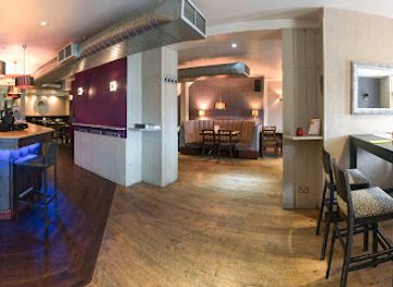
Evening life around St Helier Waterfront is centred on pubs, hotel bars, restaurants and the town’s established entertainment venues rather than a large waterfront club scene. The Weighbridge, Liberty Wharf and streets leading inland from the harbour provide the greatest concentration of places for an evening drink or meal, while the marina and quays offer a quieter setting when port activity has eased. Traditional pubs reflect Jersey’s British and Channel Island connections, and some venues host live music or seasonal entertainment, though programmes and opening patterns change. The ferry terminal itself is primarily a transport facility rather than a nightlife district. Visitors seeking a later evening should remain in central St Helier, where accommodation, taxis and bus connections are more readily available than in the island’s outlying villages.
-
Bar
Vittoria
Discover Vittoria in Jersey: Where a vibrant atmosphere meets exquisite drinks and unforgettable nightlife.
-
Bar
The Shipwright - Bar Lounge Entertainment
Discover The Shipwright in St Helier, Jersey - a lively bar lounge offering exquisite cocktails and a vibrant atmosphere for an unforgettable night out.
-
Bar
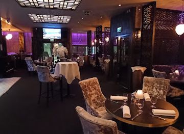
Mimosa
Experience the vibrant nightlife at Mimosa, St Helier's lively bar featuring great music, delicious drinks, and an unforgettable atmosphere.


Best shops in St. Helier Waterfront
Shopping is more developed in central St Helier than on the working quays themselves. From the waterfront, visitors can walk to the pedestrian streets, the Central Market and Beresford Market, where independent traders, food sellers and everyday island shopping provide a stronger local flavour than the port area. Liberty Wharf and nearby commercial streets add cafés, shops and services, while selected businesses sell Jersey produce, confectionery, local crafts and island-themed gifts. The waterfront also provides convenient access to practical retail for travellers arriving by ferry, though it is not a specialist craft district. Visitors looking for local food products may find Jersey potatoes, dairy goods and other regional produce in town shops and food markets, while supplies for coastal walks or island excursions are more likely to be found in central St Helier than at individual waterfront attractions.
-
Grocery store
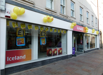
Iceland Supermarket The Parade
Explore Iceland Supermarket The Parade in St Helier for affordable groceries and local flavors that enhance your Jersey experience.
-
Stationery store
WHSmith
Explore WHSmith in St Helier for a unique blend of books, crafts, and everyday essentials, perfect for tourists and locals alike.
-
Sportswear store
More Than Sport
Discover stylish and functional sportswear at More Than Sport, the go-to destination for active lifestyles in St Helier, Jersey.
-
Store
Matalan
Experience the best of Jersey shopping at Matalan, where style meets affordability in St Helier's vibrant retail scene.

Get your free copy of our complete guide to St. Helier Waterfront, delivered straight to you.
Everything on this page, from attractions and restaurants to essentials and local phrases, in one PDF you can read offline, print or share.
Already have an account? Sign in
Your St. Helier Waterfront guide is ready.
We'll send it to · Not you? Sign out

Getting your guide ready…
We are putting together a fresh copy of the St. Helier Waterfront guide. This can take up to a minute.
This can take a few moments. If your browser asks, choose Allow so the download can start. You'll find the guide in your Downloads folder.
Nothing happened? Download it again
Sorry, the guide is taking longer than usual. Please try again in a minute, or get it by email instead.
St. Helier Waterfront essentials
Currency and Payment
Safety
Emergency Situations
Do's and Don'ts
Local Tips
From Eve
Local phrases worth knowing
You don't need to get them perfect. A few words go a long way, and locals appreciate the effort.
Basics
| English | Local | Say it |
|---|---|---|
| Hello | Bonjour | [bon-zhoor] |
| Goodbye | Au revoir | [oh ruh-vwah] |
| Yes | Oui | [wee] |
| No | Non | [nohn] |
| Please/You're welcome | S'il vous plaît / De rien | [seel voo pleh / deu ryen] |
| Thank you | Merci | [mehr-see] |
| Excuse me/Sorry | Pardon | [pahr-dohn] |
| How are you? | Comment ça va? | [koh-mohn sah vah] |
| Fine. And you? | Bien. Et vous? | [byen. ay voo] |
| Do you speak English? | Parlez-vous anglais? | [par-lay voo ahn-glay] |
| I don't understand | Je ne comprends pas | [zhuh nuh kohm-prahnd pah] |
Eating & Drinking
| English | Local | Say it |
|---|---|---|
| I'd like to see the menu, please | Je voudrais voir la carte, s'il vous plaît | [zhuh voo-dray vwahr lah kart, seel voo pleh] |
| I don't eat meat | Je ne mange pas de viande | [zhuh nuh mahnj pah duh vee-ahnd] |
| Cheers! | Santé! | [sahn-tay] |
| I would like to pay, please | Je voudrais payer, s'il vous plaît | [zhuh voo-dray pay-yay, seel voo pleh] |
Emergencies
| English | Local | Say it |
|---|---|---|
| Help! | Au secours! | [oh seh-coor] |
| Go away! | Allez-vous en! | [ah-lay voo zahn] |
| Call the Police! | Appelez la police! | [ah-play lah poh-lees] |
| Call a doctor! | Appelez un médecin! | [ah-play uh may-suhn] |
| I'm lost | Je suis perdu(e) | [zhuh swee pair-doo(eh)] |
| I'm ill | Je suis malade | [zhuh swee mah-lahd] |
Shopping
| English | Local | Say it |
|---|---|---|
| I'd like to buy... | Je voudrais acheter... | [zhuh voo-dray zah-shay...] |
| I'm just looking | Je regarde juste | [zhuh ruh-gahrd zhewst] |
| How much is it? | Combien ça coûte? | [kohm-byen sah koot] |
| That's too expensive | C'est trop cher | [say troh shair] |
| Can you lower the price? | Pouvez-vous baisser le prix? | [poo-veh voo bay-say luh pree] |
Time & Numbers
| English | Local | Say it |
|---|---|---|
| What time is it? | Quelle heure est-il? | [kell er ay-teel] |
| It's one o'clock | Il est une heure | [eel ay oon er] |
| Half past (10) | Dix heures et demie | [dees er ay duh-mee] |
| Morning | Matin | [mah-tahn] |
| Afternoon | Après-midi | [ah-pray mee-dee] |
| Evening | Soir | [swahr] |
| Yesterday | Hier | [yehr] |
| Today | Aujourd'hui | [oh-zhoor-dwee] |
| Tomorrow | Demain | [duh-mahn] |
| 1 | Un | [uhn] |
| 2 | Deux | [duh] |
| 3 | Trois | [twah] |
| 4 | Quatre | [kat] |
| 5 | Cinq | [sank] |
| 6 | Six | [sees] |
| 7 | Sept | [sett] |
| 8 | Huit | [wheat] |
| 9 | Neuf | [nuff] |
| 10 | Dix | [dees] |
Transport & Directions
| English | Local | Say it |
|---|---|---|
| Where's a/the...? | Où est...? | [oo eh...] |
| What's the address? | Quelle est l'adresse? | [kell ay la-dress] |
| Can you show me (on the map)? | Pouvez-vous me montrer (sur la carte)? | [poo-veh voo muh mohn-tray (soor lah kart)] |
| When's the next (bus)? | Quand est le prochain (bus)? | [kahn ay luh proh-shahn (bus)] |
| A ticket (to ....) | Un billet (pour ...) | [uhn bee-yay (poor ...)] |
History of St. Helier Waterfront
A Tidal Harbour and Coastal Settlement
St Helier developed around the parish church and the sheltered southern coast of Jersey, but its waterfront was shaped as much by tides and maritime trade as by the town itself. Early harbour activity centred on the natural shoreline and landing places, while later quays and breakwaters created more dependable facilities for commerce, fishing and passenger traffic. Jersey’s position close to the French coast made the harbour economically valuable and strategically sensitive. The changing relationship between the town and the sea is still visible in the contrast between older quays, modern marina basins and reclaimed ground around the port.
Elizabeth Castle and Coastal Defence
Elizabeth Castle occupies L’Islet, a tidal rock protecting the approach to St Helier’s harbour. The site was fortified during the early modern period as artillery transformed coastal defence, and it later acquired its present name in honour of Queen Elizabeth I. Its military role reflected Jersey’s exposed position in the Channel and the island’s proximity to France. The castle’s buildings and gun positions record successive phases of defence, while the tidal causeway and changing access across the foreshore remain central to its character. It is now a major heritage site associated with the waterfront rather than part of the built-up town.
Harbour Expansion and Maritime Commerce
From the eighteenth century onwards, St Helier’s harbour was progressively improved to support expanding trade, fishing and shipping. Piers, quays and protective works helped the town handle goods and passengers despite the large tidal range. Jersey merchants traded across the Channel and farther afield, while shipbuilding, privateering and seafaring contributed to the island’s maritime identity. The modern port retains this commercial inheritance, although much of the waterfront is now used by ferries, recreational boats, visitor facilities and leisure businesses rather than the small-scale maritime industries that once dominated the shore.
Occupation, Liberation and a Remade Waterfront
German forces occupied Jersey from 1940 until the island’s liberation on 9 May 1945. The harbour and waterfront formed part of the island’s strategic and administrative landscape during the Occupation, when defensive works and military infrastructure were constructed across Jersey. Liberation Square, created beside the harbour, commemorates the return of British rule and the public celebrations that followed. Post-war redevelopment altered the waterfront substantially, bringing new roads, port facilities and public spaces. Today, the square and harbour provide some of the clearest reminders of the island’s twentieth-century history within the capital.
St. Helier Waterfront in Photos
Browse through our photo collection highlighting the charm and character of the destination.
Neighbouring destination travel guides
The closest destinations to St. Helier Waterfront, if you have time for more than one.
-

-

-

-

-


Swipe for more destinations
Explore more

Explore more of Saint Helier
Discover Saint Helier: A captivating blend of history, culture, and modern charm in the heart of the Channel Islands.
Explore Saint Helier
Explore more of Jersey
Discover the charm of Jersey, the largest Channel Island, with its stunning landscapes, rich history, and a delightful blend of British and French cultures.
Explore Jersey