

Baxter State Park Travel Guide - Free Web & App
Your ultimate guide to Baxter State Park. Discover top landmarks, proposed trips, and local tips. Free on the web or via the Evendo companion app.


Baxter State Park, Maine, offers wilderness hiking, Mount Katahdin, remote ponds, wildlife and campsites in a protected landscape shaped by Percival Baxter.
A Vast Northern Wilderness
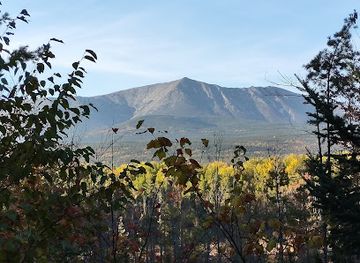
Baxter State Park occupies more than 200,000 acres in north-central Maine, a largely roadless wilderness of boreal forest, mountain ponds, rocky ridges and remote valleys. Its centrepiece is Mount Katahdin, the highest mountain in Maine and the northern terminus of the Appalachian Trail. The mountain is not a single summit but a broad massif, with Baxter Peak, Hamlin Peak and other high points rising above forests and glacially shaped valleys.Read more about Baxter State Park
Mountains, Water and Wildlife
A Deliberately Simple Visitor Experience
When is the best time to visit Baxter State Park?
Best: June–August · 22–24°C| Month | High (°C) | Rainfall (mm) |
|---|---|---|
| January | -6 | 73 |
| February | -5 | 63 |
| March | 2 | 78 |
| April | 10 | 90 |
| May | 17 | 95 |
| June (best) | 22 | 100 |
| July (best) | 24 | 105 |
| August (best) | 23 | 100 |
| September | 18 | 95 |
| October | 12 | 90 |
| November | 5 | 85 |
| December | -3 | 80 |
Getting to and around Baxter State Park
How to get there
Transportation
Best attractions in Baxter State Park
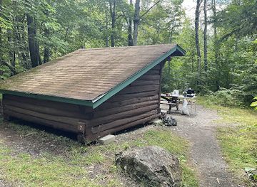
The principal attraction is the Katahdin massif, where demanding trails lead towards Baxter Peak, Hamlin Peak, Knife Edge and other high ridges, subject to weather, route conditions and park rules. Chimney Pond provides one of the park’s most memorable mountain settings beneath the dramatic basin of Katahdin, while Roaring Brook and Katahdin Stream serve as important trail areas for different approaches. Away from the summit, remote ponds and lakes including Russell Pond, Wassataquoik Lake and Lower and Upper Katahdin Lake reveal the park’s quieter, forested character. Wildlife observation is part of the experience rather than a guaranteed attraction, with moose, black bear, deer, loons and northern woodland birds inhabiting the park. The Appalachian Trail’s northern terminus at Baxter Peak adds a significant long-distance walking connection. Roads, trailheads and overnight areas are dispersed, so these places are best understood as separate sections of a large wilderness rather than a compact circuit.
-
 Campground
Matagamon Wilderness Campground
Discover the beauty of Matagamon Wilderness Campground, a serene escape in Maine perfect for camping, fishing, and reconnecting with nature.
-
Campground
Katahdin Stream Campground
Explore the scenic Katahdin Stream Campground in Baxter State Park, a serene retreat for outdoor lovers amidst breathtaking Maine landscapes.
-
Campground
Roaring Brook Campground
Experience the tranquility of Roaring Brook Campground, your gateway to exploring the stunning landscapes of Baxter State Park in Maine.
-
Tourist attraction
Debsconeag Lakes Wilderness Area
Explore the untouched wilderness of Debsconeag Lakes, a nature lover's paradise in Maine's Appalachian Mountains, rich in adventure and scenic beauty.
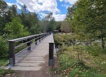
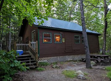
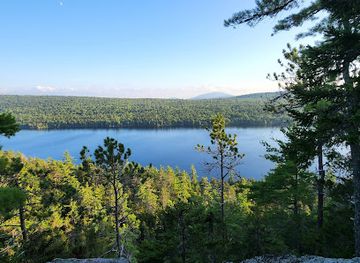
Explore Baxter State Park on the map
Plan your trip on one map. See where the top attractions, landmarks, restaurants and hotels are, and book hotels and experiences in a few clicks.
Best hotels in Baxter State Park
Best bars in Baxter State Park
Evening entertainment in Baxter State Park is deliberately limited to the quiet rhythms of a wilderness campsite: conversation, stargazing and the sound of wind or water rather than organised nightlife. Alcohol and fires are subject to park regulations, and visitors should not expect a bar, club or performance venue inside the park. Millinocket, outside the southern boundary, has the area’s most accessible selection of traditional pubs, taverns and casual evening places, while other gateway communities offer a smaller local hospitality scene. The atmosphere is generally informal and community-oriented rather than late-night or club-focused. Seasonal events and live music may occur in surrounding towns, but schedules change, so visitors should verify them locally rather than assuming they coincide with a park stay.
-
Takeout Restaurant
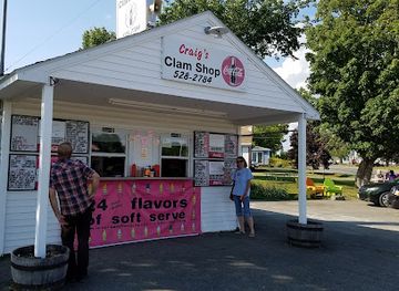
Craig's Clam Shop
Experience the best of Maine's seafood at Craig's Clam Shop, where fresh flavors meet coastal charm in Patten.
-
Restaurant
Mt. Chase Lodge
Experience the charm of Mt. Chase Lodge in Maine, where rustic comfort meets adventure amidst stunning natural beauty.
-
Park
Togue Pond Gatehouse
Explore Togue Pond Gatehouse in Baxter State Park for breathtaking views, outdoor adventures, and a tranquil escape into Maine's wilderness.
-
Campground
South Branch Pond Campground
Experience the serene beauty of South Branch Pond Campground in Baxter State Park, a perfect retreat for nature lovers and adventure seekers.
Get your free copy of our complete guide to Baxter State Park, delivered straight to you.
Everything on this page, from attractions and restaurants to essentials and local phrases, in one PDF you can read offline, print or share.
Already have an account? Sign in
Your Baxter State Park guide is ready.
We'll send it to · Not you? Sign out

Getting your guide ready…
We are putting together a fresh copy of the Baxter State Park guide. This can take up to a minute.
This can take a few moments. If your browser asks, choose Allow so the download can start. You'll find the guide in your Downloads folder.
Nothing happened? Download it again
Sorry, the guide is taking longer than usual. Please try again in a minute, or get it by email instead.
Baxter State Park essentials
Currency and Payment
Safety
Emergency Situations
Do's and Don'ts
Local Tips
From Eve
Local phrases worth knowing
You don't need to get them perfect. A few words go a long way, and locals appreciate the effort.
Basics
| English | Local | Say it |
|---|---|---|
| Hello | Wassup | [wah-suhp] |
| Goodbye | Later | [lay-tur] |
| Yes | Yup | [yuhp] |
| No | Nah | [nah] |
| Please/You're welcome | Please and thank you | [pleez and thankyuh] |
| Thank you | Thanks a bunch | [thanks uh bunch] |
| Excuse me/Sorry | My bad | [my bad] |
| How are you? | How's it going? | [hows it go-in?] |
| Fine. And you? | Not too shabby. You? | [not too shab-ee. yoo?] |
| Do you speak English? | You speak English? | [yoo speak ing-lish?] |
| I don't understand | I'm lost | [i'm lost] |
Eating & Drinking
| English | Local | Say it |
|---|---|---|
| I'd like to see the menu, please | Can I check out the menu? | [kan eye chek out the menu?] |
| I don't eat meat | I'm veggie | [im vej-ee] |
| Cheers! | Cheers! | [cheers!] |
| I would like to pay, please | I'll pay now | [eye-ll pay now] |
Emergencies
| English | Local | Say it |
|---|---|---|
| Help! | Help! | [help!] |
| Go away! | Scram! | [skram!] |
| Call the Police! | Popo! | [po-po!] |
| Call a doctor! | Doc! | [dok!] |
| I'm lost | I'm turned around | [im turnd a-round] |
| I'm ill | I'm under the weather | [im un-der the weh-thur] |
Shopping
| English | Local | Say it |
|---|---|---|
| I'd like to buy... | I wanna buy... | [eye wanna buy...] |
| I'm just looking | Just browsing | [just brows-ing] |
| How much is it? | What's the damage? | [whats the dam-ij?] |
| That's too expensive | Too steep | [too steep] |
| Can you lower the price? | Can you do me a solid? | [kan yoo do mee a sol-id?] |
Time & Numbers
| English | Local | Say it |
|---|---|---|
| What time is it? | What's the time? | [whats the time?] |
| It's one o'clock | It's one | [its one] |
| Half past (10) | Ten-thirty | [ten-thur-tee] |
| Morning | Mornin' | [morn-in'] |
| Afternoon | Afternoon | [after-noon] |
| Evening | Evenin' | [even-in'] |
| Yesterday | Yestuhday | [yest-ur-day] |
| Today | Today | [to-day] |
| Tomorrow | Tamorrow | [ta-mor-row] |
| 1 | One | [wun] |
| 2 | Two | [too] |
| 3 | Three | [three] |
| 4 | Four | [for] |
| 5 | Five | [fiv] |
| 6 | Six | [siks] |
| 7 | Seven | [sev-in] |
| 8 | Eight | [ate] |
| 9 | Nine | [nine] |
| 10 | Ten | [ten] |
Transport & Directions
| English | Local | Say it |
|---|---|---|
| Where's a/the...? | Where's the...? | [wheres the...?] |
| What's the address? | What's the addy? | [whats the add-ee?] |
| Can you show me (on the map)? | Map it out for me? | [map it out for me?] |
| When's the next (bus)? | When's the next ride? | [whens the next ride?] |
| A ticket (to ....) | A pass (to ...) | [a pass (to ...)] |
History of Baxter State Park
A Landscape Shaped by Ice
The mountains, ponds and valleys of Baxter State Park were largely formed and modified by repeated glaciation. Ice carved the broad Katahdin massif, deepened mountain basins and left the rocky, uneven terrain that characterises the park today. Katahdin rises within the northern Appalachian chain, but its isolated bulk and alpine summit environment give it a strong geographical identity of its own. The lower elevations retain forests and wetlands typical of northern Maine, while exposed summits support specialised alpine vegetation adapted to wind, cold and shallow soils.
Indigenous and Early Colonial Connections
The wider Katahdin and Penobscot region has long been connected with the Penobscot people, whose traditional homeland includes extensive parts of central and northern Maine. Indigenous travel, hunting and seasonal use of the region predate colonial settlement by centuries. Later, European-American commercial interests reached the surrounding forests through timber harvesting, river transport and settlement. The remote interior remained comparatively lightly developed, however, and its mountains and waterways continued to be understood primarily as a wilderness landscape rather than an urban or agricultural one.
Mount Katahdin and Exploration
Katahdin became increasingly known to surveyors, travellers and naturalists during the nineteenth century. The mountain’s name is generally understood to derive from an Indigenous term meaning ‘the greatest mountain’, although spellings and interpretations have varied. Henry David Thoreau’s journeys in the Maine woods, including his 1846 ascent of Katahdin, helped bring the mountain into wider literary and cultural awareness. Early visitors encountered a demanding landscape of forest, bog, rock and rapidly changing weather, characteristics that still shape the experience of climbing the mountain today.
Percival Baxter’s Vision
Baxter State Park grew from the vision and philanthropy of Percival P. Baxter, a Maine governor and legislator who began acquiring land around Katahdin in the 1930s. He donated parcels to the State of Maine over several decades, with the intention that the area remain protected and managed for wilderness rather than conventional commercial development. Baxter’s gifts established the foundation of the present park, and his conditions strongly influenced its distinctive management philosophy. The park was named in his honour while remaining separate in character from Maine’s more developed state parks.
Wilderness Management and the Appalachian Trail
Further land acquisitions and donations expanded Baxter State Park into a large protected landscape, while carefully controlled roads, campsites and trails provided limited public access without transforming its wild character. The Appalachian Trail reaches its northern terminus at Baxter Peak, linking the park to a much longer national footpath while presenting a demanding final mountain section. Today the park’s emphasis on reservations, controlled access, limited facilities and conservation reflects Baxter’s founding principles. Management continues to balance public enjoyment with the protection of forests, alpine habitats, waterways and wildlife.
Baxter State Park in Photos
Browse through our photo collection highlighting the charm and character of the destination.
Neighbouring destination travel guides
The closest destinations to Baxter State Park, if you have time for more than one.
-

-
-

-
-
 Mount Desert Island
Discover Mount Desert Island in Maine: A blend of Acadia National Park's natural wonders, charming towns, and coastal adventures. Perfect for nature lovers and explorers.


Swipe for more destinations
Explore more

Explore more of Piscataquis County
Piscataquis County offers Moosehead Lake, Katahdin landscapes, forest trails, historic villages and spacious outdoor adventures in northern Maine.
Explore Piscataquis County
Explore more of Maine
Discover Maine's breathtaking landscapes, charming coastal towns, and rich cultural heritage. From Acadia's cliffs to fresh lobster feasts, Maine promises an unforgettable adventure.
Explore Maine