

Free Dingli Cliffs Travel Guide & Mobile App
Explore Dingli Cliffs with free travel guides. Discover regional history, expert tips, proposed trips, and audio guides on web or mobile app.


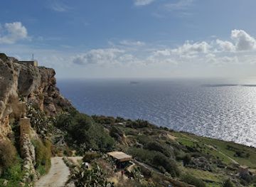
Dingli Cliffs combine Malta’s highest coastal views with limestone countryside, rural heritage, walking paths and broad Mediterranean horizons.
Read more about Dingli Cliffs
When is the best time to visit Dingli Cliffs?
Best: May–July · 22–30°C| Month | High (°C) | Rainfall (mm) |
|---|---|---|
| JANUARY | 15 | 80 |
| FEBRUARY | 15 | 60 |
| MARCH | 16 | 40 |
| APRIL | 18 | 30 |
| MAY (best) | 22 | 20 |
| JUNE (best) | 27 | 10 |
| JULY (best) | 30 | 5 |
| AUGUST | 30 | 5 |
| SEPTEMBER | 28 | 30 |
| OCTOBER | 24 | 60 |
| NOVEMBER | 19 | 70 |
| DECEMBER | 16 | 80 |
Getting to and around Dingli Cliffs
How to get there
Transportation
Best attractions in Dingli Cliffs
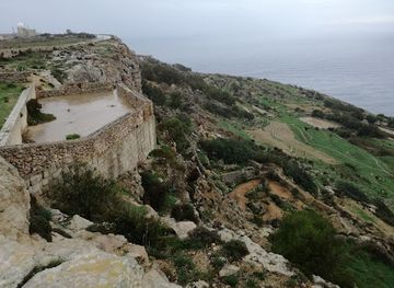
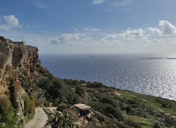
Dingli Cliffs are primarily a landscape attraction, offering elevated Mediterranean views, open limestone countryside and walking routes along Malta’s western escarpment. The Chapel of St Mary Magdalene provides a cultural focal point above the sea, while the surrounding plateau contains garigue, rubble walls, cultivated fields and ancient cart ruts that reward slower exploration. Clear-weather views may extend towards Filfla, the small offshore islet south-west of Malta. The nearby village of Dingli adds parish architecture, local cafés and a lived-in rural setting rather than a purpose-built tourist centre. Inland, Buskett Gardens and Verdala Palace are useful nearby additions, presenting woodland and historic estate landscapes in marked contrast to the exposed cliffs. The area suits walking, photography, birdwatching, geology and quiet observation more than a tightly scheduled sequence of ticketed attractions. Visitors should allow for uneven surfaces, limited shade and the possibility that some paths cross working agricultural land or approach restricted infrastructure.
-
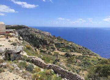
Scenic spot
Dingli Cliffs
Discover the stunning Dingli Cliffs, a scenic gem in Malta offering breathtaking views, rich nature, and unforgettable sunsets over the Mediterranean Sea.
-
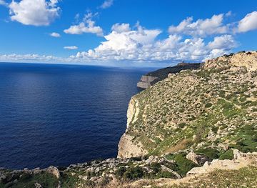
Hiking area
Dingli cliffs viewpoint
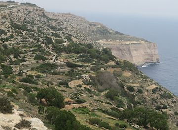
Discover the breathtaking views at Dingli Cliffs Viewpoint, where Malta's natural beauty meets the Mediterranean's edge.
-
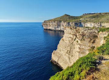
Hiking area
Ras id-Dawwara
Discover the breathtaking cliffs and natural beauty of Ras id-Dawwara, a top hiking destination in Rabat, Malta, perfect for nature lovers.
-
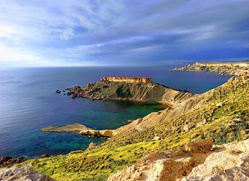
Wildlife and safari park
Clay Cliffs
Experience the breathtaking beauty of the Clay Cliffs in Mġarr, Malta, where stunning geological formations meet the serene Mediterranean Sea.
Best landmarks in Dingli Cliffs
The defining landmark is the Dingli escarpment itself, Malta’s highest coastal ground and a powerful geological boundary between the cultivated plateau and the open sea. Its long limestone edge is more significant as a continuous natural feature than as a single lookout, with changing views shaped by light, weather and seasonal vegetation. The Chapel of St Mary Magdalene stands near the cliff top and is recognised for its isolated position as much as for its simple religious architecture. Across the plateau, prehistoric or ancient cart ruts form a less monumental but historically important landscape marker, although their dating and original purpose remain debated. The small islet of Filfla, visible offshore in suitable conditions, provides a distinctive horizon feature but lies away from Dingli and should not be confused with part of the cliff landform. Nearby Buskett Gardens and Verdala Palace create a contrasting inland landmark group, clearly separate from the exposed coastal escarpment.
-
Historical landmark
Mdina Gate
Explore the grandeur of Mdina Gate, a historical landmark that offers a glimpse into Malta's rich heritage and stunning medieval architecture.
-
Beach
Golden Bay
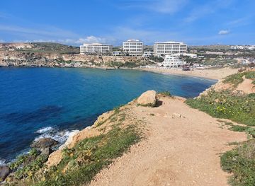
Experience the allure of Golden Bay: Malta's iconic beach with red sands, clear waters, and breathtaking sunset views.
-
Scenic spot
Blue Grotto
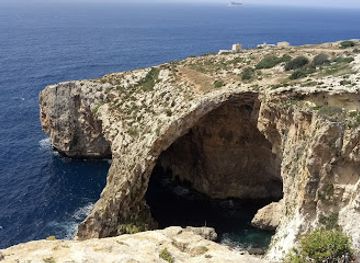
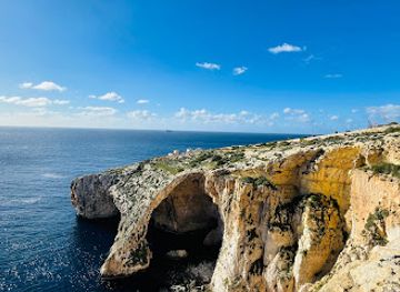
Discover the magical Blue Grotto in Malta: Explore stunning sea caves with crystal-clear azure waters and breathtaking limestone formations.
-
Archaeological museum
St Paul’s Catacombs
Discover ancient burial grounds in Rabat, Malta, exploring early Christian history and Roman funerary practices at St Paul's Catacombs.
Explore Dingli Cliffs on the map
Plan your trip on one map. See where the top cities, national parks and sights are, and book hotels and experiences in a few clicks.
Best hotels in Dingli Cliffs
Best restaurants in Dingli Cliffs
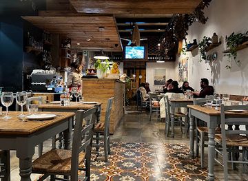
Dining around Dingli Cliffs is modest and locally focused, with the greatest choice found in Dingli village and nearby Rabat rather than on the cliff edge. Menus commonly reflect Maltese cooking, including pastizzi, ftira, soups, rabbit dishes, baked pasta, fish when available, and savoury pastries influenced by the island’s Mediterranean and historical connections. Rural restaurants and village cafés are suitable for a meal before or after walking, while nearby towns provide a wider range of casual and contemporary options. Local produce may include seasonal vegetables, olives, capers, citrus and honey, although availability changes throughout the year. Look for ġbejna, Malta’s traditional sheep’s-milk cheese, and Maltese breads and preserves where offered. Dining is generally relaxed, but the most convenient places can become busy at popular times, so advance planning is sensible if visiting with a larger group or combining the cliffs with an evening meal.
-
Maltese
Diar il-Bniet
Experience authentic Maltese cuisine at Diar il-Bniet – where local flavors meet warm hospitality in a charming setting.
-
Restaurant
The Cliffs
Discover exquisite cuisine at The Cliffs in Malta while enjoying breathtaking views over the Mediterranean Sea.
-
Restaurant
Bobbyland Restaurant
Experience authentic Maltese cuisine at Bobbyland Restaurant near Dingli Cliffs, where delicious flavors meet stunning views.
-
Restaurant
Barbajean
Discover authentic Maltese cuisine at Barbajean in Dingli – where local flavors meet stunning views.
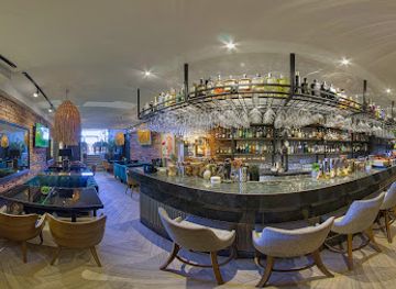
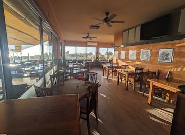
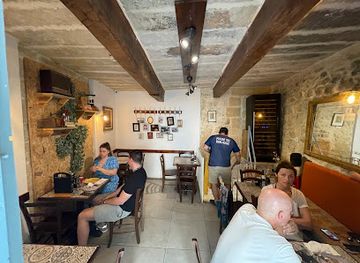
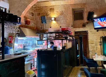
Best bars in Dingli Cliffs
Dingli Cliffs do not have a substantial nightlife scene, and the open plateau is best visited during daylight rather than treated as an evening entertainment district. In Dingli village, evening life centres on local bars, cafés and restaurants, where residents meet in an informal setting and visitors can experience the slower rhythm of an inland Maltese community. Larger choices of bars, wine venues and late-night entertainment are found in Valletta, Sliema, St Julian’s and other urban areas across Malta, not in the cliff landscape itself. Nearby Rabat offers a more varied restaurant-led evening, while a countryside visit may suit those interested in conversation, local food and a quiet drink rather than clubs. Check transport arrangements before staying late, since rural bus services and walking routes are less convenient after dark, and avoid approaching the cliff edge at night.
-
Cocktail bar
The Black Sheep drink and dine
Discover the vibrant atmosphere and delectable Mediterranean cuisine at The Black Sheep, a must-visit cocktail bar and restaurant in Sliema.
-
Restaurant
The Cliffs
Experience the best of Maltese cuisine with breathtaking views at The Cliffs, a stunning restaurant perched on Dingli's rugged coastline.
-
Cafe
CHALK cafe eatery wine
Experience the culinary fusion of local flavors and fine wines at CHALK Cafe Eatery Wine in Rabat, Malta.
-
Bar
Ferdinand's Bar & Burger
Experience the best of Malta at Ferdinand's Bar & Burger – a lively spot for burgers, tapas, and refreshing cocktails in Siġġiewi.
Best nightclubs in Dingli Cliffs
Dingli Cliffs do not have a substantial nightlife scene, and the open plateau is best visited during daylight rather than treated as an evening entertainment district. In Dingli village, evening life centres on local bars, cafés and restaurants, where residents meet in an informal setting and visitors can experience the slower rhythm of an inland Maltese community. Larger choices of bars, wine venues and late-night entertainment are found in Valletta, Sliema, St Julian’s and other urban areas across Malta, not in the cliff landscape itself. Nearby Rabat offers a more varied restaurant-led evening, while a countryside visit may suit those interested in conversation, local food and a quiet drink rather than clubs. Check transport arrangements before staying late, since rural bus services and walking routes are less convenient after dark, and avoid approaching the cliff edge at night.
-
Night club
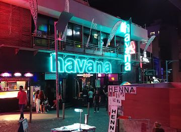
Havana Club Malta
Dive into the pulsating nightlife of Havana Club Malta, a vibrant night club in St Julian's offering eclectic music and exquisite cocktails.
-
Night club
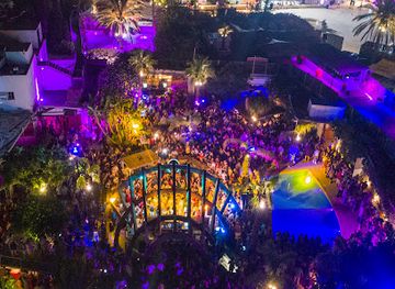
Gianpula Main Room
Gianpula Main Room: Malta's premier night club for unforgettable nights of music, dancing, and vibrant socializing.
-
Night club
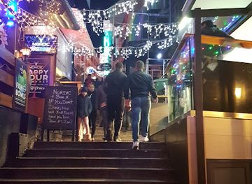
The Nordic Bar
Experience the pulse of Malta's nightlife at The Nordic Bar, a vibrant club offering exceptional drinks, music, and unforgettable nights.
-
Night club
Footloose
Experience the vibrant nightlife of St Julian's at Footloose, Malta's premier nightclub, where unforgettable memories await.

Best shops in Dingli Cliffs
Shopping at Dingli Cliffs is limited and largely practical, with no major retail district on the plateau. Dingli village offers small local businesses and places to buy refreshments, while Rabat and other nearby towns provide a broader choice of food shops, bakeries, pharmacies and independent retailers. Visitors interested in regional purchases can look for Maltese honey, olive products, capers, preserves, wine, liqueurs, ġbejna and traditional biscuits, subject to seasonal availability and individual shop stock. Malta’s wider craft traditions include filigree jewellery, ceramics, lace and hand-worked textiles, but specialised outlets are more commonly found in larger towns and tourist centres than beside the cliffs. Farmers’ produce and village bakery goods can be more meaningful souvenirs than generic cliff-themed merchandise; pack food carefully in warm weather and respect any agricultural stalls or private roadside stands.
-
Shopping mall
PAMA Shopping Mall
Explore PAMA Shopping Mall in Mosta, Malta: A dynamic shopping hub offering a wide range of stores, dining options, and entertainment for all visitors.
-
Restaurant
The Cliffs
Experience breathtaking views and exquisite cuisine at The Cliffs, a perfect blend of nature and gastronomy in Malta.
-
Craft store
Ta' Qali Craft Village
Explore the enchanting Ta' Qali Craft Village in Malta, where traditional craftsmanship meets vibrant local culture and unique handmade treasures await.
-
Jewelry store
Ta' Dbiegi Crafts Village
Discover the heart of Maltese craftsmanship at Ta' Dbiegi Crafts Village, where handmade treasures await every visitor.

Get your free copy of our complete guide to Dingli Cliffs, delivered straight to you.
Everything on this page, from attractions and restaurants to essentials and local phrases, in one PDF you can read offline, print or share.
Already have an account? Sign in
Your Dingli Cliffs guide is ready.
We'll send it to · Not you? Sign out

Getting your guide ready…
We are putting together a fresh copy of the Dingli Cliffs guide. This can take up to a minute.
This can take a few moments. If your browser asks, choose Allow so the download can start. You'll find the guide in your Downloads folder.
Nothing happened? Download it again
Sorry, the guide is taking longer than usual. Please try again in a minute, or get it by email instead.
Dingli Cliffs essentials
Currency and Payment
Safety
Emergency Situations
Do's and Don'ts
Local Tips
From Eve
Local phrases worth knowing
You don't need to get them perfect. A few words go a long way, and locals appreciate the effort.
Basics
| English | Local | Say it |
|---|---|---|
| Hello | Hello | [Hello] |
| Goodbye | Goodbye | [Goodbye] |
| Yes | Yes | [Yes] |
| No | No | [No] |
| Please/You're welcome | Please/You're welcome | [Please/You're welcome] |
| Thank you | Thank you | [Thank you] |
| Excuse me/Sorry | Excuse me/Sorry | [Excuse me/Sorry] |
| How are you? | How are you? | [How are you?] |
| Fine. And you? | Fine. And you? | [Fine. And you?] |
| Do you speak English? | Do you speak English? | [Do you speak English?] |
| I don't understand | I don't understand | [I don't understand] |
Eating & Drinking
| English | Local | Say it |
|---|---|---|
| I'd like to see the menu, please | I'd like to see the menu, please | [I'd like to see the menu, please] |
| I don't eat meat | I don't eat meat | [I don't eat meat] |
| Cheers! | Cheers! | [Cheers!] |
| I would like to pay, please | I would like to pay, please | [I would like to pay, please] |
Emergencies
| English | Local | Say it |
|---|---|---|
| Help! | Help! | [Help!] |
| Go away! | Go away! | [Go away!] |
| Call the Police! | Call the Police! | [Call the Police!] |
| Call a doctor! | Call a doctor! | [Call a doctor!] |
| I'm lost | I'm lost | [I'm lost] |
| I'm ill | I'm ill | [I'm ill] |
Shopping
| English | Local | Say it |
|---|---|---|
| I'd like to buy... | I'd like to buy... | [I'd like to buy...] |
| I'm just looking | I'm just looking | [I'm just looking] |
| How much is it? | How much is it? | [How much is it?] |
| That's too expensive | That's too expensive | [That's too expensive] |
| Can you lower the price? | Can you lower the price? | [Can you lower the price?] |
Time & Numbers
| English | Local | Say it |
|---|---|---|
| What time is it? | What time is it? | [What time is it?] |
| It's one o'clock | It's one o'clock | [It's one o'clock] |
| Half past (10) | Half past (10) | [Half past (10)] |
| Morning | Morning | [Morning] |
| Afternoon | Afternoon | [Afternoon] |
| Evening | Evening | [Evening] |
| Yesterday | Yesterday | [Yesterday] |
| Today | Today | [Today] |
| Tomorrow | Tomorrow | [Tomorrow] |
| 1 | 1 | [1] |
| 2 | 2 | [2] |
| 3 | 3 | [3] |
| 4 | 4 | [4] |
| 5 | 5 | [5] |
| 6 | 6 | [6] |
| 7 | 7 | [7] |
| 8 | 8 | [8] |
| 9 | 9 | [9] |
| 10 | 10 | [10] |
Transport & Directions
| English | Local | Say it |
|---|---|---|
| Where's a/the...? | Where's a/the...? | [Where's a/the...?] |
| What's the address? | What's the address? | [What's the address?] |
| Can you show me (on the map)? | Can you show me (on the map)? | [Can you show me (on the map)?] |
| When's the next (bus)? | When's the next (bus)? | [When's the next (bus)?] |
| A ticket (to ....) | A ticket (to ....) | [A ticket (to ....)] |
History of Dingli Cliffs
Prehistoric and Ancient Limestone Landscapes
The plateau around Dingli contains traces of long human use, including cart ruts cut into the limestone. Their exact date and purpose remain subjects of archaeological debate, and they should not be presented as the product of one definitively established period. Their presence nevertheless demonstrates how Malta’s uplands were repeatedly travelled, worked and adapted before modern roads. The wider area also retains field systems, rock-cut features and other evidence of a landscape shaped by farming and movement across exposed limestone.
The Formation of Rural Dingli
Dingli developed inland from Malta’s western cliffs as an agricultural settlement, with cultivation supported by the plateau’s soils and limited water resources. Like many Maltese villages, its identity became organised around a parish church, lanes, fields and small farming communities rather than a harbour economy. Traditional rubble walls divided plots and helped define the rural appearance that remains around the cliffs. The present village is a modern settlement, but its landscape still reflects the importance of small-scale agriculture in Malta’s past.
Hospitaller Malta and the Chapel of St Mary Magdalene
During the period of the Order of St John, Malta’s landscape was strengthened by religious foundations, estates, roads and defensive observation practices. The Chapel of St Mary Magdalene at Dingli Cliffs, generally associated with the seventeenth century, reflects the devotional presence established on the island during this era. Its isolated position above the coast gave it both religious and visual importance. The chapel is modest in scale, but its setting illustrates how sacred buildings were embedded in Malta’s agricultural and coastal geography.
Agriculture, Dry-Stone Walls and Water Scarcity
For centuries, Dingli’s economy and appearance were shaped by the demands of farming on a dry limestone island. Farmers cleared stones from fields, reused them in rubble walls and cultivated cereals, vegetables and other crops where soil allowed. Rainfall was seasonal, so cisterns and careful water management were essential. This agricultural system was never separate from the cliffs: the same plateau that provides today’s walking views was also a working environment, marked by boundaries, tracks and cultivated plots.
British Rule and Strategic Infrastructure
Under British rule, Malta became an important naval and military base, and the island’s high ground acquired renewed strategic significance. Dingli’s western position offered extensive views over the sea and made the surrounding plateau suitable for communications and observation infrastructure. Modern installations, including radar-related facilities, form part of this more recent layer of the landscape, although many are not visitor attractions. Their presence reflects Malta’s continuing military and communications importance during the nineteenth and twentieth centuries.
Modern Conservation and Rural Change
Post-war development transformed much of Malta, but Dingli Cliffs remained comparatively open because of their steep escarpment, agricultural use and environmental value. Today the area is valued for its scenery, geology, birdlife, walking and cultural landscape, while pressure from traffic, informal access and development continues to require care. The cliffs therefore represent not an untouched wilderness but a managed rural environment in which farming, recreation, heritage protection and modern infrastructure coexist.
Dingli Cliffs in Photos
Browse through our photo collection highlighting the charm and character of the destination.
Neighbouring regions of Dingli Cliffs
The closest regions to Dingli Cliffs, if you have time for more than one.
-

-

-

-

-


Swipe for more regions
Explore more
Explore more of Malta
Discover Malta's crystal-clear waters, rich history, and vibrant culture. From ancient temples to modern nightlife, this Mediterranean gem offers something for everyone.
Explore Malta