

Free Gasconade River Basin Travel Guide & Mobile App
Explore Gasconade River Basin with free travel guides. Discover regional history, expert tips, proposed trips, and audio guides on web or mobile app.


Explore Missouri's Gasconade River Basin for Ozark paddling, wooded valleys, springs, historic towns and quiet rural landscapes.
Read more about Gasconade River Basin
Getting to and around Gasconade River Basin
How to get there
Transportation
Top city travel guides in Gasconade River Basin
The cities of Gasconade River Basin, and the easiest places to base yourself.
-

-

-

-


Swipe for more cities
Destinations in Gasconade River Basin
Resorts, valleys and scenic spots worth a trip of their own.
-

-

-


Swipe for more destinations
Best attractions in Gasconade River Basin
The Gasconade River Basin's attractions are defined by outdoor settings and dispersed small-town heritage rather than a dense sequence of major museums. River recreation is central: paddling, fishing, wildlife watching and riverside picnicking are possible on suitable stretches of the Gasconade and its tributaries, subject to water conditions and lawful access. The Roubidoux Creek area near Waynesville adds clear-water Ozark scenery, while public conservation land and sections of Mark Twain National Forest provide opportunities for hiking, birdwatching and quiet woodland exploration. Springs, caves, limestone outcrops and wooded ravines reveal the region's karst geology, although sensitive underground sites may require specialist access or may be closed. History is encountered in courthouse squares, local museums, old bridges, Route 66 remnants and the rural communities scattered through the watershed. Fort Leonard Wood contributes military history but is an active installation with controlled access, not a conventional open-air attraction. The northern basin connects with the Missouri River landscape around Gasconade and Hermann, while southern sections have stronger links to Ozark forests, Route 66 and the military community near Fort Leonard Wood.
-
State park
Ha Ha Tonka State Park
Explore the breathtaking landscapes and unique geological wonders of Ha Ha Tonka State Park in Missouri, a paradise for outdoor enthusiasts.
-
Tourist attraction
Bennett Spring State Park
Discover the natural beauty of Bennett Spring State Park, a premier destination for fishing, hiking, and outdoor relaxation in Missouri's stunning Ozarks.
-
Maramec Spring Park
Experience the natural wonders of Maramec Spring Park, a serene retreat with crystal-clear springs, vibrant trails, and diverse wildlife in Missouri.
-
Tourist attraction
The Fugitive Beach
Explore The Fugitive Beach in Rolla, Missouri – a perfect blend of relaxation, adventure, and family fun amidst stunning natural beauty.


Best landmarks in Gasconade River Basin
The Gasconade River itself is the basin's defining natural landmark, a long, sinuous waterway whose wooded banks and changing width express the differences between the Ozark interior and the northern lowlands. Its tributary valleys, including the Roubidoux, add spring-fed channels, limestone formations and historic crossing points. Waynesville's historic courthouse square and older civic buildings provide an architectural focus in the eastern part of the watershed, while county seats and town centres at Dixon, Lebanon and other communities preserve the modest scale of nineteenth- and early twentieth-century Missouri settlement. Route 66 structures and surviving alignments form a cultural landmark network through the southern and eastern approaches, linking local history to the larger story of American motoring. Fort Leonard Wood is a major twentieth-century presence near the basin, but it is an active military installation rather than an unrestricted landmark. Near the northern end, the river's meeting with the Missouri River at Gasconade gives the landscape a wider geographical significance, connecting Ozark drainage country with the state's principal historic waterway.
-
State park
Bennett Spring State Park
Discover Missouri's natural beauty at Bennett Spring State Park: premier trout fishing, scenic trails, and historic charm in the Ozark hills.
-
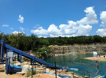
Water park
The Fugitive Beach
Discover fun and relaxation at The Fugitive Beach, a unique water park and beach pavilion in Rolla, Missouri, perfect for families and friends.
-
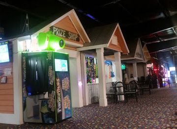
Amusement center
The Zone
Rolla's premier family entertainment center with roller skating, laser tag, arcade games, and more for an unforgettable day of fun!
-
Park
Little Prairie Conservation Area
Discover a natural oasis near Rolla, Missouri, with hiking trails, fishing, and diverse ecosystems at Little Prairie Conservation Area.


Explore Gasconade River Basin on the map
Plan your trip on one map. See where the top cities, national parks and sights are, and book hotels and experiences in a few clicks.
Best hotels in Gasconade River Basin
Best restaurants in Gasconade River Basin
Dining in the basin is practical, local and strongly connected to the broader food culture of Missouri and the American Midwest. Small-town cafés, family restaurants, bar-and-grill establishments and rural diners are the most dependable expressions of the regional scene, serving breakfasts, burgers, sandwiches, fried chicken, country-style sides and pies. Barbecue is widely available as a Missouri staple, while farm country contributes beef, pork, poultry, seasonal vegetables and baked goods. In communities near the river and larger highways, visitors may find smoked fish or locally caught freshwater fish, though availability is seasonal and not every river town has a specialised seafood tradition. Farmers' markets and roadside stands offer produce when in season, particularly in summer and early autumn. Waynesville, Lebanon, Dixon, Hermann and other larger settlements provide the broadest choice, from casual cafés to more contemporary dining. Near the northern end, Hermann's German-influenced food and wine culture is relevant as a nearby regional context, but it should not be assumed to represent every community within the interior Gasconade watershed.
-
Chicken Wings
Buffalo Wild Wings
Experience delicious chicken wings and vibrant sports entertainment at Buffalo Wild Wings in St. Robert, Missouri.
-
Breakfast
Denny's
Experience classic American breakfast at Denny's in Rolla - where comfort food meets friendly service!
-
Breakfast
Waffle House
Experience the warmth of Waffle House in Rolla, MO - where every meal feels like home with delicious breakfast served all day.
-
Barbecue
Bandana's Bar-B-Q Rolla
Experience authentic American barbecue at Bandana's Bar-B-Q in Rolla - where flavor meets tradition in every bite.


Best bars in Gasconade River Basin
Evening life in the Gasconade River Basin is generally based on local bars, pubs, restaurants, veterans' or community venues, live music and occasional seasonal events rather than a substantial nightclub circuit. Waynesville and Lebanon offer the widest choice of casual evening venues, while smaller towns tend to centre on a few established bars and places serving food. Some establishments have connections with Route 66 culture, country music or the military community near Fort Leonard Wood, but offerings and operating arrangements can change. Rural evenings are often quieter, with visitors choosing campfires, stargazing or relaxed meals over late-night entertainment. Hermann, outside the main interior of the basin but near its northern end, has a more developed wine-country evening scene. Drivers should plan transport in advance, particularly on dark rural roads, and should never drive after drinking.
-
Barbecue
Bandana's Bar-B-Q Rolla
Discover the best barbecue in Rolla, Missouri, at Bandana's Bar-B-Q, where flavor meets family-friendly dining in a welcoming atmosphere.
-
Bar
Hoppers Pub
Experience the lively atmosphere, delicious food, and refreshing drinks at Hoppers Pub in Rolla, Missouri, a must-visit for every traveler.
-
Grill
The Gravel Bar & Grill
Experience the best of American grill cuisine at The Gravel Bar & Grill in Lebanon, Missouri, where local flavors and a vibrant atmosphere await.
-
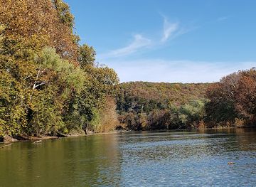
River
Gasconade River
Explore the Gasconade River - a serene oasis in Missouri perfect for fishing, kayaking, and enjoying nature's splendor.


Best nightclubs in Gasconade River Basin
Evening life in the Gasconade River Basin is generally based on local bars, pubs, restaurants, veterans' or community venues, live music and occasional seasonal events rather than a substantial nightclub circuit. Waynesville and Lebanon offer the widest choice of casual evening venues, while smaller towns tend to centre on a few established bars and places serving food. Some establishments have connections with Route 66 culture, country music or the military community near Fort Leonard Wood, but offerings and operating arrangements can change. Rural evenings are often quieter, with visitors choosing campfires, stargazing or relaxed meals over late-night entertainment. Hermann, outside the main interior of the basin but near its northern end, has a more developed wine-country evening scene. Drivers should plan transport in advance, particularly on dark rural roads, and should never drive after drinking.
-
Amusement center
The Zone
Experience thrilling adventures and endless family fun at The Zone in Rolla, Missouri - your ultimate destination for recreation and entertainment.
-
Grill
The Gravel Bar & Grill
Discover delightful dining at The Gravel Bar & Grill in Lebanon, MO, where flavor meets scenic beauty in a warm, welcoming atmosphere.
-
River
Gasconade River
Experience the breathtaking beauty of the Gasconade River in Missouri, a perfect blend of adventure and tranquility for all nature lovers.
-
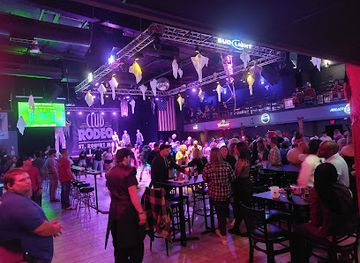
Night club
Club Rodeo Midway
Dive into the vibrant nightlife of St. Robert at Club Rodeo Midway, where music, dance, and unforgettable memories await you.


Best shops in Gasconade River Basin
Shopping in the Gasconade Basin is concentrated in small-town main streets, highway commercial areas, independent shops, flea markets, seasonal farmers' markets and roadside produce stands rather than large retail districts. Lebanon and Waynesville offer the broadest practical selection for groceries, outdoor supplies, clothing and everyday needs, while Dixon, Richland, Crocker and other communities provide smaller local services. Visitors may find antiques, books, handmade crafts, quilts, woodwork, regional art and Route 66 memorabilia, with stock varying considerably by season and shop. Farmers' markets and farm stands are useful for Missouri produce, baked goods, preserves and locally made food when available. Near the northern end, Hermann's galleries, speciality food shops and wine-related retail offer a more established visitor-shopping experience, though much of that scene lies outside the basin's central rural areas. Outdoor equipment and provisions should be purchased before heading into remote river sections, where retail choice and opening arrangements are limited.
-
Department store
T.J. Maxx
Shop stylish clothing, accessories, and home goods at T.J. Maxx in Rolla for unbeatable prices and unique finds.
-
Antique store
Piney River Antique Mall
Explore the unique charm of Piney River Antique Mall in Rolla, Missouri – a treasure trove of vintage finds and timeless home goods.
-
River
Gasconade River
Explore the serene Gasconade River in Missouri, where breathtaking landscapes meet thrilling outdoor adventures in a tranquil setting.
-
Store
Totem Pole Trading Post
Explore the Totem Pole Trading Post in Rolla, Missouri, for unique local crafts and cultural treasures that capture the essence of the region.


Get your free copy of our complete guide to Gasconade River Basin, delivered straight to you.
Everything on this page, from attractions and restaurants to essentials and local phrases, in one PDF you can read offline, print or share.
Already have an account? Sign in
Your Gasconade River Basin guide is ready.
We'll send it to · Not you? Sign out

Getting your guide ready…
We are putting together a fresh copy of the Gasconade River Basin guide. This can take up to a minute.
This can take a few moments. If your browser asks, choose Allow so the download can start. You'll find the guide in your Downloads folder.
Nothing happened? Download it again
Sorry, the guide is taking longer than usual. Please try again in a minute, or get it by email instead.
Gasconade River Basin essentials
Currency and Payment
Safety
Emergency Situations
Do's and Don'ts
Local Tips
From Eve
Local phrases worth knowing
You don't need to get them perfect. A few words go a long way, and locals appreciate the effort.
Basics
| English | Local | Say it |
|---|---|---|
| Hello | Howdy | [hau-dee] |
| Goodbye | See ya | [see yah] |
| Yes | Yup | [yup] |
| No | Nah | [nah] |
| Please/You're welcome | Please | [pleez] |
| Thank you | Thanks | [thanks] |
| Excuse me/Sorry | Excuse me | [ex-kyoos mee] |
| How are you? | How ya doin'? | [how yah doin'?] |
| Fine. And you? | Good. And you? | [good. an' you?] |
| Do you speak English? | Do ya speak English? | [doo yah speek ing-glish?] |
| I don't understand | I ain't followin' ya | [I ain't foh-lin' yah] |
Eating & Drinking
| English | Local | Say it |
|---|---|---|
| I'd like to see the menu, please | Can I see the menu, please? | [kan I see tha men-yoo, pleez?] |
| I don't eat meat | I don't eat no meat | [I don't eet no meet] |
| Cheers! | Cheers! | [cheers!] |
| I would like to pay, please | I wanna pay, please | [I wanna pay, pleez] |
Emergencies
| English | Local | Say it |
|---|---|---|
| Help! | Help! | [help!] |
| Go away! | Get lost! | [git lost!] |
| Call the Police! | Call the cops! | [call tha cops!] |
| Call a doctor! | Call a doc! | [call a doc!] |
| I'm lost | I’m lost | [I'm lost] |
| I'm ill | I ain't feelin' good | [I ain't feelin' good] |
Shopping
| English | Local | Say it |
|---|---|---|
| I'd like to buy... | I wanna buy... | [I wanna buy...] |
| I'm just looking | Just lookin' | [just lookin'] |
| How much is it? | How much's it gonna cost? | [how much's it gonna cost?] |
| That's too expensive | That's too high priced | [that's too high priced] |
| Can you lower the price? | Can ya cut the price? | [can yah kut tha price?] |
Time & Numbers
| English | Local | Say it |
|---|---|---|
| What time is it? | What time's it? | [what time's it?] |
| It's one o'clock | It's one | [it's one] |
| Half past (10) | Half past ten | [half past ten] |
| Morning | Mornin' | [mornin'] |
| Afternoon | Afternoon | [afternoon] |
| Evening | Evenin' | [evenin'] |
| Yesterday | Yesterday | [yesterday] |
| Today | Today | [today] |
| Tomorrow | Tomorrow | [tomorrow] |
| 1 | One | [one] |
| 2 | Two | [two] |
| 3 | Three | [three] |
| 4 | Four | [four] |
| 5 | Five | [five] |
| 6 | Six | [six] |
| 7 | Seven | [seven] |
| 8 | Eight | [eight] |
| 9 | Nine | [nine] |
| 10 | Ten | [ten] |
Transport & Directions
| English | Local | Say it |
|---|---|---|
| Where's a/the...? | Where's the...? | [where's tha...?] |
| What's the address? | What's the address? | [what's tha address?] |
| Can you show me (on the map)? | Can ya point it out? | [can yah point it out?] |
| When's the next (bus)? | When's the next bus? | [when's tha next bus?] |
| A ticket (to ....) | A ticket to ... | [a ticket to ...] |
History of Gasconade River Basin
Indigenous Ozark Settlement
The Gasconade Basin lies within a landscape used by Indigenous peoples for thousands of years. Archaeological evidence across the Ozarks records hunting, fishing, gathering, travel and settlement long before European-American expansion. The Osage were particularly important in the wider central Missouri region, while later Indigenous communities and displaced peoples also moved through the area. Springs, river crossings and ridges offered practical routes through the rugged terrain. Many archaeological sites are protected and are not visitor attractions, but the basin's waterways should be understood as long-established cultural corridors rather than empty wilderness encountered only after modern settlement.
French and Early American Naming
French explorers and traders entered the Missouri and Ozark country during the colonial period, creating names and map references that survived into the modern state. The name Gasconade is generally linked to French usage, although its precise linguistic history is debated. After the United States acquired the Louisiana Territory in 1803, surveyors, migrants and government officials began to map the river more systematically. The waterway became part of a wider network connecting the interior Ozarks with the Missouri River, even though its irregular channel and seasonal conditions limited large-scale navigation.
Settlement, Farms and River Communities
During the nineteenth century, settlers established farms and small communities along the river valleys and on nearby uplands. The Gasconade and its tributaries supplied water, supported mills and provided routes through country where roads were difficult. Towns such as Waynesville, Dixon, Richland and Gasconade developed within this broader settlement landscape, while county courthouses and churches became centres of civic life. Much of the surviving built heritage is modest: courthouse squares, vernacular houses, cemeteries, bridges and agricultural buildings rather than monumental estates.
Timber, Iron and Ozark Industry
The basin's forests and mineral resources supported changing industries during the nineteenth and early twentieth centuries. Timber harvesting opened parts of the Ozarks to farms and settlements, while nearby iron and lead mining districts influenced transport, employment and trade. Mills and quarries used local water and stone, and railways later reduced the river's importance as a transport route while connecting inland towns to larger markets. The resulting landscape combines second-growth woodland, pasture, quarry country and remnant industrial sites, showing how strongly natural resources shaped the regional economy.
Roads, Railways and Route 66
Modern transport altered the relationship between the basin and the rest of Missouri. Rail lines and improved highways brought larger markets within reach, while the construction of U.S. Route 66 made towns including Lebanon, Waynesville and nearby communities part of a celebrated east-west road journey. Route 66 did not follow the entire Gasconade River, but its surviving bridges, alignments, roadside buildings and museums remain important to the southern and eastern parts of the watershed. Road travel now provides the principal way to connect the river with its dispersed towns and recreation areas.
Fort Leonard Wood and Twentieth-Century Change
Fort Leonard Wood was established in 1940 in the Ozarks during the expansion of the United States Army before the Second World War. The installation, located near the basin's south-eastern side, brought major changes to local land use, employment, roads and population. Military training remains a defining presence in the area, although access to parts of the installation is controlled and visitors should not treat it as an open recreational landscape. Its history sits alongside that of long-established farming and timber communities, creating one of the basin's clearest contrasts between rural civilian life and a large federal military presence.
Conservation and River Recreation
From the late twentieth century onwards, public interest increasingly turned towards protecting water quality, forests, springs, caves and wildlife habitat while maintaining responsible recreation. State parks, conservation areas, national forest land and privately managed river access now support hiking, fishing, paddling and camping in different parts of the watershed. The Gasconade remains less intensively developed than some Missouri recreation corridors, so conservation depends heavily on visitors respecting private property, seasonal conditions, leave-no-trace principles and rules governing public access. This balance between working landscape and outdoor recreation defines its contemporary identity.
Gasconade River Basin in Photos
Browse through our photo collection highlighting the charm and character of the destination.
Neighbouring regions of Gasconade River Basin
The closest regions to Gasconade River Basin, if you have time for more than one.
-

-

-

-

-


Swipe for more regions
Explore more

Explore more of Missouri
Experience the diverse landscapes, rich history, and vibrant culture of Missouri, the heart of America, offering everything from bustling cities to serene natural escapes.
Explore Missouri