

Free Ozarks Travel Guide & Mobile App
Explore Ozarks with free travel guides. Discover regional history, expert tips, proposed trips, and audio guides on web or mobile app.


Explore Missouri's Ozarks for forested hills, clear rivers, caves, lakes, small towns, outdoor adventures and Branson's live entertainment.
Read more about Ozarks
When is the best time to visit Ozarks?
Best: May, September–October · 21–27°C| Month | High (°C) | Rainfall (mm) |
|---|---|---|
| January | 4 | 50 |
| February | 8 | 50 |
| March | 14 | 75 |
| April | 19 | 100 |
| May (best) | 24 | 125 |
| June | 29 | 100 |
| July | 32 | 100 |
| August | 32 | 100 |
| September (best) | 27 | 100 |
| October (best) | 21 | 75 |
| November | 13 | 75 |
| December | 7 | 50 |
Getting to and around Ozarks
How to get there
Transportation
Top city travel guides in Ozarks
The cities of Ozarks, and the easiest places to base yourself.
-

-

-

-

-

-


Swipe for more cities
Destinations in Ozarks
Resorts, valleys and scenic spots worth a trip of their own.
-

-

-

-

-

-


Swipe for more destinations
Best attractions in Ozarks
Missouri's Ozarks offer a dispersed collection of water, wilderness, geology and entertainment attractions. The Lake of the Ozarks and Table Rock Lake are major centres for boating, fishing, swimming and lakeside recreation, while the Current, Jacks Fork and Eleven Point rivers provide opportunities for canoeing, kayaking and floating through wooded valleys. Ozark National Scenic Riverways protects some of the region's most celebrated river landscapes, and Mark Twain National Forest contains extensive trails, campgrounds and wildlife habitat. State parks add distinctive geological and historical settings: Johnson's Shut-Ins is known for its resistant volcanic rock and river channels, Elephant Rocks preserves enormous granite boulders, and Ha Ha Tonka combines springs, caves, a natural bridge and castle ruins. The Missouri Ozarks are also notable for underground attractions, including established cave tours and the extensive cave systems associated with the karst landscape. Branson provides a contrasting concentration of theatres, family attractions and live entertainment, while Springfield supplies museums and urban cultural venues. Together these experiences reward visitors who alternate reservoir or river activities with forest walks, geology and local history.
-
Tourist attraction
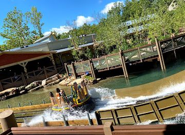
Silver Dollar City
Experience the thrill of Silver Dollar City, a unique theme park blending adventure and 1880s heritage in Branson, Missouri.
-
Tourist attraction
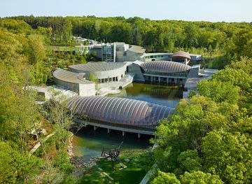
Crystal Bridges Museum of American Art
Explore the exquisite fusion of art and nature at Crystal Bridges Museum of American Art in Bentonville, Arkansas, where creativity meets tranquility.
-
Tourist attraction
Uranus Fudge Factory And General Store
Experience the sweet delight and quirky charm of Uranus Fudge Factory and General Store, the ultimate candy destination in Missouri.
-
Tourist attraction
Mark Twain National Forest
Discover the natural wonders of Mark Twain National Forest, a stunning destination for outdoor enthusiasts and nature lovers in Missouri.



Best landmarks in Ozarks
-
Monument
The Gateway Arch
Explore the iconic Gateway Arch in St. Louis, a majestic symbol of American history and breathtaking views over the Mississippi River.
-
Park
Forest Park
Explore St. Louis's iconic Forest Park: a vibrant hub of culture, history, and natural beauty, offering free attractions and endless activities.
-
Amusement park
Silver Dollar City
Experience the thrills and traditions of an 1880s Ozark village at Silver Dollar City, Branson's premier theme park and entertainment destination.
-
Museum
City Museum
Explore a surreal architectural playground in St. Louis's City Museum, where repurposed শিল্প and industrial objects create a unique, climbable experience.



Explore Ozarks on the map
Plan your trip on one map. See where the top cities, national parks and sights are, and book hotels and experiences in a few clicks.
Best hotels in Ozarks
Best restaurants in Ozarks
Dining in the Missouri Ozarks ranges from family diners, barbecue restaurants and traditional American cafés to resort dining, modern bistros and rural inns. Catfish, trout, fried chicken, burgers and smoked meats are common regional choices, reflecting the importance of rivers, lakes and American country cooking rather than a single narrowly defined Ozark cuisine. Branson and Springfield provide the widest choice of international food and contemporary restaurants, while lake communities tend to concentrate on casual seafood, barbecue and family dining. Local farms and small producers supply beef, seasonal fruit, vegetables, preserves, honey and baked goods, often encountered at farmers' markets and roadside stands. Around the region, cafés and bakeries are useful for breakfast and informal meals, and independent shops may stock Missouri-made sauces, sweets and drinks. Tipping follows United States practice in table-service establishments, and reservations are sensible for popular dining areas during summer and major holiday periods.
-
American
Lambert's Café
Discover Lambert's Café in Ozark, MO – home of throwed rolls and delicious American comfort food!
-
Fine Dining
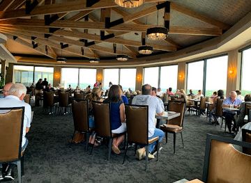
JB Hook's
Savor exquisite seafood and steak while enjoying breathtaking views at JB Hook's in Lake Ozark – where fine dining meets unforgettable experiences.
-
American
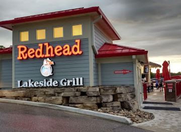
Redhead Lakeside Grill and Yacht Club
Experience lakeside dining at Redhead Lakeside Grill and Yacht Club, where delicious American cuisine meets stunning waterfront views in Osage Beach.
-
Seafood
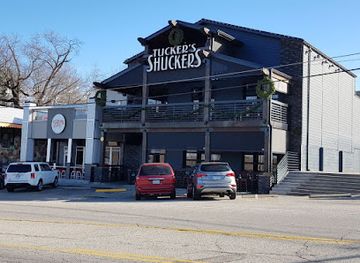
Tuckers Shuckers Oysters & Tap
Experience the best seafood in Lake Ozark at Tuckers Shuckers Oysters & Tap – where fresh meets flavor in a charming setting.

Best bars in Ozarks
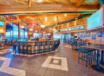
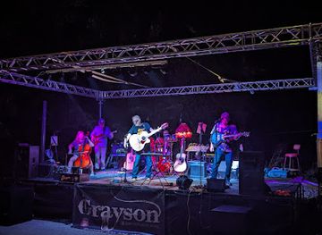
Evening life in the Missouri Ozarks varies sharply by location. Branson is the principal entertainment centre, with theatres, music shows and family-oriented evening venues rather than a large metropolitan club scene. Springfield has the broadest selection of bars, breweries, live-music rooms and late-evening restaurants, including options associated with its university and downtown districts. Around the Lake of the Ozarks and Table Rock Lake, nightlife is more seasonal and concentrated in resort communities, where waterfront bars, restaurants and live music become busier in warmer months. Elsewhere, historic inns, neighbourhood bars, small breweries and community music events are more typical than nightclubs. Rural areas can become quiet after dinner, and visitors should plan transport before drinking because distances are considerable and taxi or ride-hailing availability is uneven. Age restrictions and licensing rules follow Missouri and United States law.
-
Fine Dining
JB Hook's
Experience the best of fine dining at JB Hook's in Lake Ozark, where exquisite seafood and steaks meet breathtaking lakeside views.
-
American
Baxter's Lakeside Grille
Experience exquisite American cuisine with stunning lakeside views at Baxter's Lakeside Grille in Lake Ozark, Missouri.
-
Grill
Dog Days Bar and Grill
Savor delicious grilled dishes and enjoy live music at Dog Days Bar and Grill in the heart of Osage Beach, Missouri.
-
Bar
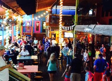
Paradise Tropical Restaurant & Bar
Experience a tropical escape at Paradise Tropical Restaurant & Bar, where American cuisine meets lakeside charm in Sunrise Beach.


Best nightclubs in Ozarks
Evening life in the Missouri Ozarks varies sharply by location. Branson is the principal entertainment centre, with theatres, music shows and family-oriented evening venues rather than a large metropolitan club scene. Springfield has the broadest selection of bars, breweries, live-music rooms and late-evening restaurants, including options associated with its university and downtown districts. Around the Lake of the Ozarks and Table Rock Lake, nightlife is more seasonal and concentrated in resort communities, where waterfront bars, restaurants and live music become busier in warmer months. Elsewhere, historic inns, neighbourhood bars, small breweries and community music events are more typical than nightclubs. Rural areas can become quiet after dinner, and visitors should plan transport before drinking because distances are considerable and taxi or ride-hailing availability is uneven. Age restrictions and licensing rules follow Missouri and United States law.
-
Night club
Shady Gators
Discover the vibrant nightlife at Shady Gators in Lake Ozark, MO, where live music, Cajun cuisine, and a lively atmosphere come together for an unforgettable experience.
-
Grill
H. Toad's Bar & Grill
Experience the best of Lake Ozark at H. Toad's Bar & Grill, where delicious food and live music create unforgettable moments.
-
Night club
Martha's Vineyard
Discover the vibrant nightlife of Martha's Vineyard with lively cocktail bars and exciting events that promise unforgettable experiences.
-
Bar
Off The Cliff And JD'S ROADHOUSE
Experience the vibrant lakeside atmosphere at Off The Cliff And JD'S ROADHOUSE, where good food, music, and company await you.

Best shops in Ozarks
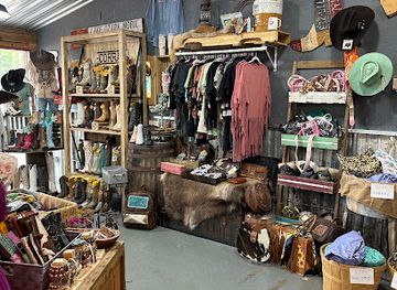
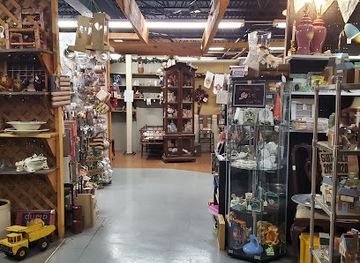
Shopping in the Missouri Ozarks is centred on small-town main streets, resort retail areas, farmers' markets, antiques shops, craft studios and regional food producers rather than large luxury districts. Branson has the region's most concentrated tourist shopping, with outlets, craft-oriented retailers and shops selling music, clothing, gifts and Missouri-themed goods. Springfield offers the widest general retail choice, alongside independent bookshops, galleries, vintage stores and markets. Around the Lake of the Ozarks, lake-oriented clothing, outdoor equipment, souvenirs and casual resort goods are prominent. In smaller communities, look for pottery, woodwork, quilts, handmade soap, artwork, preserves, honey, sweets and locally produced sauces. Farmers' markets are seasonal and their range changes throughout the year, so visitors should treat them as opportunities to buy regional produce rather than guaranteed daily attractions. For outdoor trips, purchase practical supplies in larger towns before travelling to remote river accesses or forest areas.
-
Souvenir store
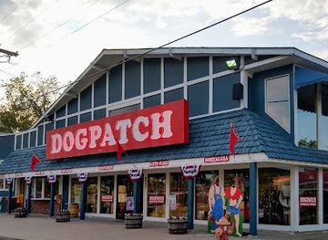
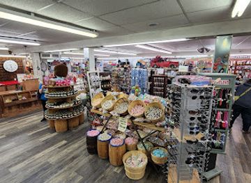
Dogpatch Store
Discover unique souvenirs and local crafts at Dogpatch Store, the perfect spot to remember your Lake Ozark adventure.
-
Gift shop
Ozarkland Store
Explore the charm of the Ozarks at Ozarkland Store, where unique gifts and local crafts await every visitor.
-
Boutique
Split Arrow Boutique
Explore the artistic spirit of Lake Ozark at Split Arrow Boutique, where unique fashion meets local craftsmanship.
-
Antique store
Camp Flea Antique Mall + Vintage Market
Explore Camp Flea Antique Mall + Vintage Market in Ozark, Missouri, for a unique shopping experience filled with vintage treasures and local craftsmanship.
Get your free copy of our complete guide to Ozarks, delivered straight to you.
Everything on this page, from attractions and restaurants to essentials and local phrases, in one PDF you can read offline, print or share.
Already have an account? Sign in
Your Ozarks guide is ready.
We'll send it to · Not you? Sign out

Getting your guide ready…
We are putting together a fresh copy of the Ozarks guide. This can take up to a minute.
This can take a few moments. If your browser asks, choose Allow so the download can start. You'll find the guide in your Downloads folder.
Nothing happened? Download it again
Sorry, the guide is taking longer than usual. Please try again in a minute, or get it by email instead.
Ozarks essentials
Currency and Payment
Safety
Emergency Situations
Do's and Don'ts
Local Tips
From Eve
Local phrases worth knowing
You don't need to get them perfect. A few words go a long way, and locals appreciate the effort.
Basics
| English | Local | Say it |
|---|---|---|
| Hello | Howdy | [Ha-dee] |
| Goodbye | See ya | [See yah] |
| Yes | Yep | [Yep] |
| No | Nope | [Nope] |
| Please/You're welcome | Please/No problem | [Please/No prob-lum] |
| Thank you | Thanks a bunch | [Thanks a bunch] |
| Excuse me/Sorry | Pardon me/Sorry 'bout that | [Par-don me/Sorry 'bout that] |
| How are you? | How ya doin'? | [How ya doin'?] |
| Fine. And you? | I’m good. And you? | [I’m good. An' you?] |
| Do you speak English? | You speakin' English? | [You speakin' English?] |
| I don't understand | I dunno what you're sayin' | [I dunno what yer sayin'] |
Eating & Drinking
| English | Local | Say it |
|---|---|---|
| I'd like to see the menu, please | Can I see the menu, please? | [Can I see the menu, please?] |
| I don't eat meat | I ain't eatin' no meat | [I ain't eatin' no meat] |
| Cheers! | Cheers! | [Cheers!] |
| I would like to pay, please | Can I pay up, please? | [Can I pay up, please?] |
Emergencies
| English | Local | Say it |
|---|---|---|
| Help! | Help! | [Help!] |
| Go away! | Leave me be! | [Leave me be!] |
| Call the Police! | Call the cops! | [Call the cops!] |
| Call a doctor! | Get me a doctor! | [Get me a doctor!] |
| I'm lost | I'm all turned around | [I'm all turned around] |
| I'm ill | I'm feelin' poorly | [I'm feelin' poorly] |
Shopping
| English | Local | Say it |
|---|---|---|
| I'd like to buy... | I wanna buy... | [I wanna buy...] |
| I'm just looking | Just lookin' around | [Just lookin' around] |
| How much is it? | How much's it gonna cost? | [How much's it gonna cost?] |
| That's too expensive | That’s too pricey | [That’s too pricey] |
| Can you lower the price? | Can ya bring that down some? | [Can ya bring that down some?] |
Time & Numbers
| English | Local | Say it |
|---|---|---|
| What time is it? | What time ya got? | [What time ya got?] |
| It's one o'clock | It's one o'clock | [It's one o'clock] |
| Half past (10) | Half past ten | [Half past ten] |
| Morning | Mornin' | [Mornin'] |
| Afternoon | Afternoon | [Afternoon] |
| Evening | Evenin' | [Evenin'] |
| Yesterday | Yesterday | [Yesterday] |
| Today | Today | [Today] |
| Tomorrow | Tomorrow | [Tomorrow] |
| 1 | One | [One] |
| 2 | Two | [Two] |
| 3 | Three | [Three] |
| 4 | Four | [Four] |
| 5 | Five | [Five] |
| 6 | Six | [Six] |
| 7 | Seven | [Seven] |
| 8 | Eight | [Eight] |
| 9 | Nine | [Nine] |
| 10 | Ten | [Ten] |
Transport & Directions
| English | Local | Say it |
|---|---|---|
| Where's a/the...? | Where's a...? | [Where's a...?] |
| What's the address? | What’s the address? | [What’s the address?] |
| Can you show me (on the map)? | Can ya show me on the map? | [Can ya show me on the map?] |
| When's the next (bus)? | When's the next bus? | [When's the next bus?] |
| A ticket (to ....) | A ticket to ... | [A ticket to ...] |
History of Ozarks
Indigenous Homelands and Early Archaeology
The Missouri Ozarks have long been inhabited by Indigenous peoples, including communities associated in different periods with the Osage, Caddo and Mississippian cultural worlds. Archaeological evidence across the region includes rock shelters, village sites, burial places and artefacts demonstrating sustained use of river valleys, ridges and springs. European-American settlement later displaced Indigenous communities through warfare, treaties and government policy. The landscape's caves, springs and waterways therefore have a history that reaches well beyond the nineteenth-century cabins and mills most visible to modern visitors.
French Claims and American Expansion
The Ozarks became part of the wider French colonial sphere through the Mississippi Valley, although European settlement remained sparse in the uplands. After the Louisiana Purchase in 1803 and Missouri statehood in 1821, American settlers, traders and government surveyors entered the region in increasing numbers. The terrain made agriculture and transport difficult, but valleys and river corridors supported small farms, hunting, timber work and local trade. County seats, churches and communities gradually developed around springs, crossroads and navigable waterways.
Lead Mining and the St Francois Mountains
Mining became one of the most important early industries in the eastern Missouri Ozarks, especially around the St Francois Mountains. Lead extraction expanded from earlier French and Spanish activity during the nineteenth century, and the region became a major source of the metal for the United States. Mining brought roads, railways, company settlements and environmental change, while towns such as Bonne Terre and Park Hills grew through the industry. The legacy remains visible in historic mining landscapes, museums and the altered terrain of the Mineral Area.
Timber, Mills and the Ozark Rural Economy
The nineteenth and early twentieth centuries saw extensive timber cutting, particularly as railways opened access to the region's shortleaf pine forests. Sawmills, charcoal production, gristmills and small farms formed a connected rural economy, while rivers powered mills and provided transport on a limited scale. Unregulated logging caused erosion and forest loss, helping prompt later conservation efforts. Restored mills, historic villages, old railway alignments and traditional farm landscapes preserve traces of the period, although much of the forest has since regenerated.
The Great Depression and Federal Conservation
The Great Depression exposed the vulnerability of isolated Ozark farming communities, where poor soils, limited markets and declining timber resources already posed difficulties. New Deal programmes brought road building, public works and land-management initiatives, while the establishment and expansion of national forests reflected a growing federal role in conservation. The Civilian Conservation Corps constructed trails, camp facilities, roads and other public infrastructure across Missouri. Many later recreation landscapes in the Ozarks depend on this combination of public ownership and twentieth-century conservation policy.
Reservoirs, Highways and Tourism
Large-scale dam building transformed the modern Missouri Ozarks. Bagnell Dam, completed in 1931, created the Lake of the Ozarks and established a major resort economy, while later reservoirs including Table Rock Lake supported boating, fishing, tourism and hydroelectric generation. Improved roads and post-war car ownership made the hills accessible to visitors from across the Midwest. Branson developed from a small town into a nationally known entertainment destination, demonstrating how the region's economy shifted from extraction and subsistence agriculture towards recreation, hospitality and cultural tourism.
River Conservation and Public Lands
Concern about development, pollution and the loss of free-flowing rivers led to stronger conservation movements during the twentieth century. Ozark National Scenic Riverways, established in 1964, was the first national park area to protect a wild and scenic river system, safeguarding substantial stretches of the Current and Jacks Fork rivers. Mark Twain National Forest and state parks added further public landscapes. Today, tourism, conservation, private landholding and traditional rural use coexist uneasily, making stewardship of water quality, caves, forests and wildlife an important part of the region's future.
Ozarks in Photos
Browse through our photo collection highlighting the charm and character of the destination.
Neighbouring regions of Ozarks
The closest regions to Ozarks, if you have time for more than one.
-
 White River Basin
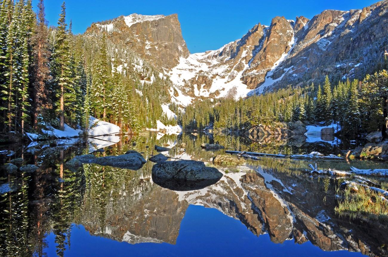
Explore Missouri’s White River Basin for Ozark landscapes, Table Rock Lake boating, trout fishing, caves, Branson shows and Springfield culture.
-

-

-
-


Swipe for more regions
Explore more

Explore more of Missouri
Experience the diverse landscapes, rich history, and vibrant culture of Missouri, the heart of America, offering everything from bustling cities to serene natural escapes.
Explore Missouri