

Free Southeast Missouri Travel Guide & Mobile App
Explore Southeast Missouri with free travel guides. Discover regional history, expert tips, proposed trips, and audio guides on web or mobile app.


Explore Southeast Missouri for Mississippi River towns, French colonial heritage, Ozark wilderness, wetlands, farm-country food and welcoming small cities.
Read more about Southeast Missouri
Getting to and around Southeast Missouri
How to get there
Transportation
Top city travel guides in Southeast Missouri
The cities of Southeast Missouri, and the easiest places to base yourself.
-

-


Swipe for more cities
Destinations in Southeast Missouri
Resorts, valleys and scenic spots worth a trip of their own.
-

-


Swipe for more destinations
Best attractions in Southeast Missouri
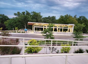
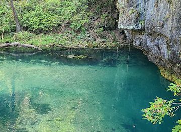
Southeast Missouri’s attractions range from Mississippi River history to rugged Ozark recreation. Cape Girardeau offers riverfront parks, a historic downtown and museums that introduce the region’s commercial and cultural development, while Ste. Genevieve provides an unusually concentrated view of French colonial Missouri through preserved houses, gardens and heritage interpretation. Trail of Tears State Park near Jackson combines woodland, lake scenery and difficult removal history. In the uplands, Elephant Rocks State Park, Johnson’s Shut-Ins State Park and the Taum Sauk Mountain area provide hiking, geology and forest landscapes, with conditions varying by season and trail. Fort Davidson Historic Site near Pilot Knob explains the Civil War significance of the Arcadia Valley. Mingo National Wildlife Refuge is the region’s principal wetland destination, offering wildlife observation and seasonal birding across marshes and bottomland forest. Big Oak Tree State Park in Mississippi County protects an impressive remnant of the Bootheel’s former hardwood landscape. Smaller museums, courthouse squares, historic cemeteries, farm markets and river parks add texture between the headline sites, making the region especially suitable for road trips that combine history, geology, wildlife and working landscapes.
-
Tourist attraction
Fantastic Caverns
Experience the breathtaking beauty and geological wonders of Fantastic Caverns in Springfield, Missouri, an unforgettable underground journey.
-
State park
Ha Ha Tonka State Park
Explore the picturesque landscapes and historical ruins of Ha Ha Tonka State Park in Missouri, offering outdoor adventures and breathtaking views.
-
State park
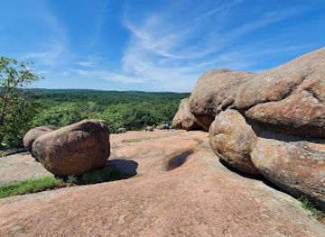
Elephant Rocks State Park
Explore the breathtaking granite formations and lush landscapes of Elephant Rocks State Park, a unique gem in Missouri's natural beauty.
-
State park
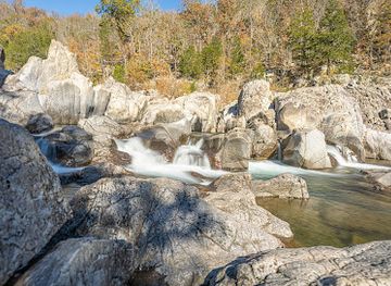
Johnson's Shut-Ins State Park
Explore the stunning landscapes and outdoor adventures at Johnson's Shut-Ins State Park, a hidden gem in Missouri's natural beauty.
Best landmarks in Southeast Missouri
The Mississippi River is Southeast Missouri’s defining geographical landmark, shaping the setting of Cape Girardeau, Ste. Genevieve and the river communities farther south. Cape Girardeau’s historic riverfront and downtown buildings reflect the city’s development as a trading and transport centre, while Ste. Genevieve’s preserved French colonial houses are among the clearest architectural reminders of Missouri’s eighteenth-century settlement. The St Francois Mountains form the region’s strongest natural skyline, with Taum Sauk Mountain marking Missouri’s highest elevation and the granite formations of Elephant Rocks providing a distinctive geological scene. Fort Davidson’s earthworks at Pilot Knob are a major military landmark, retaining the physical form of a Civil War fortification. The marshes and wooded waterways of Mingo National Wildlife Refuge represent a different kind of regional landmark, preserving the wetland character of parts of the southeastern lowlands. In the Bootheel, Big Oak Tree State Park stands for the hardwood forests that once covered more of the plain. Together these places show how river, geology, conflict, architecture and ecological change have shaped the region.
-
Nature preserve
Pickle Springs Natural Area
Explore Missouri's geological wonderland: Hike through stunning sandstone formations, box canyons, and unique plant life at Pickle Springs Natural Area.
-
State park
Bollinger Mill State Historic Site
Discover Missouri's milling heritage at Bollinger Mill State Historic Site, featuring a beautifully preserved mill and historic covered bridge.
-
Non-profit organization
Cape Girardeau County Historical Society
Explore Cape Girardeau County's history through fascinating exhibits and resources at the Historical Society in Jackson, Missouri.


Explore Southeast Missouri on the map
Plan your trip on one map. See where the top cities, national parks and sights are, and book hotels and experiences in a few clicks.
Best hotels in Southeast Missouri
Best restaurants in Southeast Missouri
Dining in Southeast Missouri reflects both its river connections and its agricultural surroundings. Cape Girardeau and other larger towns provide the broadest choice of independent restaurants, cafés, diners and contemporary menus, while smaller communities are known for family-run establishments and traditional American comfort food. Barbecue, fried chicken, catfish, burgers, country breakfasts and seasonal produce are common regional choices, with locally caught or locally prepared seafood appearing particularly often in river-oriented communities. The Bootheel’s farming economy contributes rice, cotton-country associations, soybeans and fresh produce, while the Ozark districts bring a tradition of hearty cooking and rural cafés. Ste. Genevieve’s French heritage is most visible in architecture and history, although its dining scene also includes modern interpretations rather than a single preserved colonial cuisine. Farmers’ markets, bakeries, ice-cream shops and roadside produce stands provide useful introductions to local foodways. Missouri-wide favourites such as toasted ravioli may appear, but they should not be mistaken for an exclusively Southeast Missouri dish.
-
American
Broussard's Cajun Cuisine
Experience authentic Cajun cuisine in Cape Girardeau at Broussard's - where flavorful dishes meet Southern hospitality.
-
Restaurant
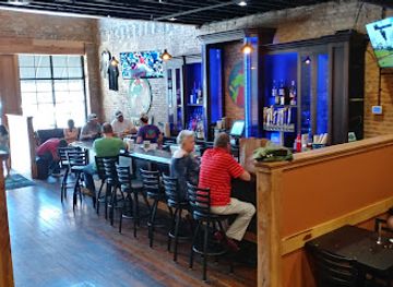
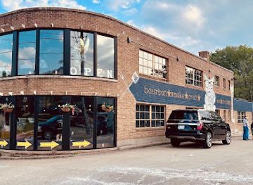
Mary Jane bourbon + smokehouse
Experience mouthwatering barbecue and innovative cocktails at Mary Jane Bourbon + Smokehouse in Cape Girardeau.
-
Restaurant
Port Cape Girardeau Restaurant and Lounge
Discover the rich flavors and vibrant atmosphere at Port Cape Girardeau Restaurant and Lounge – where history meets culinary delight by the river.
-
Irish pub
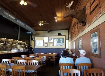
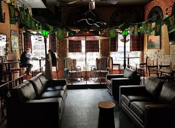
Katy O'Ferrell's Publick House
Discover authentic Irish cuisine and vibrant culture at Katy O'Ferrell's Publick House in Cape Girardeau - an unforgettable dining experience.
Best bars in Southeast Missouri
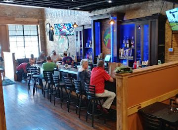
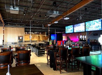
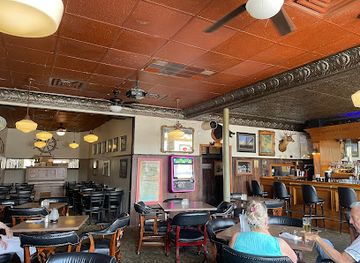
Evening life in Southeast Missouri is concentrated in Cape Girardeau, with additional restaurants, bars, breweries and live-music settings in towns such as Poplar Bluff, Sikeston and Farmington. The dominant social setting remains the traditional pub, neighbourhood bar, restaurant or community event rather than a large, nationally recognised nightclub district. Cape Girardeau’s student population adds a younger dimension during the academic year, while smaller towns generally offer a quieter mix of live music, sporting venues and locally oriented bars. Historic Ste. Genevieve is better suited to an evening meal, wine or a slow walk through its old streets than to late-night clubbing. Opening arrangements and entertainment schedules change, particularly in rural communities, so visitors should check locally rather than assume that venues operate late every night. Breweries, cafés and cultural performances can provide alternatives to alcohol-focused nightlife.
-
American
Broussard's Cajun Cuisine
Discover the authentic flavors of Louisiana at Broussard's Cajun Cuisine in Cape Girardeau, MO, where every dish tells a story.
-
Restaurant
Dogwood Social House Cape Girardeau
Enjoy a unique blend of dining, bowling, and live entertainment at Dogwood Social House in Cape Girardeau, Missouri.
-
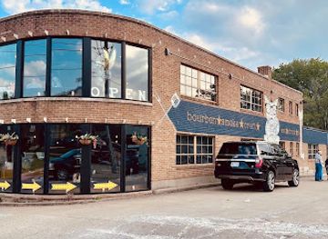
Restaurant
Mary Jane bourbon + smokehouse
Experience the best of Southern barbecue and craft cocktails at Mary Jane Bourbon + Smokehouse in Cape Girardeau.
-
Bar
Port Cape Girardeau Restaurant and Lounge
Experience the vibrant atmosphere and delicious cuisine at Port Cape Girardeau Restaurant and Lounge, where local culture meets culinary delight.
Best nightclubs in Southeast Missouri
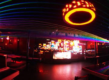
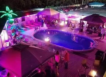
Evening life in Southeast Missouri is concentrated in Cape Girardeau, with additional restaurants, bars, breweries and live-music settings in towns such as Poplar Bluff, Sikeston and Farmington. The dominant social setting remains the traditional pub, neighbourhood bar, restaurant or community event rather than a large, nationally recognised nightclub district. Cape Girardeau’s student population adds a younger dimension during the academic year, while smaller towns generally offer a quieter mix of live music, sporting venues and locally oriented bars. Historic Ste. Genevieve is better suited to an evening meal, wine or a slow walk through its old streets than to late-night clubbing. Opening arrangements and entertainment schedules change, particularly in rural communities, so visitors should check locally rather than assume that venues operate late every night. Breweries, cafés and cultural performances can provide alternatives to alcohol-focused nightlife.
-
Night club
Aura
Experience the pulse of Kansas City nightlife at Aura, a vibrant night club offering electrifying music, innovative cocktails, and unforgettable nights out.
-
Bar
Stepchild Lounge
Experience the energy of Stepchild Lounge, where live music, karaoke, and a welcoming atmosphere await you in Springfield, MO.
-
Night club
Virtue Night Club
Discover the electrifying nightlife at Virtue Night Club in Grandview, Missouri, where music, dancing, and strong drinks come together for an unforgettable experience.
-
Night club
The SPOTT Night Club
Discover the vibrant nightlife at The SPOTT Night Club in Kansas City, a premier destination for dancing, events, and unforgettable experiences.


Best shops in Southeast Missouri
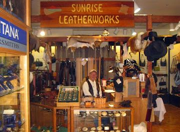
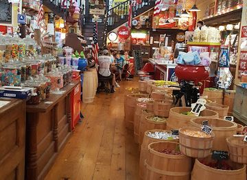
Shopping in Southeast Missouri is centred on practical town centres, regional malls, independent businesses and seasonal markets rather than a single major retail district. Cape Girardeau has the widest selection of national retailers, independent boutiques, books, gifts and food outlets, while Sikeston, Poplar Bluff, Farmington and Ste. Genevieve provide more localised high-street shopping. Ste. Genevieve is particularly suitable for browsing antiques, heritage-related gifts, galleries and small craft businesses in and around its historic core. Farmers’ markets and roadside stands offer seasonal fruit, vegetables, baked goods and other local produce, with availability changing through the year. Visitors may also find Ozark-inspired woodwork, pottery, artwork and handmade goods, although these are best sought from established galleries and craft shops rather than assumed to be available everywhere. Regional food products, Missouri wines and locally made preserves can make useful souvenirs, but check transport and customs rules before carrying food internationally.
-
Gift shop
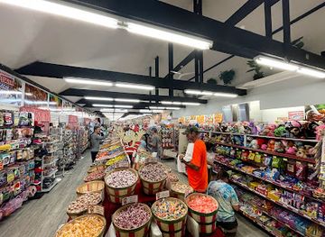
Redmon's Candy Factory
Discover the sweet magic of Redmon's Candy Factory in Phillipsburg, Missouri, where handmade confections and nostalgic treats await all candy lovers.
-
Gift shop
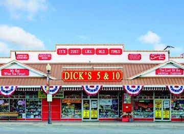
Dick's 5 & 10
Explore Branson's iconic Dick's 5 & 10, a treasure trove of unique gifts, toys, and nostalgic candies in the heart of Downtown.
-
Gift shop
Grand Village Shops
Explore the enchanting Grand Village Shops in Branson, MO, featuring unique boutiques, festive Christmas stores, and delicious dining options.
-
Ice Cream
Old Village Mercantile
Experience the charm and sweetness of Old Village Mercantile in Caledonia, MO, with artisanal ice cream, nostalgic candies, and fresh coffee.
Get your free copy of our complete guide to Southeast Missouri, delivered straight to you.
Everything on this page, from attractions and restaurants to essentials and local phrases, in one PDF you can read offline, print or share.
Already have an account? Sign in
Your Southeast Missouri guide is ready.
We'll send it to · Not you? Sign out

Getting your guide ready…
We are putting together a fresh copy of the Southeast Missouri guide. This can take up to a minute.
This can take a few moments. If your browser asks, choose Allow so the download can start. You'll find the guide in your Downloads folder.
Nothing happened? Download it again
Sorry, the guide is taking longer than usual. Please try again in a minute, or get it by email instead.
Southeast Missouri essentials
Currency and Payment
Safety
Emergency Situations
Do's and Don'ts
Local Tips
From Eve
Local phrases worth knowing
You don't need to get them perfect. A few words go a long way, and locals appreciate the effort.
Basics
| English | Local | Say it |
|---|---|---|
| Hello | Howdy | [Ha-dee] |
| Goodbye | See ya later | [See ya lay-ter] |
| Yes | Yep | [Yep] |
| No | Nah | [Nah] |
| Please/You’re welcome | Please/No problem | [Pleez/No prob-lum] |
| Thank you | Thanks a bunch | [Thanks a bunch] |
| Excuse me/Sorry | Excuse me/Sorry 'bout that | [Excuse me/Sorry 'bout that] |
| How are you? | How ya doin'? | [How ya doin'?] |
| Fine. And you? | I'm good. How 'bout you? | [I'm good. How 'bout you?] |
| Do you speak English? | Ya speakin' English? | [Ya speakin' English?] |
| I don't understand | I ain't gettin' it | [I ain't gettin' it] |
Eating & Drinking
| English | Local | Say it |
|---|---|---|
| I'd like to see the menu, please | Can I see the menu, please? | [Can I see the menu, please?] |
| I don't eat meat | I don't eat meat | [I don't eat meat] |
| Cheers! | Cheers! | [Cheers!] |
| I would like to pay, please | I'd like to settle up, please | [I'd like to settle up, please] |
Emergencies
| English | Local | Say it |
|---|---|---|
| Help! | Help! | [Help!] |
| Go away! | Get outta here! | [Get outta here!] |
| Call the Police! | Call the cops! | [Call the cops!] |
| Call a doctor! | Get a doctor! | [Get a doctor!] |
| I'm lost | I'm lost | [I'm lost] |
| I'm ill | I'm sick | [I'm sick] |
Shopping
| English | Local | Say it |
|---|---|---|
| I'd like to buy... | I wanna buy... | [I wanna buy...] |
| I'm just looking | Just lookin' around | [Just lookin' around] |
| How much is it? | How much's this? | [How much's this?] |
| That's too expensive | That’s too pricey | [That’s too pricey] |
| Can you lower the price? | Can ya knock down the price? | [Can ya knock down the price?] |
Time & Numbers
| English | Local | Say it |
|---|---|---|
| What time is it? | What time is it? | [What time is it?] |
| It's one o'clock | It's one o'clock | [It's one o'clock] |
| Half past (10) | Half past ten | [Half past ten] |
| Morning | Mornin' | [Mornin'] |
| Afternoon | Afternoon | [Afternoon] |
| Evening | Evenin' | [Evenin'] |
| Yesterday | Yesterday | [Yesterday] |
| Today | Today | [Today] |
| Tomorrow | Tomorrow | [Tomorrow] |
| 1 | One | [One] |
| 2 | Two | [Two] |
| 3 | Three | [Three] |
| 4 | Four | [Four] |
| 5 | Five | [Five] |
| 6 | Six | [Six] |
| 7 | Seven | [Seven] |
| 8 | Eight | [Eight] |
| 9 | Nine | [Nine] |
| 10 | Ten | [Ten] |
Transport & Directions
| English | Local | Say it |
|---|---|---|
| Where's a/the...? | Where's the...? | [Where's the...?] |
| What's the address? | What’s the address? | [What’s the address?] |
| Can you show me (on the map)? | Can ya show me on the map? | [Can ya show me on the map?] |
| When's the next (bus)? | When's the next bus? | [When's the next bus?] |
| A ticket (to ....) | A ticket to ... | [A ticket to ...] |
History of Southeast Missouri
Indigenous Landscapes and River Cultures
Long before European settlement, the Mississippi and its tributaries supported Indigenous communities whose histories include farming, hunting, trade and extensive movement through the region. Southeast Missouri contains archaeological evidence of long-established Native American occupation, although many sites are not presented as visitor attractions. The Osage, Shawnee, Delaware and other peoples were among the nations connected with the wider territory during the period of European expansion. Modern visitors should understand the region not as an empty frontier but as a landscape with deep Indigenous histories that continued through displacement, treaty-making and changing political control.
French Ste. Genevieve and Colonial Missouri
Ste. Genevieve was established by French settlers in the eighteenth century and became one of the earliest permanent European communities in what is now Missouri. Its economy depended on agriculture, river access and connections with the wider Mississippi Valley. French building traditions, including vertical-log construction and distinctive roof forms, remain visible in preserved houses and civic buildings. When the United States acquired the region through the Louisiana Purchase in 1803, Ste. Genevieve and neighbouring settlements became part of a rapidly changing political and cultural frontier.
River Trade and the Growth of Cape Girardeau
Cape Girardeau developed on the Mississippi as a point of exchange, transport and administration. River traffic connected local farmers and merchants with larger markets, while ferries, warehouses and later bridges strengthened the town’s regional importance. Its historic districts preserve traces of nineteenth-century commercial and residential development, although the modern city extends well beyond the old riverfront. The Mississippi remained both an opportunity and a hazard, requiring communities to respond to flooding, changing channels and the arrival of new transport systems.
The New Madrid Earthquakes, 1811–1812
A sequence of powerful earthquakes struck the New Madrid seismic zone between December 1811 and February 1812, with epicentres near the Mississippi River in what is now the Missouri Bootheel. Shaking was felt across a vast area, and local accounts describe ground movement, landslides, altered waterways and damage to settlements. The events remain among the most important natural episodes in the region’s history. They also explain why earthquake preparedness and public education continue to matter in Southeast Missouri, despite the long interval since the principal shocks.
The Trail of Tears through Southeast Missouri
The forced removal of Cherokee people from the southeastern United States in the late 1830s brought one of the routes of the Trail of Tears through Missouri. Groups travelled across the state in difficult conditions, and the route passed through the Mississippi River region. Trail of Tears State Park near Jackson commemorates this history, including the winter encampment associated with a Cherokee detachment. The story is one of coercion, loss and survival rather than a picturesque migration narrative, and the park’s interpretation places local geography within the wider history of United States removal policy.
Civil War and Borderland Conflict
Southeast Missouri occupied a strategically important position during the American Civil War because of the Mississippi River, railways and routes leading towards Arkansas and the interior. Cape Girardeau, Pilot Knob and other locations experienced military occupation, troop movements and conflict. The Battle of Pilot Knob in 1864, fought at Fort Davidson near present-day Ironton, was part of a Confederate campaign into Missouri and ended with Union forces holding the position long enough to affect the wider advance. Historic sites and cemeteries preserve evidence of the region’s contested wartime landscape.
Agriculture, Timber and Mining
During the nineteenth and twentieth centuries, Southeast Missouri’s economy was shaped by several resource industries. Timbering transformed the Ozark districts, while lead mining became especially important in and around the St Francois County mining belt. In the Bootheel, drainage and land clearance enabled large-scale agriculture on fertile lowlands, with cotton, rice, soybeans and other crops becoming significant. Railways, river shipping and improved roads linked these industries to national markets. The contrast between mining and forest communities in the uplands and mechanised farming in the plains remains visible in settlement patterns and local identities.
Neighbouring regions of Southeast Missouri
The closest regions to Southeast Missouri, if you have time for more than one.
-

-

-

-

-


Swipe for more regions
Explore more

Explore more of Missouri
Experience the diverse landscapes, rich history, and vibrant culture of Missouri, the heart of America, offering everything from bustling cities to serene natural escapes.
Explore Missouri