

Free Current River Basin Travel Guide & Mobile App
Explore Current River Basin with free travel guides. Discover regional history, expert tips, proposed trips, and audio guides on web or mobile app.


Explore Missouri's Current River Basin for spring-fed rivers, Ozark caves, forested trails, canoeing, historic mills and secluded rural scenery.
Read more about Current River Basin
Getting to and around Current River Basin
How to get there
Transportation
Top city travel guides in Current River Basin
The cities of Current River Basin, and the easiest places to base yourself.

Swipe for more cities
Destinations in Current River Basin
Resorts, valleys and scenic spots worth a trip of their own.
-

-

-


Swipe for more destinations
Best attractions in Current River Basin
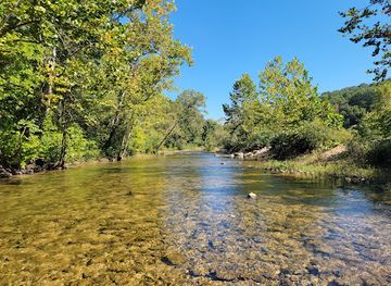
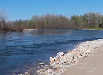
The principal attraction is the river landscape itself: clear, spring-fed water, limestone bluffs, gravel bars and wooded valleys provide opportunities for canoeing, kayaking, tubing, fishing, swimming and wildlife observation. Ozark National Scenic Riverways protects much of the Current River and the neighbouring Jacks Fork, with access points, campsites, trails and historic sites distributed across a large rural area. Big Spring near Van Buren is a major natural feature, while Round Spring, Blue Spring and Welch Spring illustrate the basin's karst geology. Alley Mill, near Eminence on the Jacks Fork, adds a well-preserved industrial-history stop. Hiking ranges from short spring and riverside walks to longer, more demanding routes through the surrounding Ozark forests. Nearby state parks and conservation areas provide additional trails and overlooks, but facilities are generally modest rather than resort-like. The basin rewards visitors who combine one water-based activity with time at springs, historic mills, caves, wildlife areas and small-town service centres.
-
Scenic spot
Ozark National Scenic Riverways Park Headquarters (No Visitor Center)
Discover stunning landscapes, pristine rivers, and adventure at the Ozark National Scenic Riverways, a premier destination for nature lovers and outdoor activities in Missouri.
-
Water mill
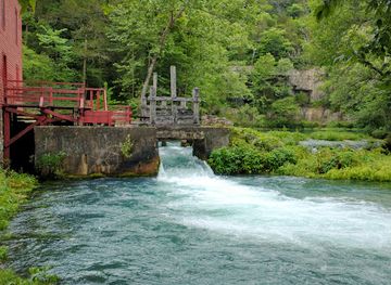
Alley Spring & Mill
Experience the beauty and history of Alley Spring & Mill, a serene retreat in the Ozarks perfect for nature lovers and history enthusiasts.
-
Raft trip outfitter
The Landing - Current River
Discover the ultimate adventure at The Landing - Current River, where thrilling raft trips meet delicious dining and cozy lodging in beautiful Missouri.
-
State park
Echo Bluff State Park
Explore the stunning landscapes of Echo Bluff State Park in Missouri, where adventure meets tranquility in the heart of nature.


Best landmarks in Current River Basin
-
Steak
Colton's Steak House & Grill
Enjoy hand-cut steaks, fresh rolls, and a Western atmosphere at Colton's Steak House & Grill in Poplar Bluff, Missouri.
-
Shopping mall
Mansion Mall
Poplar Bluff's premier shopping destination, offering a diverse mix of retail and dining for a complete experience.
-
American
Lemonade House Grille
Gourmet burgers, urban tacos, and the world's largest selection of fresh-squeezed lemonade flavors in Poplar Bluff, Missouri!
-
American
Huddle House
Your neighborhood diner in Poplar Bluff, serving homestyle meals all day long. Stop by for breakfast, lunch, or dinner!


Explore Current River Basin on the map
Plan your trip on one map. See where the top cities, national parks and sights are, and book hotels and experiences in a few clicks.
Best hotels in Current River Basin
Best restaurants in Current River Basin
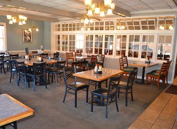
Dining in the Current River Basin is informal and practical, reflecting a rural region where visitors often spend the day on the water or trails. Van Buren and Eminence offer the broadest choice of cafés, family restaurants, takeaway food and provisions, while smaller communities have fewer options and may serve limited hours. Expect American country cooking, burgers, barbecue, fried fish, sandwiches, breakfast plates and baked goods rather than a highly specialised regional cuisine. Local grocery shops, convenience stores and outfitters are useful for picnic supplies before heading to a remote river access or campsite. Some rural restaurants and lodges provide hearty meals suited to outdoor travellers, and local businesses may offer seasonal produce or homemade items, but availability can vary. Reservations and advance planning are sensible for groups, particularly during summer weekends, when floating activity places pressure on the limited hospitality infrastructure.
-
Steak
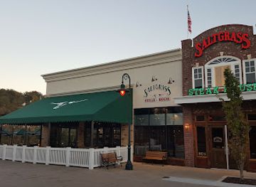
Saltgrass Steak House
Experience mouthwatering steaks and fresh seafood with stunning riverside views at Saltgrass Steak House in Downtown Branson.
-
Restaurant
Mark Twain Dinette: Maid-Rite Restaurant and Diner
Discover the charm of Mark Twain Dinette in Hannibal, MO – where classic American comfort food meets literary history.
-
Raft trip outfitter
The Landing - Current River
Experience thrilling adventures and delightful dining at The Landing - Current River, your gateway to outdoor fun in Missouri.
-
Fast Food
Jolly Cone on the Current
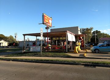
Experience classic American fast food with scenic riverside views at Jolly Cone on the Current in Van Buren, Missouri.
Best bars in Current River Basin
Nightlife in the Current River Basin is modest and concentrated around the small communities serving the river, particularly Van Buren and Eminence. Evenings generally centre on casual restaurants, traditional bars, lodging verandas, campfires where permitted and conversation after a day outdoors rather than dedicated nightclub districts. Some establishments may offer live music or seasonal entertainment, but programmes and opening arrangements can change. Rural roads are dark and distances between communities are considerable, so visitors should plan transport before drinking and never drive after consuming alcohol. The region's evening character is better suited to stargazing, listening to the river, sharing food at camp or returning to a quiet cabin than to late-night urban entertainment.
-
Grill
Dog Days Bar and Grill
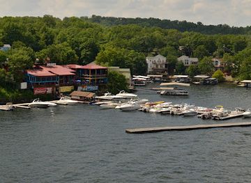
Discover the vibrant atmosphere and delicious flavors at Dog Days Bar and Grill, where live music meets great food in Osage Beach.
-
Bar
Paradise Tropical Restaurant & Bar
Discover the tropical charm and delicious American cuisine of Paradise Tropical Restaurant & Bar at Sunrise Beach, Missouri.
-
Grill
Backwater Jacks
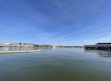
Enjoy a taste of American cuisine at Backwater Jacks, where delicious food meets stunning lakeside views in Osage Beach, Missouri.
-
Grill
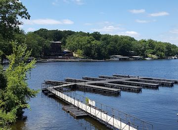
Coconuts At The Lake
Enjoy delicious grilled dishes and stunning lake views at Coconuts At The Lake, the perfect lakeside dining experience in Gravois Mills.

Best nightclubs in Current River Basin
Nightlife in the Current River Basin is modest and concentrated around the small communities serving the river, particularly Van Buren and Eminence. Evenings generally centre on casual restaurants, traditional bars, lodging verandas, campfires where permitted and conversation after a day outdoors rather than dedicated nightclub districts. Some establishments may offer live music or seasonal entertainment, but programmes and opening arrangements can change. Rural roads are dark and distances between communities are considerable, so visitors should plan transport before drinking and never drive after consuming alcohol. The region's evening character is better suited to stargazing, listening to the river, sharing food at camp or returning to a quiet cabin than to late-night urban entertainment.
-
Bar
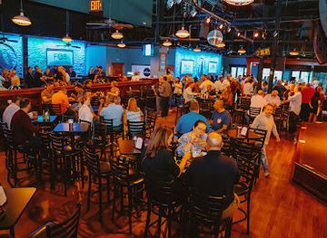
Howl at the Moon Kansas City
Dive into the vibrant nightlife at Howl at the Moon Kansas City, where live music meets expertly crafted cocktails for an unforgettable evening.
Best shops in Current River Basin
Shopping is centred on practical supplies and locally oriented small-town businesses rather than large retail centres. Van Buren and Eminence provide the most useful bases for groceries, fuel, outdoor equipment, river accessories and everyday necessities, while smaller communities have more limited choice. Visitors may find Ozark-themed gifts, locally made crafts, artwork, books, handmade goods and regional food items in independent shops, galleries, lodging businesses and seasonal stalls. Outfitters are particularly important for renting river equipment and purchasing dry bags, footwear, maps and camping provisions. Farmers' markets and roadside produce sales can appear seasonally, but their days and availability should be checked locally rather than assumed. There is little reason to travel to the basin for luxury or extensive designer shopping; its distinctive purchases are more likely to be practical outdoor equipment, locally produced food, handmade crafts or a modest souvenir connected with the rivers and Ozark landscape.
-
Shopping mall
Gravois Bluffs Plaza
Discover a vibrant shopping experience at Gravois Bluffs Plaza with diverse retail options and delicious dining in Fenton, Missouri.
-
Shopping mall
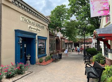
Grand Village Shops
Explore the delightful Grand Village Shops in Branson, MO, where unique boutiques and delicious dining await every visitor.
-
Grocery store
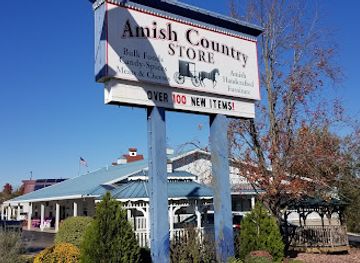
Amish Country Store
Experience the authentic flavors and craftsmanship of the Amish lifestyle at the Amish Country Store in Branson, Missouri.
-
Scenic spot
Ozark National Scenic Riverways Park Headquarters (No Visitor Center)
Experience the serene beauty of Ozark National Scenic Riverways, a stunning natural escape perfect for outdoor adventures and serene landscapes.
Get your free copy of our complete guide to Current River Basin, delivered straight to you.
Everything on this page, from attractions and restaurants to essentials and local phrases, in one PDF you can read offline, print or share.
Already have an account? Sign in
Your Current River Basin guide is ready.
We'll send it to · Not you? Sign out

Getting your guide ready…
We are putting together a fresh copy of the Current River Basin guide. This can take up to a minute.
This can take a few moments. If your browser asks, choose Allow so the download can start. You'll find the guide in your Downloads folder.
Nothing happened? Download it again
Sorry, the guide is taking longer than usual. Please try again in a minute, or get it by email instead.
Current River Basin essentials
Currency and Payment
Safety
Emergency Situations
Do's and Don'ts
Local Tips
From Eve
Local phrases worth knowing
You don't need to get them perfect. A few words go a long way, and locals appreciate the effort.
Basics
| English | Local | Say it |
|---|---|---|
| Hello | Howdy | [Ha-dee] |
| Goodbye | See ya | [See yah] |
| Yes | Yep | [Yep] |
| No | Nope | [Nope] |
| Please/You're welcome | Please/No problem | [Pleez/No prob-lum] |
| Thank you | Thanks | [Thangs] |
| Excuse me/Sorry | Excuse me/Sorry about that | [Ex-kyoos mee/Saw-ree about that] |
| How are you? | How ya doin'? | [How ya doin'?] |
| Fine. And you? | Good. And you? | [Good. An' you?] |
| Do you speak English? | Do ya speak English? | [Doo ya speak English?] |
| I don't understand | I ain't got it | [I ain't got it] |
Eating & Drinking
| English | Local | Say it |
|---|---|---|
| I'd like to see the menu, please | Can I see the menu, please? | [Can I see the men-yoo, pleez?] |
| I don't eat meat | I don't eat meat | [I don't eat meat] |
| Cheers! | Cheers! | [Cheers!] |
| I would like to pay, please | Can I get the check, please? | [Can I get the check, pleez?] |
Emergencies
| English | Local | Say it |
|---|---|---|
| Help! | Help! | [Help!] |
| Go away! | Leave me alone! | [Leave me alone!] |
| Call the Police! | Call the cops! | [Call the cops!] |
| Call a doctor! | Get a doctor! | [Get a doctor!] |
| I'm lost | I'm lost | [I'm lost] |
| I'm ill | I ain't feelin' good | [I ain't feelin' good] |
Shopping
| English | Local | Say it |
|---|---|---|
| I'd like to buy... | I wanna buy... | [I wanna buy...] |
| I'm just looking | Just lookin' | [Just lookin'] |
| How much is it? | What’s the price? | [What’s the price?] |
| That's too expensive | That's way too high | [That's way too high] |
| Can you lower the price? | Can ya bring the price down? | [Can ya bring the price down?] |
Time & Numbers
| English | Local | Say it |
|---|---|---|
| What time is it? | What time ya got? | [What time ya got?] |
| It's one o'clock | It's one o'clock | [It's one o'clock] |
| Half past (10) | Half past ten | [Half past ten] |
| Morning | Mornin' | [Mornin'] |
| Afternoon | Afternoon | [Afternoon] |
| Evening | Evenin' | [Evenin'] |
| Yesterday | Yesterday | [Yesterday] |
| Today | Today | [Today] |
| Tomorrow | Tomorrow | [Tomorrow] |
| 1 | One | [One] |
| 2 | Two | [Two] |
| 3 | Three | [Three] |
| 4 | Four | [Four] |
| 5 | Five | [Five] |
| 6 | Six | [Six] |
| 7 | Seven | [Seven] |
| 8 | Eight | [Eight] |
| 9 | Nine | [Nine] |
| 10 | Ten | [Ten] |
Transport & Directions
| English | Local | Say it |
|---|---|---|
| Where's a/the...? | Where’s the...? | [Where’s the...?] |
| What's the address? | What’s the address? | [What’s the address?] |
| Can you show me (on the map)? | Can ya show me on the map? | [Can ya show me on the map?] |
| When's the next (bus)? | When’s the next bus? | [When’s the next bus?] |
| A ticket (to ....) | A ticket to... | [A ticket to...] |
History of Current River Basin
Osage Homeland and Indigenous Use
For centuries before European-American settlement, the Ozark plateau was used and traversed by Indigenous peoples, including the Osage, whose homeland extended across parts of present-day Missouri and neighbouring states. Rivers, springs, wooded ridges and fertile bottomlands provided routes, water and seasonal resources. Archaeological evidence across the wider Ozarks records much earlier Indigenous occupation as well. The modern landscape should therefore not be treated as an untouched wilderness: its forests and waterways have long formed part of human histories, even though many visible structures in the basin date from the nineteenth and twentieth centuries.
Settlement in the Ozark Highlands
Euro-American settlement expanded through the Current River country during the nineteenth century, although the rugged terrain and limited transport links kept communities relatively dispersed. Families farmed small clearings, raised livestock, hunted and used the rivers as practical corridors. Towns such as Van Buren and Eminence developed as local trading and administrative centres. The surrounding landscape of steep ridges, narrow valleys and thin upland soils encouraged a mixed rural economy rather than the large-scale plantation agriculture associated with parts of the lower Mississippi and Missouri valleys.
Mills, Timber and River Commerce
Water power shaped the basin's early commercial history. Grist and sawmills were established near springs and streams, processing grain and timber for nearby settlements. Alley Mill, constructed in the late nineteenth century on a spring branch of the Jacks Fork, survives as a particularly clear reminder of this period, although it is not on the Current River itself. Timber cutting, small-scale farming and river transport connected the Ozarks to wider markets, while the arrival of railways and improved roads gradually reduced the rivers' importance as commercial routes.
The Civil War and Reconstruction
The Current River country was caught in the wider conflict between Union and Confederate forces and supporters during the American Civil War. The region's remote valleys and divided communities made it vulnerable to irregular warfare, disruption and local violence rather than defining it through one single battle. After 1865, reconstruction was uneven, and rural families continued to rely heavily on subsistence farming, timber and local trade. The episode remains part of the wider Ozark historical landscape, though visitors should be cautious about reducing the basin's complex local history to battlefield tourism.
Conservation and the National Scenic Riverways
The twentieth century brought roads, tourism and growing concern about the future of the Ozark rivers. In 1964, Congress established Ozark National Scenic Riverways to protect the Current River and Jacks Fork, creating the first national park unit centred on a wild river system. The designation preserved river corridors, springs, caves, forests and historic sites while allowing carefully managed recreation. It also changed the local economy by making canoeing, camping, guiding and hospitality increasingly important alongside traditional rural activities.
Modern Recreation and River Stewardship
Today the basin's identity is closely connected with floating, fishing, hiking, camping and spring tourism, but these activities depend on a fragile water environment. National park management, state conservation work and local communities share an interest in protecting water quality, riparian forests and access points. Seasonal visitor pressure can be substantial, particularly on summer weekends, while many rural services remain limited. The current challenge is balancing recreation and tourism with the preservation of the clear water, wildlife habitat and quiet character that made the region nationally significant.
Current River Basin in Photos
Browse through our photo collection highlighting the charm and character of the destination.
Neighbouring regions of Current River Basin
The closest regions to Current River Basin, if you have time for more than one.
-
-

-

-

-
 Southeast Missouri
Explore Southeast Missouri for Mississippi River towns, French colonial heritage, Ozark wilderness, wetlands, farm-country food and welcoming small cities.


Swipe for more regions
Explore more

Explore more of Missouri
Experience the diverse landscapes, rich history, and vibrant culture of Missouri, the heart of America, offering everything from bustling cities to serene natural escapes.
Explore Missouri