

Free St. Francois Mountains Travel Guide & Mobile App
Explore St. Francois Mountains with free travel guides. Discover regional history, expert tips, proposed trips, and audio guides on web or mobile app.


Explore Missouri’s St. Francois Mountains for ancient granite landscapes, waterfalls, Civil War history, forest trails and the waterways of Arcadia Valley.
Read more about St. Francois Mountains
Getting to and around St. Francois Mountains
How to get there
Transportation
Destinations in St. Francois Mountains
Resorts, valleys and scenic spots worth a trip of their own.
-

-


Swipe for more destinations
Best attractions in St. Francois Mountains
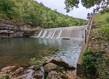
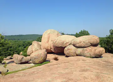
The St. Francois Mountains offer a concentrated mix of geological, outdoor and historical attractions. At Taum Sauk Mountain State Park, visitors can walk to Missouri’s highest point and tackle the Mina Sauk Falls Trail through wooded, rocky terrain. Johnson’s Shut-Ins State Park centres on the East Fork of the Black River, where resistant volcanic rock creates narrow channels, pools and rapids; water access is highly dependent on conditions and park guidance. Elephant Rocks State Park is known for giant granite boulders arranged along a short, accessible walking route, with longer trails and picnic areas adding context to the formation. Fort Davidson Historic Site brings the Civil War into the landscape through preserved earthworks and interpretation of the 1864 Battle of Pilot Knob. Conservation areas around the mountain district provide quieter hiking, wildlife observation and seasonal colour, while Arcadia, Ironton and Pilot Knob offer historic streets, local museums and mining and railway associations. The appeal lies in combining several modest-scale experiences rather than relying on one large attraction.
-
Tourist attraction
Mark Twain National Forest
Explore the breathtaking beauty of Mark Twain National Forest, a tranquil escape filled with adventure, wildlife, and stunning landscapes in Missouri.
-
State park
Elephant Rocks State Park
Explore the stunning granite formations and serene trails of Elephant Rocks State Park in Missouri, a perfect destination for nature lovers and outdoor enthusiasts.
-
State park
Johnson's Shut-Ins State Park
Experience the stunning landscapes and thrilling waters of Johnson's Shut-Ins State Park, a natural gem in Missouri perfect for adventure seekers and nature lovers.
-
State park
Saint Francois State Park
Discover the breathtaking beauty and outdoor adventures at Saint Francois State Park in Missouri, a perfect escape for nature lovers and adventure seekers.


Best landmarks in St. Francois Mountains
-
Campground
Johnson's Shut-Ins State Park Campground
Camp amidst nature's waterpark in the Missouri Ozarks; explore natural waterslides, hiking trails, and a landscape shaped by ancient geology.
-
Hiking area
Shut-Ins Trail
Hike through a billion years of geological history at Johnson's Shut-Ins State Park, where the East Fork Black River creates a natural waterpark.
-
Rapids
Johnson Shut-Ins
Explore a billion-year-old natural waterpark in the Missouri Ozarks. Swim, hike, and discover the unique beauty of Johnson's Shut-Ins State Park.


Explore St. Francois Mountains on the map
Plan your trip on one map. See where the top cities, national parks and sights are, and book hotels and experiences in a few clicks.
Best hotels in St. Francois Mountains
Best restaurants in St. Francois Mountains
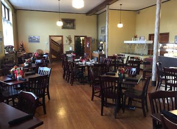
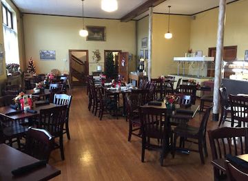
Dining in the St. Francois Mountains is centred on the everyday food culture of small Missouri towns rather than a formal restaurant district. Arcadia, Ironton, Pilot Knob, Farmington and Fredericktown provide cafés, family restaurants, pizzerias, barbecue, diners and traditional American meals, with the broadest choice generally found in the larger communities. Visitors can expect familiar regional preferences such as smoked meats, burgers, fried catfish where available, hearty breakfasts and baked goods, alongside nationally common American fare. Farm stands, seasonal produce and locally made items may appear along rural routes, but availability changes with the season. Park visitors should stock up before heading to remote trailheads, where dining facilities are limited or absent. In the evening, independent restaurants and casual grills are more typical than destination fine dining, and service can be relaxed in accordance with the area’s small-town character.
-
American
Thee Abbey Kitchen / Arcadia Academy
Experience the perfect blend of American cuisine and rich history at Thee Abbey Kitchen in Arcadia - a must-visit destination for every traveler.
-
Restaurant
The Iron Mule
Experience the best of Ironton's culinary scene at The Iron Mule - where flavorful grilled dishes meet delicious pizzas in a cozy setting.
-
Barbecue
Baylee Jo's Barbecue
Experience authentic American barbecue at Baylee Jo's Barbecue in Ironton, MO - where smoky flavors meet warm hospitality.
-
Fast Food
McDonald's
Discover fast food favorites at McDonald's in Ironton - perfect for breakfast, lunch, or dinner during your travels!


Best bars in St. Francois Mountains
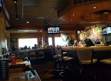
Evening life in the St. Francois Mountains is modest and locally oriented. Arcadia Valley communities and Farmington offer the greatest concentration of casual bars, restaurants, taverns and occasional live-music settings, while smaller towns tend to rely on traditional pubs or neighbourhood establishments rather than dedicated nightclubs. Visitors staying near the parks usually spend evenings around accommodation, campfires where permitted, or early dinners rather than travelling between venues. Some local breweries or bars may provide craft drinks and music, but current opening arrangements and entertainment schedules change, so checking locally is sensible. Alcohol should not be taken into waterways or protected areas, and driving after drinking is particularly risky on rural roads. The region’s evening appeal is better suited to conversation, local food and dark-sky quiet than to a major club scene.
-
State park
Elephant Rocks State Park
Explore the incredible granite formations and scenic trails of Elephant Rocks State Park, a must-visit destination in Missouri for nature lovers and adventure seekers.
-
Restaurant
Applebee's Grill + Bar
Experience the heart of American dining at Applebee's Grill + Bar, where delicious meals and a family-friendly atmosphere await.
-
American
Thee Abbey Kitchen / Arcadia Academy
Discover the perfect blend of history and flavor at Thee Abbey Kitchen, a unique American dining experience in Arcadia, Missouri.
-
Grill
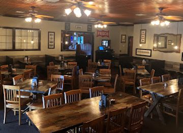
Frisco's Grill & Pub
Experience the vibrant atmosphere and delicious grill fare at Frisco's Grill & Pub, a must-visit dining spot in Cuba, Missouri.

Best nightclubs in St. Francois Mountains
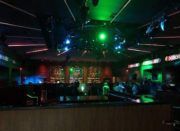
Evening life in the St. Francois Mountains is modest and locally oriented. Arcadia Valley communities and Farmington offer the greatest concentration of casual bars, restaurants, taverns and occasional live-music settings, while smaller towns tend to rely on traditional pubs or neighbourhood establishments rather than dedicated nightclubs. Visitors staying near the parks usually spend evenings around accommodation, campfires where permitted, or early dinners rather than travelling between venues. Some local breweries or bars may provide craft drinks and music, but current opening arrangements and entertainment schedules change, so checking locally is sensible. Alcohol should not be taken into waterways or protected areas, and driving after drinking is particularly risky on rural roads. The region’s evening appeal is better suited to conversation, local food and dark-sky quiet than to a major club scene.
-
Night club
RYSE Nightclub
Dive into the Heart of St. Charles Nightlife at RYSE Nightclub - Where Music, Dance, and Fun Unite!
-
Night club
Club Rodeo Midway
Discover the vibrant nightlife at Club Rodeo Midway in St. Robert, MO, where live music, dancing, and rodeo-themed fun await every night.

Best shops in St. Francois Mountains
Shopping in the St. Francois Mountains is primarily local and practical, with independent shops, antique outlets, gift stores and small-town high streets in Arcadia, Ironton, Pilot Knob, Farmington and Fredericktown. Arcadia Valley is a useful place to look for souvenirs connected with the state parks, regional history and the Ozarks, while Farmington generally offers the widest range of everyday retail and food shopping. Seasonal farm stands and local markets may carry produce, preserves, baked goods and handmade items, although market days and stock vary. Antiques, vintage goods, books and locally produced crafts can be more rewarding than generic souvenir shopping, particularly in older town centres. Visitors should buy outdoor provisions before driving to remote parks, since trail areas are not shopping districts. Regional purchases are best chosen for their practical connection to the landscape or communities rather than for mass-produced tokens of the Ozarks.
-
Ice Cream
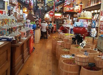
Old Village Mercantile
Discover the charm of Old Village Mercantile, where delicious ice cream, delightful candies, and aromatic coffee await in Caledonia, Missouri.
-
Flea market
OLD TIME FLEA MARKET
Explore unique finds and local treasures at the Old Time Flea Market in Farmington, Missouri - a shopper's paradise for all!
-
Shopping mall
Mineral area shopping center
Explore the Mineral Area Shopping Center in Farmington, MO for a delightful shopping and dining experience with something for everyone.
-
Gift shop
Sweet Leaf Emporium
Explore Sweet Leaf Emporium in Farmington, Missouri – a unique gift shop offering handcrafted treasures, glass art, and stunning jewelry for every occasion.


Get your free copy of our complete guide to St. Francois Mountains, delivered straight to you.
Everything on this page, from attractions and restaurants to essentials and local phrases, in one PDF you can read offline, print or share.
Already have an account? Sign in
Your St. Francois Mountains guide is ready.
We'll send it to · Not you? Sign out

Getting your guide ready…
We are putting together a fresh copy of the St. Francois Mountains guide. This can take up to a minute.
This can take a few moments. If your browser asks, choose Allow so the download can start. You'll find the guide in your Downloads folder.
Nothing happened? Download it again
Sorry, the guide is taking longer than usual. Please try again in a minute, or get it by email instead.
St. Francois Mountains essentials
Currency and Payment
Safety
Emergency Situations
Do's and Don'ts
Local Tips
From Eve
Local phrases worth knowing
You don't need to get them perfect. A few words go a long way, and locals appreciate the effort.
Basics
| English | Local | Say it |
|---|---|---|
| Hello | Howdy | [Hau-dee] |
| Goodbye | See ya later | [See yah lay-tur] |
| Yes | Yep | [Yep] |
| No | Nah | [Nah] |
| Please/You're welcome | Please / No problem | [Pleez / No prob-lum] |
| Thank you | Thanks a bunch | [Thangs a bun-ch] |
| Excuse me/Sorry | Pardon me / My bad | [Par-dun mee / My bad] |
| How are you? | How ya doin'? | [How ya doin'?] |
| Fine. And you? | Good. And you? | [Good. An' you?] |
| Do you speak English? | Can ya talk English? | [Can ya talk Ing-lish?] |
| I don't understand | I ain't followin' | [I ain't fol-lowin'] |
Eating & Drinking
| English | Local | Say it |
|---|---|---|
| I'd like to see the menu, please | Can I see the menu, please? | [Can I see the men-yoo, pleez?] |
| I don't eat meat | I ain't eatin' meat | [I ain't eatin' meet] |
| Cheers! | Cheers! | [Cheers!] |
| I would like to pay, please | I wanna pay, please | [I wanna pay, pleez] |
Emergencies
| English | Local | Say it |
|---|---|---|
| Help! | Help! | [Help!] |
| Go away! | Get lost! | [Get lost!] |
| Call the Police! | Call the cops! | [Call the cops!] |
| Call a doctor! | Get a doctor! | [Get a doc-tur!] |
| I'm lost | I'm lost | [I'm lost] |
| I'm ill | I'm sick | [I'm sick] |
Shopping
| English | Local | Say it |
|---|---|---|
| I'd like to buy... | I wanna buy... | [I wanna buy...] |
| I'm just looking | Just lookin' | [Just lookin'] |
| How much is it? | What’s it cost? | [What’s it cost?] |
| That's too expensive | That’s too pricey | [That’s too pry-see] |
| Can you lower the price? | Can ya make it cheaper? | [Can ya make it cheap-er?] |
Time & Numbers
| English | Local | Say it |
|---|---|---|
| What time is it? | What time's it? | [What time's it?] |
| It's one o'clock | It's one o'clock | [It's one o'clock] |
| Half past (10) | Half past ten | [Half past ten] |
| Morning | Mornin' | [Mornin'] |
| Afternoon | Afternoon | [Afternoon] |
| Evening | Evenin' | [Evenin'] |
| Yesterday | Yest'day | [Yest'day] |
| Today | Today | [Today] |
| Tomorrow | Tomorrah | [Tomorrah] |
| 1 | One | [One] |
| 2 | Two | [Two] |
| 3 | Three | [Three] |
| 4 | Four | [Four] |
| 5 | Five | [Five] |
| 6 | Six | [Six] |
| 7 | Seven | [Seven] |
| 8 | Eight | [Eight] |
| 9 | Nine | [Nine] |
| 10 | Ten | [Ten] |
Transport & Directions
| English | Local | Say it |
|---|---|---|
| Where's a/the...? | Where's the...? | [Where's the...?] |
| What's the address? | What’s the address? | [What’s the address?] |
| Can you show me (on the map)? | Can ya show me on the map? | [Can ya show me on the map?] |
| When's the next (bus)? | When's the next bus? | [When's the next bus?] |
| A ticket (to ....) | A ticket to... | [A tick-et to...] |
History of St. Francois Mountains
Ancient volcanic foundations
The St. Francois Mountains are built from Precambrian igneous rocks, including granite and rhyolite formed more than a billion years ago when volcanic activity shaped the core of what is now Missouri. These rocks are far older than the surrounding sedimentary layers of the Ozarks and have resisted erosion, leaving the region’s distinctive domes and rugged ridges. Features now visible at Elephant Rocks, Taum Sauk Mountain and Johnson’s Shut-Ins are part of this exceptionally old geological story. The exposed bedrock is not simply scenery; it explains why the mountain district has a different character from much of the surrounding plateau.
Indigenous landscapes and early colonial routes
Indigenous peoples used and travelled through the forests, valleys and waterways of the Ozark interior long before European settlement. During the colonial period, French influence from the Mississippi Valley extended into southeastern Missouri, where mineral deposits and navigable river connections attracted European settlers. Place names and early settlement patterns retain traces of this French colonial past, although later American migration and economic development transformed the communities. The mountains were never an isolated wilderness in a simple sense: they formed part of a lived landscape shaped by movement, hunting, extraction and trade.
Lead mining and the Old Lead Belt
Mineral extraction became one of the defining forces in southeastern Missouri. Lead mining expanded from earlier French and colonial workings into a large industrial system, especially in the Old Lead Belt north and west of the St. Francois Mountains. Mines, smelters, roads and railways altered the economy and settlement of the region, while mining employment drew workers and supported nearby towns. The industry’s legacy remains visible in historic buildings, mine landscapes and the continuing importance of discussion about land, water and environmental stewardship. The mountains themselves also contain a long record of quarrying and mineral use.
Iron production at Iron Mountain and Pilot Knob
Iron production developed around the unusual concentration of ore and fuel in the mountain district. Iron Mountain and Pilot Knob became important centres of nineteenth-century mining and furnace activity, linking the interior Ozarks to wider markets. The arrival of railways made it easier to move ore and manufactured goods, while company towns and supporting businesses grew around the works. Industrial activity declined as competition and changing technology reshaped the American iron industry, but the communities’ names, historic structures and museums preserve the memory of a period when this remote-looking landscape was part of a significant regional industrial network.
Railways and the growth of Arcadia Valley
Nineteenth-century rail connections changed the practical geography of the St. Francois Mountains. Railways tied mining and iron communities to St. Louis and other markets, brought new residents and visitors, and encouraged the growth of towns such as Arcadia, Ironton and Pilot Knob. The route through the valley also helped make the district more accessible to travellers passing between the Mississippi lowlands and the Ozark interior. Although rail transport no longer dominates everyday travel as it once did, the valley’s town plan, industrial remnants and historic associations still reflect the influence of the railway era.
The Battle of Pilot Knob, 1864
During the American Civil War, Confederate forces under Sterling Price attacked the Union garrison at Fort Davidson near Pilot Knob on 27 September 1864. The Union defenders held the fort and later evacuated it after destroying much of the position, while the engagement disrupted Price’s campaign through Missouri. The battlefield is preserved within the Fort Davidson Historic Site, where the remaining earthworks and interpretive material explain the fighting and its wider context. The battle gave Pilot Knob an importance in Missouri’s Civil War history that remains central to the identity of Arcadia Valley.
State parks and conservation in the modern era
Twentieth-century conservation efforts gradually established public protection for important parts of the St. Francois Mountains. Taum Sauk Mountain State Park, Johnson’s Shut-Ins State Park and Elephant Rocks State Park now conserve geological features, forests, waterways and recreational landscapes while making them accessible to visitors. The Civilian Conservation Corps and later public-lands programmes also influenced park infrastructure and outdoor recreation across Missouri. Modern management balances hiking, camping and water-based activities with protection of fragile rock, forest and stream environments, ensuring that the region’s geological and cultural inheritance remains part of its living landscape.
St. Francois Mountains in Photos
Browse through our photo collection highlighting the charm and character of the destination.
Neighbouring regions of St. Francois Mountains
The closest regions to St. Francois Mountains, if you have time for more than one.
-
 Southeast Missouri
Explore Southeast Missouri for Mississippi River towns, French colonial heritage, Ozark wilderness, wetlands, farm-country food and welcoming small cities.
-

-

-
-


Swipe for more regions
Explore more

Explore more of Missouri
Experience the diverse landscapes, rich history, and vibrant culture of Missouri, the heart of America, offering everything from bustling cities to serene natural escapes.
Explore Missouri