

Free Black River Basin Travel Guide & Mobile App
Explore Black River Basin with free travel guides. Discover regional history, expert tips, proposed trips, and audio guides on web or mobile app.


Explore Missouri's Black River Basin for Ozark waterways, Johnson's Shut-Ins, Clearwater Lake, forest trails and the cultural centre of Poplar Bluff.
Read more about Black River Basin
Getting to and around Black River Basin
How to get there
Transportation
Top city travel guides in Black River Basin
The cities of Black River Basin, and the easiest places to base yourself.

Swipe for more cities
Destinations in Black River Basin
Resorts, valleys and scenic spots worth a trip of their own.
-

-

-

-


Swipe for more destinations
Best attractions in Black River Basin
The Black River Basin's attractions are shaped by water and geology rather than by a dense concentration of monuments. Johnson's Shut-Ins State Park is the signature natural site, where the East Fork passes through a narrow landscape of resistant volcanic rock, creating channels, pools and unusual river scenery. Nearby public lands in the St Francois Mountains add hiking, camping and forest viewpoints. Clearwater Lake, near Piedmont, offers boating, fishing, shoreline recreation and wildlife observation, with facilities spread around a large reservoir. The lower basin is more open and agricultural, but the Black River corridor remains important for fishing, paddling and seasonal outdoor trips. Poplar Bluff provides the principal indoor and cultural attractions, including museums and arts institutions that explain the town's railway, timber and regional history. Scenic driving between small communities, forest roads and river access points is part of the experience, although visitors should distinguish public recreation areas from private land. The basin works best for travellers who combine one or two well-planned outdoor bases with time in Poplar Bluff rather than attempting to see every waterway in a single day.
-
State park
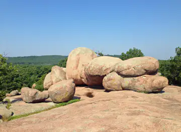
Elephant Rocks State Park
Explore the stunning granite formations and lush landscapes of Elephant Rocks State Park, a perfect retreat for nature lovers and adventure seekers.
-
State park
Johnson's Shut-Ins State Park
Explore the breathtaking scenery and unique geological features at Johnson's Shut-Ins State Park, a premier destination for outdoor enthusiasts in Missouri.
-
Tourist attraction
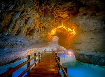
Stark Caverns
Explore Stark Caverns, an underground marvel in Missouri, showcasing stunning geological formations shaped by nature over millennia.
-
State park
Ha Ha Tonka Castle Ruins
Discover the captivating history and stunning landscapes at Ha Ha Tonka Castle Ruins in Missouri's picturesque state park.


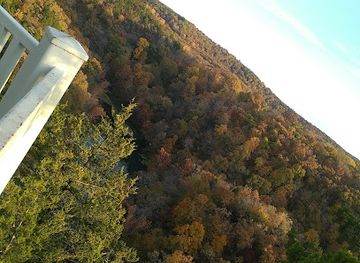
Best landmarks in Black River Basin
-
Steak
Colton's Steak House & Grill
Enjoy hand-cut steaks, fresh rolls, and a Western atmosphere at Colton's Steak House & Grill in Poplar Bluff, Missouri.
-
Shopping mall
Mansion Mall
Poplar Bluff's premier shopping destination, offering a diverse mix of retail and dining for a complete experience.
-
American
Lemonade House Grille
Gourmet burgers, urban tacos, and the world's largest selection of fresh-squeezed lemonade flavors in Poplar Bluff, Missouri!
-
American
Huddle House
Your neighborhood diner in Poplar Bluff, serving homestyle meals all day long. Stop by for breakfast, lunch, or dinner!


Explore Black River Basin on the map
Plan your trip on one map. See where the top cities, national parks and sights are, and book hotels and experiences in a few clicks.
Best hotels in Black River Basin
Best restaurants in Black River Basin
Dining in the Black River Basin is centred on practical, locally oriented food rather than a formal culinary circuit. Poplar Bluff has the broadest selection, including independent restaurants, cafés, diners and national-style establishments, while smaller communities offer traditional American meals, barbecue, sandwiches and family-run options. Rural restaurants and inns can be useful stopping points near recreation areas, but opening patterns may be limited, particularly outside the main towns. The region's food identity reflects southeast Missouri and the wider Ozarks: freshwater fish, barbecue, fried chicken, biscuits, seasonal produce and hearty country cooking are more characteristic than a single signature dish. Farmers' markets and local shops may offer fruit, vegetables, preserves, baked goods and other regional produce when in season. Visitors planning a full day at a state park or lake should carry provisions rather than rely on finding a meal immediately beside the water.
-
Restaurant
River Bend Family Restaurant
Experience delicious breakfasts and family-friendly dining at River Bend Family Restaurant in Glasgow - where comfort meets flavor!

Best bars in Black River Basin
Evening life in the Black River Basin is concentrated in Poplar Bluff and, to a lesser extent, in the small communities serving the lake and river recreation areas. Traditional bars, casual restaurants and locally oriented venues provide the main nightlife, while live music and community events may appear seasonally rather than on a fixed tourist circuit. Around Clearwater Lake and the upper river, evenings are more commonly spent at campsites, cabins or waterside accommodation than in nightclubs. Poplar Bluff offers the greatest choice of pubs, bars and late-opening food, but the overall scene remains modest and dispersed. Visitors should arrange transport before drinking, since rural taxi and rideshare options can be limited, and should not assume that a remote recreation area will have evening services.
-
River
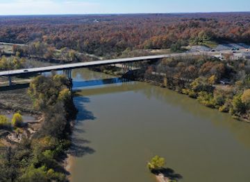
Black River
Experience the tranquil beauty of Black River, a perfect destination for outdoor adventures, relaxation, and stunning natural scenery.
-
 Lodge
Wilderness Lodge Resort
Discover the perfect blend of luxury and nature at Wilderness Lodge Resort, a serene escape in Missouri's stunning landscapes.
-
Campground
Bearcat Getaway
Discover the serene beauty of Bearcat Getaway in Annapolis, Missouri, a perfect campground for nature lovers and outdoor adventurers.
Best nightclubs in Black River Basin
Evening life in the Black River Basin is concentrated in Poplar Bluff and, to a lesser extent, in the small communities serving the lake and river recreation areas. Traditional bars, casual restaurants and locally oriented venues provide the main nightlife, while live music and community events may appear seasonally rather than on a fixed tourist circuit. Around Clearwater Lake and the upper river, evenings are more commonly spent at campsites, cabins or waterside accommodation than in nightclubs. Poplar Bluff offers the greatest choice of pubs, bars and late-opening food, but the overall scene remains modest and dispersed. Visitors should arrange transport before drinking, since rural taxi and rideshare options can be limited, and should not assume that a remote recreation area will have evening services.
-
Night club
Aura
Dive into Kansas City's nightlife at Aura, where electrifying DJ sets, vibrant ambiance, and memorable events await every night.
-
Night club
Virtue Night Club
Discover the electrifying nightlife at Virtue Night Club, Grandview's premier dance destination with top DJs and unforgettable vibes.
-
Night club
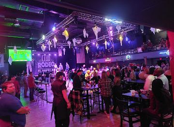
Club Rodeo Midway
Discover the vibrant nightlife at Club Rodeo Midway, St. Robert's premier destination for dancing, live music, and unforgettable evenings.
-
Lounge
Judy's Velvet Lounge
Experience the best of St. Louis nightlife at Judy's Velvet Lounge, a stylish retreat with live entertainment and a diverse drink menu.

Best shops in Black River Basin
Shopping in the Black River Basin is practical and town-based, with Poplar Bluff providing the widest choice of supermarkets, independent retailers, outdoor equipment, antiques, arts and everyday supplies. Its commercial areas are useful for preparing for a lake or river trip rather than for browsing a large specialist tourist market. Piedmont and smaller communities offer limited local shopping, including convenience stores, rural businesses and occasional craft or produce outlets. Seasonal farmers' markets may provide fruit, vegetables, baked goods, preserves and handmade items, although schedules vary and should be checked locally. Regional souvenirs are more likely to be Ozark-themed crafts, locally produced food, fishing and camping equipment, books, artwork or products connected with the area's forests and waterways than mass-produced luxury goods. Visitors should buy fuel, provisions and specialist outdoor supplies before heading into the more remote upper basin.
-
River
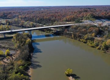
Black River
Discover the tranquil beauty and outdoor adventures that await at Black River, the perfect destination for nature lovers and thrill seekers.
-
Gift shop
The Nature Cottage
Explore The Nature Cottage in Piedmont, MO, where unique gifts, metaphysical supplies, and holistic wellness converge in a serene shopping experience.
-
Gift shop
The Windmill Flowers and More Co
Explore the enchanting Windmill Flowers and More Co in Bunker, Missouri, where unique gifts and stunning floral arrangements await every visitor.


Get your free copy of our complete guide to Black River Basin, delivered straight to you.
Everything on this page, from attractions and restaurants to essentials and local phrases, in one PDF you can read offline, print or share.
Already have an account? Sign in
Your Black River Basin guide is ready.
We'll send it to · Not you? Sign out

Getting your guide ready…
We are putting together a fresh copy of the Black River Basin guide. This can take up to a minute.
This can take a few moments. If your browser asks, choose Allow so the download can start. You'll find the guide in your Downloads folder.
Nothing happened? Download it again
Sorry, the guide is taking longer than usual. Please try again in a minute, or get it by email instead.
Black River Basin essentials
Currency and Payment
Safety
Emergency Situations
Do's and Don'ts
Local Tips
From Eve
Local phrases worth knowing
You don't need to get them perfect. A few words go a long way, and locals appreciate the effort.
Basics
| English | Local | Say it |
|---|---|---|
| Hello | Howdy | [Ha-dee] |
| Goodbye | See ya | [Cee yah] |
| Yes | Yep | [Yep] |
| No | Nope | [Nope] |
| Please/You're welcome | Please/No problem | [Pleez/No prob-lem] |
| Thank you | Thanks | [Thangs] |
| Excuse me/Sorry | Pardon me/Sorry | [Par-don mee/Sor-ree] |
| How are you? | How ya doin'? | [How yah doin'?] |
| Fine. And you? | I'm good. And you? | [I'm gud. And you?] |
| Do you speak English? | Ya speakin' English? | [Ya speekin' In-glish?] |
| I don't understand | I ain't gettin' it | [I ain't gettin' it] |
Eating & Drinking
| English | Local | Say it |
|---|---|---|
| I'd like to see the menu, please | Can I see the menu, please? | [Can I see the men-yoo, pleez?] |
| I don't eat meat | I don't do meat | [I don't do meet] |
| Cheers! | Cheers! | [Cheers!] |
| I would like to pay, please | Can I pay, please? | [Can I pay, pleez?] |
Emergencies
| English | Local | Say it |
|---|---|---|
| Help! | Help! | [Help!] |
| Go away! | Get away! | [Get away!] |
| Call the Police! | Call 911! | [Call nine-one-one!] |
| Call a doctor! | Get a doctor! | [Get a doc-tor!] |
| I'm lost | I'm lost | [I'm lost] |
| I'm ill | I ain't feelin' good | [I ain't feelin' gud] |
Shopping
| English | Local | Say it |
|---|---|---|
| I'd like to buy... | I wanna buy... | [I wanna bye...] |
| I'm just looking | Just lookin' | [Just lookin'] |
| How much is it? | What’s the price? | [What's the pryce?] |
| That's too expensive | That's a bit high | [That's a bit hi] |
| Can you lower the price? | Can ya drop the price? | [Can yah drop the pryce?] |
Time & Numbers
| English | Local | Say it |
|---|---|---|
| What time is it? | What time ya got? | [What time ya got?] |
| It's one o'clock | It's one | [It's won] |
| Half past (10) | Half past ten | [Half past ten] |
| Morning | Mornin' | [Mornin'] |
| Afternoon | Afternoon | [Afternoon] |
| Evening | Evenin' | [Evenin'] |
| Yesterday | Yesterday | [Yesterday] |
| Today | Today | [Today] |
| Tomorrow | Tomorrow | [Tomorrow] |
| 1 | One | [Won] |
| 2 | Two | [Too] |
| 3 | Three | [Three] |
| 4 | Four | [For] |
| 5 | Five | [Five] |
| 6 | Six | [Six] |
| 7 | Seven | [Seven] |
| 8 | Eight | [Eight] |
| 9 | Nine | [Nine] |
| 10 | Ten | [Ten] |
Transport & Directions
| English | Local | Say it |
|---|---|---|
| Where's a/the...? | Where's the...? | [Where's the...?] |
| What's the address? | What's the address? | [What's the ad-dress?] |
| Can you show me (on the map)? | Can ya show me on the map? | [Can yah show me on the map?] |
| When's the next (bus)? | When's the next bus? | [When's the next bus?] |
| A ticket (to ....) | A ticket to ... | [A tick-it to ...] |
History of Black River Basin
Indigenous Landscapes and Ozark Waterways
Long before American settlement, Indigenous peoples used the forests, springs and river corridors of what is now southeast Missouri for travel, hunting, fishing and seasonal settlement. The area falls within the broader cultural landscape of the Ozarks and was associated particularly with the Osage before the expansion of the United States. River valleys provided practical routes through rugged country, while uplands supplied timber, game and plant resources. Archaeological evidence across the wider region records a much longer human presence than the later towns and roads suggest.
American Settlement in the Nineteenth Century
During the nineteenth century, settlers established farms, mills and small communities along the Black River and its tributaries. The basin's hills and narrow valleys made transport difficult, so waterways and rough roads remained important before modern highways. Livelihoods combined subsistence agriculture, livestock, hunting and timber work. Settlement expanded as Missouri's southern interior became more closely connected to larger markets, although the dispersed pattern of communities still visible today reflects the region's terrain.
Railways and the Rise of Poplar Bluff
Rail connections transformed the economic geography of the lower Black River Basin during the later nineteenth century. Poplar Bluff grew as a railway and commercial centre, linking the Ozarks with markets farther north and south. Rail transport made it easier to move timber, agricultural produce and manufactured goods, while encouraging the growth of shops, warehouses and civic buildings. The town's continuing role as the basin's main service centre is rooted in this period of expanding regional connectivity.
Timber, Sawmills and Forest Industries
The forests of southeast Missouri supported a major timber economy from the late nineteenth century into the twentieth. Sawmills and related businesses employed local communities and supplied wood to markets connected by rail. Logging altered hillsides and river corridors, while subsequent forest management and regrowth helped create the mixed woodland scenery experienced by visitors today. Timber remains part of the region's economic history even where former industrial sites have disappeared or been absorbed into modern towns and conservation landscapes.
Clearwater Lake and Mid-Twentieth-Century Water Management
The construction of Clearwater Lake and its dam brought a major change to the upper Black River system. The project was intended to reduce flood risk and regulate water, while also creating opportunities for boating, fishing and public recreation. The reservoir became an important regional landscape rather than simply an engineering work. Its creation illustrates a wider twentieth-century shift in American river management, when waterways were reshaped simultaneously for flood control, economic security and outdoor use.
Conservation and River Recreation
During the later twentieth century, public investment in state parks, forests and water-based recreation helped protect important portions of the Black River Basin. Johnson's Shut-Ins State Park became especially significant for its unusual geology and river scenery, while surrounding Ozark public lands supported hiking, camping and wildlife observation. Conservation has not removed working forests, farms or communities from the basin; instead, it has created a landscape in which recreation, resource management and local economic life continue to coexist.
Black River Basin in Photos
Browse through our photo collection highlighting the charm and character of the destination.
Neighbouring regions of Black River Basin
The closest regions to Black River Basin, if you have time for more than one.
-

-

-
-
 Southeast Missouri
Explore Southeast Missouri for Mississippi River towns, French colonial heritage, Ozark wilderness, wetlands, farm-country food and welcoming small cities.
-


Swipe for more regions
Explore more

Explore more of Missouri
Experience the diverse landscapes, rich history, and vibrant culture of Missouri, the heart of America, offering everything from bustling cities to serene natural escapes.
Explore Missouri