

Free Mark Twain National Forest Travel Guide & Mobile App
Explore Mark Twain National Forest with free travel guides. Discover regional history, expert tips, proposed trips, and audio guides on web or mobile app.


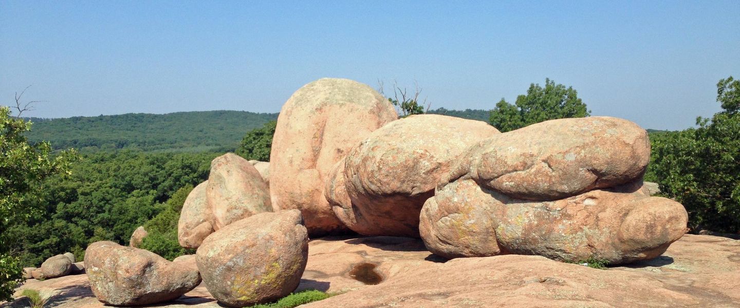


Mark Twain National Forest offers Missouri Ozark hiking, clear rivers, springs, scenic drives, caves and quiet campsites across expansive public lands.
Read more about Mark Twain National Forest
Getting to and around Mark Twain National Forest
How to get there
Transportation
Destinations in Mark Twain National Forest
Resorts, valleys and scenic spots worth a trip of their own.
-

-

-


Swipe for more destinations
Best attractions in Mark Twain National Forest
Mark Twain National Forest's attractions are primarily natural and dispersed rather than concentrated in visitor centres. Hiking ranges from short spring and woodland walks to demanding sections of the Ozark Trail, which crosses much of southern Missouri through ridges, hollows and streams. The forest contains several designated wilderness areas, including Bell Mountain, Hercules Glades, Irish Wilderness and Paddy Creek, where routes are deliberately less developed and navigation matters. Greer Spring is a major natural feature, while the Eleven Point River and other clear Ozark waterways support canoeing, fishing, swimming in suitable places and wildlife observation. Glade Top Trail is a notable scenic drive through open glades and forested hills, and Council Bluff Lake provides a focus for water-based recreation and camping. Caves, bluffs, springs, old homestead traces and historic roads add variety, although access and facilities differ greatly. The neighbouring Ozark National Scenic Riverways, including parts of the Current and Jacks Fork river system, is a separate federal designation and should not be confused with the national forest. Visitors seeking organised attractions will find more services in gateway towns, while the forest itself rewards preparation, quiet travel and time outdoors.
-
State park
Mark Twain State Park
Explore the scenic beauty and outdoor adventures at Mark Twain State Park, a true gem in Missouri's natural landscape.
-
Echo Bluff State Park
Experience the breathtaking beauty of Echo Bluff State Park, a serene escape in Missouri's Ozarks, perfect for outdoor adventures and relaxation.
-
Tourist attraction
Devil's Well
Discover the enchanting beauty of Devil's Well, a hidden gem in Missouri's Ozarks, where nature's wonders await your exploration.
-
Park
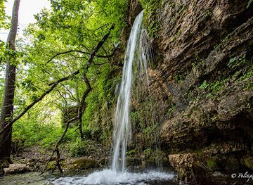
Falling Spring Mill
Discover the serene beauty and historical charm of Falling Spring Mill, a picturesque park in Winona, Missouri, perfect for nature lovers and history enthusiasts alike.


Best landmarks in Mark Twain National Forest
-
Campground
Johnson's Shut-Ins State Park Campground
Camp amidst nature's waterpark in the Missouri Ozarks; explore natural waterslides, hiking trails, and a landscape shaped by ancient geology.
-
Park
Falling Spring Mill
Discover a historic mill, natural spring, and pioneer cabin in the tranquil Mark Twain National Forest near Winona, Missouri.
-
Hiking area
Shut-Ins Trail
Hike through a billion years of geological history at Johnson's Shut-Ins State Park, where the East Fork Black River creates a natural waterpark.
-
Rapids
Johnson Shut-Ins
Explore a billion-year-old natural waterpark in the Missouri Ozarks. Swim, hike, and discover the unique beauty of Johnson's Shut-Ins State Park.


Explore Mark Twain National Forest on the map
Plan your trip on one map. See where the top cities, national parks and sights are, and book hotels and experiences in a few clicks.
Best hotels in Mark Twain National Forest
Best restaurants in Mark Twain National Forest
There is no single restaurant scene within Mark Twain National Forest; dining is concentrated in gateway towns and small communities around its districts. Rural cafés, family-owned restaurants, barbecue counters, diners and traditional American eateries provide practical meals before or after a day outdoors. Missouri's wider food culture appears in smoked meats, biscuits, fried catfish, country breakfasts and seasonal produce, while local shops and farmers' markets may offer honey, preserves, baked goods and other Ozark products. Along the Current and Eleven Point river country, provisions for canoe trips and camping are often more useful than formal dining, so visitors should shop before travelling into remote areas. Near larger gateways such as Rolla, Poplar Bluff, Farmington, West Plains and Van Buren, the choice is broader, including contemporary American cooking and international options. Independent cafés and rural restaurants may keep differing hours, particularly outside peak seasons, and cash is useful in small establishments.
-
Restaurant
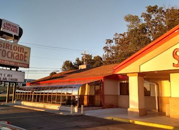
Sirloin Stockade
Discover Sirloin Stockade in Rolla, MO - where hearty American dishes and mouthwatering steaks await every hungry traveler.
-
Steak
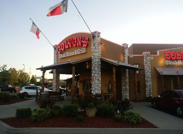
Colton's Steak House & Grill of Rolla, MO
Discover mouthwatering steaks at Colton's Steak House & Grill in Rolla, MO – where flavor meets comfort in every bite.
-
Family-friendly
Monroe Family Restaurant
Discover comfort food at Monroe Family Restaurant – where families gather for delicious American meals in a welcoming atmosphere.
-
Chinese
New Beijing Restaurant
Experience the rich flavors of authentic Chinese cuisine at New Beijing Restaurant in Monroe City - where every meal is a celebration.


Best bars in Mark Twain National Forest
-
Fast Food
Jack in the Box
Discover a diverse menu of fast food favorites, from burgers to breakfast, at Jack in the Box in Cuba, Missouri.
-
American
Thee Abbey Kitchen / Arcadia Academy
Discover the enchanting blend of American cuisine, history, and shopping at Thee Abbey Kitchen in Arcadia, Missouri.
-
Raft trip outfitter
The Landing - Current River
Discover the thrill of outdoor adventures and the comfort of home at The Landing - Current River, where nature and hospitality meet in Missouri.
-
Grill
JB Malone's Bar & Grill
Discover a vibrant grill experience at JB Malone's Bar & Grill, where delicious cuisine meets a welcoming atmosphere in Salem, Missouri.



Best nightclubs in Mark Twain National Forest
-
Canoe & kayak rental service
The Landing - Current River
Discover the perfect blend of adventure and comfort at The Landing - Current River, your gateway to stunning outdoor experiences in Missouri.
-
Canoe & kayak rental service
The Landing Current River
Discover tranquility and adventure at The Landing Current River, where nature meets comfort in Missouri's beautiful Ozarks.


Best shops in Mark Twain National Forest
-
National forest
Mark Twain National Forest
Discover the natural beauty of Mark Twain National Forest in Missouri, a paradise for outdoor enthusiasts and nature lovers with endless adventures.
-
State park
Johnson's Shut-Ins State Park
Discover the breathtaking beauty of Johnson's Shut-Ins State Park, a natural wonder in Missouri perfect for swimming, hiking, and family adventures.
-
Ice Cream
Old Village Mercantile
Explore Old Village Mercantile in Caledonia, MO - a sweet haven for ice cream lovers, candy enthusiasts, and coffee aficionados alike.
-
Campground
Johnson's Shut-Ins State Park Campground
Explore the stunning natural landscapes and unique rock formations at Johnson's Shut-Ins State Park Campground in Missouri, perfect for outdoor enthusiasts.


Get your free copy of our complete guide to Mark Twain National Forest, delivered straight to you.
Everything on this page, from attractions and restaurants to essentials and local phrases, in one PDF you can read offline, print or share.
Already have an account? Sign in
Your Mark Twain National Forest guide is ready.
We'll send it to · Not you? Sign out

Getting your guide ready…
We are putting together a fresh copy of the Mark Twain National Forest guide. This can take up to a minute.
This can take a few moments. If your browser asks, choose Allow so the download can start. You'll find the guide in your Downloads folder.
Nothing happened? Download it again
Sorry, the guide is taking longer than usual. Please try again in a minute, or get it by email instead.
Mark Twain National Forest essentials
Currency and Payment
Safety
Emergency Situations
Do's and Don'ts
Local Tips
From Eve
Local phrases worth knowing
You don't need to get them perfect. A few words go a long way, and locals appreciate the effort.
Basics
| English | Local | Say it |
|---|---|---|
| Hello | Howdy | [haʊdi] |
| Goodbye | See ya later | [si jə ˈleɪtər] |
| Yes | Yep | [jɛp] |
| No | Nope | [noʊp] |
| Please/You're welcome | Sure thing | [ʃʊr θɪŋ] |
| Thank you | Thanks a lot | [θæŋks ə lɑt] |
| Excuse me/Sorry | Pardon me | [ˈpɑrdən mi] |
| How are you? | How's it goin'? | [haʊz ɪt ˈɡoʊɪn] |
| Fine. And you? | I'm doin' good, you? | [aɪm ˈduɪn ɡʊd, ju?] |
| Do you speak English? | You speakin' English? | [ju ˈspikɪn ˈɪŋɡlɪʃ] |
| I don't understand | I ain't gettin' it | [aɪ eɪnt ˈɡɛtɪn ɪt] |
Eating & Drinking
| English | Local | Say it |
|---|---|---|
| I'd like to see the menu, please | Can I see the menu? | [kæn aɪ si ðə ˈmɛnju] |
| I don't eat meat | I ain't into meat | [aɪ eɪnt ˈɪntu mit] |
| Cheers! | Cheers! | [ʧɪrz] |
| I would like to pay, please | Can I settle up? | [kæn aɪ ˈsɛtəl ʌp] |
Emergencies
| English | Local | Say it |
|---|---|---|
| Help! | Help! | [hɛlp] |
| Go away! | Get outta here! | [ɡɛt ˈaʊtə hɪr] |
| Call the Police! | Call the cops! | [kɔl ðə kɑps] |
| Call a doctor! | Get a doc! | [ɡɛt ə dɑk] |
| I'm lost | I'm turned around | [aɪm tɜrnd əˈraʊnd] |
| I'm ill | I ain't feelin' good | [aɪ eɪnt ˈfilɪn ɡʊd] |
Shopping
| English | Local | Say it |
|---|---|---|
| I'd like to buy... | I'm lookin' to buy... | [aɪm ˈlʊkɪn tə baɪ] |
| I'm just looking | Just browsin' | [dʒʌst ˈbraʊzɪn] |
| How much is it? | What’s it cost? | [wʌt ɪt kɔst] |
| That's too expensive | That’s a bit steep | [ðæts ə bɪt stip] |
| Can you lower the price? | Can ya cut the price? | [kæn jə kʌt ðə praɪs] |
Time & Numbers
| English | Local | Say it |
|---|---|---|
| What time is it? | What time ya got? | [wʌt taɪm jə ɡɑt] |
| It's one o'clock | It's one o'clock | [ɪts wʌn əˈklɑk] |
| Half past (10) | Half past ten | [hæf pæst tɛn] |
| Morning | Mornin' | [ˈmɔrnɪn] |
| Afternoon | Afternoon | [ˈæftərˌnun] |
| Evening | Evenin' | [ˈivnɪn] |
| Yesterday | Yesterday | [ˈjɛstərˌdeɪ] |
| Today | Today | [təˈdeɪ] |
| Tomorrow | Tomorrow | [təˈmɔroʊ] |
| 1 | One | [wʌn] |
| 2 | Two | [tu] |
| 3 | Three | [θri] |
| 4 | Four | [fɔr] |
| 5 | Five | [faɪv] |
| 6 | Six | [sɪks] |
| 7 | Seven | [ˈsɛvən] |
| 8 | Eight | [eɪt] |
| 9 | Nine | [naɪn] |
| 10 | Ten | [tɛn] |
Transport & Directions
| English | Local | Say it |
|---|---|---|
| Where's a/the...? | Where's the...? | [wɛrz ðə...?] |
| What's the address? | What’s the address? | [wʌts ði əˈdrɛs] |
| Can you show me (on the map)? | Can ya point it out? | [kæn jə pɔɪnt ɪt aʊt] |
| When's the next (bus)? | When's the next bus? | [wɛn ɪz ðə nɛkst bʌs] |
| A ticket (to ....) | A ticket to... | [ə ˈtɪkɪt tə...] |
History of Mark Twain National Forest
Indigenous Ozark Landscapes Before European Settlement
The Ozarks were inhabited and travelled by Indigenous peoples for thousands of years before the establishment of the United States. Archaeological evidence across the broader region records hunting, gathering, farming and settlement, while historic Indigenous nations including the Osage had deep connections to the central and southern Missouri landscape. Rivers, springs, ridges and wooded valleys shaped movement and seasonal use. Although later settlement transformed the forest, the underlying landscape still reflects long human knowledge of its plants, animals, waterways and routes.
French and American Expansion in the Ozarks
European exploration and settlement reached the Missouri Ozarks through the Mississippi and Missouri river systems, followed by expanding American control and migration in the nineteenth century. The region remained relatively difficult to access because of its rugged terrain and scattered waterways. Small farms, mills, churches and trading communities developed along valleys and roads, while Indigenous communities were displaced by national expansion. Many later forest roads and settlements follow routes first established through this earlier pattern of movement and rural occupation.
Lead Mining and Rural Industry
Mining became a major force in the Missouri Ozarks, particularly where lead and other minerals occurred in the limestone and dolomite country. The Viburnum Trend, west of the forest's central districts, became a significant modern lead-mining area, while older mining landscapes and small industrial sites occur across the wider region. Timber cutting, charcoal production, mills and subsistence agriculture also shaped local economies. These activities connected remote communities to national markets but could also alter waterways, forests and soils.
Timber, Settlement and the Changing Forest
By the late nineteenth and early twentieth centuries, intensive logging had removed much of the original commercial timber from accessible Ozark hills. Farmers and timber companies used the land in an economy marked by small holdings, portable sawmills and difficult transport. Erosion, depleted soils and economic hardship contributed to extensive land acquisition by the federal government during the New Deal era. The resulting public ownership provided the foundation for a more systematic approach to reforestation, watershed protection and long-term forest management.
Creation of Mark Twain National Forest
Mark Twain National Forest was established in 1939 through the consolidation of federal lands in Missouri, and it expanded over subsequent decades. Its name honours Samuel Clemens, the Missouri-born writer better known as Mark Twain, although the forest is not a literary memorial in the narrow sense. Civilian Conservation Corps workers helped build roads, trails, bridges, lookout facilities and recreation infrastructure during the New Deal period. Their work remains part of the physical history of public recreation in the Ozarks.
River Conservation and Public Recreation
Twentieth-century conservation brought increasing attention to the exceptional springs, rivers, caves and forests of the Ozarks. The protection of public forest lands developed alongside the creation of neighbouring conservation areas, including the Ozark National Scenic Riverways, which preserves major stretches of the Current and Jacks Fork rivers. Today Mark Twain National Forest balances recreation, habitat protection, timber management, watershed care and local economic interests. Hiking trails, wilderness areas, scenic roads and river access reflect this continuing evolution.
Mark Twain National Forest in Photos
Browse through our photo collection highlighting the charm and character of the destination.
Neighbouring regions of Mark Twain National Forest
The closest regions to Mark Twain National Forest, if you have time for more than one.
-

-

-

-

-


Swipe for more regions
Explore more

Explore more of Missouri
Experience the diverse landscapes, rich history, and vibrant culture of Missouri, the heart of America, offering everything from bustling cities to serene natural escapes.
Explore Missouri