

Free Zaër Travel Guide & Mobile App
Explore Zaër with free travel guides. Discover regional history, expert tips, proposed trips, and audio guides on web or mobile app.


Explore Zaër south of Rabat for open plateaux, oak woodlands, market towns, pastoral heritage and quiet Moroccan countryside.
Read more about Zaër
When is the best time to visit Zaër?
Best: April–May, October · 25–29°C| Month | High (°C) | Rainfall (mm) |
|---|---|---|
| January | 18 | 41 |
| February | 19 | 35 |
| March | 22 | 41 |
| April (best) | 25 | 30 |
| May (best) | 29 | 16 |
| June | 33 | 7 |
| July | 37 | 1 |
| August | 37 | 2 |
| September | 33 | 12 |
| October (best) | 27 | 30 |
| November | 21 | 45 |
| December | 17 | 48 |
Getting to and around Zaër
How to get there
Transportation
Top city travel guides in Zaër
The cities of Zaër, and the easiest places to base yourself.

Swipe for more cities
Best attractions in Zaër
Zaër’s attractions are principally landscapes, local life and rural heritage rather than a dense sequence of ticketed monuments. The open plateau around Rommani and Sidi Yahya des Zaër offers broad views across cereal fields, pasture and low hills, while the wooded areas associated with the Zaër country provide opportunities for short walks, seasonal birdwatching and observation of cork-oak and holm-oak habitats. Ain El Aouda shows the changing edge between Rabat’s expanding urban zone and the agricultural interior. Market towns are valuable cultural stops, particularly for visitors interested in livestock, produce, household crafts and everyday Moroccan commerce. The eastern margins towards Oulmès become more elevated and wooded, but should be explored with local advice because routes and services are dispersed. Zaër is also a useful setting for learning about pastoral traditions, farming, rural architecture and the historical relationship between tribal communities and the Moroccan state. Visitors seeking major Roman or imperial monuments should make separate plans outside the region rather than assuming that famous sites near Rabat or Meknès belong to Zaër.
-
Tourist attraction
Jardin Majorelle
Discover the enchanting beauty of Jardin Majorelle, a stunning botanical garden in Marrakech filled with vibrant colors and serene landscapes.
-
Tourist attraction
Jemaa el-Fnaa
Discover the enchanting Jemaa el-Fnaa, a vibrant marketplace in Marrakesh filled with culture, cuisine, and captivating performances that bring Morocco to life.
-
Tourist attraction
Souk El Had
Discover the vibrant Souk El Had in Agadir, where local culture, spices, and crafts create an unforgettable shopping experience.
-
Tourist attraction
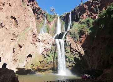
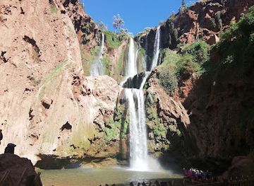
Ouzoud Waterfalls
Discover the breathtaking Ouzoud Waterfalls in Morocco, a stunning natural attraction surrounded by lush landscapes and vibrant wildlife.


Best landmarks in Zaër
Zaër’s most recognisable landmarks are often geographical or civic rather than monumental. The broad plateau itself is the defining feature, its open fields and low wooded horizons expressing the region’s agricultural and pastoral character. The Zaër woodland landscapes provide a second important reference point, particularly where mature oak stands contrast with cultivated ground. Rommani’s town centre and market area are significant as reminders of the settlement’s development as a colonial-era administrative and trading post, formerly known as Marchand, although visitors should not expect a preserved monumental quarter. Sidi Yahya des Zaër is a notable place-name and local centre whose identity directly preserves the region’s association with the Zaër community. On the western side, the changing urban edge around Ain El Aouda illustrates the pressure of Rabat’s expansion on older rural territory. These landmarks are best understood together: they show how landscape, settlement, market exchange and collective identity have shaped Zaër more strongly than a single castle, cathedral or archaeological complex.
-
Garden
Jardin Majorelle
Explore the vibrant and serene Jardin Majorelle, a botanical garden in Marrakech filled with exotic plants and artistic history, a true Moroccan gem.
-
Cultural landmark
Jemaa el-Fnaa
Experience the vibrant culture of Marrakech at Jemaa el-Fnaa, a UNESCO World Heritage site filled with street performers, delicious food, and local markets.
-
Mosque
Hassan II Mosque
Explore the stunning Hassan II Mosque in Casablanca, a masterpiece of Islamic architecture and a symbol of Morocco's rich heritage, overlooking the Atlantic Ocean.
-
Tourist attraction
Ouzoud Waterfalls
Discover the breathtaking Ouzoud Waterfalls, a natural wonder in Morocco, surrounded by lush landscapes and vibrant local culture.


Explore Zaër on the map
Plan your trip on one map. See where the top cities, national parks and sights are, and book hotels and experiences in a few clicks.
Best hotels in Zaër
Best restaurants in Zaër
Dining in Zaër is closely connected to the cooking of Morocco’s north-western interior and to the produce of its farming communities. In Rommani, Sidi Yahya des Zaër and larger roadside settlements, visitors are more likely to find straightforward cafés, grills, family restaurants and market food than a formal restaurant scene. Expect Moroccan staples such as tagines, couscous, brochettes, harira, salads, bread and sweet mint tea, with recipes and ingredients varying from household to household. Rural markets may offer seasonal fruit, vegetables, olives, dates and dairy products, while agricultural areas contribute cereals, meat and livestock to the local food economy. Breakfast cafés are useful for bread, eggs, coffee or tea before a drive, and a pre-arranged meal may be the most dependable option outside the towns. Visitors should distinguish genuinely local produce from dishes served throughout Morocco, while recognising that Zaër’s culinary identity lies in fresh rural ingredients, communal hospitality and everyday cooking rather than a narrowly defined regional cuisine.
-
Restaurant
Le Dhow
Experience exquisite dining aboard Le Dhow in Rabat—where gourmet cuisine meets stunning riverside views and vibrant entertainment.
-
Moroccan
Dar Naji
Experience the heart of Moroccan cuisine at Dar Naji, where every meal tells a story and flavors come alive in Rabat.
-
Syrian
Yamal Acham
Experience authentic Syrian cuisine at Yamal Acham in Rabat, where traditional flavors meet modern hospitality.
-
Restaurant
Les Deux Palais
Experience the vibrant flavors of Morocco at Les Deux Palais in Rabat - where traditional cuisine meets modern dining.


Best bars in Zaër
Zaër does not have a major nightclub culture, and evening life is concentrated in cafés, family restaurants and traditional meeting places in towns such as Rommani and Sidi Yahya des Zaër. Tea, coffee, conversation and televised sport are more characteristic of the local evening rhythm than late-night entertainment. Alcohol is not central to public social life, and visitors should not expect the bar scene found in Casablanca or central Rabat. After dark, rural roads become less inviting because of limited lighting, animals and changing road conditions, so plans should normally be made around daylight movement. Accommodation around the region may provide a quiet evening meal or terrace, while visitors seeking theatres, cocktail bars or clubs will generally need to return to Rabat, which lies outside Zaër and has a much broader urban nightlife offer.
-
Restaurant
La Pergola
Experience the vibrant flavors of Morocco at La Pergola, a lively restaurant and jazz bar in the heart of Marrakech's Medina.
-
Coffee shop
Le Dhow
Experience the magic of Moroccan cuisine on the water at Le Dhow, a floating restaurant offering stunning views and live entertainment in Rabat.
-
Restaurant
Les Deux Palais
Experience the fusion of Moroccan cuisine and tapas at Les Deux Palais in Rabat, where every dish tells a flavorful story.
-
Cocktail bar
BAROMETRE COCKTAILS in Marrakech
Discover the vibrant atmosphere of Barometre in Marrakech, where exquisite cocktails and Mediterranean flavors create unforgettable moments.


Best nightclubs in Zaër
Zaër does not have a major nightclub culture, and evening life is concentrated in cafés, family restaurants and traditional meeting places in towns such as Rommani and Sidi Yahya des Zaër. Tea, coffee, conversation and televised sport are more characteristic of the local evening rhythm than late-night entertainment. Alcohol is not central to public social life, and visitors should not expect the bar scene found in Casablanca or central Rabat. After dark, rural roads become less inviting because of limited lighting, animals and changing road conditions, so plans should normally be made around daylight movement. Accommodation around the region may provide a quiet evening meal or terrace, while visitors seeking theatres, cocktail bars or clubs will generally need to return to Rabat, which lies outside Zaër and has a much broader urban nightlife offer.
-
Night club
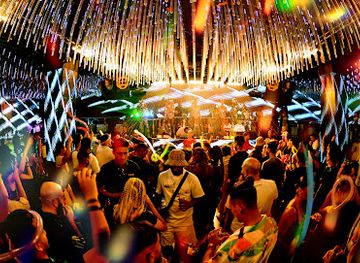
BABOUCHKA
Discover the electrifying nightlife of Marrakech at Babouchka, where vibrant music and an unforgettable atmosphere await.
-
Disco club
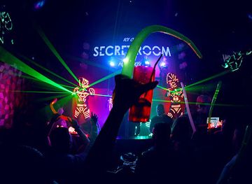
SECRET ROOM MARRAKECH
Dive into the electrifying nightlife of Marrakech at Secret Room, a premier disco club with pulsating beats and vibrant energy.
-
Lounge
Vertigo
Experience the chic and vibrant atmosphere of Vertigo, Rabat's premier lounge for cocktails, live music, and unforgettable nights.
-
Night club
555 Famous Club Marrakech
Discover the essence of Marrakech's nightlife at 555 Famous Club, where every night is a celebration of music, dance, and Moroccan hospitality.
Best shops in Zaër
Shopping in Zaër is centred on practical market-town commerce rather than specialist retail. Rommani and Sidi Yahya des Zaër are the most useful places to browse produce stalls, household goods, clothing, basic crafts and agricultural trade, with activity varying according to local market days. Small shops and cafés serve residents rather than tourists, so visitors should expect limited choice in international brands, galleries or luxury goods. Useful purchases may include olive products, dates, honey, seasonal produce, spices, bread and other foods from the wider Moroccan countryside, provided that packaging and transport arrangements are suitable. Rural markets also offer insight into livestock and farming economies, although photography should be discreet and undertaken with permission. For artisan goods, antiques, books and a much wider selection of souvenirs, Rabat’s medina and established shopping areas outside Zaër are more dependable. Prices in informal markets are often negotiable, but bargaining should remain polite and proportionate.
-
Shopping mall
Mega Mall Rabat
Explore Mega Mall Rabat for an unforgettable shopping and entertainment experience, featuring diverse stores, dining options, and fun activities for everyone.
-
Souvenir store
Dar Bouchaib
Explore Dar Bouchaib in Marrakesh: Your ultimate destination for authentic Moroccan souvenirs, cosmetics, jewelry, and unique gifts.
-
Fabric store
Miro Rabat Home-Déco-Tissus
Discover Miro Rabat, the ultimate fabric store in Rabat, for exquisite home goods and unique textiles that reflect Moroccan craftsmanship.
-
Gift shop
The Good Place Maroc
Explore The Good Place Maroc, a vibrant gift shop in Casablanca offering unique souvenirs and electronics reflecting Moroccan culture.


Get your free copy of our complete guide to Zaër, delivered straight to you.
Everything on this page, from attractions and restaurants to essentials and local phrases, in one PDF you can read offline, print or share.
Already have an account? Sign in
Your Zaër guide is ready.
We'll send it to · Not you? Sign out

Getting your guide ready…
We are putting together a fresh copy of the Zaër guide. This can take up to a minute.
This can take a few moments. If your browser asks, choose Allow so the download can start. You'll find the guide in your Downloads folder.
Nothing happened? Download it again
Sorry, the guide is taking longer than usual. Please try again in a minute, or get it by email instead.
Zaër essentials
Currency and Payment
Safety
Emergency Situations
Do's and Don'ts
Local Tips
From Eve
Local phrases worth knowing
You don't need to get them perfect. A few words go a long way, and locals appreciate the effort.
Basics
| English | Local | Say it |
|---|---|---|
| Hello | سلام | [Salam] |
| Goodbye | وداعا | [Wada'an] |
| Yes | نعم | [Na'am] |
| No | لا | [La] |
| Please/You're welcome | من فضلك | [Min fadlak] |
| Thank you | شكرا | [Shukran] |
| Excuse me/Sorry | عذرا | [Udhuran] |
| How are you? | كيف حالك؟ | [Kayfa halak?] |
| Fine. And you? | بخير. وأنت؟ | [Bikhayr. Wa anta?] |
| Do you speak English? | هل تتحدث الإنجليزية؟ | [Hal tatahaddath al-ingliziyya?] |
| I don't understand | لا أفهم | [La afham] |
Eating & Drinking
| English | Local | Say it |
|---|---|---|
| I'd like to see the menu, please | أود رؤية القائمة، من فضلك | [Awad ru'yat al-qa'ima, min fadlak] |
| I don't eat meat | لا آكل اللحم | [La akul al-lahm] |
| Cheers! | في صحتك! | [Fi sihtak!] |
| I would like to pay, please | أود الدفع، من فضلك | [Awad al-daf', min fadlak] |
Emergencies
| English | Local | Say it |
|---|---|---|
| Help! | نجدة! | [Najda!] |
| Go away! | ابتعد! | [Ibt'id!] |
| Call the Police! | اتصل بالشرطة! | [Ittasil bil-shurta!] |
| Call a doctor! | اتصل بالطبيب! | [Ittasil bil-tabeeb!] |
| I'm lost | أنا ضائع | [Ana da'i'] |
| I'm ill | أنا مريض | [Ana marid] |
Shopping
| English | Local | Say it |
|---|---|---|
| I'd like to buy... | أود شراء... | [Awad shira...] |
| I'm just looking | أنا فقط أنظر | [Ana faqat anzur] |
| How much is it? | كم ثمنه؟ | [Kam thamanuh?] |
| That's too expensive | هذا مكلف جدا | [Hatha mukallaf jiddan] |
| Can you lower the price? | هل يمكنك تخفيض السعر؟ | [Hal yumkinuka takhfid al-si'r?] |
Time & Numbers
| English | Local | Say it |
|---|---|---|
| What time is it? | كم الساعة؟ | [Kam al-sa'ah?] |
| It's one o'clock | الساعة واحدة | [Al-sa'ah wahida] |
| Half past (10) | نصف (10) | [Nisf (10)] |
| Morning | صباح | [Sabah] |
| Afternoon | بعد الظهر | [Ba'd al-zuhur] |
| Evening | مساء | [Masa'] |
| Yesterday | أمس | [Ams] |
| Today | اليوم | [Al-yawm] |
| Tomorrow | غدا | [Ghadan] |
| 1 | 1 | [1] |
| 2 | 2 | [2] |
| 3 | 3 | [3] |
| 4 | 4 | [4] |
| 5 | 5 | [5] |
| 6 | 6 | [6] |
| 7 | 7 | [7] |
| 8 | 8 | [8] |
| 9 | 9 | [9] |
| 10 | 10 | [10] |
Transport & Directions
| English | Local | Say it |
|---|---|---|
| Where's a/the...? | أين ال...؟ | [Ayn al...?] |
| What's the address? | ما هو العنوان؟ | [Ma huwa al-'unwan?] |
| Can you show me (on the map)? | هل يمكنك أن تريني (على الخريطة)؟ | [Hal yumkinuka an turini (ala al-kharita)?] |
| When's the next (bus)? | متى تأتي الحافلة القادمة؟ | [Mata ta'ti al-hafila al-qadima?] |
| A ticket (to ....) | تذكرة (إلى....) | [Tadhkara (ila....)] |
History of Zaër
The Zaër Tribal Landscape Before the Protectorate
The name Zaër refers both to a Moroccan tribal confederation and to the territory historically associated with it south of Rabat. Communities in this plateau environment combined pastoral movement, cultivation and local trade, adapting their activities to seasonal rainfall and access to grazing. Tribal organisation was important in regulating land use, alliances and relations with neighbouring groups. The region was not an isolated political unit, however: it formed part of the wider networks linking the Atlantic plains, Rabat and the interior of Morocco.
Makhzen Authority and the Alaouite State
Before the twentieth century, the Zaër country was connected to the authority of the Moroccan sultan through the changing relationship commonly described as the Makhzen system. State influence was expressed through taxation, diplomacy, military expeditions and the recognition of local intermediaries, but its practical reach varied across rural areas. The plateau’s proximity to Rabat and its position on routes towards the interior gave it continuing strategic importance. This history helps explain why local identity and national political authority developed alongside one another rather than in separate spheres.
The French Protectorate and the Pacification of the Plateau
The establishment of the French Protectorate in 1912 brought military pressure, new administrative structures and efforts to control movement across the Moroccan countryside. The Zaër region was drawn into the wider campaigns through which France sought to consolidate authority beyond the major cities. Roads, posts, surveys and administrative boundaries altered the landscape, while local communities experienced the disruption and negotiation that accompanied colonial rule. The process was not simply an administrative change: it affected land use, trade routes and the relationship between rural settlements and Rabat.
Rommani and the Growth of Market Administration
Rommani became an important market and administrative centre during the colonial period, when it was known as Marchand. Its development reflected a broader policy of creating accessible points from which officials could manage rural territory and connect agricultural producers with transport routes. The town’s significance lies less in monumental architecture than in the way it represents the transformation of a mobile and dispersed rural economy into one increasingly linked to fixed markets, roads and state institutions. Its present-day role still reflects that historical function.
Independence and Rural Transformation
After Morocco regained independence in 1956, the Zaër plateau was incorporated into the country’s modern administrative and economic systems. Agriculture remained central, particularly cereal cultivation and livestock raising, while roads, schooling, public services and communications gradually reshaped rural life. Seasonal movement and older forms of local authority did not disappear, but they operated alongside national institutions and a more monetised economy. Many families also developed stronger links with Rabat and other urban centres, changing the balance between village life, farming and commuting.
The Rabat Hinterland in Contemporary Morocco
In recent decades, the western edge of Zaër has felt the expanding influence of the Rabat metropolitan area. Settlements such as Ain El Aouda have experienced development pressures, new housing and greater daily movement towards the capital, while more distant parts of the plateau retain a rural character. This contrast is now one of the region’s defining features. Zaër remains associated with agricultural landscapes and tribal heritage, yet it is also part of a rapidly changing corridor between Morocco’s political capital and the interior.
Zaër in Photos
Browse through our photo collection highlighting the charm and character of the destination.
Neighbouring regions of Zaër
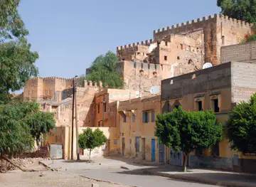
The closest regions to Zaër, if you have time for more than one.
-

-

-

-

-


Swipe for more regions
Explore more

Explore more of Morocco
Discover Morocco: A land of rich history, vibrant culture, and stunning landscapes, where ancient traditions meet modern allure.
Explore Morocco