

Free Otjiwarongo Travel Guide & Mobile App
Plan your Otjiwarongo trip with Evendo. Get free guides to top attractions, restaurants, hotels, and bars. Web access or download the mobile app.


Otjiwarongo, Namibia’s gateway to wildlife country, combines Cheetah Conservation Fund visits, railway heritage, open skies and access to Waterberg landscapes.
A Central Namibian Town
Otjiwarongo lies in Namibia’s Otjozondjupa Region, on the main road and railway linking Windhoek with the north. Its name, commonly translated from Otjiherero as “beautiful place”, reflects a town set among dry hills, thornveld and broad horizons rather than a dense urban landscape. The settlement is a practical base for travellers crossing central Namibia, with a relaxed streetscape, useful services and a strong connection to the surrounding bush country.Read more about Otjiwarongo
Wildlife and Conservation
Herero and Colonial Legacies
When is the best time to visit Otjiwarongo?
Best: May–July · 27–30°C| Month | High (°C) | Rainfall (mm) |
|---|---|---|
| January | 35 | 89 |
| February | 35 | 94 |
| March | 35 | 77 |
| April | 33 | 36 |
| May (best) | 30 | 7 |
| June (best) | 27 | 0 |
| July (best) | 27 | 0 |
| August | 31 | 0 |
| September | 34 | 1 |
| October | 35 | 12 |
| November | 36 | 34 |
| December | 35 | 66 |
Getting to and around Otjiwarongo
How to get there
Transportation
Best attractions in Otjiwarongo
Otjiwarongo’s principal attractions reflect its position between town life and Namibia’s wildlife country. The Cheetah Conservation Fund, outside the centre, offers an informative introduction to cheetah research, conservation education and the challenges of balancing predators with livestock farming. Within town, the Otjiwarongo Crocodile Ranch has been associated with local wildlife tourism, though visitors should verify its current operating status before planning a visit. The town’s streets and railway setting provide a quieter glimpse of central Namibian urban life, while the surrounding thornveld is best appreciated on drives beyond the centre. Waterberg Plateau Park, with its red cliffs and wooded plateau, is a substantial regional excursion rather than a town attraction. Otjiwarongo also works well as a base for travellers continuing towards Etosha, allowing sightseeing to be combined with practical stops for supplies, fuel and accommodation.
-
Museum
Museum of Namibian Fashion
Discover the vibrant cultural tapestry of Namibia through fashion at the Museum of Namibian Fashion in Otjiwarongo.
11 min walk · 0.8 km from city centre
-
 National park
Waterberg Plateau National Park
Experience the awe-inspiring beauty of Waterberg Plateau National Park, a true gem in Namibia's wilderness, offering adventure, wildlife, and picturesque landscapes.
5 min drive · 1.6 km from city centre
-
Park
Efululu Entertainment Park
Explore the vibrant Efululu Entertainment Park in Otjiwarongo, Namibia, a family-friendly destination filled with fun, nature, and local culture.
16 min walk · 1.3 km from city centre
-
Park
Lava's Park
Experience the serene landscapes and vibrant wildlife of Lava's Park in Otjiwarongo, a perfect nature escape in Namibia.
10 min walk · 0.8 km from city centre
Best landmarks in Otjiwarongo
Otjiwarongo’s landmarks are more understated than the monumental buildings found in Namibia’s capital, yet they reveal the town’s history clearly. The railway corridor and surviving railway-related structures recall the early twentieth-century expansion that connected central Namibia with the north and Windhoek. The town’s churches, civic buildings and older commercial premises reflect the layered influence of colonial administration, later Namibian development and regional service industries, although individual buildings should be identified locally because public access and preservation status can vary. The Cheetah Conservation Fund is not a historic landmark, but it has become an important contemporary symbol of Otjiwarongo’s conservation identity. Beyond the town, the red sandstone escarpment of Waterberg Plateau Park forms the area’s most prominent natural landmark, though the park lies outside Otjiwarongo and is a separate destination.
-
Tourist attraction
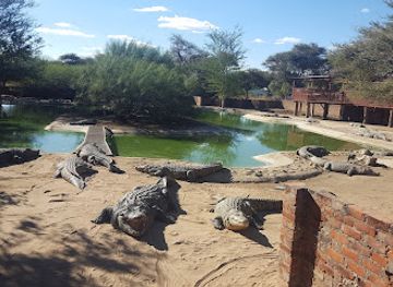
Crocodile Farm Otjiwarongo
Explore the Crocodile Farm Otjiwarongo, a unique wildlife destination dedicated to crocodile conservation and education in the heart of Namibia.
3 min walk · 0.2 km from city centre
-
Hotel
Cest Si Bon Hotel
Experience the tranquil charm of Cest Si Bon Hotel in Otjiwarongo, where comfort meets the beauty of Namibia's landscapes.
12 min walk · 0.9 km from city centre
-
Hotel
Casa Forno County Hotel
Discover Casa Forno County Hotel in Otjiwarongo, where comfort meets culinary excellence in the heart of Namibia.
10 min walk · 0.8 km from city centre
-
Hotel
Out of Africa Town Lodge
Discover the serene Out of Africa Town Lodge in Otjiwarongo, the perfect blend of comfort and adventure in Namibia's breathtaking landscapes.
15 min walk · 1.2 km from city centre
Explore Otjiwarongo on the map
Plan your Otjiwarongo trip on one map. See where the top attractions, landmarks, restaurants, bars and hotels are, find what's near where you're staying, and book hotels and experiences in a few clicks.
Best hotels in Otjiwarongo
Best restaurants in Otjiwarongo
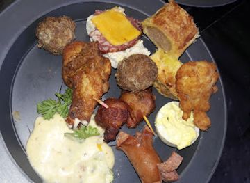
Otjiwarongo’s dining scene is shaped by its role as a regional service town and a stop on the northbound road. Restaurants and cafés generally cater to residents, farmers, drivers and safari travellers, with menus influenced by Namibian, South African and broadly international cooking. Meat, game where legally and responsibly sourced, grilled dishes, stews and straightforward country-style meals are common features of the wider regional food culture, while supermarkets and bakeries provide useful provisions for self-drive journeys. Casual cafés and hotel restaurants tend to be more dependable than a concentrated restaurant quarter, and opening patterns can vary outside peak travel periods. Visitors may also encounter biltong, a dried meat snack with strong southern African associations, along with locally available produce from the farming region. The dining experience is generally practical and relaxed rather than focused on elaborate gastronomy.
-
Restaurant
Crocodile Farm Otjiwarongo
Experience Namibia's rich wildlife at Crocodile Farm Otjiwarongo – where dining meets adventure in the heart of nature.
3 min walk · 0.2 km from city centre
-
Restaurant
Casa Forno County Hotel
Experience authentic Namibian cuisine and hospitality at Casa Forno County Hotel in Otjiwarongo – your perfect getaway destination.
10 min walk · 0.8 km from city centre
-
Restaurant
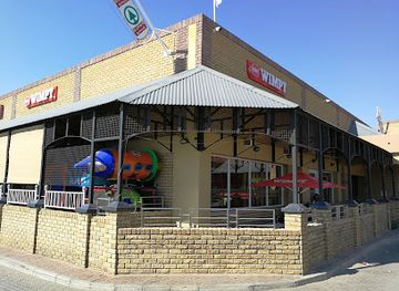
Wimpy
Experience quick bites at Wimpy in Otjiwarongo – where delicious fast food meets friendly service.
4 min walk · 0.3 km from city centre
-
Restaurant
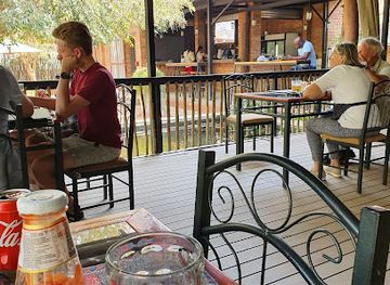
Memoirs Bar & Restaurant
Discover the vibrant culinary scene at Memoirs Bar & Restaurant in Otjiwarongo - where local flavors meet exceptional dining.
6 min walk · 0.5 km from city centre

Best bars in Otjiwarongo
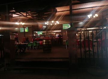
Otjiwarongo has a modest evening scene, centred mainly on hotel bars, restaurants, local drinking places and social venues used by residents rather than on a large club district. Evenings are often quiet, with travellers dining, sharing drinks or preparing for an early departure towards Etosha, Waterberg or Windhoek. South African and Namibian beer traditions are familiar, and a lodge or hotel may provide a more comfortable setting for visitors than an unfamiliar late-night venue. Live entertainment and community events can occur, but schedules are not necessarily regular and should be checked locally. The town is not known for intensive nightlife, and after dark the practical priorities are secure transport, awareness of surroundings and avoiding rural driving after sunset.
-
Restaurant
Memoirs Bar & Restaurant
Discover the culinary delights of Memoirs Bar & Restaurant in Otjiwarongo, where local flavors meet a warm, inviting atmosphere.
6 min walk · 0.5 km from city centre
-
Restaurant
Podjo's Restaurant, Bar & Grill
Discover the vibrant flavors of Namibia at Podjo's Restaurant, Bar & Grill in Otjiwarongo, where local cuisine meets warm hospitality.
9 min walk · 0.7 km from city centre
-
Bar
Virmos Bar
Experience the vibrant nightlife at Virmos Bar in Otjiwarongo, where refreshing drinks and local culture come together for an unforgettable evening.
15 min walk · 1.2 km from city centre
-
Restaurant
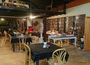
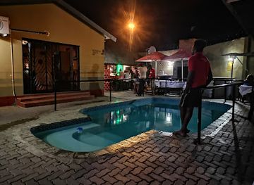
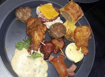
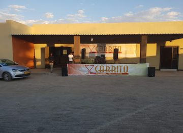
CABRITO, Lounge, Bar & Restaurant
Experience the vibrant atmosphere and delicious cuisine at CABRITO, Otjiwarongo's top lounge, bar, and restaurant, perfect for tourists and locals alike.
16 min walk · 1.3 km from city centre
Best nightclubs in Otjiwarongo
Otjiwarongo has a modest evening scene, centred mainly on hotel bars, restaurants, local drinking places and social venues used by residents rather than on a large club district. Evenings are often quiet, with travellers dining, sharing drinks or preparing for an early departure towards Etosha, Waterberg or Windhoek. South African and Namibian beer traditions are familiar, and a lodge or hotel may provide a more comfortable setting for visitors than an unfamiliar late-night venue. Live entertainment and community events can occur, but schedules are not necessarily regular and should be checked locally. The town is not known for intensive nightlife, and after dark the practical priorities are secure transport, awareness of surroundings and avoiding rural driving after sunset.
-
Hotel
Casa Forno County Hotel
Experience the essence of Namibian hospitality at Casa Forno County Hotel in Otjiwarongo, where comfort meets local charm.
10 min walk · 0.8 km from city centre
-
Bar
Virmos Bar
Experience the vibrant nightlife at Virmos Bar, where locals and visitors gather for drinks, music, and unforgettable memories in Otjiwarongo.
15 min walk · 1.2 km from city centre
-
Gym
OtjiFitness Zone
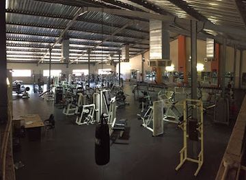
Discover your fitness journey at OtjiFitness Zone in Otjiwarongo, where wellness meets community spirit in a modern gym environment.
2 min walk · 0.1 km from city centre
-
Restaurant
Etemba Beerhouse
Discover Etemba Beerhouse in Otjiwarongo for an authentic taste of Namibian culture with local beers and delicious traditional dishes.
5 min walk · 0.4 km from city centre
Best shops in Otjiwarongo
Shopping in Otjiwarongo is practical and locally oriented, with supermarkets, fuel-station shops, pharmacies, general retailers and small independent businesses serving both residents and travellers. There is no large, concentrated souvenir quarter, but visitors may find Namibian crafts, carved items, textiles, leather goods and regional food products through local retailers, markets or accommodation-linked outlets; provenance and materials should be checked when buying wildlife-related products. Biltong and other southern African snacks are convenient purchases for long drives, while supermarkets are useful for water, provisions and picnic supplies. The town’s retail character reflects its role as a farming and transport centre rather than a specialist shopping destination. More extensive craft shopping is generally associated with larger Namibian towns or organised craft markets elsewhere in the country.
-
Supermarket
SUPERSPAR Theo's
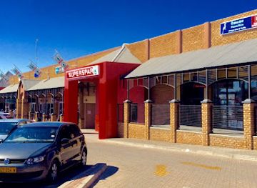
Explore the vibrant flavors of Otjiwarongo at SUPERSPAR Theo's, your go-to supermarket for fresh produce and local delicacies.
3 min walk · 0.3 km from city centre
-
Tourist attraction
Crocodile Farm Otjiwarongo
Experience the thrill of wildlife up close at Crocodile Farm Otjiwarongo, a unique attraction for animal lovers and adventure seekers in Namibia.
3 min walk · 0.2 km from city centre
-
Supermarket
Shoprite Otjiwarongo
Experience the heart of Namibia at Shoprite Otjiwarongo, where quality groceries meet local charm in a vibrant shopping environment.
7 min walk · 0.6 km from city centre
-
Market
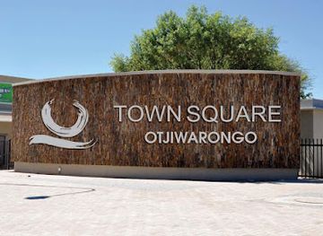
Otjiwarongo Town Square
Discover the heart of Otjiwarongo at Town Square, where local culture, fresh produce, and vibrant crafts await every visitor.
6 min walk · 0.5 km from city centre
Get your free copy of our complete guide to Otjiwarongo, delivered straight to you.
Everything on this page, from attractions and restaurants to essentials and local phrases, in one PDF you can read offline, print or share.
Already have an account? Sign in
Your Otjiwarongo guide is ready.
We'll send it to · Not you? Sign out

Getting your guide ready…
We are putting together a fresh copy of the Otjiwarongo guide. This can take up to a minute.
This can take a few moments. If your browser asks, choose Allow so the download can start. You'll find the guide in your Downloads folder.
Nothing happened? Download it again
Sorry, the guide is taking longer than usual. Please try again in a minute, or get it by email instead.
Otjiwarongo essentials
Currency and Payment
Safety
Emergency Situations
Do's and Don'ts
Local Tips
From Eve
Local phrases worth knowing
You don't need to get them perfect. A few words go a long way, and locals appreciate the effort.
Basics
| English | Local | Say it |
|---|---|---|
| Hello | Hallo | [ha-lo] |
| Goodbye | Totsiens | [toh-tsee-ens] |
| Yes | Ja | [yah] |
| No | Nee | [nee] |
| Please/You're welcome | Asseblief | [ah-suh-bleef] |
| Thank you | Dankie | [dun-kee] |
| Excuse me/Sorry | Jammer | [yah-mer] |
| How are you? | Hoe gaan dit? | [hoo gahn dit] |
| Fine. And you? | Goed. En jy? | [khoot. en yai] |
| Do you speak English? | Praat jy Engels? | [praht yai eng-els] |
| I don't understand | Ek verstaan nie | [ehk fur-staan nee] |
Eating & Drinking
| English | Local | Say it |
|---|---|---|
| I'd like to see the menu, please | Ek wil die spyskaart sien, asseblief | [ehk vil dee spys-kart seen, ah-suh-bleef] |
| I don't eat meat | Ek eet nie vleis nie | [ehk ayt nee flays nee] |
| Cheers! | Gesondheid! | [ghuh-sunt-hait] |
| I would like to pay, please | Ek wil asseblief betaal | [ehk vil ah-suh-bleef buh-tahl] |
Emergencies
| English | Local | Say it |
|---|---|---|
| Help! | Help! | [help] |
| Go away! | Gaan weg! | [ghahn vehg] |
| Call the Police! | Bel die Polisie! | [bel dee poh-lee-see] |
| Call a doctor! | Bel 'n dokter! | [bel un dohk-tuh] |
| I'm lost | Ek is verlore | [ehk is fehr-loh-ruh] |
| I'm ill | Ek is siek | [ehk is seek] |
Shopping
| English | Local | Say it |
|---|---|---|
| I'd like to buy... | Ek wil koop... | [ehk vil kohp] |
| I'm just looking | Ek kyk net | [ehk kuhk neht] |
| How much is it? | Hoeveel kos dit? | [hoo-veel kohs dit] |
| That's too expensive | Dit is te duur | [dit is tay doo-er] |
| Can you lower the price? | Kan jy die prys verlaag? | [kahn yai dee prays fur-lahg] |
Time & Numbers
| English | Local | Say it |
|---|---|---|
| What time is it? | Hoe laat is dit? | [hoo laht is dit] |
| It's one o'clock | Dit is een uur | [dit is ayn oor] |
| Half past (10) | Half tien | [hahlf teen] |
| Morning | Oggend | [oh-khuhnt] |
| Afternoon | Middag | [mi-dahkh] |
| Evening | Aand | [ahnt] |
| Yesterday | Gister | [ghis-tur] |
| Today | Vandag | [fuhn-dahkh] |
| Tomorrow | Môre | [moh-ruh] |
| 1 | Een | [ayn] |
| 2 | Twee | [twee] |
| 3 | Drie | [dree] |
| 4 | Vier | [feer] |
| 5 | Vyf | [fayf] |
| 6 | Ses | [sehs] |
| 7 | Sewe | [seh-veh] |
| 8 | Agt | [ahgt] |
| 9 | Nege | [neh-ghuh] |
| 10 | Tien | [teen] |
Transport & Directions
| English | Local | Say it |
|---|---|---|
| Where's a/the...? | Waar is 'n/die...? | [vahr is un/dee] |
| What's the address? | Wat is die adres? | [vaht is dee ah-drehs] |
| Can you show me (on the map)? | Kan jy my wys (op die kaart)? | [kahn yai may vays (ohp dee kahrt)] |
| When's the next (bus)? | Wanneer is die volgende (bus)? | [vah-nehr is dee fuhl-guhn-duh (buhs)] |
| A ticket (to ....) | 'n Kaartjie (na ....) | [un kahrt-chee (nah)] |
History of Otjiwarongo
An Otjiherero Place Name
Otjiwarongo developed in a landscape long used by pastoral communities, particularly Otjiherero-speaking people. The town’s name is generally understood as an Otjiherero expression meaning “beautiful place”, although translations of indigenous place names can vary according to interpretation and context. Its position between the central highlands and the northern interior made the area significant for grazing, movement and regional exchange. The modern town should therefore be understood not as an isolated colonial creation, but as part of a wider cultural landscape shaped by established communities, livestock routes and access to water. The surrounding thornveld and hills remain central to the area’s identity, even as the town has become a transport and service centre.
German Colonial Administration
During the period of German colonial rule in South West Africa, Otjiwarongo became increasingly drawn into the colonial administration and settler economy. The area was affected by the violence and upheaval of the Herero and Nama war of 1904–1908, when German forces conducted a brutal campaign against Herero and Nama communities. Colonial control brought new administrative structures, land dispossession and military pressure, while also connecting the settlement to expanding transport networks. The consequences were profound for local communities and landholding patterns. Any account of Otjiwarongo’s early twentieth-century development must place the town within this wider history rather than presenting colonial infrastructure as an uncomplicated sign of progress.
Railway and Regional Growth
The railway helped transform Otjiwarongo into a more important settlement during the early twentieth century. The northward line connected the town with Windhoek and other parts of the territory, supporting the movement of people, livestock, supplies and agricultural products. Otjiwarongo’s location also made it a natural service point for farms and smaller settlements scattered across the central interior. Roads later strengthened this role, particularly the route now associated with the B1 highway. The town’s built environment and transport history still reflect this period of expansion, although modern road travel has become more significant for most visitors than the railway itself.
Cattle, Farming and Conservation
For much of the twentieth century, Otjiwarongo’s economy remained closely connected to cattle farming and the commercial use of surrounding land. This produced a town whose services were directed as much towards the regional agricultural economy as towards tourism. Later, conservation became another defining influence. Namibia’s cheetah population faces pressure from habitat loss and conflict with livestock farmers, and the establishment of the Cheetah Conservation Fund near Otjiwarongo brought research, education and wildlife management into the town’s international profile. Conservation work did not replace farming, but added a new dimension to the relationship between the town, private land and the wider bush landscape.
Otjiwarongo in Independent Namibia
Namibia became independent in 1990, and Otjiwarongo continued as an important regional centre in the Otjozondjupa Region. Its location on the principal north-south road keeps it connected to Windhoek, Etosha National Park and northern Namibia, while its schools, shops, accommodation and services support surrounding farming communities. Contemporary Otjiwarongo combines a modest urban core with a strong conservation identity and a population drawn from different parts of the country. The town’s present character is therefore practical and outward-looking: it serves residents and passing travellers while providing access to wildlife projects and the landscapes of central Namibia.
Otjiwarongo in Photos
Browse through our photo collection highlighting the charm and character of the destination.
Cities near Otjiwarongo
The closest cities to Otjiwarongo, if you have time for more than one stop.
-

-

-

-

-


Swipe for more cities
Explore more

Explore more of Namibia
Discover Namibia: A land of towering dunes, ancient deserts, and vibrant cultures. Perfect for adventurers and nature lovers seeking an unparalleled African experience.
Explore Namibia