

Free North Platte River Valley Travel Guide & Mobile App
Explore North Platte River Valley with free travel guides. Discover regional history, expert tips, proposed trips, and audio guides on web or mobile app.


Explore Nebraska's North Platte River Valley for towering bluffs, overland-trail history, reservoir recreation, rail heritage and wide-open Great Plains scenery.
Read more about North Platte River Valley
Getting to and around North Platte River Valley
How to get there
Transportation
Destinations in North Platte River Valley
Resorts, valleys and scenic spots worth a trip of their own.

Swipe for more destinations
Best attractions in North Platte River Valley
The North Platte River Valley's attractions combine geological scenery, overland-trail history, working landscapes and water-based recreation. Scotts Bluff National Monument provides trails and expansive views from a landmark that guided nineteenth-century emigrants, while nearby Chimney Rock National Historic Site interprets one of the most recognisable formations on the Oregon, California and Mormon trails. Ash Hollow State Historical Park near Lewellen preserves wagon ruts, a pioneer cemetery and a setting where travellers descended towards the river. Lake McConaughy offers beaches, boating, fishing, camping and birdwatching around Nebraska's largest reservoir. In North Platte, Buffalo Bill Ranch State Historical Park explores William F. Cody's ranch and performance career, while the North Platte Canteen Museum recalls wartime volunteer work. Railway enthusiasts can view the operations of Bailey Yard from its public overlook, although it is an active freight facility rather than a conventional museum. Smaller museums, historic downtowns, ranch landscapes and roadside viewpoints fill the spaces between these principal sites.
-
Tourist attraction
Scotts Bluff National Monument
Experience the breathtaking beauty and rich history of Scotts Bluff National Monument in Nebraska, a must-visit landmark for every traveler.
-
Tourist attraction
Golden Spike Tower
Discover stunning views and railroad history at the Golden Spike Tower in North Platte, Nebraska - a must-see for all tourists.
-
Gift shop
Fort Cody Trading Post
Explore Fort Cody Trading Post in North Platte, Nebraska, where Western heritage meets unique souvenirs and captivating exhibits for all ages.
-
Park
Cody Park
Discover Cody Park, a scenic oasis in North Platte, Nebraska, where nature meets recreation for an unforgettable outdoor experience.


Best landmarks in North Platte River Valley
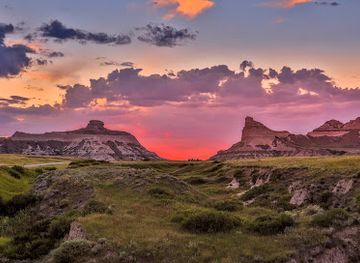
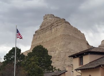
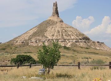
Scotts Bluff is the valley's most prominent natural landmark, a line of high bluffs above the North Platte whose distinctive profile helped guide emigrants across the plains and now defines the landscape around Gering and Scottsbluff. Chimney Rock, near Bayard, is a slender volcanic-ash formation that became an emblem of the overland trails and remains one of Nebraska's best-known geological markers. Ash Hollow's steep valley, historic trail ruts and cemetery preserve the physical evidence of wagon migration in a setting shaped by the river. Lake McConaughy and Kingsley Dam form a major modern landmark, showing how the North Platte has been engineered for water storage, irrigation and recreation. In North Platte, the railway landscape around Bailey Yard represents the continuing importance of freight transport, while Buffalo Bill Ranch's historic buildings embody the region's connection with ranching and the performed mythology of the American West.
-
Monument
Scotts Bluff National Monument
Discover the stunning vistas and rich history at Scotts Bluff National Monument, a must-see destination for travelers exploring Nebraska's natural wonders.
-
Museum
Chimney Rock Museum
Explore the iconic Chimney Rock Museum, where history comes alive, showcasing the journey of pioneers on the Oregon Trail.
Explore North Platte River Valley on the map
Plan your trip on one map. See where the top cities, national parks and sights are, and book hotels and experiences in a few clicks.
Best hotels in North Platte River Valley
Best restaurants in North Platte River Valley
Dining in the valley reflects western Nebraska's agricultural and transport-based communities. North Platte, Ogallala and Scottsbluff provide the broadest choice of family restaurants, cafés, bakeries, steakhouses and international options, while smaller towns tend to centre on locally established diners, grills and pubs. Beef is prominent on many menus because ranching remains important, and visitors will also encounter familiar Great Plains staples such as burgers, breakfast plates, sandwiches and seasonal produce. Lake communities and highway towns add relaxed casual dining suited to road trips and outdoor recreation. Farmers' markets and local shops can be useful for fruit, vegetables, baked goods and provisions, though the schedule varies by season and town. Nebraska's wider craft-beer culture is represented in some communities, but the valley's food identity is more closely tied to dependable hospitality, ranching and agriculture than to a single signature dish.
-
Breakfast
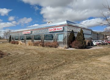
Penny's Diner
Discover Penny's Diner in North Platte - A charming breakfast spot serving delicious meals in a cozy atmosphere.
-
Restaurant
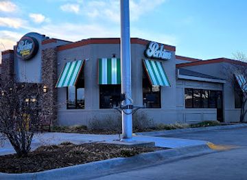
Perkins Restaurant & Bakery
Experience hearty American comfort food and delightful baked treats at Perkins Restaurant & Bakery in Scottsbluff.
-
Italian
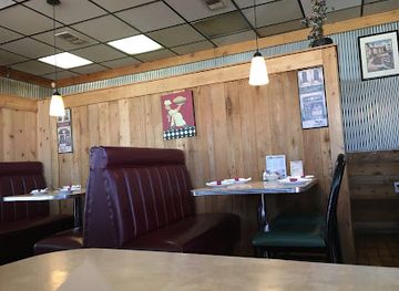
Luigi's | Italian Restaurant
Savor authentic Italian flavors at Luigi's in North Platte – where great food meets warm hospitality.
-
American
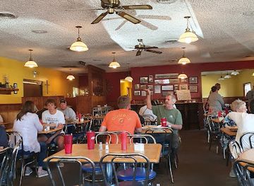
Merricks Ranch House
Experience the best of American cuisine at Merricks Ranch House in North Platte - where every meal feels like home.
Best bars in North Platte River Valley
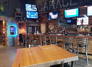
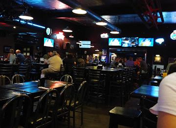
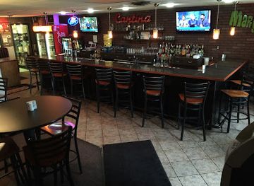
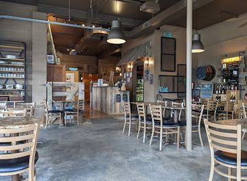
Evenings in the North Platte River Valley generally centre on traditional pubs, grills, hotel lounges, breweries, live-music events and community venues rather than a large nightclub scene. North Platte and Scottsbluff offer the widest choice of bars and occasional organised entertainment, while Ogallala combines local evening venues with hospitality aimed at travellers using Interstate 80. Smaller communities tend to have a quieter rhythm, with social life focused on restaurants, seasonal fairs, rodeo-related gatherings and town events. After dark, reservoir and rural areas are better suited to stargazing and campfires where permitted than to formal nightlife. Check local arrangements before relying on a particular performance or venue, since opening patterns and entertainment programmes can be seasonal and changeable.
-
Grill
Backaracks Steakhouse and Grill
Indulge in expertly grilled steaks and classic favorites at Backaracks Steakhouse and Grill, a must-visit culinary gem in Scottsbluff, Nebraska.
-
Grill
Steel Grill Restaurant & Bar
Discover the mouthwatering flavors of grilled cuisine at Steel Grill Restaurant & Bar in Gering, Nebraska, where great food meets a cozy atmosphere.
-
Mexican
El Charrito Restaurant
Experience the rich and vibrant flavors of authentic Mexican cuisine at El Charrito Restaurant in Scottsbluff, Nebraska.
-
Tapas
The Tangled Tumbleweed
Experience a culinary delight at The Tangled Tumbleweed, where vibrant tapas and a warm atmosphere await every visitor in Scottsbluff, Nebraska.
Best shops in North Platte River Valley
Shopping is concentrated in the town centres, commercial corridors and service communities rather than in a single regional retail district. North Platte, Ogallala and Scottsbluff provide everyday supplies, outdoor equipment, clothing, books, antiques and locally oriented gift shops, while historic downtown areas are useful for browsing independent businesses when open. Visitors may find western wear, ranch-themed goods, locally made crafts, Nebraska food products and souvenirs connected with the overland trails or geological landmarks. Farmers' markets, where operating seasonally, are good places to look for baked goods, produce and small-scale products, but dates vary by community. Shops near Lake McConaughy focus more on practical provisions and recreation needs. For a meaningful memento, consider regional art, photography, pottery or a locally produced food item rather than relying solely on generic frontier merchandise.
-
Gift shop
Fort Cody Trading Post
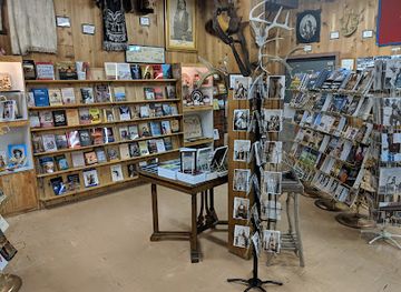
Experience the spirit of the Wild West at Fort Cody Trading Post, North Platte's charming gift shop and cultural exhibit.
-
Craft store
Hobby Lobby
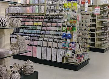
Discover a creative paradise at Hobby Lobby - your go-to destination for craft supplies, home decor, and artistic inspiration in Scottsbluff, Nebraska.
-
Shopping mall
Uptown Scottsbluff (Monument Mall)
Experience the ultimate shopping and entertainment destination at Uptown Scottsbluff, where fashion, fun, and family come together in Nebraska.
-
Department store
Murdoch's Ranch & Home Supply
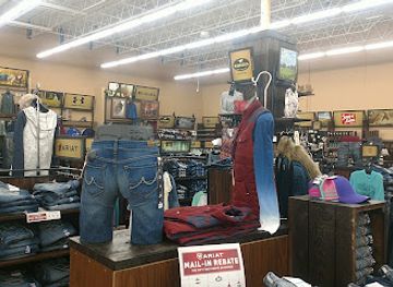
Explore Murdoch's Ranch & Home Supply in Scottsbluff for a unique shopping experience blending local culture with a vast selection of outdoor and home supplies.

Get your free copy of our complete guide to North Platte River Valley, delivered straight to you.
Everything on this page, from attractions and restaurants to essentials and local phrases, in one PDF you can read offline, print or share.
Already have an account? Sign in
Your North Platte River Valley guide is ready.
We'll send it to · Not you? Sign out

Getting your guide ready…
We are putting together a fresh copy of the North Platte River Valley guide. This can take up to a minute.
This can take a few moments. If your browser asks, choose Allow so the download can start. You'll find the guide in your Downloads folder.
Nothing happened? Download it again
Sorry, the guide is taking longer than usual. Please try again in a minute, or get it by email instead.
North Platte River Valley essentials
Currency and Payment
Safety
Emergency Situations
Do's and Don'ts
Local Tips
From Eve
Local phrases worth knowing
You don't need to get them perfect. A few words go a long way, and locals appreciate the effort.
Basics
| English | Local | Say it |
|---|---|---|
| Hello | Howdy | [hau-dee] |
| Goodbye | See ya | [see yah] |
| Yes | Yep | [yepp] |
| No | Nope | [nohp] |
| Please/You're welcome | Sure thing | [shur thing] |
| Thank you | Thanks a lot | [thanks a lot] |
| Excuse me/Sorry | Pardon me | [par-don mee] |
| How are you? | How's it goin'? | [hows it goin] |
| Fine. And you? | Good. And you? | [good and you] |
| Do you speak English? | Do ya speak English? | [doo yah speak ing-glish] |
| I don't understand | I ain't got it | [I aint got it] |
Eating & Drinking
| English | Local | Say it |
|---|---|---|
| I'd like to see the menu, please | Can I see the menu, please? | [can I see the menu please] |
| I don't eat meat | I don't eat meat | [I dont eat meat] |
| Cheers! | Cheers! | [cheers] |
| I would like to pay, please | I'd like to settle up, please | [I'd like to settle up please] |
Emergencies
| English | Local | Say it |
|---|---|---|
| Help! | Help! | [help] |
| Go away! | Leave me be! | [leave me bee] |
| Call the Police! | Call the cops! | [call the cops] |
| Call a doctor! | Get a doctor! | [get a doctor] |
| I'm lost | I’m turned around | [Im turned around] |
| I'm ill | I'm not feelin' good | [Im not feelin good] |
Shopping
| English | Local | Say it |
|---|---|---|
| I'd like to buy... | I wanna buy... | [I wanna buy] |
| I'm just looking | Just browsing | [just browsing] |
| How much is it? | What’s the price? | [whats the price] |
| That's too expensive | That's too steep | [thats too steep] |
| Can you lower the price? | Can ya drop the price? | [can ya drop the price] |
Time & Numbers
| English | Local | Say it |
|---|---|---|
| What time is it? | What time ya got? | [what time ya got] |
| It's one o'clock | It’s one | [its one] |
| Half past (10) | Half past ten | [half past ten] |
| Morning | Mornin' | [mornin] |
| Afternoon | Afternoon | [afternoon] |
| Evening | Evenin' | [evenin] |
| Yesterday | Yesterday | [yesterday] |
| Today | Today | [today] |
| Tomorrow | Tomorrow | [tomorrow] |
| 1 | One | [one] |
| 2 | Two | [two] |
| 3 | Three | [three] |
| 4 | Four | [four] |
| 5 | Five | [five] |
| 6 | Six | [six] |
| 7 | Seven | [seven] |
| 8 | Eight | [eight] |
| 9 | Nine | [nine] |
| 10 | Ten | [ten] |
Transport & Directions
| English | Local | Say it |
|---|---|---|
| Where's a/the...? | Where’s the...? | [wheres the] |
| What's the address? | What’s the address? | [whats the address] |
| Can you show me (on the map)? | Can ya show me on the map? | [can ya show me on the map] |
| When's the next (bus)? | When's the next bus? | [whens the next bus] |
| A ticket (to ....) | One ticket to... | [one ticket to] |
History of North Platte River Valley
Indigenous Peoples and the River Corridor
The North Platte River Valley has long been a route, homeland and seasonal resource for Indigenous peoples, including Pawnee, Lakota, Cheyenne and Arapaho communities. The river provided water, wildlife and access across otherwise dry plains, while the surrounding grasslands supported hunting and travel. European-American descriptions of the valley often focused on its usefulness as a route west, but the landscape already had deep cultural, economic and political significance. Present-day visitors should understand the trail landmarks and archaeological record within this much longer Indigenous history rather than treating the overland migration era as the beginning of the region's story.
Fur Trade and Early European-American Exploration
During the early nineteenth century, fur traders and explorers travelled the North Platte and its tributaries as part of the commercial and geographical expansion of the United States. Trading posts, expeditions and interactions with Indigenous nations established knowledge of the corridor before large-scale emigrant migration. The river's reliable route through the Great Plains also made it a natural approach towards the Rocky Mountains. Although much of this period left fewer conspicuous structures than later eras, it helped create the maps, commercial networks and political interest that preceded the overland trails.
The Great Overland Trails, 1840s–1860s
The North Platte corridor became one of the principal routes for emigrants travelling west on the Oregon, California and Mormon trails. Chimney Rock, Scotts Bluff and the steep descent at Ash Hollow served as navigational markers and memorable stages in journeys that could last months. Wagon traffic altered the landscape, leaving visible ruts and graves at sites such as Ash Hollow. Migration also intensified conflict, negotiation and disease along the route, while bringing the valley into the expanding territorial and military systems of the United States.
Railways and the Transformation of Settlement
The arrival of the Union Pacific Railroad in Nebraska during the late 1860s changed the valley's geography of movement and settlement. Rail lines reduced reliance on wagon trails, encouraged the growth of towns and enabled cattle, grain and manufactured goods to move over long distances. North Platte became an important railway centre, while Ogallala developed a durable association with cattle-shipping and frontier commerce. Rail transport also accelerated the dispossession of Indigenous peoples and the conversion of grasslands into farms, ranches and surveyed communities.
Cattle Trails, Ranching and Irrigated Agriculture
Late nineteenth-century ranching and cattle shipping shaped the identity of communities along the valley. Ogallala became associated with cattle drives and the stock trade, while William F. Cody's ranch near North Platte reflected the mixture of ranching, performance and national mythology that surrounded the regional West. In the twentieth century, canals, wells and irrigation projects expanded agriculture along the river and its associated groundwater system. Corn, hay, cattle and other farm production remain central to the local economy, although water management is an enduring environmental and political concern.
The North Platte Canteen during the Second World War
From 1941 to 1946, residents of North Platte operated a volunteer canteen at the railway station for military servicemen whose trains stopped briefly in the city. Thousands of local women and other volunteers supplied food, coffee and hospitality to passing troops, often working with donated ingredients and limited notice. The canteen became an important example of civilian wartime organisation and remains part of North Platte's civic memory. Its story is presented at the North Platte Canteen Museum, linking the city to the wider history of American mobilisation during the Second World War.
Modern Water, Transport and Conservation
The modern valley has been shaped by the interaction of irrigation, reservoir construction, rail freight, highways, agriculture and conservation. Lake McConaughy, created by Kingsley Dam on the North Platte River, supports recreation while also belonging to a wider system of water storage and irrigation. Rail yards and highways continue to make the corridor important for freight movement, even as some historic routes have become heritage attractions. Geological monuments, river habitats and reservoirs now draw visitors for recreation and interpretation, adding tourism to the valley's long-established working landscape.
North Platte River Valley in Photos
Browse through our photo collection highlighting the charm and character of the destination.
Neighbouring regions of North Platte River Valley
The closest regions to North Platte River Valley, if you have time for more than one.
-

-

-

-

-


Swipe for more regions
Explore more

Explore more of Nebraska
Discover Nebraska: A blend of rich history, diverse landscapes, and unique attractions in the heartland of America.
Explore Nebraska