

Free Panhandle Travel Guide & Mobile App
Explore Panhandle with free travel guides. Discover regional history, expert tips, proposed trips, and audio guides on web or mobile app.


Explore Nebraska’s Panhandle for sandstone bluffs, frontier trails, fossil beds, ranch country and wide-open High Plains landscapes.
Read more about Panhandle
Getting to and around Panhandle
How to get there
Transportation
Top city travel guides in Panhandle
The cities of Panhandle, and the easiest places to base yourself.

Swipe for more cities
Destinations in Panhandle
Resorts, valleys and scenic spots worth a trip of their own.
-

-

-

-

-

-


Swipe for more destinations
Best attractions in Panhandle
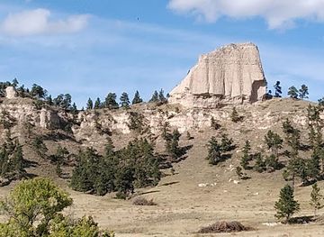
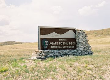
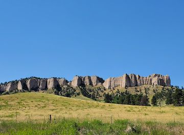
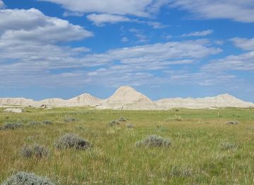
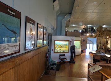
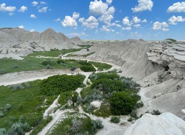
The Panhandle’s attractions combine geological formations, frontier history, public parks and working landscapes. Scotts Bluff National Monument is the region’s most prominent natural and historical site, with trails and views over the North Platte Valley along a route used by nineteenth-century emigrants. Chimney Rock National Historic Site, near Bayard, preserves another celebrated trail landmark. Around the Pine Ridge, Fort Robinson State Park offers historic buildings, trails, scenic drives and outdoor recreation, while Chadron State Park provides access to wooded ravines and upland scenery. Toadstool Geologic Park, in the north-west, is known for eroded formations and a short interpretive trail, and Agate Fossil Beds National Monument protects a scientifically important fossil landscape. Alliance’s Carhenge provides a very different, deliberately modern roadside monument. Wildlife viewing, hiking, horseback riding, camping and photography are available across the public parks and grasslands, but many sites are separated by long drives and should be planned as regional excursions rather than a single compact sightseeing circuit.
-
Tourist attraction
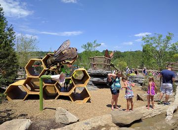
Omaha's Henry Doorly Zoo and Aquarium
Explore Omaha's Henry Doorly Zoo and Aquarium, a top-rated destination filled with diverse wildlife, interactive exhibits, and stunning marine life experiences.
-
Tourist attraction
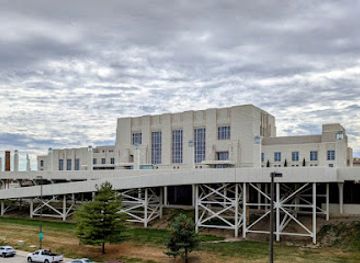
The Durham Museum
Experience the captivating history of Omaha and the Midwest at The Durham Museum, a stunning Art Deco gem filled with engaging exhibits and rich stories.
-
Tourist attraction
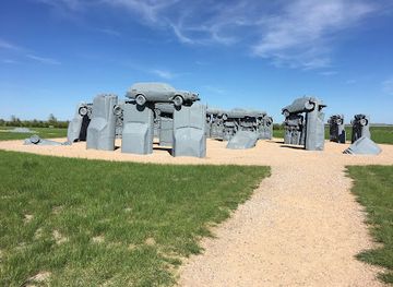
Carhenge
Discover Carhenge in Alliance, Nebraska—a whimsical tribute to Stonehenge crafted from vintage cars, blending art and history in a unique roadside attraction.
-
Tourist attraction
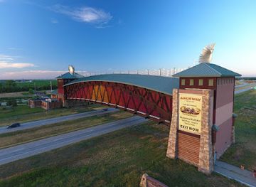
Great Platte River Road Archway Monument
Explore the Great Platte River Road Archway Monument, a historic tribute to American pioneers, and immerse yourself in the stories of the westward expansion.
Best landmarks in Panhandle
Scotts Bluff is the Panhandle’s defining landmark, a prominent bluff rising above the North Platte Valley and long used as a visual guide by Indigenous travellers and emigrants on the overland trails. Chimney Rock, a tall volcanic-ash spire near Bayard, became one of the most recognisable markers of westward migration and remains a symbol of the Oregon, California and Mormon trails. In the Pine Ridge, the historic buildings and wooded setting of Fort Robinson express the region’s military, Indigenous and ranching histories, while the escarpments around Chadron and Crawford give the landscape a markedly different character from the valley floor. Toadstool Geologic Park’s eroded clay formations are a natural landmark of the northern Panhandle, and Carhenge near Alliance is a distinctive contemporary landmark built from automobiles rather than stone. Together these places show how geology, movement, conflict, settlement and modern regional identity have shaped the Panhandle’s visual character.
-
State park
Fort Robinson State Park
Explore Fort Robinson State Park, a stunning blend of history, hiking, and wildlife in Nebraska's breathtaking landscapes.
-
Monument
Agate Fossil Beds National Monument
Discover the ancient treasures and breathtaking landscapes at Agate Fossil Beds National Monument in Nebraska, a hidden gem for nature and history lovers.
-
Museum
Fort Robinson Museum & History Center
Explore Fort Robinson Museum & History Center in Crawford, Nebraska, a captivating blend of history, culture, and scenic beauty for all ages.
-
National forest
Oglala National Grassland
Discover the breathtaking landscapes and diverse wildlife of Oglala National Grassland, a hidden gem in Nebraska perfect for outdoor enthusiasts.
Explore Panhandle on the map
Plan your trip on one map. See where the top cities, national parks and sights are, and book hotels and experiences in a few clicks.
Best hotels in Panhandle
Best restaurants in Panhandle
Dining in the Panhandle reflects the foodways of the Great Plains, with beef, burgers, steaks, fried chicken, sandwiches, chilli, potatoes and substantial breakfasts common in cafés, diners and family restaurants. Scottsbluff and Gering offer the broadest range of dining, including Mexican and other American regional influences, while Alliance, Chadron, Sidney, Kimball and smaller communities provide dependable local options along the main routes. The North Platte Valley’s irrigated agriculture supports seasonal produce, and bakeries, farm stands and grocery stores can be useful for road meals and picnics. Rural bars and historic-style cafés often function as informal community meeting places rather than destinations for elaborate cuisine. Visitors should distinguish the Panhandle’s locally produced beef and agricultural goods from dishes that belong to the broader American West, but should still expect a relaxed, practical dining culture shaped by ranching, farming and long-distance travel.
-
Italian
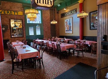
Spaghetti Works
Experience authentic Italian cuisine at Spaghetti Works in Downtown Omaha – where delicious spaghetti meets a warm atmosphere.
-
Steak
Round the Bend Steakhouse
Experience mouth-watering steaks and warm hospitality at Round the Bend Steakhouse in Ashland, Nebraska – a true culinary delight.
-
Steak
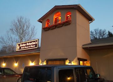
Brother Sebastian's Steakhouse
Experience Omaha's finest steaks at Brother Sebastian's Steakhouse - where quality meets exceptional service in an inviting atmosphere.
-
Family-friendly
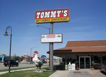
Tommy's Family Restaurant
Experience delightful breakfasts and comforting meals at Tommy's Family Restaurant in Grand Island – where every bite feels like home.
Best bars in Panhandle
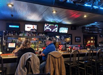
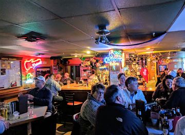
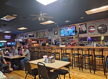
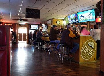
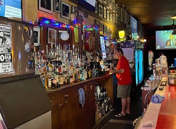
Evening life in the Panhandle is centred on traditional bars, casual restaurants, breweries and community venues rather than a large nightclub scene. Scottsbluff and Gering have the widest choice of places for a drink, dinner or occasional live music, while Alliance, Chadron, Sidney and other county-seat communities provide local bars and social venues. In smaller towns, evenings may be quiet outside community events, school or college activities and seasonal gatherings. Historic inns and rural watering holes can offer a sense of local place, but opening arrangements vary and late-night transport is limited. The region’s evening appeal is often tied to conversation, food, music and views across the open landscape rather than to a concentrated entertainment district, so visitors should arrange a safe return to their accommodation before heading into remote areas.
-
Grill
Steel Grill Restaurant & Bar
Experience a delightful fusion of flavors and a vibrant atmosphere at Steel Grill Restaurant & Bar in Gering, Nebraska.
-
Bar
The Union Bar and Grill
Discover the vibrant atmosphere and delicious food at The Union Bar and Grill in Gering, Nebraska, a must-visit for food lovers.
-
Grill
Wilds Bar & Grill
Experience the vibrant flavors of American cuisine at Wilds Bar & Grill in Chadron, Nebraska, perfect for travelers seeking a memorable meal.
-
Bar
Rustic Tavern
Experience the heart of Morrill at Rustic Tavern, a cozy bar serving hearty meals and local brews in a warm and inviting atmosphere.
Best nightclubs in Panhandle
Evening life in the Panhandle is centred on traditional bars, casual restaurants, breweries and community venues rather than a large nightclub scene. Scottsbluff and Gering have the widest choice of places for a drink, dinner or occasional live music, while Alliance, Chadron, Sidney and other county-seat communities provide local bars and social venues. In smaller towns, evenings may be quiet outside community events, school or college activities and seasonal gatherings. Historic inns and rural watering holes can offer a sense of local place, but opening arrangements vary and late-night transport is limited. The region’s evening appeal is often tied to conversation, food, music and views across the open landscape rather than to a concentrated entertainment district, so visitors should arrange a safe return to their accommodation before heading into remote areas.
-
Cocktail bar
Laka Lono Rum Club
Discover the vibrant atmosphere and unique rum cocktails at Laka Lono Rum Club in Downtown Omaha, where every night feels like a tropical getaway.
-
Bar
Zoo Bar
Experience the vibrant nightlife at Zoo Bar in downtown Lincoln, featuring live music, friendly service, and an extensive drink selection.
-
Bar
Bar 415
Discover the vibrant nightlife at Bar 415 in Downtown Omaha, where great drinks and a lively atmosphere await every visitor.
-
Bar
White Horse Tavern
Experience the rich history and vibrant atmosphere at White Horse Tavern, a beloved bar in Grand Island, Nebraska, perfect for relaxation and local culture.



Best shops in Panhandle
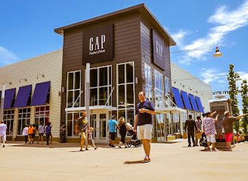
Shopping in the Panhandle is concentrated in the principal towns rather than in a continuous retail district. Scottsbluff and Gering provide the broadest selection of supermarkets, practical shops, galleries, antiques and locally oriented gifts, while Alliance, Chadron, Sidney, Kimball and other communities serve as smaller market centres. Visitors may find western clothing, ranch goods, books, artwork, handmade items and souvenirs connected with the overland trails, bluffs and fossil country. Local food shops and farm stands are useful for beef, baked goods, seasonal produce and provisions for road journeys, although availability follows the agricultural season. Art galleries and craft outlets can offer work inspired by the High Plains and Pine Ridge, but opening days and hours may be limited in smaller towns. Carhenge and the region’s heritage sites also provide interpretive and souvenir shopping, while repairing or supplying a vehicle should remain a priority before travelling into remote areas.
-
Shopping mall
Nebraska Crossing
Discover great deals and an incredible variety of stores at Nebraska Crossing, the ultimate outlet shopping destination in Gretna, Nebraska.
-
Gift shop
Fort Robinson Museum & History Center
Explore the captivating history and unique culture of Fort Robinson Museum & History Center, a treasure trove of Nebraska's past.
-
Park
Toadstool Geological Park and Campground
Discover the captivating beauty of Toadstool Geological Park and Campground, where unique rock formations meet the serene Nebraska landscape.
-
Gift shop
Cappuccino and Company
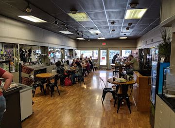
Discover the perfect blend of coffee, art, and local gifts at Cappuccino and Company, Scottsbluff's favorite café and creative hub.
Get your free copy of our complete guide to Panhandle, delivered straight to you.
Everything on this page, from attractions and restaurants to essentials and local phrases, in one PDF you can read offline, print or share.
Already have an account? Sign in
Your Panhandle guide is ready.
We'll send it to · Not you? Sign out

Getting your guide ready…
We are putting together a fresh copy of the Panhandle guide. This can take up to a minute.
This can take a few moments. If your browser asks, choose Allow so the download can start. You'll find the guide in your Downloads folder.
Nothing happened? Download it again
Sorry, the guide is taking longer than usual. Please try again in a minute, or get it by email instead.
Panhandle essentials
Currency and Payment
Safety
Emergency Situations
Do's and Don'ts
Local Tips
From Eve
Local phrases worth knowing
You don't need to get them perfect. A few words go a long way, and locals appreciate the effort.
Basics
| English | Local | Say it |
|---|---|---|
| Hello | Howdy | [Hau-dee] |
| Goodbye | See ya | [See yah] |
| Yes | Yep | [Yep] |
| No | Nope | [Nope] |
| Please/You're welcome | Sure thing | [Shoor thing] |
| Thank you | Thanks a lot | [Thangs a lot] |
| Excuse me/Sorry | Pardon me | [Pardon me] |
| How are you? | How's it going? | [How's it goin'?] |
| Fine. And you? | Good. You? | [Good. You?] |
| Do you speak English? | You speak English? | [You speak English?] |
| I don't understand | I ain't following | [I ain't followin'] |
Eating & Drinking
| English | Local | Say it |
|---|---|---|
| I'd like to see the menu, please | Can I see the menu? | [Can I see the menu?] |
| I don't eat meat | I ain't a meat eater | [I ain't a meat eater] |
| Cheers! | Cheers! | [Cheers!] |
| I would like to pay, please | Can I get the check? | [Can I get the check?] |
Emergencies
| English | Local | Say it |
|---|---|---|
| Help! | Help! | [Help!] |
| Go away! | Leave me alone! | [Leave me alone!] |
| Call the Police! | Call the cops! | [Call the cops!] |
| Call a doctor! | Get a doctor! | [Get a doctor!] |
| I'm lost | I'm turned around | [I'm turned around] |
| I'm ill | I'm not feeling well | [I'm not feelin' well] |
Shopping
| English | Local | Say it |
|---|---|---|
| I'd like to buy... | I want to buy... | [I want to buy...] |
| I'm just looking | Just browsing | [Just browsin'] |
| How much is it? | What’s the price? | [What’s the price?] |
| That's too expensive | That's way too pricey | [That's way too pricey] |
| Can you lower the price? | Can you make it cheaper? | [Can you make it cheaper?] |
Time & Numbers
| English | Local | Say it |
|---|---|---|
| What time is it? | What time ya got? | [What time ya got?] |
| It's one o'clock | It's one | [It's one] |
| Half past (10) | Half past ten | [Half past ten] |
| Morning | Morning | [Mornin'] |
| Afternoon | Afternoon | [Afternoon] |
| Evening | Evening | [Evenin'] |
| Yesterday | Yesterday | [Yesterday] |
| Today | Today | [Today] |
| Tomorrow | Tomorrow | [Tomorrow] |
| 1 | One | [One] |
| 2 | Two | [Two] |
| 3 | Three | [Three] |
| 4 | Four | [Four] |
| 5 | Five | [Five] |
| 6 | Six | [Six] |
| 7 | Seven | [Seven] |
| 8 | Eight | [Eight] |
| 9 | Nine | [Nine] |
| 10 | Ten | [Ten] |
Transport & Directions
| English | Local | Say it |
|---|---|---|
| Where's a/the...? | Where’s the nearest...? | [Where’s the nearest...?] |
| What's the address? | What’s the address? | [What’s the address?] |
| Can you show me (on the map)? | Can you point it out? | [Can you point it out?] |
| When's the next (bus)? | When's the next bus? | [When's the next bus?] |
| A ticket (to ....) | A ticket to... | [A ticket to...] |
History of Panhandle
Indigenous Great Plains Heritage
The Panhandle has long been part of the homelands and travel networks of Indigenous peoples, including the Lakota, Cheyenne and Arapaho, as well as communities connected to earlier archaeological traditions. The region’s rivers, springs, grasslands and Pine Ridge provided routes, resources and seasonal environments. Visitors should understand that later accounts of westward expansion describe only one chapter of a much longer human history. Archaeological and fossil sites in the Panhandle also demonstrate that both people and animals have occupied these landscapes over immense periods of time.
Fur Trade and Frontier Forts
During the nineteenth century, the North Platte corridor became important to traders, migrants and the United States Army. Fort Robinson, established in 1874 near the Pine Ridge, guarded routes and supported military operations during a period of conflict and forced displacement. It later became associated with the Red Cloud Agency and with the confinement and death of Northern Cheyenne people during the 1879 Fort Robinson outbreak. The surviving buildings and surrounding park provide an opportunity to examine military, Indigenous and ranching histories together rather than treating the fort solely as a frontier monument.
The Great Overland Trails
The North Platte Valley was a major corridor for emigrants travelling west along the Oregon, California and Mormon trails. Chimney Rock served as a widely recognised navigational landmark, while Scotts Bluff marked a difficult passage through the bluffs before the route continued towards Wyoming. Thousands of travellers passed through during the great migration to the American West in the mid-nineteenth century. Their diaries and trail remains reveal the physical demands of the journey, although the movement also accelerated settler expansion into Indigenous territories.
Railways and Settlement
Railway construction transformed the Panhandle in the late nineteenth century, linking agricultural communities to national markets and encouraging the growth of towns such as Alliance, Sidney, Scottsbluff and Kimball. Rail lines carried settlers, livestock, farm produce and manufactured goods, while railway companies influenced town locations and regional commerce. The railway remains important to the identity of several Panhandle communities, even where passenger services have diminished. Many present-day roads and towns still reflect the geography established by the overland routes and the rail era.
Irrigation and Agricultural Change
The semi-arid climate made reliable water essential to large-scale agriculture. Irrigation development along the North Platte helped turn parts of the valley into productive farmland, supporting crops, livestock and communities in an environment otherwise dominated by grassland. The Bureau of Reclamation’s regional projects, including the North Platte irrigation system, formed part of a wider twentieth-century effort to manage western rivers. The contrast between irrigated fields in the valley and dry grasslands on the surrounding uplands remains one of the Panhandle’s defining geographical patterns.
Ranching, Conservation and Public Landscapes
Ranching became a major economic and cultural force across the Panhandle, particularly in the Pine Ridge, Wildcat Hills and surrounding grasslands. Some former military and ranch lands later entered public ownership or conservation management, creating parks and protected areas where historic structures, wildlife habitat and recreation coexist. Fort Robinson State Park, Chadron State Park, Scotts Bluff National Monument and the fossil sites each preserve different aspects of the region’s natural and human past. Contemporary conservation work increasingly considers grassland health, erosion, water use and habitat alongside tourism.
Panhandle in Photos
Browse through our photo collection highlighting the charm and character of the destination.
Neighbouring regions of Panhandle
The closest regions to Panhandle, if you have time for more than one.
-

-

-

-

-


Swipe for more regions
Explore more

Explore more of Nebraska
Discover Nebraska: A blend of rich history, diverse landscapes, and unique attractions in the heartland of America.
Explore Nebraska