

Sarangkot (Pokhara) Travel Guide - Free
Explore Sarangkot in Pokhara with Evendo's free guide. Find the best shops, historic streets, restaurants, and gems on web or mobile.


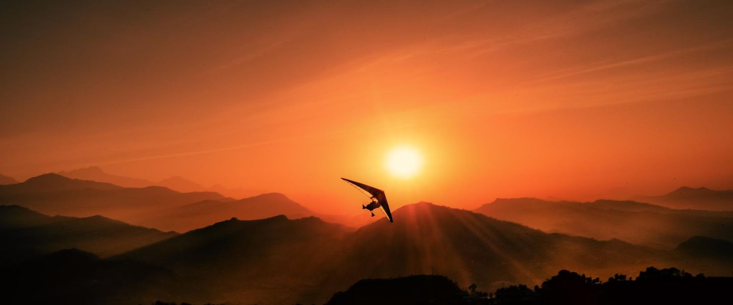


Sarangkot, Pokhara, pairs Himalayan sunrise views with paragliding, hill walks, village life and close panoramas of the Annapurna and Dhaulagiri ranges.
A Hilltop Above the Valley
Sarangkot occupies a high ridge on the northern edge of Pokhara, where a rural hill settlement has become one of Nepal’s best-known viewpoints. From the ridge, the land falls towards Phewa Lake and the Pokhara Valley, while the northern horizon opens towards the Annapurna range, Machhapuchhre, Dhaulagiri and the Lamjung Himal. On exceptionally clear mornings, the panorama stretches across several layers of snow-covered peaks; cloud, haze and changing light are equally characteristic of the view.Read more about Sarangkot
Sunrise, Flight and Village Life
Walking the Ridge
Best attractions in Sarangkot
Sarangkot’s central attraction is its elevated viewpoint, where the Pokhara Valley, Phewa Lake and Himalayan skyline form a changing panorama at sunrise and in clear afternoon light. The surrounding ridge provides additional outlooks without requiring a formal attraction: lanes pass terraced fields, forest patches, homes and small cafés, while the village setting offers a quieter counterpoint to Lakeside. Paragliding is another defining spectacle, with tandem flights launching from the hillside and gliding towards the valley below; visitors can watch from a safe distance or take part through an established operator. The Annapurna Cable Car, when operating, adds a scenic approach between Sedi and Sarangkot. Conditions are part of the experience, and mist or cloud may obscure the peaks, so the ridge’s rural landscape remains worthwhile even when the famous mountain view is hidden.
-
Tourist attraction
Sarangkot View Tower
Discover the breathtaking vistas of the Annapurna range at Sarangkot View Tower, a must-visit tourist attraction in Pokhara, Nepal.
2 min walk · 0.2 km from neighbourhood centre
-
Hiking area
Sarangkot View Point
Experience the breathtaking beauty of Sarangkot View Point, a hiker's paradise offering stunning views of the Himalayan range and thrilling paragliding adventures.
4 min walk · 0.3 km from neighbourhood centre
-
Tourist attraction
Haredanda View Point
Discover the breathtaking Haredanda View Point in Pokhara, where stunning Himalayan vistas and serene landscapes await your exploration.
10 min walk · 0.8 km from neighbourhood centre
-
Park
Sarangkot Waterfall
Discover the tranquil charm of Sarangkot Waterfall, a hidden gem in Pokhara offering breathtaking views and serene nature experiences.
4 min walk · 0.4 km from neighbourhood centre


Best landmarks in Sarangkot
Sarangkot’s most significant landmark is the ridge and its established viewpoint, a physical position that explains the settlement’s modern identity and its long relationship with the Pokhara Valley. The hillside launch area is another recognisable feature, linking the landscape to the growth of paragliding in Nepal. Traditional houses, terraced fields and small roadside shrines provide a more intimate record of the area’s rural character, although they are working parts of the community rather than museum displays. The Annapurna Cable Car infrastructure has become a contemporary landmark on the approach between Sedi and the ridge, subject to operating conditions. Together these elements show how Sarangkot has developed from a hill settlement into a tourism landscape without losing every trace of agriculture, local movement and ordinary village life.
-
Tourist attraction
Sarangkot View Tower
Experience the majestic Annapurna range and stunning sunrises at Sarangkot View Tower, a must-visit attraction in Pokhara, Nepal.
2 min walk · 0.2 km from neighbourhood centre
-
Tourist attraction
Sarangkot Sunrise Pokhara
Experience the mesmerizing sunrise views and thrilling paragliding adventures at Sarangkot, Pokhara, a nature lover's paradise in Nepal.
12 min walk · 1.0 km from neighbourhood centre
-
Hiking area
Sarangkot View Point
Experience the stunning sunrise and panoramic views of the Himalayas at Sarangkot View Point, a hiker's paradise near Pokhara, Nepal.
4 min walk · 0.3 km from neighbourhood centre
-
Tourist attraction
Haredanda View Point
Discover the stunning panoramic views of the Annapurna range at Haredanda View Point in Pokhara, a must-visit destination for nature lovers and photographers.
10 min walk · 0.8 km from neighbourhood centre


Explore Sarangkot on the map
A handpicked selection of must-see spots in Sarangkot, mapped for you.
Best hotels in Sarangkot
Best restaurants in Sarangkot
Sarangkot’s food scene is modest and closely connected to its guesthouses, cafés and small family-run eateries rather than a concentrated restaurant quarter. Menus commonly cater to trekkers and viewpoint visitors with Nepali staples such as dal bhat, momos and noodle dishes alongside tea, coffee, eggs, toast and other familiar travel fare. Some accommodation providers serve meals, which can be practical because the ridge is spread out and evening transport is less convenient than in Pokhara’s Lakeside district. The setting is often as important as the menu: hillside terraces and balconies look towards the valley, although cloud can change the view quickly. Visitors should expect a smaller range of ingredients and facilities than in central Pokhara, carry cash for smaller establishments and ask about meal availability in advance when staying in a quieter part of the ridge.
-
Restaurant
Green View Restaurant
Discover breathtaking views and delicious cuisine at Green View Restaurant in Pokhara, where every meal becomes a memorable experience.
1 min walk · 0.1 km from neighbourhood centre
-
Restaurant
Annapurna Cafe 360
Discover Annapurna Cafe 360: where delectable dishes meet breathtaking views of the iconic Annapurna mountain range.
5 min walk · 0.4 km from neighbourhood centre
-
Restaurant
Crony Cottage
Experience authentic Nepali cuisine at Crony Cottage in Pokhara, where local flavors meet stunning mountain views.
1 min walk · 0.1 km from neighbourhood centre
-
Lunch
Logs Bar & Restaurant
Experience delightful flavors at Logs Bar & Restaurant in Pokhara - where local cuisine meets global tastes in a cozy setting.
2 min walk · 0.1 km from neighbourhood centre


Best bars in Sarangkot
Sarangkot is a quiet hillside neighbourhood rather than a nightlife district, and there are no comparable concentrations of bars or nightclubs to Pokhara’s Lakeside area. Evenings generally centre on guesthouse dining rooms, hotel terraces and small cafés where visitors share tea, simple meals and views of the lights spreading across the valley. Some accommodation may serve beer or other drinks, but availability and licensing vary, so it is best to confirm locally rather than assume city-style service. The early sunrise culture also shapes the rhythm of the ridge: many guests turn in early, and noise carries readily around rural homes and hillside properties. Visitors seeking live music, late bars or a broader choice of evening entertainment will find more established options back in Lakeside, not within Sarangkot itself.
-
Bar
Feel Great Bar
Unwind and experience the vibrant nightlife of Pokhara at Feel Great Bar, where great drinks meet lively ambiance.
6 min drive · 2.1 km from neighbourhood centre
-
Bar
Sunset view & Shiva temple
Experience breathtaking sunsets and spiritual serenity at the Sunset view & Shiva temple in Pokhara, a true treasure of Nepal's natural beauty and culture.
6 min walk · 0.5 km from neighbourhood centre
-
Bar
Harpan Khola Sunset Point
Experience the stunning sunsets and serene ambiance at Harpan Khola Sunset Point in Pokhara, a perfect retreat for travelers seeking natural beauty and relaxation.
6 min drive · 1.9 km from neighbourhood centre
-
Irish pub
Branigan's Irish Pub
Discover the heart of Ireland in Pokhara at Branigan's Irish Pub, where every meal is a celebration of flavor and friendship.
7 min drive · 2.5 km from neighbourhood centre


Best shops in Sarangkot
Shopping in Sarangkot is limited and practical, with small shops and cafés serving residents, drivers, hikers and visitors waiting for sunrise or paragliding flights. Expect bottled water, snacks, drinks and basic travel necessities rather than a dedicated market or a dense collection of boutiques. Some guesthouses and local businesses may offer small souvenirs or handmade items, but Sarangkot is not primarily a craft-shopping destination. The contrast with Pokhara’s Lakeside district is useful: Lakeside has the city’s broader choice of trekking equipment, clothing, books, handicrafts and souvenir shops, while Sarangkot’s retail life remains dispersed along the ridge and focused on immediate needs. Buying modest supplies locally can support family-run businesses, but visitors should obtain specialist trekking equipment, medicines and a wider range of gifts in Pokhara.
-
 Souvenir store
Holy Himalayan Souvenir
Explore the hidden gem of Pokhara, Holy Himalayan Souvenir, for unique artisanal crafts and authentic Himalayan treasures that celebrate local heritage.
1 min walk · 0.1 km from neighbourhood centre
-
Gourmet grocery store
Bikas Stores
Explore Bikas Stores in Sarangkot for a gourmet grocery experience that captures the essence of Nepali flavors and culinary delights.
1 min walk · 0.1 km from neighbourhood centre
-
Dress store
Neupane Niwas
Discover the essence of Nepali fashion at Neupane Niwas, where traditional and modern styles meet in the heart of Pokhara.
9 min walk · 0.7 km from neighbourhood centre
-
General store
TILIJA KIRANA SHOP
Discover local flavors and unique souvenirs at TILIJA KIRANA SHOP in Sarangkot, Pokhara - a must-visit for every traveler.
1 min walk · 0.1 km from neighbourhood centre

Sarangkot essentials
Getting There
Getting Around
Safety
Emergency Situations
Do's and Don'ts
Local Tips

From Eve
Local phrases worth knowing
You don't need to get them perfect. A few words go a long way, and locals appreciate the effort.
Basics
| English | Local | Say it |
|---|---|---|
| Hello | नमस्ते | [namaste] |
| Goodbye | फेरि भेटौं | [feri bhetau] |
| Yes | हो | [ho] |
| No | होइन | [hoin] |
| Please/You're welcome | कृपया | [krupaya] |
| Thank you | धन्यवाद | [dhanyabad] |
| Excuse me/Sorry | माफ गर्नुहोस् | [maaf garnuhos] |
| How are you? | तिमीलाई कस्तो छ? | [timilai kasto cha?] |
| Fine. And you? | ठिकै। तिमीले? | [thikai. timile?] |
| Do you speak English? | तिमी अंग्रेजी बोल्नुहुन्छ? | [timi angreji bolnuhunchha?] |
| I don't understand | मलाई बुझिन्न | [malai bujhinna] |
Eating & Drinking
| English | Local | Say it |
|---|---|---|
| I'd like to see the menu, please | कृपया मेन्यू हेर्न चाहन्छु | [krupaya menu hern chahanchu] |
| I don't eat meat | म भांसामा खाँदिन | [ma bhansa ma khandin] |
| Cheers! | चियर्स! | [cheers!] |
| I would like to pay, please | कृपया चुक्ती गर्न चाहन्छु | [krupaya chukti garn chahanchu] |
Emergencies
| English | Local | Say it |
|---|---|---|
| Help! | मदत गर्नुहोस्! | [madat garnuhos!] |
| Go away! | सरेनुहोस्! | [sarenuhos!] |
| Call the Police! | पुलिसलाई बोलाउनुहोस्! | [polis lai bolaunuhos!] |
| Call a doctor! | डाक्टरलाई बोलाउनुहोस्! | [daktar lai bolaunuhos!] |
| I'm lost | मलाई हराएको छ | [malai haraeko cha] |
| I'm ill | मलाई बिरामी छ | [malai birami cha] |
Shopping
| English | Local | Say it |
|---|---|---|
| I'd like to buy... | म खरिद गर्न चाहन्छु... | [ma kharid garn chahanchu...] |
| I'm just looking | म सिर्जना गर्दैछु | [ma sirjana gardaichu] |
| How much is it? | यसको मुल्य कति हो? | [yasko mulya kati ho?] |
| That's too expensive | यो धेरै महँगो छ | [yo dherai mahango cha] |
| Can you lower the price? | मूल्य हटाउन सक्छौ? | [mulya hataun sakchau?] |
Time & Numbers
| English | Local | Say it |
|---|---|---|
| What time is it? | कति बजेको छ? | [kati bajeko cha?] |
| It's one o'clock | एक बजेको छ | [ek bajeko cha] |
| Half past (10) | दस बजे अर्धा गएको छ | [das baje ardha gayeko cha] |
| Morning | बिहान | [bihan] |
| Afternoon | दिउँसो | [diunso] |
| Evening | साँझ | [sajh] |
| Yesterday | गतवार | [gatwar] |
| Today | आज | [aaj] |
| Tomorrow | भोलि | [bholi] |
| 1 | एक | [ek] |
| 2 | दुई | [dui] |
| 3 | तीन | [tin] |
| 4 | चार | [char] |
| 5 | पाँच | [panch] |
| 6 | छ | [cha] |
| 7 | सात | [sat] |
| 8 | आठ | [aath] |
| 9 | नौ | [nau] |
| 10 | दस | [das] |
Transport & Directions
| English | Local | Say it |
|---|---|---|
| Where's a/the...? | ...कहाँ छ? | [...kaha cha?] |
| What's the address? | ठेगाना के हो? | [thegana ke ho?] |
| Can you show me (on the map)? | मलाई देखाउन सक्छौ? | [malai dekhaun sakchau?] |
| When's the next (bus)? | अर्को (बस) कहिले छ? | [arko (bas) kahile cha?] |
| A ticket (to ....) | टिकट (... लाई) | [ticket (... lai)] |
History of Sarangkot
A Rural Ridge Above Pokhara
Before Sarangkot became a major viewpoint and paragliding base, the ridge was primarily a rural settlement within the wider hill landscape north of Pokhara. Farming, footpaths and locally built houses shaped everyday life, while the elevated position connected the community visually to the valley and the Himalayan approaches beyond it. The slopes were cultivated in terraces where terrain allowed, and movement between settlements depended largely on hillside paths. Sarangkot’s importance therefore began as a place of habitation and agriculture rather than as a purpose-built tourist site.
Roads and the Growth of Tourism
Improved road access changed Sarangkot’s relationship with Pokhara, making the ridge reachable for visitors who previously had to rely more heavily on walking routes and local transport. Guesthouses, cafés and viewpoints followed, particularly as Pokhara developed into a base for trekking and mountain tourism. The area’s elevation and open views gave it a distinct role within the city’s visitor economy: it offered a rural hillside setting close to urban Pokhara without becoming a conventional city-centre district.
Paragliding and a New Identity
Paragliding added a new layer to Sarangkot’s local identity as the sport became established above Pokhara. The ridge’s launch slopes, reliable valley views and relationship with landing areas near the lake made it a natural centre for tandem flights and aerial instruction. Tourism now sits alongside older village life rather than replacing every aspect of it. The resulting landscape combines farm terraces, family homes, shrines and local roads with launch sites, accommodation and sunrise visitors, making the continuing balance between rural land use and tourism central to Sarangkot’s character.
Sarangkot in Photos
Browse through our photo collection highlighting the charm and character of the destination.
Neighbourhoods near Sarangkot
The closest neighbourhoods to Sarangkot, if you have time for more than one stop.
-

-

-

-


Swipe for more neighbourhoods
Explore more

Explore more of Pokhara
Pokhara, Nepal blends Phewa Lake, Himalayan views, sacred temples, mountain museums and outdoor adventures in a relaxed gateway to the Annapurna region.
Explore Pokhara