

Free Central Nevada Travel Guide & Mobile App
Explore Central Nevada with free travel guides. Discover regional history, expert tips, proposed trips, and audio guides on web or mobile app.


Explore Central Nevada's open basins, mountain ranges, mining towns, dark skies and high-desert roads between Austin, Eureka, Tonopah and Ely.
Read more about Central Nevada
Getting to and around Central Nevada
How to get there
Transportation
Top city travel guides in Central Nevada
The cities of Central Nevada, and the easiest places to base yourself.
-

-


Swipe for more cities
Destinations in Central Nevada
Resorts, valleys and scenic spots worth a trip of their own.
-

-

-

-


Swipe for more destinations
Best attractions in Central Nevada
Central Nevada's attractions are spread across a large high-desert landscape rather than concentrated in one resort centre. Historic US 50 links the former mining towns of Austin and Eureka, where preserved commercial buildings, courthouses, churches and local museums reveal the social infrastructure of silver-boom Nevada. Berlin-Ichthyosaur State Park combines a remarkably intact ghost town with a fossil site, while Great Basin National Park offers a very different experience of mountain trails, Lehman Caves, alpine scenery and ancient bristlecone pines. Around Ely, the Nevada Northern Railway Museum interprets the region's copper-mining railway heritage through locomotives, workshops and historic equipment. Outdoor visitors can explore public-land roads, hot springs, dark-sky viewpoints, bird habitat around mountain wetlands and hiking routes ranging from easy desert walks to demanding high-elevation trails. Archaeological and rock-art sites exist across the broader region, but many are protected or difficult to access and should be approached only according to official guidance. The attraction landscape is defined by geological contrast, working landscapes and remnants of mining history, with planning and self-sufficiency essential between stops.
-
National reserve
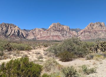
Red Rock Canyon National Conservation Area
Discover the stunning red rock formations and diverse wildlife of Red Rock Canyon National Conservation Area, a must-visit destination near Las Vegas.
-
State park
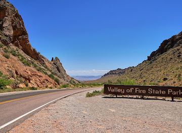
Valley of Fire State Park
Explore the stunning red rock formations and ancient history at Valley of Fire State Park, Nevada's oldest state park, perfect for adventure seekers and nature lovers.
-
National forest
Humboldt-Toiyabe National Forest
Explore the vast and diverse landscapes of Humboldt-Toiyabe National Forest, the largest national forest in the contiguous US, where adventure and serenity await.
-
Historical landmark
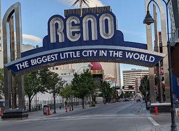
Reno Arch
Discover the vibrant history and culture of Reno at the iconic Reno Arch, a must-see historical landmark in Nevada's Biggest Little City.

Best landmarks in Central Nevada
Central Nevada's most recognisable landmarks express its mining history, geological structure and physical scale. Eureka's historic Main Street is lined with surviving nineteenth-century commercial and civic architecture, including the Eureka Opera House and the Eureka County Courthouse, making the town one of the region's clearest historic streetscapes. Austin's Stokes Castle, an unusual three-storey stone tower built by mining entrepreneur Anson Phelps Stokes, stands above the Reese River Valley as a memorable reminder of the town's silver era. Berlin-Ichthyosaur State Park preserves the fabric of a deserted mining settlement while adding the far older landmark of its ichthyosaur fossil beds. Near Ely, the Nevada Northern Railway's historic locomotives, workshops and railway buildings embody the industrial system that carried copper ore across the Great Basin. Farther east, the limestone terrain, Lehman Caves and high crest of Wheeler Peak give Great Basin National Park a powerful natural identity. Together these places show how Central Nevada's landmarks are not only monuments, but also evidence of extinct seas, mineral wealth, transport and survival in an arid interior.
-
Tourist attraction
Stokes Castle
Explore Stokes Castle in Austin, Nevada - a historical landmark showcasing Romanesque Revival architecture and breathtaking views of the surrounding landscape.

Explore Central Nevada on the map
Plan your trip on one map. See where the top cities, national parks and sights are, and book hotels and experiences in a few clicks.
Best hotels in Central Nevada
Best restaurants in Central Nevada
Dining in Central Nevada is shaped by small-town cafés, traditional American restaurants, hotel dining rooms, bars and rural establishments serving residents, travellers and working communities. In Austin, Eureka, Ely and Tonopah, expect practical meals such as burgers, sandwiches, steaks, soups, breakfast plates and baked goods rather than a dense restaurant scene. Historic mining and ranching connections are reflected in hearty portions, beef, potatoes and locally available produce, while contemporary menus vary according to the town and season. Ely's Basque heritage contributes to the wider town's food identity, although Basque cuisine is associated with Nevada more broadly rather than belonging exclusively to Central Nevada. Groceries and picnic supplies are useful for drives into remote valleys or Great Basin National Park, where dining choices are limited. Small cafés may keep different hours at weekends or in winter, and reservations or advance planning are sensible when visiting during festivals, holiday periods or popular outdoor seasons.
-
American
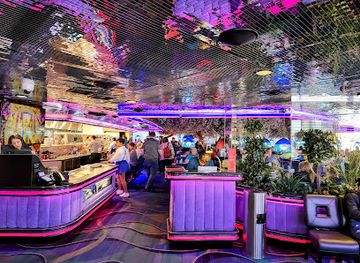
Peppermill and Fireside Lounge
Experience retro glamour at Peppermill and Fireside Lounge - where classic American cuisine meets vibrant nightlife on the Las Vegas Strip.
-
French
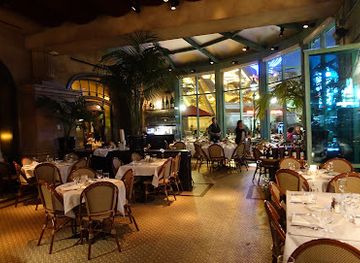
Mon Ami Gabi
Experience authentic French cuisine at Mon Ami Gabi in Las Vegas - where Paris meets the Strip with delightful dishes and vibrant atmosphere.
-
Steak
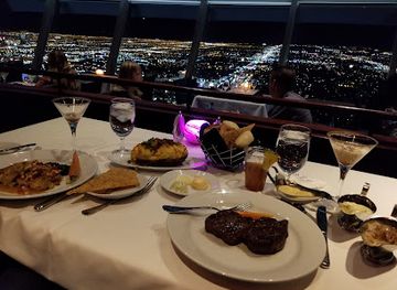
Top of the World
Experience fine dining at Top of the World with stunning panoramic views of Las Vegas while indulging in exquisite steak delicacies.
-
Grill
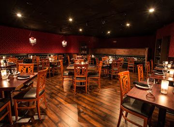
Herbs and Rye
Discover the art of grilling at Herbs and Rye - where classic steakhouse meets modern culinary excellence in Las Vegas.
Best bars in Central Nevada
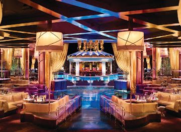
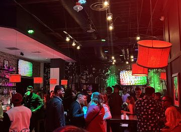
Nightlife in Central Nevada is modest and community-oriented, centred on traditional bars, hotel lounges, restaurants and long-established local gathering places rather than large clubs. Ely, Eureka, Austin and Tonopah provide the greatest concentration of evening options, with some venues combining drinks, food, gaming or occasional live entertainment. In smaller settlements, an early dinner, a quiet drink and conversation may be more typical than a late night, and opening arrangements can change with season and local demand. The region's breweries and bars, where available, fit into a wider Nevada tradition of informal social spaces rather than a defined nightlife circuit. Visitors should plan transport responsibly because distances are long, lighting is limited and taxis or rideshare services may not be readily available outside the larger towns. Stargazing, photography and quiet evening walks in town are important alternatives to organised nightlife.
-
American
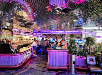
Peppermill and Fireside Lounge
Experience the iconic Peppermill and Fireside Lounge in Las Vegas, where classic American cuisine meets a vibrant cocktail bar atmosphere.
-
Bar
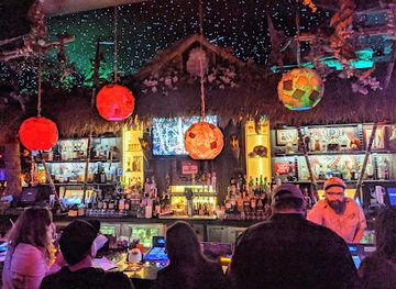
The Golden Tiki
Discover a tropical oasis in Las Vegas at The Golden Tiki, where vibrant cocktails and live music await in a lively atmosphere.
-
Pub
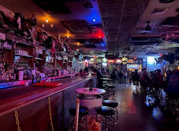
Hogs & Heifers Saloon
Discover the lively Hogs & Heifers Saloon, a historical pub in downtown Las Vegas, known for its vibrant atmosphere and interactive bartenders.
-
Bar
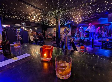
The Sand Dollar Lounge
Discover the vibrant nightlife of Las Vegas at The Sand Dollar Lounge, a cozy bar known for its cocktails and live music.
Best nightclubs in Central Nevada
Nightlife in Central Nevada is modest and community-oriented, centred on traditional bars, hotel lounges, restaurants and long-established local gathering places rather than large clubs. Ely, Eureka, Austin and Tonopah provide the greatest concentration of evening options, with some venues combining drinks, food, gaming or occasional live entertainment. In smaller settlements, an early dinner, a quiet drink and conversation may be more typical than a late night, and opening arrangements can change with season and local demand. The region's breweries and bars, where available, fit into a wider Nevada tradition of informal social spaces rather than a defined nightlife circuit. Visitors should plan transport responsibly because distances are long, lighting is limited and taxis or rideshare services may not be readily available outside the larger towns. Stargazing, photography and quiet evening walks in town are important alternatives to organised nightlife.
-
Night club
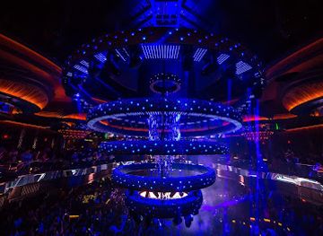
OMNIA Nightclub
Discover the ultimate nightlife experience at OMNIA Nightclub, where top DJs, luxurious ambiance, and unforgettable moments await in Las Vegas.
-
Night club
XS Nightclub
Experience the ultimate nightlife at XS Nightclub, Las Vegas. Where luxury meets electrifying entertainment in an unforgettable setting.
-
Night club
La Jolla Nightclub
Dive into the pulsating nightlife of Las Vegas at La Jolla Nightclub, where music, dancing, and hookah create an unforgettable experience.
-
Night club
Raised By Wolves
Experience the electrifying nightlife at Raised By Wolves, Downtown Las Vegas' premier nightclub offering vibrant music, stunning visuals, and unforgettable nights.

Best shops in Central Nevada
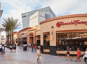
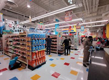
Shopping in Central Nevada is practical and locally focused, with small-town high streets, general stores, galleries, antiques outlets, bookshops, craft displays and museum shops providing more character than scale. Eureka and Austin are suited to browsing historic streets for locally made art, Western-themed goods, books, minerals and souvenirs connected with mining heritage, while Ely offers a broader range of everyday supplies and railway-related gifts. Tonopah serves as another useful stop for provisions and regional memorabilia. Farmers' markets and seasonal community events may offer baked goods, preserves, crafts or local produce, but their timing varies and should be checked before travelling. Good regional purchases include items linked to Great Basin landscapes, historic railways, geology and Nevada's ranching culture, provided fossils and archaeological objects are obtained legally and ethically. Do not remove rocks, artefacts or historic material from public land, mines or old town sites; choose established shops and galleries when buying locally produced goods.
-
Outlet mall
Las Vegas North Premium Outlets
Explore unbeatable discounts at Las Vegas North Premium Outlets, the ultimate shopping destination for fashionistas and bargain hunters alike.
-
Shopping mall
Grand Canal Shoppes at The Venetian Resort Las Vegas
Explore the Grand Canal Shoppes at The Venetian Resort Las Vegas for a unique blend of shopping, dining, and entertainment in a stunning Venetian-inspired setting.
-
Gift shop
Meow Wolf Las Vegas | Omega Mart
Dive into the surreal experience of Meow Wolf Las Vegas | Omega Mart, where art, imagination, and interactivity collide in a wondrous adventure.
-
Gift shop
Bonanza Gift Shop
Discover the ultimate gift shopping experience at Bonanza Gift Shop in Las Vegas, featuring unique souvenirs, clothing, and treasures.

Get your free copy of our complete guide to Central Nevada, delivered straight to you.
Everything on this page, from attractions and restaurants to essentials and local phrases, in one PDF you can read offline, print or share.
Already have an account? Sign in
Your Central Nevada guide is ready.
We'll send it to · Not you? Sign out

Getting your guide ready…
We are putting together a fresh copy of the Central Nevada guide. This can take up to a minute.
This can take a few moments. If your browser asks, choose Allow so the download can start. You'll find the guide in your Downloads folder.
Nothing happened? Download it again
Sorry, the guide is taking longer than usual. Please try again in a minute, or get it by email instead.
Central Nevada essentials
Currency and Payment
Safety
Emergency Situations
Do's and Don'ts
Local Tips
From Eve
Local phrases worth knowing
You don't need to get them perfect. A few words go a long way, and locals appreciate the effort.
Basics
| English | Local | Say it |
|---|---|---|
| Hello | Howdy | [/ˈhaʊ.di/] |
| Goodbye | See ya | [/siː jə/] |
| Yes | Yep | [/jɛp/] |
| No | Nah | [/nɑː/] |
| Please/You're welcome | Sure thing | [/ʃʊr θɪŋ/] |
| Thank you | Thanks a lot | [/θæŋks ə lɑt/] |
| Excuse me/Sorry | Pardon me | [/ˈpɑːr.dən mi/] |
| How are you? | How's it going? | [/haʊz ɪt ˈɡoʊ.ɪŋ/] |
| Fine. And you? | Good, you? | [/ɡʊd, ju/] |
| Do you speak English? | You speak English? | [/ju spiːk ˈɪŋ.ɡlɪʃ/] |
| I don't understand | I ain't gettin' it | [/aɪ eɪnt ˈɡɛt.ɪn ɪt/] |
Eating & Drinking
| English | Local | Say it |
|---|---|---|
| I'd like to see the menu, please | Can I see the menu? | [/kæn aɪ siː ðə ˈmɛn.ju/] |
| I don't eat meat | I ain't eatin' meat | [/aɪ eɪnt ˈiː.tɪn miːt/] |
| Cheers! | Cheers! | [/tʃɪrz/] |
| I would like to pay, please | Can I get the bill? | [/kæn aɪ ɡɛt ðə bɪl/] |
Emergencies
| English | Local | Say it |
|---|---|---|
| Help! | Help! | [/hɛlp/] |
| Go away! | Get lost! | [/ɡɛt lɔst/] |
| Call the Police! | Call the cops! | [/kɔl ðə kɑps/] |
| Call a doctor! | Get a doc! | [/ɡɛt ə dɑk/] |
| I'm lost | I'm turned around | [/aɪm tɜrnd əˈraʊnd/] |
| I'm ill | I'm not feelin' good | [/aɪm nɑt ˈfiː.lɪn ɡʊd/] |
Shopping
| English | Local | Say it |
|---|---|---|
| I'd like to buy... | I wanna buy... | [/aɪ ˈwɑː.nə baɪ/] |
| I'm just looking | Just browsing | [/dʒʌst ˈbraʊ.zɪŋ/] |
| How much is it? | What’s it cost? | [/wʌts ɪt kɔst/] |
| That's too expensive | That’s too pricey | [/ðæts tuː ˈpraɪ.si/] |
| Can you lower the price? | Can you bring down the price? | [/kæn ju brɪŋ daʊn ðə praɪs/] |
Time & Numbers
| English | Local | Say it |
|---|---|---|
| What time is it? | What time we got? | [/wʌt taɪm wi ɡɑt/] |
| It's one o'clock | It's one | [/ɪts wʌn/] |
| Half past (10) | Half past ten | [/hæf pæst tɛn/] |
| Morning | Mornin' | [/ˈmɔrn.ɪn/] |
| Afternoon | Afternoon | [/ˌæf.tərˈnun/] |
| Evening | Evenin' | [/ˈiː.vən.ɪŋ/] |
| Yesterday | Yest'day | [/ˈjɛst.deɪ/] |
| Today | Today | [/təˈdeɪ/] |
| Tomorrow | Tomorrows | [/təˈmɔː.roʊ/] |
| 1 | One | [/wʌn/] |
| 2 | Two | [/tuː/] |
| 3 | Three | [/θriː/] |
| 4 | Four | [/fɔːr/] |
| 5 | Five | [/faɪv/] |
| 6 | Six | [/sɪks/] |
| 7 | Seven | [/ˈsɛv.ən/] |
| 8 | Eight | [/eɪt/] |
| 9 | Nine | [/naɪn/] |
| 10 | Ten | [/tɛn/] |
Transport & Directions
| English | Local | Say it |
|---|---|---|
| Where's a/the...? | Where's the...? | [/wɛrz ðə/] |
| What's the address? | What's the address? | [/wʌts ði əˈdrɛs/] |
| Can you show me (on the map)? | Can you point it out? | [/kæn ju pɔɪnt ɪt aʊt/] |
| When's the next (bus)? | When's the next bus? | [/wɛnʰs ðə nɛkst bʌs/] |
| A ticket (to ....) | A ticket to ... | [/ə ˈtɪk.ɪt tuː/] |
History of Central Nevada
Indigenous Homelands and Great Basin Lifeways
Central Nevada lies within the traditional homelands of Great Basin peoples, including Western Shoshone, Northern Paiute and Southern Paiute communities. For thousands of years, people adapted to an arid environment through seasonal movement, hunting, gathering and detailed knowledge of springs, plants and wildlife. Rock art, projectile points and other archaeological remains record long occupation, although such places are vulnerable and should not be disturbed. Indigenous history did not end with the arrival of settlers; contemporary tribal communities remain part of Nevada's cultural life and sovereignty.
Exploration, Trails and the Overland Era
Nineteenth-century expeditions and emigrant routes crossed the interior between the Sierra Nevada and the Great Salt Lake. The Pony Express and associated overland corridors helped establish a pattern of transport through the region, even where permanent settlement remained sparse. Routes followed reliable water and mountain passes, linking distant stations and settlements. The later alignment of US 50 broadly preserves the importance of east–west travel across this difficult terrain, though the modern road is not itself identical to every historic trail.
Silver Mining and the Rise of Boomtowns
Discovery of precious metals transformed Central Nevada during the nineteenth century. Austin grew after silver was found in the Reese River district in the 1860s, while Eureka became a major lead and silver centre and Belmont developed around mining in the Monitor Range. Towns gained hotels, newspapers, churches, civic buildings and businesses, but their fortunes depended on ore quality, transport costs and changing metal prices. Many communities declined when mines closed, leaving archaeological sites, surviving masonry and scattered ruins across the landscape.
Ranching, Railways and Regional Connections
Ranching became an enduring complement to mining, using valley hay meadows, mountain grazing and scarce water resources. Railways also reshaped the region by reducing the difficulty of moving ore, equipment and people across Nevada. The Nevada Northern Railway connected Ely's copper district with wider markets and remains one of the clearest surviving expressions of industrial rail history in the state. Roads and motor transport later replaced much of the railway network, but the region's settlements still reflect the corridors created by mining and transportation.
Preserving Mining and Fossil Heritage
Twentieth-century decline did not erase Central Nevada's earlier industries; it changed how their remains were understood and protected. Berlin-Ichthyosaur State Park preserves a mining settlement alongside fossils of ichthyosaurs, marine reptiles that lived in the Triassic seas covering the area long before Nevada became a desert. Historic courthouses, opera houses, railway equipment and mine structures elsewhere provide further evidence of the region's working past. Conservation has increasingly linked natural history, cultural landscapes and public access rather than treating them as separate stories.
Public Lands and High-Desert Conservation
Much of Central Nevada is public land managed for a combination of recreation, wildlife, grazing, conservation and mineral use. Great Basin National Park, established in 1986, protects a particularly diverse section of the Snake Range, from desert foothills to alpine environments. The park's bristlecone pines, caves and high peaks demonstrate the ecological variation compressed into Nevada's mountain ranges. Across the wider region, land-management decisions continue to shape access, roads, grazing, mining and the protection of archaeological and natural resources.
Central Nevada in Photos
Browse through our photo collection highlighting the charm and character of the destination.
Neighbouring regions of Central Nevada
The closest regions to Central Nevada, if you have time for more than one.
-

-
-

-

-


Swipe for more regions
Explore more

Explore more of Nevada
Discover Nevada: From the bright lights of Las Vegas to the tranquil beauty of Lake Tahoe, Nevada offers a unique blend of excitement and natural wonder.
Explore Nevada