
Discover the Scenic Trails of Hakarimata Summit
Explore the breathtaking Hakarimata Summit Hiking Track, a must-visit for adventure lovers in New Zealand's stunning Waikato region.
Hakarimata Summit Hiking Track offers breathtaking views and an exhilarating hiking experience for tourists seeking adventure in New Zealand's natural beauty. This trail is perfect for both seasoned hikers and casual walkers, featuring lush landscapes and a rich variety of flora and fauna. As you ascend, you'll be rewarded with stunning vistas of the Waikato region, making it a must-visit destination for outdoor enthusiasts.
A brief summary to Hakarimata Summit Hiking Track
- 2 Brownlee Ave, Ngāruawāhia, 3720, NZ
- Visit website
Local tips
- Wear sturdy hiking boots for better grip on the trails.
- Visit early in the morning to enjoy cooler temperatures and fewer crowds.
- Pack a picnic to enjoy at the summit while taking in the views.
- Check the weather forecast before your hike to ensure a safe and enjoyable experience.
- Bring a camera to capture the stunning vistas along the way.
Getting There
-
Car
If you are traveling by car, start by heading towards Ngāruawāhia, located approximately 30 minutes north of Hamilton. From Hamilton, take State Highway 1 (SH1) north. Once you reach the Ngāruawāhia exit, take the exit onto State Highway 39 (SH39) towards Ngāruawāhia. Continue on SH39 until you reach the intersection with Brownlee Avenue. Turn onto Brownlee Avenue, and follow it to the end where you will find the Hakarimata Summit Hiking Track car park at 2 Brownlee Avenue, Ngāruawāhia 3720. There are no parking fees.
-
Public Transportation
For those using public transport, start by taking a bus from Hamilton to Ngāruawāhia. Check the local bus schedules for the most convenient route as several services operate between these locations. Once you arrive in Ngāruawāhia, you will need to take a taxi or rideshare service to reach 2 Brownlee Avenue, as public transport does not directly serve the Hakarimata Summit Hiking Track. Taxi fares may vary, so it’s advisable to check quotes through local taxi services or rideshare apps.
-
Walking from Ngāruawāhia
If you're staying in Ngāruawāhia and prefer to walk, you can head towards the Hakarimata Summit Hiking Track from the town center. It is approximately a 2.5 km walk to the track entrance on Brownlee Avenue. Walk north on the main road until you reach the intersection with Brownlee Avenue, then turn left and follow it to the end where the car park is located. This option is free but requires a moderate level of fitness.
Discover more about Hakarimata Summit Hiking Track
Iconic landmarks you can’t miss
Landmark Homes - Hamilton & Waikato
11.8 km
Explore Landmark Homes in Hamilton & Waikato for exceptional custom home building solutions, showcasing innovative designs and craftsmanship.

Hamilton Grandview Heights
14.2 km
Explore the natural beauty and serene landscapes of Hamilton Grandview Heights, a tranquil park perfect for relaxation and outdoor activities.
Chartwell Park
15.1 km
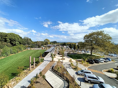
Discover tranquility at Chartwell Park, a lush green escape perfect for picnics, walks, and embracing nature's beauty in the heart of Chartwell.
Chartwell
15.1 km
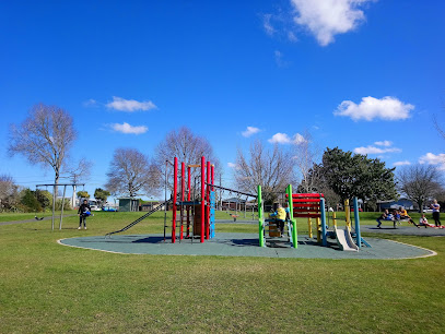
Explore the serene suburb of Chartwell in Hamilton, NZ - a perfect blend of residential charm and urban convenience for an unforgettable visit.

Event Cinemas Chartwell
15.5 km
Experience the magic of movies at Event Cinemas Chartwell in Hamilton, New Zealand, with state-of-the-art screens and comfortable seating options.

Chartwell Shopping Centre
15.6 km
Discover Chartwell Shopping Centre in Hamilton, NZ – a shopping haven with diverse stores, delightful dining, and family-friendly fun.

Donny Park
15.6 km
Explore the tranquil beauty of Donny Park in Chartwell, Hamilton - a perfect retreat for nature lovers and relaxation seekers.
The Kukutaaruhe Community Garden - Te Maara Haapori o Kukutaaruhe
16.1 km
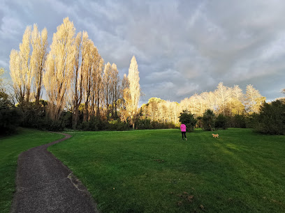
Explore the serene beauty of The Kukutaaruhe Community Garden in Hamilton, a peaceful oasis perfect for nature lovers and community enthusiasts.

Snell Drive Walkway
17.1 km
Experience the serenity of Snell Drive Walkway in Chartwell, Hamilton—an idyllic park perfect for leisurely walks, cycling, and enjoying nature's beauty.
Ninja Valley | Hamilton
17.7 km
Dive into adventure at Ninja Valley, Hamilton's top indoor playground, where fun and excitement await families and thrill-seekers of all ages.

Good George Dining Hall
18.0 km
Explore the vibrant flavors of Hamilton at Good George Dining Hall, a top dining destination offering craft beers, delicious meals, and a lively atmosphere.

Seddon Park
18.0 km
Discover the sporting spirit of Hamilton at Seddon Park, a premier cricket ground offering lush landscapes and thrilling live matches for all visitors.

Dame Hilda Ross Statue
18.7 km
Explore the Dame Hilda Ross Statue in Hamilton, a historical landmark celebrating women's contributions to New Zealand's rich heritage.
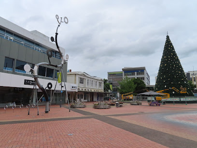
The Riverbank Lane
18.7 km
Discover Hamilton's vibrant market scene at The Riverbank Lane, where local produce, artisanal crafts, and unique finds await every visitor.
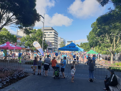
Frank N Furter's Lab
18.9 km
Experience the whimsical charm of Frank N Furter's Lab, a unique tourist attraction in Hamilton celebrating creativity and individuality.
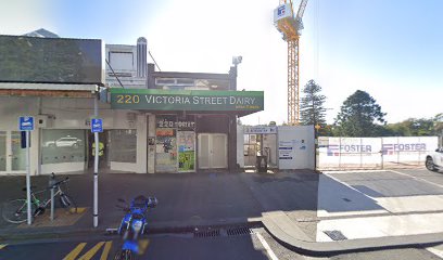
Unmissable attractions to see
Hakarimata Summit Tower
1.4 km
Experience breathtaking views and lush landscapes at Hakarimata Summit Tower, a premier scenic spot in New Zealand's Waikato region.
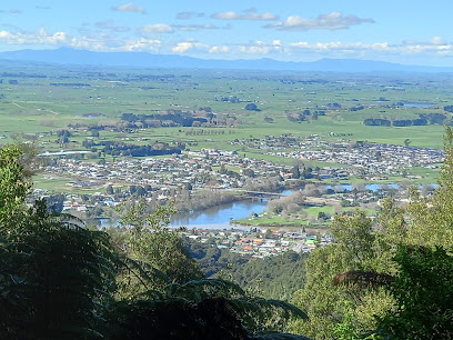
Hakarimata Rail Trail & Walkway
1.7 km
Discover the breathtaking Hakarimata Rail Trail & Walkway, a stunning blend of natural beauty, rich history, and breathtaking views in New Zealand.
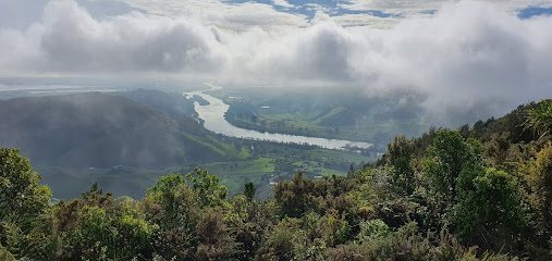
Kauri Loop Track
6.4 km
Experience the serene beauty of the Kauri Loop Track, where towering trees and stunning landscapes come together for an unforgettable hiking adventure in New Zealand.
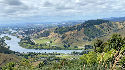
The Glen Afton Line - Heritage Railway (aka The Bush Tramway Club)
10.0 km
Discover the Glen Afton Line, a captivating heritage railway offering scenic rides and fascinating insights into New Zealand's rail history.
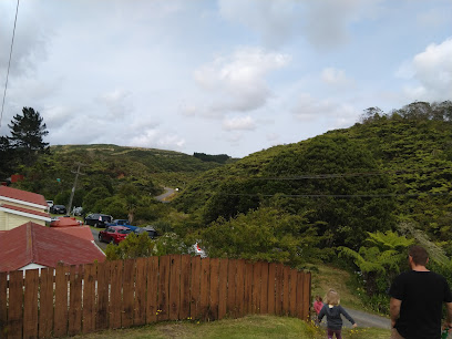
Huntly Museum
11.6 km
Explore Huntly Museum - A Journey Through the Rich History and Culture of New Zealand's Heritage.
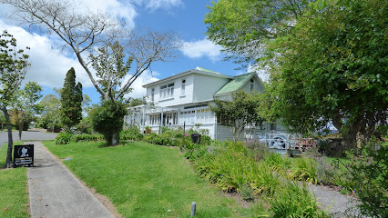
Munros Reserve
12.6 km
Experience the tranquility and natural beauty of Munros Reserve in Hamilton, New Zealand, a perfect escape for nature lovers and outdoor adventurers.
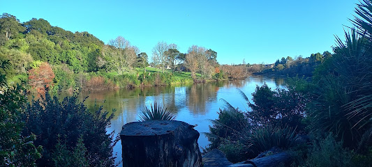
Karakariki Waterfall
13.3 km
Experience the natural beauty of Karakariki Waterfall, a stunning destination for nature lovers and adventure seekers in New Zealand's Waikato region.
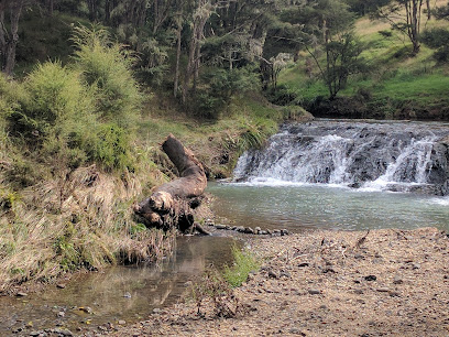
Woodlands Estate - Homestead, Gardens, Venue
13.7 km
Explore the enchanting beauty of Woodlands Estate, a historical venue in Taupiri with stunning gardens, a charming cafe, and versatile function spaces.
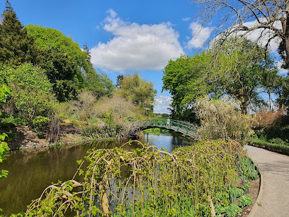
Cornerstone Alpacas Ltd.
13.8 km
Experience the charm of Cornerstone Alpacas Ltd. in Gordonton, where gentle alpacas invite you into their serene world surrounded by stunning landscapes.
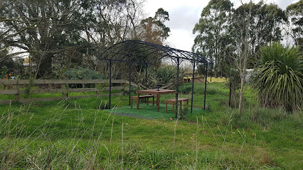
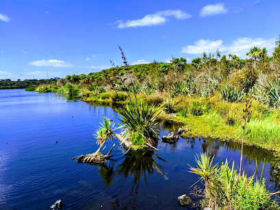
Waiwhakareke Natural Heritage Park
14.1 km
Discover the tranquility and biodiversity of Waiwhakareke Natural Heritage Park, a lush escape in Hamilton, New Zealand, perfect for nature lovers and outdoor adventurers.
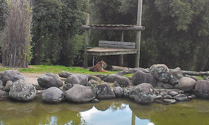
Hamilton Zoo
14.1 km
Discover the charm of Hamilton Zoo, a family-friendly animal park in New Zealand, perfect for wildlife enthusiasts and adventure seekers.
Zealong Tea Estate
14.6 km
Experience Zealong Tea Estate, New Zealand's premier destination for tea lovers, where lush gardens meet exquisite flavors in a tranquil setting.

Mangaiti Gully
14.7 km
Discover the tranquil beauty and rich birdlife of Mangaiti Gully, a hidden gem in Queenwood, Hamilton, perfect for nature lovers and outdoor enthusiasts.
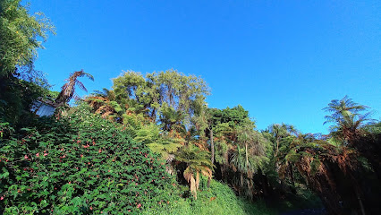
Swarbrick Landing
15.0 km
Explore Swarbrick Landing, a serene park in Hamilton perfect for picnics, nature walks, and enjoying picturesque riverside views.
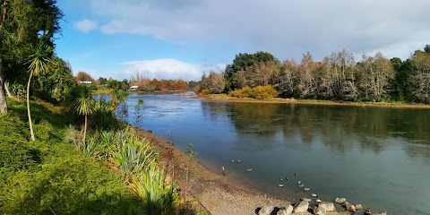
Waikato River Walk
15.2 km
Experience the breathtaking beauty of the Waikato River Walk in Hamilton, New Zealand—a perfect escape for nature lovers and outdoor enthusiasts.
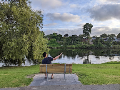
Essential places to dine
The Lookout Bar and Kitchen
11.7 km
Experience exquisite dining at The Lookout Bar and Kitchen in Hamilton, where stunning views meet exceptional local cuisine.
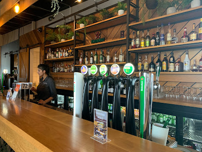
Foundation Bar
12.4 km
Discover Hamilton's culinary delight at Foundation Bar - where fresh ingredients meet innovative flavors in a vibrant gastropub setting.

Rainforest Malaysian Kitchen
13.7 km
Experience authentic Malaysian cuisine in Hamilton at Rainforest Malaysian Kitchen – a hidden gem filled with vibrant flavors and warm hospitality.

Good Neighbour
13.9 km
Discover Good Neighbour in Hamilton: A vibrant gastropub offering delicious local dishes and refreshing beverages in a welcoming atmosphere.

Lone Star Rototuna (Hamilton)
14.0 km
Experience the best of New Zealand's flavors at Lone Star Rototuna – where hearty meals meet warm hospitality in Hamilton.

The Keg Room
14.0 km
Experience culinary delights at The Keg Room – Hamilton's premier gastropub featuring gourmet pizzas and local craft beers in a friendly setting.

Camellia Restaurant at Zealong Tea Estate
14.3 km
Experience fine dining at Camellia Restaurant in Zealong Tea Estate – where exquisite cuisine meets stunning natural beauty.

Smith & McKenzie Steak House
15.5 km
Experience premium steaks and vibrant bar vibes at Smith & McKenzie Steak House in Hamilton - a must-visit for food lovers.

Hungry Wok
15.5 km
Experience the vibrant flavors of Asia at Hungry Wok in Hamilton—where every dish tells a story.

donburi bowl
15.5 km
Savor authentic Japanese donburi bowls filled with fresh ingredients at Hamilton's delightful eatery.

Buns and Rolls
15.6 km
Discover the rich flavors of Asia at Buns and Rolls in Hamilton – your destination for authentic Asian cuisine!

Maki mono
15.6 km
Savor the best fast food sushi and Asian dishes at Maki Mono in Hamilton - where quality meets convenience.

Burger King Chartwell
15.6 km
Discover Burger King Chartwell: A must-visit fast food spot in Hamilton offering delicious burgers at great prices.

Mex It Up (Chartwell)
15.6 km
Experience authentic Mexican flavors at Mex It Up in Chartwell Mall - where vibrant dishes meet warm hospitality.

Betra Kebabs
15.6 km
Discover authentic Middle Eastern flavors at Betra Kebabs in Hamilton - where every bite takes you on a culinary journey.

Markets, malls and hidden boutiques
Sew Unique NZ
0.6 km
Discover custom clothing at Sew Unique NZ, where artistry meets personal style in Ngāruawāhia's charming clothing store.

Leena Spices
1.5 km
Discover a world of flavors at Leena Spices, Ngāruawāhia's premier destination for exotic spices and Asian groceries.

Te AWA
12.5 km
Discover Te AWA, Hamilton's vibrant shopping mall, offering a diverse range of stores, dining experiences, and family-friendly activities.

Acquisitions - The Base
12.5 km
Discover unique, locally crafted gifts at Acquisitions - The Base in Hamilton, a haven for tourists seeking authentic New Zealand souvenirs.

The Base
12.6 km
Explore The Base in Hamilton, New Zealand – a shopping paradise with diverse stores and delicious dining options for all tastes.

The Base Outlet
12.8 km
Discover The Base Outlet in Hamilton, where shopping meets dining and entertainment in a vibrant and welcoming atmosphere.

Spotlight Hamilton
15.1 km
Explore Spotlight Hamilton for a treasure trove of crafting supplies, home goods, and creative inspiration in the heart of Te Rapa.

That PopUp Shop
15.1 km
Explore That PopUp Shop in Chartwell for unique crafts and local artistry reflecting the best of New Zealand's creativity.

Chiq Boutique
15.2 km
Discover unique fashion pieces at Chiq Boutique in Queenwood, Hamilton, where style meets elegance in a charming shopping experience.

Cotton On
15.6 km
Explore the latest styles at Cotton On in Hamilton, your go-to clothing store for trendy apparel and unique fashion accessories.

Forever New Chartwell
15.6 km
Explore a stylish selection of women's clothing at Forever New Chartwell for chic and elegant fashion that never goes out of style.

Smiggle Chartwell
15.6 km
Explore the colorful world of Smiggle Chartwell, your go-to destination for fun stationery, bags, toys, and unique gifts in Hamilton, New Zealand.

Country Road - Hamilton
15.6 km
Discover stylish clothing and home goods at Country Road - Hamilton, your ultimate fashion destination for men, women, and children.

Lorna Jane Hamilton
15.6 km
Discover Lorna Jane Hamilton for stylish women's activewear that blends fashion with performance, perfect for fitness lovers and everyday wear.

Jay Jays Chartwell
15.7 km
Explore the latest youth fashion trends at Jay Jays Chartwell, your go-to destination for stylish and affordable clothing in Hamilton.

Essential bars & hidden hideouts
Cock & Bull Hamilton
11.8 km
Experience the vibrant atmosphere of Cock & Bull Hamilton, a perfect pub for relaxation, hearty meals, and local brews in the heart of New Zealand.

Te Rapa Tavern-Sports Bar
14.1 km
Discover Te Rapa Tavern, Hamilton's top sports bar offering great food, drinks, and vibrant entertainment for an unforgettable night out.

The Local Te Rapa
14.1 km
Discover the vibrant culinary scene at The Local Te Rapa, where delicious grill options meet a lively sports bar atmosphere in Hamilton, New Zealand.

Brewaucracy Brewery & Taproom
14.5 km
Explore the best of Hamilton's craft brewing scene at Brewaucracy Brewery & Taproom, where every sip tells a story.

Still Working Bar
15.4 km
Discover Still Working Bar in Chartwell, Hamilton - your go-to spot for refreshing drinks and local vibes in a cozy atmosphere.

Manuka Wood Fired Pizza
15.5 km
Experience the authentic taste of wood-fired pizzas in Hamilton, New Zealand, at Manuka Wood Fired Pizza – a local favorite for pizza lovers.

TANK Chartwell- Smoothies, Raw Juices, Salads & Wraps
15.6 km
Discover TANK Chartwell: Your perfect stop for healthy smoothies, raw juices, and delicious salads in Hamilton's Westfield Chartwell.

TDO - The Dinsdale Office / Restaurant and Bar
17.5 km
Discover The Dinsdale Office in Hamilton – a charming grill and bar offering delicious dishes and a vibrant atmosphere for all occasions.

The Frankton Hotel (Aleways inn sports bar)
17.7 km
Experience the excitement of live sports and New Zealand hospitality at The Frankton Hotel, a premier sports bar and hotel in Hamilton.

Junction Station & Gaming
17.7 km
Discover the lively Junction Station & Gaming in Hamilton for a thrilling night of drinks and gaming in a vibrant atmosphere.

Hamilton Workingmen's Club Inc
17.7 km
Experience the vibrant community spirit at Hamilton Workingmen's Club, where leisure meets delicious dining and fun activities.

Jacz Sports Bar (Formerly THE QUADRANT )
18.6 km
Experience the vibrant atmosphere at Jacz Sports Bar in Hamilton Central, where delicious food and exciting sports come together.

Amuse Bar & Kitchen
18.7 km
Experience the vibrant atmosphere and exquisite flavors at Amuse Bar & Kitchen, a culinary gem in Hamilton Central, New Zealand.

The Local Taphouse
18.7 km
Experience the best of Hamilton's culinary scene at The Local Taphouse, where local brews and delicious dishes await.

LAST PLACE BAR
18.8 km
Discover Last Place Bar in Hamilton, where craft beers, gourmet burgers, and live music come together in a vibrant atmosphere.

Nightclubs & after hour spots
Memphis Rockers Rock & Roll Club
17.3 km
Discover the vibrant nightlife and electrifying music scene at the Memphis Rockers Rock & Roll Club in Dinsdale, Hamilton.
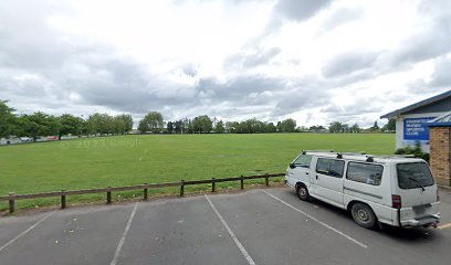
keetas Ally
18.2 km
Discover Hamilton's nightlife at Keetas Ally, where vibrant music and lively dance floors create unforgettable moments in the heart of the city.
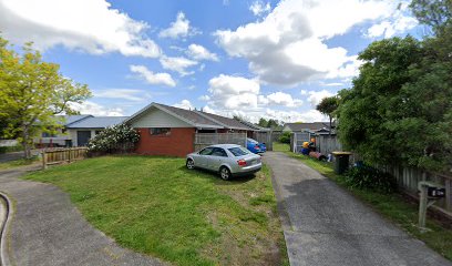
Hamilton Cosmopolitan Club
18.7 km
Discover the vibrant atmosphere of Hamilton Cosmopolitan Club, your go-to spot for dining, live music, and community events in Hamilton East, New Zealand.

The Book Club
18.9 km
Experience the vibrant nightlife at The Book Club in Hamilton, where great drinks and a lively atmosphere await you.

COYOTES HAMILTON
18.9 km
Discover the electrifying nightlife at Coyotes Hamilton, a vibrant bar offering a fantastic drink selection and unforgettable experiences.

Last Laugh Comedy Club
19.0 km
Discover the joy of laughter at Last Laugh Comedy Club, Hamilton's premier destination for comedy and entertainment.

Voltage - Nightclub & Bar
19.1 km
Experience the electrifying nightlife of Hamilton at Voltage, the city's premier nightclub and cocktail bar, where unforgettable moments await.

Hush Hush
19.1 km
Discover the vibrant nightlife at Hush Hush, Hamilton's premier adult entertainment club featuring engaging performances and a welcoming atmosphere.

Singeasy
19.7 km
Experience the joy of karaoke at Singeasy, Hamilton's vibrant bar where music, fun, and friendships come together for an unforgettable night.

Glow Worm Motel
65.8 km
Discover comfort and adventure at Glow Worm Motel, your perfect base for exploring the magical Waitomo Caves in New Zealand.

HUHU Cafe
66.5 km
Experience the flavors of New Zealand at HUHU Cafe in Waitomo, a perfect retreat for tourists exploring the enchanting caves and lush landscapes.
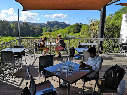
Tomo Bar & Eatery
66.6 km
Discover the culinary delights of Tomo Bar & Eatery, a hidden gem in Waitomo, serving fresh, local cuisine in a welcoming atmosphere.

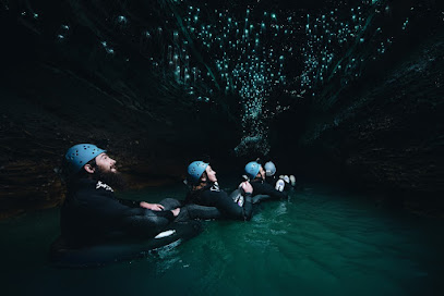
The Legendary Black Water Rafting Co, Waitomo
66.9 km
Experience the magic of Waitomo's glowworm caves with an exhilarating black water rafting adventure that unveils nature's wonders.
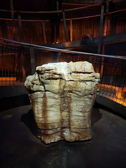
Ruakuri Cave Tours
67.6 km
Discover the magical Ruakuri Cave Tours in Waitomo, New Zealand, where glowworms twinkle and limestone formations astound visitors.
Waitomo Club Inc
74.6 km
Experience the vibrant essence of Te Kuiti at Waitomo Club Inc, where local flavors and a welcoming atmosphere await every traveler.


