

Free Aïr Mountains Travel Guide & Mobile App
Explore Aïr Mountains with free travel guides. Discover regional history, expert tips, proposed trips, and audio guides on web or mobile app.


Explore Niger’s Aïr Mountains for volcanic desert scenery, oasis valleys, ancient rock art and Tuareg heritage with expert local planning.
Read more about Aïr Mountains
When is the best time to visit Aïr Mountains?
Best: December–February · 24–26°C| Month | High (°C) | Rainfall (mm) |
|---|---|---|
| January (best) | 24 | 1 |
| February (best) | 26 | 1 |
| March | 30 | 2 |
| April | 33 | 3 |
| May | 37 | 4 |
| June | 40 | 6 |
| July | 41 | 8 |
| August | 40 | 8 |
| September | 37 | 6 |
| October | 33 | 4 |
| November | 28 | 2 |
| December (best) | 25 | 1 |
Getting to and around Aïr Mountains
How to get there
Transportation
Best landmarks in Aïr Mountains
The Aïr’s most recognisable landmarks are natural formations and archaeological landscapes rather than monumental buildings. The Bagzane massif rises as one of the region’s defining mountain groups, while Mont Greboun is associated with the northern part of the Aïr and marks the scale of the range’s volcanic and rugged terrain. Around Timia, cultivated valleys, palms and steep rock walls form a distinctive oasis landscape in which water has made permanent settlement possible. The ancient giraffe engravings at Dabous, in the wider Aïr–Ténéré desert landscape rather than a town within the mountains, are among the best-known visual markers of the region’s prehistoric heritage; their protected status and remoteness require specialist arrangements. More broadly, the Aïr and Ténéré Natural Reserve is a landmark of conservation importance, encompassing desert plains, mountain habitats and archaeological remains. These places matter because they reveal the region’s central themes: geological upheaval, changing Saharan climates, the scarcity of water and the long human history of movement through the desert.
-
 Mountain peak
I-n-Terza
Discover I-n-Terza, a breathtaking mountain peak in Niger, perfect for adventure seekers and nature lovers seeking stunning views and tranquility.
-
Mountain peak
Asia
Discover the breathtaking mountain peaks of Asia, where nature's beauty and cultural richness come together in a stunning landscape.
-
Plateau
I-n-Tadedes
Discover the breathtaking vistas and unique landscapes of I-n-Tadedes Plateau, a serene escape in the heart of Niger, perfect for nature lovers and adventurers.
-
Plateau
I-n-Tasra
Discover the stunning I-n-Tasra Plateau in Niger, a natural wonder filled with breathtaking vistas, rich biodiversity, and vibrant local culture.
Explore Aïr Mountains on the map
Plan your trip on one map. See where the top cities, national parks and sights are, and book hotels and experiences in a few clicks.
Best hotels in Aïr Mountains
Best restaurants in Aïr Mountains
Dining in the Aïr is shaped by expedition logistics, oasis hospitality and the food culture of northern Niger rather than by a developed restaurant scene. In Agadez, the regional gateway outside the mountains, visitors may find simple restaurants and cafés serving dishes such as rice with meat or vegetables, sauces, grilled meat, couscous-style preparations and sweet tea, while local markets provide fruit, bread and other supplies. Within the Aïr, meals are usually arranged by a host, camp team or guide and may rely on grains, pulses, dates, dried foods and fresh produce grown around oases such as Timia. Dates, milk and tea have particular practical importance in Saharan hospitality, although customs differ between households and communities. Visitors should discuss dietary needs before departure, carry suitable emergency provisions and avoid wasting scarce water or food. A meal shared in an oasis home is a social encounter, not a staged attraction, so accept invitations respectfully and follow the host’s lead on photography, seating and conversation.
-
Restaurant
La Cabane
Experience authentic Nigerien flavors at La Cabane, a must-visit restaurant in Niamey offering a diverse menu and inviting atmosphere.
-
Restaurant
Côté Jardin
Experience exceptional dining at Côté Jardin in Niamey, where local flavors meet international cuisine in a charming setting.
-
Restaurant
Cap Banga
Discover Cap Banga in Niamey: A vibrant restaurant and bar blending local flavors with international cuisine in an inviting atmosphere.
-
Restaurant
ALMINA Restaurant
Discover exquisite dining at ALMINA Restaurant in Niamey, offering a delightful blend of local flavors and international cuisine in an inviting atmosphere.


Best bars in Aïr Mountains
The Aïr has no conventional nightlife circuit, and evening life is centred on host communities, expedition camps and the quiet social rhythm of desert settlements. In Agadez, outside the mountains, cafés and informal eating places provide more opportunities for conversation and tea, but visitors should not expect a large club scene. Within the massif, evenings may involve shared meals, storytelling, music or discussion arranged through local hosts, with the setting shaped by darkness, weather and the need to conserve fuel and water. Alcohol is not central to local hospitality and may be inappropriate in some settings; visitors should follow local guidance and avoid importing assumptions from city nightlife. Night-time walks away from camp are unsafe without a guide because of terrain, navigation and security concerns. Keep noise low, use light sparingly near communities and wildlife, and treat any musical or cultural presentation as a genuine social exchange rather than an automatic entertainment service.
-
Restaurant
La Cabane
Explore the rich flavors of Niger at La Cabane, a vibrant restaurant in Niamey offering a blend of local and international cuisine.
-
Restaurant
New York Restaurant and Bar
Discover the fusion of local flavors and international cuisine at New York Restaurant and Bar in Niamey, a culinary gem for every traveler.
-
Restaurant
Cap Banga
Experience the vibrant flavors of Niger at Cap Banga, a popular restaurant and bar in Niamey, offering delicious local and international cuisine.
-
Bar
Le Patio Club
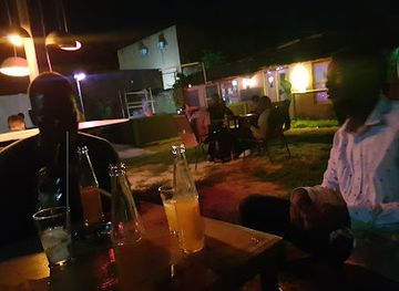
Experience the lively atmosphere of Le Patio Club in Niamey, a perfect spot for drinks and local flavors amidst a vibrant nightlife.


Best nightclubs in Aïr Mountains
The Aïr has no conventional nightlife circuit, and evening life is centred on host communities, expedition camps and the quiet social rhythm of desert settlements. In Agadez, outside the mountains, cafés and informal eating places provide more opportunities for conversation and tea, but visitors should not expect a large club scene. Within the massif, evenings may involve shared meals, storytelling, music or discussion arranged through local hosts, with the setting shaped by darkness, weather and the need to conserve fuel and water. Alcohol is not central to local hospitality and may be inappropriate in some settings; visitors should follow local guidance and avoid importing assumptions from city nightlife. Night-time walks away from camp are unsafe without a guide because of terrain, navigation and security concerns. Keep noise low, use light sparingly near communities and wildlife, and treat any musical or cultural presentation as a genuine social exchange rather than an automatic entertainment service.
-
Lounge
Sky Lounge
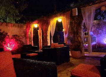
Experience the vibrant nightlife of Niamey at Sky Lounge, where relaxation meets entertainment in a chic setting.
-
Bar
Club Mooky
Discover the lively nightlife of Niamey at Club Mooky, where great drinks and vibrant music create unforgettable experiences.
-
Club
DIAM'S NIGHT CLUB
Discover the lively nightlife of Niamey at DIAM'S NIGHT CLUB, where music, dance, and culture come alive in a vibrant setting.
-
Night club
The on1e club
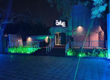
Discover the vibrant nightlife of Niamey at The On1e Club, where music, dance, and unforgettable memories await.

Best shops in Aïr Mountains
Shopping in the Aïr is limited and is usually connected with oasis communities, travelling markets and locally arranged visits rather than permanent retail districts. Agadez, outside the mountains and serving as the principal gateway, offers the broadest choice of practical supplies and regional handicrafts. Visitors may encounter Tuareg-style leatherwork, metal objects, jewellery, woven goods, knives, mats and desert textiles, although quality, provenance and cultural meaning vary and should be discussed respectfully. Dates and other oasis produce may be available seasonally around settlements such as Timia, while tea, spices and durable food are useful purchases before a remote expedition. Bargaining can form part of market transactions, but it should remain courteous and proportionate, particularly when buying directly from craftspeople. Do not purchase archaeological material, rock fragments, protected wildlife products or anything suspected to have been taken from a heritage site. Carry cash in CFA francs, because card payment and reliable retail facilities cannot be expected beyond Agadez.
-
Store
Grand Market Niamey
Discover the heart of Niamey's commerce and culture at Grand Market Niamey, where vibrant colors, rich aromas, and local crafts await.
-
Grocery store
N'wala store
Experience the vibrant flavors of Niger at N'wala Store, your gateway to local groceries and culinary delights in Zinder.
-
Boutique
Ahlame Shop
Explore Ahlame Shop, a boutique treasure trove filled with handcrafted items and exceptional local artistry in an inviting atmosphere that delights every visitor.
-
Supermarket
Marjane Market
Discover the vibrant Marjane Market in Agadez, where locals shop for fresh produce, unique spices, and international favorites.


Get your free copy of our complete guide to Aïr Mountains, delivered straight to you.
Everything on this page, from attractions and restaurants to essentials and local phrases, in one PDF you can read offline, print or share.
Already have an account? Sign in
Your Aïr Mountains guide is ready.
We'll send it to · Not you? Sign out

Getting your guide ready…
We are putting together a fresh copy of the Aïr Mountains guide. This can take up to a minute.
This can take a few moments. If your browser asks, choose Allow so the download can start. You'll find the guide in your Downloads folder.
Nothing happened? Download it again
Sorry, the guide is taking longer than usual. Please try again in a minute, or get it by email instead.
Aïr Mountains essentials
Currency and Payment
Safety
Emergency Situations
Do's and Don'ts
Local Tips
From Eve
Local phrases worth knowing
You don't need to get them perfect. A few words go a long way, and locals appreciate the effort.
Basics
| English | Local | Say it |
|---|---|---|
| Hello | Sannu | [sahn-noo] |
| Goodbye | Sai anjima | [sigh an-jee-mah] |
| Yes | Eh | [eh] |
| No | A'a | [ah-ah] |
| Please/You're welcome | Don Allah | [dohn ah-lah] |
| Thank you | Na gode | [nah goh-deh] |
| Excuse me/Sorry | Yi hakuri | [yee hah-koo-ree] |
| How are you? | Lafiya lau? | [lah-fee-yah lah-oo] |
| Fine. And you? | Lafiya. Kai fa? | [lah-fee-yah. kye fah] |
| Do you speak English? | Kuna jin turanci? | [koo-nah jeen too-rah-n-see] |
| I don't understand | Ban fahimta ba | [bahn fah-heem-tah bah] |
Eating & Drinking
| English | Local | Say it |
|---|---|---|
| I'd like to see the menu, please | Zan so ganin menu, don Allah | [zahn soh gah-neen meh-noo, dohn ah-lah] |
| I don't eat meat | Ban ci nama ba | [bahn chee nah-mah bah] |
| Cheers! | Lafiya | [lah-fee-yah] |
| I would like to pay, please | Zan so biyan kudi, don Allah | [zahn soh bee-yahn koo-dee, dohn ah-lah] |
Emergencies
| English | Local | Say it |
|---|---|---|
| Help! | Taimako! | [tie-mah-koh] |
| Go away! | Tafi! | [tah-fee] |
| Call the Police! | Kira 'yan sanda! | [kee-rah yan sahn-dah] |
| Call a doctor! | Kira likita! | [kee-rah lee-kee-tah] |
| I'm lost | Na bata | [nah bah-tah] |
| I'm ill | Ina rashin lafiya | [ee-nah rah-sheen lah-fee-yah] |
Shopping
| English | Local | Say it |
|---|---|---|
| I'd like to buy... | Zan so in sayi... | [zahn soh een sigh-ee...] |
| I'm just looking | Ina kallon kawai | [ee-nah kah-lon kah-wai] |
| How much is it? | Nawa ne? | [nah-wah neh?] |
| That's too expensive | Wannan yana da tsada | [wah-nahn yah-nah dah tsah-dah] |
| Can you lower the price? | Za ka iya rage farashi? | [zah kah ee-yah rah-geh fah-rah-shee?] |
Time & Numbers
| English | Local | Say it |
|---|---|---|
| What time is it? | Wane lokaci ne? | [wah-neh loh-kah-chee neh?] |
| It's one o'clock | Karfe daya | [kar-feh dah-yah] |
| Half past (10) | Rabi bayan (10) | [rah-bee bye-ahn (deh-shee)] |
| Morning | Safiya | [sah-fee-yah] |
| Afternoon | Yamma | [yah-mah] |
| Evening | Dare | [dah-reh] |
| Yesterday | Jiya | [jee-yah] |
| Today | Yau | [yah-oo] |
| Tomorrow | Gobe | [goh-beh] |
| 1 | Daya | [dah-yah] |
| 2 | Biyu | [bee-yoo] |
| 3 | Uku | [oo-koo] |
| 4 | Hudu | [hoo-doo] |
| 5 | Biyar | [bee-yahr] |
| 6 | Shida | [shee-dah] |
| 7 | Bakwai | [bah-kwai] |
| 8 | Takwas | [tah-kwahs] |
| 9 | Tara | [tah-rah] |
| 10 | Goma | [goh-mah] |
Transport & Directions
| English | Local | Say it |
|---|---|---|
| Where's a/the...? | Ina ...? | [ee-nah ...?] |
| What's the address? | Menene adireshin? | [meh-neh-neh ah-dee-reh-sheen?] |
| Can you show me (on the map)? | Za ka iya nuna mini (a taswira)? | [zah kah ee-yah noo-nah mee-nee (ah tah-swee-rah)?] |
| When's the next (bus)? | Yaushe ne (bas) na gaba? | [yah-oo-sheh neh (bahs) nah gah-bah?] |
| A ticket (to ....) | Tikit (zuwa ...) | [tee-kit (zoo-wah ...)] |
History of Aïr Mountains
Saharan Climate Change and Early Pastoralism
The Aïr preserves evidence of profound environmental change. During wetter phases of the prehistoric Sahara, the mountains and surrounding plains supported grasses, lakes and wildlife that included cattle, giraffes and elephants. Rock art and engravings record hunters, herders and animals from these periods, while later images reflect the spread of pastoralism and changing routes across the desert. These remains are not simply isolated artworks: together they show how communities responded to climate, water and mobility over thousands of years.
Ancient Rock Art and Desert Exchange
Engravings and paintings found across the Aïr and adjacent Ténéré document successive populations whose lives were connected to wells, pasture and long-distance movement. The famous giraffe engravings at Dabous, in the wider Aïr–Ténéré landscape, belong to this broader archaeological heritage. Later inscriptions and artefacts point to increasingly organised desert exchange. Although the identities of many early societies remain uncertain, their surviving traces demonstrate that the region was a corridor of human movement rather than an empty wilderness.
Tuareg Settlement and Caravan Networks
Over the medieval and early modern periods, Tuareg confederations established enduring relationships with the Aïr’s mountains, valleys and oases. Communities combined pastoral mobility with cultivation around reliable water sources, while caravan routes linked the massif with Agadez, the central Sahara and markets farther south. Agadez became a major entrepôt outside the mountains, and the Aïr formed part of the social and economic world that sustained trans-Saharan commerce in salt, livestock, dates and other goods.
The Sultanate of Aïr and Agadez
The political history of the region is closely linked to the Sultanate of Aïr, whose authority was centred at Agadez but negotiated with Tuareg groups and oasis communities across the massif. Agadez’s historic mosque, palaces and old streets reflect the city’s role as a religious, commercial and political centre. Power was never simply imposed across the desert: influence depended on alliances, tribute, mobility and control of routes and water, making the Aïr a landscape of overlapping authorities.
Colonial Rule and the Reordering of the Sahara
French expansion into the central Sahara during the late nineteenth and early twentieth centuries disrupted existing political arrangements and caravan patterns. The Aïr was incorporated into French colonial administration after military resistance and negotiation, while new boundaries separated communities and routes that had previously operated across a much wider desert world. Colonial rule also redirected trade towards administrative centres and roads, beginning a long transformation in the region’s economy and political relationships.
Modern Niger and the Legacy of Uranium
After Niger gained independence in 1960, the wider Aïr region remained strategically important because of its position between the north and the country’s southern population centres. Uranium mining developed around Arlit, outside the central mountain landscapes, bringing roads, industrial employment and national revenue while also generating environmental and political debate. Later Tuareg rebellions and continuing insecurity affected movement throughout northern Niger. These modern pressures help explain why access to the Aïr today depends on current security conditions as much as on geography.
Aïr Mountains in Photos
Browse through our photo collection highlighting the charm and character of the destination.
Neighbouring regions of Aïr Mountains
The closest regions to Aïr Mountains, if you have time for more than one.
-
-

-

-

-


Swipe for more regions
Explore more

Explore more of Niger
Discover the untamed beauty of Niger – a land of desert wonders, rich traditions, and vibrant cultures, nestled in the heart of West Africa.
Explore Niger