

Free Devils Lake Basin Travel Guide & Mobile App
Explore Devils Lake Basin with free travel guides. Discover regional history, expert tips, proposed trips, and audio guides on web or mobile app.




Devils Lake Basin combines walleye fishing, prairie wildlife, Indigenous history and open-water recreation in north-eastern North Dakota.
Read more about Devils Lake Basin
Getting to and around Devils Lake Basin
How to get there
Transportation
Top city travel guides in Devils Lake Basin
The cities of Devils Lake Basin, and the easiest places to base yourself.
Swipe for more cities
Destinations in Devils Lake Basin
Resorts, valleys and scenic spots worth a trip of their own.

Swipe for more destinations
Best attractions in Devils Lake Basin
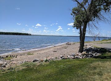
The core attraction is Devils Lake itself, a large, changing body of water known for boating, shoreline recreation and walleye fishing. Grahams Island State Park provides camping and access to the lake, while other designated ramps and public areas support anglers and paddlers. South of the main city, Fort Totten State Historic Site preserves a substantial nineteenth-century military and federal institutional complex, with interpreted buildings and grounds that explain military history, Spirit Lake Dakota history and the legacy of the Indian boarding-school system. Sullys Hill National Game Preserve adds a wildlife dimension, protecting rolling prairie, wooded slopes and habitat for bison, elk, deer and birds. The surrounding basin is also suitable for birdwatching, photography, scenic drives and quiet walks, particularly during migration seasons. In Devils Lake, local museums and civic institutions provide a useful introduction to settlement, farming and the town's relationship with the lake, although opening arrangements should be checked before visiting. The region's appeal lies in the relationship between water, prairie, wildlife and difficult history rather than in a dense concentration of conventional visitor attractions.
-
State park
Devils Lake State Parks
Explore the breathtaking landscapes and recreational wonders of Devils Lake State Park, a top destination for nature lovers in North Dakota.
-
Museum
Lake Region Heritage Center
Explore the cultural treasures of North Dakota at the Lake Region Heritage Center in Devils Lake, where history comes alive through unique exhibits and artifacts.
Best landmarks in Devils Lake Basin
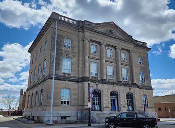
Devils Lake is the basin's defining natural landmark, its broad water surface and shifting shoreline embodying the unusual character of a closed-drainage lake. The name also appears in the region's civic and historical identity, though the lake's geography is more important than any single viewpoint. Fort Totten State Historic Site is the principal architectural landmark: its preserved military buildings, parade-ground setting and later institutional structures represent federal expansion, the presence of the Spirit Lake Dakota community and the painful history of Indigenous boarding schools. Grahams Island is a recognisable geographic feature within the lake and is associated with public recreation and changing water levels. Sullys Hill's wooded rise above the surrounding prairie creates another distinct visual landmark, contrasting with flatter farmland and wetlands. Around Devils Lake, grain elevators, railway infrastructure and the town's civic buildings provide reminders of the settlement and transport systems that made the community a regional centre. Together these places express the basin's natural, Indigenous, military, agricultural and modern identities.
-
Museum
Lake Region Heritage Center
Explore the rich cultural heritage of Devils Lake at Lake Region Heritage Center, where history and community come alive.
-
History museum
Cavalier County Dresden Museum
Explore the rich history of Langdon at the Cavalier County Dresden Museum, where local heritage comes alive through captivating exhibits and artifacts.
-
Museum
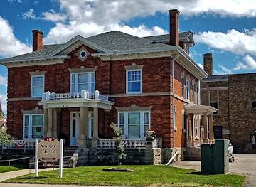
Sheriff's House Museum
Discover the captivating history of Devils Lake at the Sheriff's House Museum, where local stories come alive through fascinating exhibits and antiques.
-
 Historical landmark
Devil’s Lake Water Tower
Discover the historic charm of the Devil’s Lake Water Tower, a significant landmark in North Dakota showcasing local heritage and beautiful views.


Explore Devils Lake Basin on the map
Plan your trip on one map. See where the top cities, national parks and sights are, and book hotels and experiences in a few clicks.
Best hotels in Devils Lake Basin
Best restaurants in Devils Lake Basin
Dining in Devils Lake Basin is centred on the city of Devils Lake, with the surrounding rural area offering a smaller selection of cafés, family restaurants, bars and seasonal food services. Visitors can expect practical North American fare, breakfast cafés, burgers, sandwiches, pizza and steak alongside dishes associated with the wider Upper Midwest. Freshly caught walleye is a regional menu feature when available, although availability and preparation vary, and it should not be treated as a single fixed local recipe. The area's farms and grain country are reflected in menus built around beef, pork, potatoes, breads and seasonal produce. Coffee shops and informal diners are useful stops for travellers driving between the lake, parks and historic sites. Farmers' markets and local-goods outlets may offer preserves, baked items or regional produce at particular times of year, but schedules are seasonal. Dining options are more limited outside Devils Lake, so visitors exploring the basin should plan meals and supplies rather than relying on spontaneous restaurant stops.
-
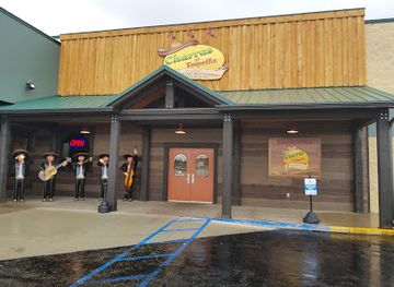
Mexican
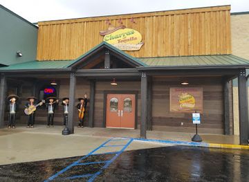
Anna's Cocina & Tequila
Discover authentic Mexican cuisine and an extensive tequila selection at Anna's Cocina & Tequila in Devils Lake.
-
American
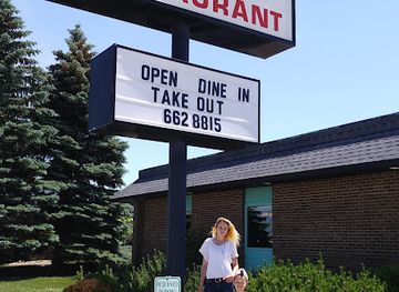
Mr & Mrs J's Restaurant
Discover comfort food at its finest in Devils Lake at Mr & Mrs J's Restaurant - perfect for breakfast lovers seeking local flavors.
-
American
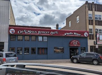
Old Main Street Cafe
Experience the charm of Old Main Street Cafe in Devils Lake—your go-to destination for delicious American breakfasts and comfort food.
-
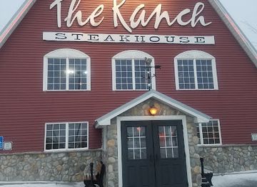
Steak
Ranch Steakhouse
Experience the finest steaks at Ranch Steakhouse in Devils Lake – where flavor meets tradition in a warm and welcoming atmosphere.
Best bars in Devils Lake Basin
Evening life in Devils Lake Basin is modest and community-oriented rather than built around a large club scene. Devils Lake provides the broadest choice of bars, pubs, casual restaurants and places to watch sport, while smaller communities generally rely on local taverns, social clubs or restaurant bars. Traditional North Dakota bar culture tends to emphasise conversation, food and community gatherings rather than elaborate nightlife districts. Live music and seasonal events may occur, but programmes and opening arrangements change and should be checked locally. After dark, the surrounding countryside is better suited to quiet stargazing and listening to prairie night sounds than to organised entertainment; visitors should avoid trespassing and observe park or private-land restrictions. Alcohol service follows United States licensing laws, and responsible transport is particularly important where distances between rural locations are substantial.
-
Mexican
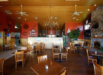
Anna's Cocina & Tequila
Discover authentic Mexican flavors and an extensive tequila selection at Anna's Cocina & Tequila in Devils Lake, ND, a perfect spot for food lovers.
-
American
Mr & Mrs J's Restaurant
Discover the flavors of American breakfast at Mr & Mrs J's Restaurant in Devils Lake, ND, where hearty meals and warm hospitality await.
-
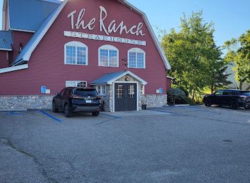
Steak
Ranch Steakhouse
Experience the ultimate steak dining at Ranch Steakhouse, where every bite is a delicious journey in Devils Lake, North Dakota.
-
Grill
Proz Lakeside
Discover the perfect blend of stunning lakeside views and delectable grill cuisine at Proz Lakeside in Devils Lake, ND.
Best nightclubs in Devils Lake Basin
Evening life in Devils Lake Basin is modest and community-oriented rather than built around a large club scene. Devils Lake provides the broadest choice of bars, pubs, casual restaurants and places to watch sport, while smaller communities generally rely on local taverns, social clubs or restaurant bars. Traditional North Dakota bar culture tends to emphasise conversation, food and community gatherings rather than elaborate nightlife districts. Live music and seasonal events may occur, but programmes and opening arrangements change and should be checked locally. After dark, the surrounding countryside is better suited to quiet stargazing and listening to prairie night sounds than to organised entertainment; visitors should avoid trespassing and observe park or private-land restrictions. Alcohol service follows United States licensing laws, and responsible transport is particularly important where distances between rural locations are substantial.
-
Cocktail bar
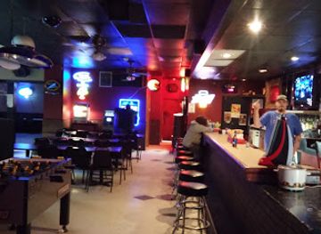
Nellie's Bar & Lounge
Discover the lively atmosphere of Nellie's Bar & Lounge, a must-visit cocktail bar in Devils Lake, North Dakota, for unforgettable drinks and good times.
Best shops in Devils Lake Basin
Shopping is concentrated in Devils Lake, where practical high-street businesses, supermarkets, outdoor retailers, gift shops and service establishments supply residents and visitors. Anglers can find tackle, licences and boating-related equipment through local retailers and outfitters, while travellers may also encounter clothing, souvenirs and locally themed gifts. The region does not have a major luxury-shopping district; its retail character is that of a small North Dakota service centre supporting a wide rural hinterland. Seasonal farmers' markets and community events may provide baked goods, preserves, produce, crafts and other locally made items, though dates and locations vary. Around the basin, independent shops and historic-site gift outlets can be useful for books, educational material and regional memorabilia. Visitors should buy food, fuel and specialist outdoor supplies in Devils Lake before heading to remote recreation areas, where retail choice is limited. Respect tribal sovereignty and local trading arrangements when purchasing items associated with Spirit Lake Nation communities, and ask about provenance rather than assuming that every Indigenous-themed product is locally made.
-
Department store
Walmart Supercenter
Discover convenience at Walmart Supercenter in Devils Lake, ND, where you can shop for groceries, clothing, electronics, and more—all in one place.
-
State park
Devils Lake State Parks
Discover the serene beauty and diverse activities at Devils Lake State Parks, North Dakota's stunning outdoor destination.
-
Furniture store
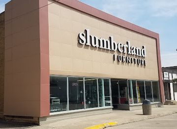
Slumberland Furniture
Explore a wide selection of stylish and comfortable furniture at Slumberland Furniture in Devils Lake, where quality meets affordability.
-
Shopping mall
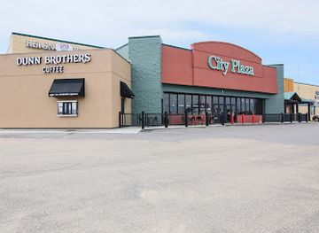
City Plaza
Discover a diverse shopping experience at City Plaza, the premier shopping mall in Devils Lake, North Dakota, featuring stores, dining, and business facilities.


Get your free copy of our complete guide to Devils Lake Basin, delivered straight to you.
Everything on this page, from attractions and restaurants to essentials and local phrases, in one PDF you can read offline, print or share.
Already have an account? Sign in
Your Devils Lake Basin guide is ready.
We'll send it to · Not you? Sign out

Getting your guide ready…
We are putting together a fresh copy of the Devils Lake Basin guide. This can take up to a minute.
This can take a few moments. If your browser asks, choose Allow so the download can start. You'll find the guide in your Downloads folder.
Nothing happened? Download it again
Sorry, the guide is taking longer than usual. Please try again in a minute, or get it by email instead.
Devils Lake Basin essentials
Currency and Payment
Safety
Emergency Situations
Do's and Don'ts
Local Tips
From Eve
Local phrases worth knowing
You don't need to get them perfect. A few words go a long way, and locals appreciate the effort.
Basics
| English | Local | Say it |
|---|---|---|
| Hello | Hey | [Hay] |
| Goodbye | See ya | [See yah] |
| Yes | Yep | [Yep] |
| No | Nah | [Nah] |
| Please/You're welcome | Sure thing | [Shur thing] |
| Thank you | Thanks | [Thangs] |
| Excuse me/Sorry | Pardon me | [Pardon me] |
| How are you? | How's it going? | [How's it goin'?] |
| Fine. And you? | Good. You? | [Good. You?] |
| Do you speak English? | You speak English? | [You speak English?] |
| I don't understand | I don’t get it | [I don’t get it] |
Eating & Drinking
| English | Local | Say it |
|---|---|---|
| I'd like to see the menu, please | Can I see the menu? | [Can I see the menu?] |
| I don't eat meat | I’m a vegetarian | [I’m a vegetarian] |
| Cheers! | Cheers! | [Cheers!] |
| I would like to pay, please | Can I get the check? | [Can I get the check?] |
Emergencies
| English | Local | Say it |
|---|---|---|
| Help! | Help! | [Help!] |
| Go away! | Leave me alone! | [Leave me alone!] |
| Call the Police! | Call the cops! | [Call the cops!] |
| Call a doctor! | Get a doctor! | [Get a doctor!] |
| I'm lost | I’m turned around | [I’m turned around] |
| I'm ill | I'm not feeling well | [I'm not feelin' well] |
Shopping
| English | Local | Say it |
|---|---|---|
| I'd like to buy... | I want to buy... | [I want to buy...] |
| I'm just looking | Just browsing | [Just browsing] |
| How much is it? | What's the price? | [What's the price?] |
| That's too expensive | That's pricey | [That's pricey] |
| Can you lower the price? | Can you give me a deal? | [Can you give me a deal?] |
Time & Numbers
| English | Local | Say it |
|---|---|---|
| What time is it? | What time? | [What time?] |
| It's one o'clock | It's one | [It's one] |
| Half past (10) | Half past ten | [Half past ten] |
| Morning | Morning | [Morning] |
| Afternoon | Afternoon | [Afternoon] |
| Evening | Evening | [Evening] |
| Yesterday | Yesterday | [Yesterday] |
| Today | Today | [Today] |
| Tomorrow | Tomorrow | [Tomorrow] |
| 1 | One | [One] |
| 2 | Two | [Two] |
| 3 | Three | [Three] |
| 4 | Four | [Four] |
| 5 | Five | [Five] |
| 6 | Six | [Six] |
| 7 | Seven | [Seven] |
| 8 | Eight | [Eight] |
| 9 | Nine | [Nine] |
| 10 | Ten | [Ten] |
Transport & Directions
| English | Local | Say it |
|---|---|---|
| Where's a/the...? | Where's the...? | [Where's the...?] |
| What's the address? | What’s the address? | [What’s the address?] |
| Can you show me (on the map)? | Can you point it out? | [Can you point it out?] |
| When's the next (bus)? | When’s the next bus? | [When’s the next bus?] |
| A ticket (to ....) | A ticket to... | [A ticket to...] |
History of Devils Lake Basin
Glacial Formation and the Closed Basin
Devils Lake Basin was shaped by the retreat of the last continental glaciers, which left depressions, moraines and wetlands across north-eastern North Dakota. Devils Lake occupies one of these depressions and is unusual because it has no natural surface outlet to a larger river system. Water levels therefore depend heavily on precipitation, evaporation and groundwater conditions. Earlier shorelines and exposed beach ridges record substantial changes in the lake's extent over time, while the surrounding wetlands have provided habitat for waterfowl and other prairie species.
Dakota Homeland and Indigenous Continuity
The basin lies within the historic homeland of Dakota peoples, whose relationships with the land, water and wildlife long predate United States settlement. The Spirit Lake Nation, formerly known in federal usage as the Devils Lake Sioux Tribe, remains a sovereign tribal nation with communities and lands in the region. Indigenous history is not confined to museum displays or the past: it continues through governance, community life, cultural practice and stewardship. Visitors should approach tribal places with respect and follow locally stated rules.
Fort Totten and the Nineteenth-Century Frontier
Fort Totten was established in 1867 on the southern side of Devils Lake during a period when the United States expanded military and administrative control across the northern Plains. The post formed part of a wider network intended to protect transport routes and assert federal authority. Its subsequent history was closely connected with the Spirit Lake Dakota community and with federal education policy. The preserved buildings at Fort Totten State Historic Site reveal both military architecture and the unequal power structures that shaped the region after the Civil War.
Railways, Settlement and Agricultural Development
Railway construction in the late nineteenth century strengthened Devils Lake's role as a regional centre and connected the basin with wider markets. The town developed as a place for trade, transport, government and services, while surrounding settlers converted portions of the prairie to agriculture. Grain farming, livestock and local commerce became central to the regional economy. The resulting landscape of fields, shelterbelts, farm roads and small communities remains a visible layer of the basin's history, alongside older Indigenous geographies and natural wetlands.
Federal Boarding-School History at Fort Totten
Fort Totten later became the site of the Fort Totten Indian Industrial School, one of the federal boarding schools established to assimilate Indigenous children and suppress their languages, cultures and family connections. The institution caused lasting harm in the Spirit Lake community and forms an essential part of the site's interpretation. Visiting the historic buildings with this context in mind gives a fuller understanding of the property than viewing it solely as a frontier military relic. The subject remains connected to wider national efforts to acknowledge boarding-school abuses.
The Rising Lake and Modern Basin Transformation
Devils Lake rose dramatically from the early 1990s into the 2010s after a prolonged period of wet conditions. Because the basin lacks a natural outlet, water spread across low-lying land, affected roads and properties and required major engineering responses, including diversion and water-management works. The episode altered shorelines, infrastructure and public understanding of the lake's volatility. It also reinforced the importance of checking current access information: the contemporary basin is a changing landscape rather than a fixed shoreline mapped once and permanently settled.
Devils Lake Basin in Photos
Browse through our photo collection highlighting the charm and character of the destination.
Neighbouring regions of Devils Lake Basin
The closest regions to Devils Lake Basin, if you have time for more than one.
-

-

-

-

-


Swipe for more regions
Explore more
Explore more of North Dakota
Discover the rugged beauty, rich history, and warm hospitality of North Dakota, the untamed frontier of the United States.
Explore North Dakota