

Free Red River Valley Travel Guide & Mobile App
Explore Red River Valley with free travel guides. Discover regional history, expert tips, proposed trips, and audio guides on web or mobile app.


Explore North Dakota's Red River Valley for fertile prairie landscapes, river cities, Indigenous and frontier history, museums and welcoming small-town culture.
Read more about Red River Valley
When is the best time to visit Red River Valley?
Best: June–August · 24–27°C| Month | High (°C) | Rainfall (mm) |
|---|---|---|
| January | -8 | 20 |
| February | -5 | 19 |
| March | 2 | 25 |
| April | 12 | 40 |
| May | 19 | 60 |
| June (best) | 24 | 75 |
| July (best) | 27 | 80 |
| August (best) | 26 | 75 |
| September | 21 | 60 |
| October | 13 | 45 |
| November | 3 | 30 |
| December | -4 | 25 |
Getting to and around Red River Valley
How to get there
Transportation
Top city travel guides in Red River Valley
The cities of Red River Valley, and the easiest places to base yourself.
-

-

-
 Devils Lake
, North Dakota, combines walleye fishing, prairie scenery, Dakota heritage, Fort Totten history and relaxed small-town sightseeing.
-

-


Swipe for more cities
Destinations in Red River Valley
Resorts, valleys and scenic spots worth a trip of their own.

Swipe for more destinations
Best attractions in Red River Valley
The Red River Valley's attractions combine working agricultural landscapes with museums, historic sites, urban culture and accessible outdoor recreation. Fargo provides the greatest concentration: the Plains Art Museum interprets regional, national and contemporary art, while the Red River Zoo focuses on species suited to northern climates and family-oriented visits. In nearby West Fargo, Bonanzaville preserves historic buildings and collections that explain settlement, farming, transport and community life in North Dakota. Grand Forks offers the North Dakota Museum of Art and cultural institutions connected with the University of North Dakota, as well as parks and trails shaped by the city's flood-recovery landscape. South of Fargo, the Wahpeton area leads towards Fort Abercrombie State Historic Site, where reconstructed buildings and interpretation examine military and frontier history. The valley's natural attractions are understated but rewarding: river corridors, prairie remnants, woodland patches, wetlands and broad skies support walking, cycling and birdwatching. State recreation areas and local parks are particularly appealing from late spring through early autumn, while winter brings snow-based activities and a very different visual character. Many sites are seasonal or have limited rural hours, so checking current arrangements is important.
-
National park
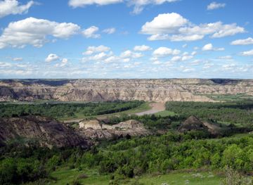
Theodore Roosevelt National Park
Discover the stunning landscapes and rich wildlife of Theodore Roosevelt National Park, a true gem of North Dakota's natural beauty.
-
Zoo
Red River Zoo
Discover the Red River Zoo, a conservation-focused attraction featuring northern wildlife and educational experiences in Fargo, North Dakota.
-
Historical landmark
World's Largest Buffalo Monument
Explore the World's Largest Buffalo Monument, a historic landmark in Jamestown, North Dakota, celebrating the legacy of the American West and its majestic buffalo.
-
Zoo
Roosevelt Park Zoo
Explore the enchanting Roosevelt Park Zoo in Minot, ND – a delightful destination for animal lovers and families, featuring diverse species and educational experiences.
Best landmarks in Red River Valley
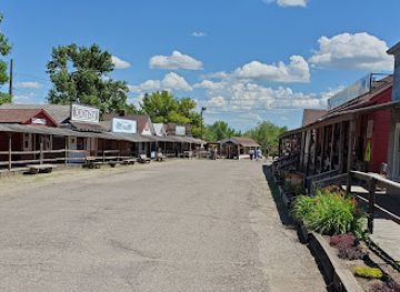
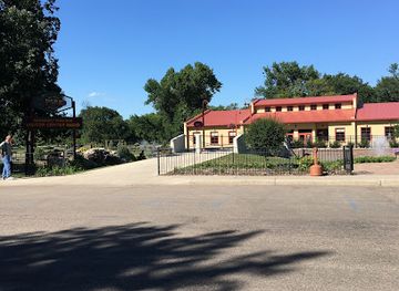
The Red River is the valley's defining natural landmark, a slow, north-flowing waterway whose course forms the North Dakota–Minnesota boundary for much of the region and whose flooding has shaped civic life. In Fargo, the Fargo Theatre is a notable surviving downtown cinema building and a symbol of the city's early commercial centre, while the historic blocks around Broadway preserve the scale of the railway-era city. Bonanzaville's collection of moved and reconstructed buildings is an important material record of North Dakota settlement and agricultural development. Near Wahpeton, Fort Abercrombie State Historic Site marks the location of an 1858 military post and connects the valley with the contested history of the northern frontier. Grand Forks's flood-protection landscape, including river parks and engineered embankments, is a modern civic landmark rather than a single monument: it expresses the lasting consequences of the 1997 flood and the region's efforts to live with the river. In the countryside, grain elevators, shelterbelts, straight roads and immense cultivated fields form a characteristic vernacular landscape, linking present-day farming with the valley's railway and commercial-agricultural past.
-
Zoo
Red River Zoo
Discover the enchanting Red River Zoo in Fargo, ND, where wildlife meets education in an unforgettable family-friendly adventure.
-
State park
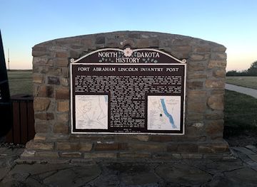
Fort Abraham Lincoln State Park
Discover the historical significance and natural beauty of Fort Abraham Lincoln State Park – an unmissable destination in North Dakota.
-
Local history museum
Bonanzaville USA
Discover the heart of North Dakota's past at Bonanzaville USA, a local history museum showcasing the region's rich culture and heritage.
-
Museum
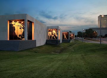
North Dakota Heritage Center & State Museum
Explore the North Dakota Heritage Center & State Museum, where the state's geological and cultural history comes alive through engaging exhibits and artifacts.


Explore Red River Valley on the map
Plan your trip on one map. See where the top cities, national parks and sights are, and book hotels and experiences in a few clicks.
Best hotels in Red River Valley
Best restaurants in Red River Valley
Dining in the Red River Valley reflects the region's farm economy and the broader food traditions of the northern Great Plains. Fargo has the widest range, from independent cafés, bakeries and breweries to contemporary restaurants using locally sourced grains, meat and seasonal produce. Grand Forks combines university-influenced dining with long-established American, Scandinavian and immigrant traditions, while Wahpeton and smaller communities are more likely to centre on family restaurants, cafés, taverns and rural establishments. Regional menus may feature wheat-based baking, locally grown vegetables, beef, pork and products from the valley's large-scale crop agriculture. Scandinavian and German-Russian influences are part of the area's cultural history, although they sit alongside contemporary American and international cooking rather than defining every meal. Farmers' markets and seasonal farm stands are useful places to encounter produce, preserves and baked goods. Tipping is customary in table-service restaurants, and listed prices generally exclude sales tax. In rural areas, dining choices can be separated by considerable distances, so plan meals around driving routes rather than assuming a full-service restaurant will be available in every small town.
-
Steak
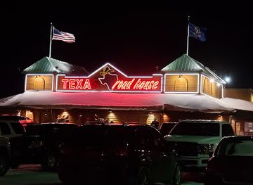
Texas Roadhouse
Experience authentic American cuisine at Texas Roadhouse in Grand Forks - where every meal is a celebration of flavor!
-
Breakfast
Kroll's Diner
Discover the heart of Fargo at Kroll's Diner—where classic American breakfasts meet German culinary traditions.
-
Chicken
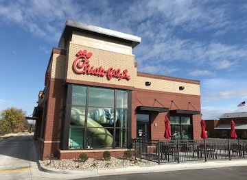
Chick-fil-A
Indulge in mouthwatering chicken delights at Chick-fil-A in Grand Forks - where flavor meets friendly service.
-
Breakfast
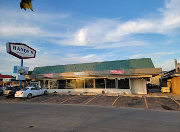
Randy's University Diner
Experience hearty breakfasts at Randy's University Diner in Fargo – where tradition meets flavor in a cozy setting.

Best bars in Red River Valley
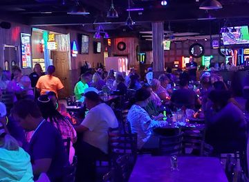
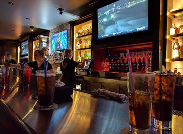
Evening life is concentrated in Fargo and Grand Forks, where a substantial student and professional population supports pubs, breweries, cocktail bars, live-music venues, restaurants and occasional late-night entertainment. Fargo's downtown has the broadest selection, with renovated commercial buildings providing settings for bars, cafés, music and theatre-oriented evenings. Grand Forks combines university nightlife with neighbourhood bars, restaurants and community performances, though the atmosphere varies with the academic calendar. Wahpeton and smaller valley towns generally offer a quieter pattern centred on local taverns, restaurants, breweries or seasonal events rather than a large club scene. Sporting fixtures, concerts and university programmes can make particular evenings busier, so visitors should check current listings. Alcohol purchase and service follow North Dakota law, identification may be required, and designated-driving or ride arrangements are sensible because rural distances and winter conditions can make late travel difficult.
-
Bar
JL Beers
Discover the vibrant atmosphere of JL Beers in Grand Forks, where gourmet burgers and craft beers create an unforgettable dining experience.
-
Grill
Parrot's Cay Tavern & Grill
Discover the flavors of the tropics at Parrot's Cay Tavern & Grill in Grand Forks, the perfect blend of grill and bar for every palate.
-
Casino
Southgate Casino Bar & Grill
Discover the perfect blend of gaming and American cuisine at Southgate Casino Bar & Grill in Grand Forks, ND.
-
Grill
The Hub Pub
Discover the cozy charm of The Hub Pub, a grill and bar in Grand Forks, offering delicious food and a friendly atmosphere for all visitors.

Best nightclubs in Red River Valley
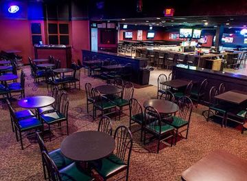
Evening life is concentrated in Fargo and Grand Forks, where a substantial student and professional population supports pubs, breweries, cocktail bars, live-music venues, restaurants and occasional late-night entertainment. Fargo's downtown has the broadest selection, with renovated commercial buildings providing settings for bars, cafés, music and theatre-oriented evenings. Grand Forks combines university nightlife with neighbourhood bars, restaurants and community performances, though the atmosphere varies with the academic calendar. Wahpeton and smaller valley towns generally offer a quieter pattern centred on local taverns, restaurants, breweries or seasonal events rather than a large club scene. Sporting fixtures, concerts and university programmes can make particular evenings busier, so visitors should check current listings. Alcohol purchase and service follow North Dakota law, identification may be required, and designated-driving or ride arrangements are sensible because rural distances and winter conditions can make late travel difficult.
-
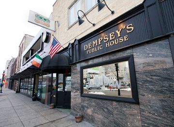
Irish pub
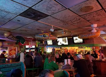
Dempsey's Public House
Dempsey's Public House: A lively Irish pub in Fargo with great food, live music, and a welcoming atmosphere for all visitors.
-
Bar
JL Beers
Discover the ultimate burger experience at JL Beers in Grand Forks, where craft beers and gourmet flavors come together in a vibrant setting.
-
Bar
The Windbreak
Experience the vibrant nightlife at The Windbreak in Fargo, ND, where live music and great drinks create unforgettable memories.
-
Lounge
Johnny's Lounge
Discover the lively atmosphere of Johnny's Lounge, where delicious food, refreshing drinks, and thrilling casino games come together in Grand Forks, ND.


Best shops in Red River Valley
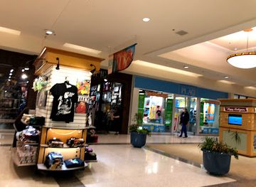
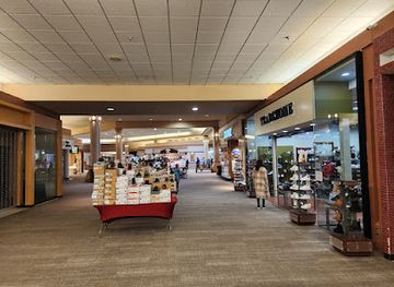
Fargo is the valley's principal shopping centre, with downtown independent shops, galleries, specialist retailers and larger commercial areas serving both North Dakota and nearby Minnesota communities. Its historic centre is the best place to combine retail browsing with cafés, restaurants and early commercial architecture. Grand Forks offers a mixture of downtown businesses, university-area shops, galleries and conventional retail, while Wahpeton and smaller towns provide practical local shopping rather than extensive destination retail. Farmers' markets and farm stands, particularly in the warmer months, are useful for seasonal produce, baked goods, preserves and locally made items. At museums and cultural venues, visitors may find books, regional art, craftwork and educational material connected with North Dakota history and Indigenous or prairie themes; these are generally more meaningful souvenirs than generic merchandise. Shopping hours and market schedules vary considerably outside the larger cities, and rural shops may close earlier or operate seasonally. Local food products, prairie-themed artwork and books about the Red River Valley make thoughtful purchases for visitors interested in the region's landscape and history.
-
Shopping mall
West Acres Mall
Experience the ultimate shopping and dining destination at West Acres Mall in Fargo, where retail therapy meets community spirit.
-
Shopping mall
Kirkwood Mall
Discover an exceptional shopping experience at Kirkwood Mall in Bismarck, ND, with diverse stores, dining options, and community events.
-
Shopping mall
Columbia Mall
Discover shopping, dining, and entertainment at Columbia Mall, Grand Forks' premier shopping destination with a vibrant atmosphere.
-
Shopping mall
Dakota Square Mall
Explore Dakota Square Mall in Minot, ND: Your ultimate shopping destination featuring diverse shops, dining, and family-friendly entertainment.

Get your free copy of our complete guide to Red River Valley, delivered straight to you.
Everything on this page, from attractions and restaurants to essentials and local phrases, in one PDF you can read offline, print or share.
Already have an account? Sign in
Your Red River Valley guide is ready.
We'll send it to · Not you? Sign out

Getting your guide ready…
We are putting together a fresh copy of the Red River Valley guide. This can take up to a minute.
This can take a few moments. If your browser asks, choose Allow so the download can start. You'll find the guide in your Downloads folder.
Nothing happened? Download it again
Sorry, the guide is taking longer than usual. Please try again in a minute, or get it by email instead.
Red River Valley essentials
Currency and Payment
Safety
Emergency Situations
Do's and Don'ts
Local Tips
From Eve
Local phrases worth knowing
You don't need to get them perfect. A few words go a long way, and locals appreciate the effort.
Basics
| English | Local | Say it |
|---|---|---|
| Hello | Howdy | [haʊdi] |
| Goodbye | See ya | [si jə] |
| Yes | Yup | [jʌp] |
| No | Nah | [nɑ] |
| Please/You're welcome | Sure thing | [ʃʊr θɪŋ] |
| Thank you | Thanks a lot | [θæŋks ə lɑt] |
| Excuse me/Sorry | Pardon me | [ˈpɑrdən mi] |
| How are you? | How's it going? | [haʊz ɪt ˈgoʊɪŋ] |
| Fine. And you? | Good. And you? | [ɡʊd. ənd ju] |
| Do you speak English? | Can you speak English? | [kæn ju spiːk ˈɪŋɡlɪʃ] |
| I don't understand | I don’t get it | [aɪ doʊnt ɡɛt ɪt] |
Eating & Drinking
| English | Local | Say it |
|---|---|---|
| I'd like to see the menu, please | Can I see the menu, please? | [kæn aɪ si ðə ˈmɛnju, pliz] |
| I don't eat meat | I’m a vegetarian | [aɪm ə ˌvɛdʒəˈtɛriən] |
| Cheers! | Cheers! | [ʧɪrz] |
| I would like to pay, please | Can I get the bill, please? | [kæn aɪ ɡɛt ðə bɪl, pliz] |
Emergencies
| English | Local | Say it |
|---|---|---|
| Help! | Help! | [hɛlp] |
| Go away! | Get lost! | [ɡɛt lɔst] |
| Call the Police! | Call the cops! | [kɔl ðə kɑps] |
| Call a doctor! | Get a doctor! | [ɡɛt ə ˈdɑktər] |
| I'm lost | I can’t find my way | [aɪ kænt faɪnd maɪ weɪ] |
| I'm ill | I’m not feeling well | [aɪm nɑt ˈfiːlɪŋ wɛl] |
Shopping
| English | Local | Say it |
|---|---|---|
| I'd like to buy... | I want to buy... | [aɪ wɑnt tə baɪ...] |
| I'm just looking | Just browsing | [dʒʌst ˈbraʊzɪŋ] |
| How much is it? | What’s the price? | [wʌts ðə praɪs] |
| That's too expensive | That’s a bit pricey | [ðæts ə bɪt ˈpraɪsi] |
| Can you lower the price? | Can you make it cheaper? | [kæn ju meɪk ɪt ˈʧipər] |
Time & Numbers
| English | Local | Say it |
|---|---|---|
| What time is it? | What time is it? | [wʌt taɪm ɪz ɪt] |
| It's one o'clock | It’s one o’clock | [ɪts wʌn əˈklɑk] |
| Half past (10) | Half past ten | [hæf pæst tɛn] |
| Morning | Morning | [ˈmɔrnɪŋ] |
| Afternoon | Afternoon | [ˌɑftərˈnun] |
| Evening | Evening | [ˈiːvnɪŋ] |
| Yesterday | Yesterday | [ˈjɛstərdeɪ] |
| Today | Today | [təˈdeɪ] |
| Tomorrow | Tomorrow | [təˈmɔroʊ] |
| 1 | One | [wʌn] |
| 2 | Two | [tu] |
| 3 | Three | [θri] |
| 4 | Four | [fɔr] |
| 5 | Five | [faɪv] |
| 6 | Six | [sɪks] |
| 7 | Seven | [ˈsɛvən] |
| 8 | Eight | [eɪt] |
| 9 | Nine | [naɪn] |
| 10 | Ten | [tɛn] |
Transport & Directions
| English | Local | Say it |
|---|---|---|
| Where's a/the...? | Where's the...? | [wɛrz ðə...?] |
| What's the address? | What’s the address? | [wʌts ði ˈædrɛs] |
| Can you show me (on the map)? | Can you point it out on the map? | [kæn ju pɔɪnt ɪt aʊt ɑn ðə mæp] |
| When's the next (bus)? | When's the next bus? | [wɛnʔs ðə nɛkst bʌs] |
| A ticket (to ....) | A ticket to... | [ə ˈtɪkɪt tə...] |
History of Red River Valley
Lake Agassiz and the Formation of the Valley
At the end of the last Ice Age, glacial Lake Agassiz covered much of what is now the Red River Valley. When the lake drained, it left behind exceptionally flat terrain and deep, fertile sediments. The Red River follows part of the former lake basin and flows north towards Lake Winnipeg. This geological legacy explains the valley's productive farmland, its limited natural relief and its susceptibility to overland flooding. The landscape may appear simple, but its soil and drainage patterns are the foundation of the region's modern economy and settlement.
Indigenous Peoples and Regional Trade
Long before US settlement, the valley was travelled and occupied by Indigenous peoples, including Dakota communities and Anishinaabe peoples, with later connections to Métis communities and the Red River settlement to the north. Hunting, fishing, agriculture and trade linked the valley to a much wider northern Plains network. Seasonal routes and river crossings later became important to fur traders and cart brigades. Indigenous history remains essential to understanding the region, even though many later town centres and museums present the story through the lens of nineteenth-century American settlement.
Fort Abercrombie and the Frontier Borderland
Fort Abercrombie, established near present-day Wahpeton in 1858, was one of the earliest United States military posts in the upper Red River country. Its position near the Bois de Sioux and Red rivers reflected the strategic importance of routes between the northern Plains and the Red River settlement. During the US-Dakota War of 1862, the fort became a refuge and defensive post, and it was besieged for several weeks. The preserved site, interpreted as Fort Abercrombie State Historic Site, provides a direct connection with the region's contested frontier history.
Railways, Towns and Commercial Agriculture
Railway construction in the late nineteenth century transformed the valley from a traversed frontier into a settled agricultural region. Fargo, Grand Forks, Wahpeton and smaller communities developed as railway, grain and commercial centres, while elevators and warehouses connected local farms to national markets. The railways also encouraged migration from Europe and other parts of the United States. Town plans, surviving commercial blocks and agricultural institutions still reflect this period, when transport access and fertile land made the Red River Valley one of the most intensively cultivated areas of the northern Great Plains.
Bonanza Farms and the Agricultural Economy
Large-scale bonanza farms became a defining feature of the nineteenth-century Red River Valley. Backed by investors and worked with mechanised equipment and hired labour, some covered enormous areas, although the model was not uniformly successful or permanent. Its legacy can be seen in the region's grain-growing traditions, farm buildings, land patterns and agricultural museums. The expansion of wheat production was followed by diversification into crops such as sugar beets, soybeans and corn. Agriculture remains central, but modern farming is more varied than the early bonanza-farm image suggests.
Urban Growth and Higher Education
During the twentieth century, Fargo and Grand Forks developed beyond their original roles as railway and farm-service towns. Fargo became a major commercial, medical and educational centre for eastern North Dakota, while Grand Forks grew around the University of North Dakota and established civic institutions. North Dakota State University in Fargo and the University of North Dakota in Grand Forks have influenced research, culture, sport and the regional workforce. Their presence gives the valley a younger and more institutionally diverse character than its agricultural setting alone might suggest.
The 1997 Red River Flood
In spring 1997, exceptional snow accumulation, rapid thawing and ice conditions produced catastrophic flooding along the Red River. Grand Forks and East Grand Forks were particularly severely affected, with widespread evacuations and a major fire in Grand Forks. The disaster prompted extensive rebuilding, flood-protection projects and changes in land-use planning on both sides of the river. Its effects remain visible in parks, embankments, relocated or reconstructed buildings and public memorials. The flood is a defining modern event in the valley's civic history and its understanding of river risk.
Red River Valley in Photos
Browse through our photo collection highlighting the charm and character of the destination.
Neighbouring regions of Red River Valley
The closest regions to Red River Valley, if you have time for more than one.
-

-

-
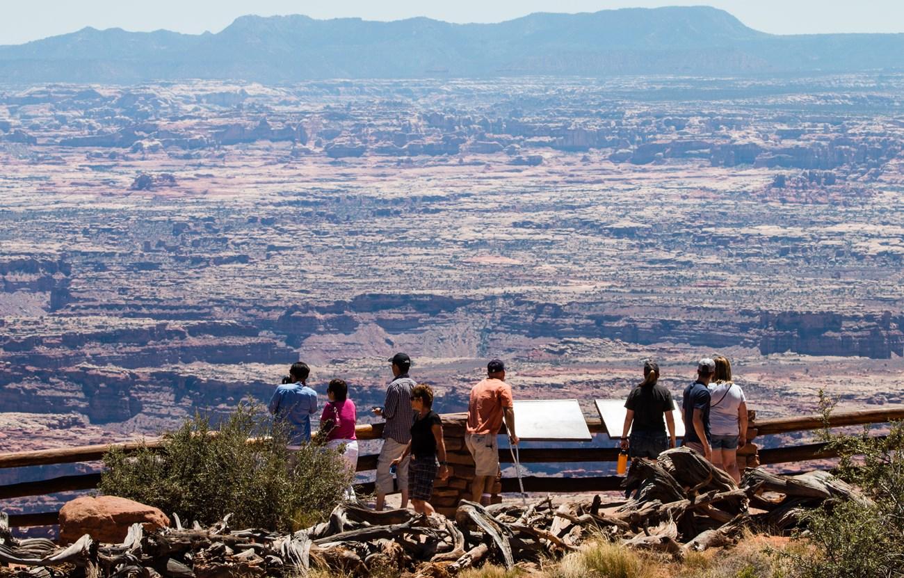 Devils Lake Basin
 combines walleye fishing, prairie wildlife, Indigenous history and open-water recreation in north-eastern North Dakota.
-

-


Swipe for more regions
Explore more
Explore more of North Dakota
Discover the rugged beauty, rich history, and warm hospitality of North Dakota, the untamed frontier of the United States.
Explore North Dakota