

Free Muskingum Valley Travel Guide & Mobile App
Explore Muskingum Valley with free travel guides. Discover regional history, expert tips, proposed trips, and audio guides on web or mobile app.


Explore Ohio’s Muskingum Valley for river towns, canal locks, pottery heritage, wooded parks, historic villages and relaxed Appalachian foothill scenery.
Read more about Muskingum Valley
When is the best time to visit Muskingum Valley?
Best: May–June, September · 22–27°C| Month | High (°C) | Rainfall (mm) |
|---|---|---|
| January | 3 | 70 |
| February | 5 | 65 |
| March | 10 | 75 |
| April | 16 | 90 |
| May (best) | 22 | 100 |
| June (best) | 27 | 105 |
| July | 29 | 110 |
| August | 28 | 100 |
| September (best) | 24 | 90 |
| October | 18 | 80 |
| November | 11 | 75 |
| December | 5 | 70 |
Getting to and around Muskingum Valley
How to get there
Transportation
Top city travel guides in Muskingum Valley
The cities of Muskingum Valley, and the easiest places to base yourself.

Swipe for more cities
Best attractions in Muskingum Valley
The Muskingum Valley’s attractions are connected by its river and transport history. In Zanesville, the Y-Bridge and the Zanesville Museum of Art introduce the city’s geography and creative traditions, while galleries and studios reflect the area’s long association with pottery, glass and sculpture. North of the city, historic Roscoe Village near Coshocton presents a restored canal-era settlement with buildings, demonstrations and interpretation of nineteenth-century trade. Along the river south of Zanesville, the surviving locks and dams of the Muskingum Navigation System provide distinctive heritage stops, best visited as part of a wider driving route rather than as isolated monuments. Dillon State Park offers boating, camping, walking and birdwatching around its reservoir, while Blue Rock State Park provides wooded recreation and access to the region’s rolling terrain. Smaller communities such as McConnelsville, Malta and Dresden add historic streets, local museums, cafés and independent shops. The valley is also suited to fishing, paddling, scenic drives and visits to working farms and craft businesses, with the greatest variety of services found in Zanesville and Coshocton.
-
Blackhand Gorge State Nature Preserve
Explore the breathtaking landscapes and rich biodiversity of Blackhand Gorge State Nature Preserve, a must-visit natural sanctuary in Ohio.
-
Tourist attraction
Newark Earthworks
Explore Newark Earthworks, Ohio's ancient Native American monumental site, and uncover the rich history and culture of early civilizations.
-
Tourist attraction
Flint Ridge State Memorial
Explore Flint Ridge State Memorial, Ohio's gem of history and natural beauty, showcasing Native American heritage in a stunning state park setting.
-
Community garden
Mission Oaks Gardens
Explore Mission Oaks Gardens in Zanesville, Ohio - a hidden gem of community beauty, featuring themed gardens, waterfalls, and serene walking paths.


Best landmarks in Muskingum Valley
The Y-Bridge in Zanesville is the Muskingum Valley’s most recognisable civic landmark, standing at the confluence of the Muskingum and Licking rivers and embodying the city’s unusual river geography. The surviving locks and dams of the Muskingum Navigation System are the region’s defining historic engineering landmarks; together they show how nineteenth-century Ohio made an inland river navigable for commerce. Roscoe Village near Coshocton preserves a carefully interpreted canal settlement, with restored buildings that convey the scale and appearance of a working nineteenth-century transport community. In Zanesville, the historic downtown and older residential streets reflect the prosperity generated by roads, railways, river trade and manufacturing, while the city’s bridges and industrial traces reveal successive phases of expansion. South of Zanesville, the river valley narrows into a more wooded landscape around McConnelsville and Malta, where historic civic buildings and the waterway remain central visual features. The surrounding hills, reservoirs and forested ridges are natural landmarks on a smaller scale, offering the landscape context that explains why the towns developed where they did.
-
Nature preserve
Blackhand Gorge State Nature Preserve
Explore the breathtaking landscapes and diverse wildlife at Blackhand Gorge State Nature Preserve, Ohio's premier outdoor destination.
-
Tourist attraction
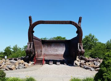
Big Muskie Bucket
Explore the Big Muskie Bucket in Ohio, a monumental tribute to mining history surrounded by breathtaking landscapes.
-
Historical landmark
Newark Earthworks
Discover the Newark Earthworks, a historic site featuring ancient Native American mounds and a rich cultural heritage in Ohio.
-
Historical place museum
Flint Ridge State Memorial
Explore the rich history and natural beauty of Flint Ridge State Memorial, Ohio's unique historical site and scenic park.



Explore Muskingum Valley on the map
Plan your trip on one map. See where the top cities, national parks and sights are, and book hotels and experiences in a few clicks.
Best hotels in Muskingum Valley
Best restaurants in Muskingum Valley
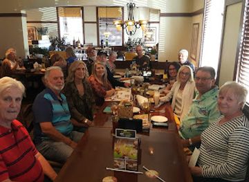
Dining in the Muskingum Valley reflects the food culture of inland Ohio: family restaurants, cafés, classic diners, taverns, bakery counters and rural eateries are more prominent than formal culinary districts. Menus commonly draw on American comfort food, locally available produce, sandwiches, burgers, soups, fried fish and seasonal specials, while the region’s farm country supports roadside stands and occasional farmers’ markets. Amish and Mennonite communities in the wider Coshocton area contribute to the availability of traditional baked goods, preserves and hearty country cooking, although visitors should distinguish locally sold food from dishes with a single regional origin. Zanesville provides the broadest choice, including independent restaurants and internationally influenced cooking, while Roscoe Village and the smaller river towns offer heritage-oriented cafés and casual dining. Local pottery traditions make handmade tableware a particularly appropriate part of the regional dining experience. In rural areas, restaurants may close earlier or operate on limited days, so checking arrangements before a long drive is sensible.
-
American
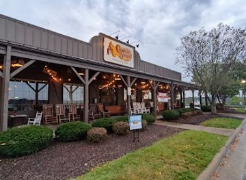
Cracker Barrel Old Country Store
Savor authentic Southern flavors at Cracker Barrel Old Country Store in Zanesville – where every meal feels like home.
-
Italian
Olive Garden Italian Restaurant
Experience authentic Italian dining at Olive Garden in Zanesville—delicious food and warm hospitality await you!
-
Buffet
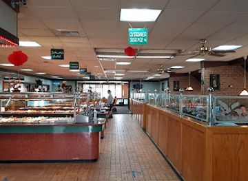
Oriental Super Buffet
Discover endless Asian culinary delights at Oriental Super Buffet in Zanesville - a paradise for food lovers seeking variety and flavor.
-
Grill
Tumbleweed Tex Mex Grill & Margarita Bar
Discover a vibrant Tex-Mex culinary adventure at Tumbleweed Tex Mex Grill & Margarita Bar in Zanesville, where every bite bursts with flavor.
Best bars in Muskingum Valley
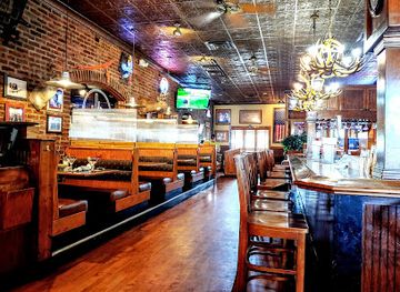
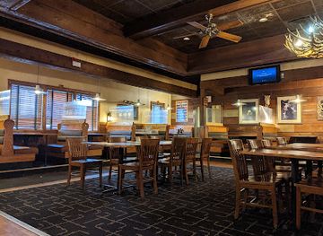
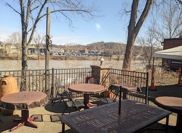
Evening life in the Muskingum Valley is centred on traditional pubs, taverns, restaurants, small bars and occasional live-music events rather than a large nightclub scene. Zanesville has the widest selection of places for an evening meal, drinks or local entertainment, with smaller concentrations in Coshocton and the river towns. McConnelsville and Malta offer a quieter atmosphere, where social life is more likely to centre on neighbourhood establishments and community events than late-night venues. Breweries and craft-drink businesses may feature in the wider regional scene, but opening arrangements vary and should be checked directly. In rural districts, evenings are often shaped by outdoor recreation, dining, seasonal festivals or performances rather than clubs. Responsible drinking and arranging a driver are especially important where distances between towns are considerable and public transport is limited.
-
Grill
Tumbleweed Tex Mex Grill & Margarita Bar
Discover the vibrant flavors of Tex-Mex cuisine at Tumbleweed Tex Mex Grill & Margarita Bar in Zanesville, where every meal is a fiesta.
-
American
Muddy Misers Restaurant
Experience the best of American cuisine at Muddy Misers Restaurant in Zanesville, Ohio – where delicious food meets a warm atmosphere.
-
Grill
Copper Penny Lakeside
Experience the perfect blend of delicious grill cuisine and stunning lake views at Copper Penny Lakeside, a must-visit destination for food lovers.
-
Bar
The Hole in the Wall
Experience the vibrant nightlife of Somerset at The Hole in the Wall, where great drinks meet friendly faces in a cozy setting.


Best nightclubs in Muskingum Valley
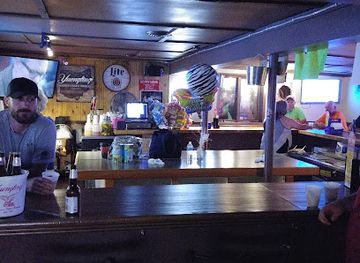
Evening life in the Muskingum Valley is centred on traditional pubs, taverns, restaurants, small bars and occasional live-music events rather than a large nightclub scene. Zanesville has the widest selection of places for an evening meal, drinks or local entertainment, with smaller concentrations in Coshocton and the river towns. McConnelsville and Malta offer a quieter atmosphere, where social life is more likely to centre on neighbourhood establishments and community events than late-night venues. Breweries and craft-drink businesses may feature in the wider regional scene, but opening arrangements vary and should be checked directly. In rural districts, evenings are often shaped by outdoor recreation, dining, seasonal festivals or performances rather than clubs. Responsible drinking and arranging a driver are especially important where distances between towns are considerable and public transport is limited.
-
Grill
Lazy River Lounge
Experience the perfect blend of casual dining and entertainment at Lazy River Lounge, Zanesville's favorite grill and bar.
-
Bar
Triple Nickel Saloon
Experience the lively atmosphere of Triple Nickel Saloon in Zanesville, where local charm meets a vibrant nightlife scene.
-
Night club
The Fox Hole
Discover the vibrant nightlife at The Fox Hole, Walhonding's premier night club, where music, dance, and new friendships await.


Best shops in Muskingum Valley
Shopping in the Muskingum Valley is strongest in its market towns and independent downtowns rather than in large luxury retail districts. Zanesville offers the broadest range of everyday shops, galleries, antiques, books, homewares and locally made art, with pottery and glass especially relevant to the area’s industrial and studio-craft heritage. Coshocton and Roscoe Village are useful for heritage-related gifts, handmade goods, local food products and shops in historic buildings, while McConnelsville, Malta and Dresden provide smaller-scale browsing and antique shopping. Seasonal farmers’ markets, farm stands and roadside producers may offer fruit, vegetables, baked goods, preserves and other regional produce, though locations and operating days change through the year. Ohio-made ceramics, craft pieces and locally produced food make more meaningful souvenirs than generic river-themed merchandise. Rural shopping is dispersed, and many independent businesses keep shorter hours than national chains, so plan visits around the main daytime trading period and carry a practical amount of cash.
-
Department store
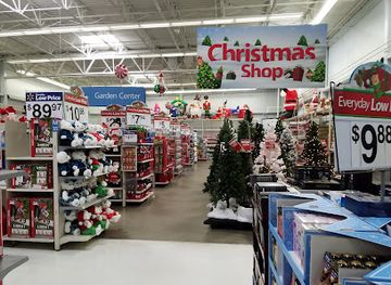
Walmart Supercenter
Discover the convenience of Walmart Supercenter in Zanesville, your ultimate shopping destination for groceries, clothing, and more.
-
Discount store
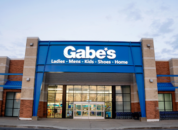
Gabe's
Discover unbeatable discounts on fashion and home essentials at Gabe's in Zanesville, Ohio, your go-to discount store for the whole family.
-
Craft store
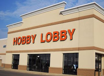
Hobby Lobby
Explore endless creativity at Hobby Lobby, your one-stop shop for crafting supplies, home décor, and DIY inspiration in Zanesville, Ohio.
-
Department store
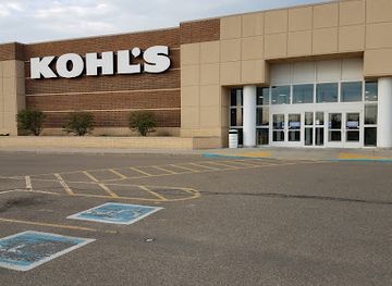
Kohl's
Explore affordable fashion and home goods at Kohl's Zanesville, your ultimate shopping destination for stylish finds and delightful surprises.
Get your free copy of our complete guide to Muskingum Valley, delivered straight to you.
Everything on this page, from attractions and restaurants to essentials and local phrases, in one PDF you can read offline, print or share.
Already have an account? Sign in
Your Muskingum Valley guide is ready.
We'll send it to · Not you? Sign out

Getting your guide ready…
We are putting together a fresh copy of the Muskingum Valley guide. This can take up to a minute.
This can take a few moments. If your browser asks, choose Allow so the download can start. You'll find the guide in your Downloads folder.
Nothing happened? Download it again
Sorry, the guide is taking longer than usual. Please try again in a minute, or get it by email instead.
Muskingum Valley essentials
Currency and Payment
Safety
Emergency Situations
Do's and Don'ts
Local Tips
From Eve
Local phrases worth knowing
You don't need to get them perfect. A few words go a long way, and locals appreciate the effort.
Basics
| English | Local | Say it |
|---|---|---|
| Hello | Hi | [Hai] |
| Goodbye | See ya | [See yah] |
| Yes | Yep | [Yep] |
| No | Nope | [Nope] |
| Please/You're welcome | Please/No problem | [Pleez/No prob] |
| Thank you | Thanks | [Thangs] |
| Excuse me/Sorry | Excuse me/Sorry | [Excuse me/Sorry] |
| How are you? | How ya doin'? | [How yah doin'?] |
| Fine. And you? | Good. And you? | [Good. An' you?] |
| Do you speak English? | You speakin' English? | [Yoo speakin' Inglish?] |
| I don't understand | I ain't gettin' it | [I ain't gettin' it] |
Eating & Drinking
| English | Local | Say it |
|---|---|---|
| I'd like to see the menu, please | Can I see the menu, please? | [Can I see th' menu, pleez?] |
| I don't eat meat | I ain't eatin' meat | [I ain't eatin' meet] |
| Cheers! | Cheers! | [Cheers!] |
| I would like to pay, please | Can I pay, please? | [Can I pay, pleez?] |
Emergencies
| English | Local | Say it |
|---|---|---|
| Help! | Help! | [Help!] |
| Go away! | Get outta here! | [Get outta here!] |
| Call the Police! | Call the cops! | [Call th' cops!] |
| Call a doctor! | Get a doctor! | [Get a doc!] |
| I'm lost | I’m lost | [I'm lost] |
| I'm ill | I ain't feelin' good | [I ain't feelin' good] |
Shopping
| English | Local | Say it |
|---|---|---|
| I'd like to buy... | I wanna buy... | [I wanna buy...] |
| I'm just looking | Just lookin' | [Just lookin'] |
| How much is it? | What’s the price? | [What's th' price?] |
| That's too expensive | That's way too pricey | [That's way too pricey] |
| Can you lower the price? | Can ya make it cheaper? | [Can ya make it cheaper?] |
Time & Numbers
| English | Local | Say it |
|---|---|---|
| What time is it? | What time is it? | [What time is it?] |
| It's one o'clock | It's one o'clock | [It's one o'clock] |
| Half past (10) | Half past ten | [Half past ten] |
| Morning | Mornin' | [Mornin'] |
| Afternoon | Afternoon | [Afternoon] |
| Evening | Evenin' | [Evenin'] |
| Yesterday | Yesterday | [Yesterday] |
| Today | Today | [Today] |
| Tomorrow | Tomorrow | [Tomorrow] |
| 1 | One | [One] |
| 2 | Two | [Two] |
| 3 | Three | [Three] |
| 4 | Four | [Four] |
| 5 | Five | [Five] |
| 6 | Six | [Six] |
| 7 | Seven | [Seven] |
| 8 | Eight | [Eight] |
| 9 | Nine | [Nine] |
| 10 | Ten | [Ten] |
Transport & Directions
| English | Local | Say it |
|---|---|---|
| Where's a/the...? | Where's the...? | [Where's th'...?] |
| What's the address? | What's the address? | [What's th' address?] |
| Can you show me (on the map)? | Can ya show me on the map? | [Can ya show me on th' map?] |
| When's the next (bus)? | When's the next bus? | [When's th' next bus?] |
| A ticket (to ....) | A ticket to... | [A ticket to...] |
History of Muskingum Valley
Indigenous Ohio and the Muskingum River Corridor
Long before European settlement, the Muskingum and its tributaries formed routes through the eastern Ohio landscape. Indigenous communities used the waterways for movement, exchange, fishing and settlement, while the wider region contains archaeological evidence of ancient societies that built earthworks and ceremonial landscapes. The river’s name is generally linked to an Indigenous language, although interpretations vary. Later, Lenape and other Native peoples remained connected with the Ohio country during the period of expanding colonial settlement. Understanding this earlier history is essential: the valley was not an empty frontier awaiting newcomers, but part of an established cultural and environmental network.
Zane’s Trace and Early Settlement, 1790s
After the American Revolution, roads and land surveys opened the interior of Ohio to intensified settlement. Zane’s Trace, established in the 1790s along a route associated with Ebenezer Zane, crossed the region and helped connect the Ohio River with the interior. New communities grew near river crossings, mills and transport routes, including the settlement that became Zanesville. Early settlers relied on the Muskingum and its tributaries for transport and power, while farms, inns and small commercial centres appeared along the developing roads. These routes laid the foundations for the valley’s later towns and transport economy.
The National Road and the Opening of the Interior
The National Road reached central and eastern Ohio during the early nineteenth century, creating a more dependable east-west route for migrants, mail and commercial traffic. In the Muskingum Valley, it reinforced the importance of towns such as Zanesville and linked local producers to markets beyond the region. Taverns, coach services, workshops and warehouses developed along the road, while bridges and improved crossings altered the relationship between communities on opposite sides of the river. Although railways and motor roads later reduced the National Road’s practical importance, surviving sections and historic buildings still reveal how strongly federal transport investment influenced the valley.
The Muskingum Navigation System, 1820s–1840s
The Muskingum River was transformed in the nineteenth century by a system of locks and dams designed to make navigation more reliable. Construction took place during the canal era, when Ohio sought to connect its interior farms and towns with the Ohio River and the wider national market. The completed navigation system supported freight, encouraged mills and warehouses, and helped establish the river as an economic spine. Its engineering legacy is especially important because much of the original system survives. Today, the locks and dams form a connected heritage landscape rather than isolated monuments, illustrating how water engineering shaped the valley’s towns and industries.
Pottery, Glass and River Manufacturing
From the nineteenth century onwards, the Zanesville area and nearby valley communities developed important industries based on local clay, coal, timber, water power and transport access. Pottery became particularly associated with the region, supported by skilled workers, factories and a market for household and decorative wares. Glassmaking and other manufacturing also contributed to the industrial character of the river towns. Railways later expanded the movement of raw materials and finished products. Although industrial employment has changed substantially, the legacy remains visible in local museums, surviving factory landscapes, studio ceramics, galleries and the continued reputation of the area as a centre for Ohio craft and decorative arts.
River Towns, Railways and Modern Change
Railways and improved highways gradually displaced river navigation as the principal means of moving goods, while agriculture, manufacturing and public services continued to shape the valley’s economy. Zanesville became the largest regional centre, and smaller communities such as McConnelsville, Malta, Dresden and Coshocton retained their roles as market towns and county seats or local service centres. In the twentieth and twenty-first centuries, heritage conservation, recreation and cultural tourism gained greater importance as older industries declined or changed. The river, canal structures, historic roads and craft traditions now provide a framework for interpreting the region’s past while supporting contemporary visits.
Muskingum Valley in Photos
Browse through our photo collection highlighting the charm and character of the destination.
Neighbouring regions of Muskingum Valley
The closest regions to Muskingum Valley, if you have time for more than one.
-

-

-

-

-


Swipe for more regions
Explore more

Explore more of Ohio
Explore Ohio's vibrant cities, rich history, and stunning natural landscapes. From bustling urban centers to serene state parks, Ohio offers diverse attractions for every traveler.
Explore Ohio