

Free Jefferson County Travel Guide & Mobile App
Explore Jefferson County with free travel guides. Discover regional history, expert tips, proposed trips, and audio guides on web or mobile app.


Jefferson County, Oregon combines high-desert scenery, river canyons, Lake Billy Chinook, Metolius waters and Indigenous cultural heritage.
Read more about Jefferson County
Getting to and around Jefferson County
How to get there
Transportation
Top city travel guides in Jefferson County
The cities of Jefferson County, and the easiest places to base yourself.

Swipe for more cities
Destinations in Jefferson County
Resorts, valleys and scenic spots worth a trip of their own.
-

-


Swipe for more destinations
Best attractions in Jefferson County
Jefferson County's attractions are shaped by the meeting of high desert, river canyons, mountain forest and working farmland. Cove Palisades State Park is the principal outdoor destination, with Lake Billy Chinook offering boating, fishing, camping, wildlife observation and trails above the Deschutes, Crooked and Metolius river arms. The reservoir's steep basalt scenery gives it a character unlike the open plateau around Madras. West of the county seat, the Metolius corridor and Camp Sherman provide access to clear, cold water, forest walks and fly-fishing landscapes, with recreation best approached quietly and responsibly. In Warm Springs, the Museum at Warm Springs provides Indigenous-led interpretation of Wasco, Warm Springs and Northern Paiute history and art. Madras offers local civic history, community events and practical access to the surrounding countryside, while the agricultural basin is itself an attraction for travellers interested in irrigation, crops and rural Oregon. Scenic drives along US 26 and US 97 reveal broad views of the Cascades, volcanic ridges and cultivated fields, although viewpoints and services are widely spaced. The county is better suited to self-guided exploration, fishing, boating, hiking, photography and cultural learning than to a dense programme of conventional urban attractions.
-
National park
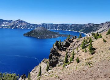
Crater Lake National Park
Explore the breathtaking beauty of Crater Lake National Park, Oregon's stunning natural wonder featuring deep blue waters and diverse ecosystems.
-
Hiking area
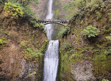
Columbia River Gorge National Scenic Area
Explore the stunning Columbia River Gorge National Scenic Area, a top destination for hiking, waterfalls, and breathtaking landscapes in Oregon.
-
State park
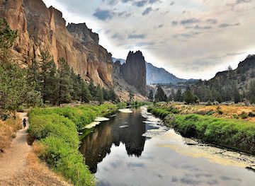
Smith Rock State Park
Discover the stunning landscapes and thrilling adventures at Smith Rock State Park, Oregon's iconic outdoor playground for nature lovers and adventurers.
-
National forest
Willamette National Forest
Explore the wonders of Willamette National Forest, a stunning national forest in Oregon filled with breathtaking landscapes and endless outdoor adventures.

Best landmarks in Jefferson County
The most recognisable natural landmark in Jefferson County is Lake Billy Chinook, whose waters occupy a deeply incised canyon system at the junction of the Deschutes, Crooked and Metolius rivers. The enclosing basalt cliffs and long, branching reservoir arms give Cove Palisades State Park its defining visual character. Round Butte Dam, at the southern end of the reservoir, represents the major twentieth-century engineering intervention that reshaped the local river landscape. The Metolius River is a contrasting landmark: its famously clear headwaters and forested course create a cool, sheltered environment within a county more often associated with dry plateau scenery. In Madras, the Jefferson County Courthouse and the town's civic core reflect the county's early twentieth-century administrative development, while the wider agricultural basin forms an important cultural landscape of fields, irrigation works and open horizons. The Museum at Warm Springs is significant not only as a building but as a centre of Indigenous interpretation, memory and contemporary artistic expression. Together these places express the county's principal themes: volcanic geology, managed water, rural settlement and the continuing presence of Indigenous nations.
-
National park
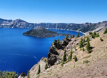
Crater Lake National Park
Explore the breathtaking landscapes and deep blue waters of Crater Lake National Park, a must-visit destination in Oregon for nature enthusiasts and adventurers.
-
Hiking area
Columbia River Gorge National Scenic Area
Explore the stunning landscapes and outdoor adventures at Columbia River Gorge National Scenic Area, Oregon's breathtaking natural wonder.
-
 Hotel
Timberline Lodge
Discover Timberline Lodge, a historic mountain retreat offering stunning views, exceptional skiing, and a cozy atmosphere in the heart of Oregon.
-
Historical landmark
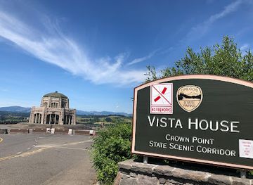
Vista House at Crown Point
Experience breathtaking views and rich history at the iconic Vista House at Crown Point, a must-visit landmark in the Columbia River Gorge.

Explore Jefferson County on the map
Plan your trip on one map. See where the top cities, national parks and sights are, and book hotels and experiences in a few clicks.
Best hotels in Jefferson County
Best restaurants in Jefferson County
Dining in Jefferson County is centred on practical local cafés, family-run restaurants, bakeries, pubs and food service in Madras and other small communities rather than a concentrated restaurant district. The county's agricultural economy gives local menus a connection to potatoes, grains, mint, seasonal produce and cattle, while neighbouring central Oregon contributes craft drinks and broader Pacific Northwest influences. Madras is the most dependable base for a choice of everyday meals, breakfast stops and take-away food, with options reflecting the area's diverse population as well as familiar American fare. Around recreation areas, food services may be seasonal or limited, so visitors heading to Lake Billy Chinook or Camp Sherman should plan supplies in advance. Farmers' markets and community events, when operating, are useful places to find regional produce, baked goods and locally made items, although availability changes with the season. Dining in Warm Springs should be approached with respect for the community and its businesses; the most important cultural experience is provided by the Museum and the landscape, not by treating Indigenous food or traditions as curiosities.
-
American
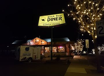
Black Bear Diner Madras
Experience hearty American comfort food at Black Bear Diner Madras—where family-friendly dining meets delicious flavors.
-
Mexican
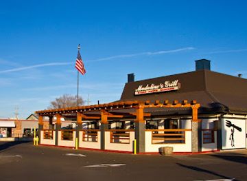
Madaline's Grill & Steak House
Experience culinary excellence at Madaline's Grill & Steak House with its perfect blend of Mexican and American flavors in Redmond.
-
Grill
Skyway Bar & Grill
Experience the best American cuisine and live music at Skyway Bar & Grill in scenic Zigzag, Oregon.
-
Grill
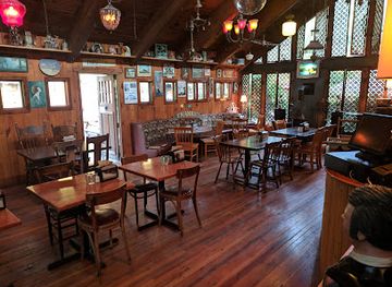
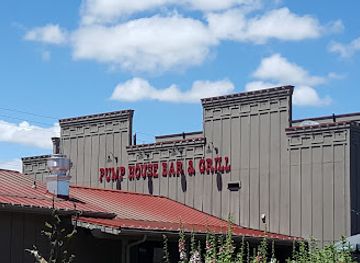
Pump House Bar & Grill
Experience delightful American cuisine at Pump House Bar & Grill in scenic Terrebonne, Oregon—where great food meets stunning views.
Best bars in Jefferson County
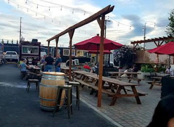
Jefferson County has a modest evening scene, with social life concentrated in local pubs, taverns, restaurants and community venues rather than purpose-built nightclub districts. Madras provides the broadest choice for an evening meal or drink, while smaller communities offer a quieter, locally oriented atmosphere. In the warmer months, activity around Lake Billy Chinook and camping areas may extend into the evening, but visitors should follow quiet hours, fire rules and park regulations rather than assuming that recreation sites function as nightlife venues. Live music, seasonal gatherings and community events may appear in local calendars, but schedules change and should be checked before travelling. The county's evenings are often better suited to conversation, stargazing and an early start outdoors than to late-night entertainment. Anyone drinking should arrange a safe journey, particularly because rural roads are dark, distances are substantial and taxis or ride-hailing services may be limited outside Madras.
-
Bar
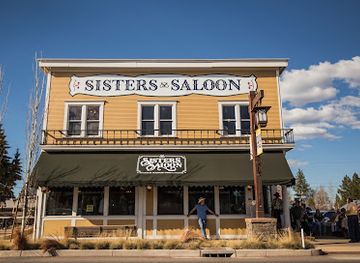
Sisters Saloon & Ranch Grill
Discover the lively Sisters Saloon & Ranch Grill in Sisters, Oregon, where hearty meals meet vibrant live music in a welcoming atmosphere.
-
Brewery
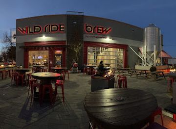
Wild Ride Brewing
Experience the best of craft beer at Wild Ride Brewing in Redmond, Oregon, where quality brews meet a vibrant atmosphere.
-
Grill
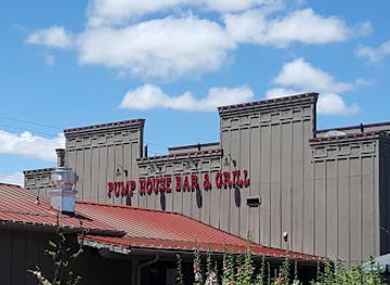
Pump House Bar & Grill
Experience the vibrant atmosphere and delicious grill offerings at Pump House Bar & Grill in Terrebonne, Oregon.
-
Beer Garden
General Duffy's Waterhole
Enjoy live music and delicious food in a vibrant beer garden atmosphere at General Duffy's Waterhole in Redmond, Oregon.
Best nightclubs in Jefferson County
-
Bar
Velvet Lounge
Experience the eclectic vibe of Velvet Lounge in Bend, where art, live music, and gourmet cuisine converge for an unforgettable night out.
-
Bar
M & J Tavern
Discover M & J Tavern in Bend, Oregon—a lively bar and grill offering delicious food, craft drinks, and a vibrant atmosphere for an unforgettable night out.
-
Mountain peak
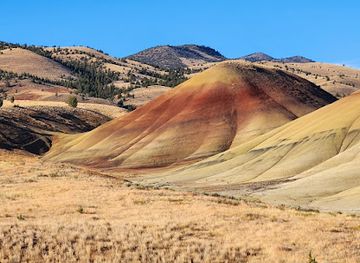
Painted Hills
Explore the Painted Hills of Oregon, a stunning geological wonder featuring vibrant colors and rich history, perfect for nature lovers and adventurers alike.
-
Cocktail bar
The Capitol
Discover Bend's premier cocktail bar and dance club, The Capitol, where great drinks and vibrant nightlife come together for an unforgettable experience.



Best shops in Jefferson County
Shopping in Jefferson County is practical and locally focused, with Madras providing the largest concentration of supermarkets, everyday services, independent retailers and fuel stops. Smaller communities offer fewer shops, so visitors should purchase specialist outdoor supplies, food and medicines before leaving the main town. Local produce and baked goods may be available through seasonal farmers' markets, farm stands and community events, with the selection changing during the agricultural year. Regional products associated with central Oregon include potatoes, grain-based foods, preserves and other farm goods, although availability is not guaranteed outside harvest periods. The Museum at Warm Springs shop is an appropriate place to look for Indigenous art, books and culturally informed merchandise when open, and purchases support a more respectful form of cultural engagement than generic souvenir buying. Visitors may also find locally made jewellery, ceramics, textiles, artwork and outdoor equipment in small independent businesses. There is no large luxury-shopping district in the county; its retail character is better understood through useful provisions, local craft and the products of a working agricultural region.
-
Rock shop
Richardson's Rock Ranch
Explore the geological wonders of Richardson's Rock Ranch, where adventure meets education in the heart of Oregon's natural beauty.
-
Department store
The Outpost
Explore The Outpost in Madras, Oregon - A charming department store bursting with unique finds, local crafts, and essentials.
-
Gift shop
Stitchin' Post
Explore Stitchin' Post in Sisters, Oregon - a delightful gift and fabric shop for quilting, sewing, and crafting enthusiasts, brimming with unique finds.
-
Gift shop
The Hen's Tooth
Explore the charming Hen's Tooth gift shop in Sisters, Oregon, for unique treasures that capture the spirit of your travels.


Get your free copy of our complete guide to Jefferson County, delivered straight to you.
Everything on this page, from attractions and restaurants to essentials and local phrases, in one PDF you can read offline, print or share.
Already have an account? Sign in
Your Jefferson County guide is ready.
We'll send it to · Not you? Sign out

Getting your guide ready…
We are putting together a fresh copy of the Jefferson County guide. This can take up to a minute.
This can take a few moments. If your browser asks, choose Allow so the download can start. You'll find the guide in your Downloads folder.
Nothing happened? Download it again
Sorry, the guide is taking longer than usual. Please try again in a minute, or get it by email instead.
Jefferson County essentials
Currency and Payment
Safety
Emergency Situations
Do's and Don'ts
Local Tips
From Eve
Local phrases worth knowing
You don't need to get them perfect. A few words go a long way, and locals appreciate the effort.
Basics
| English | Local | Say it |
|---|---|---|
| Hello | Howdy | [haʊdi] |
| Goodbye | See ya | [si jə] |
| Yes | Yep | [jɛp] |
| No | Nah | [nɑ] |
| Please/You’re welcome | You're welcome | [jʊr ˈwɛlkəm] |
| Thank you | Thanks | [θæŋks] |
| Excuse me/Sorry | Sorry | [ˈsɔri] |
| How are you? | How's it going? | [haʊz ɪt ˈɡoʊɪŋ] |
| Fine. And you? | Good. And you? | [ɡʊd. ənd jʊ] |
| Do you speak English? | Do ya speak English? | [du jə spiːk ˈɪŋɡlɪʃ] |
| I don’t understand | I don't get it | [aɪ doʊnt ɡɛt ɪt] |
Eating & Drinking
| English | Local | Say it |
|---|---|---|
| I’d like to see the menu, please | Can I see the menu? | [kæn aɪ si ðə ˈmɛnju] |
| I don’t eat meat | I’m a vegetarian | [aɪm ə ˌvɛdʒəˈtɛriən] |
| Cheers! | Cheers! | [tʃɪrz] |
| I would like to pay, please | Can I get the check? | [kæn aɪ ɡɛt ðə tʃɛk] |
Emergencies
| English | Local | Say it |
|---|---|---|
| Help! | Help! | [hɛlp] |
| Go away! | Leave me alone! | [liːv mi əˈloʊn] |
| Call the Police! | Call 911! | [kɔl naɪn wʌn wʌn] |
| Call a doctor! | Get a doctor! | [ɡɛt ə ˈdɑktər] |
| I’m lost | I’m lost | [aɪm lɔst] |
| I’m ill | I’m not feeling well | [aɪm nɑt ˈfiːlɪŋ wɛl] |
Shopping
| English | Local | Say it |
|---|---|---|
| I’d like to buy... | I want to buy... | [aɪ wɑnt tu baɪ] |
| I’m just looking | Just browsing | [dʒʌst ˈbraʊzɪŋ] |
| How much is it? | What’s the price? | [wʌts ðə praɪs] |
| That’s too expensive | That’s pricey | [ðæts ˈpraɪsi] |
| Can you lower the price? | Can you make it cheaper? | [kæn jə meɪk ɪt ˈtʃipər] |
Time & Numbers
| English | Local | Say it |
|---|---|---|
| What time is it? | What time is it? | [wʌt taɪm ɪt] |
| It’s one o’clock | It’s one o’clock | [ɪts wʌn əˈklɑk] |
| Half past (10) | Half past ten | [hæf pæst tɛn] |
| Morning | Morning | [ˈmɔrnɪŋ] |
| Afternoon | Afternoon | [ˌæftərˈnun] |
| Evening | Evening | [ˈivnɪŋ] |
| Yesterday | Yesterday | [ˈjɛstərdeɪ] |
| Today | Today | [təˈdeɪ] |
| Tomorrow | Tomorrow | [təˈmɔroʊ] |
| 1 | One | [wʌn] |
| 2 | Two | [tu] |
| 3 | Three | [θri] |
| 4 | Four | [fɔr] |
| 5 | Five | [faɪv] |
| 6 | Six | [sɪks] |
| 7 | Seven | [ˈsɛvən] |
| 8 | Eight | [eɪt] |
| 9 | Nine | [naɪn] |
| 10 | Ten | [tɛn] |
Transport & Directions
| English | Local | Say it |
|---|---|---|
| Where's a/the...? | Where's the...? | [wɛrz ðə] |
| What's the address? | What’s the address? | [wʌts ði ˈædrɛs] |
| Can you show me (on the map)? | Can you point it out? | [kæn jə pɔɪnt ɪt aʊt] |
| When's the next (bus)? | When’s the next bus? | [wɛnʔs ðə nɛkst bʌs] |
| A ticket (to ....) | One ticket to... | [wʌn ˈtɪkɪt tu] |
History of Jefferson County
Indigenous Homelands Before European Settlement
The area now called Jefferson County lies within the homelands and travel networks of Indigenous peoples, including the Wasco, Warm Springs and Northern Paiute. Rivers, plateau grasslands and mountain corridors supported fishing, hunting, gathering and seasonal movement long before the arrival of American settlers. The meeting of the Deschutes, Crooked and Metolius rivers was particularly important within this wider cultural landscape. Indigenous knowledge of water, plants, routes and weather continues to shape the region, and the history of the county cannot be understood solely through later settlement and agriculture.
The Treaty of 1855 and the Warm Springs Reservation
In 1855, the United States negotiated treaties with several Indigenous peoples of central Oregon. The resulting Warm Springs Reservation became the principal modern land base of the Confederated Tribes of Warm Springs, whose members include Wasco, Warm Springs and Northern Paiute people. The reservation extends across more than one present-day county, including a substantial area associated with Jefferson County. Despite the pressures of federal policy, land loss and cultural suppression, tribal communities maintained identity and institutions that remain central to the county's contemporary cultural life.
Trails, Missions and Regional Contact in the Nineteenth Century
During the nineteenth century, Indigenous trails and river routes became part of a wider network used by explorers, missionaries, traders and settlers. The Deschutes corridor connected the Columbia River country with central Oregon, while routes across the plateau helped link emerging settlements and military posts. Contact brought disease, commercial pressure and expanding federal authority to Indigenous communities. Later wagon roads and stage routes followed the practical geography established by earlier travel, helping to integrate the Madras Basin and surrounding country into Oregon's developing transport system.
Jefferson County and the Growth of Madras
Jefferson County was created in 1914 from parts of Crook, Wasco and Linn counties, reflecting the growth of settlement and the need for a local administrative centre. Madras, founded in the early twentieth century and named for the Indian city of Madras, developed as the county seat. Its position on the plateau made it a service and trading centre for farming districts and for routes crossing central Oregon. Courthouse functions, businesses, schools and transport connections gave the town a continuing role in a region where communities are widely separated.
Railways, Roads and Irrigated Agriculture
The arrival of improved railway and highway connections in the early twentieth century transformed the movement of crops, livestock, machinery and people through the county. The Oregon Trunk Railway helped connect central Oregon with wider markets, while later improvements to US 97 and US 26 reinforced Madras as a transport point. Irrigation changed the productive possibilities of the dry plateau, supporting crops such as potatoes, mint and grass seed alongside grain and livestock. Agriculture remains one of the most visible forces shaping the county's landscape and economy.
Dams, Reservoirs and the Modern Recreation Economy
Twentieth-century water engineering altered the Deschutes Basin and created opportunities as well as environmental debates. The completion of Round Butte Dam in the 1960s formed Lake Billy Chinook behind the dam complex, inundating river valleys while producing a major reservoir for hydroelectric generation, water management and recreation. Cove Palisades State Park subsequently became an important destination for boating, camping, fishing and hiking. The reservoir's canyon scenery is now one of the county's best-known visitor assets, while river restoration and fish passage remain significant regional concerns.
Contemporary Tribal Cultural Renewal
The Confederated Tribes of Warm Springs have continued to strengthen cultural education, artistic practice and public interpretation in the modern era. The Museum at Warm Springs, opened in the late twentieth century, provides a prominent setting for collections and exhibitions relating to Wasco, Warm Springs and Northern Paiute history and creativity. Its presence reflects a shift from outsider accounts of the region towards Indigenous-led interpretation. For visitors, this is an important reminder that tribal history is not confined to the past but remains part of everyday cultural and political life.
Jefferson County in Photos
Browse through our photo collection highlighting the charm and character of the destination.
Neighbouring regions of Jefferson County
The closest regions to Jefferson County, if you have time for more than one.
-
 Central Oregon
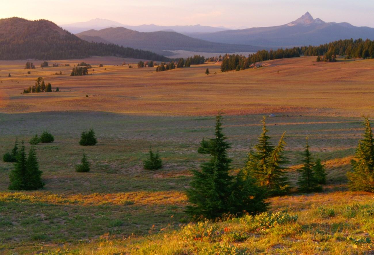
 combines Bend, volcanic landscapes, high-desert towns, mountain recreation, clear rivers and Indigenous and ranching heritage.
-
 Wasco County
Discover Wasco County, Oregon: A blend of natural beauty, rich history, and vibrant communities, perfect for outdoor adventures, cultural experiences, and wine tasting.
-

-

-


Swipe for more regions
Explore more

Explore more of Oregon
Discover Oregon's diverse landscapes, vibrant cities, and rich culture. From stunning coastlines to lush forests, this Pacific Northwest gem offers endless adventures.
Explore Oregon