

Cerro Pero Travel Guide - Free Web & App
Your ultimate guide to Cerro Pero. Discover top landmarks, proposed trips, and local tips. Free on the web or via the Evendo companion app.


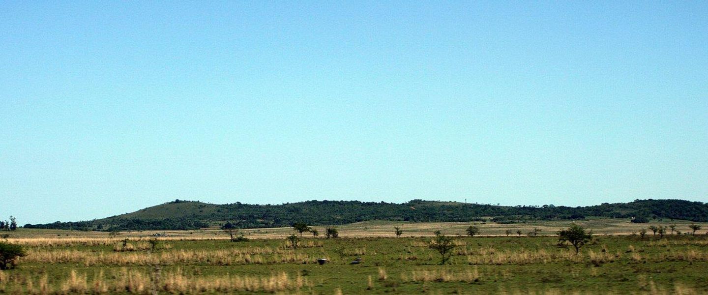


Cerro Pero in Paraguay’s Ybytyruzú range offers forested hills, rural scenery, hiking opportunities and access to one of the country’s upland landscapes.
A Forested Highland Landscape
Cerro Pero is a prominent hill in Paraguay’s Cordillera del Ybytyruzú, a rugged upland region in the department of Guairá. The mountain belongs to a chain of wooded ridges and isolated elevations that rise above the surrounding eastern Paraguayan countryside, where red-earth roads, pastureland, forest remnants and small rural settlements create a markedly different landscape from the country’s lowland plains. Its setting is rural and lightly developed, with the appeal centred on scenery, terrain and the experience of reaching a relatively quiet highland area rather than on formal visitor infrastructure.Read more about Cerro Pero
The Ybytyruzú Range
Rural Access and Outdoor Exploration
When is the best time to visit Cerro Pero?
Best: June–August · 28–31°C| Month | High (°C) | Rainfall (mm) |
|---|---|---|
| January | 37 | 150 |
| February | 37 | 141 |
| March | 35 | 130 |
| April | 33 | 121 |
| May | 31 | 110 |
| June (best) | 28 | 101 |
| July (best) | 29 | 90 |
| August (best) | 31 | 81 |
| September | 33 | 70 |
| October | 35 | 61 |
| November | 36 | 50 |
| December | 37 | 40 |
Getting to and around Cerro Pero
How to get there
Transportation
Best attractions in Cerro Pero
The principal attraction is Cerro Pero itself, a wooded elevation within the Cordillera del Ybytyruzú whose appeal lies in its rural setting, upland terrain and views across the surrounding Guairá countryside. The broader mountain range offers forested ridges, stream valleys, red-earth roads and scattered agricultural landscapes rather than a dense concentration of formal visitor sites. Nearby Cerro Tres Kandú, widely recognised as Paraguay’s highest point, provides an important geographical comparison and may be visited as part of a wider Ybytyruzú itinerary, although it is a separate mountain. Villarrica and the German-influenced settlement of Independencia serve as useful regional gateways, with access to local culture, supplies and accommodation. Visitors should regard the area as a lightly developed natural destination: trails, viewpoints and access points may be informal, and privately held land is interwoven with the rural landscape. The experience is consequently shaped by walking, observation and local guidance rather than by extensive visitor facilities.
-
Nature preserve
Inicio Del Sendero Al Tres Kandu
Discover the serene beauty of Inicio Del Sendero Al Tres Kandu, a nature preserve perfect for hiking, wildlife spotting, and tranquil escapes in Paraguay.
-
Tourist attraction
Cerro Amor, Colonia Independencia Guairá
Explore the majestic Cerro Amor in Colonia Independencia, Guairá - a scenic haven for nature lovers and cultural explorers alike.
-
Tourist attraction
Cerro 3 Kandú
Experience the breathtaking views and lush landscapes at Cerro 3 Kandú, Paraguay's highest point, ideal for nature lovers and adventurers alike.
-
Tourist attraction
Cerro Corá, san Pablo
Explore the natural beauty and rich history of Cerro Corá, a breathtaking tourist attraction in Paraguay perfect for nature lovers and adventure seekers.


Best landmarks in Cerro Pero
Cerro Pero is a natural landmark of the Cordillera del Ybytyruzú, distinguished less by monumental construction than by its elevation, wooded slopes and position within one of Paraguay’s principal upland landscapes. The surrounding ridge system is itself significant, rising above the agricultural countryside of Guairá and preserving fragments of the Atlantic Forest environment. Cerro Tres Kandú, another summit in the wider Ybytyruzú region, is a separate and more nationally recognised landmark because it is regarded as Paraguay’s highest point. The contrast between these elevations and the red-soil rural roads, pasture and forest remnants below gives the area its visual identity. Settlements such as Independencia and Villarrica provide cultural landmarks and historical context beyond the mountain, but they should not be confused with landmarks located on Cerro Pero itself. Natural features may be experienced through informal routes, and their condition or accessibility should be confirmed locally.
-
Nature preserve
Cerro Tres Kandú
Explore the breathtaking landscapes and rich biodiversity of Cerro Tres Kandú, a top tourist attraction in Paraguay's stunning wilderness.
-
Tourist attraction
Mirador del Cerro Akati
Explore breathtaking views and savor authentic Paraguayan cuisine at Mirador del Cerro Akati, a must-visit destination in Independencia.
-
National reserve
Salto Suizo
Explore the breathtaking landscapes, stunning waterfalls, and diverse wildlife of Salto Suizo, a must-visit national reserve in Paraguay.
-
Mountain peak
Cerro Peró
Discover the breathtaking beauty of Cerro Perú, a majestic mountain peak in Paraguay, perfect for hiking, photography, and serene nature escapes.


Explore Cerro Pero on the map
Plan your trip on one map. See where the top attractions, landmarks, restaurants and hotels are, and book hotels and experiences in a few clicks.
Best hotels in Cerro Pero
Best restaurants in Cerro Pero
Cerro Pero has no established dining district, and food choices are concentrated in nearby towns and rural settlements rather than at the mountain itself. Villarrica provides the broadest selection of everyday Paraguayan meals, cafés and bakeries, while Independencia and smaller communities offer more limited local options where available. Regional cooking commonly features mandioca, maize, rice, beans, grilled meats and sopa paraguaya, a savoury baked dish made with cornmeal, cheese and onion. Tereré, the cold herbal infusion strongly associated with Paraguayan social life, is especially relevant in warm weather. German-Paraguayan heritage is visible in parts of the Independencia area, although visitors should distinguish local traditions from specifically German dishes offered by individual establishments. Anyone heading into the uplands should carry water and food, as rural access points cannot be assumed to have cafés, shops or dependable meal services.
-
Restaurant
Camping Tacuara
Camping Tacuara: A unique blend of nature, delicious cuisine, and recreational fun in Melgarejo's stunning landscapes.
-
Restaurant
TUSS Restaurant & Fast Food
Discover the vibrant flavors of TUSS Restaurant & Fast Food in Villarrica – where delicious food meets exceptional service.
-
Restaurant
Patio Gua'i
Savor authentic Paraguayan cuisine at Patio Gua'i in Villarrica—where delightful flavors meet a cozy atmosphere.
-
Restaurant
El Cortijo
Discover culinary excellence at El Cortijo in Villarrica - where local flavors meet international flair in a warm and welcoming setting.


Best bars in Cerro Pero
Evening entertainment around Cerro Pero is quiet and locally oriented rather than built around nightlife. The mountain itself has no known concentration of bars or clubs, and visitors staying in the countryside should expect darkness, limited services and an early start for outdoor activities. In Villarrica, the regional centre, restaurants, cafés and ordinary local bars provide a more developed evening scene, while Independencia has a smaller settlement-based choice shaped by its rural and German-Paraguayan history. Social life may include tereré, conversation, music and community events rather than a dedicated nightlife district. Opening days and operating patterns can vary, particularly outside larger towns, so evening plans are best kept flexible and transport should be arranged before travelling between rural accommodation and town venues.
-
Grill
RD Tembi'u Pya'e
Experience the vibrant flavors of Paraguayan cuisine at RD Tembi'u Pya'e, a grill restaurant in Paso Yobái known for its delicious grilled dishes and local charm.
-
Bar
Pinky Floyd Bar
Discover the lively Pinky Floyd Bar in Melgarejo, where delicious food and vibrant nightlife come together for an unforgettable experience.
-
Bar
Ruchi Bar
Discover Ruchi Bar, the vibrant local hotspot in Gral Eugenio Alejandrino Garay, where delightful drinks and a lively atmosphere await!
-
Karaoke bar
Laura Barrios Bar Bodega Karaoke
Unleash your inner superstar at Laura Barrios Bar Bodega Karaoke, the ultimate destination for vibrant nightlife and unforgettable musical moments in Numi.


Best shops in Cerro Pero
Shopping opportunities are limited at Cerro Pero and are concentrated in Villarrica, Independencia and other nearby settlements rather than at the hill. Visitors can obtain food, water, basic outdoor supplies and everyday necessities in the larger towns before travelling into the rural uplands. Regional purchasing may include Paraguayan food products, woven goods, pottery, leather items and small-scale craftwork, although the range and availability depend on the individual shop, market or producer. Independencia’s German-Paraguayan cultural identity may be reflected in selected local products and businesses, but it should not be treated as a permanent specialist shopping district. Farm shops and roadside sellers may appear in the countryside, yet opening patterns and payment methods are variable. Buying directly from small producers can support the local economy when conducted respectfully and without assuming that every rural property is open to visitors.
-
 Shopping mall
Almacén San Blás
Experience the vibrant local culture at Almacén San Blás, a shopping mall in Gral Eugenio Alejandrino Garay with unique shops and delightful dining options.
-
Shopping mall
Comercial Otazu
Discover the vibrant shopping experience at Comercial Otazu, where local culture meets modern retail in José Fassardi, Paraguay.
-
Grocery store
Destino Tres kandu
Explore local flavors and unique products at Destino Tres Kandu, a vibrant grocery store in Paraguay offering a culinary adventure for visitors.
-
Store
Super Sol
Explore Super Sol in San Pablo - your destination for local products, fresh produce, and an authentic Paraguayan shopping experience.


Get your free copy of our complete guide to Cerro Pero, delivered straight to you.
Everything on this page, from attractions and restaurants to essentials and local phrases, in one PDF you can read offline, print or share.
Already have an account? Sign in
Your Cerro Pero guide is ready.
We'll send it to · Not you? Sign out

Getting your guide ready…
We are putting together a fresh copy of the Cerro Pero guide. This can take up to a minute.
This can take a few moments. If your browser asks, choose Allow so the download can start. You'll find the guide in your Downloads folder.
Nothing happened? Download it again
Sorry, the guide is taking longer than usual. Please try again in a minute, or get it by email instead.
Cerro Pero essentials
Currency and Payment
Safety
Emergency Situations
Do's and Don'ts
Local Tips
From Eve
Local phrases worth knowing
You don't need to get them perfect. A few words go a long way, and locals appreciate the effort.
Basics
| English | Local | Say it |
|---|---|---|
| Hello | Mba'éichapa | [m-ba-eh-ee-cha-pa] |
| Goodbye | Ja'u | [ja-u] |
| Yes | Ha | [ha] |
| No | Ndaipóri | [nda-ee-poh-ree] |
| Please/You're welcome | Pora favor | [po-ra fa-vor] |
| Thank you | Aguyje | [a-goo-yeh] |
| Excuse me/Sorry | Ñandejára | [nyaan-de-ja-ra] |
| How are you? | Mba'éichapa | [m-ba-eh-ee-cha-pa] |
| Fine. And you? | Ha peteï | [ha peh-teh-ee] |
| Do you speak English? | Añe'érape inglés-pe? | [an-ye-eh-ra-pe een-gles-pe] |
| I don't understand | Ndaipóri oñe'ê | [nda-ee-poh-ree oh-neh-eh] |
Eating & Drinking
| English | Local | Say it |
|---|---|---|
| I'd like to see the menu, please | Che reta vy'ahára, pora favor | [che reh-ta vee-ah-ha-ra po-ra fa-vor] |
| I don't eat meat | Ndaiporive mba'emo | [nda-ee-poh-ree-veh mba-eh-moh] |
| Cheers! | Kanpai! | [kan-pai] |
| I would like to pay, please | Che reta mbo'ehao, pora favor | [che reh-ta mbo-eh-ha-o po-ra fa-vor] |
Emergencies
| English | Local | Say it |
|---|---|---|
| Help! | Ñe'ẽ! | [nye-eh] |
| Go away! | Jaháichapa! | [ja-ha-ee-cha-pa] |
| Call the Police! | Policía-ro ñemombe'ú! | [po-lee-see-a-ro nye-mom-be-oo] |
| Call a doctor! | Mbareté-ro ñemombe'ú! | [mba-re-te-ro nye-mom-be-oo] |
| I'm lost | Añembo'ehári | [an-em-bo-eh-ha-ree] |
| I'm ill | Añembo'eharakuérape | [an-em-bo-eh-ha-ru-eh-ra-pe] |
Shopping
| English | Local | Say it |
|---|---|---|
| I'd like to buy... | Che reta mba'épa... | [che reh-ta mba-eh-pa] |
| I'm just looking | Nde rire | [nde ree-reh] |
| How much is it? | Piko mba'épa? | [pee-ko mba-eh-pa] |
| That's too expensive | Oikói hese | [oy-koy heh-seh] |
| Can you lower the price? | Mba'éichapa piko jeporúva? | [m-ba-eh-ee-cha-pa pee-ko heh-po-ru-va] |
Time & Numbers
| English | Local | Say it |
|---|---|---|
| What time is it? | Ha'e peteî nde tiempo? | [ha-eh peh-teh-ee nde tee-em-po] |
| It's one o'clock | Ipurúva peteî | [ee-poo-roo-va peh-teh-ee] |
| Half past (10) | Ikatu pyhare (10) | [ee-ka-too pee-ha-reh (10)] |
| Morning | Aña | [an-ya] |
| Afternoon | Tarde | [tar-deh] |
| Evening | Jahápe | [ja-ha-peh] |
| Yesterday | Jahápe oikovevẽ | [ja-ha-peh oy-ko-veh-ve] |
| Today | Ñane | [nya-ne] |
| Tomorrow | Ñande | [nyan-de] |
| 1 | Peteĩ | [peh-teh-ee] |
| 2 | Mokoĩ | [mo-koh-ee] |
| 3 | Mbose | [mbo-seh] |
| 4 | Ivai | [ee-va-ee] |
| 5 | Ikoru | [ee-ko-roo] |
| 6 | Takuára | [ta-kwa-ra] |
| 7 | Guasú | [gwa-soo] |
| 8 | Jagua | [ja-gwa] |
| 9 | Ikatu | [ee-ka-too] |
| 10 | Peteĩ | [peh-teh-ee] |
Transport & Directions
| English | Local | Say it |
|---|---|---|
| Where's a/the...? | Ko'ã...? | [ko-ah] |
| What's the address? | Ko'ã mba'épa ñe'ẽme? | [ko-ah mba-eh-pa nye-eh-me] |
| Can you show me (on the map)? | Mba'epa ndive (mapa-pe)? | [mba-eh-pa ndee-veh mah-pa-pe] |
| When's the next (bus)? | Peteî ñemombyry ojapo (ómnibus)? | [peh-teh-ee nye-mom-byr-ee o-ha-po ohm-nee-boos] |
| A ticket (to ....) | Peteî tikétera (ka...)? | [peh-teh-ee tee-keh-teh-ra ka] |
History of Cerro Pero
Ancient Geological Foundations
Cerro Pero forms part of the Cordillera del Ybytyruzú, an upland system whose ridges and rocky elevations contrast with the flatter landscapes across much of Paraguay. Its geological story belongs to timescales far older than human settlement, while erosion, weathering and tropical rainfall have shaped the slopes and valleys visible today. The mountain is therefore best understood as one element of a wider highland formation rather than as a monument created by a single historical event.
Indigenous Landscapes and Guaraní Heritage
The Ybytyruzú region lies within the historic cultural landscape of the Guaraní world. Indigenous knowledge, movement through woodland and reliance on forest and water resources shaped relationships with the eastern Paraguayan environment long before the modern departmental boundaries were established. The name Ybytyruzú is generally associated with Guaraní terminology for a mountain or highland area, reflecting the enduring importance of linguistic and cultural heritage in the region. Specific archaeological claims about Cerro Pero itself should not be assumed without local evidence.
Rural Settlement and Land Use
Over later centuries, the wider Guairá highlands became connected with rural settlement, small-scale agriculture, livestock raising and the development of roads linking villages and market towns. The landscape around the mountain has consequently combined forest remnants with pasture, cultivated land and privately held rural properties. These changes explain why access to a natural elevation may pass through working countryside rather than through a fully managed national park or a purpose-built visitor zone.
Conservation in the Ybytyruzú Range
The remaining forests and steep upland terrain of the Cordillera del Ybytyruzú have encouraged conservation efforts and the creation of protected areas in the broader range. Protection has focused on maintaining Atlantic Forest remnants, water sources, wildlife habitat and the distinctive mountain landscape. Conservation and tourism remain closely linked: visitors can help sustain the area by following local access rules, avoiding fires and litter, and treating forest and rural land as a living environment rather than an open recreational facility.
Cerro Pero in Photos
Browse through our photo collection highlighting the charm and character of the destination.
Cities in Cerro Pero
The towns and cities of Cerro Pero, and the easiest places to base yourself.

Swipe for more cities
Neighbouring destination travel guides
The closest destinations to Cerro Pero, if you have time for more than one.
-

-

-

-

-


Swipe for more destinations
Explore more
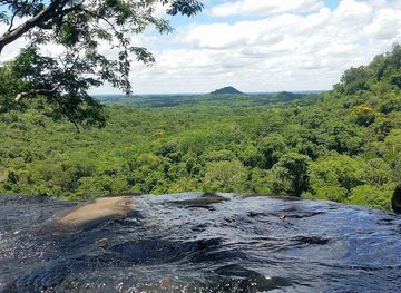
Explore more of Ybytyruzú Mountains
Discover the tranquil beauty of the Ybytyruzú Mountains in Paraguay, where nature's splendor and cultural richness come together for an unforgettable experience.
Explore Ybytyruzú Mountains
Explore more of Paraguay
Discover Paraguay: A blend of history, culture, and natural beauty in the heart of South America. Visit Asunción, explore Jesuit ruins, and experience the local cuisine.
Explore Paraguay