

Santa Cruz Trek Travel Guide - Free Web & App
Your ultimate guide to Santa Cruz Trek. Discover top landmarks, proposed trips, and local tips. Free on the web or via the Evendo companion app.


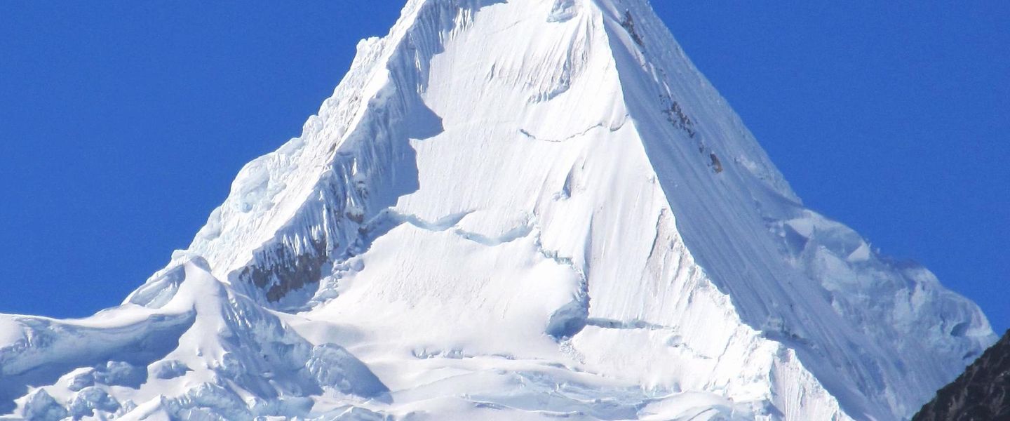


Santa Cruz Trek in Peru crosses the Cordillera Blanca, Huascarán National Park and Punta Unión, with alpine lakes, glaciers and high-altitude hiking.
Mountain Landscape
The Santa Cruz Trek is one of the classic walking routes of Peru's Cordillera Blanca, a glaciated mountain range in the Ancash region. Most itineraries cross Huascarán National Park between the highland villages of Cashapampa and Vaquería, or in the opposite direction, linking narrow valleys, broad pasturelands and a high pass beneath snow-covered peaks. The route is usually completed over several days and reaches Punta Unión at approximately 4,750 metres, making acclimatisation in or around Huaraz essential rather than optional.Read more about Santa Cruz Trek
Lakes, Valleys and Peaks
People and Practical Character
When is the best time to visit Santa Cruz Trek?
Best: June–August · 26°C| Month | High (°C) | Rainfall (mm) |
|---|---|---|
| January | 24 | 50 |
| February | 25 | 45 |
| March | 25 | 40 |
| April | 26 | 35 |
| May | 27 | 30 |
| June (best) | 26 | 25 |
| July (best) | 26 | 25 |
| August (best) | 26 | 30 |
| September | 26 | 35 |
| October | 26 | 40 |
| November | 27 | 45 |
| December | 26 | 50 |
Getting to and around Santa Cruz Trek
How to get there
Transportation
Best attractions in Santa Cruz Trek
The Santa Cruz Trek's principal attractions are the changing landscapes of Huascarán National Park rather than built visitor facilities. The route through the Santa Cruz valley leads past Laguna Ichiccocha and Laguna Jatuncocha, whose blue-green waters reflect surrounding moraine slopes and snowy summits. The climb to Punta Unión is the trek's defining passage, opening views across a stark high-altitude mountain environment before the trail descends towards the Quebrada Huaripampa and Vaquería side of the circuit. Peaks such as Taulliraju, Quitaraju, Artesonraju and Alpamayo form much of the visual drama, although cloud can obscure them. Pampa Queñua woodland and puna grasslands add ecological variety to the glacial scenery, while the approach villages of Cashapampa and Vaquería reveal the working rural landscape beyond the high camps. Huaraz and nearby valleys also provide acclimatisation walks and access to other parts of the Cordillera Blanca, but they are gateways rather than attractions within the Santa Cruz trail itself.
-
Church
Iglesia Del Señor De La Soledad
Explore the architectural beauty and spiritual serenity of Iglesia Del Señor De La Soledad in Huaraz, a must-visit destination for tourists seeking cultural experiences.
-
Mountain peak
Huascaran
Explore the breathtaking heights of Huascarán, Peru's highest peak, where adventure and stunning natural beauty await every traveler.
-
Mountain peak
Churup
Discover the breathtaking beauty of Churup, a majestic mountain peak in Peru perfect for adventurous travelers seeking stunning views.
-
Mountain peak
Pukarahu
Experience the breathtaking beauty of Pukarahu, a majestic mountain peak in Peru that offers unparalleled trekking adventures and stunning vistas.


Best landmarks in Santa Cruz Trek
Punta Unión is the defining natural landmark of the Santa Cruz Trek, a high mountain pass at roughly 4,750 metres linking the Santa Cruz and Huaripampa valleys. The pass is framed by the glaciated summits of the Cordillera Blanca, while Taulliraju is especially prominent in views from the surrounding valleys. Laguna Jatuncocha and Laguna Ichiccocha are important glacial landscape features, their colours and shorelines changing with light, weather and sediment. The broader landmark is Huascarán National Park, whose protected mountain environment includes glaciers, high lakes, puna grassland and stands of native queñua woodland. The route's rural trailheads, particularly Cashapampa and Vaquería, represent the human edge of the landscape rather than monumental architecture. There are no major urban monuments or historic buildings along the high route; its significance lies in the relationship between Andean valleys, glacial terrain and a nationally and internationally protected mountain ecosystem.
-
Hiking area
Trek Santa Cruz
Discover the breathtaking beauty and diverse ecosystems of the Santa Cruz Trek in the Peruvian Andes, a must-visit for hiking enthusiasts.

Explore Santa Cruz Trek on the map
Plan your trip on one map. See where the top attractions, landmarks, restaurants and hotels are, and book hotels and experiences in a few clicks.
Best hotels in Santa Cruz Trek
Best restaurants in Santa Cruz Trek
There are no conventional restaurants along the Santa Cruz Trek, so catering is normally provided by an organised trekking team or planned as self-catering. Meals on supported itineraries commonly rely on practical camp cooking, while visitors should carry snacks suited to long days at altitude and confirm drinking-water arrangements before setting out. The wider regional food culture is rooted in Andean produce such as potatoes, maize, quinoa and native grains, with soups, stews and hearty dishes particularly appropriate in the highland climate; local preparations vary between communities and providers. Huaraz has the broadest choice of restaurants, cafés and markets, while Caraz and other gateway settlements offer simpler places to eat before or after a trek. In rural areas, options may be limited and opening patterns can change, so supplies should not be assumed at trailheads or camps.
-
Restaurant
Trivio Resto Bar
Discover Trivio Resto Bar in Huaraz - where local flavors meet international cuisine in a vibrant setting.
-
Restaurant
Cafe Andino
Discover the flavors of Peru at Cafe Andino in Huaraz – where every meal is a celebration of local culture and culinary excellence.
-
Italian
Mi Comedia - Pizzeria
Discover exquisite Italian cuisine at Mi Comedia - Pizzeria in Huaraz: A culinary delight featuring authentic wood-fired pizzas and more.
-
French
Creperie Patrick
Discover authentic French crepes at Creperie Patrick in Huaraz - where every bite transports you to France amidst breathtaking Andean views.


Best bars in Santa Cruz Trek
Nightlife belongs mainly to Huaraz rather than to the Santa Cruz Trek itself. The city has the region's concentration of cafés, bars and casual evening venues, where climbers, trekkers and local residents sometimes gather after trips, although the atmosphere is generally more relaxed than that of Peru's major nightlife centres. Caraz and other approach settlements offer a quieter choice of local restaurants and small drinking establishments, while villages near the trailheads have very limited evening infrastructure. On the route, nights are defined by camp routines, cold temperatures, dark skies and early starts rather than bars or clubs. Visitors should not expect entertainment facilities at high camps and should respect the quiet of rural communities and protected mountain environments.
-
 Hotel
EL TUMI HOTEL
Discover El Tumi Hotel in Huaraz: A perfect blend of comfort, local cuisine, and stunning Andean adventures await you.
-
Hotel
CORDILLERA HOTEL
Experience unmatched comfort and breathtaking views at Cordillera Hotel, your luxurious base for exploring Huaraz's stunning landscapes.
-
Restaurant
Cafe Andino
Discover the flavors of Peru at Cafe Andino, a charming restaurant and coffee shop in Huaraz offering delightful dishes and a cozy ambiance for every visitor.
-
French
Creperie Patrick
Experience the charming flavors of France at Creperie Patrick in Huaraz, where delightful crepes and fine wines await every visitor.


Best nightclubs in Santa Cruz Trek
Nightlife belongs mainly to Huaraz rather than to the Santa Cruz Trek itself. The city has the region's concentration of cafés, bars and casual evening venues, where climbers, trekkers and local residents sometimes gather after trips, although the atmosphere is generally more relaxed than that of Peru's major nightlife centres. Caraz and other approach settlements offer a quieter choice of local restaurants and small drinking establishments, while villages near the trailheads have very limited evening infrastructure. On the route, nights are defined by camp routines, cold temperatures, dark skies and early starts rather than bars or clubs. Visitors should not expect entertainment facilities at high camps and should respect the quiet of rural communities and protected mountain environments.
-
Disco club
Murcia Club
Discover the vibrant nightlife at Murcia Club, a premier disco club in Independencia, offering electrifying music and a lively atmosphere.
-
Love hotel
Santa Cruz Trek - 4 days / 3 Nights
Discover the breathtaking landscapes of the Santa Cruz Trek in the Peruvian Andes, a must for adventure enthusiasts and nature lovers.


Best shops in Santa Cruz Trek
Shopping on the Santa Cruz Trek is limited to practical supplies arranged before departure, and there are no established retail areas or craft markets at the high camps. Huaraz is the main place to obtain trekking equipment, clothing, food and fuel, with additional provisions available in larger regional settlements according to local supply. Caraz and villages on the approach may offer small shops and basic goods, but visitors should not depend on them for specialist equipment or a complete trekking load. In the wider Ancash region, markets and independent businesses may sell Andean textiles, woven goods, hats, food products and small handicrafts, although selection and availability vary. Buying directly and respectfully from local producers can support rural economies, while bargain-driven purchasing, photographing goods without permission or removing natural materials from the park should be avoided.
-
Hiking area
Trek Santa Cruz
Discover the breathtaking landscapes of Trek Santa Cruz, Peru's premier hiking destination, offering stunning views and rich biodiversity.
-
Clothing store
SANTA CRUZ OUTDOOR
Discover the ultimate outdoor clothing store in Huaraz, offering high-quality gear for trekking and climbing adventures in the Andes.


Get your free copy of our complete guide to Santa Cruz Trek, delivered straight to you.
Everything on this page, from attractions and restaurants to essentials and local phrases, in one PDF you can read offline, print or share.
Already have an account? Sign in
Your Santa Cruz Trek guide is ready.
We'll send it to · Not you? Sign out

Getting your guide ready…
We are putting together a fresh copy of the Santa Cruz Trek guide. This can take up to a minute.
This can take a few moments. If your browser asks, choose Allow so the download can start. You'll find the guide in your Downloads folder.
Nothing happened? Download it again
Sorry, the guide is taking longer than usual. Please try again in a minute, or get it by email instead.
Santa Cruz Trek essentials
Currency and Payment
Safety
Emergency Situations
Do's and Don'ts
Local Tips
From Eve
Local phrases worth knowing
You don't need to get them perfect. A few words go a long way, and locals appreciate the effort.
Basics
| English | Local | Say it |
|---|---|---|
| Hello | ¡Hola! | [O-lah] |
| Goodbye | ¡Adiós! | [Ah-dee-ohs] |
| Yes | Sí | [See] |
| No | No | [Noh] |
| Please/You're welcome | Por favor/De nada | [Pohr fah-vohr/Deh nah-dah] |
| Thank you | ¡Gracias! | [Grah-see-ahs] |
| Excuse me/Sorry | Disculpe/Lo siento | [Dees-kool-peh/Loh see-en-toh] |
| How are you? | ¿Cómo estás? | [Koh-moh ehs-tahs] |
| Fine. And you? | Bien. ¿Y tú? | [Byen. Ee too] |
| Do you speak English? | ¿Hablas inglés? | [Ah-blahs een-glays] |
| I don't understand | No entiendo | [Noh ehn-tyen-doh] |
Eating & Drinking
| English | Local | Say it |
|---|---|---|
| I'd like to see the menu, please | Me gustaría ver el menú, por favor | [Meh goos-tah-ree-ah behr ehl meh-noo, pohr fah-vohr] |
| I don't eat meat | No como carne | [Noh koh-moh kahr-neh] |
| Cheers! | ¡Salud! | [Sah-lood] |
| I would like to pay, please | Me gustaría pagar, por favor | [Meh goos-tah-ree-ah pah-gahr, pohr fah-vohr] |
Emergencies
| English | Local | Say it |
|---|---|---|
| Help! | ¡Ayuda! | [Ah-yoo-dah] |
| Go away! | ¡Vete! | [Veh-teh] |
| Call the Police! | ¡Llama a la Policía! | [Yah-mah ah lah Poh-lee-see-ah] |
| Call a doctor! | ¡Llama a un doctor! | [Yah-mah ah oon dohk-tohr] |
| I'm lost | Estoy perdido/a | [Ehs-toy pehr-dee-doh/dah] |
| I'm ill | Estoy enfermo/a | [Ehs-toy ehn-fehr-moh/dah] |
Shopping
| English | Local | Say it |
|---|---|---|
| I'd like to buy... | Me gustaría comprar... | [Meh goos-tah-ree-ah kohm-prahr] |
| I'm just looking | Solo estoy mirando | [Soh-loh ehs-toy mee-rahn-doh] |
| How much is it? | ¿Cuánto cuesta? | [Kwan-toh kwehs-tah] |
| That's too expensive | Eso es demasiado caro | [Eh-soh ehs deh-mah-syah-doh kah-roh] |
| Can you lower the price? | ¿Puedes rebajar el precio? | [Pweh-dehs reh-bah-hahr ehl preh-syoh] |
Time & Numbers
| English | Local | Say it |
|---|---|---|
| What time is it? | ¿Qué hora es? | [Keh oh-rah ehs] |
| It's one o'clock | Es la una en punto | [Ehs lah oo-nah ehn poon-toh] |
| Half past (10) | Las diez y media | [Las dyehs ee meh-dee-ah] |
| Morning | Mañana | [Mah-nyah-nah] |
| Afternoon | Tarde | [Tahr-deh] |
| Evening | Noche | [Noh-cheh] |
| Yesterday | Ayer | [Ah-yehr] |
| Today | Hoy | [Oy] |
| Tomorrow | Mañana | [Mah-nyah-nah] |
| 1 | Uno | [Oo-noh] |
| 2 | Dos | [Dohs] |
| 3 | Tres | [Trehs] |
| 4 | Cuatro | [Kwah-troh] |
| 5 | Cinco | [Seeng-koh] |
| 6 | Seis | [Sehs] |
| 7 | Siete | [Syeh-teh] |
| 8 | Ocho | [Oh-choh] |
| 9 | Nueve | [Nweh-veh] |
| 10 | Diez | [Dyehs] |
Transport & Directions
| English | Local | Say it |
|---|---|---|
| Where's a/the...? | ¿Dónde está el/la...? | [Dohn-deh ehs-tah ehl/lah] |
| What's the address? | ¿Cuál es la dirección? | [Kwahl ehs lah dee-rehk-syohn] |
| Can you show me (on the map)? | ¿Puedes enseñarme (en el mapa)? | [Pweh-dehs ehn-seh-nyahr-meh (ehn ehl mah-pah)] |
| When's the next (bus)? | ¿Cuándo es el próximo (autobús)? | [Kwan-doh ehs ehl proh-ksee-moh (ow-toh-booce)] |
| A ticket (to ....) | Un boleto (a ....) | [Oon boh-leh-toh (ah)] |
History of Santa Cruz Trek
Ancient Andean Landscapes
The Santa Cruz route crosses landscapes shaped by the long geological history of the Andes, with uplift, erosion and glaciation producing steep valleys, high passes and the moraine-dammed or rock-basin lakes characteristic of the Cordillera Blanca. Human communities have lived in the wider Ancash highlands for centuries, adapting agriculture and pastoralism to sharply different ecological zones. Quechua remains an important language in the region, and traditional rural life is still visible around the valleys and approach villages, although the trekking corridor itself is sparsely settled.
Indigenous Settlement and Regional Change
The valleys around the trek have long formed part of an Andean cultural landscape in which farming, livestock keeping and seasonal movement connect lower settlements with high grazing grounds. The wider Ancash region was influenced by the Chavín civilisation, centred east of the Cordillera Blanca at Chavín de Huántar, and later by Inca and Spanish colonial rule. These wider historical layers are not represented by a single monumental site on the Santa Cruz trail, but they help explain the enduring importance of mountain passes, cultivated valleys and highland communities.
Huascarán National Park
Huascarán National Park was established in 1975 to protect much of the Cordillera Blanca, including glaciers, high-altitude lakes, puna grasslands and important Andean habitats. The park became part of UNESCO's World Network of Biosphere Reserves in 1977 and was inscribed as a World Heritage Site in 1985 for its natural values. The Santa Cruz Trek's contemporary identity therefore developed within a framework of conservation, regulated access and increasing awareness of the sensitivity of high mountain environments.
Trekking and a Changing Mountain Environment
Organised trekking grew as Huaraz became an international base for climbing and walking in the Cordillera Blanca, bringing guides, muleteers, transport providers and equipment businesses into the regional economy. At the same time, retreating glaciers and changing water conditions have made climate change a visible concern across the range. Visitors now encounter a landscape shaped both by long-established pastoral use and by modern conservation management, tourism and the need to protect fragile soils, lakes and high-altitude habitats.
Santa Cruz Trek in Photos
Browse through our photo collection highlighting the charm and character of the destination.
Cities in Santa Cruz Trek
The towns and cities of Santa Cruz Trek, and the easiest places to base yourself.
-

-

-
-
-

-


Swipe for more cities
Neighbouring destination travel guides
The closest destinations to Santa Cruz Trek, if you have time for more than one.
-

-

-

-

-


Swipe for more destinations
Explore more
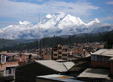
Explore more of Ancash
Discover Ancash, Peru: A region of towering mountains, ancient ruins, and breathtaking landscapes, perfect for adventure seekers and history enthusiasts alike.
Explore Ancash
Explore more of Peru
Discover the wonders of Peru: ancient ruins, stunning landscapes, and a vibrant culture that will captivate your heart and soul.
Explore Peru