

Adam's Peak Travel Guide - Free Web & App
Your ultimate guide to Adam's Peak. Discover top landmarks, proposed trips, and local tips. Free on the web or via the Evendo companion app.


Adam’s Peak in Sri Lanka combines a sacred summit, highland forests, tea country and a demanding pilgrimage climb with sunrise views over the island.
A Mountain of Faith and Landscape
Adam’s Peak, known locally as Sri Pada or Samanala Kanda, rises to 2,243 metres in Sri Lanka’s central highlands. Its summit is marked by a revered footprint-shaped impression in the rock, making the mountain one of the island’s most important pilgrimage destinations. Buddhists traditionally associate the footprint with the Buddha, while Hindus connect it with Shiva; Islamic and Christian traditions also attach their own interpretations to the summit. This shared religious significance gives the mountain a cultural importance that extends well beyond its physical height.Read more about Adam's Peak
The Pilgrimage Routes
Highland Views and Sacred Ritual
When is the best time to visit Adam's Peak?
Best: January–March · 22–23°C| Month | High (°C) | Rainfall (mm) |
|---|---|---|
| January (best) | 22 | 200 |
| February (best) | 23 | 200 |
| March (best) | 23 | 200 |
| April | 24 | 300 |
| May | 24 | 500 |
| June | 25 | 700 |
| July | 25 | 900 |
| August | 24 | 900 |
| September | 24 | 700 |
| October | 23 | 500 |
| November | 23 | 400 |
| December | 22 | 300 |
Getting to and around Adam's Peak
How to get there
Transportation
Best attractions in Adam's Peak
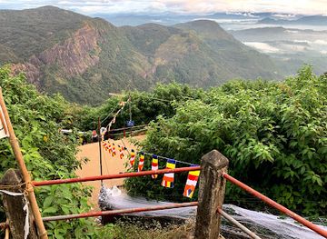
The principal attraction is the pilgrimage ascent to the summit of Adam’s Peak, where the sacred footprint shrine and the pre-dawn atmosphere form the focus of the journey. The Nallathanniya route is the most familiar, with a long stairway through the highland landscape, while Palabaddala and Erathna provide alternative approaches from the Ratnapura side. At the top, clear weather can reveal layered ridges and the surrounding central highlands, although cloud and mist are common. The lower region adds a different set of experiences: tea estates, winding roads and settlements around Hatton and Maskeliya contrast with the wetter forests and valleys near the southern approaches. Visitors interested in the natural setting can explore the wider highland environment through locally appropriate walks and scenic drives, while the pilgrimage infrastructure, shrines and seasonal roadside stalls reveal how religious travel continues to shape the mountain’s visitor culture.
-
Tourist attraction
Horton Plains National Park
Discover the awe-inspiring landscapes and unique biodiversity of Horton Plains National Park, a must-visit destination in the heart of Sri Lanka.
-
Tourist attraction
Sripada Peak Wilderness Sanctuary
Experience the breathtaking landscapes and spiritual significance of Sripada Peak Wilderness Sanctuary, a must-visit destination in Sri Lanka for nature and culture enthusiasts.
-
Tourist attraction
Gartmore Falls
Explore the enchanting Gartmore Falls in Mulgama, a serene escape into nature's beauty, perfect for relaxation and adventure in Sri Lanka.
-
Tourist attraction
Indi Katupāna - Point of Needles
Explore Indi Katupāna, the historic Point of Needles, a breathtaking landmark along the sacred Sri Pada pilgrimage route in Sri Lanka.


Best landmarks in Adam's Peak
The defining landmark is the summit shrine of Sri Pada, built around the footprint-shaped impression revered by several religious traditions. The mountain itself, rising to 2,243 metres, is an important highland landmark visible across parts of the surrounding region, while the triangular shadow seen at sunrise has become an emblematic visual feature of the pilgrimage. The stairway, wayside shrines and seasonal structures along the Nallathanniya approach form a cultural landscape rather than isolated monuments. On the southern side, the routes from Palabaddala and Erathna express the mountain’s older, more dispersed pilgrimage geography. Beyond the sacred summit, the surrounding ridges, forested slopes, tea estates and river valleys are significant natural landmarks that explain Adam’s Peak’s place within Sri Lanka’s central highlands, although visibility and access vary with weather and season.
-
Mountain peak
Sri Pada / Adam's Peak
Discover the spiritual and natural beauty of Sri Pada, also known as Adam's Peak, a sacred mountain offering breathtaking views and unforgettable experiences.
-
National park
Sripada Peak Wilderness Sanctuary
Explore the breathtaking beauty and spiritual significance of Sripada Peak Wilderness Sanctuary, a must-visit national park in Sri Lanka.
-
Buddhist temple
Sri Pada Holy Mountain
Discover the spiritual heart of Sri Lanka at Sri Pada, a sacred mountain offering breathtaking views and a rich tapestry of cultural significance.
-
Historical landmark
Indi Katupāna - Point of Needles
Discover the enchanting Indi Katupāna - Point of Needles, a historical landmark blending rich culture with stunning natural beauty in Sri Lanka.


Explore Adam's Peak on the map
Plan your trip on one map. See where the top attractions, landmarks, restaurants and hotels are, and book hotels and experiences in a few clicks.
Best hotels in Adam's Peak
Best restaurants in Adam's Peak
Dining around Adam’s Peak is concentrated in gateway settlements rather than on the mountain itself. Nallathanniya and nearby plantation communities offer simple cafés, guesthouse meals and small eateries serving Sri Lankan staples such as rice and curry, hoppers, string hoppers, roti and tea, with menus often shaped by what can be prepared for pilgrims and walkers. Hatton and Maskeliya provide a broader choice, including Tamil, Sinhalese and South Asian cooking alongside food served by hotels and guesthouses. Ratnapura and Kuruwita are the more substantial bases for southern approaches. Tea is central to the region’s identity, and local shops commonly serve it with short eats and simple snacks. At busy pilgrimage times, food stalls may operate along the route, but visitors should carry water and avoid assuming that every stop will be open outside the main season.
-
Restaurant
Hill Cool Restaurant හිල් කූල් රෙස්ටුරන්ට්
Experience authentic Sri Lankan flavors amidst breathtaking views at Hill Cool Restaurant in Kotagala.
-
 Hotel
Hugging Clouds Guest house, Restaurant & Tours
Discover tranquility at Hugging Clouds Guest House with cozy stays, delicious dining, and unforgettable tours amidst Sri Lanka's breathtaking landscapes.
-
Restaurant
Blue sky Guest House and Restaurant
Experience unparalleled hospitality at Blue Sky Guest House and Restaurant in Nallathanniya—where comfort meets exquisite local flavors.
-
Restaurant
Dilum's Restaurant ️
Discover the essence of Sri Lanka through authentic flavors at Dilum's Restaurant in Lindula.


Best bars in Adam's Peak
Adam’s Peak is not a nightlife destination, and evening activity is largely shaped by pilgrimage, rest and the early start required by many climbers. Nallathanniya and nearby accommodation areas may have simple dining rooms, tea stalls and quiet guesthouse spaces, while local establishments in Hatton and Maskeliya provide a more conventional setting for an evening meal. Ratnapura offers the widest choice among the main gateways, though its atmosphere remains that of a regional town rather than a resort centre. Alcohol may not be served in every accommodation or eatery, particularly near religious sites, and visitors should not expect nightclubs or a concentrated bar district beside the mountain. During the pilgrimage season, the route can remain active after dark with pilgrims and seasonal stalls, but this is devotional activity rather than commercial nightlife.
-
Hotel
Daddy's Guest Home Bar & Restaurant Cafeteria
Discover the charm of Daddy's Guest Home Bar & Restaurant Cafeteria, your perfect stop at Adam's Peak for authentic cuisine and stunning views.
-
Restaurant
Blue sky Guest House and Restaurant
Discover the comforting embrace of Blue Sky Guest House and Restaurant, your perfect retreat near Adam's Peak in Nallathanniya.
-
Western
Habit Cafe
Discover the exquisite Western cuisine and breathtaking views at Habit Cafe in Nallathanniya, where every meal is a journey for your taste buds.
-
Wine bar
Frank Land Hotel And Bar
Discover a charming wine bar in Hatton, where exquisite wines meet stunning views and delightful ambiance.


Best nightclubs in Adam's Peak
Adam’s Peak is not a nightlife destination, and evening activity is largely shaped by pilgrimage, rest and the early start required by many climbers. Nallathanniya and nearby accommodation areas may have simple dining rooms, tea stalls and quiet guesthouse spaces, while local establishments in Hatton and Maskeliya provide a more conventional setting for an evening meal. Ratnapura offers the widest choice among the main gateways, though its atmosphere remains that of a regional town rather than a resort centre. Alcohol may not be served in every accommodation or eatery, particularly near religious sites, and visitors should not expect nightclubs or a concentrated bar district beside the mountain. During the pilgrimage season, the route can remain active after dark with pilgrims and seasonal stalls, but this is devotional activity rather than commercial nightlife.
-
Mountain peak
Sri Pada / Adam's Peak
Explore the breathtaking Sri Pada, also known as Adam's Peak, a sacred mountain in Sri Lanka renowned for its stunning views and spiritual significance.
-
Asian Fusion
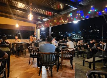
Slightly Chilled Lounge Bar and Restaurant
Discover an Asian Fusion culinary delight at Slightly Chilled Lounge Bar and Restaurant in Kandy, where vibrant flavors meet a relaxing atmosphere.
-
Disco club
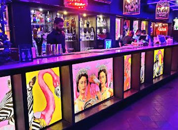
The Love Bar at Flamingo House
Discover the vibrant nightlife at The Love Bar in Colombo, where energetic music, exquisite drinks, and a lively atmosphere await you.
-
Bar
Luccumbe Bar
Explore Luccumbe Bar on Norton - Maskeliya Rd for a vibrant atmosphere and a variety of drinks, capturing the local nightlife in style.


Best shops in Adam's Peak
Shopping at Adam’s Peak is modest and closely linked to pilgrimage and the surrounding highland economy. Nallathanniya has small shops and seasonal stalls selling refreshments, practical items for the climb and religious souvenirs, while larger selections are available in Hatton, Maskeliya, Ratnapura and Kuruwita. Tea from the central highlands is the most recognisable regional purchase, with packets available through shops and tea-related businesses around the plantation districts. Visitors may also encounter devotional objects, simple handicrafts, textiles and locally produced foodstuffs, although the range varies by settlement and season. Ratnapura is also Sri Lanka’s famous gem-trading centre, but gem purchases require particular care, reputable sellers and appropriate documentation. The mountain itself is not a large retail destination, so practical shopping is best completed before beginning the ascent.
-
Mountain peak
Sri Pada / Adam's Peak
Explore the spiritual and natural wonders of Sri Pada, Sri Lanka's iconic Adam's Peak, a trekking paradise and sacred pilgrimage site.
-
Mountain peak
Sri Padaya
Explore the breathtaking beauty and spiritual significance of Sri Padaya, the sacred mountain peak in Sri Lanka, famous for its stunning sunrise views.
-
Hotel
Hugging Clouds Guest house, Restaurant & Tours
Experience comfort and nature at Hugging Clouds Guest House, a perfect retreat for adventure seekers and nature lovers in Nallathanniya.
-
Clothing store
Upul's International
Explore Upul's International in Ratnapura for unique Sri Lankan fashion and accessories that blend tradition with modern style.


Get your free copy of our complete guide to Adam's Peak, delivered straight to you.
Everything on this page, from attractions and restaurants to essentials and local phrases, in one PDF you can read offline, print or share.
Already have an account? Sign in
Your Adam's Peak guide is ready.
We'll send it to · Not you? Sign out

Getting your guide ready…
We are putting together a fresh copy of the Adam's Peak guide. This can take up to a minute.
This can take a few moments. If your browser asks, choose Allow so the download can start. You'll find the guide in your Downloads folder.
Nothing happened? Download it again
Sorry, the guide is taking longer than usual. Please try again in a minute, or get it by email instead.
Adam's Peak essentials
Currency and Payment
Safety
Emergency Situations
Do's and Don'ts
Local Tips
From Eve
Local phrases worth knowing
You don't need to get them perfect. A few words go a long way, and locals appreciate the effort.
Basics
| English | Local | Say it |
|---|---|---|
| Hello | ආයුබෝවන් | [Ayubowan] |
| Goodbye | ආගන්නාස් | [Agannas] |
| Yes | ඔව් | [Owa] |
| No | නෑ | [Nae] |
| Please/You're welcome | කරන්න | [Karanna] |
| Thank you | ස්තූතියි | [Sthuthiyi] |
| Excuse me/Sorry | කරුණාකරන්න | [Karunakaranna] |
| How are you? | ඔයා කොහෙද? | [Oya koheda?] |
| Fine. And you? | හොඳේ. ඔයා? | [Hode. Oya?] |
| Do you speak English? | ඔයා ඉංග්රීසි කතා කරයිද? | [Oya ingreesi katha karayi da?] |
| I don't understand | මට දැනුම් නොවේ | [Mata danum nowe] |
Eating & Drinking
| English | Local | Say it |
|---|---|---|
| I'd like to see the menu, please | කරුණාකරන්න මෙනූ පොතක් බලන්න | [Karunakaranna menu pethann] |
| I don't eat meat | මම වම් නැතිවේ | [Mama vam nativae] |
| Cheers! | සුභ අලුත්මයි! | [Suba aluthmayi] |
| I would like to pay, please | කරුණාකරන්න මම ගෙවන්නයි | [Karunakaranna mama gewanayi] |
Emergencies
| English | Local | Say it |
|---|---|---|
| Help! | උක්තම්! | [Uktam!] |
| Go away! | පිටවන්න! | [Pitawanna!] |
| Call the Police! | පොලිස් ඇතුළත් කරන්න | [Police atulata karanna] |
| Call a doctor! | වෛරයක් ඇතුළත් කරන්න | [Vaidyak atulata karanna] |
| I'm lost | මම අහන්නේ | [Mama ahannae] |
| I'm ill | මම අයියේ | [Mama ayeye] |
Shopping
| English | Local | Say it |
|---|---|---|
| I'd like to buy... | මම ... මෙනූ එකක් වෙනවා | [Mama ... menu ekak wenawa] |
| I'm just looking | මම දැන්ම බලන්න | [Mama danma balanna] |
| How much is it? | එසේ අඩුවක් අඩුවට යන්නෙයි? | [Ese aduwak aduwata yanneyi?] |
| That's too expensive | එය වේගයි | [Eya wegai] |
| Can you lower the price? | අඩු කරන්නක් හොදේද? | [Adu karannak hode?] |
Time & Numbers
| English | Local | Say it |
|---|---|---|
| What time is it? | දිනය කොහෙද? | [Dinaya koheda?] |
| It's one o'clock | එක වත් | [Eka wath] |
| Half past (10) | දහයෙ (දසු) ගිනි | [Dahaye (dasu) gini] |
| Morning | පෙරවරු | [Peravaru] |
| Afternoon | පසළු | [Pasalu] |
| Evening | වයස | [Wayasa] |
| Yesterday | ඊයේ | [Iye] |
| Today | අද | [Ada] |
| Tomorrow | හෙට | [Heta] |
| 1 | එක | [Eka] |
| 2 | දෙක | [Deka] |
| 3 | තුන | [Thuna] |
| 4 | හතර | [Hathara] |
| 5 | පහ | [Paha] |
| 6 | හය | [Haya] |
| 7 | හත | [Hatha] |
| 8 | අට | [Ata] |
| 9 | නත | [Nata] |
| 10 | දහ | [Daha] |
Transport & Directions
| English | Local | Say it |
|---|---|---|
| Where's a/the...? | ... කොහෙද? | [... koheda?] |
| What's the address? | ලිපිනය කොහෙද? | [Lipinaya koheda?] |
| Can you show me (on the map)? | මාපයෙ (මත) පෙන්වන්නයිද? | [Mapaye (mata) penwanayi da?] |
| When's the next (bus)? | ඊළඟ (බස්) කොහෙද? | [Ilanga (bas) koheda?] |
| A ticket (to ....) | ප්රාථමිකය (එකට ....) | [Prathamikaya (ekata ....)] |
History of Adam's Peak
A Mountain Shaped by Water and Time
Adam’s Peak forms part of Sri Lanka’s central highlands, a region of steep ridges, deeply cut valleys and highland streams. The mountain’s elevation and exposed summit distinguish it from the surrounding tea-growing country, while the wet climate has supported forests and waterways on its slopes. Its significance is therefore both physical and cultural: the peak is a prominent landmark in the island’s interior and a source-area landscape for rivers flowing towards lower country. Geological formation belongs to a far earlier timescale than the human pilgrimage traditions that later developed around the summit.
Early Pilgrimage and the Sacred Footprint
The summit footprint has been venerated for centuries, although accounts of the pilgrimage and its origins vary between religious traditions and historical sources. In Sri Lankan Buddhist tradition, the impression is associated with the Buddha and the mountain is called Sri Pada, meaning ‘sacred footprint’. The shrine and ascent became important within the island’s wider network of Buddhist pilgrimage places. The route connected highland communities with visitors from across Sri Lanka, while the mountain’s difficult climb reinforced the devotional character of the journey.
Shared Religious Interpretations
Adam’s Peak is notable for the several religious meanings attached to the same summit. Hindu tradition commonly identifies the footprint with Shiva, while Muslim tradition associates the mountain with Adam’s descent to earth. Christian accounts have also linked it with the apostle Thomas or other sacred interpretations, though these associations differ in detail and historical authority. Rather than belonging exclusively to one tradition, the mountain has long occupied a shared religious landscape in which pilgrimage, local memory and the physical journey to the summit overlap.
Routes, Settlements and Highland Change
Pilgrimage routes developed from different sides of the mountain, including approaches from Palabaddala, Erathna and Nallathanniya. The surrounding highlands changed substantially during the colonial period as commercial plantations, especially tea, expanded around settlements such as Hatton and Maskeliya. Roads and railways improved access to these gateway areas, although the final ascent remained a strenuous climb on foot. Seasonal stalls and basic services grew along the principal pilgrimage route, reflecting the continuing relationship between religious travel and local livelihoods.
Modern Pilgrimage and Conservation
Today Adam’s Peak remains an active pilgrimage centre rather than simply a mountain attraction. The busiest period generally runs through the wetter months of the island’s pilgrimage calendar, when shrines and route facilities support large numbers of visitors; outside that period, services may be reduced and the mountain can feel more solitary. The surrounding forests and highland watersheds have increased the area’s environmental importance, while pressure from litter, foot traffic and seasonal crowds makes responsible behaviour essential. The mountain’s modern identity therefore combines sacred practice, rural tourism and stewardship of a sensitive upland landscape.
Adam's Peak in Photos
Browse through our photo collection highlighting the charm and character of the destination.
Cities in Adam's Peak
The towns and cities of Adam's Peak, and the easiest places to base yourself.
-

-

-

-
-

-


Swipe for more cities
Neighbouring destination travel guides
The closest destinations to Adam's Peak, if you have time for more than one.
-

-

-

-

-


Swipe for more destinations
Explore more

Explore more of Wet Zone
Explore Sri Lanka’s Wet Zone for Colombo culture, Galle’s historic fort, rainforest walks, tropical coasts and cool central tea country.
Explore Wet Zone
Explore more of Sri Lanka
Discover Sri Lanka: Rich culture, stunning landscapes, and warm hospitality await you in this tropical paradise. Explore ancient cities, wildlife, tea plantations, and pristine beaches.
Explore Sri Lanka