

Free Ustyurt Plateau Travel Guide & Mobile App
Explore Ustyurt Plateau with free travel guides. Discover regional history, expert tips, proposed trips, and audio guides on web or mobile app.


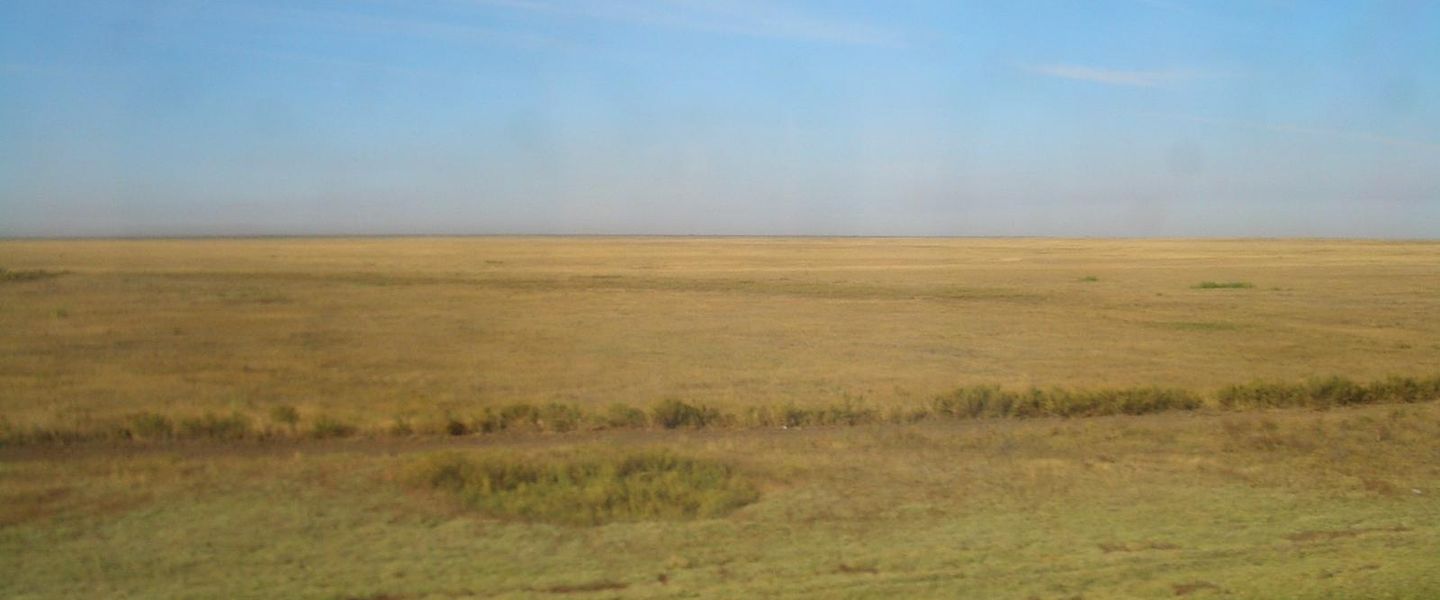


Ustyurt Plateau in Turkmenistan offers remote desert escarpments, geological drama, archaeological horizons and demanding overland travel.
Read more about Ustyurt Plateau
When is the best time to visit Ustyurt Plateau?
Best: May, August–September · 25–30°C| Month | High (°C) | Rainfall (mm) |
|---|---|---|
| January | 3 | 15 |
| February | 6 | 15 |
| March | 11 | 20 |
| April | 19 | 25 |
| May (best) | 25 | 20 |
| June | 30 | 10 |
| July | 32 | 5 |
| August (best) | 30 | 5 |
| September (best) | 25 | 10 |
| October | 18 | 15 |
| November | 10 | 15 |
| December | 6 | 15 |
Getting to and around Ustyurt Plateau
How to get there
Transportation
Destinations in Ustyurt Plateau
Resorts, valleys and scenic spots worth a trip of their own.

Swipe for more destinations
Best attractions in Ustyurt Plateau
The Turkmen section of Ustyurt offers an expedition landscape rather than a conventional collection of visitor attractions. Its principal draw is the plateau itself: immense gravel plains, salt-affected depressions, desert vegetation and long escarpments whose exposed strata reveal the geological history of the Aral-Caspian region. The chinks and ravines are especially compelling for landscape photography and field observation, although their edges and approaches can be hazardous. Wildlife watching may reveal desert-adapted birds, reptiles and mammals, but sightings are unpredictable and should never be guaranteed. Archaeological interest centres on the wider network of wells, trackways and scattered remains associated with movement between Khorezm and the Caspian, best visited with specialist guidance rather than searched for independently. There are no developed museums, resorts or family attractions on the remote plateau itself. Travellers sometimes pair the journey with historic Khorezm sites near Kunya-Urgench, but that oasis heritage lies outside Ustyurt and should be described as a separate nearby component of a broader northern Turkmenistan itinerary.
-
Archaeological site
Gonur Tepe
Discover the ancient wonders of Gonur Tepe, an archaeological gem in Turkmenistan, revealing the secrets of a lost civilization.
-
 Ravine
Aryk Deyston
Explore Aryk Deyston, a stunning ravine in Turkmenistan known for its breathtaking landscapes and rich cultural experiences.

Best landmarks in Ustyurt Plateau
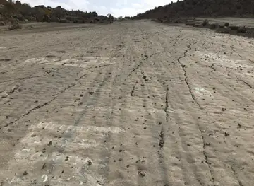
Ustyurt’s most recognisable landmarks are geological rather than architectural. The plateau edge forms long, abrupt escarpments, locally known as chinks, where pale sedimentary rock drops towards lower desert basins and creates some of the region’s strongest profiles. Ravines cut into these faces, while salt depressions and bare gravel surfaces produce a restrained palette of white, beige, ochre and red. Their scale and isolation express the geography of the Aral-Caspian basin more powerfully than any built monument. Historic wells, abandoned tracks and scattered archaeological traces are also important markers of the human landscape, recording movement between oasis and steppe, but many are unmarked and should only be approached with knowledgeable local support. The monumental heritage of Kunya-Urgench is relevant to a wider journey through northern Turkmenistan, yet the site lies outside the Ustyurt Plateau and is not a landmark within this region itself.
-
Mosque
Ertugrul Gazi Mosque
Explore the stunning Ertugrul Gazi Mosque in Ashgabat, Turkmenistan, an architectural masterpiece and a significant cultural landmark.
-
Tourist attraction
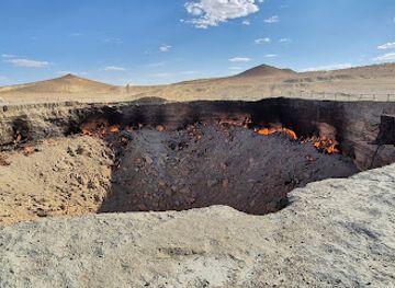
Darvaza Gas Crater - "Door to Hell"
Experience the surreal beauty of the Darvaza Gas Crater, a fiery natural wonder in Turkmenistan's desert, captivating all who dare to visit.
-
Tourist attraction
Independence Monument
Discover the Independence Monument in Ashgabat, a stunning symbol of Turkmenistan's freedom surrounded by beautiful gardens and rich history.
-
Mosque
Turkmenbashy Ruhy Mosque
Experience the architectural splendor and cultural significance of Turkmenbashy Ruhy Mosque in Ashgabat, a central hub of spirituality and heritage.



Explore Ustyurt Plateau on the map
Plan your trip on one map. See where the top cities, national parks and sights are, and book hotels and experiences in a few clicks.
Best hotels in Ustyurt Plateau
Best restaurants in Ustyurt Plateau
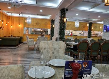
There is no established restaurant scene on the Turkmen section of Ustyurt Plateau. Food for an expedition is normally arranged in advance by the tour operator or prepared by the travelling group, with provisions purchased in a larger town before departure. Meals may draw on Turkmen and wider Central Asian staples such as flatbread, rice dishes, soups, preserved foods, tea and grilled meat, but remote conditions limit fresh produce and refrigeration. Visitors should not expect cafés, roadside eateries, market stalls or reliable drinking-water supplies on the plateau. In gateway towns and villages outside the region, dining is generally more practical and may include home-style cooking or simple restaurants serving national dishes. Carry dietary supplies that are difficult to obtain locally, and confirm arrangements for vegetarian, medical or religious requirements before entering the desert.
-
Steak
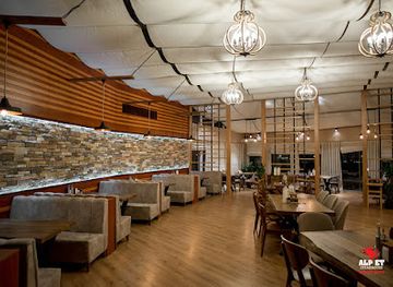
AlpEt Steakhouse
Discover the culinary excellence of AlpEt Steakhouse in Ashgabat - where succulent steaks meet warm hospitality.
-
Cafe
Üzüm Café
Discover the cozy ambiance and delightful flavors at Üzüm Café in Ashgabat – your perfect retreat in Turkmenistan.
-
Restaurant
KOPETDAG PROJECT
Experience authentic Turkmen cuisine at Kopetdag Project in Ashgabat – where tradition meets taste in every dish.
-
Restaurant
Ресторан "SOLTAN"
Experience authentic Turkmen cuisine at Restaurant SOLTAN in Ashgabat - where tradition meets modern elegance.

Best bars in Ustyurt Plateau
Ustyurt Plateau has no meaningful nightlife infrastructure. Evenings are spent at an expedition camp, guest accommodation or a temporary vehicle-supported base, usually with tea, conversation, photography and attention to weather and navigation rather than organised entertainment. Alcohol should not be assumed to be available or appropriate in every setting, particularly near border areas, official facilities or conservative communities. Any cafés or restaurants encountered in gateway towns outside the plateau may offer a modest social setting, but visitors should not expect a dedicated bar district or nightclub scene. The region’s night-time appeal is environmental: exceptionally dark skies, silence and open horizons, all of which require careful behaviour around fire, waste and wildlife.
-
Pub
British Pub
Discover the warmth and hospitality of the British Pub in Ashgabat, offering a taste of Britain in the heart of Turkmenistan.

Best nightclubs in Ustyurt Plateau
Ustyurt Plateau has no meaningful nightlife infrastructure. Evenings are spent at an expedition camp, guest accommodation or a temporary vehicle-supported base, usually with tea, conversation, photography and attention to weather and navigation rather than organised entertainment. Alcohol should not be assumed to be available or appropriate in every setting, particularly near border areas, official facilities or conservative communities. Any cafés or restaurants encountered in gateway towns outside the plateau may offer a modest social setting, but visitors should not expect a dedicated bar district or nightclub scene. The region’s night-time appeal is environmental: exceptionally dark skies, silence and open horizons, all of which require careful behaviour around fire, waste and wildlife.
-
Night club
Yunus Club
Experience the vibrant nightlife at Yunus Club, Ashgabat's premier destination for unforgettable music and dancing.
Best shops in Ustyurt Plateau
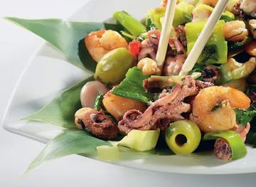
Ustyurt Plateau has no shops, permanent craft market or developed souvenir trade. All practical purchases, including fuel, water, food, medicines, batteries and outdoor supplies, should be made in a gateway town before entering the desert. In settlements outside the plateau, visitors may find Turkmen textiles, embroidered goods, carpets, felt products, dried foods and locally produced household items, although availability and export rules vary. Good souvenirs should come from established shops or authorised sellers rather than from archaeological or geological collecting. Do not buy fossils, artefacts, old coins or apparently historic objects offered informally, since they may be protected, illegally excavated or impossible to export. Shopping is therefore a logistical preparation rather than a core Ustyurt activity.
-
Shopping mall
Berkarar
Explore Berkarar, Ashgabat's premier shopping mall, featuring a wide array of stores, dining options, and cultural experiences in a vibrant atmosphere.
-
Market
State shopping center Gulistan (Russian bazaar)
Discover the heart of Ashgabat at Gulistan State Shopping Center, a vibrant market brimming with local culture, crafts, and culinary delights.
-
Bazar
Teke Bazar
Discover the vibrant heart of Ashgabat at Teke Bazar, where local culture, delicious food, and unique crafts await every traveler.
-
Park
Independence Park
Discover the beauty and history of Independence Park in Ashgabat, a serene oasis filled with monuments and lush landscapes, perfect for relaxation and exploration.


Get your free copy of our complete guide to Ustyurt Plateau, delivered straight to you.
Everything on this page, from attractions and restaurants to essentials and local phrases, in one PDF you can read offline, print or share.
Already have an account? Sign in
Your Ustyurt Plateau guide is ready.
We'll send it to · Not you? Sign out

Getting your guide ready…
We are putting together a fresh copy of the Ustyurt Plateau guide. This can take up to a minute.
This can take a few moments. If your browser asks, choose Allow so the download can start. You'll find the guide in your Downloads folder.
Nothing happened? Download it again
Sorry, the guide is taking longer than usual. Please try again in a minute, or get it by email instead.
Ustyurt Plateau essentials
Currency and Payment
Safety
Emergency Situations
Do's and Don'ts
Local Tips
From Eve
Local phrases worth knowing
You don't need to get them perfect. A few words go a long way, and locals appreciate the effort.
Basics
| English | Local | Say it |
|---|---|---|
| Hello | Salam | [sah-lahm] |
| Goodbye | Hoş görişiň | [hosh go-ree-shin] |
| Yes | Hawa | [hah-wah] |
| No | Ýok | [yok] |
| Please/You're welcome | Siziň üçin | [siz-een ee-zhin] |
| Thank you | Sag boluň | [sahg bo-loon] |
| Excuse me/Sorry | Bagyşlaň | [bah-guh-lahn] |
| How are you? | Näme bilen? | [na-me bee-len] |
| Fine. And you? | Jüýje. Siz näme? | [joo-ee-jay. siz na-me?] |
| Do you speak English? | Inglisçe gepleşýärsiňizmi? | [in-glis-che gep-leh-shyer-sin-iz-mi] |
| I don't understand | Men düşünmeýärin | [men doo-shun-meh-yairin] |
Eating & Drinking
| English | Local | Say it |
|---|---|---|
| I'd like to see the menu, please | Menu görüp bileýin, haýyş | [meh-nu go-roop bee-lay-een, ha-yish] |
| I don't eat meat | Men et iýmeýärin | [men et ee-yeh-meh-yairin] |
| Cheers! | Şerefe! | [she-reh-feh] |
| I would like to pay, please | Hasap bermek isleyin, haýyş | [ha-sap ber-meck iss-leh-een, ha-yish] |
Emergencies
| English | Local | Say it |
|---|---|---|
| Help! | Ýardam! | [yahr-dahm] |
| Go away! | Aşak git! | [ah-shak git] |
| Call the Police! | Polisiýa çagyr! | [po-li-see-yah cha-gir] |
| Call a doctor! | Doktory çagyr! | [dok-tor-ee cha-gir] |
| I'm lost | Men ýitdim | [men yeet-dim] |
| I'm ill | Men keselim | [men keh-seh-lim] |
Shopping
| English | Local | Say it |
|---|---|---|
| I'd like to buy... | Men satyn almak isleyin... | [men sa-tin al-mak iss-leh-een] |
| I'm just looking | Men diňe gözleýärin | [men din-eh gooz-leh-yairin] |
| How much is it? | Bu näçe? | [boo nah-cheh] |
| That's too expensive | Bu aşakdyr | [boo ah-shak-dur] |
| Can you lower the price? | Bahany peseltip bilersiňizmi? | [ba-ha-nee pe-sel-tip bee-lair-sin-iz-mi] |
Time & Numbers
| English | Local | Say it |
|---|---|---|
| What time is it? | Sagat näme? | [sah-gat nah-meh] |
| It's one o'clock | Bu bir sagat | [boo beer sah-gat] |
| Half past (10) | Ona ýetdi | [oh-na yet-dee] |
| Morning | Erken | [er-ken] |
| Afternoon | Gündiz | [gun-diz] |
| Evening | Gije | [gi-jeh] |
| Yesterday | Düýn | [düyn] |
| Today | Şu gün | [shoo gun] |
| Tomorrow | Erte | [er-teh] |
| 1 | Bir | [beer] |
| 2 | Iki | [ee-kee] |
| 3 | Üç | [uech] |
| 4 | Dört | [dur-t] |
| 5 | Bäş | [beh-sh] |
| 6 | Alty | [ahl-tee] |
| 7 | Ýedi | [yeh-dee] |
| 8 | Sekiz | [seh-kiz] |
| 9 | Dokuz | [dok-uz] |
| 10 | On | [on] |
Transport & Directions
| English | Local | Say it |
|---|---|---|
| Where's a/the...? | Nerede ...? | [ne-reh-deh] |
| What's the address? | Salgy näme? | [sal-gy nah-meh] |
| Can you show me (on the map)? | Meni görkezip bilersiňizmi? | [meh-nee go-reh-zip bee-lair-sin-iz-mi] |
| When's the next (bus)? | Indi näme wagt? | [in-dee nah-meh vahkt] |
| A ticket (to ....) | Bilet (....) | [bee-let (....)] |
History of Ustyurt Plateau
Ancient Desert Movement and Early Archaeology
The Ustyurt region formed part of the wider Aral-Caspian environmental zone used by mobile communities from prehistoric times. Its wells, seasonal water sources and sheltered ravines offered intermittent opportunities for movement across otherwise difficult terrain. Archaeological evidence around the plateau and its margins includes traces of pastoral activity, camps and later routes, although settlement was far less continuous than in the irrigated oases to the south and east. The plateau’s significance lies partly in its position between ecological worlds: steppe, desert, Caspian lowlands and the river-fed lands of Khorezm.
Khorezm and the Oasis Frontier
From antiquity through the medieval period, the eastern and southern approaches to Ustyurt were connected with Khorezm, the powerful oasis civilisation centred on the lower Amu Darya. Trade, pastoral migration and political influence extended beyond the cultivated delta into surrounding deserts, while routes crossed the plateau towards the Caspian basin. Ustyurt itself was not a densely urbanised province, but it functioned as a difficult frontier and corridor. The historical monuments of Kunya-Urgench, near the wider Khorezm region but outside the plateau, reflect the settled civilisation that made movement across this desert possible.
Caravan Routes between Khorezm and the Caspian
Medieval and early-modern travellers used routes linking Khorezm with Caspian territories, adapting their journeys to wells, grazing conditions and political security. These were not single permanent roads in the modern sense: tracks shifted with water availability, weather and local control. The plateau’s broad emptiness can therefore be misleading, since it once formed part of a network of caravan movement, pastoral circulation and regional exchange. Surviving wells, track lines and archaeological traces are associated with this wider history, though many are remote and difficult to identify without specialist guidance.
Turkmen Tribal and Political Landscapes
The deserts of western and northern Turkmenistan were shaped by the movements and political relationships of Turkmen groups, neighbouring steppe peoples and oasis authorities. Control was often expressed through access to water, seasonal pasture and routes rather than through permanent administration across every part of the plateau. These shifting relationships formed part of the complex political landscape later incorporated into the Russian imperial sphere and, after revolution, into Soviet Central Asia. The plateau should not be imagined as an empty borderland devoid of human history.
Imperial Survey and Soviet Geological Development
Russian imperial expeditions and later Soviet institutions mapped the Aral-Caspian deserts with increasing precision, recording water sources, routes, elevations and geological formations. During the Soviet period, geological surveying and the search for hydrocarbons brought new technical interest to western Turkmenistan, while roads, military installations and extraction infrastructure altered selected parts of the desert. The Ustyurt landscape remained overwhelmingly open, however, and large areas continued to have few permanent settlements. This era established much of the surveying and industrial framework that still influences access today.
Modern Conservation, Borders and Resource Pressures
Since the end of the Soviet Union, Ustyurt has been divided among independent states whose border controls and land-management systems differ. In Turkmenistan, access is affected by visa rules, security restrictions, industrial interests and the sensitivity of frontier districts. The plateau supports specialised desert wildlife and fragile vegetation, while roads, energy development and unmanaged vehicle travel can disturb habitats and archaeological traces. Contemporary travel to the area therefore combines geographical exploration with strict logistical and environmental responsibilities.
Ustyurt Plateau in Photos
Browse through our photo collection highlighting the charm and character of the destination.
Neighbouring regions of Ustyurt Plateau
The closest regions to Ustyurt Plateau, if you have time for more than one.
-

-

-

-
-


Swipe for more regions
Explore more
Explore more of Turkmenistan
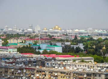
Discover Turkmenistan: A Unique Blend of Ancient Silk Road Heritage, Modern Architectural Marvels, and Stunning Natural Landscapes.
Explore Turkmenistan