From Eve
Know before you go
Hi, I'm Eve. Here are a few practical things to know before exploring Kinder Downfall.
Local know-how to help you travel smarter and make the most of every moment.

Peak District's tallest waterfall, famous for its reversed-flow effect during high winds and dramatic moorland setting.
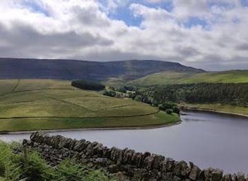
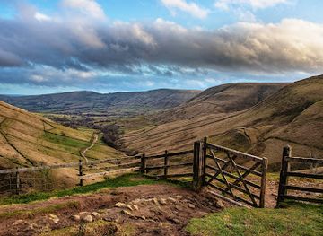
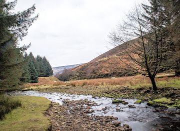
Kinder Downfall is the Peak District's tallest waterfall at 30 metres, cascading dramatically from the edge of Kinder Scout plateau. Located on the River Kinder near Hayfield, this iconic natural landmark is famous for its spectacular reversed waterfall effect during high winds, when water is blown back up and over the cliff edge. Accessible via moderate hiking routes from Hayfield or Edale, it offers breathtaking views and is a favourite destination for hikers, nature enthusiasts, and photographers seeking an unforgettable moorland experience.
Opening times, essentials, and a few local tips gathered into one calmer, easier-to-scan planning section.
Hi, I'm Eve. Here are a few practical things to know before exploring Kinder Downfall.
Local know-how to help you travel smarter and make the most of every moment.
From Hayfield by foot
Start at Bowden Bridge Car Park (165 Kinder Road, Hayfield, High Peak SK22 2LH). Follow William Clough uphill steeply for approximately 1.5 kilometres, gaining 200 metres elevation. The path winds through moorland before reaching the Kinder Plateau edge. Continue along the plateau footpath for approximately 1 kilometre, following the rocky path as it winds along the edge. The total walk is approximately 13.8 kilometres with 596 metres total ascent, taking 4.5 to 5.5 hours. Terrain includes steep initial ascent, exposed moorland, and boggy sections. Suitable for moderate to experienced hikers.
From Edale by foot
Start from Edale village (accessible by train from Manchester or Sheffield). Follow Jacob's Ladder, a historic stepped path ascending steeply onto the Kinder Plateau. Once on the plateau, traverse eastward along the Pennine Way footpath, following the edge until reaching Kinder Downfall. Total distance approximately 13 to 14 kilometres with similar elevation gain to the Hayfield route. Walking time 4.5 to 5.5 hours. The route offers varied terrain and passes through distinctive landscape features. Suitable for moderate to experienced hikers.
By car and public transport to trailhead
By car: From Manchester, take the A57 towards Glossop, then the A624 towards Hayfield. Parking available at Bowden Bridge Car Park or street parking near the Sportsman pub. From Sheffield, take the A6187 towards Edale. By public transport: Edale has regular train services from Manchester Piccadilly and Sheffield (approximately 45 minutes from Manchester, 30 minutes from Sheffield). Hayfield is accessible by bus from Buxton and Stockport. Both villages have visitor facilities including pubs, cafes, and outdoor shops.
Accommodation and facilities nearby
Hayfield and Edale both offer accommodation options ranging from budget to mid-range. Upper Booth farm campsite provides affordable parking and camping facilities. Hayfield village has pubs, cafes, and outdoor shops. Edale, as the southern terminus of the Pennine Way, offers more extensive visitor amenities. No facilities exist at Kinder Downfall itself; all supplies must be brought from the villages. Mobile reception is variable on the plateau.
Catch the right light and the right mood, whether you want a bright city moment or a more cinematic evening visit.


Use Tower Bridge as your starting point for nearby food, family ideas, nightlife, and more local discoveries.
A quick look at seasonal patterns and peak visiting hours.

Explore expert travel guides, compare and book tours, experiences, hotels, and more—all from the palm of your hand. Download now for seamless trip planning wherever your wanderlust takes you.
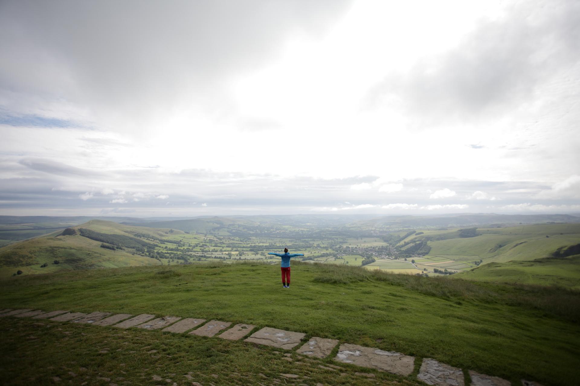
Discover the Peak District: Explore stunning landscapes, historic sites, and charming villages in Britain's first National Park.
Tell me more about Peak District