

Free Radnorshire Travel Guide & Mobile App
Explore Radnorshire with free travel guides. Discover regional history, expert tips, proposed trips, and audio guides on web or mobile app.


Explore Radnorshire in mid-Wales for Victorian spa towns, Elan Valley reservoirs, border history, market towns and quiet hill-country walks.
Read more about Radnorshire
When is the best time to visit Radnorshire?
Best: June–August · 20–23°C| Month | High (°C) | Rainfall (mm) |
|---|---|---|
| January | 7 | 81 |
| February | 7 | 70 |
| March | 10 | 70 |
| April | 14 | 60 |
| May | 17 | 60 |
| June (best) | 20 | 60 |
| July (best) | 23 | 70 |
| August (best) | 23 | 70 |
| September | 19 | 70 |
| October | 14 | 80 |
| November | 10 | 80 |
| December | 7 | 80 |
Getting to and around Radnorshire
How to get there
Transportation
Best attractions in Radnorshire
Radnorshire's attractions are defined less by large visitor complexes than by the relationship between historic settlements, working landscapes and open uplands. The Elan Valley is the region's major landscape attraction, combining Victorian dams and reservoirs with moorland, woodland, walking routes and wildlife habitats. Around Rhayader, visitors can explore the valley at a relaxed pace, while the hills and nature reserves elsewhere in the county provide opportunities for birdwatching, photography and walking. Llandrindod Wells offers museums, spa-era public spaces and the National Cycle Collection, giving context to the town's Victorian development. Presteigne's Judge's Lodging provides an unusually vivid look at the administration of a former county, while Knighton is a useful base for sections of Offa's Dyke Path and the border countryside. Abbeycwmhir brings medieval monastic history into a quiet rural setting, and the surrounding lanes lead towards churches, earthworks and small communities shaped by farming. Activities are primarily walking, cycling, scenic driving, wildlife observation and heritage exploration, with the greatest rewards often coming from combining a modest indoor visit with time in the landscape.
-
Castle
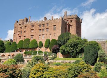
National Trust - Powis Castle and Garden
Explore Powis Castle’s medieval grandeur and stunning terraced gardens nestled in the scenic Welsh countryside.
-
Visitor centre
National Showcaves Centre for Wales
Explore ancient caves, meet life-sized dinosaurs, and enjoy family fun in Wales’ premier underground adventure at the National Showcaves Centre.
-
Pub
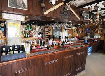
Tŷ Coch Inn
Historic red pub on a sandy beach offering stunning sea views, simple tasty food, and a welcoming dog-friendly atmosphere in North Wales.
-
Botanical garden
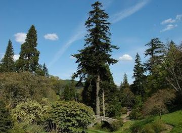
Dawyck Botanic Garden
Explore Dawyck Botanic Garden’s majestic trees, vibrant seasonal blooms, and serene woodland walks in the heart of the Scottish Borders.

Best landmarks in Radnorshire
The Elan Valley dams and reservoirs are Radnorshire's most recognisable engineered landmarks, their stonework, spillways and long water surfaces forming an extensive nineteenth- and twentieth-century landscape of public utility. In Llandrindod Wells, the Pump House, spa-era hotels, villas and landscaped public spaces recall the town's rise as a Victorian health resort, while the Albert Hall and surrounding civic architecture add to its period character. Presteigne's historic centre and parish church express the town's former importance as a county and marcher administrative centre; the Judge's Lodging is especially significant for its survival as a rare assize-court building. At Abbeycwmhir, the remains of Cwmhir Abbey mark the region's medieval religious and political history, including its association with Llywelyn ap Gruffudd. Knighton lies beside the River Teme and near the route of Offa's Dyke, linking the modern border town to the earthwork frontier created in the eighth century. Around New Radnor, castle earthworks and the older settlement pattern point to the strategic importance of the medieval March, even where the surviving remains are more archaeological than monumental.
-
Historical landmark
Machynlleth Town Clock
Historic Machynlleth Town Clock, a Victorian landmark symbolizing community pride and Welsh heritage in the heart of Penrallt Street.
-
Historical landmark
Admiral Rodney’s Pillar
A towering 18th-century monument celebrating Admiral Rodney’s naval victories, set atop scenic Breidden Hill with panoramic valley views.
-
Historical landmark
Llywelyn Monument
A solemn granite monument in Cilmeri marking the historic site where Llywelyn the Last fell, symbolizing Welsh resilience and heritage.


Explore Radnorshire on the map
Plan your trip on one map. See where the top cities, national parks and sights are, and book hotels and experiences in a few clicks.
Best hotels in Radnorshire
Best restaurants in Radnorshire
Dining in Radnorshire reflects its dispersed rural population and agricultural setting. Market towns such as Llandrindod Wells, Rhayader, Presteigne and Knighton provide cafés, bakeries, pubs and restaurants, while country inns and farm-based enterprises serve visitors along the main scenic routes. Welsh lamb and beef, local cheeses, seasonal vegetables, preserves and traditional baking are common regional themes, complemented by produce from the wider Welsh Marches. Breakfasts, soups, savoury pastries and substantial pub meals are useful choices for walkers, while afternoon tea and locally made cakes fit the area's Victorian spa-town heritage. Farm shops and delis are valuable for picnic supplies before travelling into the Elan Valley or the more remote hills. Menus vary considerably with season and location, so advance booking is sensible for smaller rural dining rooms and evening meals. Local ales, ciders and other Welsh drinks may appear alongside a broader British offering, but Radnorshire's food identity is best understood through its links with farms, markets and small-scale producers rather than a single signature dish.
-
 Restaurant
Metropole Hotel and Spa
Historic Victorian hotel with spa and pool facilities offering classic charm and modern comfort in the heart of Llandrindod Wells.
-
Gastropub
The Nags Head Inn
A historic Grade II listed coaching inn blending five-star comfort, award-winning British cuisine, and warm Welsh hospitality in scenic Mid-Wales.
-
Inn
The Felin Fach Griffin
A welcoming inn and gastropub in the Brecon Beacons with cosy rooms, local cuisine, and a friendly atmosphere for families and walkers.
-
Restaurant
The Old Barn Inn
A charming family-run pub in Powys serving seasonal, locally sourced dishes in a cozy barn setting with warm hospitality.

Best bars in Radnorshire
Evenings in Radnorshire are centred on traditional pubs, hotel bars, restaurants and occasional live-music events rather than a large nightclub scene. Llandrindod Wells has the broadest choice of places open after dark, with a mixture of long-established pubs, casual bars and venues connected to the town's accommodation and cultural life. Rhayader, Presteigne and Knighton offer a more compact evening circuit, usually focused on pubs serving local drinks and food. In smaller villages, evening culture is closely tied to community pubs and scheduled events, while rural accommodation may be the practical choice for visitors who do not want to drive after drinking. Some breweries and food venues provide tastings or social events at particular times of year, but arrangements are changeable and should be checked locally. The region's dark skies and quiet lanes also make evenings outdoors attractive, provided visitors use safe routes and respect residents, farmland and wildlife.
-
Gastropub
The Ragleth Inn
A warm and cosy gastropub nestled in the scenic Shropshire countryside, offering excellent ales, fresh food, and friendly village charm.
-
Pub
The Moody Cow
A charming country gastropub blending rustic ambiance with fresh, local British cuisine and warm hospitality in Upton Bishop.
-
Bar
The Three Tuns Inn
Step into centuries of history at The Three Tuns Inn, Bishops Castle’s cozy pub offering local cuisine and exceptional ales in a warm, historic setting.
-
Pub
Lamb & Flag Inn
Traditional British pub and budget-friendly inn offering hearty meals, friendly service, and a lively atmosphere in the heart of Rhayader.


Best nightclubs in Radnorshire
Evenings in Radnorshire are centred on traditional pubs, hotel bars, restaurants and occasional live-music events rather than a large nightclub scene. Llandrindod Wells has the broadest choice of places open after dark, with a mixture of long-established pubs, casual bars and venues connected to the town's accommodation and cultural life. Rhayader, Presteigne and Knighton offer a more compact evening circuit, usually focused on pubs serving local drinks and food. In smaller villages, evening culture is closely tied to community pubs and scheduled events, while rural accommodation may be the practical choice for visitors who do not want to drive after drinking. Some breweries and food venues provide tastings or social events at particular times of year, but arrangements are changeable and should be checked locally. The region's dark skies and quiet lanes also make evenings outdoors attractive, provided visitors use safe routes and respect residents, farmland and wildlife.
-
Nightclub
Trilogy Nightclub
Experience Bangor’s vibrant nightlife at Trilogy Nightclub, where music, themed rooms, and lively crowds create unforgettable weekend nights.
-
Nightclub
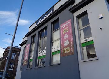
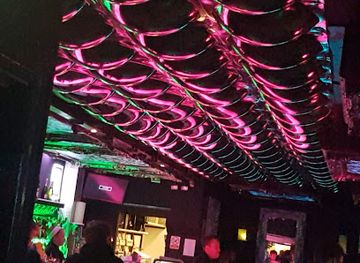
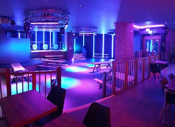
Academi
A lively, student-centered nightclub in Bangor offering affordable nights out, themed parties, and a welcoming atmosphere for university social life.
-
Nightclub
Eddie Rocks
Experience vibrant nightlife and diverse music at Eddie Rocks, Haverfordwest’s energetic multi-floor nightclub with a welcoming atmosphere.
-
Nightclub
Pulse
A vibrant LGBTQ+ nightclub and café in Cardiff, Pulse offers lively music, themed nights, and a welcoming atmosphere day and night.

Best shops in Radnorshire
Shopping in Radnorshire is concentrated in small market towns rather than large retail centres. Llandrindod Wells has the widest selection of everyday shops, independent retailers, galleries and services, while Presteigne and Knighton are suited to browsing smaller high-street businesses, books, antiques, gifts and locally made goods. Rhayader is a practical place to buy provisions and outdoor essentials before travelling into the Elan Valley. Farm shops, delis and periodic markets offer Welsh cheeses, preserves, honey, baked goods, meat and other produce associated with the surrounding countryside. Craft shopping may include pottery, textiles, artwork, woodwork and jewellery, although availability varies by town and season. Visitors seeking a regional souvenir should look for products with a clear local provenance rather than assuming every Welsh-themed item was made in Radnorshire. Opening arrangements can be limited in smaller settlements, particularly outside the main visitor season, so shopping is best combined with market days, gallery visits or planned stops in the principal towns.
-
Convenience Store
Escos
Your friendly village convenience store in New Radnor, offering local produce and essentials in a welcoming Welsh countryside setting.
-
Gift shop
Anrhegaron | Welsh Gifts
Discover authentic Welsh craftsmanship and unique gifts at Anrhegaron, a charming boutique in Tregaron’s historic market square.
-
Clothing Shop
Siop Awyr Acored The Outdoor Shop
Your trusted outdoor gear specialist in Llanberis, offering quality clothing and expert advice for Snowdonia adventures.
-
Gift shop
Gifts of Wales Ltd
Discover authentic Welsh gifts and artisanal treasures in the heart of Welshpool’s historic market town.


Get your free copy of our complete guide to Radnorshire, delivered straight to you.
Everything on this page, from attractions and restaurants to essentials and local phrases, in one PDF you can read offline, print or share.
Already have an account? Sign in
Your Radnorshire guide is ready.
We'll send it to · Not you? Sign out

Getting your guide ready…
We are putting together a fresh copy of the Radnorshire guide. This can take up to a minute.
This can take a few moments. If your browser asks, choose Allow so the download can start. You'll find the guide in your Downloads folder.
Nothing happened? Download it again
Sorry, the guide is taking longer than usual. Please try again in a minute, or get it by email instead.
Radnorshire essentials
Currency and Payment
Safety
Emergency Situations
Do's and Don'ts
Local Tips
From Eve
Local phrases worth knowing
You don't need to get them perfect. A few words go a long way, and locals appreciate the effort.
Basics
| English | Local | Say it |
|---|---|---|
| Hello | Shwmae | [shoo-my] |
| Goodbye | Hwyl fawr | [hool vowr] |
| Yes | Ie | [yay] |
| No | Na | [nah] |
| Please/You're welcome | Os gwelwch yn dda | [oss gweh-lukh un thah] |
| Thank you | Diolch | [dee-olch] |
| Excuse me/Sorry | Mae'n ddrwg gennyf | [my-een droog gen-iv] |
| How are you? | Sut wyt ti? | [sit weet tee] |
| Fine. And you? | Iawn. A ti? | [yown. ah tee] |
| Do you speak English? | Wyt ti'n siarad Saesneg? | [weet teen sha-rad sighs-neg] |
| I don't understand | Dydw i ddim yn deall | [dih-doo ee dim un deh-al] |
Eating & Drinking
| English | Local | Say it |
|---|---|---|
| I'd like to see the menu, please | Baswn i'n hoffi gweld y fwydlen, os gwelwch yn dda | [bah-soon een hoff-ee gweh-lled uh voo-id-len, oss gweh-lukh un thah] |
| I don't eat meat | Dydw i ddim yn bwyta cig | [dih-doo ee dim un boo-ee-ta keeg] |
| Cheers! | Iechyd da! | [yeh-khid dah] |
| I would like to pay, please | Baswn i'n hoffi talu, os gwelwch yn dda | [bah-soon een hoff-ee tah-lee, oss gweh-lukh un thah] |
Emergencies
| English | Local | Say it |
|---|---|---|
| Help! | Help! | [help] |
| Go away! | Dewch yma! | [dewch uh-ma] |
| Call the Police! | Galwch am y heddlu! | [gal-ook ahm uh hed-lee] |
| Call a doctor! | Galwch am doctor! | [gal-ook ahm doc-tor] |
| I'm lost | Rwy'n colledig | [roo-een kol-thee-g] |
| I'm ill | Rwy'n sâl | [roo-een sahl] |
Shopping
| English | Local | Say it |
|---|---|---|
| I'd like to buy... | Baswn i'n hoffi prynu... | [bah-soon een hoff-ee prin-ee] |
| I'm just looking | Rwy'n dim ond edrych | [roo-een dim ond ed-rukh] |
| How much is it? | Faint mae'n costio? | [vint mine koss-tee-oh] |
| That's too expensive | Mae hynny'n rhy drud | [my huni un ree drid] |
| Can you lower the price? | Alla i ostwng y pris? | [ah-lah ee ost-ung uh prees] |
Time & Numbers
| English | Local | Say it |
|---|---|---|
| What time is it? | Faint yw'r awr? | [vint yoo'r ow-r] |
| It's one o'clock | Mae hi'n un o'r gloch | [my heen een or gloch] |
| Half past (10) | Hanner awr | [han-er ow-r] |
| Morning | Bore | [bore-eh] |
| Afternoon | Pryd dydd | [prid dhee] |
| Evening | Prynhawn | [prin-hown] |
| Yesterday | Ddoe | [thoy] |
| Today | Heddiw | [heh-dhiw] |
| Tomorrow | Fory | [vor-ee] |
| 1 | Un | [een] |
| 2 | Dau | [die] |
| 3 | Tri | [tree] |
| 4 | Pedwar | [ped-war] |
| 5 | Pump | [pum-p] |
| 6 | Chwech | [khwehkh] |
| 7 | Saith | [sigh-th] |
| 8 | Wyth | [wee-th] |
| 9 | Naw | [now] |
| 10 | Deg | [deg] |
Transport & Directions
| English | Local | Say it |
|---|---|---|
| Where's a/the...? | Ble mae...? | [bleh my...?] |
| What's the address? | Beth yw'r cyfeiriad? | [beth yoo'r kuh-vey-ree-ad] |
| Can you show me (on the map)? | Allwch chi fy ngwneud i ar y map? | [ahl-ook kee vee ng-wain ee ar uh map] |
| When's the next (bus)? | Pryd mae'r bws nesaf? | [prid mire bus neh-sahf] |
| A ticket (to ....) | Tocyn (i ....) | [tok-inn (ee ....)] |
History of Radnorshire
Prehistoric Hillforts and Early Settlement
Radnorshire's hills contain evidence of settlement long before the creation of the county, including prehistoric earthworks and defended hilltops associated with communities living from farming and pastoralism. The upland landscape encouraged scattered settlement rather than large urban centres, and many archaeological remains are now experienced as subtle banks, ditches and elevated sites rather than monumental ruins. These places help explain the region's enduring pattern of open ridges, small valleys and dispersed communities. Later roads and fields often overlay earlier land use, so the historic landscape is best understood as a succession of adaptations to the same hills and river corridors.
The Norman March and Medieval Radnor
After the Norman conquest of England, the terrain along the Welsh border became part of the March of Wales, where powerful lords built castles and established boroughs to control routes and territory. Radnor, Presteigne and nearby settlements developed within this contested frontier zone. New Radnor became an important medieval centre, while castles and churches expressed the authority of marcher institutions. The region's political identity was shaped by shifting relationships between English crown interests, marcher lordships and Welsh communities. Much of the original castle fabric has disappeared, but town plans, earthworks, parish churches and surviving street patterns preserve the medieval framework.
Cwmhir Abbey and the Welsh Princes
Cwmhir Abbey was founded for the Cistercians in the late twelfth century in a secluded valley near Abbeycwmhir. Although the monastery was never completed on the grand scale originally intended, it became an important religious foundation in a region where Welsh and marcher interests overlapped. The abbey is also associated with Llywelyn ap Gruffudd, the last native Prince of Wales, who was killed nearby in 1282 during the final campaigns of Edward I's conquest. The surviving ruins and later interpretations of the site offer a powerful reminder that central Wales was involved in the major political struggles of medieval Welsh history.
Owain Glyndwr and the Battle of Bryn Glas
The Glyndwr rising in the early fifteenth century reached into Radnorshire and the borderlands. In 1402, forces supporting Owain Glyndwr defeated an English army at the Battle of Bryn Glas near Pilleth, close to Knighton. The battle demonstrated the continuing strategic importance of the border and the ability of the rebellion to challenge English authority beyond its strongest Welsh heartlands. Today the battlefield landscape is rural and understated, but its location near Knighton places it within one of the region's most historically charged corridors. The episode forms part of the longer story of Welsh resistance and political change.
Turnpikes, Agriculture and the Market County
From the eighteenth century, improved roads and turnpike trusts linked Radnorshire's market towns more effectively with Herefordshire, Shropshire and the developing commercial centres of Wales and England. Agriculture remained central, particularly sheep farming and cattle dealing, while fairs and markets gave towns such as Presteigne, Knighton and Rhayader their economic roles. The county remained relatively sparsely populated and industrialisation was limited compared with South Wales, but transport improvements changed the movement of livestock, people and goods. This agricultural economy still shapes the appearance of the valleys, commons and small settlements.
Victorian Spa Culture and the Railway
Llandrindod Wells expanded rapidly in the nineteenth century after the popularity of spa treatments brought visitors seeking mineral waters and leisure. Hotels, villas, public gardens and civic buildings gave the settlement a distinctive Victorian character. The arrival of the railway made the spa accessible from wider parts of Britain and connected Radnorshire more closely to national markets. Although the fashion for taking the waters declined, Llandrindod Wells retained its role as an administrative and service centre. Its architecture and public spaces remain the clearest regional record of the county's Victorian transformation.
The Elan Valley Waterworks
The construction of the Elan Valley reservoirs began in the late nineteenth century to supply Birmingham with clean water. Dams, aqueducts, purpose-built infrastructure and altered valley settlements created one of Britain's most extensive upland water-supply schemes. The project transformed the landscape while leaving much of the surrounding hills open and pastoral. Today the reservoirs are both working infrastructure and a major recreational setting, valued for walking, landscape photography, wildlife and engineering interest. Their presence illustrates how decisions made beyond Radnorshire could reshape its economy, geography and public identity.
Radnorshire in Photos
Browse through our photo collection highlighting the charm and character of the destination.
Neighbouring regions of Radnorshire
The closest regions to Radnorshire, if you have time for more than one.
-

-

-

-
-


Swipe for more regions
Explore more

Explore more of United Kingdom
Discover the United Kingdom: A blend of rich history, stunning landscapes, and vibrant cities, offering a unique travel experience for every visitor.
Explore United Kingdom