

Smugglers' Notch State Park Travel Guide - Free Web & App
Your ultimate guide to Smugglers' Notch State Park. Discover top landmarks, proposed trips, and local tips. Free on the web or via the Evendo companion app.


Smugglers' Notch State Park in Vermont pairs granite cliffs, forest trails and seasonal camping with scenic drives, hiking and access to Mount Mansfield.
Cliffs, Forest and a Narrow Mountain Pass
Smugglers' Notch State Park occupies the dramatic southern gateway to Smugglers' Notch, a constricted mountain pass in northern Vermont where Route 108 threads between Mount Mansfield and Sterling Mountain. Massive granite walls, glacial boulders, spruce and northern hardwood forest give the area a character unlike the more open farming valleys beyond Stowe and Jeffersonville. The state park is closely associated with the notch itself, although the wider landscape also extends through Mount Mansfield State Forest and other protected mountain terrain.Read more about Smugglers' Notch State Park
Outdoor Access and Seasonal Character
A Landscape Shaped by History
When is the best time to visit Smugglers' Notch State Park?
Best: June–August · 24–26°C| Month | High (°C) | Rainfall (mm) |
|---|---|---|
| January | -4 | 75 |
| February | -2 | 70 |
| March | 4 | 80 |
| April | 11 | 85 |
| May | 18 | 95 |
| June (best) | 24 | 100 |
| July (best) | 26 | 105 |
| August (best) | 25 | 100 |
| September | 20 | 95 |
| October | 13 | 90 |
| November | 6 | 85 |
| December | 0 | 80 |
Getting to and around Smugglers' Notch State Park
How to get there
Transportation
Best attractions in Smugglers' Notch State Park
The defining attraction is the notch itself, where Route 108 passes between towering rock walls and huge glacial boulders in a narrow forested valley. Smugglers' Notch State Park provides seasonal camping and access to the surrounding mountain environment, while nearby trails lead into the wider Mount Mansfield landscape. The Long Trail crosses the Green Mountains through this region, and Sterling Pond Trail climbs towards a high-elevation pond on the Sterling Mountain side. Bingham Falls, outside the state park in the surrounding public-forest landscape, is a popular waterfall destination reached from the Route 108 area, though access and conditions vary. Hikers can also explore routes towards Mount Mansfield, Vermont's highest summit, from other approaches near Stowe. The villages of Stowe and Jeffersonville are useful complements to the natural attractions, offering local history, food and supplies rather than forming part of the state park itself.
-
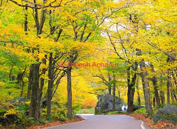
Mountain pass
Smugglers Notch
Experience the breathtaking views and outdoor adventures at Smugglers Notch, a stunning mountain pass in Vermont's Green Mountains.
-
Park
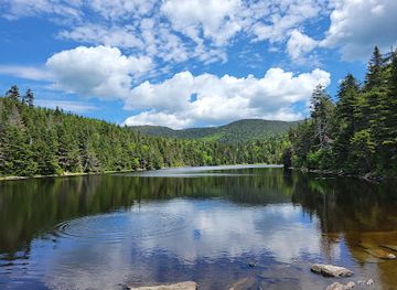
Sterling Pond Trail
Explore the breathtaking beauty of Sterling Pond Trail in Stowe, Vermont, where nature and tranquility await every visitor.
-
Tourist information center
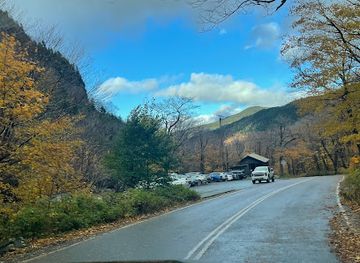
Smugglers' Notch Visitor Center
Explore the stunning Green Mountains at Smugglers' Notch Visitor Center, your essential stop for local insights and resources in Stowe, Vermont.
Best landmarks in Smugglers' Notch State Park
Smugglers' Notch is the principal landmark: a narrow passage between Mount Mansfield and Sterling Mountain marked by steep granite walls, forested slopes and angular boulders left by glacial action. Its physical confinement explains both the route's historic reputation and the distinctive character of the modern road. The Long Trail is another important regional landmark, forming part of the long-distance footpath that follows Vermont's Green Mountains. Sterling Pond, reached by a steep trail on the mountain side of the notch, is notable for its high setting and forest surroundings, while nearby Bingham Falls provides a contrasting waterfall landscape outside the state park's core facilities. Mount Mansfield, visible from parts of the wider region, dominates the southern mountain skyline and gives the surrounding landscape its highest point and distinctive alpine character.
-
Tourist information center
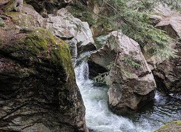
Smugglers' Notch Visitor Center
Explore the beautiful Green Mountains at Smugglers' Notch Visitor Center, your gateway to adventure in Vermont's stunning outdoor landscape.
Explore Smugglers' Notch State Park on the map
Plan your trip on one map. See where the top attractions, landmarks, restaurants and hotels are, and book hotels and experiences in a few clicks.
Best hotels in Smugglers' Notch State Park
Get your free copy of our complete guide to Smugglers' Notch State Park, delivered straight to you.
Everything on this page, from attractions and restaurants to essentials and local phrases, in one PDF you can read offline, print or share.
Already have an account? Sign in
Your Smugglers' Notch State Park guide is ready.
We'll send it to · Not you? Sign out

Getting your guide ready…
We are putting together a fresh copy of the Smugglers' Notch State Park guide. This can take up to a minute.
This can take a few moments. If your browser asks, choose Allow so the download can start. You'll find the guide in your Downloads folder.
Nothing happened? Download it again
Sorry, the guide is taking longer than usual. Please try again in a minute, or get it by email instead.
Smugglers' Notch State Park essentials
Currency and Payment
Safety
Emergency Situations
Do's and Don'ts
Local Tips
From Eve
Local phrases worth knowing
You don't need to get them perfect. A few words go a long way, and locals appreciate the effort.
Basics
| English | Local | Say it |
|---|---|---|
| Hello | Howdy | [haw-dee] |
| Goodbye | Catch ya later | [ketch ya lay-tur] |
| Yes | Yup | [yup] |
| No | Nah | [nah] |
| Please/You're welcome | Sure thing | [shur thang] |
| Thank you | Much obliged | [muhch uh-blahy-jd] |
| Excuse me/Sorry | Pardon | [pahr-dn] |
| How are you? | How's it goin'? | [hows it go-in] |
| Fine. And you? | Not too shabby. You? | [naht too shab-bee. yoo] |
| Do you speak English? | Ya speak English? | [yah speak ing-glish] |
| I don't understand | I ain't gettin' ya | [ahnt get-tin yah] |
Eating & Drinking
| English | Local | Say it |
|---|---|---|
| I'd like to see the menu, please | Can I check out the grub options, please | [kan eye chek out thuh grub op-shuns, please] |
| I don't eat meat | I'm a veggie | [ahm uh veh-jee] |
| Cheers! | Bottoms up! | [bot-uhms up] |
| I would like to pay, please | I'll settle up now, please | [ahyl set-tl up now, please] |
Emergencies
| English | Local | Say it |
|---|---|---|
| Help! | SOS! | [ess-oh-ess] |
| Go away! | Scram! | [skram] |
| Call the Police! | Get the cops! | [get thuh cops] |
| Call a doctor! | Summon a healer! | [sum-muhn uh hee-lur] |
| I'm lost | I'm disoriented | [ahm dis-or-ee-en-ted] |
| I'm ill | I'm under the weather | [ahm un-der thuh weh-thur] |
Shopping
| English | Local | Say it |
|---|---|---|
| I'd like to buy... | I'm interested in... | [ahm in-tur-es-ted in] |
| I'm just looking | Just browsin' | [just brow-zin] |
| How much is it? | What's the damage? | [wuts thuh dam-ij] |
| That's too expensive | That's a bit steep | [thats uh bit steep] |
| Can you lower the price? | Can ya do any better on the price? | [kan yah do any bet-er on thuh price] |
Time & Numbers
| English | Local | Say it |
|---|---|---|
| What time is it? | What's the hour? | [wuts thuh ow-ur] |
| It's one o'clock | It's one | [its wun] |
| Half past (10) | Ten thirty | [ten thur-tee] |
| Morning | Mornin' | [morn-in] |
| Afternoon | Afternoon | [af-ter-noon] |
| Evening | Evenin' | [even-in] |
| Yesterday | Yest'day | [yest-duh] |
| Today | Today | [to-day] |
| Tomorrow | Tomorra | [tuh-mor-uh] |
| 1 | One | [wun] |
| 2 | Two | [too] |
| 3 | Three | [three] |
| 4 | Four | [for] |
| 5 | Five | [five] |
| 6 | Six | [six] |
| 7 | Seven | [sev-en] |
| 8 | Eight | [ayt] |
| 9 | Nine | [nine] |
| 10 | Ten | [ten] |
Transport & Directions
| English | Local | Say it |
|---|---|---|
| Where's a/the...? | Where's the... | [wheres thuh] |
| What's the address? | What's the street? | [wuts thuh street] |
| Can you show me (on the map)? | Can ya point it out? | [kan yah point it out] |
| When's the next (bus)? | When's the next ride? | [whens thuh next ryd] |
| A ticket (to ....) | A pass (to ....) | [uh pass (to)] |
History of Smugglers' Notch State Park
A Pass Shaped by Ice
Smugglers' Notch is a glacial mountain pass formed within the northern Green Mountains, where moving ice helped carve a narrow corridor between Mount Mansfield and Sterling Mountain. The resulting cliffs, enormous boulders and steep-sided valley define the landscape encountered today. These geological features are not a human historical period, but they explain why the route became both a natural passage and a dramatic obstacle for travellers crossing the mountains.
Early Routes Through the Mountains
Long before modern tourism, Indigenous peoples travelled through the wider Green Mountain region, using established knowledge of valleys, waterways and mountain passes. European settlement gradually brought farms, timber cutting and local roads into northern Vermont. The notch remained difficult to cross, and its restricted terrain gave it strategic value as a route through otherwise challenging mountain country. The name Smugglers' Notch reflects this history of concealment and evasion rather than a single documented episode.
Smuggling and Mountain Settlement
The pass became associated with smuggling during the early nineteenth century, particularly when people sought to avoid trade restrictions connected with the Embargo period and the War of 1812. Its isolated ravines and difficult terrain also encouraged later stories of illicit movement during Prohibition. At the same time, the surrounding communities developed through farming, timber work and small-scale commerce, while the mountain forests were repeatedly altered by logging and changing land-use practices.
Roads, Recreation and Conservation
Improved road access eventually transformed Smugglers' Notch from a difficult local passage into a scenic destination. The modern route through the pass remains constrained by steep rock walls, and seasonal closures reflect the practical limits of winter travel in this terrain. State ownership and conservation management helped protect the mountain landscape while allowing carefully managed recreation. The state park, campground and nearby public forest now support hiking, camping and scenic travel without removing the area's rugged physical character.
Smugglers' Notch State Park in Photos
Browse through our photo collection highlighting the charm and character of the destination.
Neighbouring destination travel guides
The closest destinations to Smugglers' Notch State Park, if you have time for more than one.
-

-

-

-

-


Swipe for more destinations
Explore more

Explore more of Lamoille County
Explore Lamoille County’s Vermont villages, ski slopes, maple farms, mountain passes, lakes and river valleys across every season.
Explore Lamoille County
Explore more of Vermont
Discover Vermont: A year-round haven of natural beauty, charming towns, and rich heritage in the Green Mountain State.
Explore Vermont