

Free Eastern Shore Travel Guide & Mobile App
Explore Eastern Shore with free travel guides. Discover regional history, expert tips, proposed trips, and audio guides on web or mobile app.


Explore Virginia’s Eastern Shore for Atlantic wildlife, bay beaches, historic towns, seafood, farm produce and boat-access island communities.
Read more about Eastern Shore
Getting to and around Eastern Shore
How to get there
Transportation
Best attractions in Eastern Shore
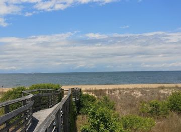
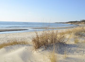
The Eastern Shore’s attractions are closely tied to its coastal geography and small-town scale. Chincoteague is the main base for visiting Chincoteague National Wildlife Refuge and the Virginia side of Assateague Island, where beaches, dunes, marshes and migratory birds provide opportunities for walking, photography and wildlife observation. Kiptopeke State Park offers Chesapeake Bay access, trails and views of the line of concrete ships used as an offshore breakwater. At the peninsula’s southern tip, the Eastern Shore of Virginia National Wildlife Refuge protects important habitat and has trails and interpretation focused on migration and coastal ecology. Cape Charles, Onancock and Accomac provide historic streets, museums, galleries and preserved civic buildings, while the Barrier Islands Center in Machipongo interprets island communities and maritime life. NASA Wallops Flight Facility, near Wallops Island, adds a scientific dimension through visitor information and public launch viewing when available. Kayaking, charter fishing, birdwatching and cycling reveal landscapes that are easy to miss from the main road, although boat trips and refuge access should be checked ahead.
-
State park
First Landing State Park
Discover the breathtaking beauty and rich history of First Landing State Park, a natural oasis in Virginia Beach perfect for outdoor adventures.
-
Wildlife refuge
Chincoteague National Wildlife Refuge
Discover the stunning beauty and diverse wildlife at Chincoteague National Wildlife Refuge, a must-visit destination for nature lovers and adventurers alike.
-
Historical landmark
Cape Henry Lighthouse
Discover the historic Cape Henry Lighthouse, where maritime history meets breathtaking views of the Atlantic coast.
-
State park
Kiptopeke State Park
Explore the serene landscapes and endless recreational activities at Kiptopeke State Park, a gem on Virginia's Eastern Shore.


Best landmarks in Eastern Shore
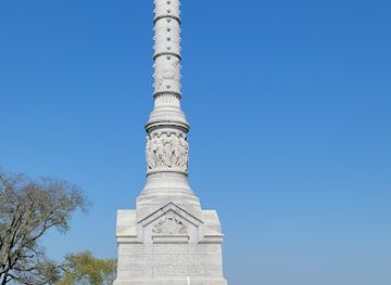
Cape Charles Historic District is one of the Eastern Shore’s most recognisable built landmarks, with a regular street grid and rows of Victorian and early-twentieth-century houses, commercial buildings and railway-era structures. In Onancock, the historic town centre and houses such as Ker Place preserve the architectural imprint of a Chesapeake port shaped by trade and county society. Accomac’s courthouse area expresses the peninsula’s long history of local government and public institutions. At Kiptopeke State Park, the line of concrete ships offshore is an unusual industrial and maritime landmark, built during the Second World War and later used as a breakwater. The lighthouse and maritime structures associated with Chincoteague and Assateague reflect the hazards of the Atlantic coast, while the barrier islands themselves are major natural landmarks defined by shifting sand, ocean beaches and tidal marshes. The Chesapeake Bay Bridge-Tunnel lies outside the region but is the dramatic southern gateway through which many visitors arrive.
-
Battle site
Yorktown Battlefield
Discover the pivotal moments of the American Revolutionary War at Yorktown Battlefield, where history comes alive amidst scenic landscapes and educational tours.
-
State park
First Landing State Park
Explore the natural wonders and historical significance of First Landing State Park, a stunning coastal paradise in Virginia Beach.
-
Historical landmark
USS Wisconsin BB-64
Discover the USS Wisconsin BB-64, a historic battleship and maritime museum in Norfolk, Virginia, showcasing naval history and heritage.
-
Archaeological museum
Historic Jamestowne
Explore the historical roots of America at Historic Jamestowne, where the past comes alive through archaeology and engaging exhibits.

Explore Eastern Shore on the map
Plan your trip on one map. See where the top cities, national parks and sights are, and book hotels and experiences in a few clicks.
Best hotels in Eastern Shore
Best restaurants in Eastern Shore
Dining on Virginia’s Eastern Shore reflects both the Atlantic and Chesapeake settings and the peninsula’s agricultural interior. Oysters, clams, blue crabs, locally caught fish and other seafood feature in restaurants, dockside businesses and seasonal markets, while farm stands supply tomatoes, corn, melons and other produce. Cape Charles, Onancock and Chincoteague have the broadest choice of cafés, seafood restaurants, bakeries, casual eateries and more contemporary menus; smaller communities tend towards local diners, country stores and informal establishments. Traditional Southern and Mid-Atlantic influences appear in seafood preparations, crab dishes, fritters, barbecue, biscuits and vegetable sides, alongside familiar American fare. Local craft drinks and Virginia wines may appear on menus, but availability varies. The region is best approached as a place for fresh, seasonal eating rather than a single signature cuisine, and visitors should ask about the day’s catch and farm produce.
-
Seafood
Waterman's Surfside Grille
Experience fresh seafood and stunning ocean views at Waterman's Surfside Grille in Virginia Beach.
-
Seafood
Dockside Seafood & Fishing Center
Discover Dockside Seafood & Fishing Center in Virginia Beach – Fresh seafood and thrilling fishing charters await!
-
Seafood
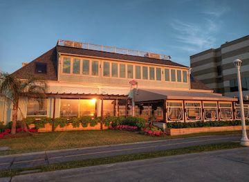
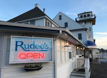
Rudee's Restaurant and Cabana Bar
Experience the best of Virginia Beach at Rudee's Restaurant and Cabana Bar - fresh seafood, great drinks, and stunning ocean views await!
-
Seafood
Bubba's Seafood Restaurant and Crabhouse
Experience the best seafood at Bubba's Seafood Restaurant in Virginia Beach—where fresh flavors meet coastal charm.


Best bars in Eastern Shore
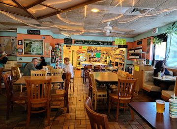
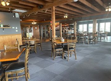
Evening life on the Eastern Shore is generally low-key and community-oriented rather than centred on large clubs. Cape Charles, Onancock and Chincoteague offer the widest selection of pubs, restaurants with bars, breweries, wine-focused venues and occasional live-music spaces. Historic inns and waterfront establishments provide relaxed settings for a drink or meal, while local events may bring music to community venues during the warmer months. In smaller towns and rural areas, evenings tend to finish earlier, with conversation, dining and seasonal gatherings more prominent than late-night entertainment. Chincoteague can feel busier during the summer visitor season, whereas Cape Charles and Onancock maintain a more year-round town-centre rhythm. Check current arrangements locally, since opening patterns and entertainment schedules can change and many venues are independent.
-
Seafood
Ropewalk Restaurant - Chincoteague
Experience the best of Chincoteague's coastal cuisine at Ropewalk Restaurant, where fresh seafood and stunning waterfront views await you.
-
Seafood
The Great Machipongo Clam Shack
Experience the freshest seafood and delightful clam dishes at The Great Machipongo Clam Shack, a culinary gem in Virginia.
-
Seafood
The Shanty
Experience the best of Cape Charles at The Shanty, where delectable seafood and live music create unforgettable dining moments.
-
Restaurant
Island House Restaurant & Marina
Experience the best of coastal dining at Island House Restaurant & Marina, where fresh seafood meets stunning waterfront views in Wachapreague, Virginia.

Best nightclubs in Eastern Shore
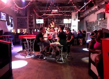
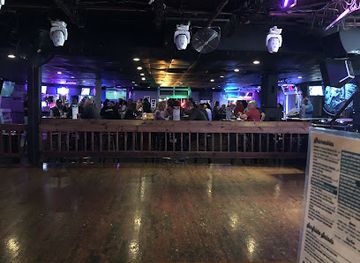
Evening life on the Eastern Shore is generally low-key and community-oriented rather than centred on large clubs. Cape Charles, Onancock and Chincoteague offer the widest selection of pubs, restaurants with bars, breweries, wine-focused venues and occasional live-music spaces. Historic inns and waterfront establishments provide relaxed settings for a drink or meal, while local events may bring music to community venues during the warmer months. In smaller towns and rural areas, evenings tend to finish earlier, with conversation, dining and seasonal gatherings more prominent than late-night entertainment. Chincoteague can feel busier during the summer visitor season, whereas Cape Charles and Onancock maintain a more year-round town-centre rhythm. Check current arrangements locally, since opening patterns and entertainment schedules can change and many venues are independent.
-
Bar
PBR Norfolk A Coors Banquet Bar
Experience the vibrant nightlife at PBR Norfolk, where fun meets excitement with dancing, drinks, and live music in a captivating atmosphere.
-
Night club
Allure 30/30
Experience the best of Virginia Beach nightlife at Allure 30/30, where vibrant music and unforgettable moments await every visitor.
-
Night club
Venue 112
Unleash your night at Venue 112, Virginia Beach's premier night club, featuring electrifying music, delicious cocktails, and a vibrant atmosphere.
-
Night club
Peabody's Nightclub
Discover the vibrant nightlife at Peabody's Nightclub, where live music and dancing create unforgettable memories in Virginia Beach.


Best shops in Eastern Shore
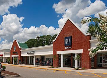
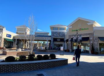
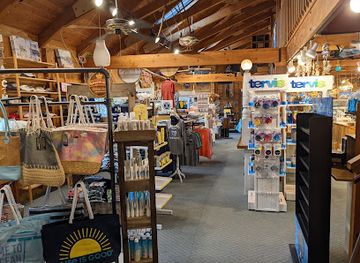
Shopping on the Eastern Shore is concentrated in historic town centres, roadside farm stands, small galleries and locally owned food businesses rather than large retail districts. Cape Charles offers independent shops, art and gift businesses within its historic streets, while Onancock combines galleries, cafés, antiques and specialist shops in a compact centre. Chincoteague has visitor-oriented stores selling clothing, artwork, books, nautical goods and island-related souvenirs. Farm stands and produce markets are particularly useful for seasonal fruit, vegetables, honey and other local products, and seafood retailers may offer oysters, clams or fish subject to availability and regulations. Craft goods, paintings, photography, pottery and maritime-themed work provide more meaningful souvenirs than mass-produced items. Retail provision becomes markedly thinner outside the main towns, so visitors travelling through the rural peninsula should not expect extensive shopping or late opening hours.
-
Outlet mall
Williamsburg Premium Outlets
Discover unbeatable deals and luxury brands at Williamsburg Premium Outlets, a shopper's paradise in Virginia.
-
Outlet mall
Norfolk Premium Outlets
Discover great deals and a variety of high-end brands at Norfolk Premium Outlets, your ultimate shopping destination in Virginia.
-
Shopping mall
The Shops at Hilltop
Discover The Shops at Hilltop, where shopping meets dining and entertainment in the heart of Virginia Beach, offering something for everyone.
-
Gift shop
The Brant
Discover unique gifts and local crafts at The Brant in Chincoteague, where every item tells a story of this beautiful coastal town.

Get your free copy of our complete guide to Eastern Shore, delivered straight to you.
Everything on this page, from attractions and restaurants to essentials and local phrases, in one PDF you can read offline, print or share.
Already have an account? Sign in
Your Eastern Shore guide is ready.
We'll send it to · Not you? Sign out

Getting your guide ready…
We are putting together a fresh copy of the Eastern Shore guide. This can take up to a minute.
This can take a few moments. If your browser asks, choose Allow so the download can start. You'll find the guide in your Downloads folder.
Nothing happened? Download it again
Sorry, the guide is taking longer than usual. Please try again in a minute, or get it by email instead.
Eastern Shore essentials
Currency and Payment
Safety
Emergency Situations
Do's and Don'ts
Local Tips
From Eve
Local phrases worth knowing
You don't need to get them perfect. A few words go a long way, and locals appreciate the effort.
Basics
| English | Local | Say it |
|---|---|---|
| Hello | Howdy | [haʊdi] |
| Goodbye | See ya | [si jə] |
| Yes | Yup | [jʌp] |
| No | Nope | [noʊp] |
| Please/You’re welcome | Sure thing | [ʃʊr θɪŋ] |
| Thank you | Thanks a lot | [θæŋks ə lɑt] |
| Excuse me/Sorry | Pardon me | [ˈpɑrdən mi] |
| How are you? | How ya doin'? | [haʊ jə ˈduɪn] |
| Fine. And you? | I’m good, you? | [aɪm ɡʊd, ju] |
| Do you speak English? | Ya speakin' English? | [jə ˈspikɪn ˈɪŋɡlɪʃ] |
| I don't understand | I don't get it | [aɪ doʊnt ɡɛt ɪt] |
Eating & Drinking
| English | Local | Say it |
|---|---|---|
| I’d like to see the menu, please | Can I see the menu? | [kæn aɪ si ðə ˈmɛnju] |
| I don't eat meat | I ain't eatin' meat | [aɪ eɪnt ˈitɪn mit] |
| Cheers! | Cheers! | [ʧɪrz] |
| I would like to pay, please | Can I settle up? | [kæn aɪ ˈsɛtəl ʌp] |
Emergencies
| English | Local | Say it |
|---|---|---|
| Help! | Help! | [hɛlp] |
| Go away! | Get lost! | [ɡɛt lɔst] |
| Call the Police! | Call the cops! | [kɔl ðə kɑps] |
| Call a doctor! | Get a doctor! | [ɡɛt ə ˈdɑktər] |
| I’m lost | I’m turned around | [aɪm tɜrnd əˈraʊnd] |
| I’m ill | I ain't feelin' well | [aɪ eɪnt ˈfilɪn wɛl] |
Shopping
| English | Local | Say it |
|---|---|---|
| I’d like to buy... | I wanna buy... | [aɪ ˈwɑnə baɪ] |
| I’m just looking | Just browsing | [dʒʌst ˈbraʊzɪŋ] |
| How much is it? | What’s it gonna cost? | [wʌts ɪt ˈɡʌnə kɔst] |
| That’s too expensive | That’s too pricey | [ðæts tu ˈpraɪsi] |
| Can you lower the price? | Can ya knock down the price? | [kæn jə nɑk daʊn ðə praɪs] |
Time & Numbers
| English | Local | Say it |
|---|---|---|
| What time is it? | What time ya got? | [wʌt taɪm jə ɡɑt] |
| It’s one o'clock | It’s one | [ɪts wʌn] |
| Half past (10) | Half past ten | [hæf pæst tɛn] |
| Morning | Mornin' | [ˈmɔrnɪn] |
| Afternoon | Aft'n | [æftʊrn] |
| Evening | Evenin' | [ˈivnɪn] |
| Yesterday | Yest'day | [ˈjɛstdeɪ] |
| Today | Today | [təˈdeɪ] |
| Tomorrow | Tomorra' | [təˈmɔroʊ] |
| 1 | One | [wʌn] |
| 2 | Two | [tu] |
| 3 | Three | [θri] |
| 4 | Four | [fɔr] |
| 5 | Five | [faɪv] |
| 6 | Six | [sɪks] |
| 7 | Seven | [ˈsɛvən] |
| 8 | Eight | [eɪt] |
| 9 | Nine | [naɪn] |
| 10 | Ten | [tɛn] |
Transport & Directions
| English | Local | Say it |
|---|---|---|
| Where's a/the...? | Where’s the...? | [wɛrz ðə] |
| What’s the address? | What’s the address? | [wʌts ði ˈædrɛs] |
| Can you show me (on the map)? | Can ya point it out? | [kæn jə pɔɪnt ɪt aʊt] |
| When's the next (bus)? | When’s the next bus? | [wɛnʤ ðə nɛkst bʌs] |
| A ticket (to ....) | A ticket to... | [ə ˈtɪkɪt tu] |
History of Eastern Shore
Indigenous Communities and Early Coastal Exchange
Before European settlement, the peninsula was inhabited by Indigenous peoples, including communities associated with the Accomack and Occohannock names recorded by English colonists. The coastal environment supported fishing, shellfishing, hunting and the gathering of plant foods, while waterways connected settlements and trading networks. European accounts and later colonial names preserve fragments of this earlier landscape, although much Indigenous history was displaced or distorted by colonisation. The shore’s creeks, inlets and barrier islands continued to shape settlement long after English arrival.
English Settlement in the Seventeenth Century
English colonists established settlements on the Eastern Shore during the early seventeenth century, soon after Jamestown was founded in 1607. The peninsula’s relative separation from the mainland encouraged a distinctive local society based on small farms, livestock, timber, fishing and maritime trade. Anglican parishes and county institutions gradually developed, while landholding families established estates and public buildings. Accomack County was created in the colonial period and later divided, leaving Northampton County in the southern part of the peninsula.
Plantations, Courthouses and Colonial Society
During the eighteenth century, the Eastern Shore became a settled agricultural region linked to Chesapeake commerce. Tobacco was cultivated, though the peninsula’s economy was also supported by grain, livestock, timber, fishing and coastal shipping. Courthouses, churches and private houses expressed the authority of county government and prosperous landowners. The courthouse complex at Accomac, together with surviving houses such as Ker Place in Onancock, reflects the region’s colonial and early American development. Enslaved Africans and their descendants were an essential part of this economy and community life.
The Chesapeake’s Maritime Economy
The surrounding bay, creeks and Atlantic barrier islands made maritime work fundamental to Eastern Shore life. Oystering, clamming, fishing, boatbuilding and coastal transport expanded during the nineteenth century, while small ports served farm communities and island settlements. The water routes also connected the peninsula to Baltimore, Philadelphia, Norfolk and other Chesapeake markets. Tangier Island and towns such as Onancock and Wachapreague retain particularly visible links with this maritime past, although modern fishing communities face changing stocks, regulations, storms and economic pressures.
Railways, Cape Charles and New Connections
Rail transport transformed the southern end of the peninsula in the late nineteenth century. The establishment of Cape Charles as a planned railroad and ferry terminus connected Eastern Shore farms and ports with the mainland and with rail routes across the Chesapeake. Its streets filled with commercial buildings, hotels, warehouses and houses associated with railway and maritime activity. The later decline of railway-ferry operations changed the town’s economic role, but Cape Charles’s historic district preserves the physical plan and architecture created during this period of expansion.
Twentieth-Century Mobility and Agricultural Change
Motor roads and bridges gradually replaced many earlier rail and ferry connections, bringing the Eastern Shore more directly into Virginia’s road network. The Chesapeake Bay Bridge-Tunnel, opened in 1964, provided a major fixed link to the Hampton Roads region and altered patterns of travel, trade and tourism. At the same time, agriculture became more mechanised and communities lost some traditional services and industries. The peninsula nevertheless remained an important producer of vegetables and seafood, while its quiet roads, beaches and wildlife habitats attracted increasing numbers of visitors.
Conservation, Space Research and Coastal Heritage
The modern Eastern Shore combines working landscapes with nationally important conservation and scientific sites. The establishment of wildlife refuges protected sections of the Atlantic and Chesapeake coasts for migratory birds and other species. Nearby Wallops Island became a centre for rocket launches and atmospheric research, adding a space-science dimension to the region’s maritime identity. Conservation organisations, historic-preservation groups and local communities now interpret barrier-island ecology, African American history, maritime work and rural life alongside traditional tourism.
Eastern Shore in Photos
Browse through our photo collection highlighting the charm and character of the destination.
Neighbouring regions of Eastern Shore
The closest regions to Eastern Shore, if you have time for more than one.
-

-

-

-

-


Swipe for more regions
Explore more

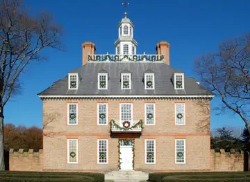
Explore more of Virginia
Discover Virginia: A blend of historic landmarks, natural beauty, and vibrant culture perfect for history buffs, nature lovers, and culture seekers.
Explore Virginia