

Free Hampton Roads Travel Guide & Mobile App
Explore Hampton Roads with free travel guides. Discover regional history, expert tips, proposed trips, and audio guides on web or mobile app.


Explore Hampton Roads for naval heritage, Atlantic beaches, museums, seafood, wetlands and distinctive cities across coastal Virginia.
Read more about Hampton Roads
Getting to and around Hampton Roads
How to get there
Transportation
Top city travel guides in Hampton Roads
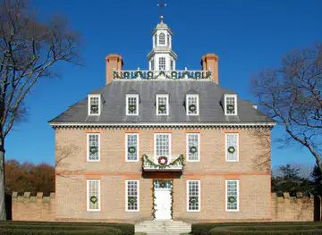
The cities of Hampton Roads, and the easiest places to base yourself.
-

-
-

-

-

-


Swipe for more cities
Destinations in Hampton Roads
Resorts, valleys and scenic spots worth a trip of their own.
-

-

-


Swipe for more destinations
Best attractions in Hampton Roads
Hampton Roads offers an unusual combination of maritime museums, military heritage, beaches, wetlands and urban cultural institutions. Norfolk’s Nauticus and USS Wisconsin introduce the region’s naval history through a major waterfront complex, while the Chrysler Museum of Art provides a broader artistic counterpoint. Portsmouth’s Olde Towne rewards slower exploration of historic streets, museums and river views. On the Peninsula, Fort Monroe combines a substantial nineteenth-century fort with beaches, trails and the Casemate Museum, and Newport News adds the Mariners’ Museum and Park, the Virginia Living Museum and extensive Newport News Park. Virginia Beach ranges from the busy Oceanfront to the quieter dunes and waterways of Sandbridge, First Landing State Park and Back Bay National Wildlife Refuge. The Cape Henry area brings together maritime scenery, lighthouse history and woodland trails. Kayaking, birdwatching, fishing and cycling are available in suitable locations, while the Great Dismal Swamp National Wildlife Refuge offers a more remote wetland environment near Suffolk and Chesapeake. Because distances and traffic can be significant, these attractions are best arranged by city or landscape rather than treated as one compact circuit.
-
Escape room center
Breakout Games - Virginia Beach
Experience the thrill of escape rooms at Breakout Games in Virginia Beach – perfect for families and friends seeking adventure and teamwork.
-
Norfolk Botanical Garden
Experience the breathtaking scenery and diverse flora at Norfolk Botanical Garden, a must-visit tourist attraction in Virginia.
-
 State park
First Landing State Park
Explore First Landing State Park, a blend of history and natural beauty in Virginia Beach, featuring diverse ecosystems, hiking trails, and beautiful beaches.
-
Zoo
Virginia Zoo
Uncover the beauty of wildlife and conservation at Virginia Zoo, a family-friendly destination in Norfolk, Virginia.


Best landmarks in Hampton Roads
The most recognisable landmarks of Hampton Roads express its strategic position between rivers, bay and ocean. Fort Monroe at Old Point Comfort is the region’s defining historic structure: its massive walls, moat and harbour-facing setting embody centuries of coastal defence, while the surrounding grounds connect military history with African American history and public beaches. Norfolk’s USS Wisconsin, permanently displayed beside Nauticus, is a powerful reminder of the city’s naval identity and twentieth-century warfare. The Cape Henry Lighthouse in Virginia Beach marks the entrance to Chesapeake Bay and stands near the site associated with the arrival of the English colonists in 1607; the historic lighthouse is complemented by a later lighthouse on the same military reservation. Portsmouth’s historic Olde Towne forms an architectural landmark in its own right, with an unusually concentrated collection of colonial, Federal and Victorian buildings. On the Peninsula, the Mariners’ Museum reflects Newport News’s shipbuilding heritage, while the Hampton Roads Bridge-Tunnel has become a defining piece of regional infrastructure, carrying traffic beneath and across the waterways that make the area both distinctive and logistically complex.
-
Historical landmark
Colonial Williamsburg
Explore the heart of America’s revolutionary history at Colonial Williamsburg, where the past is brought to life through immersive experiences and engaging storytelling.
-
Tourist attraction
Norfolk Botanical Garden
Explore the natural beauty of Norfolk Botanical Garden, a stunning oasis of flora, tranquility, and vibrant colors in Norfolk, Virginia.
-
Tourist attraction
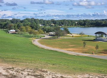
Mount Trashmore Park
Explore Mount Trashmore Park in Virginia Beach, where lush landscapes and scenic views create the perfect backdrop for outdoor adventures and family fun.
-
Tourist attraction
Buckroe Beach and Park
Discover the sun-kissed shores and vibrant park life at Buckroe Beach and Park in Hampton, Virginia, a perfect escape for relaxation and recreation.


Explore Hampton Roads on the map
Plan your trip on one map. See where the top cities, national parks and sights are, and book hotels and experiences in a few clicks.
Best hotels in Hampton Roads
Best restaurants in Hampton Roads
The dining culture of Hampton Roads is closely tied to the Chesapeake Bay, the Atlantic coast and Virginia’s agricultural hinterland. Seafood restaurants and casual waterfront venues commonly feature oysters, blue crabs, clams, shrimp and locally inspired fish dishes, with availability varying by season and catch. In Norfolk, Portsmouth, Hampton and Newport News, independent restaurants, cafés, breweries and international kitchens reflect the region’s urban and naval population. Virginia Beach combines Oceanfront dining with neighbourhood restaurants in areas such as ViBe Creative District and the inland communities, while Suffolk, Chesapeake and southern Virginia Beach offer farm-to-table settings, country stores and rural markets rather than dense restaurant streets. Chesapeake Bay crab traditions are shared across the wider bay region, so menus should not be treated as exclusively local, but seafood is a defining part of the area’s food identity. Virginia-grown produce, peanuts, barbecue, biscuits and craft beverages also appear across the region, and farmers’ markets provide a useful way to encounter seasonal products.
-
American
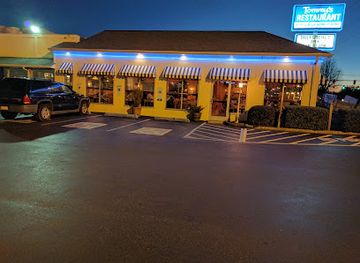
Tommy's Restaurant
Discover delicious American cuisine at Tommy's Restaurant in Hampton – perfect for breakfast lovers seeking unique flavors.
-
European
Park Lane Tavern of Hampton
Experience the best of European cuisine combined with American favorites at Park Lane Tavern in Hampton.
-
Seafood
The Deadrise
Experience fresh seafood delights at The Deadrise in Fort Monroe, where stunning views meet flavorful dishes in a relaxed coastal setting.
-
Barbecue
County Grill & Smokehouse
Discover the taste of authentic barbecue at County Grill & Smokehouse in Hampton - where every bite is packed with flavor!


Best bars in Hampton Roads
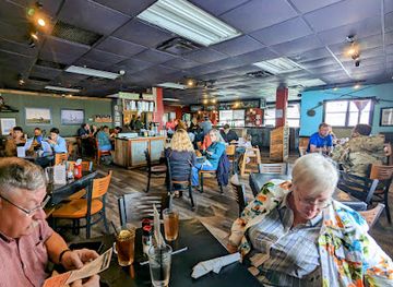
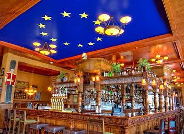
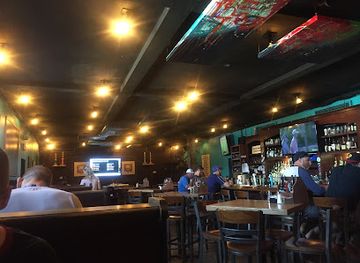
Evening life in Hampton Roads is concentrated in Norfolk, Virginia Beach, Portsmouth and selected districts of Hampton and Newport News. Norfolk’s downtown, Ghent and nearby waterfront areas offer pubs, cocktail bars, breweries, live music and performance venues, while Portsmouth’s Olde Towne is known for historic buildings alongside restaurants and smaller bars. Virginia Beach has the region’s most recognisable resort nightlife, particularly around the Oceanfront, with seasonal live entertainment, casual bars and late-opening venues, although its character changes outside the summer period. Hampton and Newport News provide local pubs, breweries, music venues and restaurants rather than one continuous nightlife district. Rural Chesapeake, Suffolk and the outlying parts of Virginia Beach are quieter, with evening activity centred on restaurants, taverns and community events. Visitors should check current arrangements for individual venues, as opening patterns and entertainment schedules change frequently.
-
Bar
Park Lane Tavern of Hampton
Experience the vibrant flavors and lively atmosphere at Park Lane Tavern, a top destination for American and European cuisine in Hampton, VA.
-
Bar
County Grill & Smokehouse
Experience the vibrant flavors of County Grill & Smokehouse, a top American barbecue destination in Hampton, VA, blending great food with a lively atmosphere.
-
Grill
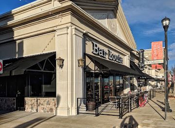
Bar Louie - Hampton
Experience the vibrant atmosphere and delectable cuisine at Bar Louie - Hampton, where American flavors meet craft cocktails in a lively setting.
-
Event venue
Paradise Ocean Club
Experience the best of Fort Monroe at Paradise Ocean Club, where stunning views meet delicious food and unforgettable events.

Best nightclubs in Hampton Roads
Evening life in Hampton Roads is concentrated in Norfolk, Virginia Beach, Portsmouth and selected districts of Hampton and Newport News. Norfolk’s downtown, Ghent and nearby waterfront areas offer pubs, cocktail bars, breweries, live music and performance venues, while Portsmouth’s Olde Towne is known for historic buildings alongside restaurants and smaller bars. Virginia Beach has the region’s most recognisable resort nightlife, particularly around the Oceanfront, with seasonal live entertainment, casual bars and late-opening venues, although its character changes outside the summer period. Hampton and Newport News provide local pubs, breweries, music venues and restaurants rather than one continuous nightlife district. Rural Chesapeake, Suffolk and the outlying parts of Virginia Beach are quieter, with evening activity centred on restaurants, taverns and community events. Visitors should check current arrangements for individual venues, as opening patterns and entertainment schedules change frequently.
-
Night club
PBR - Hampton
Discover the electrifying nightlife at PBR - Hampton, a premier night club and bar offering unforgettable evenings filled with music and fun.
-
Night club
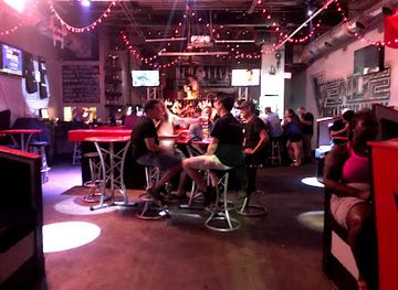
Venue 112
Discover the pulse of Virginia Beach nightlife at Venue 112, where vibrant music and unforgettable parties come together.
-
Restaurant
Charm'd Lounge
Discover the lively atmosphere of Charm'd Lounge in Hampton, VA, where exquisite dining meets unforgettable nightlife entertainment.
-
Social club
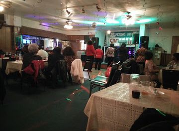
Flying Twenties Social Club
Discover the charm of the 1920s at the Flying Twenties Social Club, a vibrant social hub in Hampton, Virginia, perfect for dancing and mingling.


Best shops in Hampton Roads
Shopping in Hampton Roads ranges from urban independent retailers to resort stores, historic-district antiques and agricultural markets. Norfolk’s Ghent, downtown and nearby creative districts offer galleries, design shops, books, clothing and locally made goods, while Portsmouth’s Olde Towne combines antiques, art, gifts and independent businesses within historic streets. Virginia Beach’s Oceanfront has the broadest concentration of holiday-oriented retail, with more individual character found in the ViBe Creative District and smaller inland shopping areas. Peninsula cities such as Hampton and Newport News provide neighbourhood high streets, galleries and established retail centres rather than a single dominant tourist market. Farmers’ markets across Norfolk, Virginia Beach, Chesapeake, Suffolk, Hampton and Newport News are good places to look for Virginia produce, baked goods, honey, preserves and craft products when operating seasonally. Useful regional purchases include local foodstuffs, maritime-themed goods, artwork, pottery and books on naval or coastal history; shop around rather than assuming every waterfront souvenir represents the broader region.
-
Outlet mall
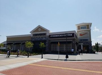
Norfolk Premium Outlets
Experience the thrill of shopping at Norfolk Premium Outlets, where designer brands meet unbeatable prices in a vibrant atmosphere.
-
Shopping mall
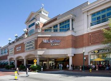
MacArthur Center
Explore the MacArthur Center in Norfolk, Virginia – a premier shopping destination with diverse shops, dining, and entertainment options for all tastes.
-
Gift shop
Banner's Hallmark Shop
Discover unique gifts, seasonal décor, and delightful cards at Banner's Hallmark Shop in Virginia Beach, a perfect stop for all your gifting needs.

Get your free copy of our complete guide to Hampton Roads, delivered straight to you.
Everything on this page, from attractions and restaurants to essentials and local phrases, in one PDF you can read offline, print or share.
Already have an account? Sign in
Your Hampton Roads guide is ready.
We'll send it to · Not you? Sign out

Getting your guide ready…
We are putting together a fresh copy of the Hampton Roads guide. This can take up to a minute.
This can take a few moments. If your browser asks, choose Allow so the download can start. You'll find the guide in your Downloads folder.
Nothing happened? Download it again
Sorry, the guide is taking longer than usual. Please try again in a minute, or get it by email instead.
Hampton Roads essentials
Currency and Payment
Safety
Emergency Situations
Do's and Don'ts
Local Tips
From Eve
Local phrases worth knowing
You don't need to get them perfect. A few words go a long way, and locals appreciate the effort.
Basics
| English | Local | Say it |
|---|---|---|
| Hello | Hey y'all | [Hey y'all] |
| Goodbye | See ya | [See ya] |
| Yes | Yep | [Yep] |
| No | Nope | [Nope] |
| Please/You're welcome | Sure thing | [Shur thing] |
| Thank you | Thanks | [Thanks] |
| Excuse me/Sorry | Pardon me | [Pardon me] |
| How are you? | How ya doin'? | [How ya doin'?] |
| Fine. And you? | Good. And you? | [Good. An' you?] |
| Do you speak English? | You speakin' English? | [You speakin' English?] |
| I don't understand | I ain't got it | [I ain't got it] |
Eating & Drinking
| English | Local | Say it |
|---|---|---|
| I'd like to see the menu, please | Can I see the menu? | [Can I see the menu?] |
| I don't eat meat | I ain't eatin' meat | [I ain't eatin' meat] |
| Cheers! | Cheers! | [Cheers!] |
| I would like to pay, please | Can I get the check? | [Can I get the check?] |
Emergencies
| English | Local | Say it |
|---|---|---|
| Help! | Help! | [Help!] |
| Go away! | Leave me alone! | [Leave me alone!] |
| Call the Police! | Call the cops! | [Call the cops!] |
| Call a doctor! | Get a doctor! | [Get a doctor!] |
| I'm lost | I’m lost | [I’m lost] |
| I'm ill | I ain't feelin' good | [I ain't feelin' good] |
Shopping
| English | Local | Say it |
|---|---|---|
| I'd like to buy... | I wanna buy... | [I wanna buy...] |
| I'm just looking | Just browsin' | [Just browsin'] |
| How much is it? | What’s the price? | [What’s the price?] |
| That's too expensive | That's too pricey | [That's too pricey] |
| Can you lower the price? | Can ya lower the price? | [Can ya lower the price?] |
Time & Numbers
| English | Local | Say it |
|---|---|---|
| What time is it? | What time is it? | [What time is it?] |
| It's one o'clock | It's one | [It's one] |
| Half past (10) | Half past ten | [Half past ten] |
| Morning | Mornin' | [Mornin'] |
| Afternoon | Afternoon | [Afternoon] |
| Evening | Evenin' | [Evenin'] |
| Yesterday | Yesterday | [Yesterday] |
| Today | Today | [Today] |
| Tomorrow | Tomorrow | [Tomorrow] |
| 1 | One | [One] |
| 2 | Two | [Two] |
| 3 | Three | [Three] |
| 4 | Four | [Four] |
| 5 | Five | [Five] |
| 6 | Six | [Six] |
| 7 | Seven | [Seven] |
| 8 | Eight | [Eight] |
| 9 | Nine | [Nine] |
| 10 | Ten | [Ten] |
Transport & Directions
| English | Local | Say it |
|---|---|---|
| Where's a/the...? | Where’s a...? | [Where’s a...?] |
| What's the address? | What's the address? | [What's the address?] |
| Can you show me (on the map)? | Can ya show me on the map? | [Can ya show me on the map?] |
| When's the next (bus)? | When's the next bus? | [When's the next bus?] |
| A ticket (to ....) | A ticket to... | [A ticket to...] |
History of Hampton Roads
Indigenous Chesapeake Communities
Long before European colonisation, the shores and rivers of Hampton Roads were inhabited by Indigenous peoples, including communities associated with the Powhatan paramount chiefdom and the Nansemond, who lived in the region now occupied by Suffolk and surrounding areas. Rivers, tidal creeks and wetlands supported fishing, hunting, farming and trade. European settlement disrupted these societies through disease, land acquisition and armed conflict, but Indigenous history remains fundamental to understanding Tidewater Virginia. The waterways that shaped Indigenous life later became the routes of colonial commerce, military movement and industrial development.
English Settlement and the Tidewater Colony
The English established Jamestown on the James River in 1607, outside the modern urban core of Hampton Roads but within the wider historical landscape of Tidewater Virginia. Hampton, founded nearby in the early seventeenth century, became one of the colony’s earliest settled communities and developed around agriculture, trade and maritime access. The lower Chesapeake’s deep rivers linked plantations and ports with the Atlantic world. This colonial economy depended heavily on enslaved labour, whose presence and resistance are central to the region’s history rather than a marginal footnote.
Hampton Roads in the American Revolution
The waterways of Hampton Roads made the region strategically important during the American Revolution. British and American forces contested control of the lower Chesapeake, while local communities experienced military occupation, disrupted trade and attacks along the coast. The decisive 1781 Battle of the Chesapeake was fought offshore between Cape Henry and the mouth of the bay, not in the harbour itself, but its outcome prevented a British resupply effort and helped make the Yorktown campaign possible. The region’s coastal geography therefore had consequences far beyond its local settlements.
Fort Monroe and the Civil War
Fort Monroe, built on Old Point Comfort at the entrance to Hampton Roads, was a major Union stronghold during the American Civil War. In 1861, three enslaved men who reached the fort were declared contraband of war, a decision that encouraged thousands of other enslaved people to seek refuge behind Union lines. Hampton was later burned during the conflict, while the waters around Hampton Roads witnessed the famous 1862 clash between USS Monitor and CSS Virginia, the first battle between ironclad warships. The fort and surrounding landscape preserve several overlapping military and African American histories.
Shipbuilding, Railways and Military Growth
During the nineteenth and twentieth centuries, railways, coal shipping and shipbuilding transformed Hampton Roads into one of the United States’ principal maritime-industrial centres. Newport News Shipbuilding, founded in 1886, constructed commercial and naval vessels and remains a major employer. Norfolk developed around its harbour, rail connections and naval facilities, while Portsmouth grew as a shipbuilding and port city. The establishment and expansion of the naval station at Norfolk reinforced the region’s global strategic importance and shaped housing, employment, transport and civic life across the surrounding cities.
The Great Migration and African American Communities
Hampton Roads was shaped profoundly by African American workers, families, churches, educators and entrepreneurs. Hampton’s history includes the nationally important Hampton Normal and Agricultural Institute, founded in 1868 to educate formerly enslaved people and later Native American students; it became Hampton University. The region’s shipyards, naval facilities, docks, farms and service industries created employment while segregation restricted opportunity and movement. African American neighbourhoods and institutions developed across Norfolk, Portsmouth, Hampton and Newport News, contributing to civil-rights activism, music, education and the region’s modern cultural identity.
Twentieth-Century Aviation and the Space Age
Hampton Roads became an important centre for aviation and aerospace research during the twentieth century. Langley Research Center in Hampton, established in 1917, pioneered wind-tunnel research and later contributed to the American space programme. Langley Air Force Base and nearby engineering institutions reinforced the area’s role in military and scientific development. At the same time, expanding suburbs, bridges, tunnels and road systems connected formerly separate communities into the modern metropolitan region. The result was a landscape where naval bases, shipyards, research facilities, beaches and wetlands coexist within a single economic area.
Environmental Protection and a Changing Waterfront
Recent decades have brought greater attention to the ecological importance of Hampton Roads’ estuaries, dunes, forests and tidal wetlands. The Great Dismal Swamp, Back Bay and the coast around Cape Henry support wildlife while also facing pressures from development, sea-level rise, storms and saltwater intrusion. Waterfront renewal has added museums, promenades, restaurants and public spaces to former industrial areas, without removing the region’s working ports and naval functions. Contemporary Hampton Roads is therefore negotiating between maritime industry, heritage tourism, dense urban development and long-term coastal resilience.
Hampton Roads in Photos
Browse through our photo collection highlighting the charm and character of the destination.
Neighbouring regions of Hampton Roads
The closest regions to Hampton Roads, if you have time for more than one.
-
-

-

-

-


Swipe for more regions
Explore more

Explore more of Virginia
Discover Virginia: A blend of historic landmarks, natural beauty, and vibrant culture perfect for history buffs, nature lovers, and culture seekers.
Explore Virginia