

Free Mount St. Helens Area Travel Guide & Mobile App
Explore Mount St. Helens Area with free travel guides. Discover regional history, expert tips, proposed trips, and audio guides on web or mobile app.


Explore the Mount St. Helens Area in Washington for volcanic landscapes, recovering forests, lava caves and revealing outdoor adventures.
Read more about Mount St. Helens Area
Getting to and around Mount St. Helens Area
How to get there
Transportation
Destinations in Mount St. Helens Area
Resorts, valleys and scenic spots worth a trip of their own.

Swipe for more destinations
Best attractions in Mount St. Helens Area
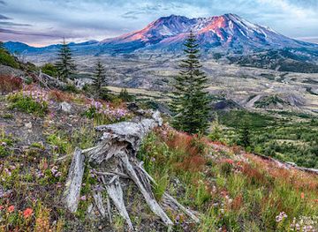
The Mount St. Helens Area is primarily an outdoor and interpretive destination. Along the western Spirit Lake Memorial Highway, the Mount St. Helens Visitor Center near Silver Lake provides an accessible introduction to the volcano, the 1980 eruption and the changing landscape, while viewpoints and trails farther along the route reveal the blast zone at progressively closer range. The monument's trails cross young forests, ash plains, river valleys and ridges with views towards the crater, although conditions and access vary seasonally. On the southern side, Ape Cave offers a memorable encounter with a lava tube formed by an earlier eruption; it requires preparation, suitable footwear and attention to current management arrangements. The Lewis River corridor adds waterfalls, forest scenery, reservoirs and opportunities for camping, fishing and walking. More distant eastern approaches offer quieter viewpoints and a stronger sense of remoteness, but require longer drives and careful road planning. The area's attraction is not a dense collection of conventional amusements: it is the opportunity to observe a volcano, understand a major natural disaster and see ecological recovery unfolding across a protected landscape.
-
Observation deck
Johnston Ridge Observatory
Discover breathtaking views and volcanic history at Johnston Ridge Observatory, a must-visit destination in Washington State's stunning landscape.
-
National reserve
Mount St. Helens National Volcanic Monument
Explore the stunning landscapes and rich history of Mount St. Helens National Volcanic Monument, a must-visit destination for nature lovers and adventure seekers.
-
Volcano
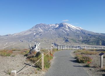
Mt St Helens
Explore the awe-inspiring Mt. St. Helens, a testament to nature's power and resilience, offering breathtaking views and rich geological history.
-
Hiking area
Ape Cave Interpretive Site
Discover the breathtaking Ape Cave Interpretive Site in Cougar, Washington, a geological marvel perfect for hiking and adventure enthusiasts.
Best landmarks in Mount St. Helens Area
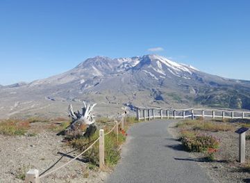
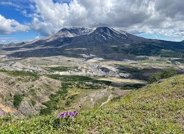
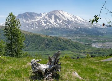
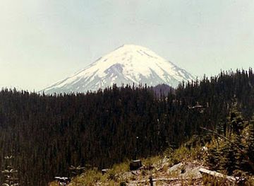
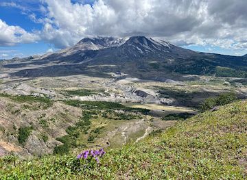
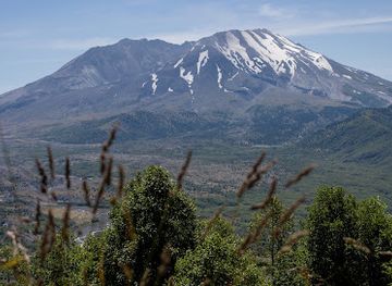
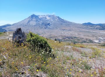
The defining landmark is Mount St. Helens itself, whose truncated summit and open northern crater preserve the outline of the 1980 eruption. The crater contains a growing lava dome and remains an active volcanic feature, although close approaches are restricted and viewpoints depend on access conditions. Spirit Lake is another powerful landmark: debris from the eruption radically reshaped its basin and the lake remains surrounded by the blast zone and recovering forest. The broad Toutle River valley records the scale of the lahars and sediment flows generated during the disaster, while the standing snags on ridges and hillsides show the reach of the lateral blast. Ape Cave, on the southern side, is a notable geological landmark formed when the outer surface of a basaltic lava flow cooled around molten rock. The Johnston Ridge area, where accessible, provides an especially direct relationship between human interpretation and the crater, though facilities and routes may change after weather, landslides or other damage. Together these places are significant not merely for their appearance, but because they make volcanic force, geological time and ecological renewal visible within one landscape.
-
Historical landmark
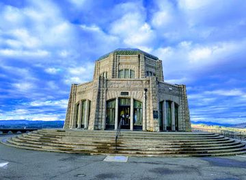
Vista House at Crown Point
Experience breathtaking views and rich history at Vista House, a stunning landmark in Oregon's Columbia River Gorge.
-
Observation deck
Johnston Ridge Observatory
Experience the stunning vistas and educational exhibits at Johnston Ridge Observatory, a premier destination for nature lovers and history enthusiasts near Mount St. Helens.
-
National reserve
Mount St. Helens National Volcanic Monument
Explore the awe-inspiring landscapes and rich ecology of Mount St. Helens National Volcanic Monument, a testament to nature's power and resilience.
-
Volcano
Mt St Helens
Explore the breathtaking landscapes of Mt. St. Helens, an iconic volcano showcasing nature's power and beauty in Washington State.
Explore Mount St. Helens Area on the map
Plan your trip on one map. See where the top cities, national parks and sights are, and book hotels and experiences in a few clicks.
Best hotels in Mount St. Helens Area
Best restaurants in Mount St. Helens Area
Dining in the Mount St. Helens Area is shaped by rural communities and the practical needs of travellers rather than by a concentrated restaurant scene. Castle Rock, Toutle, Kelso and Longview, outside or on the edge of the main mountain area, provide the broadest choice of diners, cafés, bakeries and everyday restaurants. Smaller settlements such as Cougar offer limited services, so visitors heading towards Ape Cave or the Lewis River should carry provisions and avoid assuming that a meal will be available near every trailhead. Expect familiar Pacific Northwest fare, including locally sourced salmon where offered, burgers, soups, sandwiches, seasonal produce and coffee, alongside traditional American diner cooking. Farm stands and small food shops may provide fruit, preserves or other regional products depending on the season. Picnic food is particularly useful for long days in the monument, where expansive viewpoints and trails are separated by substantial distances. The surrounding region's timber and working-rural heritage is reflected in straightforward, informal dining rather than a formal food-tourism circuit.
-
Resort hotel
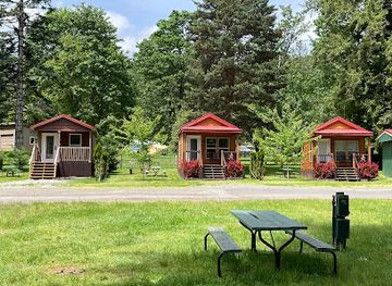
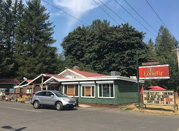
Lone Fir Resort
Discover tranquility at Lone Fir Resort – your perfect retreat in Cougar, Washington with cabins, camping, dining & endless outdoor adventures.
-
Diner
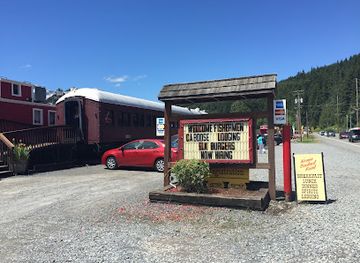
Mt. Rainier Railroad Dining Co.
Savor classic American dishes at Mt. Rainier Railroad Dining Co., where delicious meals meet breathtaking mountain views.
-
Grill
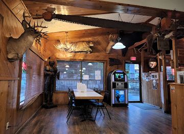
Cougar Bar & Grill
Discover delicious grilled delights at Cougar Bar & Grill amidst Washington's breathtaking natural beauty.
-
Restaurant
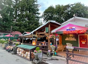
Lone Fir Cafe
Discover culinary delights at Lone Fir Cafe while enjoying breathtaking views near Mt. St. Helens.
Best bars in Mount St. Helens Area
Nightlife is limited and dispersed, with evening activity concentrated in the communities west and south of the monument rather than at the mountain itself. Castle Rock, Kelso and Longview have the widest selection of traditional pubs, sports bars, casual restaurants and occasional live-music settings, while smaller settlements generally offer only a few places to eat or drink. In the Mount St. Helens Area proper, evenings are more commonly spent at campsites, cabins or rural accommodation after hiking, rather than in nightclubs. Visitors should plan transport before drinking because roads are dark, winding and remote, and ride-hailing coverage cannot be assumed. Breweries, taprooms and contemporary bars are more readily found in the larger nearby towns than along the monument roads. Seasonal events and community gatherings may add local entertainment, but they should be checked locally rather than assumed to operate on a fixed schedule.
-
Restaurant
Lone Fir Cafe
Discover Lone Fir Cafe, a cozy family restaurant near Mount St. Helens, offering delicious meals and a warm atmosphere for all visitors.
Best nightclubs in Mount St. Helens Area
Nightlife is limited and dispersed, with evening activity concentrated in the communities west and south of the monument rather than at the mountain itself. Castle Rock, Kelso and Longview have the widest selection of traditional pubs, sports bars, casual restaurants and occasional live-music settings, while smaller settlements generally offer only a few places to eat or drink. In the Mount St. Helens Area proper, evenings are more commonly spent at campsites, cabins or rural accommodation after hiking, rather than in nightclubs. Visitors should plan transport before drinking because roads are dark, winding and remote, and ride-hailing coverage cannot be assumed. Breweries, taprooms and contemporary bars are more readily found in the larger nearby towns than along the monument roads. Seasonal events and community gatherings may add local entertainment, but they should be checked locally rather than assumed to operate on a fixed schedule.
-
Night club
Sarajevo Nightclub
Dive into the dynamic nightlife of Seattle at Sarajevo Nightclub, where electrifying music and vibrant crowds create unforgettable experiences.
-
Comedy club
Jokers Comedy Club
Experience the best comedy and nightlife at Jokers Comedy Club in Richland, WA - where laughter meets great drinks in a vibrant atmosphere.
-
Bar
Club Silverstone
Unleash your nightlife adventure at Club Silverstone, Tacoma's premier bar and nightclub with an electrifying atmosphere and unforgettable experiences.
-
Casino
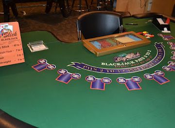
Jokers Casino & Nightclub
Jokers Casino & Nightclub: Richland's ultimate destination for gaming, dancing, and live entertainment, where unforgettable nights come alive.


Best shops in Mount St. Helens Area
Shopping is modest and practical, with the main opportunities found in Castle Rock, Toutle, Cougar and nearby Kelso and Longview rather than at the isolated viewpoints. Small stores and visitor facilities may sell maps, books, clothing, locally themed gifts and educational material about Mount St. Helens, while outdoor shops in larger towns are useful for fuel, food, equipment and weather-appropriate clothing. Regional farmers' markets and farm stands, where operating seasonally, may offer fruit, honey, preserves and other products from south-western Washington. The most meaningful souvenirs are often geology books, locally produced artwork, maps or small craft items that interpret the volcano rather than objects removed from protected land. Visitors should not collect rocks, pumice, plants, timber or other natural material from the monument. For broader retail choice, Kelso and Longview provide conventional shopping outside the immediate mountain area, while Portland and Vancouver offer substantially larger arts, food and specialist retail scenes.
-
National reserve
Mount St. Helens National Volcanic Monument
Discover the awe-inspiring landscapes and rich geological history at Mount St. Helens National Volcanic Monument, a true natural wonder in Washington State.
-
Nature preserve
Mount Saint Helens National Volcanic Monument
Experience the awe-inspiring beauty and ecological rebirth of Mount Saint Helens National Volcanic Monument, a natural wonder in Washington State.
-
Visitor center
Mt St Helens Forest Learning Center
Explore the ecological marvels and volcanic history at Mt St Helens Forest Learning Center, a unique educational experience in Washington's stunning landscapes.
-
National forest
Mount St. Helens National Volcanic Monument Headquarters
Explore the stunning Mount St. Helens National Volcanic Monument Headquarters, where nature's power meets educational adventure in Washington State.

Get your free copy of our complete guide to Mount St. Helens Area, delivered straight to you.
Everything on this page, from attractions and restaurants to essentials and local phrases, in one PDF you can read offline, print or share.
Already have an account? Sign in
Your Mount St. Helens Area guide is ready.
We'll send it to · Not you? Sign out

Getting your guide ready…
We are putting together a fresh copy of the Mount St. Helens Area guide. This can take up to a minute.
This can take a few moments. If your browser asks, choose Allow so the download can start. You'll find the guide in your Downloads folder.
Nothing happened? Download it again
Sorry, the guide is taking longer than usual. Please try again in a minute, or get it by email instead.
Mount St. Helens Area essentials
Currency and Payment
Safety
Emergency Situations
Do's and Don'ts
Local Tips
From Eve
Local phrases worth knowing
You don't need to get them perfect. A few words go a long way, and locals appreciate the effort.
Basics
| English | Local | Say it |
|---|---|---|
| Hello | Hey there | [Hey thir] |
| Goodbye | See ya later | [See ya lay-tur] |
| Yes | Yep | [Yep] |
| No | Nah | [Nah] |
| Please/You're welcome | No problem | [No prob-lem] |
| Thank you | Thanks a lot | [Thanks a lot] |
| Excuse me/Sorry | Sorry about that | [Sorry about that] |
| How are you? | How's it going? | [How's it goin'?] |
| Fine. And you? | Good, you? | [Good, you?] |
| Do you speak English? | Do ya speak English? | [Doo ya speek Inglish?] |
| I don't understand | I don't get it | [I don't git it] |
Eating & Drinking
| English | Local | Say it |
|---|---|---|
| I'd like to see the menu, please | Can I see the menu? | [Can I see the menu?] |
| I don't eat meat | I'm a vegetarian | [I'm a vege-tair-ian] |
| Cheers! | Cheers! | [Cheers!] |
| I would like to pay, please | Could I get the check? | [Could I get the check?] |
Emergencies
| English | Local | Say it |
|---|---|---|
| Help! | Help! | [Help!] |
| Go away! | Leave me alone! | [Leave me uh-lone!] |
| Call the Police! | Call 911! | [Call nine-one-one!] |
| Call a doctor! | Get a doctor! | [Get a doctor!] |
| I'm lost | I'm turned around | [I'm turned around] |
| I'm ill | I'm not feeling well | [I'm not feel-ing well] |
Shopping
| English | Local | Say it |
|---|---|---|
| I'd like to buy... | I wanna buy... | [I wanna buy...] |
| I'm just looking | Just browsing | [Just brows-ing] |
| How much is it? | What's the price? | [What's the price?] |
| That's too expensive | That's pricey | [That's pry-see] |
| Can you lower the price? | Can you give me a deal? | [Can you give me a deal?] |
Time & Numbers
| English | Local | Say it |
|---|---|---|
| What time is it? | What time ya got? | [What time ya got?] |
| It's one o'clock | It's one | [It's one] |
| Half past (10) | Half past ten | [Half past ten] |
| Morning | Morning | [Morn-ing] |
| Afternoon | Afternoon | [Afternoon] |
| Evening | Evening | [Evening] |
| Yesterday | Yesterday | [Yes-ter-day] |
| Today | Today | [To-day] |
| Tomorrow | Tomorrow | [To-morrow] |
| 1 | One | [One] |
| 2 | Two | [Two] |
| 3 | Three | [Three] |
| 4 | Four | [Four] |
| 5 | Five | [Five] |
| 6 | Six | [Six] |
| 7 | Seven | [Seven] |
| 8 | Eight | [Eight] |
| 9 | Nine | [Nine] |
| 10 | Ten | [Ten] |
Transport & Directions
| English | Local | Say it |
|---|---|---|
| Where's a/the...? | Where's the...? | [Where's the...?] |
| What's the address? | What's the addy? | [What's the addy?] |
| Can you show me (on the map)? | Can ya point it out? | [Can ya point it out?] |
| When's the next (bus)? | When's the next bus? | [When's the next bus?] |
| A ticket (to ....) | A ticket to... | [A ticket to...] |
History of Mount St. Helens Area
Indigenous Homelands and Mount St. Helens
Mount St. Helens stands within a landscape long connected with Indigenous peoples, including the Cowlitz and Klickitat. The mountain has cultural, spiritual and practical significance, and Native knowledge forms an important part of understanding its place in the region. The English name derives from the title associated with the British diplomat Lord St Helens, but that later name does not replace the mountain's Indigenous histories. Visitors should understand the monument not simply as a dramatic geological site, but as part of an older cultural landscape whose relationships with land, water, plants and animals continue today.
Volcanic Formation and Cascade Landscapes
Mount St. Helens is a relatively young, highly active volcano within the Cascade Range, formed by the subduction of the Juan de Fuca tectonic plate beneath North America. Earlier eruptions built successive volcanic layers and shaped nearby ridges, lava formations and valleys. Ape Cave, a long lava tube on the southern side, records an earlier phase of volcanic activity. These geological processes created the terrain that later supported forests, rivers, wildlife habitat and human settlement, while also explaining why the area remains subject to volcanic monitoring and changing access conditions.
Logging, Settlement and Infrastructure
During the nineteenth and twentieth centuries, timber became central to the economy of south-western Washington. Logging towns, mills, roads and rail connections developed in the valleys around the mountain, while the Lewis River system was altered by hydroelectric projects and reservoirs. Commercial forestry shaped employment and settlement patterns, but it also transformed forests and landscapes. The communities that serve Mount St. Helens today retain this working-country character, combining timber, construction, public services, tourism and outdoor recreation rather than functioning solely as visitor resorts.
The 1980 Eruption
After months of earthquakes and visible volcanic unrest, Mount St. Helens erupted on 18 May 1980. A massive landslide removed the northern flank, followed by a lateral blast, ash column and destructive lahars, or volcanic mudflows. Fifty-seven people died, and homes, roads, forests and wildlife habitat were severely affected. The eruption altered the mountain's profile and created the broad crater seen today. It also transformed volcanology, emergency planning and public understanding of volcanic hazards in the United States. The surrounding landscape became a major outdoor laboratory for studying ecological change.
Creation of the National Volcanic Monument
In 1982, much of the devastated landscape was protected as the Mount St. Helens National Volcanic Monument, managed by the United States Forest Service. The decision allowed natural processes to proceed with limited intervention while providing carefully managed opportunities for research, education and recreation. Roads, viewpoints, interpretive facilities and trails were developed around the protected area, but the monument was not designed as a conventional landscaped park. Its value lies partly in seeing natural succession, erosion and volcanic change continue without extensive reconstruction.
Recovery, Research and Continuing Activity
The decades after 1980 have shown that ecological recovery is neither uniform nor predictable. Plants returned through surviving root systems, seeds, waterways and animal movement, while some areas remain sparsely vegetated or frequently disturbed. A lava dome grew inside the crater during eruptions between 2004 and 2008, demonstrating that Mount St. Helens remains active even when quiet. Monitoring by scientists and public agencies continues, and the region remains an important place for research into volcanoes, forests, rivers, wildlife and long-term landscape recovery.
Mount St. Helens Area in Photos
Browse through our photo collection highlighting the charm and character of the destination.
Neighbouring regions of Mount St. Helens Area
The closest regions to Mount St. Helens Area, if you have time for more than one.
-

-
-

-

-


Swipe for more regions
Explore more

Explore more of Washington
Explore Washington State: From the vibrant streets of Seattle to the tranquil beauty of the Olympic Peninsula, discover the diverse landscapes, culture, and adventures awaiting you.
Explore Washington