

Free Columbia River Gorge Travel Guide & Mobile App
Explore Columbia River Gorge with free travel guides. Discover regional history, expert tips, proposed trips, and audio guides on web or mobile app.


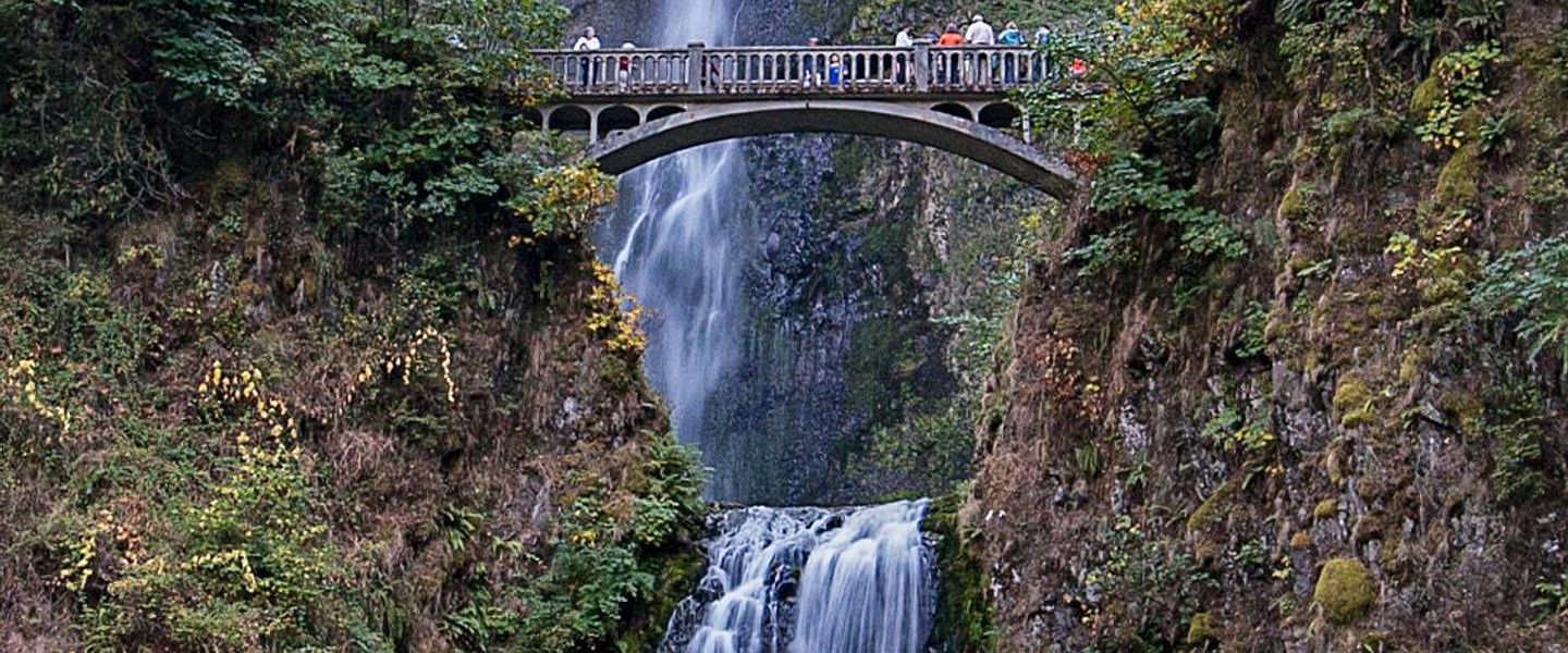


Explore Washington’s Columbia River Gorge for basalt cliffs, forested trails, river towns, vineyards, wind sports and wide-open Cascade scenery.
Read more about Columbia River Gorge
Getting to and around Columbia River Gorge
How to get there
Transportation
Destinations in Columbia River Gorge
Resorts, valleys and scenic spots worth a trip of their own.

Swipe for more destinations
Best attractions in Columbia River Gorge
The Washington side of the Columbia River Gorge offers a varied combination of geological, natural, historical and agricultural attractions. Beacon Rock State Park is the best-known western landmark, with a steep, engineered trail climbing the basalt monolith and forested routes extending through the surrounding park. Nearby, Cape Horn overlooks the river from a high wooded slope, while the communities of Stevenson and North Bonneville provide access to trails, viewpoints and river history. East of the forested corridor, Columbia Hills State Park opens into a drier landscape of basalt formations, grassland and seasonal wildflowers. Maryhill Museum of Art and the nearby Maryhill Stonehenge add cultural and architectural interest near the eastern edge of the Washington gorge. White Salmon, Bingen and Lyle are useful bases for wineries, orchards, cafés, cycling and wind-sport activities. The river itself supports fishing, boating, birdwatching and scenic photography, although currents and wind demand care. Hiking ranges from short viewpoints to strenuous routes with limited shade, and conditions can change sharply between the damp western gorge and the warmer eastern hills. Visitors should check land-access, wildfire and trail information before travelling, since some areas are managed by different public agencies or affected by seasonal restrictions.
-

Columbia River Gorge National Scenic Area
Explore the breathtaking landscapes and vibrant ecosystems of Columbia River Gorge National Scenic Area, a must-visit destination for nature lovers and adventurers.
-
Scenic spot
Rowena Crest Viewpoint
Experience breathtaking views and outdoor adventures at Rowena Crest Viewpoint, a scenic gem in the heart of the Columbia River Gorge.
-
Wild Horse Scenic View Area & Hiking Trail
Discover breathtaking vistas and hiking adventures at the Wild Horse Scenic View Area in Quincy, Washington, a must-see destination for outdoor enthusiasts.
-
Columbia Gorge Museum
Discover the captivating history of the Columbia River Gorge at the Columbia Gorge Museum, where the past meets the natural beauty of Washington.


Best landmarks in Columbia River Gorge
Beacon Rock is the Washington gorge’s most recognisable natural landmark: a vast basalt monolith rising beside the river and named by members of the Lewis and Clark expedition. Its engineered summit trail reveals the scale of the gorge and the relationship between the river, cliffs and Cascade foothills. The Bridge of the Gods is another prominent feature, carrying road and pedestrian traffic across the Columbia between Washington and Oregon and forming a visible link between the two sides of the national scenic area. In the eastern gorge, the Maryhill Stonehenge is a striking early twentieth-century concrete monument built as a memorial to local soldiers who died in the First World War; its setting above the river gives it additional visual force. The basalt walls and open formations of Columbia Hills form a landmark landscape rather than a single structure, while Cape Horn’s elevated river views show the heavily forested character of the western Washington shore. Historic townscapes in Stevenson, White Salmon, Bingen and Goldendale are more modest, but they reflect the enduring role of transport, agriculture and trade in the region.
-
Hiking area
Columbia River Gorge National Scenic Area
Explore the stunning Columbia River Gorge National Scenic Area, a nature lover's paradise filled with breathtaking views, waterfalls, and outdoor adventures.
-
Historical landmark
Vista House at Crown Point
Experience breathtaking views and rich history at Vista House, a stunning landmark overlooking the Columbia River Gorge in Oregon.
-
Tourist attraction
Scenic Overlook of the Columbia River
Experience the stunning vistas of the Columbia River at the Scenic Overlook, a must-visit gem in Washington's breathtaking landscapes.
-
Scenic spot
Rowena Crest Viewpoint
Experience the breathtaking views of the Columbia River Gorge at Rowena Crest Viewpoint, a stunning scenic spot and hiking destination in Oregon.


Explore Columbia River Gorge on the map
Plan your trip on one map. See where the top cities, national parks and sights are, and book hotels and experiences in a few clicks.
Best hotels in Columbia River Gorge
Best restaurants in Columbia River Gorge
Dining in Washington’s Columbia River Gorge reflects the transition from Pacific Northwest forest to dry inland farming country. Stevenson, White Salmon and Bingen have the broadest choice of cafés, brewpubs, casual restaurants and more ambitious dining, while smaller communities and rural roads are served by seasonal businesses, farm stands and roadside stops. Apples, pears, cherries and other orchard produce are prominent, particularly in the warmer eastern sections, and local menus often use regional beef, vegetables, grains and river-country ingredients. Wineries and tasting rooms provide a strong part of the food-and-drink economy, with Washington wines joined by craft beer, cider and non-alcoholic orchard products. Around Lyle and the eastern gorge, vineyard visits can be combined with views across open hills and the Columbia. Reservations are sensible for popular weekend meals, and opening patterns can be seasonal in rural areas. The region is not defined by one single dish; its culinary character lies in the combination of farm produce, small-town hospitality, wine-country dining, cafés and outdoor-oriented food culture.
-
Pacific Northwestern
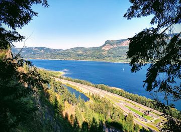
Multnomah Falls Lodge
Experience breathtaking views and rich history at Multnomah Falls Lodge in Oregon's scenic Columbia River Gorge.
-
Orchard
The Gorge White House
Discover fresh flavors and stunning views at The Gorge White House - your gateway to Oregon's agricultural charm.
-
Hotel
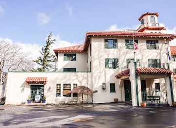
Columbia Gorge Hotel & Spa
Discover luxury at Columbia Gorge Hotel & Spa—where history meets breathtaking views in Oregon's stunning landscape.
-
Chinese
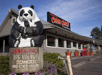
Grace Su's China Gorge Restaurant
Experience authentic Chinese cuisine with breathtaking views at Grace Su's China Gorge Restaurant in Hood River, Oregon.
Best bars in Columbia River Gorge
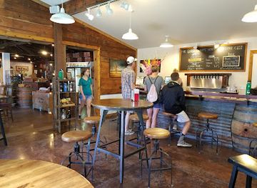
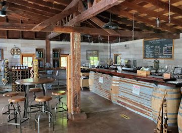
Evening life in the Washington gorge is centred on pubs, brewpubs, wine tasting rooms, restaurants and community-oriented venues rather than a large nightclub scene. Stevenson offers a convenient western base for a drink after hiking, while White Salmon and Bingen have a more concentrated selection of bars, breweries and casual evening establishments. In the eastern gorge, wineries and cider producers contribute to a quieter tasting culture, often connected with local agriculture and views over the river and open hills. Live music and seasonal events may appear in town venues, but schedules change and should be checked locally. Rural communities can become quiet once dinner services end, and not every tasting room operates late. Drink-driving is a serious risk on winding gorge roads, so arrange a designated driver or stay within walking distance of accommodation. The most characteristic evenings combine a local drink with a meal, sunset scenery or a small-town event rather than late-night clubbing.
-
Pacific Northwestern
Multnomah Falls Lodge
Experience the breathtaking beauty of Multnomah Falls Lodge, where nature meets rustic charm in the heart of the Pacific Northwest.
-
Restaurant
Riverside
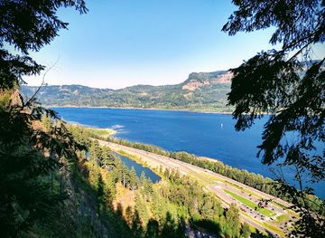
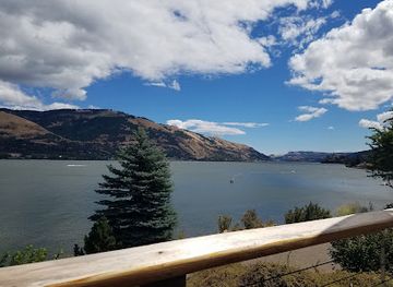
Discover Riverside, a delightful dining oasis in Hood River, where culinary excellence meets breathtaking views of the Columbia River Gorge.
-
Orchard
The Gorge White House
Experience the organic charm of The Gorge White House, where orchards meet artisanal flavors and local hospitality in the heart of Hood River Valley.
-
Restaurant
3 Rivers Grill
Discover the culinary magic at 3 Rivers Grill, where exquisite American cuisine meets breathtaking views of the Columbia River Gorge.
Best shops in Columbia River Gorge
-
Shopping mall
Columbia Gorge Outlets
Shop a variety of brands at Columbia Gorge Outlets while enjoying breathtaking views of the Columbia River Gorge in Oregon.
-
Department store
Walmart
Explore Hood River's best shopping destination at Walmart, offering everything from groceries to electronics at unbeatable prices.


Get your free copy of our complete guide to Columbia River Gorge, delivered straight to you.
Everything on this page, from attractions and restaurants to essentials and local phrases, in one PDF you can read offline, print or share.
Already have an account? Sign in
Your Columbia River Gorge guide is ready.
We'll send it to · Not you? Sign out

Getting your guide ready…
We are putting together a fresh copy of the Columbia River Gorge guide. This can take up to a minute.
This can take a few moments. If your browser asks, choose Allow so the download can start. You'll find the guide in your Downloads folder.
Nothing happened? Download it again
Sorry, the guide is taking longer than usual. Please try again in a minute, or get it by email instead.
Columbia River Gorge essentials
Currency and Payment
Safety
Emergency Situations
Do's and Don'ts
Local Tips
From Eve
Local phrases worth knowing
You don't need to get them perfect. A few words go a long way, and locals appreciate the effort.
Basics
| English | Local | Say it |
|---|---|---|
| Hello | Hola | [OH-lah] |
| Goodbye | Adiós | [ah-DYOS] |
| Yes | Sí | [SEE] |
| No | No | [NO] |
| Please/You're welcome | Por favor/De nada | [por fah-VOR/deh NAH-dah] |
| Thank you | Gracias | [GRAH-syahs] |
| Excuse me/Sorry | Perdón | [pehr-DON] |
| How are you? | ¿Cómo estás? | [KOH-moh ehs-TAHS] |
| Fine. And you? | Bien. ¿Y tú? | [BYEN. ee TOO] |
| Do you speak English? | ¿Hablas inglés? | [AH-blahs een-GLES] |
| I don't understand | No entiendo | [NO en-TYEN-doh] |
Eating & Drinking
| English | Local | Say it |
|---|---|---|
| I'd like to see the menu, please | Me gustaría ver el menú, por favor | [meh goos-tah-REE-ah BEHR el meh-NOO, por fah-VOR] |
| I don't eat meat | No como carne | [NO KOH-moh KAR-neh] |
| Cheers! | ¡Salud! | [sah-LOOD] |
| I would like to pay, please | Me gustaría pagar, por favor | [meh goos-tah-REE-ah pah-GAR, por fah-VOR] |
Emergencies
| English | Local | Say it |
|---|---|---|
| Help! | ¡Ayuda! | [ah-YOO-dah] |
| Go away! | ¡Vete! | [VEH-teh] |
| Call the Police! | ¡Llama a la policía! | [YAH-mah ah lah poh-lee-SIAH] |
| Call a doctor! | ¡Llama a un doctor! | [YAH-mah ah oon dok-TOR] |
| I'm lost | Estoy perdido | [es-TOY pehr-DEE-doh] |
| I'm ill | Estoy enfermo | [es-TOY en-FER-mo] |
Shopping
| English | Local | Say it |
|---|---|---|
| I'd like to buy... | Me gustaría comprar... | [meh goos-tah-REE-ah kom-PRAHR] |
| I'm just looking | Solo estoy mirando | [SOH-lo es-TOY mee-RAHN-doh] |
| How much is it? | ¿Cuánto cuesta? | [KWAN-toh KWES-tah] |
| That's too expensive | Es demasiado caro | [es deh-mah-SYA-doh KAH-roh] |
| Can you lower the price? | ¿Puedes bajar el precio? | [PWEH-des bah-HAR el PREH-syo] |
Time & Numbers
| English | Local | Say it |
|---|---|---|
| What time is it? | ¿Qué hora es? | [KEH OH-rah es] |
| It's one o'clock | Es la una | [es lah OO-nah] |
| Half past (10) | Y diez y media | [ee DYAS ee MEH-dyah] |
| Morning | Mañana | [mah-NYAH-nah] |
| Afternoon | Tarde | [TAR-deh] |
| Evening | Noche | [NOH-cheh] |
| Yesterday | Ayer | [ah-YER] |
| Today | Hoy | [OY] |
| Tomorrow | Mañana | [mah-NYAH-nah] |
| 1 | Uno | [OO-no] |
| 2 | Dos | [DOS] |
| 3 | Tres | [TRES] |
| 4 | Cuatro | [KWAH-tro] |
| 5 | Cinco | [SEEN-koh] |
| 6 | Seis | [SAYS] |
| 7 | Siete | [SYEH-teh] |
| 8 | Ocho | [OH-choh] |
| 9 | Nueve | [NWEH-beh] |
| 10 | Diez | [DYAS] |
Transport & Directions
| English | Local | Say it |
|---|---|---|
| Where's a/the...? | ¿Dónde está...? | [DON-deh es-TAH] |
| What's the address? | ¿Cuál es la dirección? | [KWAL es lah dee-rek-SYON] |
| Can you show me (on the map)? | ¿Puedes mostrarme (en el mapa)? | [PWEH-des mos-TRAR-meh (en el MAH-pah)] |
| When's the next (bus)? | ¿Cuándo es el próximo (autobús)? | [KWAN-doh es el PROK-see-mo (ow-toh-BOOS)] |
| A ticket (to ....) | Un boleto (a ...) | [OON boh-LEH-toh (ah ...)] |
History of Columbia River Gorge
Indigenous Columbia River Cultures
The gorge has been a major Indigenous travel, trading and fishing corridor for thousands of years. The river connected communities on both sides of the modern Washington–Oregon boundary, while salmon, roots, berries and game supported seasonal economies. Peoples associated with the Cowlitz, Klickitat, Yakama and Umatilla traditions remain connected to the region. European and American mapping often reduced these complex networks to place names and territorial claims, but Indigenous knowledge and continuing cultural presence are essential to understanding the gorge’s history.
Volcanic Landscapes and Ice Age Floods
The gorge’s cliffs and exposed basalt were formed by repeated volcanic eruptions, particularly the extensive Columbia River Basalt eruptions of the Miocene period. Much later, floods released by the collapse of glacial Lake Missoula scoured and widened parts of the corridor during the Ice Age. The resulting cliffs, benches and unusual drainage patterns help explain the region’s abrupt change from damp Cascade forest to dry grassland. Geological features such as Beacon Rock and the Columbia Hills are visible expressions of this long natural history.
The Lewis and Clark Expedition, 1805–1806
The Corps of Discovery travelled through the Columbia River corridor during its westward journey in 1805 and its return in 1806. The expedition depended on Indigenous knowledge, established river routes and encounters with Native communities, even though later popular accounts often placed disproportionate emphasis on the expedition itself. Their journals recorded the gorge’s cliffs, rapids, vegetation and inhabitants. Several locations associated with the journey, including the area around present-day Beacon Rock and the lower gorge, remain part of the region’s historical interpretation.
Fur Trade, Missions and Early American Settlement
During the nineteenth century, the Columbia became a route for fur traders, missionaries, military travellers and settlers moving through the Pacific Northwest. Fort Vancouver, located outside the gorge near present-day Vancouver, Washington, became an important regional centre, while river landings and trails supported movement through the corridor itself. Settlement brought agriculture, new transport links and profound disruption to Indigenous communities. Towns such as Stevenson and Goldendale later developed within different parts of this wider network of river, road and overland commerce.
River Navigation, Railways and Hydroelectric Development
The Columbia’s rapids and variable water levels made navigation difficult, encouraging successive improvements to river transport, roads and railways. In the twentieth century, dams transformed the river into a major navigation and power system, while also altering fisheries, shorelines and Indigenous access to traditional resources. The Columbia River Gorge became both an industrial corridor and a valued scenic landscape. Modern conservation efforts reflect an ongoing attempt to balance energy, transport, recreation, habitat protection and the rights of communities connected to the river.
Orchards, Vineyards and the Scenic-Area Era
Agriculture expanded in the gorge as irrigation, roads and improved transport made commercial fruit growing increasingly viable. Apples, pears and cherries became important products, particularly in the warmer eastern sections, while vineyards and small-scale food businesses later added a prominent visitor economy. The Columbia River Gorge National Scenic Area was established in 1986 to protect the landscape while accommodating existing communities, farms and industry. Its planning framework helped shape the contemporary balance between conservation, rural development and tourism on both sides of the river.
Columbia River Gorge in Photos
Browse through our photo collection highlighting the charm and character of the destination.
Neighbouring regions of Columbia River Gorge
The closest regions to Columbia River Gorge, if you have time for more than one.
-

-

-

-

-


Swipe for more regions
Explore more

Explore more of Washington
Explore Washington State: From the vibrant streets of Seattle to the tranquil beauty of the Olympic Peninsula, discover the diverse landscapes, culture, and adventures awaiting you.
Explore Washington