

Free Kettle Moraine Travel Guide & Mobile App
Explore Kettle Moraine with free travel guides. Discover regional history, expert tips, proposed trips, and audio guides on web or mobile app.


Explore Kettle Moraine's glacial hills, forests, lakes and trails across south-eastern Wisconsin, with hiking, camping, cycling and winter recreation.
Read more about Kettle Moraine
Getting to and around Kettle Moraine
How to get there
Transportation
Destinations in Kettle Moraine
Resorts, valleys and scenic spots worth a trip of their own.

Swipe for more destinations
Best attractions in Kettle Moraine
Kettle Moraine's attractions are primarily landscape-based, with recreation and geological interpretation woven into a large public forest. The Northern Unit offers woodland walks, swimming and paddling at places such as Mauthe Lake and Long Lake, along with access to the Ice Age National Scenic Trail and viewpoints including Parnell Tower. In the Southern Unit, Ottawa Lake, Scuppernong Springs and extensive networks for hiking, mountain biking, horseback riding and winter sports reveal a more varied pattern of woods, prairie, wetlands and glacial ridges. Lapham Peak and Pike Lake provide additional public recreation areas with their own trails and seasonal activities. Campgrounds range from developed family-oriented sites to quieter settings, while interpretive signs explain the moraine, kettle holes and ecological succession. Around the forest, rural roads, historic villages, farm country and small-town museums add cultural context, though these are separate communities rather than attractions contained within one park. Visitors interested in wildlife can look for deer, wild turkey, waterfowl and woodland birds, while careful observers may find spring flowers and restored prairie species. The area rewards repeat visits because trails and lakes change markedly between summer, autumn, snow season and spring thaw.
-
Tourist attraction
The House on the Rock
Experience the whimsical architecture and eclectic collections at The House on the Rock, a must-visit attraction in Spring Green, Wisconsin.
-
State park
Governor Dodge State Park
Explore the breathtaking beauty of Governor Dodge State Park, a premier destination for outdoor adventures and serene escapes in Wisconsin.
-
State park
Copper Falls State Park
Explore the stunning waterfalls and scenic trails of Copper Falls State Park, a natural haven in Wisconsin for outdoor enthusiasts and nature lovers.
-
State park
Kettle Moraine State Forest - Northern Unit
Discover the scenic beauty and outdoor adventures awaiting you at Kettle Moraine State Forest - Northern Unit in Wisconsin.


Best landmarks in Kettle Moraine
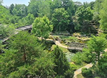
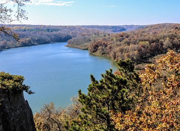
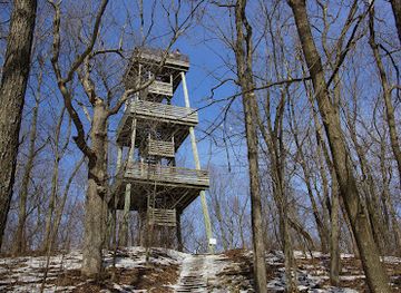
Kettle Moraine's most important landmarks are geological as much as architectural. The long, irregular ridges of the moraine and the depressions of kettle holes express the movement and retreat of the Ice Age glaciers, while eskers and drumlins create the region's characteristic mixture of climbs, wooded slopes and open farmland. Parnell Tower in the Northern Unit is one of the clearest human-made viewpoints, rising above the surrounding forest and glacial country. Lapham Peak, in the unit near Delafield, is another prominent high point and a well-known place for observing the topography of south-eastern Wisconsin. Scuppernong Springs in the Southern Unit marks a distinctive natural feature within a landscape shaped by groundwater and glacial deposits, and the Ice Age National Scenic Trail gives the region a strong long-distance walking identity. Ottawa Lake and the forest's major campground landscapes are recognisable recreational places, though their importance lies in their setting rather than monumental architecture. Historic rural churches, farmsteads and village buildings around the forest provide a quieter architectural counterpoint to these natural landmarks.
-
State park
Kettle Moraine State Forest - Northern Unit
Explore the breathtaking landscapes and diverse wildlife of Kettle Moraine State Forest - Northern Unit in Wisconsin, a perfect retreat for outdoor enthusiasts.
-
State park
Kettle Moraine State Forest - Lapham Peak Unit
Explore the stunning Kettle Moraine State Forest - Lapham Peak Unit, where nature's beauty and outdoor adventures await in Wisconsin's picturesque landscapes.
-
Historical place museum
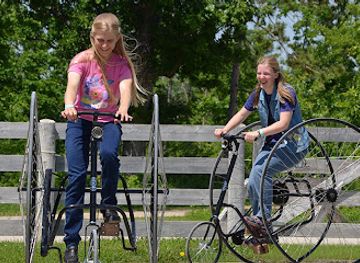
Old World Wisconsin
Step into the past at Old World Wisconsin, where history comes alive through immersive experiences and stunning cultural exhibits.
-
Historical landmark
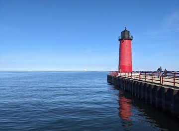
Milwaukee Pierhead Lighthouse
Explore the historic Milwaukee Pierhead Lighthouse, a stunning landmark offering breathtaking views of Lake Michigan and a glimpse into maritime history.
Explore Kettle Moraine on the map
Plan your trip on one map. See where the top cities, national parks and sights are, and book hotels and experiences in a few clicks.
Best hotels in Kettle Moraine
Best restaurants in Kettle Moraine
Dining in Kettle Moraine is centred on the surrounding small towns, villages and rural crossroads rather than on a single restaurant district. Traditional Wisconsin food is widely represented by taverns, family restaurants, cafés and supper-club-style establishments, with dishes and ingredients reflecting the state's German-American, dairy and farm traditions. Expect cheese curds, bratwurst, burgers, fish fries, locally produced dairy foods and substantial breakfasts, although these are Wisconsin fare rather than inventions exclusive to Kettle Moraine. Farm stands and seasonal markets can provide fruit, vegetables, baked goods and locally made preserves, particularly during the growing season. Around lakes and popular recreation areas, casual food is more common than formal dining, while communities such as those near the Northern and Southern units offer a broader choice of cafés, bakeries and independent restaurants. Visitors camping in the forest should shop before heading to remote sites, as food outlets are not evenly distributed and evening options may be limited. Wisconsin beer is widely available, but responsible consumption is important when driving or using trails and watercraft.
-
American
The Mineshaft
Experience diverse American cuisine at The Mineshaft in Hartford - where great food meets fun and family-friendly entertainment.
-
American
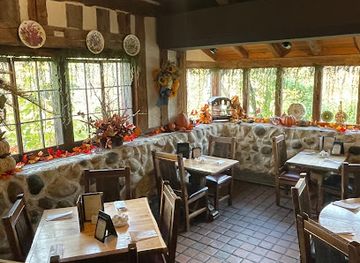
The Fox & Hounds Restaurant & Tavern
Experience fine dining at The Fox & Hounds Restaurant & Tavern, where exquisite American cuisine meets a cozy tavern atmosphere in Hubertus.
-
Grill
Joe Mama's Bar & Grill
Experience delicious American cuisine at Joe Mama's Bar & Grill in Colgate, WI - where great food meets friendly service.
-
Restaurant
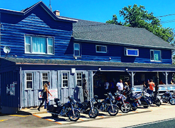
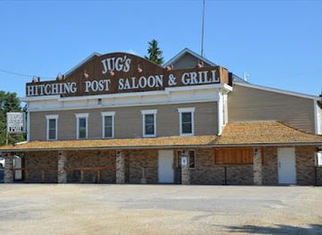
Jug's Hitching Post Saloon & Grill
Discover Jug's Hitching Post Saloon & Grill in West Bend - A perfect blend of rustic charm and culinary creativity awaits you!

Best bars in Kettle Moraine
Kettle Moraine does not have a major nightclub scene; evening life is shaped by village taverns, historic-looking inns, family restaurants, breweries and community events in the surrounding towns. Traditional Wisconsin bars often serve as informal meeting places for local residents and recreational visitors, while larger settlements near the forest provide more choice for live music, casual drinks and late meals. In rural areas, venues may close earlier and distances between them can be considerable, so plan transport before drinking rather than relying on a last-minute taxi or rideshare. Summer campground evenings are usually organised around quiet conversation, fires where permitted and stargazing rather than loud entertainment, and winter brings a smaller, more local social rhythm. Breweries and taprooms in south-eastern Wisconsin may offer regional beer, but they should be treated as optional additions to a forest itinerary rather than as the defining culture of the destination.
-
American
The Mineshaft
Experience the perfect blend of American and Mexican cuisine with arcade fun at The Mineshaft, Hartford's ultimate dining destination.
-
American
The Fox & Hounds Restaurant & Tavern
Experience the finest American cuisine at The Fox & Hounds Restaurant & Tavern, a charming dining destination in Hubertus, WI.
-
Grill
Joe Mama's Bar & Grill
Experience the vibrant flavors of American cuisine at Joe Mama's Bar & Grill in Colgate, Wisconsin, where good food and great company meet.
-
Restaurant
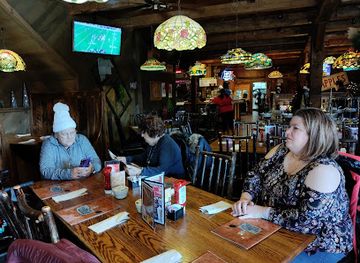
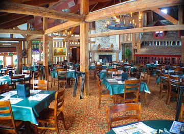
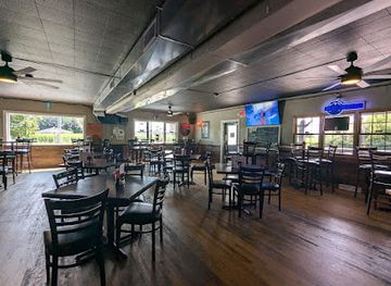
Jug's Hitching Post Saloon & Grill
Discover the rustic charm and delicious cuisine at Jug's Hitching Post Saloon & Grill in West Bend, WI – a unique dining experience awaits you!
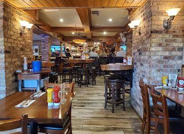
Best nightclubs in Kettle Moraine
Kettle Moraine does not have a major nightclub scene; evening life is shaped by village taverns, historic-looking inns, family restaurants, breweries and community events in the surrounding towns. Traditional Wisconsin bars often serve as informal meeting places for local residents and recreational visitors, while larger settlements near the forest provide more choice for live music, casual drinks and late meals. In rural areas, venues may close earlier and distances between them can be considerable, so plan transport before drinking rather than relying on a last-minute taxi or rideshare. Summer campground evenings are usually organised around quiet conversation, fires where permitted and stargazing rather than loud entertainment, and winter brings a smaller, more local social rhythm. Breweries and taprooms in south-eastern Wisconsin may offer regional beer, but they should be treated as optional additions to a forest itinerary rather than as the defining culture of the destination.
-
Grill
Sheryl's Club 175
Experience the best of American cuisine and live music at Sheryl's Club 175 in Slinger, Wisconsin - a top spot for food lovers and entertainment seekers.
-
Bar
Tiki Beach Resort
Experience the ultimate family-friendly adventure at Tiki Beach Resort in Campbellsport, WI, featuring a bar, restaurant, water park, and boat rentals.
-
Bar
The Reef
Discover the vibrant nightlife of The Reef, a premier bar and dance club in Lake Delton, Wisconsin, featuring live music and a lively atmosphere.
-
Bar
The Speakeasy
Discover the charm of The Speakeasy, where crafted cocktails and a relaxed ambiance create unforgettable nights in Newburg, Wisconsin.
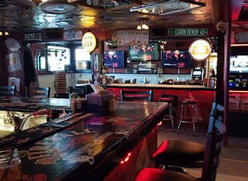
Best shops in Kettle Moraine
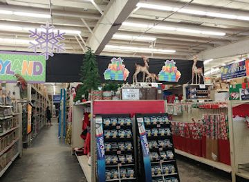
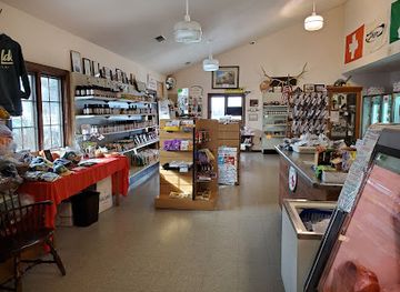
Shopping in Kettle Moraine is local and dispersed, with the best opportunities found in the surrounding market towns rather than inside the forest. Small-town main streets offer independent cafés, bookshops, antique dealers, galleries, outdoor suppliers and practical provisions, while farm stands and seasonal markets sell Wisconsin cheese, honey, preserves, vegetables, apples, baked goods and other produce. Craft shops may stock pottery, woodwork, textiles and locally made gifts, although selection varies by community and season. Visitors staying in campgrounds should buy food, fuel and specialist equipment before heading to remote sites, as forest facilities are not intended to function as full retail centres. Regional souvenirs connected with glacial landscapes, hiking and Wisconsin dairy culture are generally more appropriate than generic resort merchandise. Larger retail areas lie outside the immediate forest in cities such as Waukesha, West Bend and Oconomowoc, but these are gateways and service centres rather than parts of a single Kettle Moraine shopping district.
-
Sporting goods store
Cabela's
Explore the great outdoors at Cabela's in Richfield, Wisconsin – your one-stop shop for all things camping, fishing, and hunting.
-
Department store
Fleet Farm
Discover Fleet Farm in West Bend: A Unique Shopping Experience for Clothing, Farm Equipment, and More!
-
State park
Kettle Moraine State Forest - Northern Unit
Experience the breathtaking beauty and outdoor adventures waiting at Kettle Moraine State Forest - Northern Unit, a premier destination in Wisconsin.
-
Meat products store
Held's Meat and Cheese Market
Discover gourmet meats and artisanal cheeses at Held's Meat and Cheese Market in Slinger, WI – a culinary gem for food lovers!

Get your free copy of our complete guide to Kettle Moraine, delivered straight to you.
Everything on this page, from attractions and restaurants to essentials and local phrases, in one PDF you can read offline, print or share.
Already have an account? Sign in
Your Kettle Moraine guide is ready.
We'll send it to · Not you? Sign out

Getting your guide ready…
We are putting together a fresh copy of the Kettle Moraine guide. This can take up to a minute.
This can take a few moments. If your browser asks, choose Allow so the download can start. You'll find the guide in your Downloads folder.
Nothing happened? Download it again
Sorry, the guide is taking longer than usual. Please try again in a minute, or get it by email instead.
Kettle Moraine essentials
Currency and Payment
Safety
Emergency Situations
Do's and Don'ts
Local Tips
From Eve
Local phrases worth knowing
You don't need to get them perfect. A few words go a long way, and locals appreciate the effort.
Basics
| English | Local | Say it |
|---|---|---|
| Hello | Hi there | [Hai thair] |
| Goodbye | See ya | [See yah] |
| Yes | Yep | [Yep] |
| No | Nah | [Nah] |
| Please/You're welcome | No problem | [No prob-lem] |
| Thank you | Thanks a lot | [Thangs a lot] |
| Excuse me/Sorry | Pardon me | [Pardon mee] |
| How are you? | How ya doin'? | [How ya doin'?] |
| Fine. And you? | Good. And you? | [Gudd. An' you?] |
| Do you speak English? | Can ya talk English? | [Can ya talk English?] |
| I don't understand | I ain't gettin' it | [I ain't gettin' it] |
Eating & Drinking
| English | Local | Say it |
|---|---|---|
| I'd like to see the menu, please | Can I get a look at the menu? | [Can I get a look at tha menu?] |
| I don't eat meat | I’m a vegetarian | [I'm a vege-tarian] |
| Cheers! | Cheers! | [Cheers!] |
| I would like to pay, please | Can I get the check, please? | [Can I get tha check, please?] |
Emergencies
| English | Local | Say it |
|---|---|---|
| Help! | Help! | [Help!] |
| Go away! | Leave me alone! | [Leave me alone!] |
| Call the Police! | Call the cops! | [Call the cops!] |
| Call a doctor! | Get a doctor! | [Get a doctor!] |
| I'm lost | I'm turned around | [I'm turned around] |
| I'm ill | I ain't feelin' good | [I ain't feelin' good] |
Shopping
| English | Local | Say it |
|---|---|---|
| I'd like to buy... | I wanna buy... | [I wanna buy...] |
| I'm just looking | Just browsin' | [Just browsin'] |
| How much is it? | What's the price? | [What's tha price?] |
| That's too expensive | That's a bit pricey | [That's a bit pricey] |
| Can you lower the price? | Can ya bring it down a bit? | [Can ya bring it down a bit?] |
Time & Numbers
| English | Local | Say it |
|---|---|---|
| What time is it? | What time ya got? | [What time ya got?] |
| It's one o'clock | It's one o'clock | [It's one o'clock] |
| Half past (10) | Half past ten | [Half past ten] |
| Morning | Mornin' | [Mornin'] |
| Afternoon | Afternoon | [Afternoon] |
| Evening | Evenin' | [Evenin'] |
| Yesterday | Yesterday | [Yesterday] |
| Today | Today | [Today] |
| Tomorrow | Tomorrow | [Tomorrow] |
| 1 | One | [One] |
| 2 | Two | [Two] |
| 3 | Three | [Three] |
| 4 | Four | [Four] |
| 5 | Five | [Five] |
| 6 | Six | [Six] |
| 7 | Seven | [Seven] |
| 8 | Eight | [Eight] |
| 9 | Nine | [Nine] |
| 10 | Ten | [Ten] |
Transport & Directions
| English | Local | Say it |
|---|---|---|
| Where's a/the...? | Where's a...? | [Where's a...?] |
| What's the address? | What's the address? | [What's the address?] |
| Can you show me (on the map)? | Can ya point it out on the map? | [Can ya point it out on tha map?] |
| When's the next (bus)? | When's the next bus? | [When's the next bus?] |
| A ticket (to ....) | One ticket to ... | [One ticket to ...] |
History of Kettle Moraine
Glaciation and the Kettle Moraine Landscape
The region's most important long-term history is geological. During the late Pleistocene, lobes of the Laurentide Ice Sheet advanced across what is now Wisconsin, depositing till and reorganising drainage as the ice retreated. The resulting moraine ridges, kettle holes, eskers and drumlins give Kettle Moraine its name and unusual topography. The landscape is not a single terminal moraine in a simple linear sense, but a complex collection of glacial deposits and meltwater features. Its scientific value helped make parts of the area central to the study and interpretation of Wisconsin's Ice Age heritage.
Indigenous Homelands and Movement
Before and during European settlement, the Kettle Moraine landscape was used and travelled by Indigenous peoples, including the Ho-Chunk, Menominee and Potawatomi, among other communities connected to the wider Great Lakes region. Forests, wetlands, prairies and lakes supplied food, materials and routes, while treaty-making and forced removals in the nineteenth century profoundly altered Indigenous landholding and political authority. The modern forest is therefore situated within a much longer human history than its state-park infrastructure suggests, and place-based interpretation should be understood alongside the continuing presence of Wisconsin's Native nations.
Nineteenth-Century Settlement and Farming
The arrival of Euro-American settlers during the nineteenth century brought survey lines, roads, mills, farms and growing communities to south-eastern Wisconsin. German and other European immigrants were especially influential in the region's agricultural and village culture, although settlement patterns varied from one locality to another. Much of the original woodland was cleared or heavily exploited for farmland, fuel and timber. The resulting patchwork of fields, hedgerows, woods and small settlements remains visible around the state forest and helps explain why Kettle Moraine is a lived-in rural landscape rather than an isolated wilderness.
Conservation and Reforestation in the Early Twentieth Century
By the early twentieth century, erosion, depleted soils and extensive woodland clearance encouraged a new interest in reforestation and public land management. Wisconsin acquired and consolidated land in the Kettle Moraine area during the 1920s and 1930s, establishing the foundations of the modern state forest. Conservation work addressed both ecological recovery and public recreation, with tree planting, fire control, road building and the development of campsites and trails. The forest seen today is therefore partly a natural landscape and partly the result of decades of deliberate restoration and management.
Civilian Conservation Corps Legacy
During the 1930s, the Civilian Conservation Corps became an important force in developing public lands across Wisconsin. CCC workers built roads, shelters, erosion-control structures, fire facilities and other improvements in the Kettle Moraine area, while also undertaking planting and land-management work. Their projects helped turn newly protected and recovering land into a usable recreational forest. Although many structures have been altered or replaced, the period established a durable model in which conservation, public employment and outdoor recreation were closely linked.
The Ice Age National Scientific and Scenic Legacy
Kettle Moraine became part of a wider national effort to preserve and explain Wisconsin's glacial heritage. The Ice Age National Scientific Reserve was established in 1964 to protect representative glacial features, and the Ice Age National Scenic Trail was developed as a long-distance walking route through the state's moraine country. Sections of the trail pass through Kettle Moraine State Forest and connect the local landscape to a much larger geological story. Today, interpretation, hiking and scientific interest remain central to the region's identity.
Kettle Moraine in Photos
Browse through our photo collection highlighting the charm and character of the destination.
Neighbouring regions of Kettle Moraine
The closest regions to Kettle Moraine, if you have time for more than one.
-

-
-

-

-


Swipe for more regions
Explore more

Explore more of Wisconsin
Discover Wisconsin: A Midwestern gem offering stunning natural landscapes, rich cultural experiences, and a taste of America's finest dairy products.
Explore Wisconsin