When is the best time to go to Kettle Moraine State Forest?
Weather at a glance
Use the monthly temperature and precipitation trends to compare typical conditions across the year before planning city walks, museum days, and riverside exploring.

Discover the beauty of Kettle Moraine State Forest in Wisconsin, a scenic haven for hiking, camping, and outdoor adventures amidst glacial landscapes and diverse wildlife.
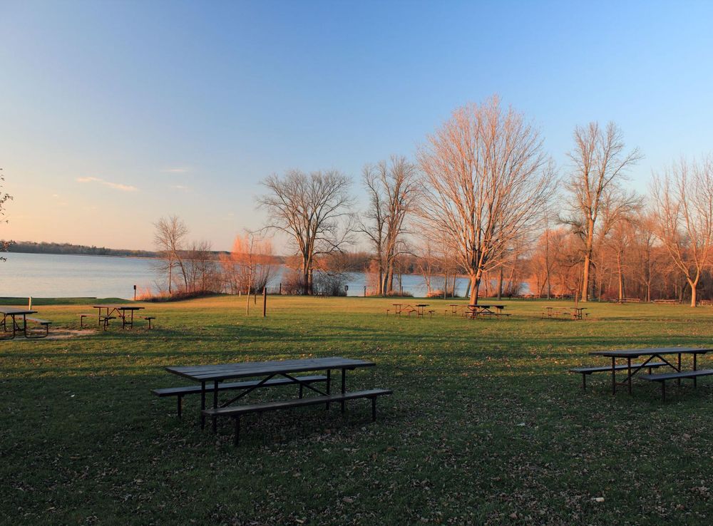
Nestled in the heart of southeastern Wisconsin, Kettle Moraine State Forest is a natural wonder that offers a perfect escape for nature lovers and outdoor enthusiasts. This sprawling forest covers over 56,000 acres and is divided into several units, each offering its own unique landscapes and recreational opportunities. The forest is named after the geological formations created by glacial movement thousands of years ago, which have left behind a stunning terrain of rolling hills, deep kettles, and serene lakes. Whether you're an avid hiker, a bird watcher, or someone who simply enjoys a peaceful stroll through nature, Kettle Moraine State Forest has something for everyone. The forest features more than 160 miles of trails, including the famous Ice Age National Scenic Trail, which winds through the forest's diverse habitats. In addition to hiking, visitors can enjoy biking, horseback riding, and cross-country skiing in the winter months. The forest's numerous lakes and rivers also provide excellent opportunities for fishing, kayaking, and swimming. Kettle Moraine State Forest is not just about its natural beauty; it also offers a rich cultural experience. The forest is home to several historic sites and interpretive centers that provide insights into the area's glacial history and the Native American tribes who once inhabited the region. Campgrounds and picnic areas are scattered throughout the forest, making it an ideal destination for a family outing or a weekend getaway. With its breathtaking landscapes and myriad recreational activities, Kettle Moraine State Forest is a must-visit destination for anyone looking to reconnect with nature and explore the great outdoors.
Jump straight into the city guide by the kind of discovery you want first.
Weather at a glance
Use the monthly temperature and precipitation trends to compare typical conditions across the year before planning city walks, museum days, and riverside exploring.

 Best experiences in Kettle Moraine State Forest

 Best hotels in Kettle Moraine State Forest

 Best landmarks in Kettle Moraine State Forest

 Best attractions in Kettle Moraine State Forest

 Best shops in Kettle Moraine State Forest

 Best restaurants in Kettle Moraine State Forest

 Best bars in Kettle Moraine State Forest

Explore expert travel guides, compare and book tours, experiences, hotels, and more—all from the palm of your hand. Download now for seamless trip planning wherever your wanderlust takes you.
Core city planning details in the same structured guide format used across the Country/Region page language.
Kettle Moraine State Forest is located in southeastern Wisconsin. The nearest major airport is General Mitchell International Airport in Milwaukee, which is about 40 miles away. From Milwaukee, you can rent a car or take a taxi to reach the forest. Alternatively, you can fly into Dane County Regional Airport in Madison or Chicago O'Hare International Airport, both of which offer car rental services. The forest is also accessible by road; you can drive via Interstate 43 or U.S. Highway 45.
Having your own vehicle is the most convenient way to explore Kettle Moraine State Forest, as public transportation options are limited. The forest spans multiple units, making a car essential for moving between different areas. Biking is also a popular option within the forest, with several trails available. If you prefer not to drive, private tours and shuttles are occasionally offered by local tour companies.
The official currency in the United States is the U.S. Dollar (USD). Credit and debit cards are widely accepted, including in most shops, restaurants, and gas stations around the forest. ATMs are available in nearby towns, but it is advisable to carry some cash for smaller establishments that might not accept cards.
Kettle Moraine State Forest is generally a safe destination for tourists. However, always be mindful of your surroundings and take standard precautions. Avoid leaving valuables in your car, especially in visible areas. The forest itself is safe, but follow posted guidelines and stay on marked trails to avoid getting lost. There are no specific high-crime areas targeting tourists, but be cautious in less populated areas, especially after dark.
In case of emergency, dial 911 for immediate assistance. Park rangers and local law enforcement are available to help. There are medical facilities in nearby towns such as West Bend and Elkhorn. It is advisable to carry a basic first aid kit and have travel insurance that covers medical emergencies. For minor health issues, there are pharmacies in nearby towns where you can purchase over-the-counter medications.
Fashion: Do wear comfortable and weather-appropriate clothing, including sturdy hiking boots. Avoid wearing open-toed shoes. Religion: There are no specific religious customs to observe, but always be respectful of other visitors. Public Transport: Do plan your route in advance if you are using public transportation to nearby towns, as options are limited. Don't rely solely on public transport to explore the forest. Greetings: Do greet fellow hikers and visitors with a friendly nod or wave. Eating & Drinking: Do pack enough food and water for your visit, as amenities within the forest are limited. Don't leave trash behind; always use designated waste bins.
To experience Kettle Moraine State Forest like a local, visit during weekdays or off-peak seasons to avoid crowds. Engage in popular activities such as hiking, mountain biking, and bird watching. Don't miss out on the Ice Age National Scenic Trail, which offers stunning views and a glimpse into the area's geological history. Attend local events and festivals in nearby towns to get a taste of regional culture and cuisine.
Follow the city from Roman Londinium to its modern global identity through landmark moments that still shape the visitor experience.
The Kettle Moraine State Forest is a geologically significant area that was formed during the last Ice Age, approximately 10,000 to 25,000 years ago. As the glaciers advanced and retreated, they sculpted the landscape, leaving behind a series of ridges, valleys, and depressions known as kettles. This unique topography provides a dramatic backdrop for visitors and is a key feature of the forest.
Long before European settlers arrived, the area now known as Kettle Moraine was inhabited by various Indigenous tribes, including the Potawatomi, Menominee, and Ho-Chunk (Winnebago) peoples. These tribes utilized the land for hunting, fishing, and gathering, and the region holds significant cultural and spiritual importance for them. Evidence of their presence can still be found in the form of burial mounds and artifacts.
European settlers began arriving in the Kettle Moraine area in the early 19th century. The rich natural resources, including timber and fertile soil, attracted farmers and loggers. By the mid-1800s, small communities and farms were established, and the landscape began to change as forests were cleared for agriculture and development.
During the Great Depression in the 1930s, the Civilian Conservation Corps (CCC) played a crucial role in the development of Kettle Moraine State Forest. The CCC was a public work relief program that provided jobs for young men. In Kettle Moraine, they constructed trails, roads, and buildings, many of which are still in use today. Their efforts helped lay the foundation for the forest's infrastructure and accessibility.
Kettle Moraine State Forest was officially established in 1937 to protect and preserve the unique glacial landscape and natural resources of the area. The forest is divided into two units: the Northern Unit and the Southern Unit, each offering a variety of recreational opportunities and natural attractions. Over the years, the state forest has expanded through land acquisitions and continues to be managed for conservation, recreation, and education.
Adjacent to the Kettle Moraine State Forest is the Horicon Marsh, one of the largest freshwater marshes in the United States. This area is a vital habitat for migratory birds and other wildlife. The marsh and forest together provide a diverse ecosystem that supports a wide variety of flora and fauna. The rich biodiversity makes it a popular destination for birdwatchers, naturalists, and outdoor enthusiasts.
Today, Kettle Moraine State Forest is a beloved destination for outdoor recreation, including hiking, biking, camping, and winter sports. The forest is also an important site for ongoing conservation efforts. Programs and initiatives focus on protecting native species, restoring habitats, and educating the public about the importance of preserving natural landscapes. The forest's blend of history, culture, and natural beauty continues to draw visitors from around the world.
Browse practical local phrases by situation. Each group opens only when needed, keeping the guide tidy while preserving the full phrase set.
A quick visual tour through classic views, riverside landmarks, royal streets, and skyline moments.


Continue exploring nearby destinations and classic US city breaks after Kettle Moraine State Forest.