

Free Wind River Basin Travel Guide & Mobile App
Explore Wind River Basin with free travel guides. Discover regional history, expert tips, proposed trips, and audio guides on web or mobile app.


Explore Wind River Basin for Indigenous heritage, high-desert landscapes, hot springs, dinosaur fossils and access to Wyoming’s mountain trails.
Read more about Wind River Basin
Getting to and around Wind River Basin
How to get there
Transportation
Top city travel guides in Wind River Basin
The cities of Wind River Basin, and the easiest places to base yourself.

Swipe for more cities
Destinations in Wind River Basin
Resorts, valleys and scenic spots worth a trip of their own.

Swipe for more destinations
Best attractions in Wind River Basin
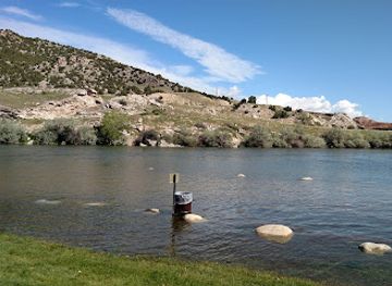
The Wind River Basin’s attractions combine Indigenous heritage, geological history and outdoor landscapes rather than forming a single compact sightseeing circuit. Riverton provides access to museums, cultural events and the central Wind River valley, while Fort Washakie offers important historical context on the Wind River Reservation; visitors should observe local access and photography guidance. Near Lander, Sinks Canyon State Park is the region’s most distinctive natural attraction, with cliffs, forest, the disappearing Popo Agie River and routes towards the Wind River Range. The mountains support hiking, climbing, fishing, camping and high-country exploration, although many trailheads require preparation and changing weather conditions can be serious. Boysen State Park, north of Riverton, brings boating, fishing, camping and canyon scenery around Boysen Reservoir. Thermopolis adds mineral hot springs and the Wyoming Dinosaur Center, whose collections interpret the fossil-rich geology of the state. Dubois offers access to upper-valley scenery, ranching landscapes and western heritage. Across the basin, scenic drives, wildlife watching, dark skies and public-land recreation are often as important as formal attractions; distances between them mean that a thoughtful itinerary is more rewarding than trying to see everything in one day.
-
State park
Hot Springs State Park
Experience the healing waters and stunning landscapes of Hot Springs State Park, a natural oasis in Thermopolis, Wyoming, perfect for relaxation and adventure.
-
Bar
Lander Bar & Grill
Experience the vibrant atmosphere and local flavors at Lander Bar & Grill – your perfect dining destination in Lander, Wyoming.
-
Museum
Wind River Heritage Center
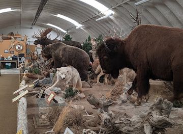
Discover the Wind River Heritage Center in Riverton, Wyoming, where history, culture, and nature come together in an engaging museum experience.
-
Art gallery
Lander Art Center
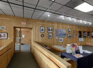
Explore the vibrant local art scene at Lander Art Center, a hub of creativity in the heart of Wyoming, showcasing diverse works and engaging community events.

Best landmarks in Wind River Basin
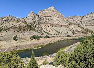
Fort Washakie is among the Wind River Basin’s most significant historic places, representing the overlapping histories of the Eastern Shoshone, Northern Arapaho, the United States military and reservation administration. The associated cemetery contains the graves of notable figures, including Chief Washakie and Sacagawea, and should be approached with appropriate respect. In Lander, the confluence of town, river and mountain foothills creates a strong gateway landscape, while nearby Sinks Canyon is a defining geological landmark: the Popo Agie River vanishes into limestone at the Sinks and reappears at the Rise a short distance away. Boysen Canyon and the reservoir form another prominent engineered and natural landscape where the Wind River cuts through mountain rock. Thermopolis is marked by its mineral springs and terraces, evidence of geological forces beneath the basin. In the upper valley, Dubois is framed by mountain ranges and broad ranch country, with the nearby National Museum of Military Vehicles offering a substantial modern landmark outside the region’s older frontier narrative. The Wind River Range itself, visible from western approaches and accessible through mountain roads and trails, remains the basin’s most imposing geographical presence.
-
State park
Boysen State Park
Explore the stunning landscapes and recreational activities at Boysen State Park, Wyoming's natural paradise for outdoor enthusiasts.
-
State park
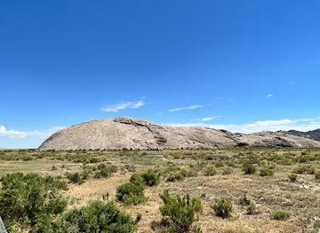
Independence Rock State Historic Site
Explore Independence Rock State Historic Site, where history meets breathtaking natural beauty in the heart of Wyoming's wilderness.
-
Historical place museum
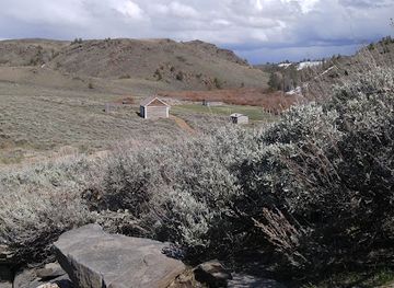
South Pass City State Historic Site
Discover the captivating history of the Gold Rush at South Pass City State Historic Site, a preserved mining town in Wyoming.
-
Historical landmark
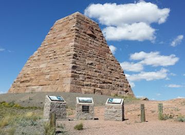
Ames Monument State Historic Site
Explore the historic Ames Monument in Wyoming - a stunning tribute to pioneering spirit surrounded by breathtaking landscapes.
Explore Wind River Basin on the map
Plan your trip on one map. See where the top cities, national parks and sights are, and book hotels and experiences in a few clicks.
Best hotels in Wind River Basin
Best restaurants in Wind River Basin
Dining in the Wind River Basin reflects Wyoming’s ranching economy, Indigenous communities and the practical food culture of small western towns. Riverton, Lander, Thermopolis and Dubois offer the broadest choice of cafés, family restaurants, bakeries, bars serving food and informal grills, while rural communities have fewer options and earlier closing patterns. Beef, burgers, steaks, chilli, trout and other straightforward western fare are common, with locally sourced ingredients appearing seasonally rather than uniformly across every menu. Visitors may encounter bison and game dishes, but these are not exclusive to the basin and should not be treated as a single regional cuisine. Reservation communities and local events provide opportunities to learn about Eastern Shoshone and Northern Arapaho food traditions, although public access and commercial availability vary. Farmers’ markets and small food producers can be useful places to find seasonal vegetables, baked goods, preserves and ranch products during the warmer months. Pack provisions for mountain excursions, where cafés and shops are scarce, and ask locally about current service days in smaller settlements.
-
 Restaurant
The Local Food Exchange
Experience Riverton's culinary charm at The Local Food Exchange - where local ingredients meet innovative cuisine in a warm atmosphere.
Best bars in Wind River Basin
Evening life in the Wind River Basin is concentrated in its towns and is generally low-key rather than club-oriented. Riverton, Lander, Thermopolis and Dubois have the region’s main selection of pubs, casual bars, restaurants and occasional live-music settings, while smaller communities tend to centre on a limited number of local establishments. Traditional bars and eateries are more characteristic than dedicated nightclubs, and many evenings end early outside the busiest summer periods. Lander’s connection with climbing, outdoor recreation and community events can give it a comparatively active social atmosphere, while Dubois and Thermopolis retain a distinctly small-town western character. Seasonal festivals, rodeos, cultural gatherings and performances may provide additional evening entertainment, but dates and venues change. Drink responsibly, arrange a safe return when travelling between towns and remember that distances, wildlife and darkness make late rural driving more demanding than it may appear on a map.
-
Bar
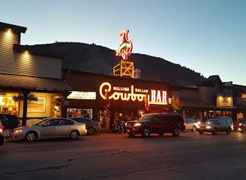
Million Dollar Cowboy Bar
Discover the lively spirit of the Wild West at the Million Dollar Cowboy Bar, where cowboy culture meets modern entertainment in Jackson, Wyoming.
-
Grill
Silver Dollar Bar
Experience the lively ambiance and delicious American cuisine at Silver Dollar Bar in Jackson, WY - a top choice for food and entertainment.
-
Grill
Bunkhouse Bar & Grill
Discover Bunkhouse Bar & Grill in Cheyenne, where hearty American cuisine meets lively music in a charming, family-friendly atmosphere.
-
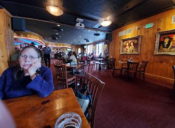
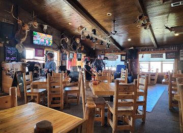
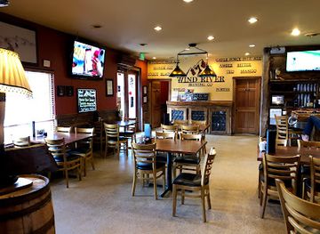
Brewpub
Wind River Brewing Company
Experience craft beer and gourmet dining at Wind River Brewing Company, a top brewpub in Pinedale, Wyoming, where flavor meets community.
Best nightclubs in Wind River Basin
-
Bar
Beacon Club
Discover the vibrant nightlife at Beacon Club in Mills, Wyoming - a lively bar and club offering great drinks and unforgettable experiences.
-
Bar
Stagecoach Bar
Experience the lively spirit of Wyoming at Stagecoach Bar, where great food, drinks, and local charm come together in a rustic setting.
-
Bar
Cadillac Ranch Bar
Experience the lively nightlife at Cadillac Ranch Bar in Cheyenne, Wyoming, where great drinks and a fun atmosphere await every visitor.
-
Bar
Bar Ten
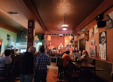
Discover the vibrant atmosphere and delicious American cuisine at Bar Ten in Riverton, Wyoming - a perfect spot for food and fun.


Best shops in Wind River Basin
Shopping in the Wind River Basin is centred on practical town services, independent main-street businesses, galleries, western clothing, books, outdoor equipment and locally made food rather than large retail complexes. Riverton offers the broadest everyday choice, while Lander, Thermopolis and Dubois have more concentrated districts of small shops, art spaces, antiques and visitor-oriented stores. Look for regional photography, pottery, jewellery, leatherwork, textiles and other crafts, but ask about provenance rather than assuming that every item represents Eastern Shoshone or Northern Arapaho culture. Authentic Indigenous art should be purchased from reputable artists, tribal outlets or established galleries, with cultural motifs treated respectfully. Seasonal farmers’ markets may sell produce, preserves, baked goods and ranch products, although schedules vary. Outdoor shops are useful for maps, safety equipment and clothing before entering the Wind River mountains. Souvenirs associated with Wyoming’s wildlife, geology, ranching and Indigenous history are widely available, but the most useful purchases are often locally produced food, artwork or books that explain the basin’s communities and landscapes.
-
Outdoor sports store
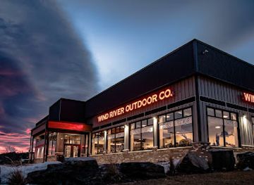
Wind River Outdoor Company
Discover top-notch outdoor gear and clothing at Wind River Outdoor Company, your adventure hub in Lander, Wyoming.
-
Gift shop
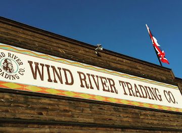
Wind River Trading Co.
Explore authentic Native American goods and unique gifts at Wind River Trading Co. in Fort Washakie, Wyoming – a cultural shopping experience!
-
Raft trip outfitter
Wind River Canyon Whitewater & Fly Fishing
Discover thrilling whitewater rafting and tranquil fly fishing in the stunning landscapes of Wind River Canyon, Wyoming.
-
Rock shop
Avas Silver & Rock Shop
Explore Avas Silver & Rock Shop in Thermopolis for stunning minerals, rocks, and exquisite silver jewelry, perfect for all nature lovers.

Get your free copy of our complete guide to Wind River Basin, delivered straight to you.
Everything on this page, from attractions and restaurants to essentials and local phrases, in one PDF you can read offline, print or share.
Already have an account? Sign in
Your Wind River Basin guide is ready.
We'll send it to · Not you? Sign out

Getting your guide ready…
We are putting together a fresh copy of the Wind River Basin guide. This can take up to a minute.
This can take a few moments. If your browser asks, choose Allow so the download can start. You'll find the guide in your Downloads folder.
Nothing happened? Download it again
Sorry, the guide is taking longer than usual. Please try again in a minute, or get it by email instead.
Wind River Basin essentials
Currency and Payment
Safety
Emergency Situations
Do's and Don'ts
Local Tips
From Eve
Local phrases worth knowing
You don't need to get them perfect. A few words go a long way, and locals appreciate the effort.
Basics
| English | Local | Say it |
|---|---|---|
| Hello | Howdy | [Ha-dee] |
| Goodbye | See ya | [See yah] |
| Yes | Yep | [Yep] |
| No | Nope | [Nope] |
| Please/You're welcome | Sure thing | [Shoor thing] |
| Thank you | Thanks a lot | [Thanks a lot] |
| Excuse me/Sorry | Pardon me | [Par-don me] |
| How are you? | How ya doin'? | [How ya doin'?] |
| Fine. And you? | I'm good, you? | [I'm good, you?] |
| Do you speak English? | You speakin' English? | [You speakin' English?] |
| I don't understand | I ain't gettin' it | [I ain't gettin' it] |
Eating & Drinking
| English | Local | Say it |
|---|---|---|
| I'd like to see the menu, please | Can I see the menu? | [Can I see the menu?] |
| I don't eat meat | I don't do meat | [I don't do meat] |
| Cheers! | Cheers! | [Cheers!] |
| I would like to pay, please | Can I get the check? | [Can I get the check?] |
Emergencies
| English | Local | Say it |
|---|---|---|
| Help! | Help! | [Help!] |
| Go away! | Beat it! | [Beat it!] |
| Call the Police! | Call 911! | [Call 911!] |
| Call a doctor! | Get a doc! | [Get a doc!] |
| I'm lost | I'm turned around | [I'm turned around] |
| I'm ill | I'm feelin' rough | [I'm feelin' rough] |
Shopping
| English | Local | Say it |
|---|---|---|
| I'd like to buy... | I wanna buy... | [I wanna buy...] |
| I'm just looking | Just browsin' | [Just browsin'] |
| How much is it? | What’s the price? | [What’s the price?] |
| That's too expensive | That's too rich for my blood | [That's too rich for my blood] |
| Can you lower the price? | Can you cut me a deal? | [Can you cut me a deal?] |
Time & Numbers
| English | Local | Say it |
|---|---|---|
| What time is it? | What time ya got? | [What time ya got?] |
| It's one o'clock | It's one | [It's one] |
| Half past (10) | Half past ten | [Half past ten] |
| Morning | Mornin' | [Mornin'] |
| Afternoon | Afternoon | [Afternoon] |
| Evening | Evenin' | [Evenin'] |
| Yesterday | Yesterday | [Yesterday] |
| Today | Today | [Today] |
| Tomorrow | Tomorrow | [Tomorrow] |
| 1 | One | [One] |
| 2 | Two | [Two] |
| 3 | Three | [Three] |
| 4 | Four | [Four] |
| 5 | Five | [Five] |
| 6 | Six | [Six] |
| 7 | Seven | [Seven] |
| 8 | Eight | [Eight] |
| 9 | Nine | [Nine] |
| 10 | Ten | [Ten] |
Transport & Directions
| English | Local | Say it |
|---|---|---|
| Where's a/the...? | Where's the...? | [Where's the...?] |
| What's the address? | What’s the address? | [What’s the address?] |
| Can you show me (on the map)? | Can ya point it out? | [Can ya point it out?] |
| When's the next (bus)? | When's the next bus? | [When's the next bus?] |
| A ticket (to ....) | A ticket to ... | [A ticket to ...] |
History of Wind River Basin
Indigenous Homelands Before American Settlement
The Wind River Basin lies within the historic homelands and travel routes of Indigenous peoples, including the Eastern Shoshone and Northern Arapaho. The Wind River Range, river valleys and surrounding plains supported seasonal movement, hunting and trade, while later encounters with United States authorities transformed access to the land. Indigenous history is not confined to the past: both nations continue to maintain communities, institutions and cultural life in the basin and on the Wind River Reservation.
The Wind River Reservation, 1868
The Treaty of Fort Bridger in 1868 established the Wind River Reservation for the Eastern Shoshone, under the leadership of figures including Chief Washakie. The reservation originally covered a far larger area than it does today. In 1878, the Northern Arapaho were allowed to settle there, creating the unusual but enduring arrangement in which two sovereign Indigenous nations share the reservation. Fort Washakie became an important centre of administration, trade and military presence.
Fort Washakie and the Frontier Era
Fort Washakie developed from an earlier military post and remained a significant United States presence in the Wind River country during the late nineteenth century. It was named for Chief Washakie and later became associated with federal administration, education and changing reservation policy. The site and nearby cemetery preserve connections to Chief Washakie, Sacagawea and other figures whose lives link Indigenous history, westward expansion and the complicated legacy of the American frontier.
Ranching, Railways and Permanent Towns
During the late nineteenth and early twentieth centuries, ranching, irrigation and transport encouraged the growth of permanent settlements across the basin. Riverton was founded in the early twentieth century near the confluence of the Big Wind and Little Wind rivers, while Lander and Thermopolis developed as regional service towns. Railways and improved roads connected agricultural producers, mines and local businesses with wider Wyoming markets, although the basin remained sparsely populated and strongly rural.
Oil, Gas and Basin Geology
The Wind River Basin is one of Wyoming’s important sedimentary basins, with geological layers formed over immense spans of time and containing fossil fuels as well as fossils. Oil and natural gas development expanded during the twentieth century, adding an industrial dimension to landscapes long shaped by ranching and Indigenous land use. Production has fluctuated with national energy markets, but wells, service infrastructure and energy-related employment remain visible in parts of the basin.
Conservation and Outdoor Recreation
Improved roads, public-land management and growing interest in climbing, fishing, hiking and camping brought the Wind River mountains and surrounding valleys to a wider audience during the twentieth century. Sinks Canyon became a protected state park, while the Wind River Range gained recognition for alpine terrain and long-distance trail opportunities. Recreation now forms a major part of the regional economy, alongside ranching, energy and public services.
A Contemporary Cultural Landscape
Modern Wind River Basin communities reflect several overlapping histories: Eastern Shoshone and Northern Arapaho sovereignty, ranching traditions, extractive industries, tourism and Wyoming’s wider movement towards outdoor recreation. Museums, powwows, historic sites, public art and local celebrations offer different ways into this story, but no single attraction represents the whole region. The basin’s contemporary identity is best understood through its communities as well as its scenery.
Wind River Basin in Photos
Browse through our photo collection highlighting the charm and character of the destination.
Neighbouring regions of Wind River Basin
The closest regions to Wind River Basin, if you have time for more than one.
-

-

-

-

-


Swipe for more regions
Explore more

Explore more of Wyoming
Discover Wyoming: A Land of Unspoiled Beauty, Rich History, and Boundless Outdoor Adventures in the Heart of the American West.
Explore Wyoming