

Free Wind River Range Travel Guide & Mobile App
Explore Wind River Range with free travel guides. Discover regional history, expert tips, proposed trips, and audio guides on web or mobile app.


Explore Wyoming’s Wind River Range for granite peaks, alpine lakes, wilderness trails and demanding adventures from Lander, Dubois and Pinedale.
Read more about Wind River Range
Getting to and around Wind River Range
How to get there
Transportation
Top city travel guides in Wind River Range
The cities of Wind River Range, and the easiest places to base yourself.
-

-

-


Swipe for more cities
Destinations in Wind River Range
Resorts, valleys and scenic spots worth a trip of their own.
-
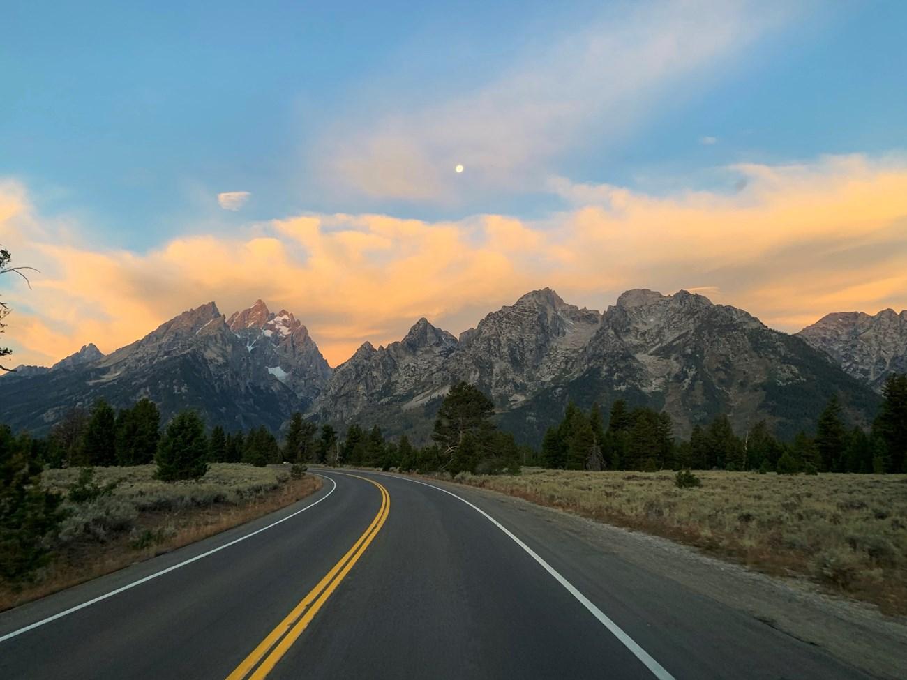 Bridger-Teton National Forest
Discover the majesty of Bridger-Teton National Forest, where vast wilderness, diverse wildlife, and outdoor adventures await in the heart of Wyoming.
-

-

-


Swipe for more destinations
Best attractions in Wind River Range
The Wind River Range’s attractions are overwhelmingly natural and dispersed across several protected landscapes. Green River Lakes, at the northern end, offers an accessible introduction to the upper Green River and views towards Squaretop Mountain, while the Bridger Wilderness leads towards Titcomb Basin, one of the range’s best-known alpine settings. From the south, the Popo Agie Wilderness includes the granite formations and high lakes of the Cirque of the Towers. The Fitzpatrick Wilderness contains some of the range’s most glaciated terrain, including approaches towards Gannett Peak. Near Lander, Sinks Canyon provides a more readily reached setting for walking, climbing and understanding how the Popo Agie River disappears underground before re-emerging at the Rise. Elsewhere, visitors find fishing lakes, wildflower meadows, forest trails, horseback routes and long sections of the Continental Divide Trail. These are not attractions connected by a sightseeing road: access typically involves a trailhead, a sustained hike and changing mountain conditions. Wildlife watching may include elk, mule deer, moose, marmots and mountain goats, but sightings are never guaranteed and animals should be observed from a respectful distance.
-
Devils Tower National Monument
Discover the majestic beauty and rich heritage of Devils Tower National Monument, a unique natural and historical treasure in Wyoming.
-
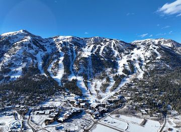
Jackson Hole Mountain Resort
Discover the exhilarating beauty and adventure of Jackson Hole Mountain Resort, a premier ski destination nestled in the stunning Teton Range.
-
Hot Springs State Park
Discover the therapeutic waters and breathtaking landscapes at Hot Springs State Park, a natural haven in Thermopolis, Wyoming.
-
Jenny Lake Overlook
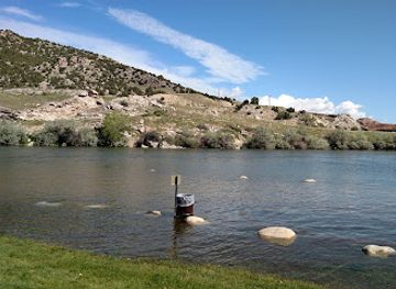
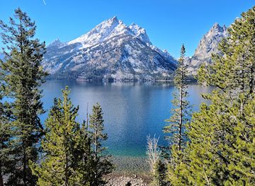
Discover the stunning beauty of Jenny Lake Overlook, a scenic gem in Grand Teton National Park, offering breathtaking views and abundant wildlife experiences.
Best landmarks in Wind River Range
Gannett Peak is the defining summit of the Wind River Range and the highest point in Wyoming, rising within the Fitzpatrick Wilderness amid glaciers, snowfields and difficult approaches. The Cirque of the Towers is an equally recognisable landscape of sharply sculpted granite peaks and lakes in the Popo Agie Wilderness, valued by climbers and backpackers but reached only by trail. In the north, Squaretop Mountain forms a distinctive twin-topped profile above Green River Lakes and the upper Green River, making it one of the range’s most memorable visual landmarks. Sinks Canyon, near Lander, is a geological landmark where the Popo Agie River vanishes into limestone and reappears a short distance away at the Rise. Titcomb Basin, within the Bridger Wilderness, presents a classic high-alpine amphitheatre beneath prominent peaks and is one of the best-known destinations on the western side of the range. These landmarks are not roadside monuments: their significance is inseparable from the surrounding wilderness, the effort required to reach them and the need to protect fragile alpine environments.
-
Historical place museum
Old Trail Town
Explore the captivating history of the American West at Old Trail Town in Cody, Wyoming, where authentic buildings and artifacts bring the past to life.
-
Historical place museum
Wyoming Territorial Prison State Historic Site
Discover the intriguing history of the American West at the Wyoming Territorial Prison State Historic Site in Laramie—a captivating museum experience.
-
History museum
Museum of the Mountain Man
Explore the adventurous history of the American West at the Museum of the Mountain Man in Pinedale, Wyoming, with engaging exhibits and reenactments.
-
State park
Independence Rock State Historic Site
Discover Independence Rock State Historic Site, a historic landmark where adventure and history converge amidst Wyoming's breathtaking landscapes.


Explore Wind River Range on the map
Plan your trip on one map. See where the top cities, national parks and sights are, and book hotels and experiences in a few clicks.
Best hotels in Wind River Range
Best restaurants in Wind River Range
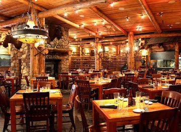
Dining in the Wind River Range is centred on its gateway communities rather than the wilderness itself. Lander, Dubois and Pinedale provide the widest choice of cafés, bakeries, casual restaurants, steakhouses, pizzerias and bars, with provisions for building a packed lunch before a trail departure. Food reflects the wider culture of Wyoming and the American West: beef, burgers, hearty breakfasts, chilli, sandwiches and locally sourced seasonal ingredients are common, while ranching and hunting traditions influence some menus. Trout and other freshwater fish may appear, although visitors should distinguish locally caught food from dishes simply marketed with a mountain theme. Farmers’ markets and small food producers can be useful places to find bread, preserves, fruit, vegetables and picnic supplies during the warmer months. In rural areas, opening days and service can be limited, so travellers should not assume that a restaurant will be available near a trailhead or after a late arrival. Carrying food for remote trips is essential, and all provisions must be stored to prevent wildlife encounters.
-
Barbecue
Bubba's Bar-B-Que Restaurant
Experience authentic barbecue at Bubba's Bar-B-Que Restaurant in Jackson, WY – where flavor meets tradition in every bite!
-
Steak
Gun Barrel Steak and Game House
Discover Gun Barrel Steak and Game House: A premier dining destination in Jackson offering exquisite steaks and local game meats.
-
Pizza
Hand Fire Pizza
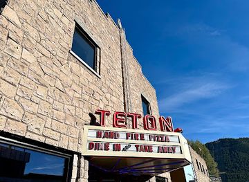
Experience mouthwatering artisanal pizzas and creative cocktails at Hand Fire Pizza in Jackson, Wyoming – perfect for families and food lovers!
-
Restaurant
Sidewinders American Grill
Savor authentic American cuisine at Sidewinders American Grill in Jackson - where every meal is an unforgettable experience.

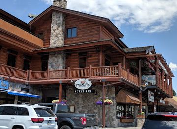
Best bars in Wind River Range
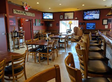
Evening life around the Wind River Range is low-key and concentrated in Lander, Dubois and Pinedale, rather than in the mountains. Local bars, historic-style pubs, breweries, casual restaurants and saloons provide places for a meal and conversation, while occasional live music and community events add to the social calendar. Pinedale and Lander have particularly strong connections with outdoor recreation, so it is common for evening venues to serve hikers, climbers, guides and ranch-country residents. Dubois has a small-town western character and is better suited to relaxed evenings than late-night clubbing. The range itself has no nightlife infrastructure: wilderness campsites are governed by quiet, safety and fire regulations, not entertainment. Visitors should check current arrangements locally, especially outside the summer season, when opening patterns may be reduced. A responsible evening in the gateway towns also means planning transport in advance, since distances between communities and remote accommodation can be substantial.
-
Bar
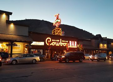
Million Dollar Cowboy Bar
Dive into the authentic Western spirit at the Million Dollar Cowboy Bar, where lively music, delicious cocktails, and cowboy culture come together in Jackson, Wyoming.
-
Grill
Silver Dollar Bar
Discover the Silver Dollar Bar, a lively grill and live music venue in Jackson, Wyoming, where American cuisine meets local charm.
-
Live music bar
Mangy Moose Jackson Hole
Discover the lively Mangy Moose Jackson Hole, where great food and live music create an unforgettable atmosphere in Teton Village.
-
Brewpub
Wind River Brewing Company
Discover a blend of craft beers and gourmet food at Wind River Brewing Company in Pinedale, Wyoming, a haven for food and beer lovers.


Best nightclubs in Wind River Range
Evening life around the Wind River Range is low-key and concentrated in Lander, Dubois and Pinedale, rather than in the mountains. Local bars, historic-style pubs, breweries, casual restaurants and saloons provide places for a meal and conversation, while occasional live music and community events add to the social calendar. Pinedale and Lander have particularly strong connections with outdoor recreation, so it is common for evening venues to serve hikers, climbers, guides and ranch-country residents. Dubois has a small-town western character and is better suited to relaxed evenings than late-night clubbing. The range itself has no nightlife infrastructure: wilderness campsites are governed by quiet, safety and fire regulations, not entertainment. Visitors should check current arrangements locally, especially outside the summer season, when opening patterns may be reduced. A responsible evening in the gateway towns also means planning transport in advance, since distances between communities and remote accommodation can be substantial.
-
Beacon Club
Discover the vibrant nightlife at Beacon Club in Mills, Wyoming - a lively bar and club offering great drinks and unforgettable experiences.
-
Bar
Stagecoach Bar
Experience the lively spirit of Wyoming at Stagecoach Bar, where great food, drinks, and local charm come together in a rustic setting.
-
Cadillac Ranch Bar
Experience the lively nightlife at Cadillac Ranch Bar in Cheyenne, Wyoming, where great drinks and a fun atmosphere await every visitor.
-
Sundance Lounge
Experience the vibrant nightlife of Gillette at Sundance Lounge, a cocktail bar perfect for drinks, karaoke, and socializing in a cozy setting.



Best shops in Wind River Range
Shopping around the Wind River Range is practical, local and closely tied to outdoor travel. Lander, Dubois and Pinedale have independent outfitters supplying maps, camping equipment, fishing tackle, fuel and clothing, as well as galleries, bookshops, western-style stores and places selling locally made art. Visitors may find leather goods, jewellery, paintings, photography, pottery and other crafts, but stock varies by town and season. Farmers’ markets and small producers offer opportunities to buy preserves, baked goods, meat, vegetables and other provisions for a journey, particularly in summer. Western clothing and ranch-inspired gifts are widely available, although buyers should distinguish locally made work from generic souvenirs. Pinedale’s historic and outdoor-oriented commercial character differs from Lander’s arts and climbing scene, while Dubois combines small-town services with western heritage and outfitting businesses. There are no major shopping malls in the range itself, so purchase specialist equipment, medication and substantial supplies before heading to remote trailheads.
-
Clothing store
Murdoch's Ranch & Home Supply
Explore Murdoch's Ranch & Home Supply for western apparel, hardware, and a unique shopping experience in Riverton, Wyoming.
-
Outdoor sports store
Wind River Outdoor Company
Explore the great outdoors with quality gear from Wind River Outdoor Company, your go-to outdoor sports store in Lander, Wyoming.
-
Native american goods store
Wind River Trading Co.
Explore Wind River Trading Co. for unique Native American gifts, clothing, and treasures that embody the local culture of Wyoming.
-
Raft trip outfitter
Wind River Canyon Whitewater & Fly Fishing
Discover thrilling whitewater rafting and peaceful fly fishing in the stunning Wind River Canyon, a paradise for outdoor enthusiasts in Wyoming.



Get your free copy of our complete guide to Wind River Range, delivered straight to you.
Everything on this page, from attractions and restaurants to essentials and local phrases, in one PDF you can read offline, print or share.
Already have an account? Sign in
Your Wind River Range guide is ready.
We'll send it to · Not you? Sign out

Getting your guide ready…
We are putting together a fresh copy of the Wind River Range guide. This can take up to a minute.
This can take a few moments. If your browser asks, choose Allow so the download can start. You'll find the guide in your Downloads folder.
Nothing happened? Download it again
Sorry, the guide is taking longer than usual. Please try again in a minute, or get it by email instead.
Wind River Range essentials
Currency and Payment
Safety
Emergency Situations
Do's and Don'ts
Local Tips
From Eve
Local phrases worth knowing
You don't need to get them perfect. A few words go a long way, and locals appreciate the effort.
Basics
| English | Local | Say it |
|---|---|---|
| Hello | Howdy | [haʊdi] |
| Goodbye | See ya | [si jə] |
| Yes | Yup | [jʌp] |
| No | Nah | [nɑ] |
| Please/You're welcome | Sure thing | [ʃʊr θɪŋ] |
| Thank you | Thanks a lot | [θæŋks ə lɑt] |
| Excuse me/Sorry | Pardon me | [ˈpɑrdən mi] |
| How are you? | How ya doin'? | [haʊ jə ˈduɪn] |
| Fine. And you? | Good. You? | [ɡʊd. ju?] |
| Do you speak English? | You speakin' English? | [ju ˈspiːkɪn ˈɪŋɡlɪʃ] |
| I don't understand | I ain't gettin' it | [aɪ eɪnt ˈɡɛtɪn ɪt] |
Eating & Drinking
| English | Local | Say it |
|---|---|---|
| I'd like to see the menu, please | Can I see the menu? | [kæn aɪ si ðə ˈmɛnju] |
| I don't eat meat | I don't do meat | [aɪ doʊnt du mit] |
| Cheers! | Cheers! | [tʃɪrz] |
| I would like to pay, please | Can I get the check? | [kæn aɪ ɡɛt ðə tʃɛk] |
Emergencies
| English | Local | Say it |
|---|---|---|
| Help! | Help! | [hɛlp] |
| Go away! | Get lost! | [ɡɛt lɔst] |
| Call the Police! | Call the cops! | [kɔl ðə kɑps] |
| Call a doctor! | Get a doc! | [ɡɛt ə dɑk] |
| I'm lost | I’m turned around | [aɪm tɜrnd əˈraʊnd] |
| I'm ill | I ain't feelin' good | [aɪ eɪnt ˈfiːlɪn ɡʊd] |
Shopping
| English | Local | Say it |
|---|---|---|
| I'd like to buy... | I wanna buy... | [aɪ ˈwɒnə baɪ] |
| I'm just looking | Just browsin' | [dʒʌst ˈbraʊzɪn] |
| How much is it? | What’s the price? | [wʌts ðə praɪs] |
| That's too expensive | That’s pricey | [ðæts ˈpraɪsi] |
| Can you lower the price? | Can ya make it cheaper? | [kæn jə meɪk ɪt ˈtʃiːpər] |
Time & Numbers
| English | Local | Say it |
|---|---|---|
| What time is it? | What time ya got? | [wʌt taɪm jə ɡɑt] |
| It's one o'clock | It's one | [ɪts wʌn] |
| Half past (10) | Half past ten | [hæf pæst tɛn] |
| Morning | Mornin' | [ˈmɔrnɪn] |
| Afternoon | Afternoon | [ˌæftərˈnun] |
| Evening | Evenin' | [ˈivnɪn] |
| Yesterday | Yesterday | [ˈjɛstərdeɪ] |
| Today | Today | [təˈdeɪ] |
| Tomorrow | Tomorrow | [təˈmɔroʊ] |
| 1 | One | [wʌn] |
| 2 | Two | [tu] |
| 3 | Three | [θri] |
| 4 | Four | [fɔr] |
| 5 | Five | [faɪv] |
| 6 | Six | [sɪks] |
| 7 | Seven | [ˈsɛvən] |
| 8 | Eight | [eɪt] |
| 9 | Nine | [naɪn] |
| 10 | Ten | [tɛn] |
Transport & Directions
| English | Local | Say it |
|---|---|---|
| Where's a/the...? | Where's the...? | [wɛrz ðə] |
| What's the address? | What’s the address? | [wʌts ði ˈædrɛs] |
| Can you show me (on the map)? | Can ya point it out? | [kæn jə pɔɪnt ɪt aʊt] |
| When's the next (bus)? | When's the next bus? | [wɛnʔs ðə nɛkst bʌs] |
| A ticket (to ....) | One ticket to... | [wʌn ˈtɪkɪt tə] |
History of Wind River Range
Indigenous Homelands and Seasonal Travel
The Wind River country is part of the long-established homeland and cultural landscape of Eastern Shoshone people, with Northern Arapaho people also connected to the region through the history of the Wind River Indian Reservation. Mountain valleys, rivers and passes supported seasonal travel, hunting, gathering and exchange long before written descriptions by outsiders. The range should therefore be understood not as an empty wilderness discovered by later explorers, but as a lived landscape with continuing cultural significance.
Nineteenth-Century Exploration and Mapping
American and European explorers, trappers and surveyors entered the central Rocky Mountains during the nineteenth century, gradually placing the Wind River Mountains on expanding maps of the American West. Their accounts introduced eastern audiences to the range’s high peaks and difficult passes, while also reflecting the era’s changing political relationships with Indigenous nations. Later surveys improved geographical knowledge, but travel remained slow and dependent on pack animals and established mountain routes.
Trails, Trade and the Western Frontier
The valleys around the range became part of wider networks linking fur trade posts, ranches, military routes and emigrant travel across Wyoming. South Pass, to the south-west of the main range, was especially important to overland migration, although it is not itself within the Wind River high country. Communities such as Lander, Dubois and Pinedale developed later as service centres for ranching, outfitting, transport and access to the surrounding mountains.
Ranching and Resource Development
Cattle and sheep ranching shaped the lower valleys and plains around the range, where open grassland and river corridors contrast with the protected alpine interior. Mining and mineral development also influenced nearby parts of western Wyoming, though the most remote high basins remained difficult to exploit. The resulting landscape combines working ranch country, forest lands and large areas preserved primarily for their ecological and wilderness values.
Early Mountaineering and Alpine Exploration
By the late nineteenth and early twentieth centuries, climbers, surveyors and scientific parties were increasingly drawn to the range’s high summits and glaciers. Gannett Peak and other major mountains became objectives for organised expeditions, while granite formations such as the Cirque of the Towers later gained a strong reputation among climbers. Alpine exploration helped establish the Wind Rivers as one of the most important mountain destinations in the contiguous United States.
Wilderness Protection in the Twentieth Century
Large sections of the range were ultimately protected through the national forest and wilderness systems. The Bridger Wilderness, Fitzpatrick Wilderness and Popo Agie Wilderness preserve contrasting parts of the range, from broad glacial valleys to high granite cirques and heavily glaciated summits. These designations restrict roads and motorised access, protecting solitude and habitat while making travel more physically demanding and dependent on careful preparation.
Modern Outdoor and Conservation Culture
Today the Wind River Range supports backpacking, climbing, fishing, horseback travel, mountaineering and long-distance hiking, alongside ranching and communities that serve visitors. The Continental Divide Trail crosses the region, while national forest and wilderness managers balance recreation with wildlife protection, watershed health and the preservation of Indigenous cultural connections. Modern access has made the mountains better known, but much of the range remains remote by United States standards.
Wind River Range in Photos
Browse through our photo collection highlighting the charm and character of the destination.
Neighbouring regions of Wind River Range
The closest regions to Wind River Range, if you have time for more than one.
-

-

-

-

-


Swipe for more regions
Explore more

Explore more of Wyoming
Discover Wyoming: A Land of Unspoiled Beauty, Rich History, and Boundless Outdoor Adventures in the Heart of the American West.
Explore Wyoming