

Free Ouarsenis Mountains Travel Guide & Mobile App
Explore Ouarsenis Mountains with free travel guides. Discover regional history, expert tips, proposed trips, and audio guides on web or mobile app.


Explore Algeria’s Ouarsenis Mountains for cedar forests, highland villages, Chelif Valley views and rewarding walking in a little-visited landscape.
Read more about Ouarsenis Mountains
When is the best time to visit Ouarsenis Mountains?
Best: May–June, October · 24–30°C| Month | High (°C) | Rainfall (mm) |
|---|---|---|
| January | 13 | 70 |
| February | 14 | 60 |
| March | 17 | 50 |
| April | 20 | 40 |
| May (best) | 25 | 30 |
| June (best) | 30 | 20 |
| July | 34 | 10 |
| August | 34 | 10 |
| September | 30 | 20 |
| October (best) | 24 | 30 |
| November | 18 | 50 |
| December | 14 | 60 |
Getting to and around Ouarsenis Mountains
How to get there
Transportation
Destinations in Ouarsenis Mountains
Resorts, valleys and scenic spots worth a trip of their own.

Swipe for more destinations
Best attractions in Ouarsenis Mountains
The principal attractions of the Ouarsenis Mountains are its forests, upland scenery and opportunities for low-impact outdoor travel. Theniet El Had National Park is the region’s best-known protected landscape, preserving Atlas cedar woodland, high ridges and valleys suitable for guided walking, nature observation and photography. Around the wider range, rural roads reveal changing views over the Chelif basin, cultivated slopes and interior plateaux, while small settlements provide an insight into mountain agriculture and everyday life. Tissemsilt is useful for understanding the region’s administrative and commercial role, and the approaches towards Bordj Bounaama and Boucaid offer access to less urbanised landscapes. Visitors interested in history can explore the wider area’s connection with ancient routes, Roman-era settlement and later Islamic and Ottoman networks, although many sites require local advice rather than a fully developed visitor circuit. The attraction landscape is consequently more ecological and geographical than museum-based: it rewards patient exploration, birdwatching, walking and scenic driving rather than a checklist of major monuments. Facilities may be limited outside the principal towns, so independent travellers should plan transport, food and route-finding in advance.
-
Mountain peak
Ouarsenis
Discover Ouarsenis, Algeria's breathtaking mountain peak near Bordj Bounaama, offering panoramic views, hiking trails, and rich cultural experiences.
-
Mountain peak
Djebel Ouarsenis
Discover Djebel Ouarsenis: Algeria's breathtaking mountain peak offering hiking, diverse ecosystems, and cultural immersion.
Best landmarks in Ouarsenis Mountains
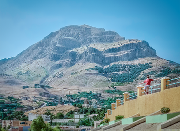
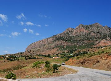
The most recognisable natural landmark of the region is the high Ouarsenis massif itself, whose ridges rise prominently above the Chelif basin and surrounding agricultural country. The forested heights of Theniet El Had National Park are especially significant, with Atlas cedar slopes creating a distinctive silhouette and a rare example of protected mountain woodland in north-western Algeria. The upland passes and valleys around Theniet El Had, Bordj Bounaama and Boucaid are important geographical landmarks because they reveal the range’s role as a transition between lowland and interior landscapes. Tissemsilt’s urban presence provides a contrasting civic reference point at the edge of the mountain country, while the wider Chelif hinterland contains traces of ancient settlement and historic movement. These landmarks are valued less for monumental architecture than for their relationship to terrain, forest, agriculture and long-established routes. There is no single compact historic centre that represents the entire range; the Ouarsenis are best understood through a sequence of summits, wooded valleys, passes and rural settlements.
-
Historical landmark
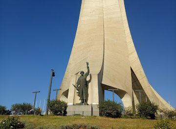
Martyrs Memorial
A towering monument in Algiers honoring Algeria's independence, offering panoramic views and a glimpse into the nation's history.
-
Botanical garden
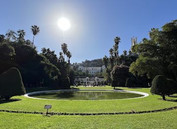
Botanical Garden Hamma
Discover a historic botanical garden in Algiers with diverse plant species, tranquil walkways, and cultural attractions for a serene escape.
-
Fortress
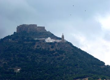
Fort of Santa Cruz
Explore Oran's iconic Fort of Santa Cruz: a historic fortress offering stunning panoramic views of the city and the Mediterranean Sea.
-
Basilica
Church of Notre Dame d'Afrique
Discover Algiers' iconic basilica: a blend of architectural styles, religious significance, and stunning Mediterranean views.
Explore Ouarsenis Mountains on the map
Plan your trip on one map. See where the top cities, national parks and sights are, and book hotels and experiences in a few clicks.
Best hotels in Ouarsenis Mountains
Best restaurants in Ouarsenis Mountains
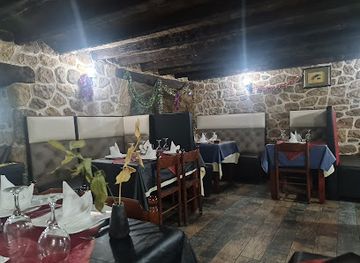
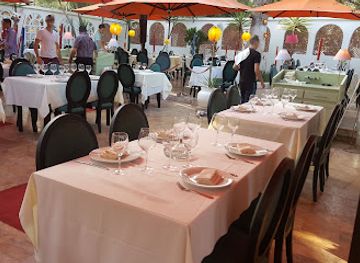
Dining in the Ouarsenis region is primarily local and family-oriented, with restaurants and cafés concentrated in Tissemsilt, Theniet El Had, Chlef and other larger settlements rather than beside remote trails. Expect Algerian staples such as couscous, chorba, tajines, grilled meats, vegetable dishes, flatbreads and savoury pastries, with recipes and ingredients varying between households and communities. Seasonal produce from the surrounding agricultural districts may include olives, fruit, vegetables and dairy products, while tea and coffee are common refreshments during journeys or social visits. Roadside cafés and modest eateries can be useful for a simple meal, but opening arrangements and menus may be informal. Visitors staying in guest accommodation should ask in advance about meals, particularly in rural areas. The most distinctive culinary experience is often the combination of home cooking, bread, preserved ingredients and locally sourced produce rather than a formal restaurant scene. Alcohol is not a defining part of public dining, and visitors should respect the customs of individual establishments.
-
Restaurant
Restaurant La Grotte des Saveurs
Experience the essence of Algerian cuisine at La Grotte des Saveurs - where tradition meets innovation in every bite.
-
Restaurant
Le Tantra restaurant
Experience the finest international and Algerian cuisine at Le Tantra in El Madania - a culinary delight for every traveler.
-
Restaurant
Restaurant Le Farfalla
Discover exquisite Mediterranean cuisine at Restaurant Le Farfalla in Hydra—an essential dining experience for every traveler in Algiers.
-
Restaurant
Restaurant des Artisans
Experience authentic Algerian cuisine at Restaurant des Artisans in El Madania - where every dish tells a story.
Best bars in Ouarsenis Mountains
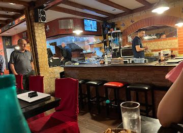
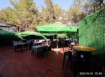
Nightlife in the Ouarsenis Mountains is quiet and town-centred rather than club-focused. Evenings generally revolve around cafés, tea and coffee houses, family restaurants and informal social spaces in Tissemsilt, Theniet El Had and other sizeable settlements. In smaller villages, activity often diminishes after dinner, while forest areas have no conventional nightlife and should be treated as places for daytime recreation. Visitors may find occasional cultural programming or community events, but these can be seasonal or locally arranged rather than part of a fixed tourist calendar. Alcohol is not central to the region’s evening culture, and licensed venues are not a dependable feature of rural travel. Plan evening transport carefully, as shared taxis and local buses may be less available after dark, and remain conscious that mountain roads have limited lighting and can be difficult to navigate at night.
-
Mountain peak
Ouarsenis
Discover the breathtaking beauty and adventure of Ouarsenis, a majestic mountain peak in Algeria, offering stunning views and rich biodiversity.
-
Pub
Non lue
Discover the heart of Ouenza at Non lue, a lively pub offering a delightful selection of drinks and a welcoming atmosphere for all.
-
 Bar
Beni hareth's bar
Experience the vibrant local culture at Beni Hareth's Bar, where refreshing drinks and warm hospitality await in Talassa.
-
Bar
Bar Restaurant LE SELECT
Discover the inviting ambiance of Bar Restaurant LE SELECT in Akbou, a perfect spot for relaxation and authentic Algerian drinks.

Best nightclubs in Ouarsenis Mountains
Nightlife in the Ouarsenis Mountains is quiet and town-centred rather than club-focused. Evenings generally revolve around cafés, tea and coffee houses, family restaurants and informal social spaces in Tissemsilt, Theniet El Had and other sizeable settlements. In smaller villages, activity often diminishes after dinner, while forest areas have no conventional nightlife and should be treated as places for daytime recreation. Visitors may find occasional cultural programming or community events, but these can be seasonal or locally arranged rather than part of a fixed tourist calendar. Alcohol is not central to the region’s evening culture, and licensed venues are not a dependable feature of rural travel. Plan evening transport carefully, as shared taxis and local buses may be less available after dark, and remain conscious that mountain roads have limited lighting and can be difficult to navigate at night.
-
Mountain peak
Ouarsenis
Experience the breathtaking views and adventurous trails of Ouarsenis, a mountain peak offering serenity and outdoor thrills in Algeria.
-
Night club
NEPTUNE CLUB
Experience the vibrant nightlife of Ain El Turk at Neptune Club, where music, dance, and unforgettable memories await in Algeria's premier night club.
-
Disco club
Club Pacha Nightclub
Discover the heartbeat of Algiers' nightlife at Club Pacha Nightclub, where music, dance, and vibrant energy await you.
-
Night club
Arena Club
Discover the vibrant nightlife at Arena Club in Oran, where music, dance, and culture come alive for an unforgettable experience.

Best shops in Ouarsenis Mountains
Shopping in the Ouarsenis Mountains is practical and locally oriented. Tissemsilt and other provincial towns provide the broadest choice of groceries, clothing, household goods and everyday supplies, while smaller settlements mainly serve local needs. Traditional markets and independent food shops are useful places to look for seasonal produce, olives, dates, spices, breads and other Algerian pantry goods, although market days vary by town and should be confirmed locally. Visitors may encounter handmade textiles, woven items or small craft products, but these are not produced as a standardised tourist industry throughout the range. Locally sourced olive oil, honey or dried foods can make appropriate purchases when their origin and quality are clear; carry food products in suitable packaging for onward travel. Do not expect large shopping centres, luxury retail or a broad selection of international brands in the mountain districts. Bargaining may occur in some informal markets, but it should be polite and reasonable, while fixed-price shops generally do not require negotiation.
-
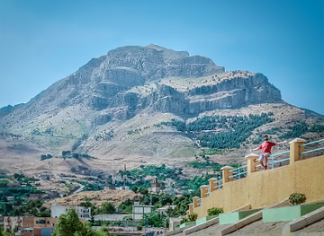
Mountain peak
Ouarsenis
Discover the breathtaking heights of Ouarsenis, a majestic mountain peak in Bordj Bounaama, perfect for adventure seekers and nature lovers.
-
Women's clothing store
Boutique R&R
Discover unique women's fashion pieces at Boutique R&R, where local style meets contemporary trends in the heart of Oran.
-
Clothing store
Universal shopping
Explore a vibrant blend of local fashion and culture at Universal Shopping in Bab El Oued, Algiers.
-
Clothing store
Universal shopping cheraga
Discover the latest fashion trends at Universal Shopping Cheraga, where local culture meets contemporary style in a vibrant shopping experience.


Get your free copy of our complete guide to Ouarsenis Mountains, delivered straight to you.
Everything on this page, from attractions and restaurants to essentials and local phrases, in one PDF you can read offline, print or share.
Already have an account? Sign in
Your Ouarsenis Mountains guide is ready.
We'll send it to · Not you? Sign out

Getting your guide ready…
We are putting together a fresh copy of the Ouarsenis Mountains guide. This can take up to a minute.
This can take a few moments. If your browser asks, choose Allow so the download can start. You'll find the guide in your Downloads folder.
Nothing happened? Download it again
Sorry, the guide is taking longer than usual. Please try again in a minute, or get it by email instead.
Ouarsenis Mountains essentials
Currency and Payment
Safety
Emergency Situations
Do's and Don'ts
Local Tips
From Eve
Local phrases worth knowing
You don't need to get them perfect. A few words go a long way, and locals appreciate the effort.
Basics
| English | Local | Say it |
|---|---|---|
| Hello | سلام | [Salam] |
| Goodbye | وداعًا | [Wada'an] |
| Yes | نعم | [Na'am] |
| No | لا | [La] |
| Please/You're welcome | من فضلك | [Min Fadlik] |
| Thank you | شكرًا | [Shukran] |
| Excuse me/Sorry | عذرًا | [Uthran] |
| How are you? | كيف حالك؟ | [Kayfa Halak?] |
| Fine. And you? | بخير. وأنت؟ | [Bikhair. Wa Anta?] |
| Do you speak English? | هل تتحدث الإنجليزية؟ | [Hal Tatahadath Al-Ingliziyya?] |
| I don't understand | لا أفهم | [La Afham] |
Eating & Drinking
| English | Local | Say it |
|---|---|---|
| I'd like to see the menu, please | أود رؤية القائمة، من فضلك | [Awad Ru'yat Al-Qaimah, Min Fadlik] |
| I don't eat meat | لا أتناول اللحم | [La Atanawwal Al-Lahm] |
| Cheers! | في صحتك! | [Fi Sihtak!] |
| I would like to pay, please | أود الدفع، من فضلك | [Awad Al-Daf', Min Fadlik] |
Emergencies
| English | Local | Say it |
|---|---|---|
| Help! | نجدة! | [Najda!] |
| Go away! | اذهب بعيدًا! | [Idhhab Ba'idhan!] |
| Call the Police! | اتصل بالشرطة! | [Ittasil Bil-Shurta!] |
| Call a doctor! | اتصل بالطبيب! | [Ittasil Bil-Tabeeb!] |
| I'm lost | أنا ضائع | [Ana Daa'i] |
| I'm ill | أنا مريض | [Ana Mareed] |
Shopping
| English | Local | Say it |
|---|---|---|
| I'd like to buy... | أود شراء... | [Awad Shira'a...] |
| I'm just looking | أنا فقط أبحث | [Ana Faqat Abhath] |
| How much is it? | كم ثمنه؟ | [Kam Thamanuh?] |
| That's too expensive | هذا مكلف جدًا | [Hatha Mukallaf Jiddan] |
| Can you lower the price? | هل يمكنك خفض السعر؟ | [Hal Yumkinuka Khafd Al-Si'r?] |
Time & Numbers
| English | Local | Say it |
|---|---|---|
| What time is it? | كم الساعة؟ | [Kam Al-Saa'a?] |
| It's one o'clock | الساعة الواحدة | [Al-Saa'a Al-Wa'idah] |
| Half past (10) | نصف الساعة (10) | [Nisf Al-Saa'a (10)] |
| Morning | صباحًا | [Sabahan] |
| Afternoon | بعد الظهر | [Ba'd Al-Zuhr] |
| Evening | مساءً | [Masa'an] |
| Yesterday | أمس | [Ams] |
| Today | اليوم | [Al-Yawm] |
| Tomorrow | غدًا | [Ghadan] |
| 1 | واحد | [Wahid] |
| 2 | اثنان | [Ithnayn] |
| 3 | ثلاثة | [Thalatha] |
| 4 | أربعة | [Arba'a] |
| 5 | خمسة | [Khamsa] |
| 6 | ستة | [Sitta] |
| 7 | سبعة | [Sab'a] |
| 8 | ثمانية | [Thamaniya] |
| 9 | تسعة | [Tis'a] |
| 10 | عشرة | [Ashara] |
Transport & Directions
| English | Local | Say it |
|---|---|---|
| Where's a/the...? | أين يوجد ...؟ | [Ayna Yujad...?] |
| What's the address? | ما هو العنوان؟ | [Ma Huwa Al-Unwan?] |
| Can you show me (on the map)? | هل يمكنك أن تريني (على الخريطة)؟ | [Hal Yumkinuka An Turini (Ala Al-Kharita)?] |
| When's the next (bus)? | متى يكون (الباص) التالي؟ | [Mata Yakun (Al-Bus) Al-Tali?] |
| A ticket (to ....) | تذكرة (إلى ....) | [Tadhkara (Ila ....)] |
History of Ouarsenis Mountains
Prehistoric and Indigenous Mountain Settlement
The Ouarsenis belongs to the long-inhabited mountain belt of northern Algeria, where communities used upland valleys, wooded slopes and passes linking the coastal plains with the interior. Archaeological evidence in the wider region records prehistoric occupation and changing patterns of pastoralism and farming. The mountains were not an isolated wilderness: their routes connected communities across the Chelif basin and high plateaux, while local populations adapted their livelihoods to limited arable land, seasonal water and heavily varied elevation.
Roman Routes and the Chelif Hinterland
Roman power reached the wider Chelif region and the adjacent high plateaux, bringing fortified settlements, roads and agricultural administration to parts of north-western Algeria. The deepest mountain valleys were less urbanised than the plains, but the Ouarsenis formed part of a wider strategic landscape between the Mediterranean coast and interior centres. Roman remains in the surrounding region are a reminder that the mountains stood near important lines of movement, even where later settlement has obscured or reused earlier sites.
Islamisation and Medieval Regional Networks
After the Arab-Muslim conquest of the Maghreb, the mountains were incorporated gradually into changing political and religious networks. Rural communities retained strong local identities while participating in wider systems of trade, scholarship and governance centred on towns and market routes beyond the highest ridges. Across the medieval period, the Chelif basin and neighbouring plateaux experienced the influence of successive dynasties and movements, leaving the Ouarsenis connected to the political history of north-western Algeria without becoming a single, centralised urban region.
Ottoman-Era Interior Algeria
During the Ottoman period, much of inland Algeria was governed through a combination of provincial authority, local notables and tribal or village structures. Mountain terrain made direct administration uneven, and communities in the Ouarsenis relied on agriculture, pastoralism and local exchange. Routes through the range remained useful for movement between the Chelif lowlands and interior districts. The period helped shape the layered political and social geography that French colonial authorities later attempted to reorganise.
French Colonial Rule and Changing Land Use
French colonial rule brought new administrative boundaries, cadastral systems, roads and forms of agricultural and forestry management to the Ouarsenis and surrounding provinces. Forest resources, particularly cedar and other upland woodland, acquired increased commercial and administrative importance. Colonial development also altered patterns of landholding and mobility, while towns and transport links in the Chelif region became more closely tied to the wider colonial economy. Many present-day roads, town plans and land-use divisions reflect this period, although local communities continued to shape daily life.
War of Independence and Post-Independence Transformation
The mountains and rural districts of north-western Algeria were affected by the Algerian War of Independence from 1954 to 1962, when difficult terrain made upland areas strategically important and communities experienced military pressure and disruption. After independence, Algeria reorganised its administrative structure and invested in roads, public services, agriculture and forestry. Out-migration from some mountain villages and the growth of provincial towns have since changed settlement patterns, while protected areas such as Theniet El Had National Park have given conservation a larger role in the region’s future.
Ouarsenis Mountains in Photos
Browse through our photo collection highlighting the charm and character of the destination.
Neighbouring regions of Ouarsenis Mountains
The closest regions to Ouarsenis Mountains, if you have time for more than one.
-
-

-
-
-


Swipe for more regions
Explore more
Explore more of Algeria
Discover Algeria: A captivating blend of ancient history, stunning landscapes, and vibrant culture. From the Sahara desert to Mediterranean coasts, adventure awaits.
Explore Algeria