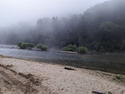
Richland Creek Wilderness: Arkansas's Hidden Waterfall Paradise
Discover pristine waterfalls and rugged beauty in Arkansas's Richland Creek Wilderness, a haven for adventurous hikers and nature lovers.
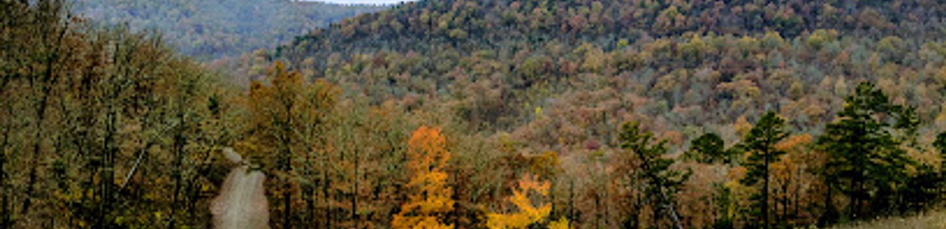
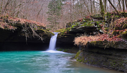
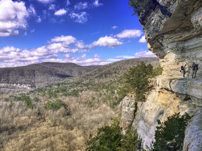
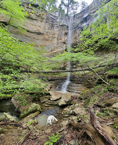
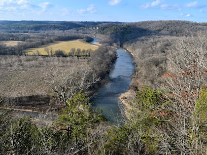
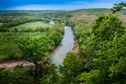
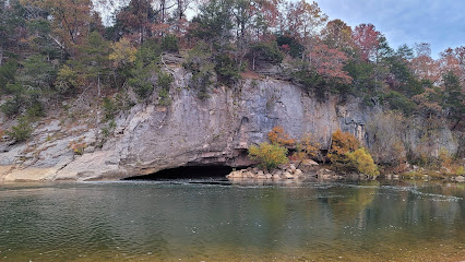
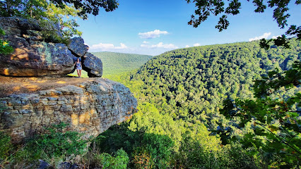
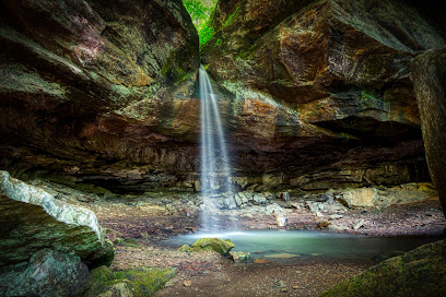
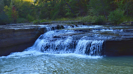
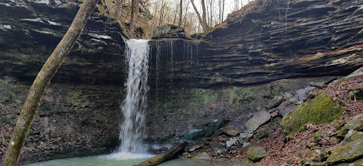
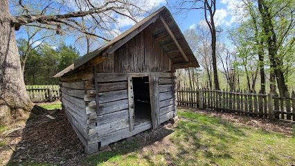
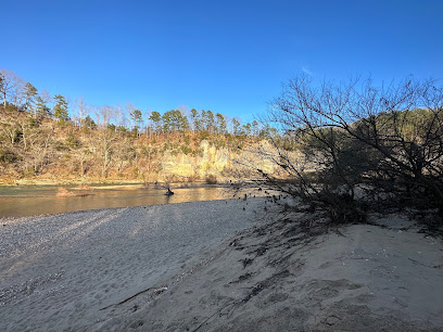
The Richland Creek Wilderness, nestled in the Ozark-St. Francis National Forest, is a rugged and scenic area known for its pristine creeks, cascading waterfalls, and challenging hiking. It's a haven for those seeking solitude and natural beauty.
A brief summary to Richland Creek Wilderness
- Pelsor, Arkansas, 72856, US
- +1479-284-3150
- Visit website
Local tips
- Wear sturdy hiking boots and be prepared to get your feet wet, as creek crossings are often necessary.
- Bring a map and compass or GPS, as there are no marked trails within the wilderness.
- Pack plenty of water and snacks, as there are no facilities within the wilderness area.
- Be aware of potential hazards such as slippery rocks, steep drop-offs, and wildlife.
- Check the weather forecast before you go, as flash floods can occur in the creek beds.
Getting There
-
Driving
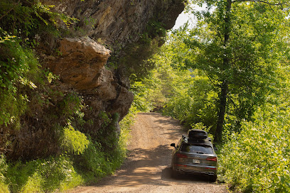
The most popular access point is via Richland Creek Campground. From Russellville, take Highway 7 north for 37 miles to Pelsor. Turn right (east) onto Highway 16 and continue for 10 miles, then turn left (north) onto Forest Service Road 1205 (gravel) about 1.5 miles east of Ben Hur. Follow Forest Service Road 1205 north for 9 miles to reach the campground. Note that Forest Service Road 1205 is a gravel road and may be rough in places; camping trailers are not recommended. Parking at the campground is free. Be aware that the road between Falling Water Falls and the Richland Creek Wilderness is prone to landslides.
-
Walking
From Richland Creek Campground, several access points lead into the wilderness. One popular option is to hike north along Forest Road 1205 for about 0.5 miles to a pullout area with a visitor registration box. From here, you can access Richland Creek and begin exploring the area's waterfalls and bluffs. Remember that there are no maintained trails, so navigation skills are essential.
Discover more about Richland Creek Wilderness
Iconic landmarks you can’t miss
Richland Creek Wilderness
0.0 km
Discover pristine waterfalls and rugged beauty in Arkansas's Richland Creek Wilderness, a haven for adventurous hikers and nature lovers.
Pedestal Rocks Scenic Area
11.7 km
Experience the breathtaking beauty and unique rock formations of Pedestal Rocks Scenic Area in the heart of Arkansas's Ozark National Forest.
Valentine-Williams House
23.7 km
Discover the Valentine-Williams House in Arkansas: A beautifully preserved historical landmark offering a glimpse into the past.
Round Top Mountain Trail
27.4 km
Explore scenic trails, discover fascinating rock formations, and reflect on history at Round Top Mountain near Jasper, Arkansas.
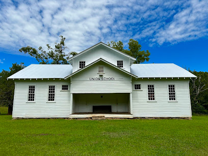
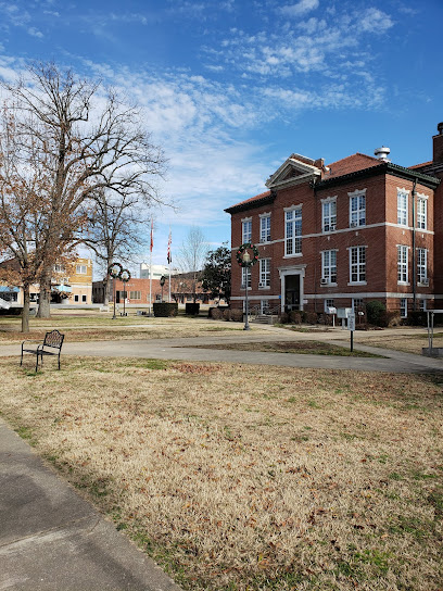
Union School House
37.8 km
Explore the Union School House in Hagarville, Arkansas, a historical landmark that captures the essence of early 20th-century education in a beautiful natural setting.
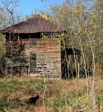
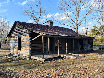
Granny Henderson Cabin
41.8 km
Explore the historical richness and natural beauty at Granny Henderson Cabin, a charming landmark in Compton, Arkansas.
Centerpoint Trailhead
45.5 km
Explore the breathtaking trails and stunning vistas of Centerpoint Trailhead in the Ozark National Forest, perfect for hiking enthusiasts and nature lovers alike.
Harrison, Arkansas National Historic District
48.7 km
Explore the Harrison, Arkansas National Historic District, where history and charm blend seamlessly in a beautifully preserved setting.
Ozark National Forest sign
49.0 km
Explore the natural wonders of Ozark National Forest, a scenic destination in Arkansas perfect for outdoor adventures and breathtaking landscapes.
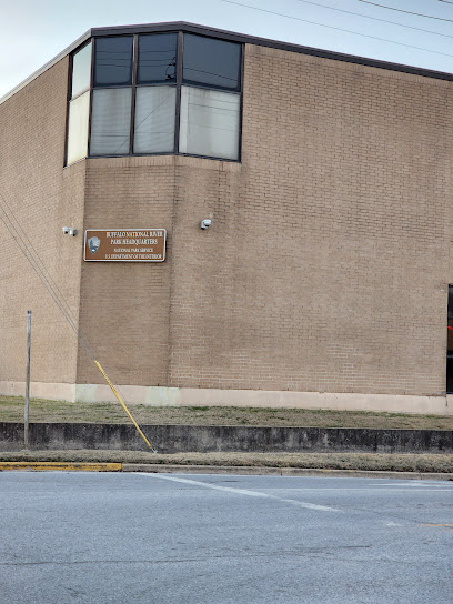
Buffalo National River Headquarters
49.1 km
Plan your Ozark adventure at the Buffalo National River Headquarters in Harrison, Arkansas. Explore America's first national river!
The Ozarks Sign
51.1 km
Discover the Ozarks Sign, a charming historical landmark in Clinton, Arkansas, and capture the essence of this beautiful region.
Shoe Sensation
51.3 km
Explore stylish footwear at Shoe Sensation in Harrison, Arkansas – your go-to shop for quality shoes, boots, and running gear.
La Quinta Inn & Suites by Wyndham Russellville
58.0 km
Experience comfort and convenience at La Quinta Inn & Suites in Russellville, the perfect base for exploring Arkansas's stunning landscapes.

Cracker Barrel Old Country Store
58.0 km
Experience the warmth of Southern hospitality at Cracker Barrel Old Country Store, where comfort food and charm meet in Russellville, Arkansas.
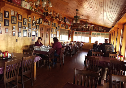
Old South Restaurant
58.1 km
A Russellville dining tradition serving classic American comfort food in a warm and welcoming atmosphere since 1947.
Unmissable attractions to see
Pedestal Rocks & Kings Bluff Trailhead
10.2 km
Explore unique rock formations and breathtaking views at Pedestal Rocks & Kings Bluff Trailhead in the heart of the Ozark National Forest.
King's Bluff
10.5 km
Discover breathtaking views and a stunning waterfall at King's Bluff in the Ozark National Forest, a natural gem near Witts Springs, Arkansas.
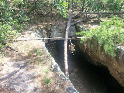
Big Creek Cave Falls
18.0 km
Discover a hidden Ozark treasure: hike to a stunning waterfall emerging from a cave at Big Creek Cave Falls near Jasper, Arkansas.
Arkansas Grand Canyon
23.4 km
Experience the breathtaking beauty of the Arkansas Grand Canyon, a stunning scenic spot perfect for outdoor adventures and tranquil escapes in the Ozark Mountains.
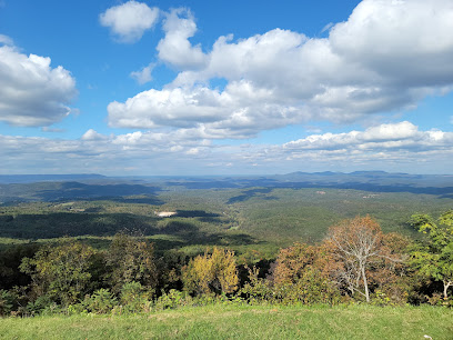
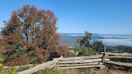
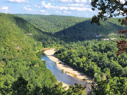
Buffalo River Scenic Lookout
26.0 km
Experience breathtaking panoramic views of the Buffalo River Valley, perfect for nature lovers and photographers seeking a serene escape.
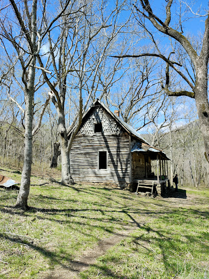
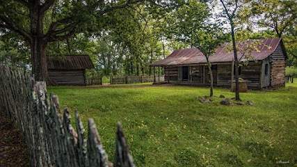
Collier Homestead
26.1 km
Step back in time at the Collier Homestead, a preserved 1930s Ozark homestead in Buffalo National River, offering a glimpse into pioneer life.
Tyler Bend Visitor Center
27.1 km
Discover the Buffalo National River: History, nature, and adventure await at the Tyler Bend Visitor Center in the heart of the Ozarks.
Buffalo National River
27.4 km
Explore the breathtaking Buffalo National River in Arkansas, a perfect destination for outdoor adventure and serene natural beauty.
Grinder's Ferry
28.1 km
Escape to Grinder's Ferry on the Buffalo National River for swimming, camping, and scenic beauty in the heart of the Arkansas Ozarks.
Car Wash Falls
28.4 km
Experience Arkansas's only drive-through waterfall: a unique natural car wash nestled in the scenic Ozark Mountains near Hagarville.
Saint Joe Historic Depot Museum
28.9 km
Explore railroad and local history at the beautifully restored Saint Joe Historic Depot Museum in the heart of the Arkansas Ozarks.
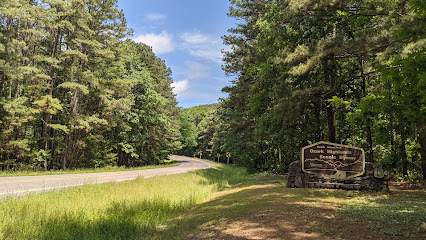
Ozark - St. Francis National Forest
29.0 km
Explore the stunning landscapes and diverse wildlife of Ozark - St. Francis National Forest, a paradise for outdoor enthusiasts and nature lovers.
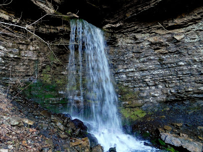
Pam's Grotto
29.4 km
Discover Pam's Grotto: A hidden waterfall oasis in the Ozark National Forest offering a short, scenic hike to a stunning natural grotto.
Haw Creek Falls
29.7 km
Discover the beauty of Haw Creek Falls in Arkansas' Ozark National Forest: a year-round natural escape with waterfalls, camping, and hiking.
Pack Rat Falls
29.7 km
Discover the serene beauty of Pack Rat Falls in the Ozark Mountains, a short hike from Haw Creek Falls Campground near Hagarville, Arkansas.
Essential places to dine
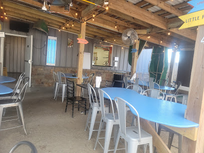
Slim's BBQ
14.8 km
Discover the authentic taste of Southern barbecue at Slim's BBQ in Witts Springs - where flavor meets tradition.
Cliff House Inn
23.3 km
Discover breathtaking views and rustic charm at Cliff House Inn – your gateway to the stunning Arkansas Grand Canyon.
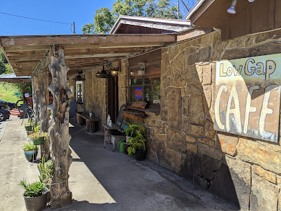
Low Gap Cafe
29.9 km
Discover culinary delights at Low Gap Cafe in Jasper - where American comfort meets Italian flair and fresh seafood in a charming setting.
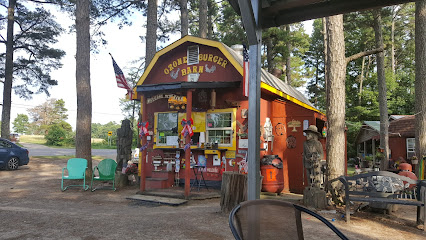
Ozone Burger Barn
46.7 km
Experience authentic Southern flavors at Ozone Burger Barn—home of mouthwatering burgers in the heart of Arkansas.
Buffalo Point Cabins & Restaurant
47.4 km
Experience authentic American dining amidst the serene beauty of Arkansas at Buffalo Point Cabins & Restaurant.
Wrecked Canoe Bistro + Patio
56.9 km
Experience Southern hospitality at Wrecked Canoe Bistro + Patio with delicious cuisine and charming outdoor dining in Clarksville.
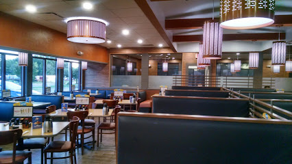
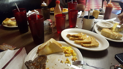
IHOP
58.0 km
Experience the ultimate breakfast destination at IHOP in Russellville—where delicious pancakes meet family-friendly service!
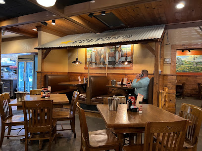
Cagle's Mill Restaurant
58.0 km
Discover the flavors of Arkansas at Cagle's Mill Restaurant - where grilling meets great company in a cozy atmosphere.
Colton's Steak House & Grill
58.1 km
Indulge in mouthwatering steaks at Colton's Steak House & Grill in Russellville - where great taste meets Southern hospitality.
Gogi BBQ House
58.3 km
Experience authentic Korean barbecue at Gogi BBQ House in Russellville – grill your own meats and savor traditional flavors in a vibrant setting.

New China
58.4 km
Discover the authentic flavors of Chinese cuisine at New China Restaurant in Russellville - where every dish tells a story.
Sam's Southern Eatery (Russellville)
59.5 km
Experience authentic Southern cuisine at Sam's Southern Eatery in Russellville—where every meal feels like home.
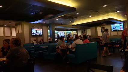
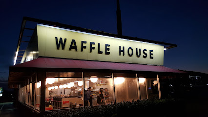
Waffle House
59.5 km
Experience authentic Southern hospitality at Waffle House in Russellville - where delicious breakfast meets friendly service 24/7.
Foodies Restaurant & Grill
59.6 km
Experience mouthwatering American cuisine at Foodies Restaurant & Grill in Russellville - where flavor meets hospitality.

Mulan's
59.6 km
Discover Mulan's: A delightful blend of authentic Chinese cuisine and exquisite sushi rolls in Russellville.
Markets, malls and hidden boutiques
On Bear Creek Mountain
19.1 km
Explore the artistry of handcrafted leather goods at On Bear Creek Mountain in Leslie, Arkansas, where unique craftsmanship meets scenic beauty.
Scenic Point Gift Shop
25.7 km
Explore Scenic Point Gift Shop in Arkansas for unique souvenirs, local crafts, and a friendly shopping experience in a picturesque setting.
Buffalo River Outfitters
26.7 km
Explore the beauty of the Buffalo National River with Buffalo River Outfitters - your gateway to canoeing, kayaking, and cabin rentals in Arkansas.
Elk Ridge Trading Co
28.3 km
Explore Elk Ridge Trading Co in St. Joe, Arkansas for an unparalleled antique shopping experience, showcasing unique finds and local craftsmanship.
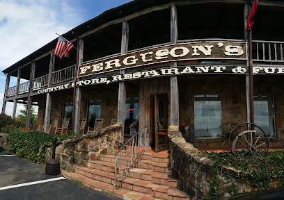
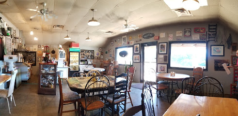
Fergusons Country Store & Restaurant, solid Cherry & Oak Furniture
28.3 km
Experience the charm of Americana at Fergusons Country Store & Restaurant, where hearty breakfasts meet handcrafted furniture in St. Joe, Arkansas.
Big Springs Trading Company
28.4 km
Experience authentic Southern barbecue and deli delights at Big Springs Trading Company in St. Joe, Arkansas, where flavor meets a warm atmosphere.
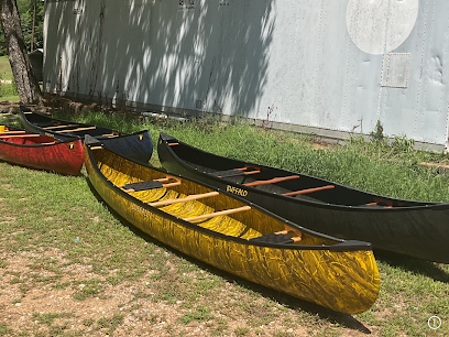
Buffalo Canoe Manufacturing
28.4 km
Discover Buffalo Canoe Manufacturing in Jasper, AR - your gateway to exceptional canoes, expert advice, and unforgettable outdoor adventures.
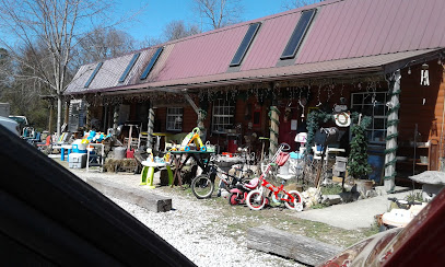
Dry Creek Homestead Merchantile
29.7 km
Explore the unique flavors and treasures of Dry Creek Homestead Merchantile, where delicious deli food meets charming antiques in Pindall, Arkansas.
Paisley Sister llc
29.8 km
Explore unique gifts and local crafts at Paisley Sister LLC, a charming gift shop in Jasper, Arkansas, perfect for souvenirs and memorable finds.
Wild Hare Gifts
29.8 km
Explore Wild Hare Gifts in Jasper, Arkansas, for unique, locally crafted souvenirs and delightful treasures that embody the spirit of the Ozarks.
Bubba's Buffalo River Store
29.8 km
Discover unique souvenirs and local crafts at Bubba's Buffalo River Store in Jasper, Arkansas, your go-to shop for memorable keepsakes.
The Crystal Cottage Rocks & Beads
29.9 km
Explore The Crystal Cottage Rocks & Beads for enchanting jewelry and unique natural stones in the heart of Jasper, Arkansas.
Glorie's Gifts and More.
30.1 km
Explore Glorie's Gifts and More in Western Grove, Arkansas, where unique treasures and local crafts await every visitor.
Buffalo Camping & Canoeing
30.4 km
Experience the great outdoors at Buffalo Camping & Canoeing, your gateway to adventure in the heart of Arkansas, with camping, canoeing, and local flavors.
Gilbert General Store
30.4 km
Explore the heart of the Ozarks at Gilbert General Store, your one-stop shop for camping gear and local groceries in beautiful Arkansas.
Essential bars & hidden hideouts
Bridget's Bigmouth Burgers
16.5 km
Experience the best of classic American burgers at Bridget's Bigmouth Burgers in Tilly, Arkansas, where flavor meets friendly service.
Tyler Bend Campground
27.4 km
Experience the beauty of nature at Tyler Bend Campground, where adventure meets tranquility along the Buffalo River.
Craw Billy's Seafood Boil & BBQ
28.3 km
Experience the best of Cajun cuisine at Craw Billy's Seafood Boil & BBQ in St. Joe, AR, where fresh seafood meets southern hospitality.
Haskel's
28.8 km
Discover Haskel's: A cozy gas station and restaurant in St. Joe, Arkansas, perfect for a hearty meal and convenient pit stop for travelers.
Shine Eye Campground
29.0 km
Discover tranquility and adventure at Shine Eye Campground, a perfect retreat in the heart of Arkansas surrounded by nature's beauty.
Missouri Smoke, LLC
29.3 km
Experience the authentic taste of BBQ at Missouri Smoke, LLC in Everton, AR - a true gem for meat lovers seeking smoky satisfaction.
Boston Mountain Pizza
29.5 km
Discover Boston Mountain Pizza: A delightful culinary experience in Marshall, Arkansas, serving delicious pizzas and a welcoming atmosphere.
Sonic Drive-In
29.9 km
Discover the nostalgic charm and delicious fast-food offerings at Sonic Drive-In in Marshall, Arkansas, a perfect pit stop for travelers.
Gilbert Gravel Bar
30.2 km
Experience the serene beauty of Gilbert Gravel Bar, a perfect park retreat in Arkansas for relaxation, picnics, and outdoor adventures.
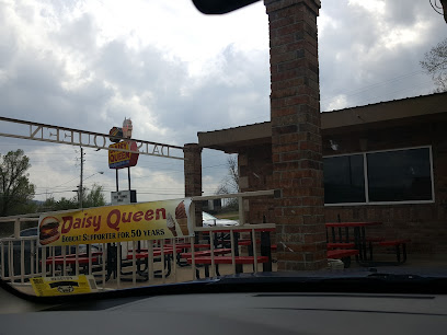
Daisy Queen
31.0 km
Experience classic American fast food at Daisy Queen in Marshall, Arkansas, where delicious flavors and a nostalgic atmosphere await.
Marshall Restaurant
31.8 km
Experience delicious home-cooked American meals at Marshall Restaurant, a cozy spot in the heart of Arkansas, perfect for breakfast or lunch.
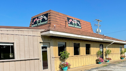
Los Locos Mexican Restaurant Marshall Ar
31.9 km
Experience the rich flavors of authentic Mexican cuisine at Los Locos, a must-visit restaurant in Marshall, Arkansas.
Buffalo River Lodge
41.0 km
Discover the natural beauty and adventure at Buffalo River Lodge, a perfect retreat in the heart of Arkansas.
Buffalo Outdoor Center
43.0 km
Experience the best of Arkansas at Buffalo Outdoor Center, where adventure meets nature in the stunning Ozark Mountains.
TallGrass Bar and Grill
47.6 km
Experience the delightful flavors and inviting atmosphere at TallGrass Bar and Grill in Harrison, Arkansas—your culinary oasis in the Ozarks.
Nightclubs & after hour spots
Russellville Country Club - Public Welcome
54.3 km
Experience the beauty and camaraderie at Russellville Country Club, where golf and community meet in breathtaking Arkansas.

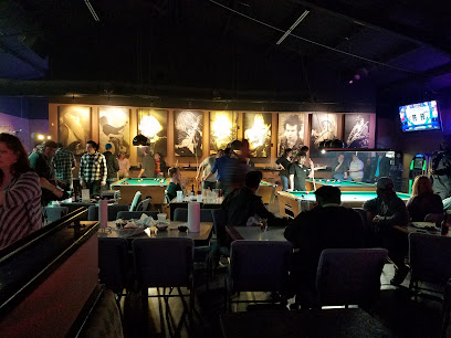
Beezer's Fine Billiards
59.8 km
Discover Beezer's Fine Billiards in Russellville, Arkansas - the ultimate pool hall experience for enthusiasts and newcomers alike, where fun meets community spirit.

IronGear Athletics
60.7 km
Experience the thrill of baseball and softball at IronGear Athletics, the premier batting cage center in Russellville, Arkansas.
Fraternal Order of Eagles
61.6 km
Explore the Fraternal Order of Eagles in Russellville, AR, for a unique blend of fun, community, and local culture, perfect for every visitor.
Russellville Columbus Club
66.3 km
Discover the Russellville Columbus Club, a lively event venue offering unique local experiences and a taste of Arkansas culture.
AC'S Bar & Grill + Live Event Center
85.3 km
Experience live music, delicious food, and vibrant nightlife at AC'S Bar & Grill + Live Event Center in Mountain Home, Arkansas.
The RAB Conway
90.4 km
Experience the vibrant nightlife of Conway at The RAB, offering karaoke, dancing, and good times in one dynamic venue.

Cambridge Village Townhomes
90.5 km
Discover the vibrant nightlife at Cambridge Village Townhomes, Conway's premier night club for dancing and socializing.
Conway Country Club
91.4 km
Experience luxury and leisure at Conway Country Club, featuring a premier golf course, exquisite dining, and stunning wedding venues in Arkansas.
Area71 - Branson
91.5 km
Discover the perfect blend of dining, recreation, and convenience at Area71 in Branson - a must-visit for every traveler.
Kings Live Music
92.7 km
Experience unforgettable live music, delicious food, and a vibrant nightlife at Kings Live Music in Conway, Arkansas.
Brick and Forge Taproom
93.0 km
Savor the best of American cuisine with craft beers at Brick and Forge Taproom in Conway, Arkansas, where family-friendly meets flavorful.
Crazy Craig's Cheeky Monkey Bar
93.4 km
Discover the heart of Branson's nightlife at Crazy Craig's Cheeky Monkey Bar, where live music, delicious food, and vibrant energy await.
TGI Fridays
94.0 km
Discover TGI Fridays in Conway, the perfect blend of delicious American cuisine, lively atmosphere, and fun-filled moments for all ages.
T C's Midtown
94.6 km
Discover the lively atmosphere and diverse drink selection at T C's Midtown, the ideal spot for nightlife and entertainment in Conway, Arkansas.